
Home » Traffic Management (Page 16)
Category Archives: Traffic Management
Transport and traffic purgatory, paradise and inferno
A lot of people have been referring to the traffic congestion and other derivative issues that will be the result of the construction of several transport projects around Metro Manila as “traffic armageddon.” Some friend have appropriately (I think) referred to it more as “car-mageddon.” This seems to be the case since it is perceived to have the most impact on car users than public transport users, cyclists or pedestrians. This is far from the truth as there are more people taking public transport, cycling or walking than those driving their own cars. In fact, estimates for Metro Manila indicate that 70-80% of travelers take public transport while 20-30% take private vehicles. These mode splits do not include bicycles or walking, which obviously will further decrease private car shares.
I would rather refer to this period of construction as a sort of “purgatory” though it has nothing to do with the cleansing that’s associated with it. There is still the suffering involved while improvements are being implemented. But, most importantly, there is hope at the end of this process. This “hope” is not necessarily the “light at the end of a dark tunnel” kind of thing as surely population and the number of vehicles will surely increase over time even as the transport projects are being implemented. By the time these are completed, there are sure to be more people, more vehicles, as well as more of other developments that will put our transport system to a stress test. We can only hope that the designs of these infrastructure we are building now are based on honest to goodness trip or traffic forecasts. Otherwise, we’ll end up with congested or saturated systems by the time they start operating.
Unfortunately, most projects mentioned and those we know have the green light and would likely be proceeding with construction in the near future are basically road projects. It’s ironic considering that what Metro Manila urgently, and maybe desperately, needs now are public transport systems including the much delayed MRT 7, LRT 2 Extension and LRT 1 Extension. The proposals for Bus Rapid Transit (BRT) seem to be in a limbo, too, despite extensive studies and surveys to support BRT along corridors such as Ortigas Avenue and Circumferential Road 5. These are blamed on institutional and legal impediments including allegations of shortcomings among officials of agencies responsible for these infrastructure.
I am aware of an initiative led by an environmental lawyer seeking to effect the redistribution of road space in favor of public transport users, cyclists and pedestrians. I think such actions are useful from the perspective of getting the attention necessary to push government and private sector players to have a sense of urgency not just in words but also in actions in as far as transport infrastructure programs and projects are concerned. We are already lagging behind our ASEAN neighbors with regards to infrastructure and at this pace, it is likely that less developed countries like Cambodia and Myanmar might just overtake us in the foreseeable future. From another perspective, it is hard to push for sharing the road when people really don’t have better options for commuting. Walking and cycling are not for everyone and many people have turned to the motorcycle to solve their transport woes. In the latter case, motorcycles are perceived as a vehicle that’s fuel efficient and allows the users to zip through congested streets often at high risks of being involved in a crash or spill.
We can only achieve “paradise” in our highly urbanized cities if we build these mass transit systems along with the pedestrian and cycling facilities that will complement each other. Those for whom car travel is a necessity would also benefit from reduced road congestion so it will eventually (hopefully) play out well for most people. Meanwhile, we would have to endure transport and traffic hell (some more and longer than others) as the government and private sector embark on this round of infrastructure projects implementation. It helps to look back at our experiences with the last major batch of projects in the latter part of the 1990’s when the number coding scheme was first implemented. At the time, it was implemented as a temporary measure to alleviate congestion while projects where being implemented. What was a temporary measure is now still being implemented along with a truck ban that has also been evolving the past years with the latest being the one implemented by the City of Manila starting last February 24. Will these vehicle restraint schemes be modified to cope with the traffic congestion expected from projects like the Skyway connector? Will these be relaxed or removed after all these projects have been completed? Your guess is as good as mine.
–
Manila’s truck ban experiment
The City of Manila has announced that it will implement a truck ban from February 10, Monday. Trucks of at least 8-wheels and 4,500kg gross weight will not be allowed to travel in Manila’s roads from 5AM to 9PM. Manila’s City Ordinance No. 8336 calls for the daytime truck ban in the city in order to reduce traffic congestion that is perceived to be brought about by trucks. 8-wheelers are likely 3-axle trucks with a 4-wheel, 2-axle prime mover pulling a 1-axle, 4-wheel (double-tired) trailer. I am not aware of the technical basis for the ordinance. Perhaps the city has engaged consultants to help them determine the pros and cons of this daytime truck ban. I hope it is not all qualitative analysis that was applied here as logistics is quite a complicated topic. And such schemes in favor of passenger transport (and against goods movement) actually creates a big problem for commerce due to the challenges of scheduling that they have to deal with. To cope with this ordinance, companies would have to utilize smaller vehicles to transport goods during the daytime. This actually might lead to more vehicles on the streets as companies try to compensate for the capacity of the large trucks that will be banned from traveling during the restricted period by fielding smaller trucks.
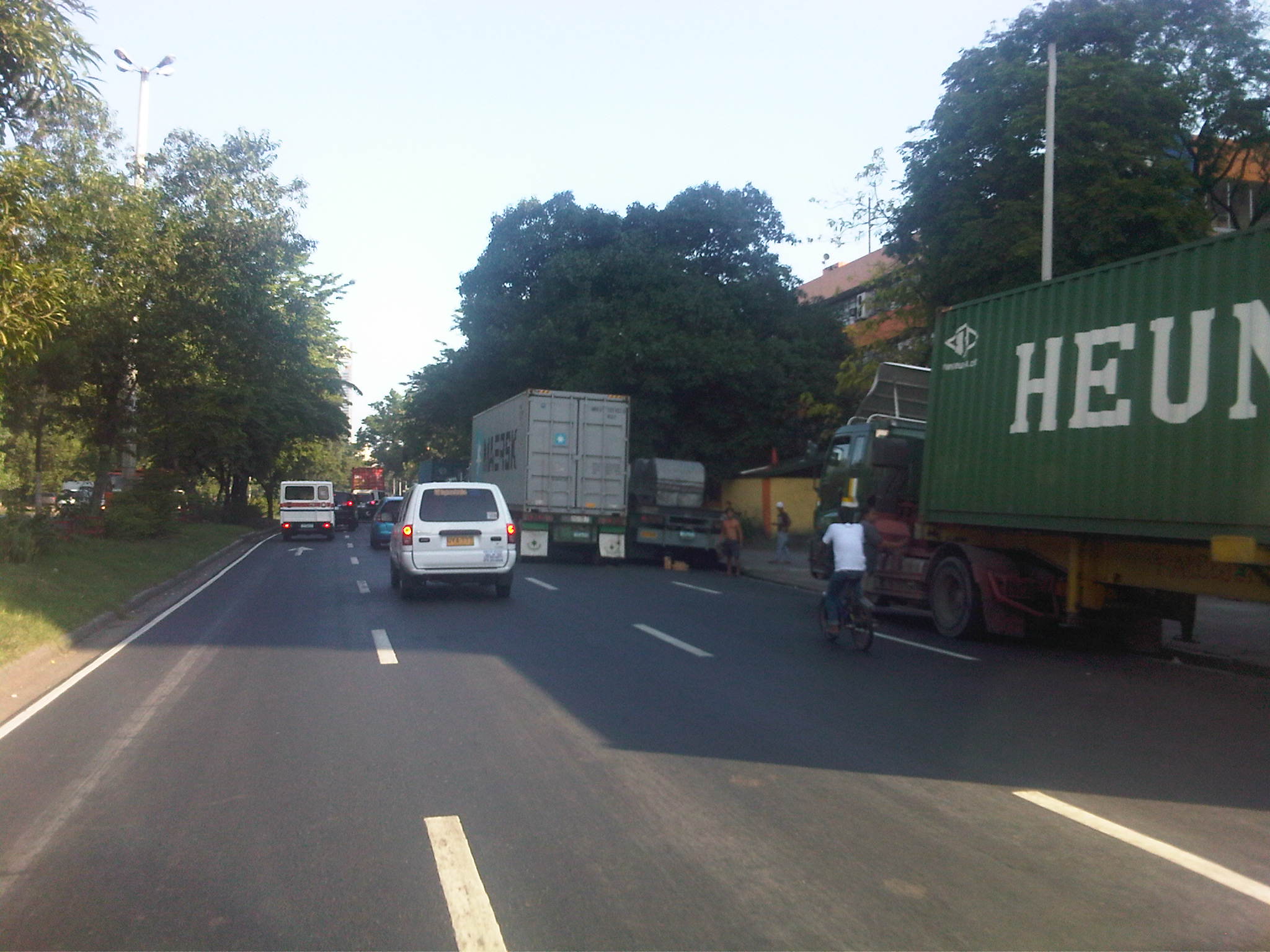 Trucks parked along Bonifacio Drive near the DPWH Central Office in Manila’s Port Area.
The latest word is that Manila has postponed implementation of the ordinance to February 24. This was apparently due to the reaction they got from various sectors, especially truckers and logistics companies who would be most affected by the restrictions. It was only natural for them to show their opposition to the scheme. Reactions from the general public, however, indicated that private car users and those taking public transport welcomed the truck ban as they generally stated that they thought trucks were to blame for traffic congestion in Manila. The truck ban will definitely have impacts beyond Manila’s boundaries as freight/goods transport schedules will be affected for the rest of Metro Manila and beyond. The Port of Manila, after all, is critical to logistics for the National Capital Region, and its influence extends to adjacent provinces where industries are located. Such issues on congestion and travel demand management measures focused on trucks bring back talks about easing freight flow to and from the Port of Manila to major ports in Subic and Batangas. There have been studies conducted to assess the decongestion of the Port of Manila as Batangas and Subic are already very accessible with high standard highways connecting to these ports including the SLEX and STAR tollways to Batangas and the NLEX and SCTEX to Subic. Perhaps it would be good to revisit the recommendations of these studies while also balancing the treatment of logistics with efforts necessary to improve public transport. After all, trucks are not all to blame for Manila’s and other cities’ traffic woes as buses are repeatedly being blamed for congestion along EDSA. In truth, there are more cars than the numbers of buses, trucks, jeepneys and UV Express combined. And the only way to reduce private car traffic is to come up with an efficient and safe public transport system. –
On high definition cameras to improve traffic enforcement and management
Watching the news one evening, I saw a report that featured traffic enforcers being caught on camera extorting money from drivers caught violating traffic rules and regulations. Extortion, “kotong” or “pangongotong” is not a new thing. It is actually a given to many motorist, particularly those who spend a lot of time on the road like drivers of public utility vehicles and trucks. In many cases, the enforcer or police officer is already or automatically assumed to be an extortionist even without the subtle suggestions via talk or body language. Motorists simply slip a bill with their license or in the form of a handshake to the apprehending officer. This, of course, translates into bribery, which is also a crime for both parties involved.
Traffic violations carry penalties in the form of fines that vary in amount depending on the violation. Usually, the amount is commensurate to the bribe or the “suggested” amount being extorted by the apprehending enforcer(s). In other cases, a larger amount is “suggested,” often to remind the erring motorist Of course, this assumes that the motorist is indeed guilty or in any case (guilty or not) didn’t want to waste time and opts for the perceived easy way out. However, there have also been cases when corrupt enforcers/officers meet their match in motorists who are aware of their rights and are knowledgable of traffic laws (e.g., lawyers, etc.) or are well-connected and simply show business cards of influential people (e.g., politicians, high government officials, police or military officers, etc.) to get out of a traffic bind. These instances actually reveal that many enforcers/officers are not so familiar with traffic rules and regulations so are unable to justify their apprehensions beyond their very basic knowledge.
The MMDA has made a lot of effort in trying to simplify the process of paying the penalties with the guilty party now being allowed to take the ticket and pay the fine through accredited banks within a certain grace period. Traffic enforcers can no longer take your driver’s license (Note: Only Land Transportation Office officers and deputized personnel may confiscate licenses.) and this eliminated the long lines of drivers at the MMDA offices to get back their confiscated licenses. This has also reduced the incidence of extortion as many private motorists can just opt to have tickets issued to by the apprehending officer. The latter is basically no longer allowed to collect money and contact time is also reduced. There is a grace period for the erring driver so he/she has to pay the fine within this period or else risk being flagged by the LTO itself.
The new camera system that the MMDA has in place is part of Phase 1 of its traffic signalization project. With this project, the MMDA hopes to upgrade the network of traffic signals in Metro Manila and have in place a dynamic, adaptive system to better address traffic circulation in the metropolis. This is actually a departure from a past program that was premised on the continuous traffic flow that was supposedly derived from U-turns masquerading as rotundas or roundabouts. Though the sensors and software for the traffic signal system are not yet in place, the MMDA already has a new traffic control center just across its building at the corner of EDSA and Orense Street in Makati City, from where they can now monitor traffic conditions using high definition cameras installed across the metro.
Davao has been in the forefront of using such high definition cameras for traffic management as well as for monitoring the behavior of traffic enforcers and motorists. Their traffic management center has been operational for the past few years and I’ve had the chance to have a look at how the city is able to monitor traffic conditions in that city. With this tool, they are able to address issues by deploying personnel on sight or by changing the setting of traffic signals. In certain cases, they can watch out for incidents like road crashes or monitor apprehensions to make sure both apprehending personnel and erring motorists are honest and no anomalies are encountered.
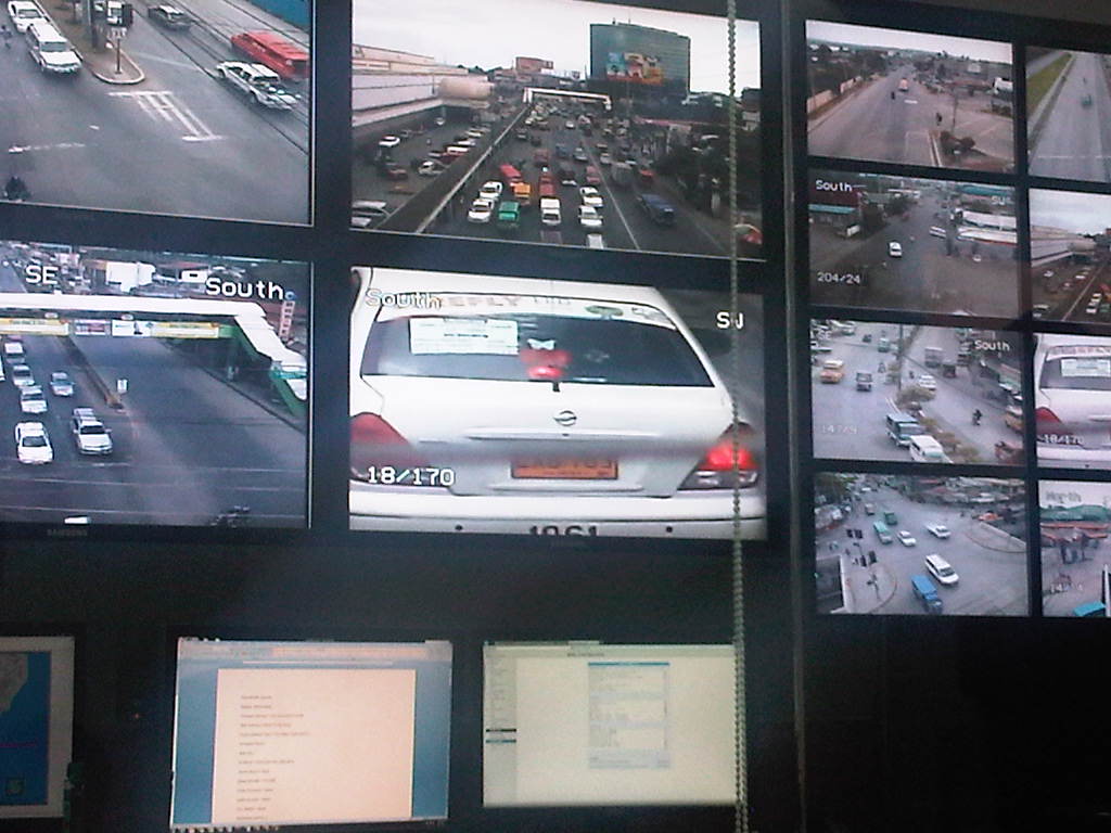 Davao’s cameras have been used to monitor not just erring motorists and pedestrians but also erring traffic enforcers and policemen who might be preying on road users. The city has also been able to use their system to record and evaluate incidences of road crashes.
Perhaps in the near future, many other cities would be able to acquire and apply such tools in traffic management. I think the larger and highly urbanized cities in the country already require sophisticated systems for traffic. Unfortunately, there is always the issue of having limited resources, which usually discourages a city from investing in expensive systems, often opting for basic signals for their intersections. Such basic systems, however, can be optimized if city personnel in-charge of these have the knowledge or capability for setting signals to be synchronized with each other. These are fundamentals necessary for whoever will be dealing with traffic engineering and management in these cities. Also, there are now ongoing researches at universities with some now sponsored by the Department of Science and Technology (DOST) through its Philippine Council for Industry, Energy and Emerging technology Research and Development (PCIEERD) seeking to produce traffic systems at lower costs. These should eventually be deployed in our cities to help alleviate traffic problems.
–
To commute or not to commute
To commute or not to commute? That seems to be the question many people would like our political leaders and government officials to ponder the answer to. Of course, the word “commute” itself refers to traveling whether by public or private transport. However, in the Philippines we have equated “commuting” with taking public transportation. Anyhow, the reality is that most of our top officials, elected or appointed are car owners and are most likely to drive or be driven between their homes, offices and appointments. This is what is perceived by many people as “The Reason” why public officials have little or no appreciation of the difficulties experienced by the commuting public.
While sympathy is usually assumed or claimed by responsible persons, it is empathy that is most desirable from our public officials as they should feel how most people feel when they commute every working day. But how can you empathize if you have not experienced the difficulties of commuting in Metro Manila or other city? How can you say you understand the plight of pedestrians, cyclists and those taking public transport if you prefer or opt to drive or be driven in your car or SUV to and from your office? Did you really commute when you were in high school or college? Or maybe you were one of those cool guys or gals driving their own cars?
Almost every week, I have left my car at the office to commute or hitch a ride with my wife where our routes overlap. I have used public transportation since I was in high school so I am quite familiar with taking pedicabs, tricycles, jeepneys, buses and trains. I have also commuted whenever I am on trips to other cities including those abroad. Public transport is part of the experience whenever I am on trips and when I am in a new place, I make it a point to take long walks first to explore the surrounding area. It is a familiarization of sorts and makes me comfortable with the area. I remember that when I was a student in Japan, I would try to look for the nearest church to where I was staying, especially if I was there over the weekend.
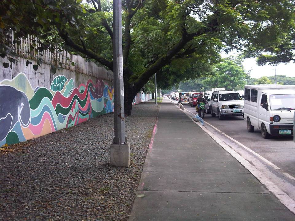 Walking is part of commuting and I am thankful that where I work, the surroundings are basically pedestrian-friendly. The photo above shows the sidewalk along Katipunan Avenue on the side of the university.
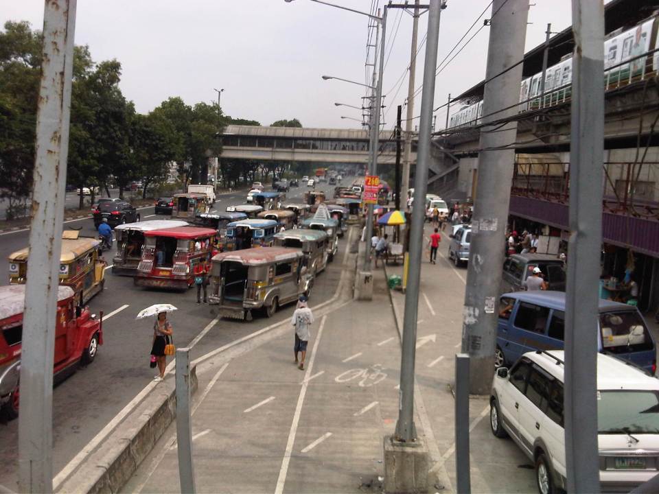 Seamless transfers are not yet quite the norm in the Philippines. The photo shows one of the better examples where transfers between modes are more convenient. This is at the LRT 2 Santolan Station. Note the markings for the bicycle path. I took this as I was descending from the pedestrian overpass that connected with a nearby mall by the Marikina River.
While traveling within other cities, whether in the Philippines or abroad, the first option for many if not most people would be to take public transportation. Taking out a rental vehicle is not common and taxis are considered as part of the public transport system. As such, we try to get information on how to get to places of interest from relatives, friends, hosts or staff of the hotel we are staying at. These include maps like the old fashioned ones we can get at airports, train stations and tourist booths. Nowadays, there’s a wealth of information available online and apps that can help us navigate around cities.
We tend to comment on how good the public transportation is in the places we’ve visited or how easy it was to commute in these cities. And upon returning to our country we are quick to criticize our public transport, pedestrian and cycling facilities. The irony, of course, is that many of those who are quick to criticize don’t even use public transport, walk or cycle. Even more tragic (for lack of a better word, I think) is that we don’t demand for better public transport, pedestrian or cycling facilities. Perhaps that should change and in this New Year, we should resolve to push the government and its partners for better transit, pedestrian and cycling infrastructure for our cities. And part of that push is by getting involved in advocacies, including projects, for these causes on transport. We should not forget that though we need and seek champions for public transport, walking and cycling among our leaders, we should also be champions in our own ways.
–
U.P. Town Center
Passing along the University of the Philippines’ part of Katipunan, one will see a new development at the area where the UP Integrated School (UPIS) is currently located. The UP Town Center is being promoted as part of a university town center concept and is the second major Ayala development on UP land after the Technohub in the north side of the 493-hectare campus. The surrounding area to the newly built Town Center will most likely host business process outsourcing (BPO) including call centers that currently populate Technohub.
I learned that the development’s design was reviewed on the UP side by a team that included faculty members from UP Diliman’s College of Architecture and School of Urban and Regional Planning. I assume that they were able to cover most if not all the aspects of the design for this particular development and the rest that will follow once UPIS moves to the main campus and the entire lot is developed much like into what Technohub is at present. I would assume that they provided recommendations to Ayala and that these recommendations were used to improve on potential issues with the development. However, my worry is that the transport or traffic component of the design (i.e., transport impact assessment) was not sufficient for the traffic that will be generated by the development. While Technohub had no serious problems regarding traffic as it was along the wide Commonwealth Avenue, the Town Center was located in the narrower C-5 that is the route for much private traffic as well as trucks.
Let us look at the potential problems for the UP Town Center in relation to transport and traffic. For one, the development is close to a major intersection, the junction of Katipunan-CP Garcia. The current traffic signal cycle for the intersection allows for continuous through traffic for the northbound side of Katipunan. Thus, traffic in front of the development, which is along this same northbound side of C-5 will be continuous. Vehicles slowing down to enter the parking lots at either end of the building will likely slow down traffic along C-5. Meanwhile, there are no driveways or bays for transport to load/unload passengers in front of the building. Instead, the driveway is right after Katipunan-C.P. Garcia intersection and does not appear to be designed for jeepneys, taxis and cars will, instead, likely stop on the road and such will mean one lane of C-5 will be occupied, contributing to a decrease in the capacity of the roadway.
Another thing is the parking. Currently, there are limited spaces as understandably the area is still being developed and the lots are temporary facilities. I presume that there will be more spaces available soon considering the parking generation characteristics of such types of developments that tend to attract car-owning people though perhaps the target is a broader range of customers.
And then there are the issues regarding walking and cycling. One friend was asking if there were bicycle racks at the Town Center. I saw none (yet?) but perhaps there will be facilities for cyclists. As for walking, this section of Katipunan is more walkable compared to the segments in front of Ateneo and Miriam where cars seemed to be parked or standing everywhere and pedestrians are forced to walk on the road. Along the side of the U.P. Diliman campus, there are sidewalks where pedestrians can safely walk. On the Town Center’s side, there are also sidewalks and we hope these can still be improved once construction is at full swing. Perhaps what requires attention for both pedestrians and cyclists are crossings. With the increased traffic along C-5 due to the opening of the Luzon Avenue overpass crossing Commonwealth, it has become more dangerous to cross C-5. As such, there is a need to address such issues as surely there will be significant pedestrian traffic crossing to and from the Town Center.
 No driveways or bays for public transport? Construction work continues for the soon to open UP Town Center even as the fences are taken down to reveal a modern building that will host restaurants and shops.
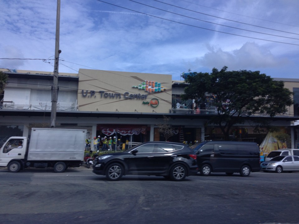 The UP Town Center is already attracting traffic as some restaurants and shops have already made “soft” openings.
A colleague once made the comment that the Town Center was not really for UP but, like the Alabang Town Center, was for the posh residential subdivisions in the area. These include nearby La Vista, Loyola Grand Villas and Ayala Heights subdivisions. Also, it will likely attract more car users than public transport users as locator restaurants and shops are mainly upper-middle to upper class. There are no Jollibees, Chowkings or McDos here. For now, the developer and UP Diliman deserves to be given the benefit of the doubt in as far as the development’s design is concerned. Perhaps the issues I mentioned above will be addressed once the entire area leased to Ayala would have been fully developed. And until then, there would be opportunities to check and ascertain if the development is indeed people friendly and something that can be called a university town center and not just another commercial development that attracts traffic.
–
Some thoughts on the issues on bus bans and terminals in Metro Manila
I had originally wanted to use “Clarifying issues on bus bans and terminals in Metro Manila” as the title for this post. However, I felt it was too strong a title, and one that would be more appropriate for a government agency like the MMDA or DOTC, or an LGU like Manila. More than fault-finding and criticizing government agencies and local governments, I believe we should take a closer and more objective look at the issues (or non issues?) pertaining to the Manila bus ban and the opening of the southwest provincial bus terminal for Cavite-bound buses. Following are my comments on issues raised the past weeks about the two initiatives.
Issue 1: There were no or few announcements about the implementation of the bus ban in Manila and the southwest terminal in Cavite.
Comments: While the bus ban in Manila came as a surprise to many, the move was actually a consequence of a Manila City Council resolution. Normally, such resolutions would take time to implement and would entail announcements for stakeholders. Though we will probably never know the truth or who is saying the truth about the resolution and its implementation, it is likely that bus operators already knew about the implications but decided to call Manila’s bluff and play the media and public appeal cards rather than comply with Manila’s requirements for franchised buses and terminals as they have done before in other issues like fuel prices and fare hikes.
I find it difficult to believe that the MMDA did not do its part in announcing the opening of the southwest terminal. Perhaps people thought the announcement was over a very short period? Or maybe people didn’t mind the announcement and are also at fault for paying no or little attention to the announcement? If so, then the public is also partly to blame for disregarding the announcement from the MMDA, assuming the agency won’t push through with its initiatives to implement central terminals for buses. Next up will be another southern terminal at Alabang and a northern one near Trinoma.
Issue 2: Poor transfer facilities and services including a lack of pedestrian facilities between the bus terminal and transfer point, and lack of public transport like jeepneys to ferry passengers to their destinations.
Comments: I think it’s quite clear that the MMDA and LGUs are at fault here. Despite the construction and scheduled opening of the southwest terminal, there have been limited effort in improving pedestrian facilities. Such facilities needed to be in place prior to or upon the opening of the southwest terminal and requiring all provincial buses to terminate at the facility instead of continuing to Metro Manila. People-friendly facilities could have helped people in adjusting to the new policy though walking from 100 to 200 meters is certainly not for all, especially during this rainy season. Senior citizens and persons with disabilities (PWDs) would have specific needs that could have been addressed from day one of operation of the terminal. One approach to “bridge the gap” between the terminal and where people could take city bus and jeepney rides could have been to modify some city bus and jeepney routes to make these closer to the terminal. Ideally, the terminal could have been an intermodal facility providing efficient, seamless transfers between modes of transport.
In the case of Manila, the jeepneys were already there with routes overlapping with buses but their numbers and capacity could not cope with the demand from the buses. Since the main objective of Manila was to weed out colorum buses, it could have coordinated with the LTFRB to check the registration and franchises of buses rather than generalizing among all buses. Perhaps Manila just wanted to make a big statement? But then this was at the expense of the riding public, which obviously got the attention of many including the media. Coordination among agencies and LGUs, however, has not been a strong suit for these agencies, and this thought leads us to the next issue.
Issue 3: Lack of coordination among LGUs and agencies in implementing transport schemes.
Comments: This issue is an enduring one and has been the topic of discussions, arguments and various fora for as long as we can remember. On one hand, the DOTC and the LTFRB should provide guidelines and guidance to local governments on transport planning and services. The agencies should be proactive in their engagement of LGUs in order to optimize transport services under the jurisdiction of national agencies and local governments. On the other hand, LGUs must accept the fact that most if not all of them are ill equipped or do not have the capacity nor capability to do transport planning much less addressing issues regarding public transport. Citing the Local Government Code and its devolution of local transport to LGUs everytime there’s a transport issue certainly won’t help LGUs solve their problems.
Issue 4: Terminals required for city buses in Manila.
Comments: There should be a terminal for city buses in Manila but not a terminal for each company. There should only be one or maybe two terminals where buses can make stops prior to making the turnaround for the return trip. There is actually a terminal in Manila, which the city can start with for city buses. This is the one just beside the Metropolitan Theater and near City Hall, which can be utilized by city buses. It is also close to the LRT Line 1 Central Station so the facility can be developed as a good intermodal terminal for land transport.
Issue 5: Colorum or illegal public transport vehicles in Manila
Comments: This is actually a problem not just for Manila but for the rest of Metropolitan Manila and the rest of the country. The colorum problem is there for both conventional and paratransit services as there are illegal buses, jeepneys, UV express, multicabs, taxis, tricycles and pedicabs everywhere. Many of these are allegedly being tolerated by national agencies and local governments with many allegedly being fielded or owned by public transport operators themselves.
–
In most cases, the best time to evaluate a traffic policy or scheme is NOT during its first days or weeks of implementation but after a significant time, say at least a month, after it was implemented. This is because the stakeholders, the people involved would take some time to adjust to any scheme or policy being implemented. This adjustment period will vary according to the magnitude or scope of the scheme/policy and can be quite “painful” to many who have gotten used to the old ways. Usually, a lot of comments and criticisms are quite emotional but it is clear that the collective sentiment is the result years or decades of poor transport services and fumbling by government agencies. Transport in Metro Manila is already quite complicated with routes overlapping and services competing with each other for the same passengers. Perhaps it is time to simplify transport while also in the process of optimizing and rationalizing services. I have written about this in this previous post.
More transport issues in Manila will come about should the city train its attention on other modes of transport including jeepneys, UV express vehicles, tricycles, pedicabs and kuligligs. If the city is really intent on reforming transport services within its jurisdiction, it should consider the needs of all stakeholders and especially and particularly the riding public. Transport should be inclusive, people-friendly as well as environment-friendly and there are many good practices in other cities that Manila could refer to and study for adaption and adoption for the city. If it is successful in improving transport, then perhaps Manila could be the country’s model for transformation from being the “Gates of Hell” to being a “Portal to Heaven” to residents and visitors alike.
–
Old style intersection traffic management
Heading to the DOST complex for a meeting, I took a few photos of the enforcers managing the traffic at the intersections at the Bicutan interchange from on top a traffic box. The intersections are formed by the on and off ramps of the South Luzon Expressway, the service roads and Gen. Santos Ave./Dona Soledad Ave. It was a welcome scene considering the enforcers seemed to be doing very well (i.e., traffic was flowing quite smoothly at the intersections) while also evoking times when traffic signals weren’t the norm in major intersections. Of course, it helped that pedestrian movements on the ground were eliminated by the pedestrian overpass set-up at the interchange, a legacy of the BF era at the MMDA.
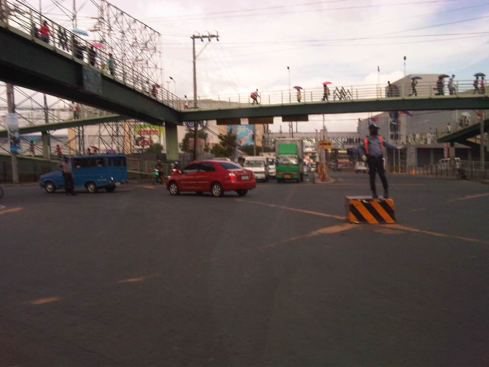 Traffic enforcer on a box directing traffic at the intersection of the SLEX soutbound ramps, the West Service Road and Dona Soledad Ave. That’s SM Bicutan in the background with its two buildings on either side of Dona Soledad and connected by an elevate walkway. Pedestrians have been eliminated from the equation thanks to the elevated walkway at the SLEX Bicutan interchange.
 Traffic enforcer at the intersection of the the SLEX northbound ramps, the East Service Road and Gen. Santos Ave. The PNR tracks run along just after the intersection.
–
Dream plan for the Greater Capital Region?
A report came out last Saturday on a major daily about a JICA study estimating losses of as much as 2.4 Billion pesos per day due to traffic jams experienced in Metro Manila. Not mentioned was the 1.0 Billion pesos per day estimated losses for the Bulacan, Rizal, Laguna and Cavite areas that are at present considered part of what has been loosely defined as Mega Manila or the Greater Capital Region (GCR). That’s 3.4 Billion pesos per day of lost productivity and potential income that if reduced, could generate resources that could be distributed to the rest of the country. The JICA estimate, as reported by NEDA, is the product of a study that is in its concluding phase that looked into transport for an area comprised of Metro Manila, Region 3 (Central Luzon) and Region 4A (Southern Tagalog or Calabarzon). The main objective of the study was to come up with a Transport Infrastructure Framework and Roadmap for the GCR that would guide planners and engineers, and most importantly decision-makers (i.e., our leaders) in identifying and prioritizing transport infra projects that would ultimately improve the way we travel in the GCR.
While I am not at liberty at present to divulge the details of this study as the entirety has not been made public yet, I can say that the study was comprehensive and the conclusion an urgent reminder to what needs to be done for transport in the GCR. The latter is necessary because we have failed to deliver on the transport infrastructure required by Metro Manila and its surrounding areas since the late 1970s adn early 1980s when some decisions were made that were detrimental to public transport development and, to my view, inhibited and limited us from implementing a much more efficient transport system than what we have now. In my own conversations with the person who led the study, I can understand his own frustrations as he was himself a witness to the deterioration of transport in this country. Much of this deterioration have been attributed to a lack of political will to make the hard decisions in relation to transport. These decisions include those pertaining to the rationalization of transport services like phasing out jeepneys and tricycles where they are no longer suitable and committing to the implementation of mass transit projects that have been delayed for decades now.
 Network of recommended rail rapid transit (RRT) lines for the Manila Metropolitan area in 1973 (UTSMMA, 1973)
Perhaps we are at a crossroads in terms of transport in this country. Perhaps our leaders should listen to the clamor of their constituents for better transport systems in our cities, for more efficient ways to move about. Perhaps, too, we could finally see what’s really at the end of the tunnel rather than the proverbial light that we have always seen, frustratingly, for the past few decades. Perhaps the current administration will prove itself the catalyst for transforming transport in this country towards what it has preached as a “straight path.” Will we have a champion or champions who would push for the realization of a dream plan for transport? Whoever should step forward would definitely get my vote in 2016!
–
Construction and congestion along the Manggahan East Bank Road
The East Bank Road along the Manggahan Floodway stretches from Pasig City through Cainta and Taytay in Rizal Province. It provides an alternate route for people traveling to/from the Rizal towns of Cainta, Taytay, Binangonan and the City of Antipolo from/to Metro Manila. The East Bank Road is directly connected to Amang Rodriguez Ave. and Ortigas Ave. while local roads connect it with C-6 and the Manila East Road. It is also an alternate route for people living in the residential areas of Pasig, Cainta and Taytay that are accessible via the many local streets connecting to the East Bank Road. After the Manggahan Bridge along Ortigas Ave Extension, there are two more bridges that travelers can use to cross the floodway. These are the Javier Bridge, which people can use to get to Raymundo Ave. or Sixto Antonio Ave. to eventually get to C-5, and the Barkadahan Bridge, which connects Highway 2000 in Taytay to Ejercito Ave. in Pasig in an area that’s contested by 3 LGUS (Pasig, Taytay and Cainta).
Sections of the East Bank Road are currently being rehabilitated. However, the contractors have started by working on the middle lane of a carriageway that’s 3 to 4 lanes wide with significant on-street parking on both sides of the road. There were minimal or no semblance at all of any traffic management on the side of the contractor, the MMDA or the LGUs involved in the project and so congestion occurs as it’s practically every driver/rider for him/herself along the road. I managed to take a few photos of the road and traffic conditions as we traveled towards Taytay and the Barkadahan Bridge from Ortigas Ave. and I can’t imagine how traffic is during the peak periods. I leave that up to the imagination of my readers.
 Middle lane undergoing pavement rehabilitation
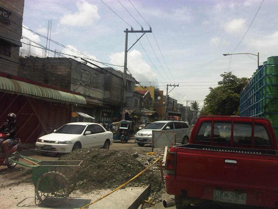 Construction and waste materials and equipment

–
Traffic congestion and the limits of quick fixes
One time last summer night, it took me 2.5 hours to get to the airport from where I reside when it should only be an hour or 1.5 hours (on a typical bad day). Very early mornings (between 2 to 4 AM), it only takes me 40 minutes between my home an the airport. The route I usually take is mainly along Circumferential Road 5 (C-5); a route that basically has sparse public transport (mostly jeepneys along different sections) but is a truck route. It was summer though and one would have thought that there would be less vehicles along the road with school still out. I was wrong in that assumption and that cost me both time and fuel that night.
Traffic congestion in Metro Manila and other Philippine cities have been issues for such a long time that one tends to assume there’s nothing being done to fix the problem. In Metro Manila, the Metropolitan Manila Development Authority (MMDA), in cooperation with the various local governments and national agencies, has implemented various schemes including the number coding, truck ban and a bus dispatch system along EDSA. Yet, congestion persists and only last week, the President got caught in traffic as he traveled from Malacanang Palace in Manila to the DOST Compound in Taguig. The news was filled with a comment that he supposedly made to the MMDA Chair about the delay he and his entourage experienced. The bad news is that this congestion will not go away and will only worsen if there are no steps taken to address the problem. And this happens not only in Metro Manila but in other highly urbanized cities in the country. Quite obviously, quick fixes are no longer enough and we have reached the limits of their applicability.
 EDSA during the morning rush hours
 EDSA during the afternoon peak, which actually extends to an evening and even nighttime traffic jam
So how do we alleviate traffic congestion? Here’s three things that come to mind as they seem to be quite logical and very obvious:
1. Build the mass transit infrastructure required – these infra include rail and bus rapid transit systems and are urgently needed in Metro Manila, Metro Cebu, Davao and other highly urbanized cities. A shift from private vehicle use to public transport will not happen if people have no attractive options for commuting. In Metro Manila, there is a backlog of mass transit projects with lines that should have been constructed and operational years or even decades ago.
2. Rationalize transport services – the long standing practice is to increase the number of existing modes of transport as the demand increases. This logic is one that is most abused as a doubling of demand is conveniently but incorrectly interpreted as requiring a corresponding doubling of the number of tricycles or jeepneys, for example. What is required is for our cities to “graduate” from low capacity and less efficient modes to higher capacity and more efficient ones. Many cities seem plagued with tricycles as their main modes of transport within their CBDs when these should have been restricted to residential areas and mainly in the periphery rather than allowed to dominate (and clog) urban streets.
3. Build more walkways and cycling facilities – its difficult to encourage people to walk and cycle if there are no space for pedestrians and cyclists to travel safely and efficiently. Most trips are actually short ones and do not require motor vehicles so it makes sense to invest in pedestrian and cycling facilities so people get the clear message of support for such options for travel. Such investment is also one for healthy living as walking and cycling are forms of exercise and it is well established that these modes of transport promote healthier lifestyles and therefore, healthier people in cities.
–
 Caught (up) in traffic
