
Home » Traffic Management (Page 17)
Category Archives: Traffic Management
Common causes of traffic congestion along Philippine roads
As a follow-up to a previous post on traffic congestion, I am writing on some of the most basic causes of congestion along Philippine roads. I say most basic because these are the usual situations we see along the road as we commute. And these are also supposed to be easily solved or addressed by the most basic approaches – enforcement. Here are a couple of photos and commentaries on this matter.
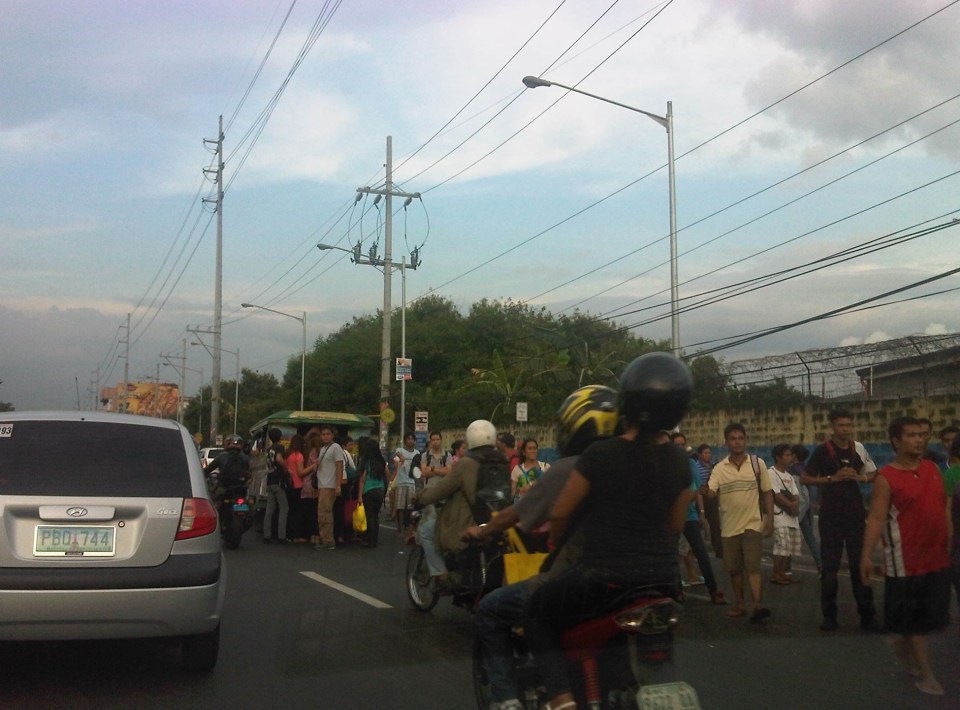 Commuters occupying two lanes of the road as they wait for public transport along Marcos Highway in Pasig – PUVs like the jeepney in the photo stop in the middle of the road to load/unload passengers. Were there traffic enforcers/aides in the area? Sometimes. Were they doing their jobs? Definitely not. In many cases, I’ve seen enforcers using the congestion (i.e., slowed traffic) to apprehend number coding violators. Now, number coding is premised on motorists being discouraged from traveling during certain times of the day to reduce congestion from vehicle volume. In the photo above, it’s pretty clear that the problem isn’t number coding violators but the mayhem caused by public transport and commuters. Something that traffic enforcers/aides could have acted on and with regularity and persistence so that they can positively influence jeepney driver and commuters towards orderly conduct.
 On-street parking and pedestrian activity along Manila roads – many cities such as Manila are guilty of not having any serious initiatives to address on-street parking. In many cases, its tolerated particularly in commercial areas as local governments don’t like to engage business in what they assume to be the small issue (or non-issue) of parking. In the case of pedestrians, it is a behavioral thing that requires a bit more effort than police or enforcer visibility (or the occasional apprehension). As a result, people will generally cross wherever they want and walk along the carriageway, not minding their safety. Of course, such behavior is encouraged by the absence of space for walking as vehicles, merchandise and other stuff occupy space that’s supposed to be for pedestrians.
–
Traffic congestion along Buendia (Gil Puyat Ave.)
The Makati CBD generates a very high number of trips owing to it being arguably the largest CBD in Metro Manila in terms of offices and workers. There are several other CBDs like Manila, Ortigas, Cubao, Eastwood, Filinvest City, and Bonifacio but they generate less traffic compared to Makati. There are several major roads in the area including four intersecting roads that practically define the CBD. These are Ayala Avenue, Gil Puyat Avenue (formerly but still popularly known as Buendia Avenue), Makati Avenue and Paseo de Roxas. Both Gil Puyat and Ayala Avenue are lined with offices along either side and are often congested due to the vehicle traffic generated by the CBD. Following are a few photos of Buendia Ave.
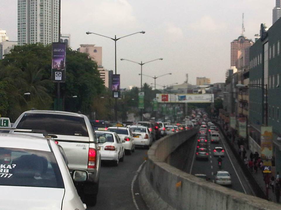 Traffic congestion along Gil Puyat Ave. as seen from the overpass from Kalayaan Ave. Even the sidewalk on the right side of the road is filled with pedestrians.
 One can see many people walking along the narrow sidewalk along Buendia. Some buildings have been renovated and refitted but many remain as they were in the last decade or more. The building in the center of the photo has so many air-conditioning units jutting outside the windows that it is quite obvious the units were an afterthought. Other buildings would likely have centralized or more strategically positioned air-conditioning units.
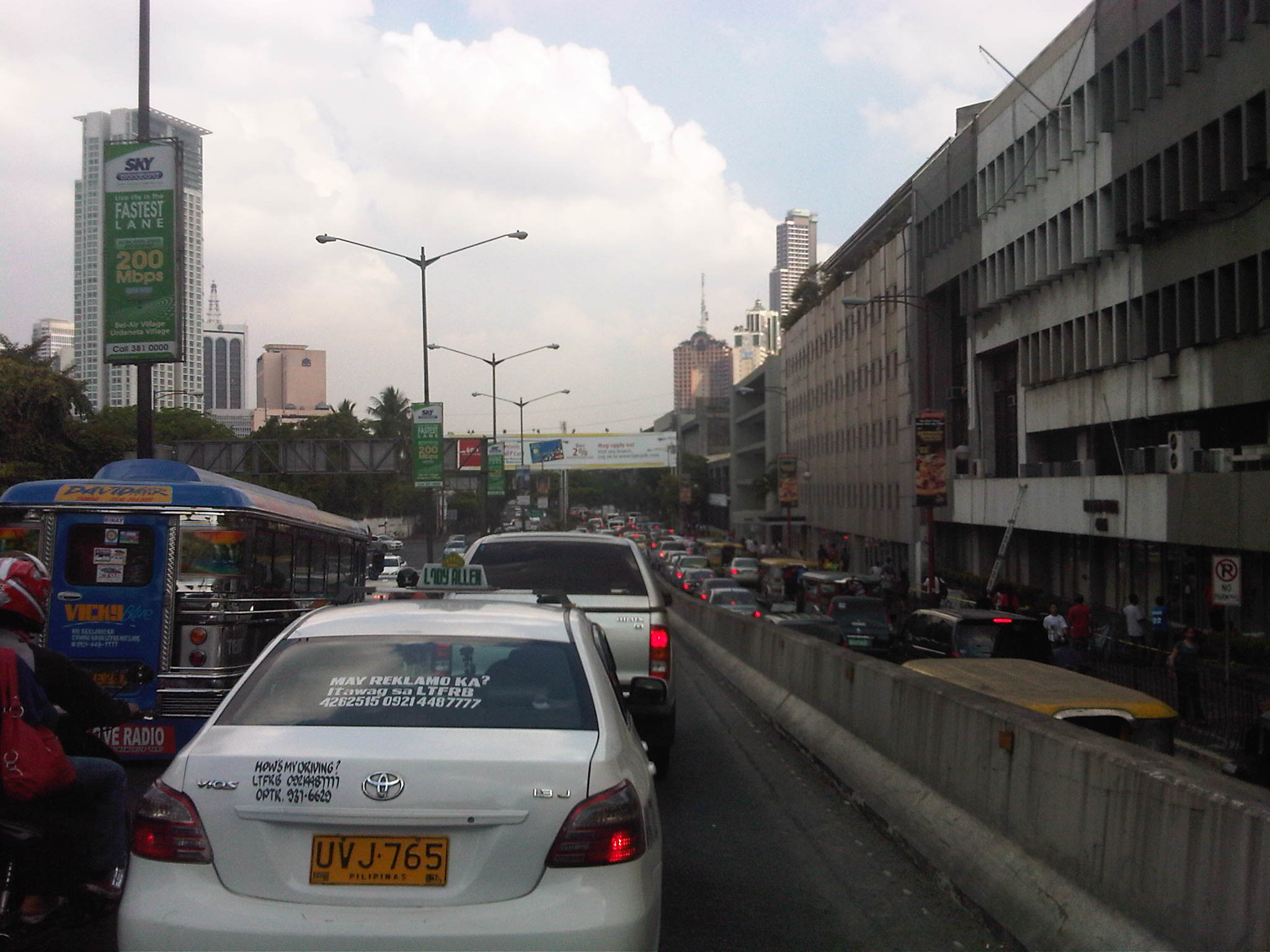 Another look at the traffic jam along one of Makati’s main roads indicate a lengthy queue from the Buendia Ave.-Paseo De Roxas intersection. The junction is signalized but saturated during peak periods. I am not sure about the optimization of the signal settings but it should be synchronized with at least two other intersections: Buendia Ave.-Makati Ave. and Paseo de Roxas-Makati Ave.
The DPWH is proposing a grade separation project along Buendia that is supposed to alleviate congestion at the intersections with Paseo de Roxas and Makati Avenue. The plan is to have an underpass along the avenue that would allow vehicles to flow through and bypassing the two major intersections. At-grade would still be signalized intersections but minus substantial through traffic along Buendia. The downside of such a project, of course, would be the expected traffic congestion during the construction phase. With very limited alternate routes and restricted space (i.e., unlike the case of the Quezon Ave. underpass at Araneta Ave.), traffic management in the area will surely be a challenge for the combined forces of Makati and MMDA traffic enforcers.
–
Rizal Avenue – Part 2: Tayuman to Pampanga Street
In the last post on Rizal Avenue, the featured photos show conditions under the LRT Line 1, which included visual evidence of certain issues like on-street parking, poor lighting and even sanitation (i.e., garbage) along the corridor. This post features more of the same and perhaps worse in some cases that are used as proof of the blight caused in part by the LRT superstructure. I say in part because LRT Line 1 is not wholly to blame for problems under and around it. Local governments and the private sector share responsibility for the decline of the areas within the direct influence of the rail line. Napabayaan. But of course, this does not absolve proponents of the LRT Line 1 for poor station design.
 Approach to Tayuman Station along the northbound side of Rizal Avenue.
 Tayuman Station – shown in the upper part of the photo is one end of the northbound platform.
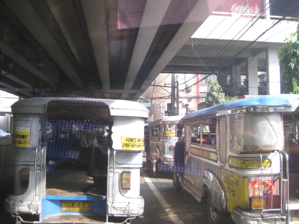 Underneath the station, jeepneys clog the lanes as they load/unload passengers. LRT Line 1 stations are poorly designed for intermodal transfers (e.g., LRT to jeepney, LRT to bus, etc.).
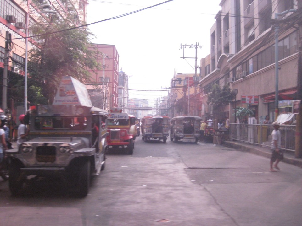 Tayuman Road is a busy street in Manila that’s served by jeepneys connecting to major streets like Lacson Avenue to the east and Abad Santos and Juan Luna to the west. The photo shows a view to the east of the LRT Tayuman Station.
 Approach to the junction with Herrera Street
 Approach to Blumentritt Station – the station is named after Ferdinand Blumentritt, an Austrian who was a close friend of the national hero Jose Rizal. The street leads to a large public market close to the station (near the intersection) that is also named after the fellow and one of the more crowded markets in the metropolis. There are many jeepney lines with Blumentritt as part of their routes.
 Birds and other creatures being sold as pets around Blumentritt – many have been painted to attract children and other buyers curious at the colored birds.
 Vendors line the Rizal Avenue, Blumentritt and the other side streets in the area, which is usually crowded no matter what day of the week it is.
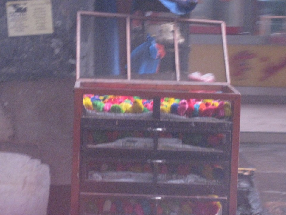 Angry birds? A closer look reveals the birds as chicken chicks colored by the vendors to attract interest. Sadly, many of these do not survive to become full grown chickens and children (and adults) will be disappointed to discover later that the color comes off pretty quick when the chicks come in contact with water.
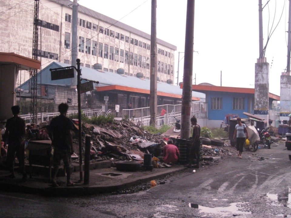 There is a PNR Blumentritt Station and unless there’s been some radical clean-up of the area, this is pretty much what you’d see around the station – garbage, dirt, informal settlers and other characters. The building behind the station is a public school.
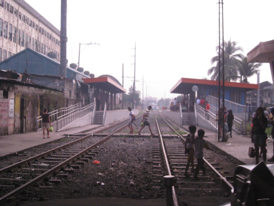 The PNR Blumentritt Station has two platforms on either side of the double track. Security is quite lax and people, including children, cross the tracks freely. Fortunately, train service frequencies are quite low (about 1 per hour) so the risk of getting hit by a train is also low. The photo shows the view to the east of Rizal Avenue.
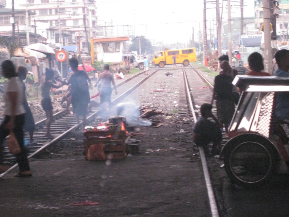 On the left side of Rizal Avenue is a scene where people are oblivious to the railways with some even doing their cooking between the tracks.
 Blumentritt Avenue is a very crowded street with a public school (building at right) just across the public market (at left). There are many vendors lined along the street and people as just about everywhere and without regard to vehicular traffic.
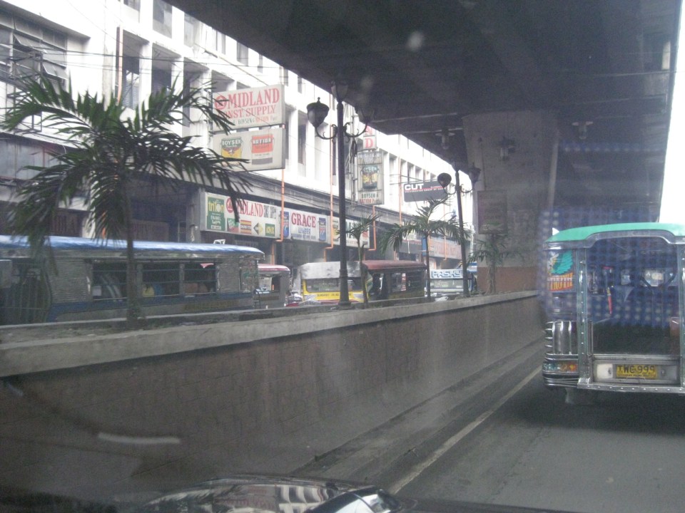 Traffic congestion along Rizal Avenue is attributed mainly to the market and median barriers were constructed to reduce pedestrian crossings anywhere along the road. Commercial establishments line either side of Rizal Avenue, basically contributing to congestion in the area.
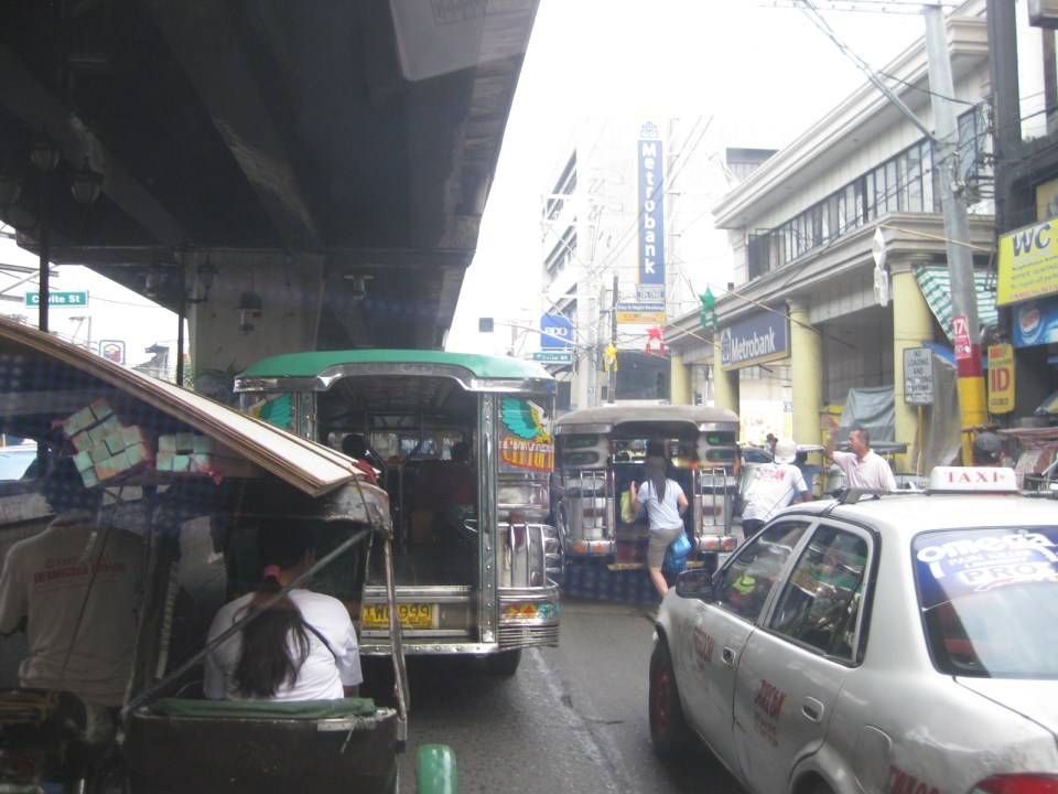 Commercial establishments plus customers plus paratransit equal to traffic congestion
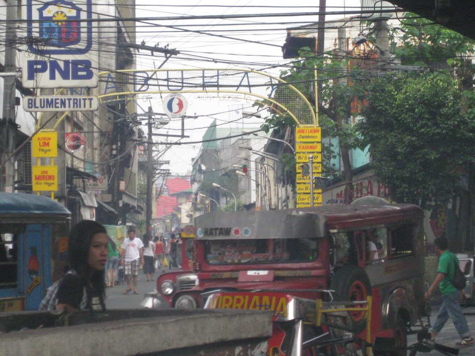 16A busy side street in the Blumentritt area – there are no sidewalks so pedestrians and motor vehicles mix it up along the road.
 Bulacan Street serves as an informal terminal for jeepneys. The road appears to be newly paved but there are no sidewalks and tents are found along the road often bearing the names of politicians sponsoring the tents for various purposes such as wakes and parties.
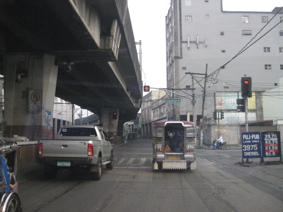 Intersection with Pampanga Street, just before Rizal Avenue and the LRT line turns towards Aurora Boulevard and proceed to Caloocan City and Monumento.
More on Rizal Avenue in future post…
–
Night time congestion along C-5
Traffic congestion along Circumferential Road 5 is experienced practically throughout the day with the worst congestion along the southbound direction during the mornings between the Riverbanks Road in Quezon City and Kalayaan Avenue in Makati City, and the northbound direction between Bonifacio Global City and Eastwood from noon to nighttime. The following photos taken by my wife as I fetched her one night from her office shows the traffic jam along C-5 as we turned from the flyover past Market! Market! towards the highway.
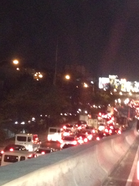 Congestion along the C-5 northbound is a regular thing during the weekdays from the afternoon to late at night. While apps like the MMDA’s Traffic Navigator and Waze allow us to have an idea of how congested C-5 is during such periods, the actual experience is much worse than what many of us can just imagine from the apps.
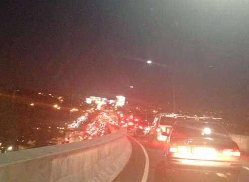 As far as the eye could see – congestion in the form of the taillights of vehicles along the northbound side of C-5 indicate just how many people are caught in traffic from Taguig all the way to Pasig and beyond. The giant billboards from Kalayaan Avenue to Pasig Boulevard including those seen along the bridge crossing the Pasig River. Most of these people are office workers coming from Makati and Global City and heading home to Quezon City, Pasig, and the towns of Rizal. After 7 PM, trucks add to the traffic
Many people are asking if there is a solution in sight for congestion along C-5. To be frank, there is none in the immediate future. There are proposals to introduce a public transport system along the corridor with one option being a Bus Rapid Transit (BRT) and another an elevated rail transit line. The BRT line is a recommendation of a Pre-FS for Metro Manila BRT conducted around 6 years ago though there was a proposal for a bus system (Philtrak) along the same corridor back in the late 80’s and pursued for some time during the 90’s. Not much have been done towards realizing any of these proposals. An efficient mass transit system along the corridor could encourage people to shift from private to public transport and help reduce vehicular traffic along C-5 considering that even as I write this post, vehicle ownership is increasing in Metro Manila and its environs and this could only mean more congestion along C-5 and other roads.
–
Streets of Olongapo: Rizal Avenue
Olongapo City is located in the Province of Zambales, the only city in that province, and beside the Subic Freeport. It is a pioneer in public transport service innovations in the form of the first initiative on the color-coding of jeepneys according to their routes. Despite what seemed to be forever being linked to the Freeport in terms of economic development, the city has enjoyed continued growth and is currently experiencing more challenges attributed to this growth. Among these challenges are those pertaining to traffic congestion and public transport services for the city. A Transportation and Traffic Management Plan Study was conducted by UP Diliman through the National Center for Transportation Studies and is up for formal adoption of the city.
Following are photos taken along the city’s main street, Rizal Avenue, where many of the city’s transport and traffic problems are manifested.
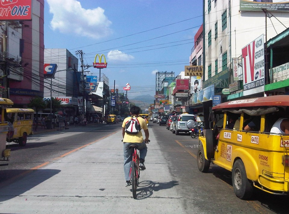 Cyclist pedaling along Rizal Avenue beside a yellow jeepney taking passengers at the designated stop at curbside. Downstream are parked vehicles along the road.
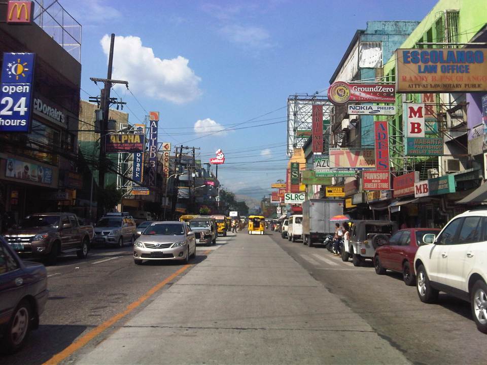 More parked vehicles at either side of Rizal Avenue effectively reducing road capacity for the 4-lane street.
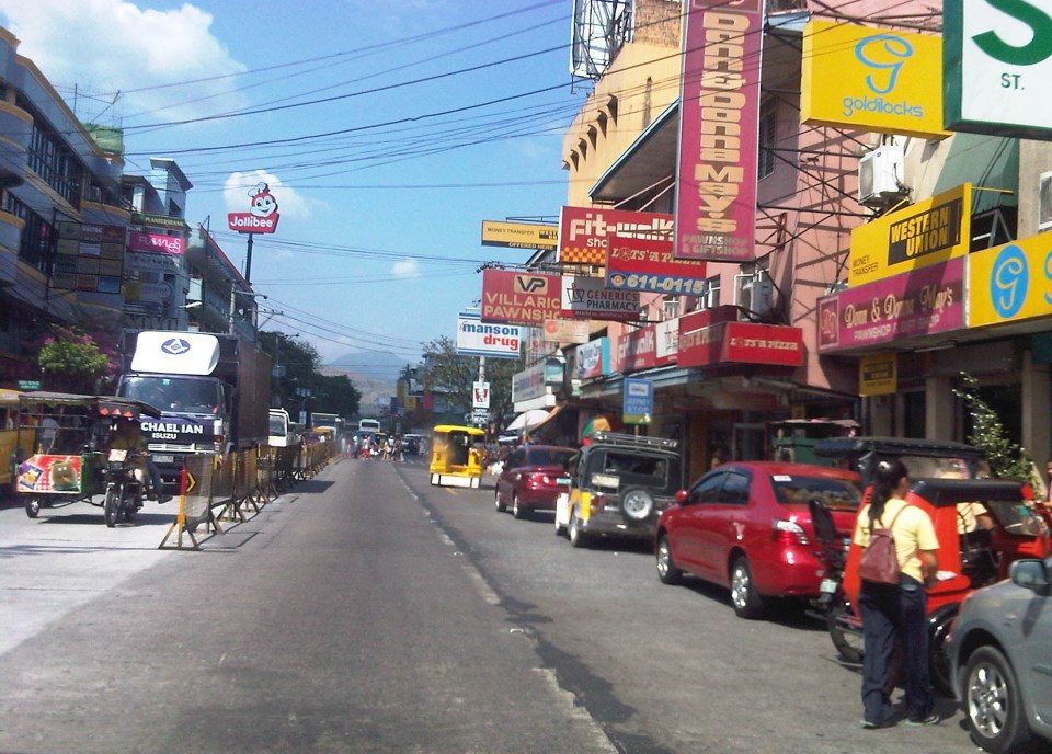 On-street parking is a problem for the city as there are few, if any, off-street parking facilities in the city. On-street parking turnover is quite low since many of the parked vehicles are not clients or customers but establishment owners or managers.
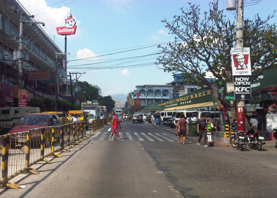 Most of Rizal Avenue is undivided but there are median barriers along the section in front of the public market to reduce jaywalking among pedestrians.
 The section in front of city hall – just across are many commercial establishments and on-street parking.
 Another view of the Rizal Avenue, this time along the westbound side, with the the market on the left side. The yellow jeepneys are quite conspicuous and remind me of the UP Ikot jeepneys.
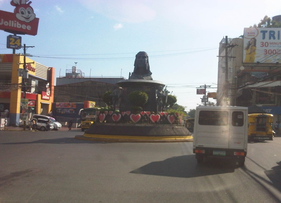 A monument to the Ulo ng Apo, from which the name of the city is said to be derived from, is right in the middle of a rotunda at a major intersection along Rizal Avenue. Around the rotunda are commercial establishments and a major provincial bus terminal.
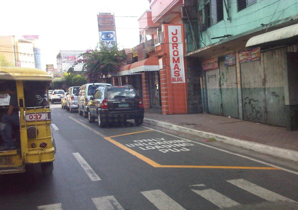 There are designated stops for jeepneys along the avenue but these are often crowded out by parked vehicles. As a result, jeepneys could not maneuver properly and end up unloading/loading passengers in the middle of the road.
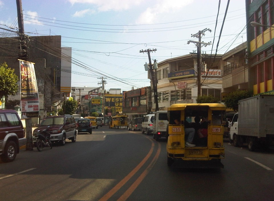 On-street parking along curves tend to impede the flow of traffic. There are also issues where electric posts like the one shown in the photo have not been transferred, posing risks to vehicular traffic.
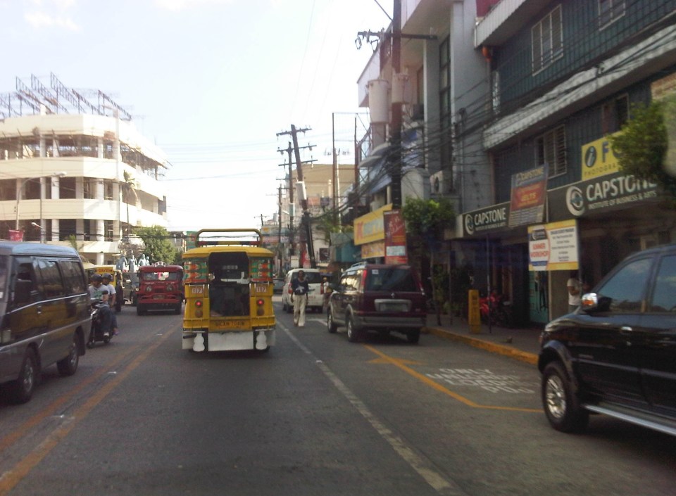 Another example of a designated jeepney stop along the avenue where parked vehicles constrict maneuvering space for jeepneys.
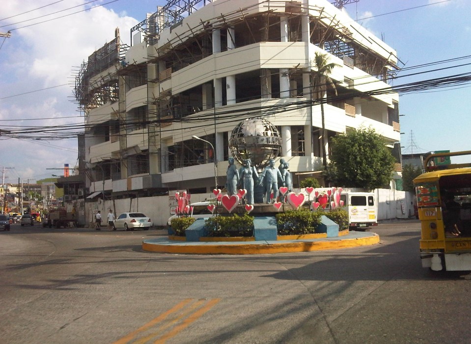 A monument to the volunteers of Olongapo during the Mt. Pinatubo episode after the closure of the U.S. Naval Base in what is now a Freeport. I wonder if the building under construction in the photo has enough parking spaces for the traffic it generates.
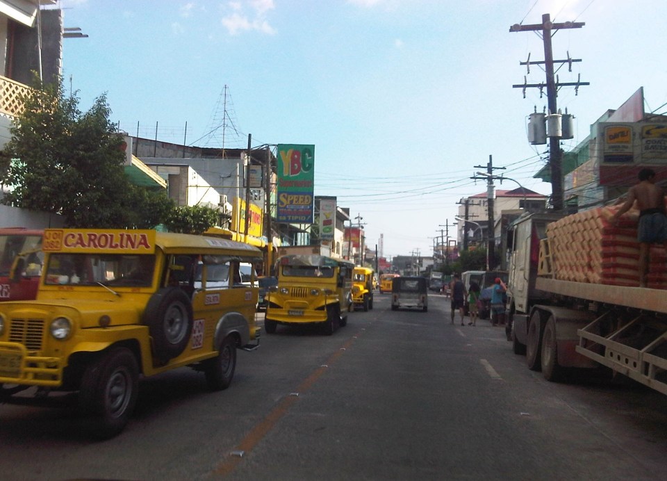 More jeepneys and more on-street parking – there is a perception that there are too many (oversupply) of jeepneys. Note though that most PUJs in Olongapo are not the bigger 20 to 24 seater jeepneys we see in Metro Manila but the older, 16 to 18 seaters like the ones shown in the photo.
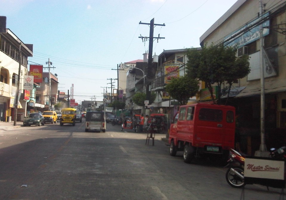 Some on-street parking spaces are “reserved” by establishments. I didn’t mention that on-street parking is free of charge and such situation probably encourages longer parking durations. Perhaps the city should seriously consider parking fees to reduce long-term parking and ensure smoother flow of traffic along its streets. There are examples of these parking schemes in other cities including Makati City that Olongapo can adopt and adjust.
–
Rizal Avenue – Part 1: Carriedo – Bambang
Rizal Avenue stretches from Manila northward to Caloocan city from Carriedo to Monumento. What used to be one of the more cosmopolitan streets in Manila was transformed (some say blighted) by the construction of the elevated LRT Line in the early 1980’s. Carriedo, for example, used to be a popular shopping street along with Escolta. Those were times when there were none of the huge shopping malls now scattered in Metro Manila and people came to Manila to shop.
The following photos were taken while we traversed Rizal Avenue as part of a recon we were conducting for a project with the Department of Transportation and Communications (DOTC) back in 2011. I’m not sure if there have been any significant changes along Rizal Avenue and I am not aware of any recent programs to improve conditions under the LRT Line 1.
 Approaching the LRT Line 1 Carriedo Station from the McArthur Bridge
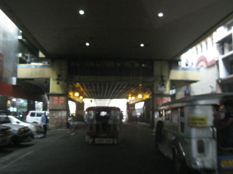 Under Carriedo Station, one experiences first-hand what people have been saying about the area being blighted by the LRT 1 structure
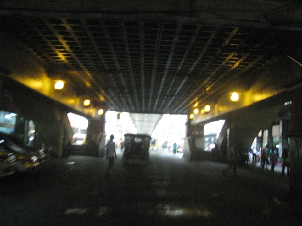 Poorly lighted? It was broad daylight outdoors when we conducted the recon but underneath an LRT 1 Station it can get quite dark. Of course, aside from the need to improve illumination, perhaps authorities can also improve the environment including the cleanliness of the area under the station. A common complaint is garbage and there are those saying the area smells of piss (i.e., mapanghi).
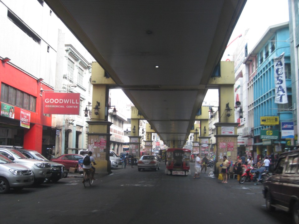 Past Carriedo Station, it was brighter and perhaps the area can be developed so that stretches can be pedestrian friendly. Maybe there should also be restrictions on vehicle parking, which tends to make the area look congested. It would be good to have a strategically located multilevel facility in the area where most vehicles can park instead of along the streets as shown in the photo.
 5More roadside parking plus the presence of tricycles contribute to traffic congestion in the area. People are everywhere walking and crossing anywhere. The arcades where they are supposed to walk along are mainly occupied by vendors or merchandise of stores/shops occupying the ground floors of the buildings along the street.
 Each side of Rizal Avenue is surprisingly wide with 3 lanes per direction. One lane is effectively used for on-street parking while the other two are for general traffic. There are no lane markings at the time we passed by the area so there can be confusion as to lane assignments.
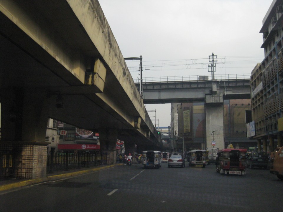 Approach to the junction with Recto Ave. and the LRT Line 2, which is also elevated and at the 3rd level as shown in the photo.
 Rizal Ave.-Recto Ave. intersection – visible downstream in the photo is Doroteo Jose Station
 Provincial bus terminal between Doroteo Jose and Bambang Stations
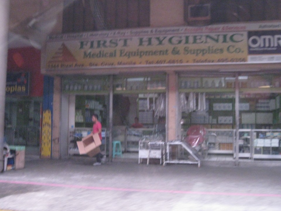 The Sta. Cruz district and particularly the Bambang area is well-known for shops selling medical equipment and supplies. Medical, nursing and other students of allied medical professions as well as professionals come to Bambang to purchase equipment and supplies from these shops, which offer items at lower prices.
 LRT 1 Bambang Station
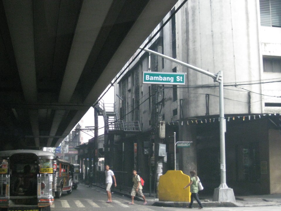 Rizal Ave.-Bambang St. intersection beneath the station
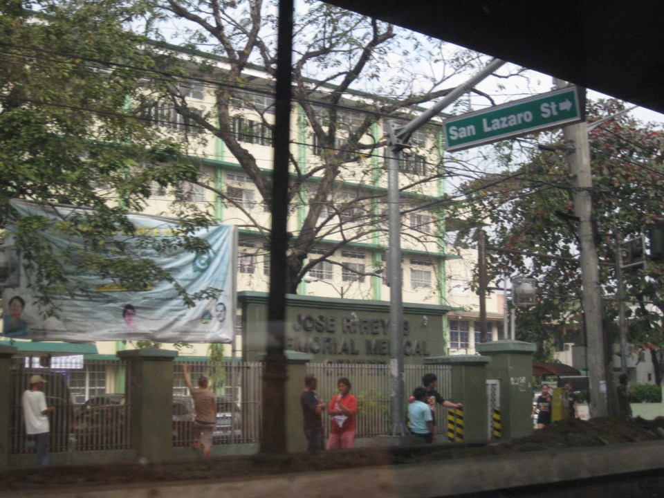 Two large government hospitals are located in the area between Bambang Station and Tayuman Station – San Lazaro Hospital and Jose Reyes Memorial Medical Center. Both are run by the Department of Health (DOH), which is located beside Jose Reyes.
–
Quiapo, Manila
The Quiapo district of Manila is one of the oldest CBDs in the metropolis and is a major end point for public transport similar to Cubao and Divisoria. Quiapo is best known for its church, which is dedicated to the Black Nazarene, and one of the most visited by pilgrims in the Philippines along with Baclaran (Our Lady of Perpetual Help) and Antipolo (Our Lady of Peace and Good Voyage). Fridays are usually the most congested days in the area as it is the day designated for services for the Black Nazarene (Note: Wednesdays are for Baclaran.).
 Underpass along Quezon Boulevard – the Far Eastern University is at the left while the bridge downstream is the elevated LRT Line 2 that is directly above Claro M. Recto Avenue. At right are commercial and residential buildings surrounding the Manila City Jail. The building at the right behind the LRT 2 is the Isetann mall.
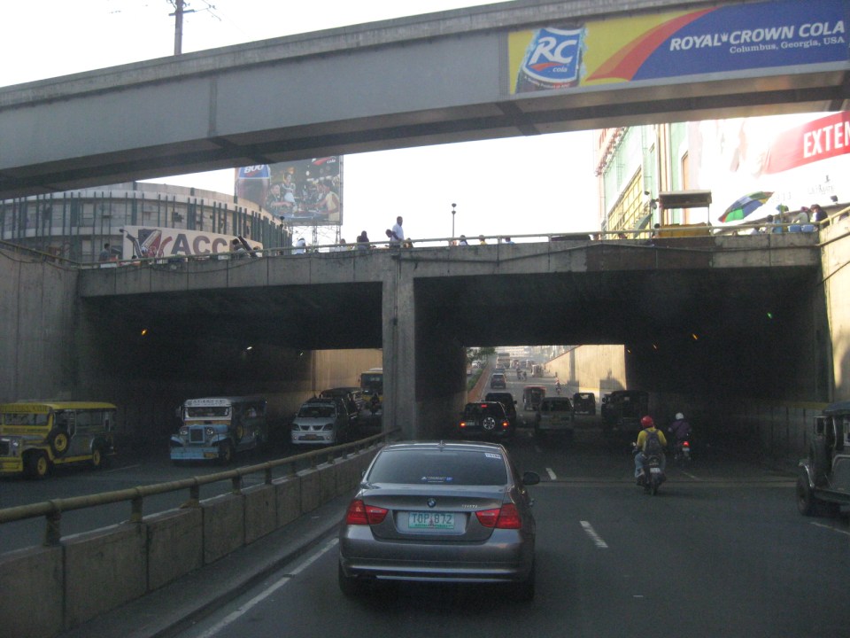 Grade separation – the Quezon Blvd. underpass running beneath LRT Line 2 and Claro M. Recto Ave. has 3 lanes per direction.
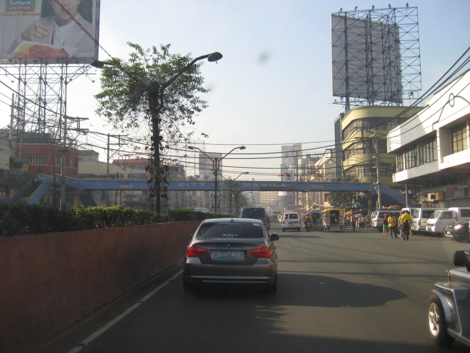 The Intramuros-bound direction of Quezon Blvd. has five (5) lanes but these are confused due to the lack of lane markings. Effectively, there are only 4 lanes due to road-side parking and pedestrian activity. While many old buildings are designed in the arcade style where pedestrians are supposed to have right-of-way, these are usually occupied by merchandize, signs and other obstacles to pedestrian flow. As such, pedestrians walk along the carriageway as seen in the photo.
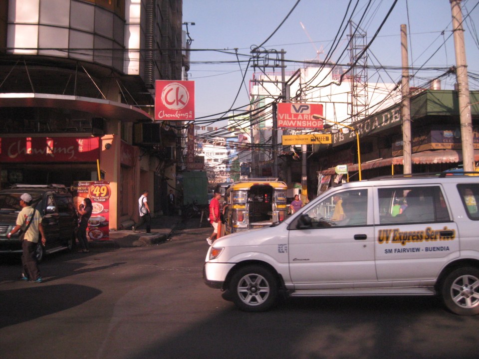 One of the side streets in Quiapo is Raon, popular for electronics and camera shops. People came and continue to come here for good deals on music players, karaoke machines, speakers, digital cameras and other electronic goods. However, one has to be attentive or alert as there are supposedly many snatchers and pickpockets in the area.
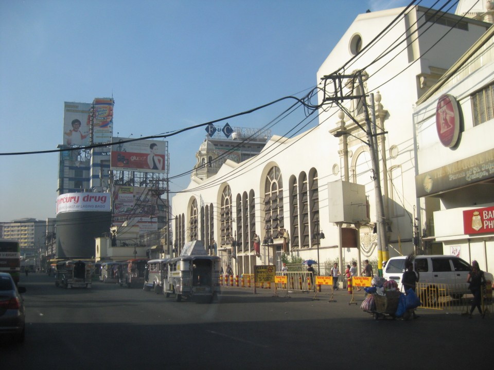 The Quiapo Church is a shrine dedicated to the Black Nazarene. The Feast Day every January attracts hundreds of thousands of people in a procession that now starts from the Quirino Grandstand in Rizal Park and ends at the church.
 The giant screen usually shows ads by the sponsor, a major drugstore chain, and popular television shows. The screen is quite bright at night and you can see many people gathering around for when it features primetime TV shows.
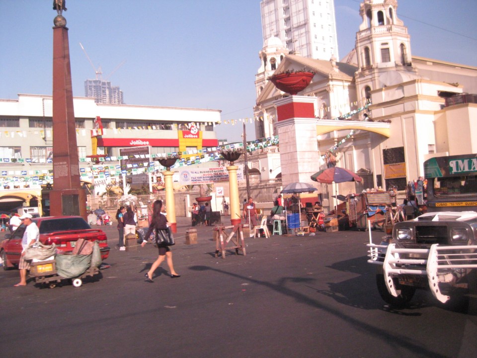 Plaza Miranda in front of Quiapo Church has been the site of many events including the infamous bombing of a political gathering in 1972 that led to the imposition of Martial Law in September of that year. Common around the plaza are vendors peddling herbal medicines, religious items, and even religious services like praying for the client in exchange for a small fee. There are also fortune tellers and other characters.
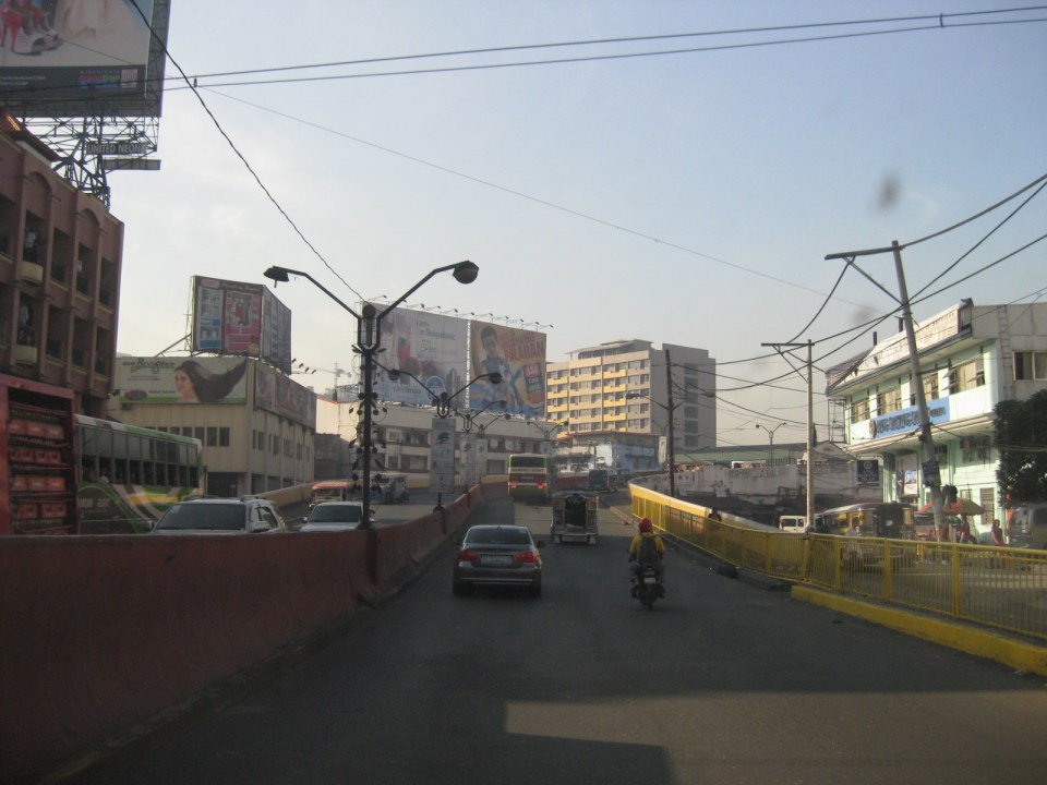 Past the Quiapo church is the ramp towards the Quezon Bridge. Underneath and faintly visible in the photo is an underpass along which is Carlos Palanca Street that leads to Rizal Avenue in the northwest and P. Casal in the southeast. There are many shops along this road where the Quinta Market is also located at the corner of Quezon Blvd. and Palanca Street. Among these shops are those selling handicrafts and the notorious ones selling bootleg DVD movies.
 Approach to Quezon Bridge, one of the oldest bridges in Manila spanning the Pasig River. It’s steel truss design has been an example used in many civil engineering and architecture classes.
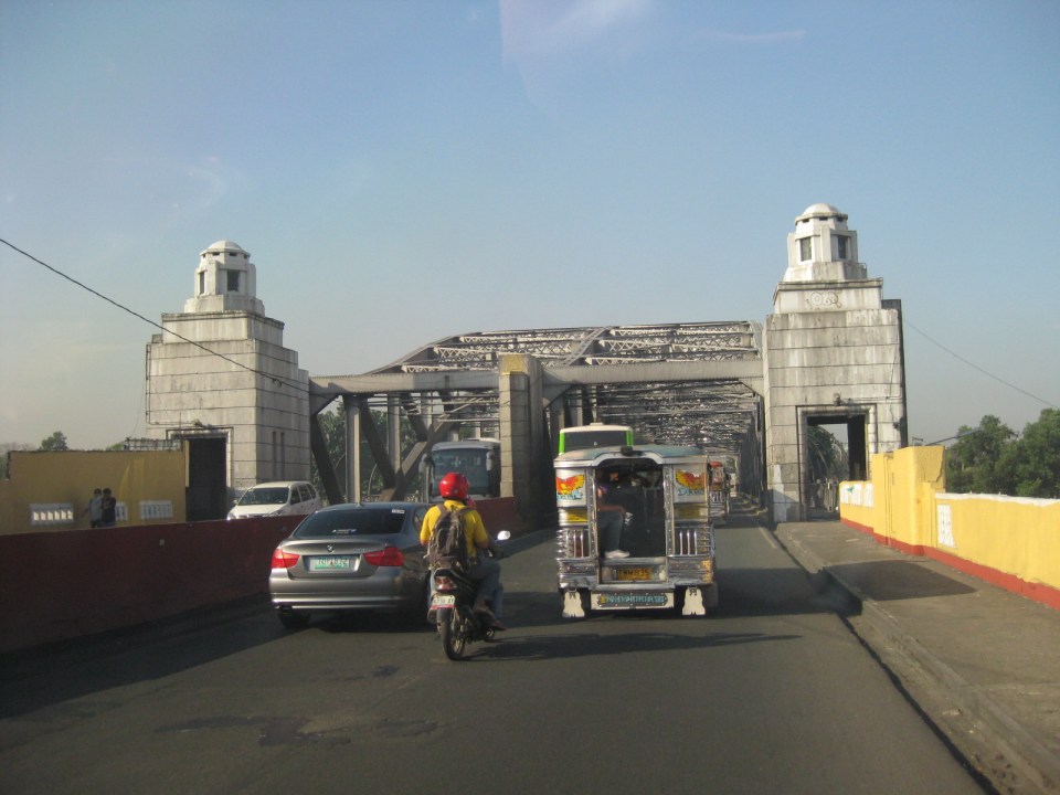 A closer look at Quezon Bridge.
–
Streets of Intramuros: Calle Real del Palacio
I haven’t had a good chance to take photos of the streets in Intramuros, Manila. The historic streets within what was for hundreds of years regarded as Manila deserves a more detailed treatment. Recently, I have been able to go around a little bit thanks to meetings at the DPWH and a lecture at the Mapua Institute of Technology. I took full advantage of the opportunity to take photos along some streets along the way to my meetings and am posting these in a few articles about what I think should be a good example for heritage conservation including the street names and old structures within the walled city.
The original name of Andres Soriano Jr. Avenue, the main road stretching from Plaza Mexico along the Pasig River to A. Bonifacio Drive in the Port Area, was Calle Real del Palacio. I believe they should have stuck with the original name in order to preserve this piece of history. Our politicians have a penchant for renaming streets after their kin, heroes, or for purposes like claiming that we should exorcise names associated with our colonial past. While the latter seems to be a basis for changing names elsewhere (not just in the Philippines), perhaps the remedy here is to still retain the original name under the new one.
 Ruins of the aduana or customs building, visible upon turning from the Muelle Del Rio at Plaza Mexico towards Andres Soriano Jr. Ave.
 The road is a four lane, two-way street. It is usually congested because of public transport loading and unloading operations (usually in the middle of the street) and roadside parking, which is tolerated. In fact, there are parking aides in charge of collecting fees from drivers parking along the streets. Intramuros is host to a lot of offices, commercial establishments and schools – all major traffic generators that attract so many vehicles thereby requiring a lot of parking space. The building to the left is the reconstructed building where the old ayuntamiento used to stand.
 The new building where the ayuntamiento was is now supposed to be the new offices of the Bureau of Treasury.
 The open space at left is the along which are many parked cars is the Plaza Roma, which is in front of the Manila Cathedral. The building right after the plaza is where the Palacio del Gobernador used to be. It is now the offices of the Bureau of Treasury.
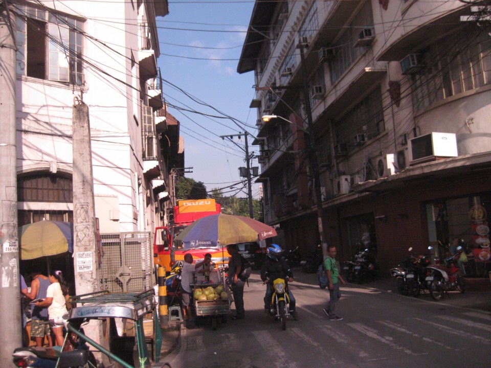 Cabildo Street, one of the side streets from across the Plaza Roma, which ultimately leads to Fort Santiago.
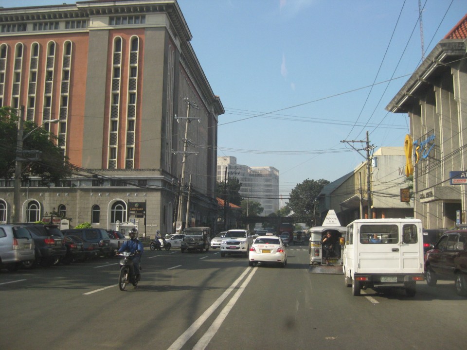 6Another look at the building where the old Governor’s Palace used to be. Visible downstream along the Soriano Ave. is the gate leading to the Simeon de Anda monument located at a roundabout along A. Bonifacio Drive.
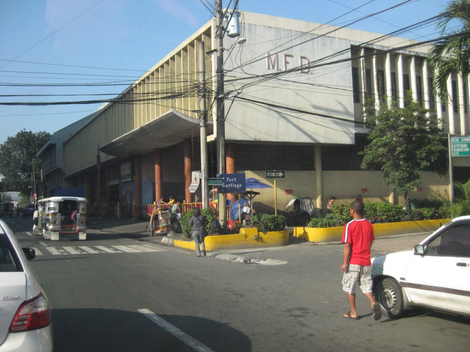 At right is Gen. Antonio Luna Street, which is another main road that has one end at Puerto Real, the southernmost gate of the Intramuros and the other at Fort Santiago. Curiously, this road was also called Calle Real del Palacio as it passed in front of the Palacio del Gobernador.
 A view along Gen. Antonio Luna Street towards Fort Santiago, which is a one-way street.
 Western entrance to Intramuros along Soriano Ave. leads to Bonifacio Drive and the Port Area.
 Arzobispo Street, which also leads to Fort Santiago but also passes along the Archbishop’s Palace, the office of the Archdiocese of Manila and with its southernmost end at San Agustin Church.
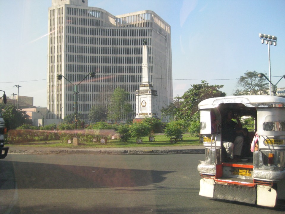 The Simeon de Anda monument at the Anda Circle along Bonifacio Drive.
–
Another revolution needed along EDSA?
One of the most powerful images of EDSA that sticks to anyone’s mind is one where you see hundreds of thousands of people occupying the sections near what is now a shrine dedicated to the People Power Revolution that led to the ouster of Ferdinand Marcos in 1986. Perhaps a more recent version of this image is another associated with a People Power 2 that ended the term of another Philippine President, Erap Estrada, in 2001. The latter had in the background the newly operational MRT-3 as well as the overpasses at the intersection of EDSA-Ortigas that were built after 1986. These images are now mostly replaced by those depicting EDSA as one huge parking lot for cars during peak periods that seem to stretch beyond the typical morning and afternoon hours. A couple of photos are reproduced below showing day time and night time traffic congestion along the stretch of EDSA from Ortigas to Camp Aguinaldo.
 Afternoon congestion along the section of EDSA between Ortigas and Santolan. Note that even the overpasses are full of vehicles. Camp Aguinaldo is the green area on the top right.
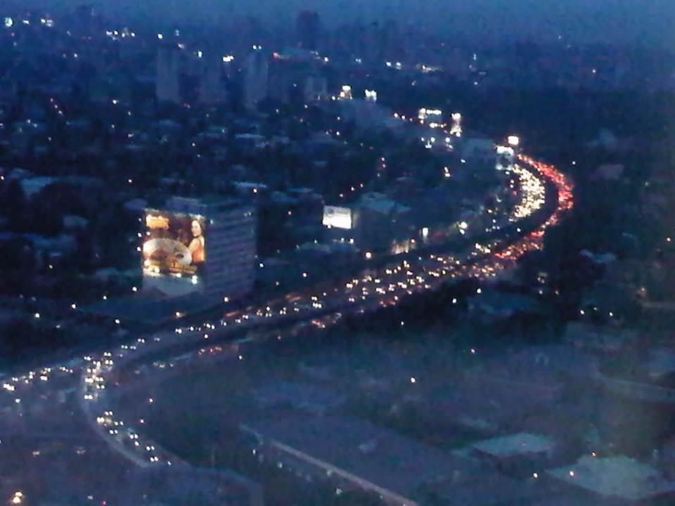 Traffic congestion along the same section of EDSA at night. The head and tail lights represent the motor vehicles crawling along the highway.
Already the Metropolitan Manila Development Authority (MMDA) has tried so many schemes along EDSA but mostly to regulate bus traffic. These have included various versions of dispatching schemes including a failed foray into the use of RFIDs. The current system that was launched in January is another attempt that we hope to be more successful than the previous ones. Already, the system has been able to weed out drivers with multiple traffic violations. There are many more of these drivers behind the wheels of public transport vehicles who probably shouldn’t be driving such vehicles as they put their passengers at risk of being involved in road crashes. Incidentally, such traffic violations associated with the different private bus companies operating in Metro Manila have been the subject of an interesting discussion during one congressional inquiry on public transport franchises where the MMDA reported hundreds if not thousands of traffic violations attributed to various bus companies.
The MMDA is limited by its mandate in so far as buses are concerned. It is the Land Transportation Franchising and Regulatory Board (LTFRB), which has the responsibility to address franchise violations and enforce rules in such a way that the agency could influence bus companies to improve their services. However, the MMDA is not at all helpless here as they are in the best position to petition for sanctions against erring bus companies based on their data on traffic violations. Such obviously constitute a violation in the franchise particularly where reckless or irresponsible driving exposes their passengers and the general public to risks in the form of road crashes. Such crashes can translate into losses of lives, injuries or significant damages to property.
The Department of Public Works and Highways (DPWH) has proposed an elevated highway on top of EDSA. This is supposed to have been inspired by similar elevated expressways found in other principal metropolitan areas including those in Tokyo. Would it solve the problem of traffic along EDSA? Probably in the short run after its opening but likely not in the long run as the elevated highway will rapidly become congested much like the experience with C-5. An elevated highway will also require ramps at many of EDSA’s intersections with other major highways and congested on the ground will lead to the condition spreading to the elevated sections.
The planned rehabilitation of EDSA is overdue. However, it has met a lot of opposition and mixed signals from various sectors including the MMDA itself, which is supposed to work with the DPWH in finding a solution for Metro Manila’s busiest thoroughfare. It seems that the MMDA is perhaps more interested in pursuing another elevated highway project, the Skybridge, which would be along a corridor on top of the San Juan River. Curiously, the objective of this other proposal is to have another alternate route to EDSA or simply “to decongest EDSA.” While well meaning, I have the gut feeling it won’t have a tremendous impact as it will still cater mainly to private cars. How about the commuters who comprise 70 to 80 percent of travelers along EDSA but only have about 30 percent of the road? We have to realize that only by keeping people, who do not need to drive, on public transport can we effectively decongest our roads. It is when they start using cars or motorcycles that our road space become all the more limited.
Meanwhile, the Department of Transportation and Communications (DOTC), the agency which is supposed to come up with the solutions to our transport problems has not been as active as it should be on the topic of EDSA. To be fair, the agency seems to be working on the acquisition of additional coaches to address the also overdue capacity expansion for the MRT Line 3. However, it also seems that now worries that the line was poorly planned in the sense that it failed to anticipate the present transport demand, has been validated. MRT Line 3 is really a light rail transit line that was built along EDSA despite the need for a higher capacity system. But is it too late to upgrade this system? Or do we need another to supplement or complement the MRT 3?
Perhaps what is needed along EDSA is another revolution but one of the sustainable transport kind. “Sobra na! Tama na! Palitan na!” were cries in 1986 that are now very much applicable to the transport system we have along EDSA. It will not be an easy nor an inexpensive task to upgrade the MRT-3 into a higher capacity system required along this corridor. But opportunities are now available to ease the burden along the line. The emergence of bus rapid transit (BRT) as a viable option along EDSA would have to be explored. But a BRT cannot be simply installed along the corridor. The government would also have to be firm with the conventional buses plying routes that all seem to be overlapping along EDSA. These routes would have to be simplified along with the numerous companies that would have to be encouraged to form consortia (or cooperatives?) that can participate in a MRT-BRT-bus integrated network. The question now is who will champion or lead such a revolution for transport? Who will be progressive enough to lead us into an era of modern transport that should be inclusive, environment-friendly, and promotes “dignity of travel” for all?
–
The streets and sidewalks of Melaka
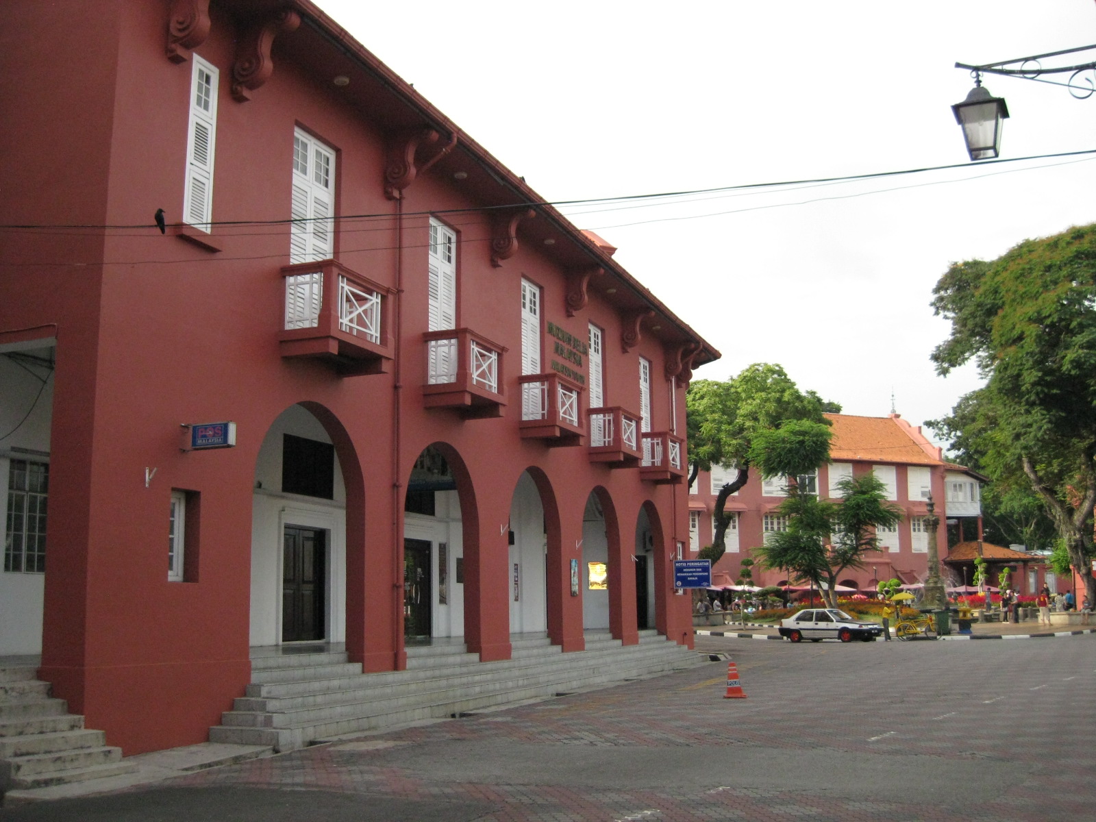 |
| View towards the plaza – the red building is part of the Christ Church complex but is now home of the Melaka Post Office |
 |
| The walkways reminded me of similar forms in Manila, Cebu and Iloilo, all old cities established during the Spanish Period when Melaka was under the rival Portuguese. |
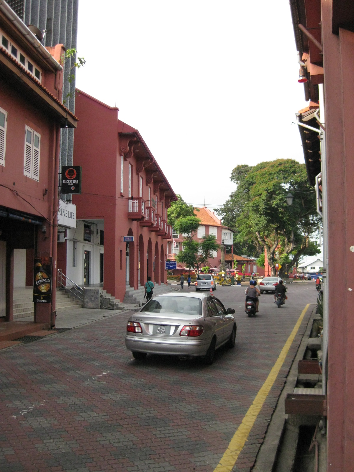 |
| The pavement was tiled but well-maintained |
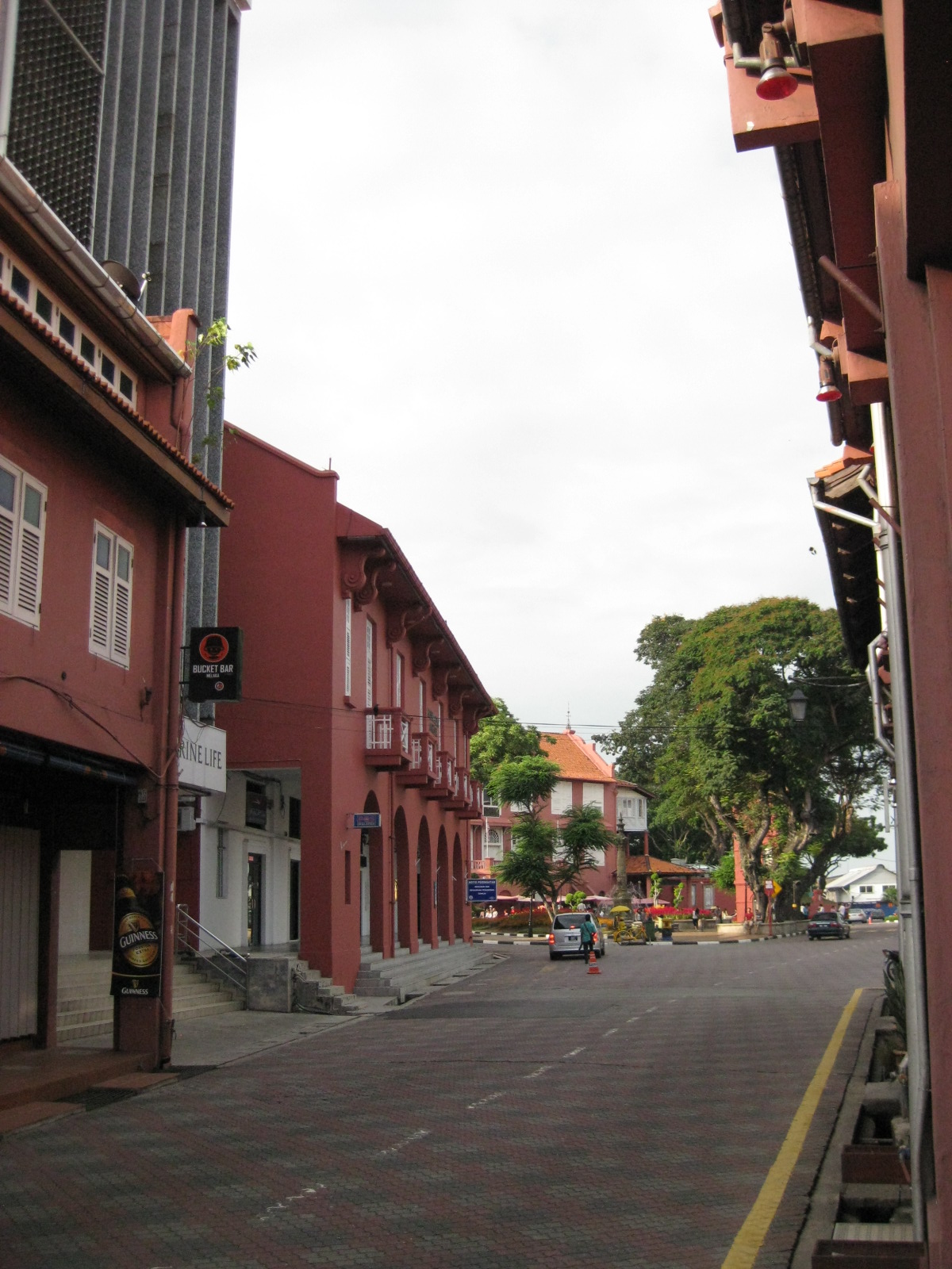 |
| Traffic was light so one could get a good shot of the street leading up to the plaza. |
 |
| The street leading to St. Francis Xavier made me imagine how old cities in the Philippines would have looked like if those cities made an effort to preserve heritage and controlled motor vehicle access to their street. |
 |
| Some buildings have been converted to restaurants and bars but they retained their nostalgic features and feel. |
 |
| Melaka made sure their signposts and lamps were designed consistent with the ambiance of the heritage city |
 |
| Another shot of the seemingly endless walkway beneath the buildings. |
 Caught (up) in traffic