
Home » Traffic Management (Page 18)
Category Archives: Traffic Management
The Streets of Bacolod: Around the Public Plaza
The streets surrounding the Bacolod Public Plaza are one-way streets following a counter-clockwise circulation around the plaza. Typical of plazas of old, the latter has around it the church (in this case San Sebastian Cathedral), the old city hall, commercial establishments, the police headquarters, and a major school (La Consolacion College). The following photos were actually taken a year ago in February 2012. I doubt if much has changed since then but the circulation and traffic situation should practically be the same give and take the normal traffic growth due to progress for the capital city of Negros Occidental.
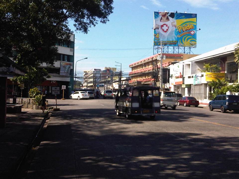 Intersection of San Juan St. and Gonzaga St. (view along San Juan St. towards southwest)
 Intersection of San Juan St. and Luzuriaga St. (view from east corner of intersection towards Westown Hotel)
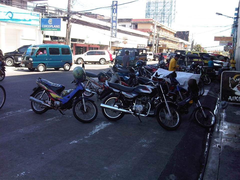 Roadside parking along San Juan St. Noticeable above are the motorcycle parked along the road, with some occupying pedestrian crossing space.
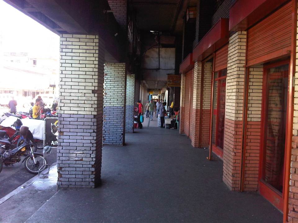 Old cities like Bacolod have buildings featuring arcades like this where pedestrians have the ROW and are sheltered from the elements. I was glad to see that the city basically cleared these facilities from obstacles. It is not entirely without impediments though as shown in the photo.
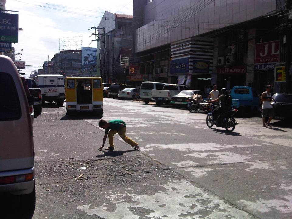 Luzuriaga Street (view towards southeast)
 Arcade of Plaza Mart building along Gonzaga Street and across from the Bacolod Public Plaza (view towards Araneta Ave. and Gatuslao Street)
 Another view of the arcade of Plaza Mart, this time along San Juan Street (towards Luzuriaga St.)
 San Juan Street (view from the corner at Gonzaga Street) – at right is the Plaza
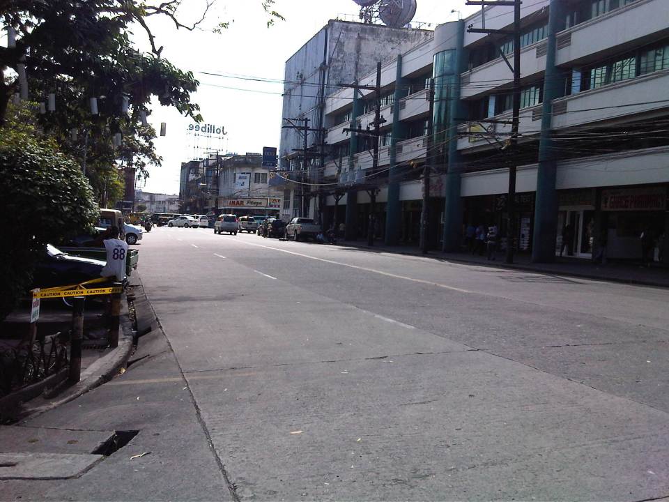 Gonzaga Street (view at corner of the Plaza along San Juan Street) – vehicles downstream are at the intersection of Gonzaga St. and Araneta Ave. Further downstream is Gatuslao Street
 Rizal Street taken from the plaza side and featuring San Sebastian Cathedral
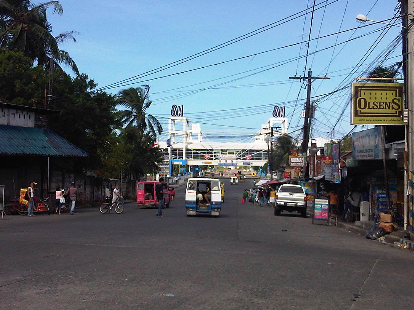 Rizal Street leads to SM City Bacolod, which is found in the reclamation area. (View from the intersection of Rizal St. with San Juan Street)
 Steel barriers along Rizal Street prevent vehicles crossing the street from the northeast side of San Juan St. All traffic must turn right towards SM. (view from the corner of San Juan and Rizal along San Juan towards the southwest direction) The PNP headquarters is the building on the opposite corner with the blue roof.
 Intersection of San Juan Street and Luzuriaga Street (view along San Juan St. towards southwest)
 San Juan-Luzuriaga intersection (view from Westown Hotel corner)
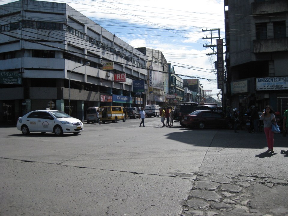 San Juan-Luzuriaga intersection (view along Luzuriaga St. towards southeast)
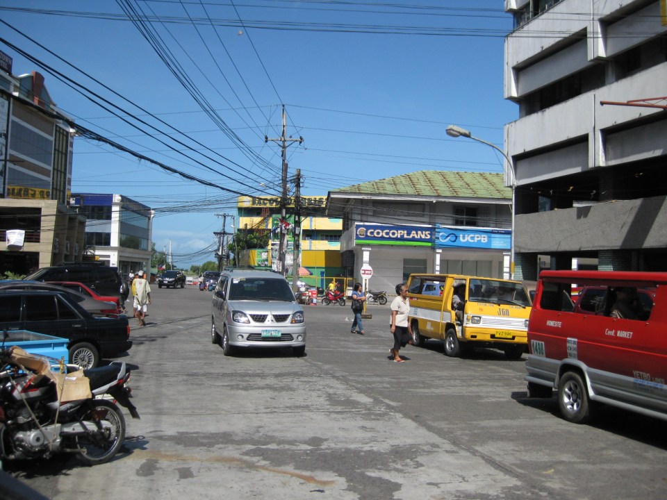 Luzuriaga Street is also a one-way street and with significant roadside parking as shown in the left side of the photo. View of traffic coming from the intersection with San Juan St. Westown Hotel is the building at left.
The circulation scheme at the plaza seems to be working out well at the time. This is despite the proliferation of roadside parking along the streets and around the plaza. The streets are relatively wide and so a one-way scheme works well in terms of taking advantage of the capacities of the streets while allowing for curbside parking that typically occupies one lane of road space as shown in the photos above. We didn’t see anyone charging parking fees for the vehicles and so we assume that these are practically free though we did see some informal “watch-your-car” boys who rely on tips from those parking along the road. Ultimately, though, the city should look into the provision off-street parking facilities as I can imagine traffic congestion, for example, in the vicinity of San Sebastian Cathedral on Sundays. Traffic in the area should be expected to increase as the city continues to experience economic growth and more developments ultimately locate at the reclamation area.
–
Antipolo Simbahan
“All roads lead to Antipolo” is a saying that is especially true for devotees to Our Lady of Peace and Good Voyage for whom the shrine in Antipolo is dedicated. Indeed, major transport routes lead to Antipolo City and signboards on jeepneys (and buses of old) state “Antipolo Simbahan” as their destination. In much older days, the Manila Railroad Company used to have trains directly serving this route. The remnants of its right-of-way is still there but in the form of roads. These are the Daang Bakal, which stretches from Valley Golf in Cainta, Rizal until its junction with Taktak Road and Ninoy Aquino Blvd., where it becomes the Lorenzo Sumulong Memorial Circle, Antipolo’s circumferential road. A trace of this old railway line may be found in this previous post.
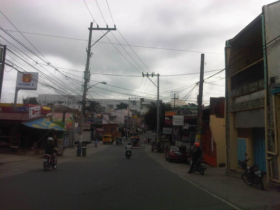 From J.P. Rizal Street, which extends from Sumulong Highway, one turns left to head straight towards the Antipolo church along P. Oliveros Street. The street is a two-lane, one-way road that has been widened at some sections. The shoulders, however, are mostly used for parking as shown in the photo.
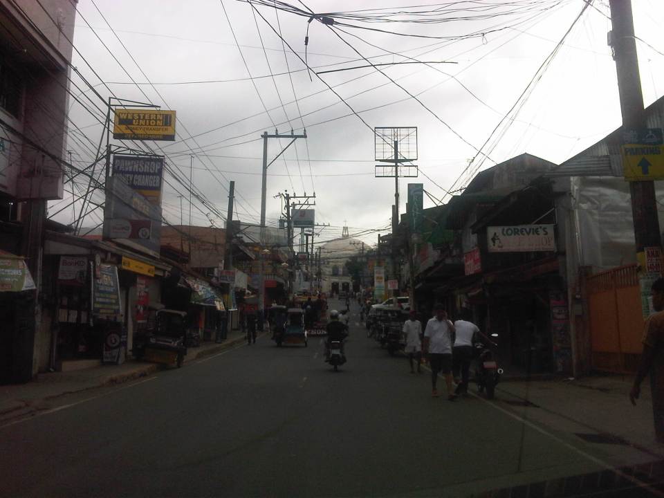 The dome of the church becomes visible to the traveler as one comes closer. P. Oliveros St. is closed to traffic during the feast day in May. It is usually open during Lent even during the Holy Week when there are lots of people coming to Antipolo for the Visita Iglesia. Traffic during those times can be quite slow because there are also lots of people walking along the streets, many of whom are devotees who are namamanata, or have promises of sacrifice and prayers to the patron of the shrine.
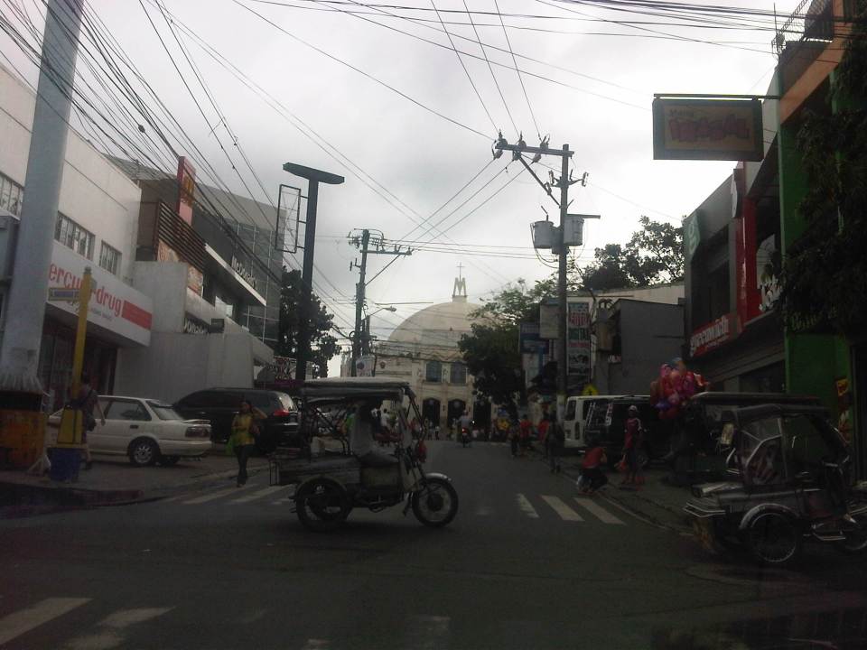 Similar to other poblacions around the country, commerce surrounds the church. Antipolo receives thousands of visitors daily and its being a natural traffic generator provides opportunities for businesses to thrive around it. Establishments around the church are proof of this and one will find most major fast food chains within a stone’s throw away from the shrine. In the photo are major chains Jollibee, Mang Inasal, Greenwich along the right and Mercury Drug(not fast food but the largest drug store chain in the Philippines) and McDonald’s on the left. There are more including banks and food stalls along M.L. Quezon Street, which is the main street of the poblacion.
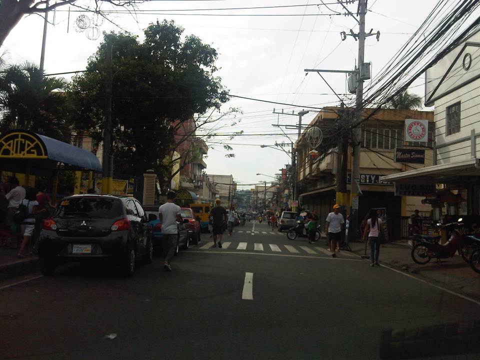 M.L. Quezon Street in front of the shrine and the main street of the poblacion, is also a two-lane, one-way street (southbound flow). There are many one-way streets here as it is no longer possible to widen streets. One side of M.L. Quezon is used for parking and a short walk from the church is Antipolo City Hall, which is the red building barely visible (obscured by the tree on the left) downstream in the photo.
 The Antipolo City Hall building is seen here at the left in this photo.
There is a proliferation of tricycles operating in the poblacion. I don’t know how many there are but they seem to be from different tricycle operators and drivers associations (TODA) that all converge at the shrine. This overlap of service areas (tricycles do not have fixed routes) suggest everyone is taking advantage of the shrine and city hall being major traffic generators. The problem is that the city has not been able to control their numbers and regulation is probably limited to registration, which brings some revenues to the city. This is certainly not sustainable from the perspective of transport
It would be nice to see the poblacion re-planned, designed and managed so that walking may be given primacy over other modes, particularly motorized ones. Antipolo should be walkable and it was in the past considering there were no tricycles and automobiles during the Spanish and early American periods. One took an animal-drawn vehicle, road a horse, or walked even when there was a train service in the early part of the last century. If parking is an issue, then perhaps the city, with the cooperation of the private sector, could find ways of building multi-storey parking facilities in the periphery and within comfortable walking distance from the shrine and city hall. There’s much potential here that is steadily being wasted due to traffic and with no design theme even for buildings surrounding the shrine. The shrine represents heritage and to preserve and enhance it, Antipolo City should find ways to introduce sustainable transport as well as applying architectural principles for the poblacion.
–
Technical Papers on Sustainable Urban Transport
This is just a quick post to end this first month of the year. Following is a link to the website of the GIZ-supported Sustainable Urban Transport Project featuring the page with the latest technical papers. These represent some of the latest work on sustainable transport featuring good practices from developing and developed cities that can be used as guides or benchmarks for those dealing with transport issues in their respective cities or towns.
Link: Measuring Transport Efficiency
I’m sharing a recent article from Todd Litman of the Victoria Transport Policy Institute. The article is entitled Measuring Transport System Efficiency that appears in the Planetizen online journal. It’s a very good read for all, even those without planning or engineering backgrounds, who want to have an understanding of how to evaluate or assess transport systems according to the various aspects of a system (e.g., there’s a difference between conventional road planning and accessibility-based transport planning). Todd is as usual very good in discussing these topics given his experience and expertise, and is able to present it in a manner that is easily understood by any reader (well, except maybe the trolls we find anywhere online these days).
Happy reading!
–
Sound bites on transport and traffic
If there was one thing I both dreaded and enjoyed during my 6-year stint as head of UP’s National Center for Transportation Studies, it is granting interviews to the media. My predecessors warned me about how some media outfits have been notorious for editing interviews to suit their needs. In certain cases, they are alleged to have spliced recordings that if taken as is would have been boring or not quite informative in order to have material that were more sensational. There are features, for example, where it seems interviewees were responding to the each other’s opinions making it look like they were arguing. And then there are those where certain statements are taken out of context when cut from a long explanation in the actual interview that took place.
I think I tried my best to be careful about what I said and how I explained or related things in my interviews. I looked at interviews as a way the Center could reach out and advance its advocacies. These were opportunities to spread the message of sustainable transport, to educate and inform officials and the public about what we should aspire and work hard towards achieving in transport and traffic. I think we had to be both progressive and aggressive with our messages because it was our duty, our responsibility not just to do research and train people but also to inform and educate people about sustainable transport. Popular mass media is an effective way to do this and we should be engaging but careful about our messages in order to be constructive and fair.
The last news interview I had before finally being relieved of being holdover Director for a month after my term ended was with GMA News. I like this interview about traffic congestion because I was able to put in some of the ideas that people in the forefront of sustainable transport have been preaching and practicing. These include the truth that in developed countries and cities, the wealthy take public transportation and that in order to improve public transportation, decision makers should themselves experience commuting.
These are not new ideas and I have to be clear that these were not my original ideas but those that I have come to embrace and advocate. I truly believe that if we don’t take public transportation, walk or cycle, we can’t really have a clear picture of what our cities need in order to solve the traffic mess and come up with services that are safe, efficient, inclusive and equitable.
The feature appearing on Jessica Soho’s State of the Nation on Channel 11 from the GMA News website.
The same report that appeared in the primetime 24 Oras:
–
Taming the beast(s) of traffic
An article came out of Rappler last weekend referring to addressing one of the most persistent problems in Metro Manila – traffic. It is a problem that is the result of years of neglect, poor planning, inconsistencies and a lack of foresight for future transport needs.
“Perhaps there are more than one beast to talk about considering that there is not one cause of the transport and traffic problems we experience everyday in Metro Manila (and elsewhere). We love ranting about how traffic is bad and how other people should leave their cars at home and yet we do little ourselves to pitch in to improve the situation. And so we are beasts ourselves in this manner. The discussions on public transport and road infrastructure have been going on since perhaps the author decided to practice transportation engineering. What has changed? Have things improved or have they worsened? It is really difficult to effect change when decision-makers and policy-makers are short of memory or have no memory or understanding at all of what’s going on. It seems that we are always starting on a clean slate every time someone new is at DOTC, DPWH or whichever agencies are supposed to handle transport and traffic in MM (and the country). Perhaps some criteria should be applied to whoever will be in-charge of transport and traffic, and one should be that the person or persons should be someone taking public transport to the workplace. At the least, we can be assured that he/she has first-hand experience of the painful way we travel each day and lead the person to really work towards improving transport in this country.”
I don’t usually write replies or comments on material posted online. I believe it is a very public platform and nowadays, when there’s a lot of talk on items like plagiarism, transparency, freedom of information, etc., it seems so easy to solicit opinions and comments from anyone who would care or dare post one. And transport and traffic seems to be a topic where everyone has his/her own opinion so much so that some people tend to project themselves as experts on the topic. Nevertheless, I thought that an opinion was necessary in order to offer another perspective on the matter of the “beast.” I would like to believe that in our case, we probably have had one too many “thought leaders” in transport and traffic. It is time that we also have “action leaders” who would do rather than simply say or write. We need people who will practice what they preach and actively and willingly contribute when called upon for help in solving this traffic mess we are in.
–
Another look at Imelda Avenue traffic
A reader brought to my attention some traffic problems encountered along a section of Imelda Avenue in the vicinity of a major retail chain’s branch. There are experiences of traffic congestion along the section fronting the SM Hypermarket from across the Village East subdivision. However, the commercial development and the traffic generated is not really new since the hypermarket replaced another similar establishment (Makro). Arguably though, the trip generation rates of SM developments can be higher than their competitors considering their branding and customer preferences based on traffic experience around SM malls. Following are some specific observations and comments for the case of Imelda Ave. in the vicinity of the SM Hypermarket along the highway.
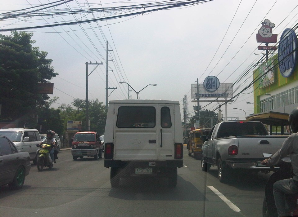 Slow-moving traffic in front of the SM Hypermarket along Imelda Avenue in Cainta, Rizal
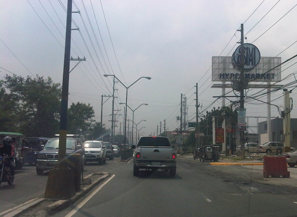 Congestion in the previous photo turned out to be caused by jeepneys loading and unloading passengers in front of the commercial development. Jeepneys tend to occupy the outer lane of the highway, significantly reducing road capacity thereby causing a bottleneck leading to congestion propagating upstream. There is actually a loading/unloading bay on the Hypermarket side of the road but jeepneys do not use this and almost always stop in the middle of the road.
 There are also tricycles using Imelda Ave. despite the regulations prohibiting them from national roads. The tricycles serve the residential subdivisions along the highway but used to be the main mode of transport along an unfinished Imelda Ave. from the 1970’s and competed directly with the jeepneys from the 1980’s one the connection between Ortigas Ave. and Marcos Highway had been made, leading to the opening of new jeepney routes through Imelda Avenue.
 The bottleneck for this section is along both directions as jeepneys stop not only for the Hypermarket but also for the residential subdivision (Village East) that is located just across from SM. The gate of the village opens toward SM with traffic generated significant enough to create a 3-leg intersection at the subdivision access/egress. This is an unsignalized intersection that has no enforcer to manage traffic, leaving it up to the motorists to determine acceptable gaps for conflicting movements. Compounding the situation are pedestrians crossing just about anywhere along the road like the people shown in the photo above.
The issues mentioned above are not all unique to the location but are often the case for many other places where there are major traffic generators such as malls, supermarkets and even residential developments. In fact, middle class villages are major traffic generators due to the car ownership but they are usually predictable in terms of peak periods. That is, the morning and afternoon/evening peak are well-defined according to office or school hours associated with residents (i.e., “to school,” “to work,” and “to home” trips). The solution, of course, is quite basic though not so simple – traffic management in the form of personnel who will enforce traffic and manage intersection flow. It is basic because it is a solution that’s definitely “in the box” and traditional or conventional. It is not simple because often, there is a lack of qualified personnel who can manage traffic full-time, and competent to firmly enforce traffic rules and regulations in order to effect behavioral change (for the better) among motorists and pedestrians. Granted, the commercial development should take the initiative to manage traffic and these may be recommendations already made when a traffic/transport impact assessment was conducted prior to the construction of the Hypermarket. Such assessments should have included traffic forecasting (estimating future traffic) in order to determine potential traffic congestion in the area and the formulation of site specific and appropriate mitigation measures. Perhaps there is a document somewhere (EMB?) that Cainta may use as a guide for how to address transport and traffic problems in the area due to the presence of the supermarket. If none, then the burden will be on the local government to study the traffic and come up with a strategy on how to lessen the detrimental traffic impacts of development in the area.
–
Sunduan at NAIA Terminal 1
Manila’s Ninoy Aquino International Terminal 1 has been named as the worst airport in Asia by a website that seems more focused on “sleeping in airports.” The same site ranks Changi, Incheon and Hong Kong as the top airports in the region and mentions a couple more in Southeast Asia in the top ten. Surprising for me is the low ranking for Changi’s Budget Terminal. One can practically sleep on the floor there as it is sparkling clean! But of course, I won’t encourage it as what’s not visible to thehuman eye might probably make one sick especially in places like airports where you have people from all over using the facilities. In fairness to the same site, it differentiates NAIA’s old Terminal 1 from the newer Terminals 2 and 3, which received fair assessments but again especially for sleeping. I think the value of such independent assessments is that they are very objective and given the power of social media, it informs people about the quality of facilities and challenge those in-charge to do better.
So to continue with my features on NAIA Terminal 1, I am featuring a few more photos from the perspective of someone waiting for or fetching a loved one, relative, friend or anyone arriving at the terminal from the building just across from the passengers’ arrival area.
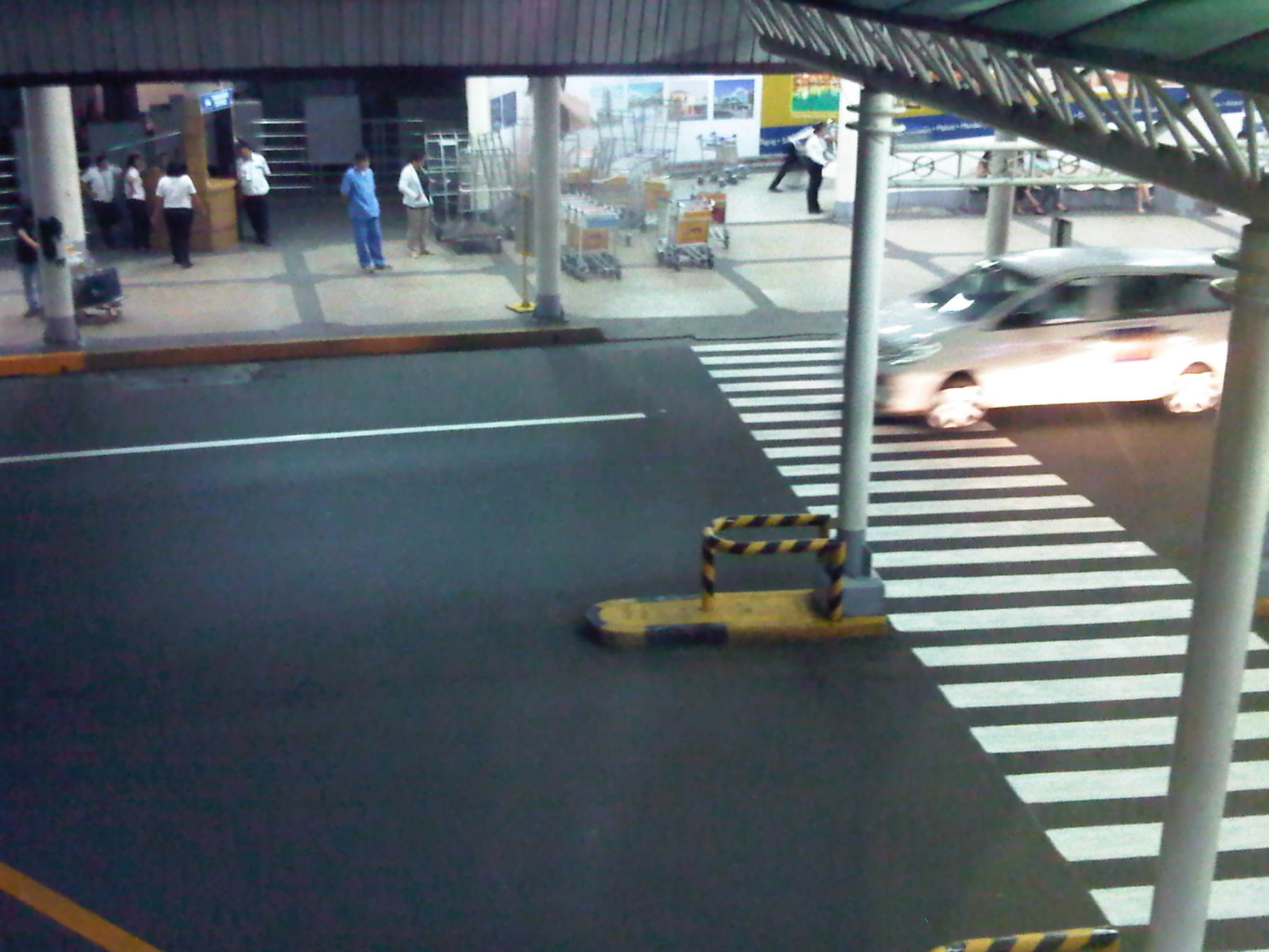 Before the mayhem – prior to the arrival of aircraft and exiting passengers, the area appears like a picture of calm with few people including airport staff.
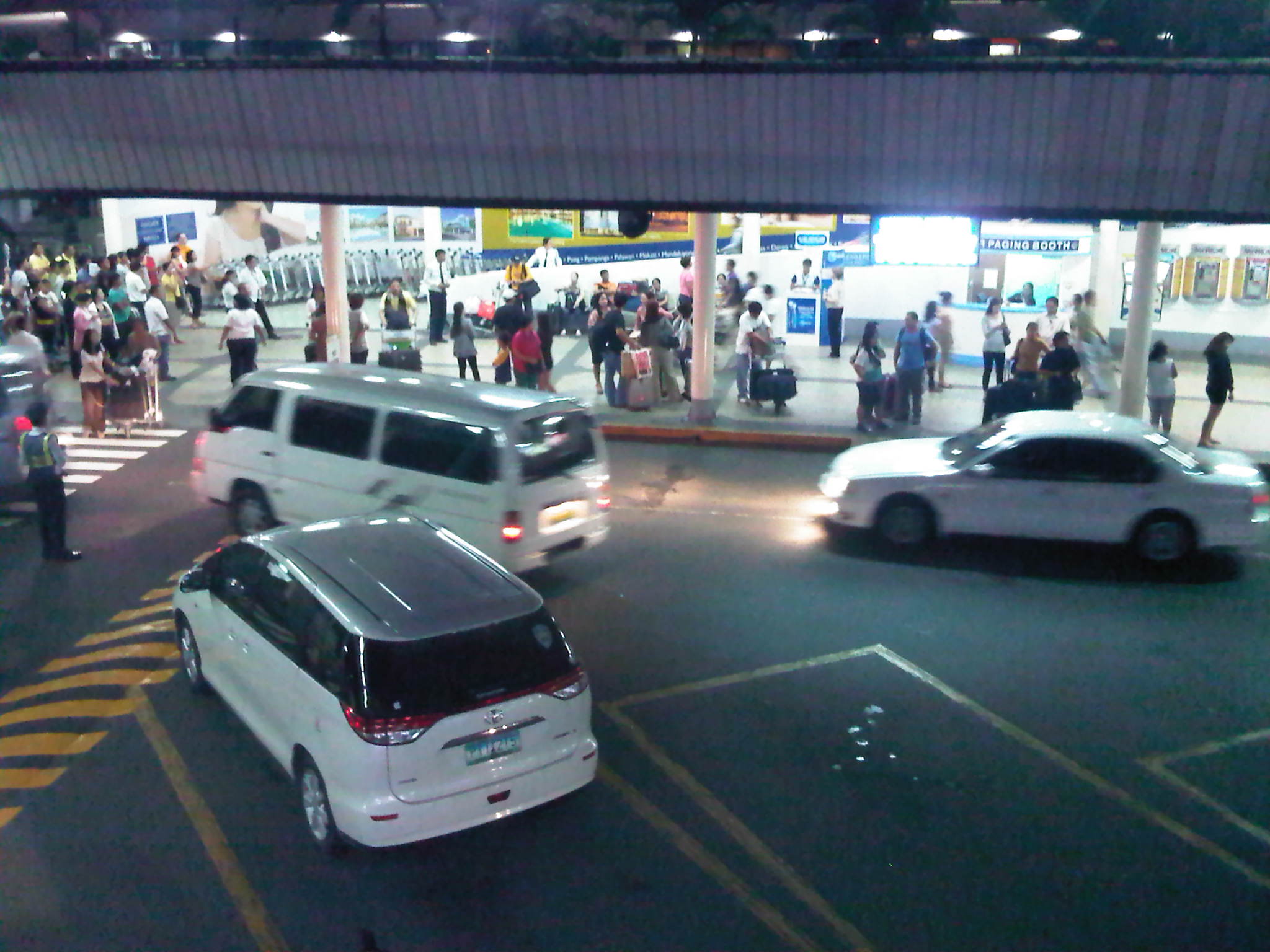 Here they come – passengers start accumulating at the area along with vehicles whose drivers have probably been notified of the arrivals
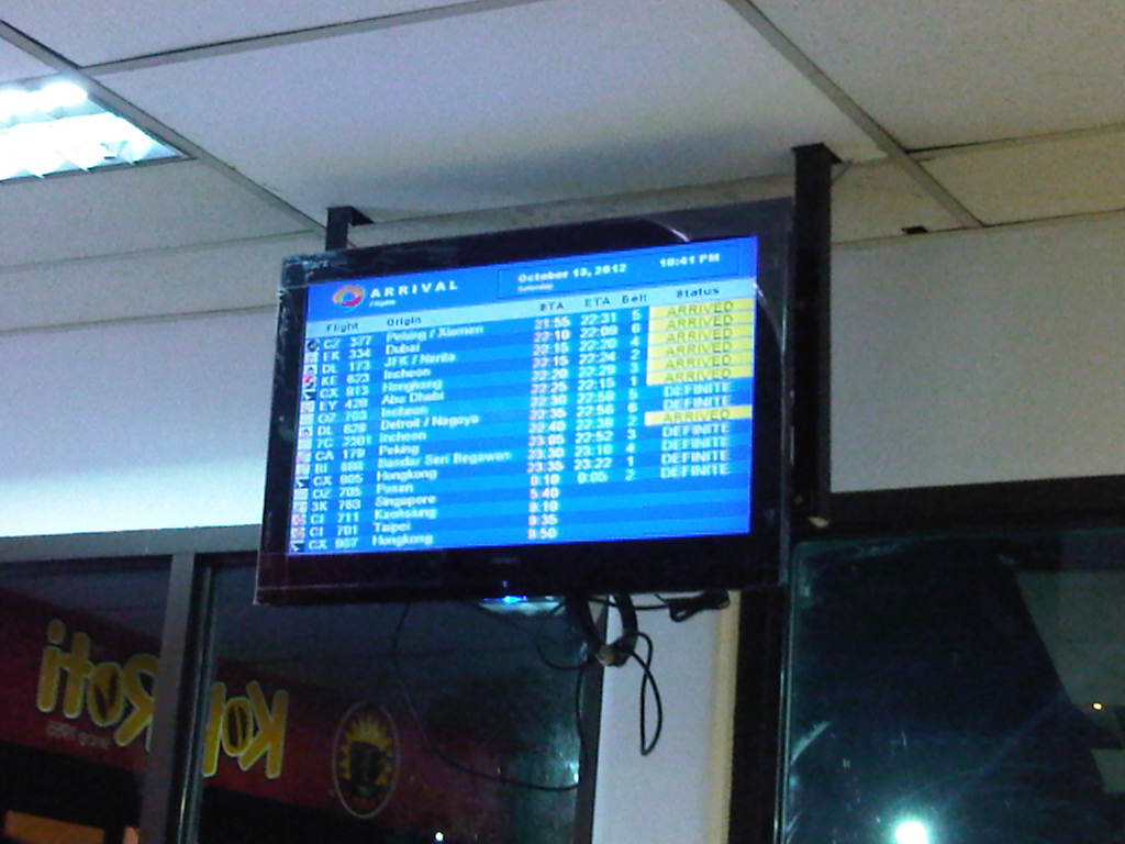 Information screen – there are several screens at the waiting area for people to check the aircraft arrivals
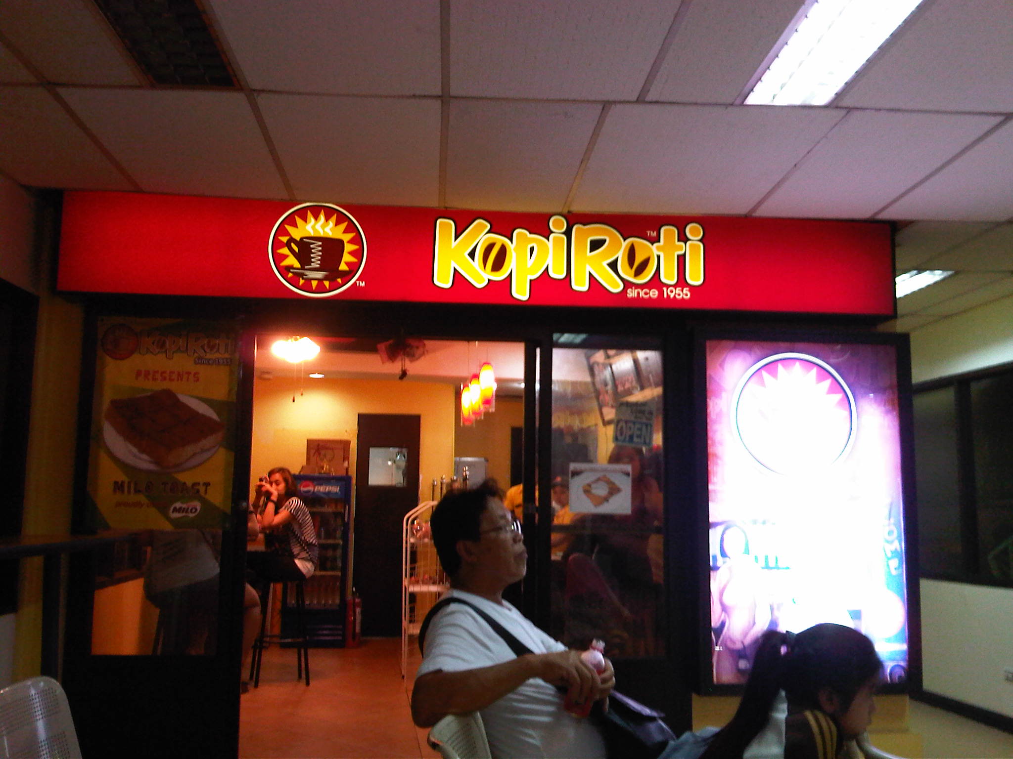 Refreshments – there are 3 concessionaires inside the building, all on the second floor, including one generic food stall and this one featured in the photo that’s quite popular for its coffee buns and kaya toast.
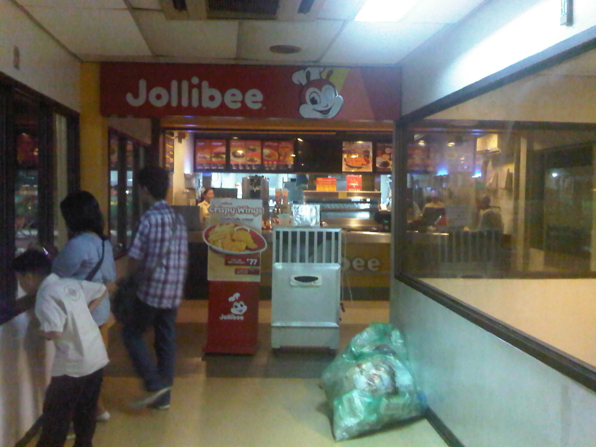 Fast food – the other concessionaire is a branch of the most popular and largest fast food chain in the Philippines
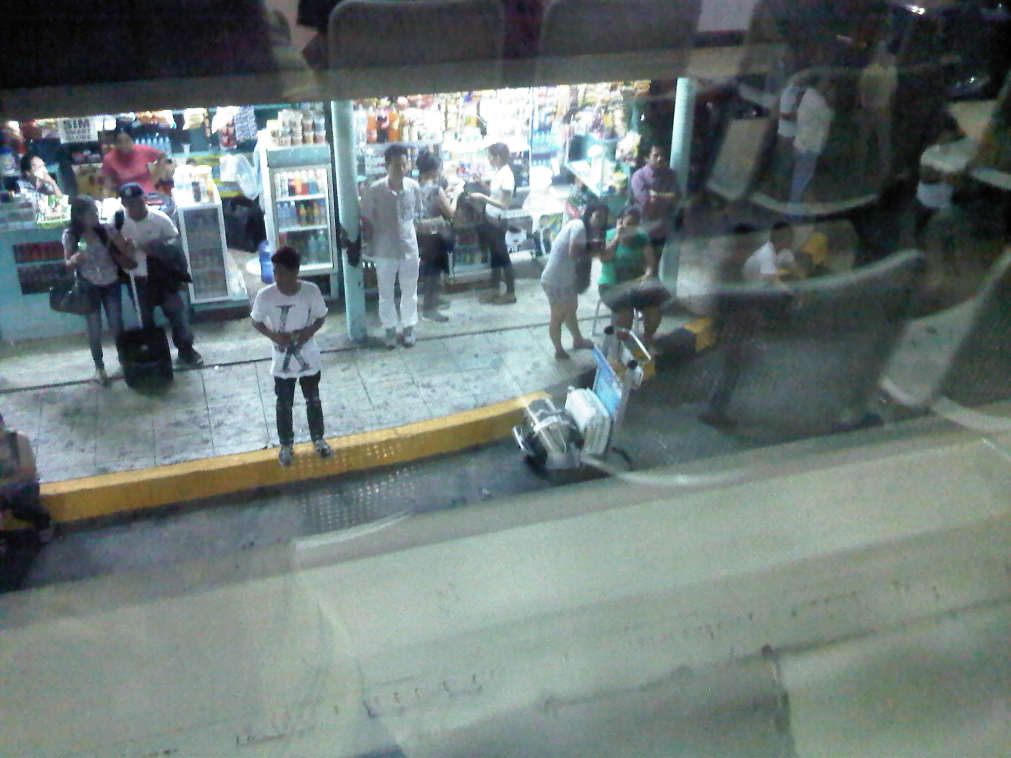 Kiosks and stalls – at the back of the building are kiosks and stores spread out in the open parking lot for people who’d rather wait in these areas. One will find here whole families and other groups loitering about or even picnicking as they wait for arriving passengers.
 Comfortable – the second level of the building is air-conditioned unlike the first level and so many people choose to lounge around the area. Most seats, however, are immediately taken and so a lot of people end up standing while watching out for people they’re fetching.
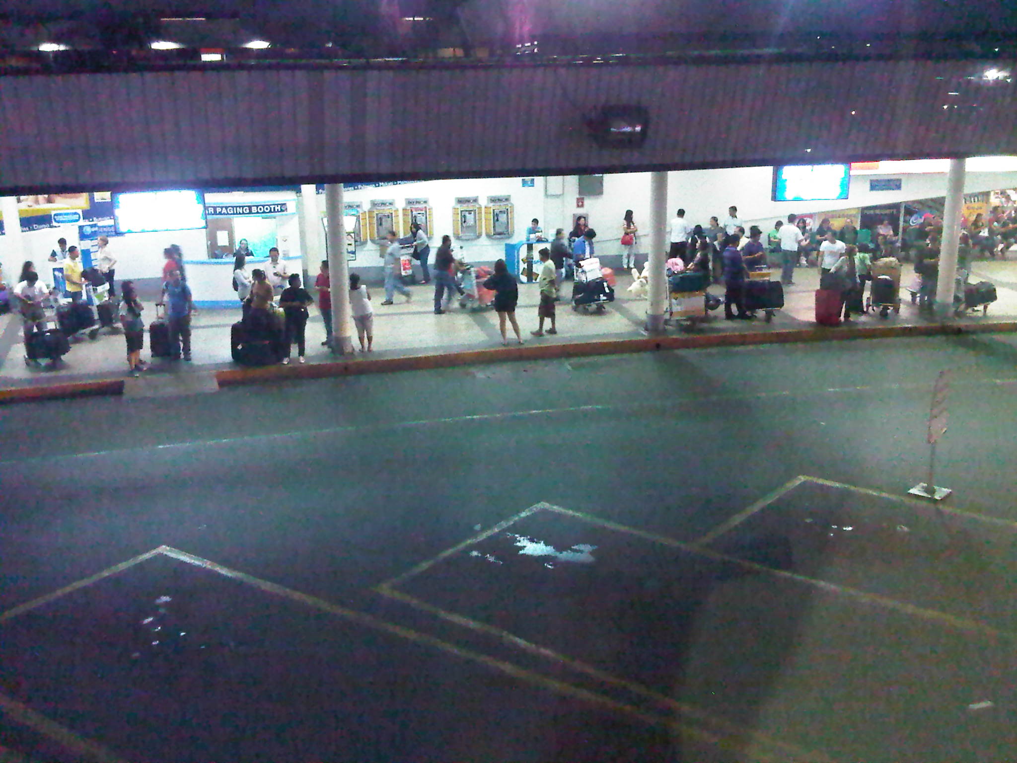 Waiting game – arrivals waiting for their sundo (people fetching them).
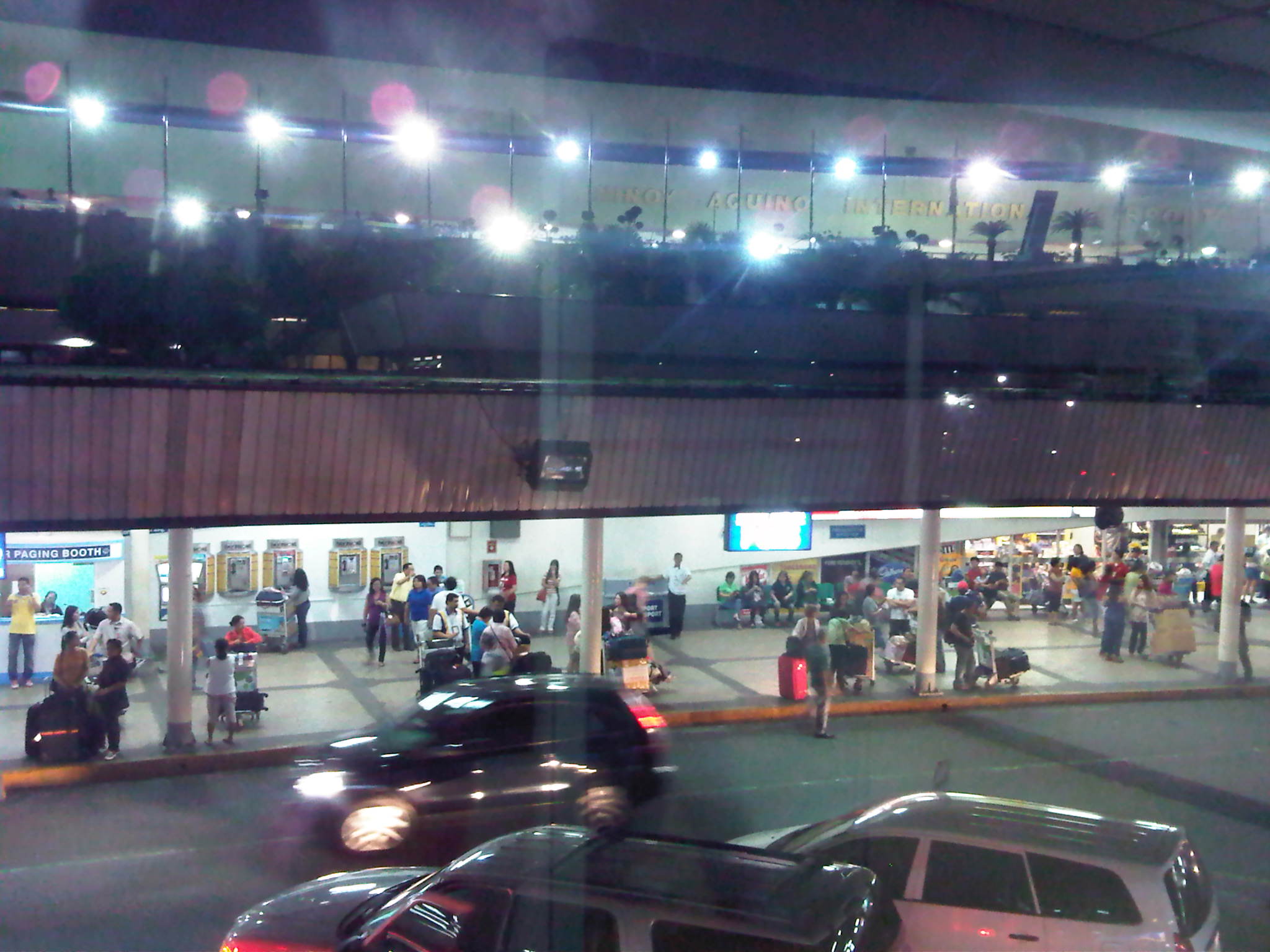 Another level – there is actually another driveway atop the one seen in the photo. The lights at the top of the photo are lined up along the driveway for the main terminal building, which is reserved for VIPs and others extended the privilege of using the driveway. All other passengers have to cross from the main terminal to descend towards the area shown and the lower driveway that’s level with the open parking lot.
 Congestion and mayhem – the arrival of several aircraft particularly from major origins like Hong Kong, Dubai and the US (via Narita and Nagoya) meant that the area would be very crowded with passengers, well-wishers and vehicles. People and drivers tend to disregard personnel trying to manage the people crossing between the terminal and the waiting area, and traffic along the driveway.
 Crowded house – the ground floor area of the building where passengers an well-wishers generally meet up is a very crowded area and airport personnel often struggle in controlling people from crossing over to the arrival area to personally fetch passengers, often with cause due to the amount of luggage (e.g., balikbayan boxes) passengers tend to bring with them when traveling to Manila.
NAIA Terminal 1 serves most international flights coming in and out of Manila that are not Philippine Airlines, Cebu Pacific or ANA (the only other foreign carrier using the larger and more modern Terminal 3). It definitely has seen better days and its current capacity and facilities are not suitable for the number of flights that it serves given that it wasn’t adequate from the time it started operation in the early 1980’s. There is the welcome news that T1 would be renovated and that a large reputable firm has been hired to do the unenviable task of improving this gateway. We can only hope that the project proceeds with little delay so that travelers would be able to avail of better services and perhaps allow this terminal to shed its tag of being the worst airport in Asia.
–
Some thoughts on transport and traffic while commuting between Cainta and Antipolo
Commuting from the Ortigas (Cainta) end of Imelda Ave. to its other end at Marcos Highway (near where Pasig, Marikina, Cainta and Antipolo meet), one should be able to observe and make a quick assessment of the positives and negatives of our local transport system. While there are more negatives at Cainta Junction and along Imelda Avenue, Marcos Highway definitely has improved particularly in terms of walkability. It is a commute that I have taken so many times since my childhood days and I can only now remember times when one could walk safely from one end to the other when there were far less vehicles than the volume that flows along Imelda Ave. these days.
Junction is still quite the mess despite some road widening at the intersection owing to various factors including the fact that the intersection simply cannot handle the volume of vehicles using it even after the elimination of some turning movements from Ortigas Ave. in favor of U-turns particularly for traffic coming from the eastbound side of Ortigas. It seems the traffic signal settings can no longer handle peak period traffic and manual traffic management probably aggravates the situation especially when enforcers employ the buhos technique of trying to dissipate as much of the queued vehicles per approach or movement. The latter technique does not take into consideration that the longer a movement or group of movements are allowed to move, there are corresponding build-ups in traffic along all other approaches. It is a vicious cycle (pun intended) that is supposed to be addressed by an optimally times signal system. Saturated conditions, though, are inevitable due to the sheer volume of vehicles using the intersection given that Junction is a catchment for vehicles from Rizal Province that ultimately uses Ortigas Ave. to head into Metro Manila in the mornings. The reverse is true in the afternoon to evening periods.
Imelda Avenue, which was also known for a time as Francisco Felix Ave., is plagued congestion due to notoriously bad pavement conditions, so many median openings, and high vehicle trip generation rates from the many residential subdivisions or village along the road. The pavement conditions are due mainly to damage brought about by trucks and, during the wet season, frequent flooding along many sections of the avenue. Bad pavement conditions and flooded streets significantly slow down traffic as Imelda Ave only has two lanes along each direction and is divided by a narrow median island that’s just enough for a few plant boxes and lamp posts.
There are mostly middle class subdivisions including the large Vista Verde, Village East, Karangalan, and Pasig and Cainta Green Parks along the road. There is also a DMCI medium rise development has its main access road also connecting to Imelda Ave. These villages generate much vehicle traffic and each have their own median openings that practically function as intersections along the entire stretch of the avenue. These openings create a lot of conflict between through traffic and vehicles entering and exiting the villages, especially those taking left turns to or from their gates.
While there are commercial establishments along the avenue, most were small and traffic generation characteristics were not so significant as to cause severe congestion. The first major generator in the middle of the avenue was a branch of the membership-concept Makro supermarket cum depot. Makro generated significant traffic but did not cause much congestion along the stretch in front of the Village East gate. It was eventually acquired by commercial giant SM and the branch is now an SM Supercenter that seems to be generating much more traffic than Makro did at its peak. While traffic studies are usually the norm before such developments are constructed given the trips attracted by SM, the congestion experienced along Imelda Ave has been reported to be generally un-managed despite the need for more disciplined loading and unloading by public transport, pedestrian movements and vehicle entries and exits.
Jeepneys are the main public transport mode along Imelda Ave. although there are tricycles serving the various subdivisions that often not only cross the road but also travel along Imelda Ave. for short distances. I remember in the 1970’s and early 80’s that the tricycles used to be the primary mode of transport from Junction and the Cainta Public Market as Imelda was not yet connected to the still to be completed and unpaved Marcos Highway. There was even a Metro Manila Transit Corp. bus service (probably missionary route and with low frequency of service) along Imelda Ave. that turned around near Kasibulan Village, one of the first subdivisions in the area. Many jeepneys are noticeably the patok or popular type known for their loud stereos and reckless driving. Still, there are the smaller, older jeepneys whose route connects either ends of Imelda Avenue. Most patok jeepneys are from the many longer routes between Rizal towns and Cubao overlapping along Imelda Ave (e.g., Angono-Cubao, Antipolo-Cubao, Binangonan-Cubao, Taytay-Cubao, etc.).
–
Predictability of school-generated traffic congestion
I have written about schools generating much traffic. The same characteristics of trip generation make congestion along streets affected by the schools quite predictable. For example, traffic congestion due primarily to the trip generation characteristics of schools along Katipunan Ave. may be observed during 6:30 – 7:30 AM as well as around 3:30 – 4:30 PM. The afternoon congestion though is exacerbated by the presence of significant truck traffic using C5 as part of their routes. Other cases would have similar predictability and I pointed this out to some guests while we were having a coffee break from our day-long meetings. The following photos were taken in the mid-afternoon and shows congestion along Ortigas Avenue in Mandaluyong City, including along an overpass affected by school traffic generation from a private school (the school is the one with the dome in the photo). Traffic is typically bad between 3:20 to 4:30 PM, after which it subsides until after 5:30 when the afternoon to evening rush from workplaces to homes take over much of the road space.
 View of the EDSA-Ortigas intersection showing the start of the build-up of traffic along the left turn overpass to Greenhills on the left side of the photo.
 View of the same flyover at around 3:36 PM. Note the long queue along both lanes of the overpass.
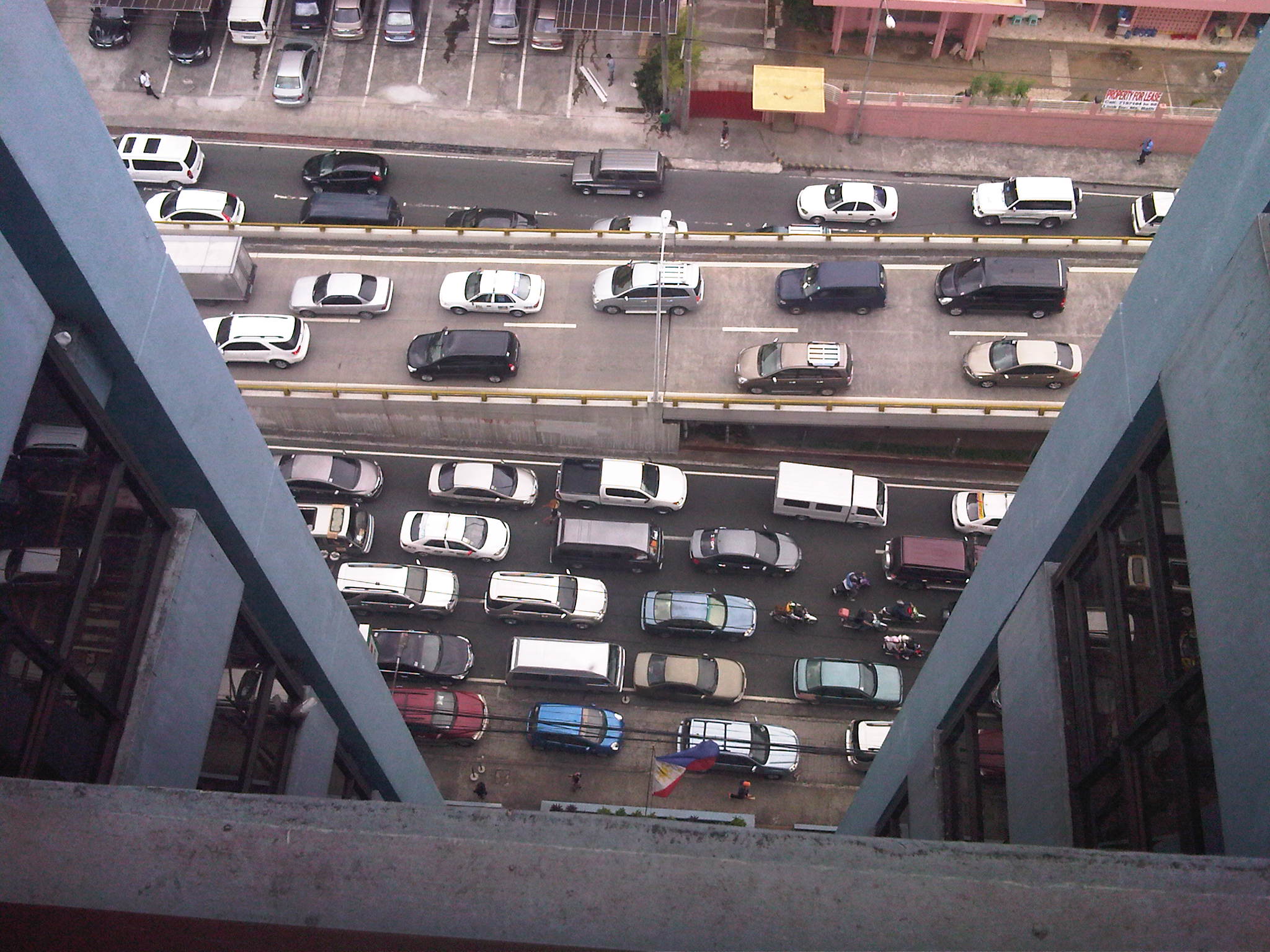 View of traffic congestion from the 16F of the building hosting the headquarters of the Department of Transportation and Communications. The overpass featured in the preceding photos is shown with vehicles descending to merge with Ortigas Avenue traffic. Both directions of Ortigas Ave. are congested.
 Congestion as seen from the street level. Vehicles descending the overpass are generally bound for San Juan while those on the foreground are bound for the EDSA-Ortigas intersection. Long queues are likely caused by a combination of high traffic volumes and non-optimal green time management at the intersection.
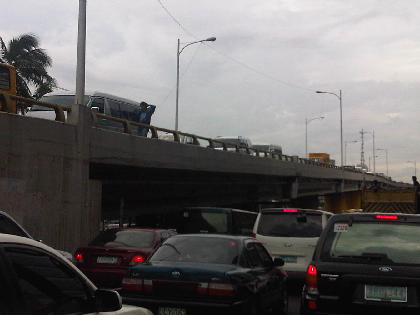 Another view of the congestion at both ground and overpass levels. Traffic is really bad when you have ambulant vendors walking along the overpass to sell their wares (e.g., cigarettes, candies, water, etc.) like what the man on the overpass near the van is doing.
Given the predictability of traffic congestion along this road, many motorists who have a choice or alternate route they can take avoid this road during such periods. Unfortunately, those taking public transport cannot avoid the congestion with passengers thereby incurring delays equivalent to wasted time. Most trips generated by such schools take private vehicles often having low occupancies (e.g., a driver plus a student = 2 passengers per vehicle). Perhaps schools should offer better school services/buses for their students? Or maybe there is a public transport option to be explored here? One thing is for sure and that is people at a young age learn that having cars is better than commuting. Such thinking is eventually carried over to when the same children become adults and an orientation favoring cars over public transport or even walking or cycling that they will eventually pass on to their own children, and so on. Perhaps our schools are in a very good position to influence the developing minds of their students and be responsible in promoting sustainable transport to their students.
–
 Caught (up) in traffic
