
Home » Posts tagged 'aerial photo'
Tag Archives: aerial photo
Aerial photos – reclamation projects in Manila Bay
Last week’s travel allowed me to take aerial photos of the reclamation projects in Manila Bay. Here are the photos:
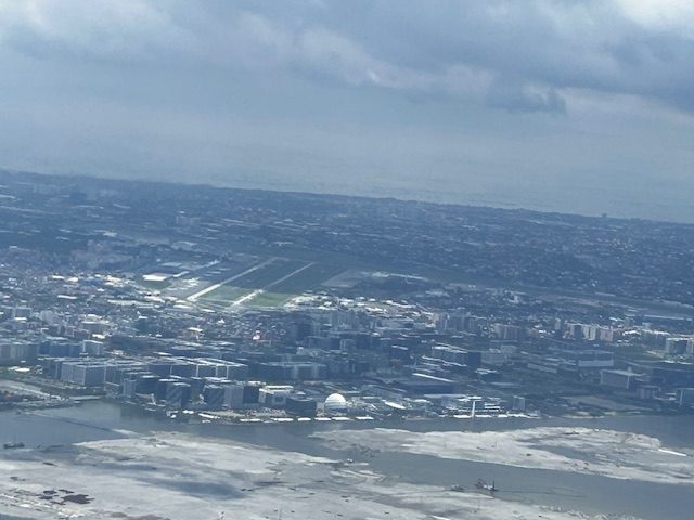
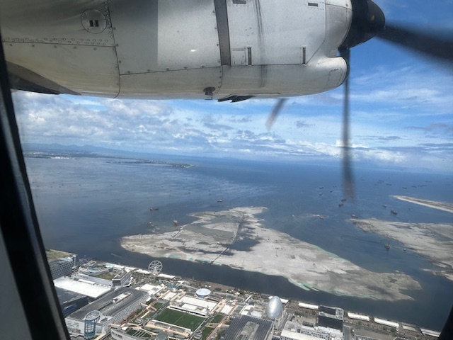 The view as we lifted off from NAIA shows SM’s reclamation project across from the MOA complex.
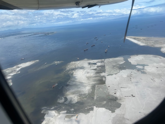 Our plane then climbed and afforded this close-up of sorts of the reclamation across from the now closed Sofitel Hotel.
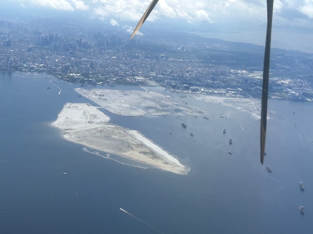
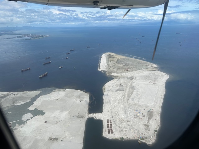 Past the largest of the three reclaimed lands is another man-made island.
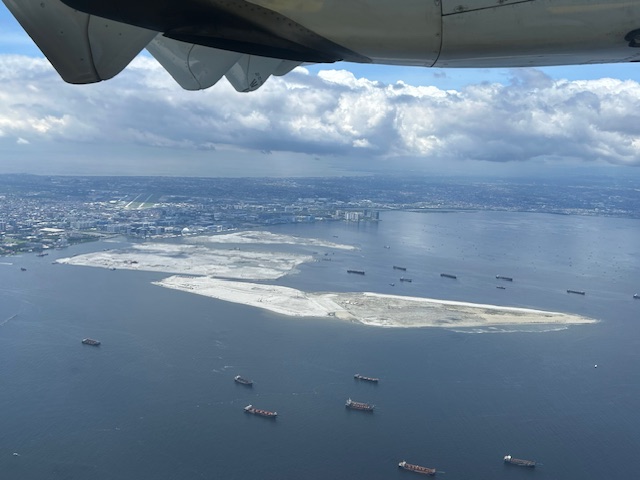 As our plane turned left, we were able to see all three reclamation projects
 A close-up of the reclamation across the MOA complex. Also in the photo is NAIA.
 All three reclamations in one photo as we continued to turn towards the south and southeast (towards Bicol).
More aerial photos soon!
–
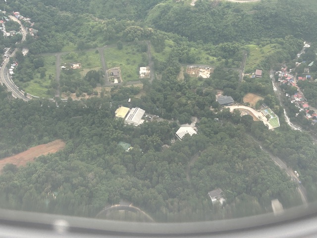
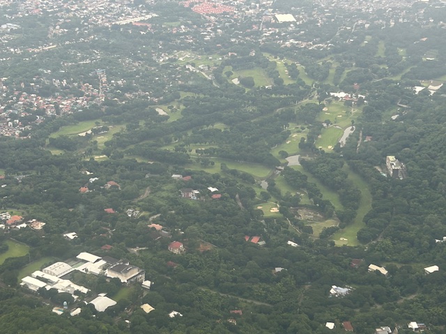
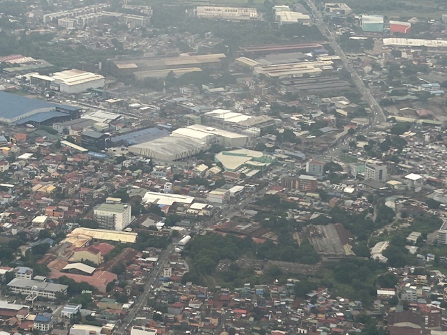
Aerial photos of Rizal
Following is a continuation of my recent post on aerial photos I took when I went to Iloilo for some meetings. This set is from our plane’s approach to land at NAIA. The path led us through Rizal province and the following photos mainly of Antipolo and Cainta.
–
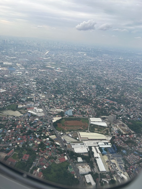
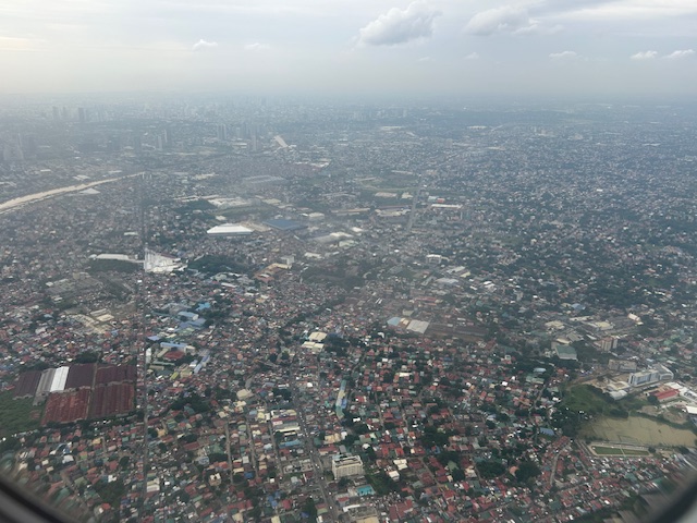
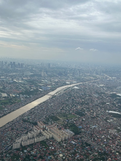
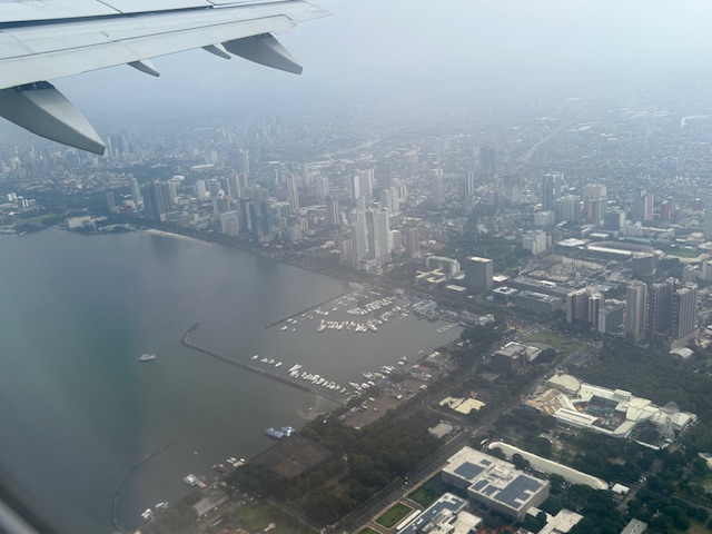
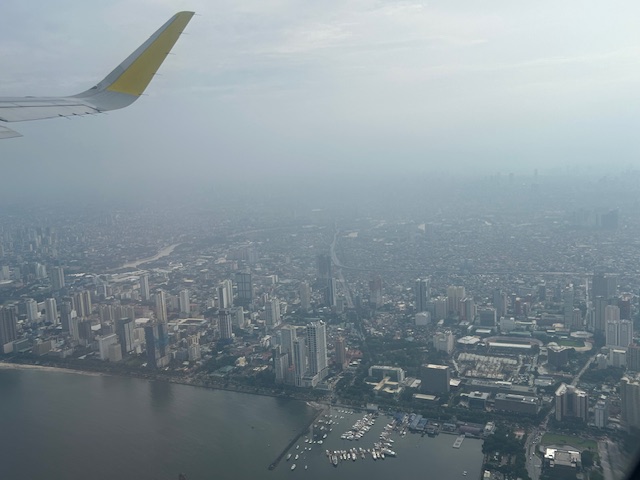
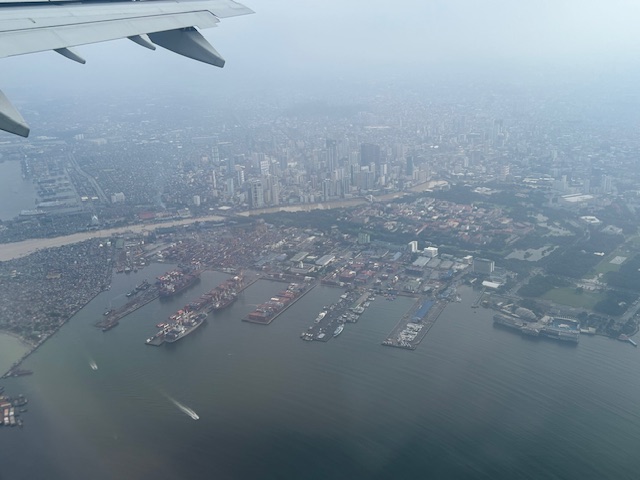
Post Habagat Aerial Photos
We flew to Iloilo just after the Habagat floods that ravaged much of Metro Manila and its surrounding provinces. As our plane took off from Runway 13-31, I figured there was an opportunity to take a few photos of Metro Manila especially as I was seated by the window of the plane.
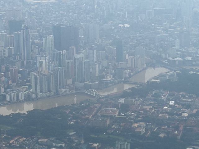
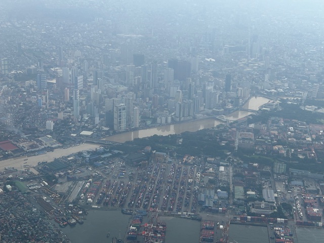
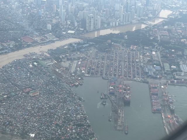
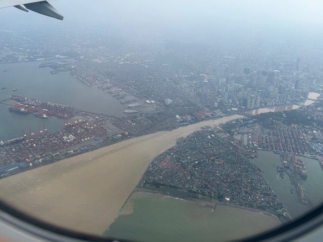
More aerial photos to be posted here soon!
–
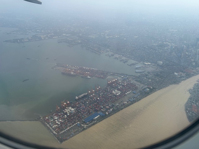
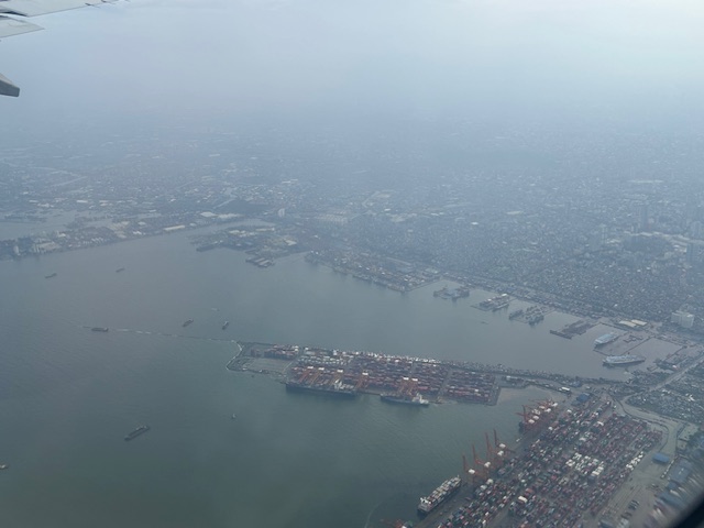
Aerial photo: Zamboanga City’s fish canning and bottling factories
As we approached Zamboanga City’s airport last week, my colleague and I surveyed the landscape trying to identify landmarks. He was quite good at this being a geographer/transport planner. We took a few photos from the plane and one is this shot of the fish port and factories in Barangay Recodo along the national highway.
 Canning and bottling factories lined along the Zamboanga City coast with are mostly fishing vessels anchored off-shore.
There is still an abundance of aquatic resources in the Sulu Sea where these vessels go for fishing. These should be more than enough for domestic as well as typical international demand. Unfortunately, there are alleged foreign trawlers or vessels poaching our resources. These should be seriously looked into by our coast guard and navy.
–
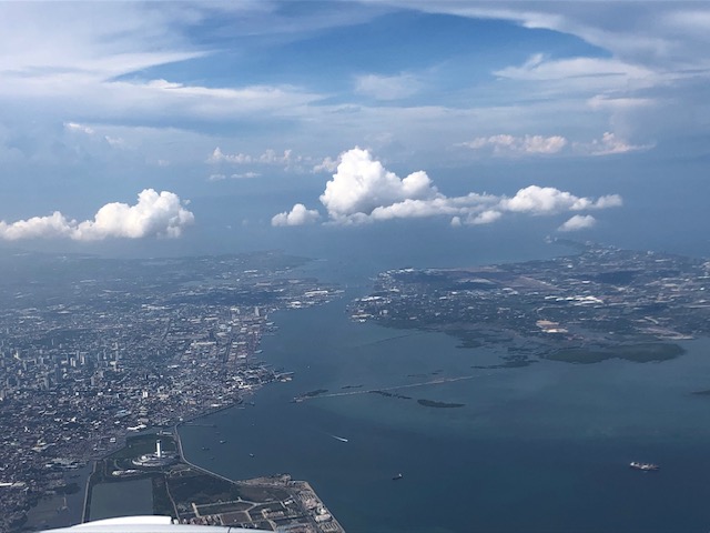
Aerial photos of Cebu and Mactan
I enjoy taking aerial photos when the opportunities present themselves. Leaving Cebu for Manila a couple of weeks ago, I was able to take some nice photos as or plane took off and cruised over Mactan Island. Here are some of the better photos:
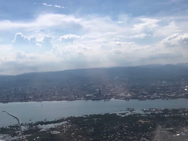 A view of Mandaue and Cebu cities across from Mactan Island as our plane took off from the airport
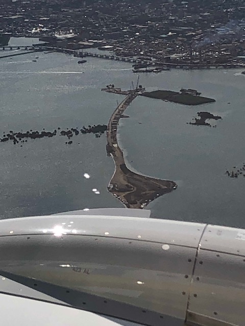
 Here’s a first look (a bird’s eye view) of the ongoing construction of the third bridge connecting Cebu and Mactan Islands. This is part of the Cebi-Cordova Link Expressway (CCLEX) project.
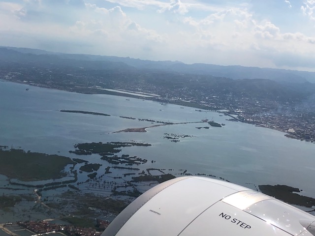 Here’s another view of the island with the airplane engine in the photo.
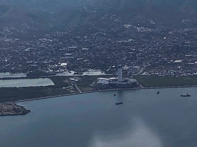
 Here is a close-up photo of the island where tall columns will be built to support the CCLEX bridge. The viaduct in the photo is the one connecting downtown Cebu City with the South Reclamation Project area that includes the SM Seaside development.
 The SM Seaside as seen from the air
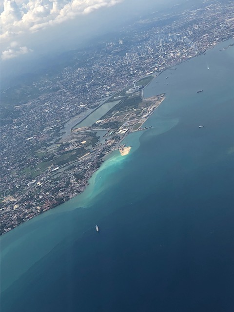 Here’s a view of the South Reclamation Project area with SM Seaside as our plane turned north towards Manila.
 Another view of Cebu City and the SRP
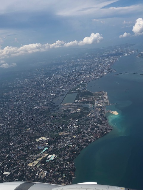
 Here’s my favourite shot of Cebu and Mactan Islands with the SRP on the foreground, the CCLEX bridge under construction and Mactan International Airport
–
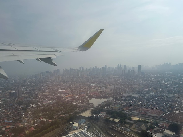
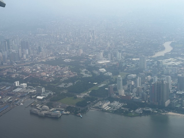
Aerial photo: Diliman, Quezon City
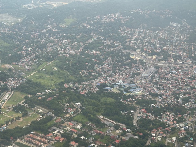
The aircraft we were flying on in a recent trip circled on the approach to NAIA and we were afforded some terrific opportunities to take aerial shots of Quezon City. This was before the rains of the Christmas holidays so the skies were clear of clouds. Here is one of the photos I took showing the University of the Philippines Diliman campus.
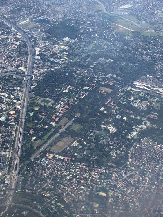
That wide road on the left is Commonwealth Avenue and you can see part of the Elliptical Road at the bottom left. There are few large patches of green in Metro Manila and many are in the largest city – Quezon City. You can see that these include the campus and Balara.
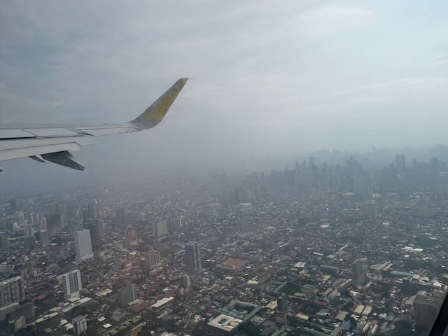
Aerial photos are no longer that rare these days as there are many who take shots from drones. Then, of course, there are shots like these you can take from the plane you’re riding. Have a nice Sunday!
–
