
Home » Posts tagged 'C-6'
Tag Archives: C-6
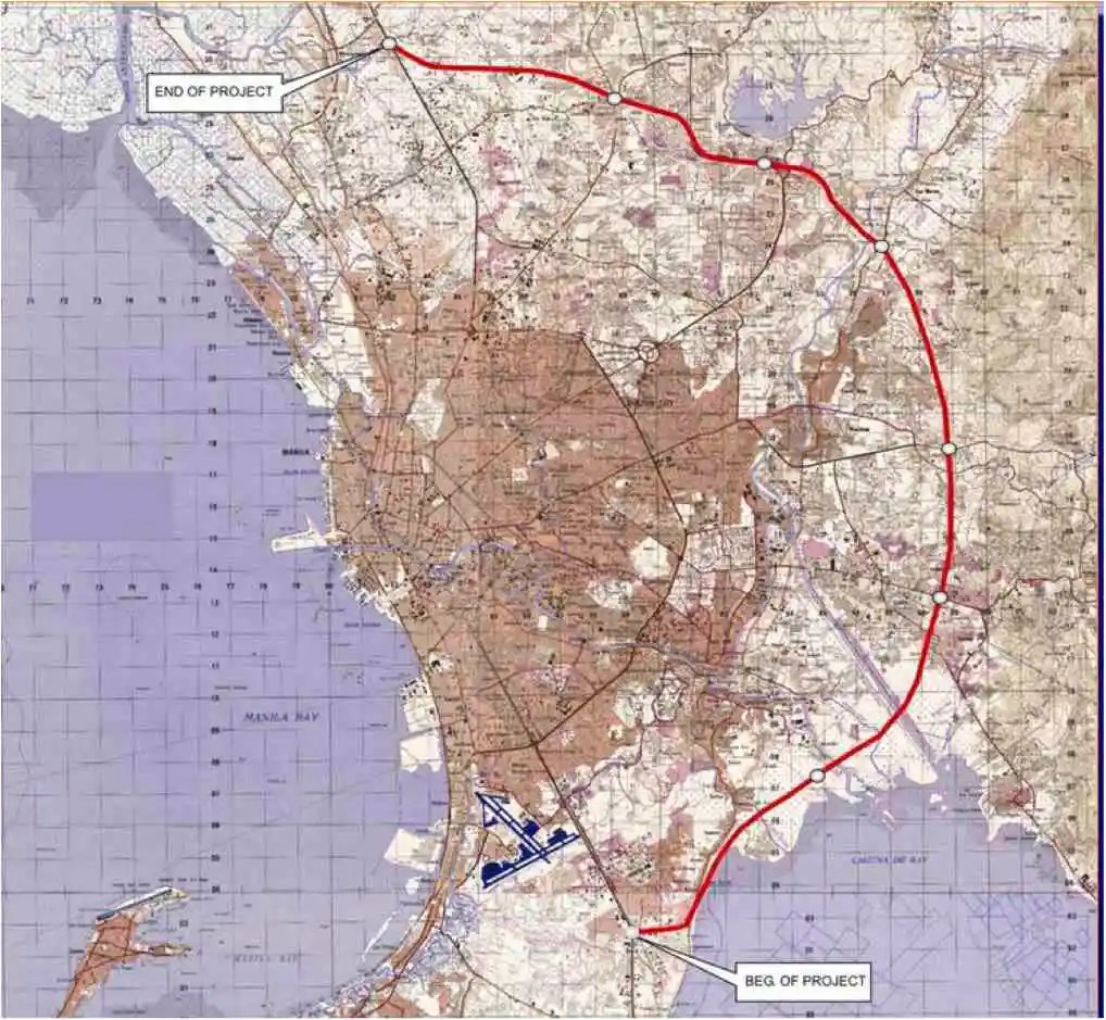
On C-6 and the proposal for another expressway, Part 1
I’ve written about Circumferential Road 6 many times in the blog. Mostly, these were about the existing sections along the Laguna de Bai in Taguig and Pasig cities of Metro Manila and Taytay in Rizal Province. I share below two maps showing different alignments of C-6. The first one is a rather old one from the 1990s that I recall was from a presentation of a friend at DPWH.
 An old map I got from the DPWH a long time ago that I have used in my lectures.
The second map is supposed to be more recent, perhaps in the last 5 to 10 years if not more recent. This shows a more realistic alignment composed of what looks like existing road sections that were connected to form a semblance of a circumferential alignment.
 Here is a more recent map that’s also attributed to the DPWH.
In the first map, you will notice that the proposed alignment is more circular and smoother. This means that the road would have had a mostly new alignment instead of utilizing existing roads like Circumferential Road 5 before it. The newer sections for the latter were the ones connecting the existing roads. For the second map, noticeable is the somewhat forced connections of what looks like existing roads on the map. And while for Map 1 the alignment will be passing under the La Mesa reservoir, the alignment for Map 2 will circle the watershed like a coastal road. The alternative alignments presented an interesting exercise for students of highway engineering particularly for the topic of alignment design. Do you pick an entirely new alignment, sketch it out and determine the crossings and other constraints or do you try to make do of what roads are existing and perhaps improve (i.e., widen) these to produce an arterial?
The proposed alignment for what is now called the Southeast Metro Manila Expressway (SEMME) seems closer to the alignment in Map 1 than the one in Map 2. I will write about the proposed expressway that was recently launched in the next post.
–
Progress of C-6 expansion and upgrading
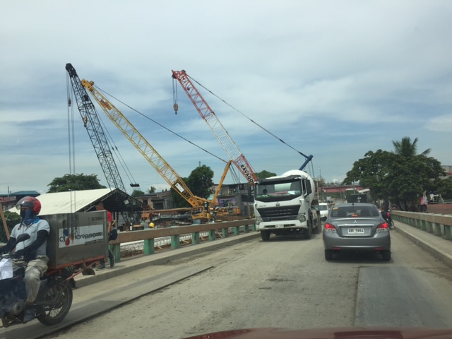
The recent news about the groundbreaking for the C-6 expressway led some people to this site and looking for information on C-6. Here are more photos I took last month (January 2018):
 The future northbound lanes of C-6 is currently under rehabilitation and are being upgraded to Portland cement Concrete Pavement (PCCP). The new southbound lanes currently serve the two-way traffic.
 The sign is an old one and perhaps still in use as a barrier more than for information
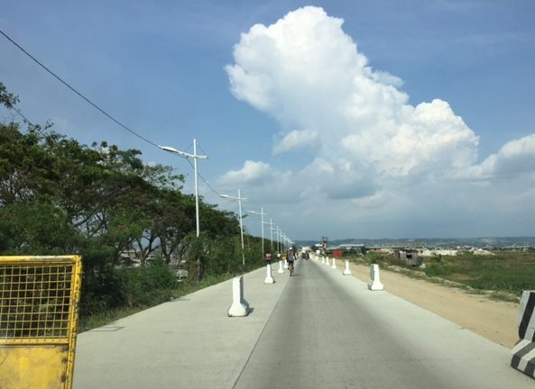
 You see a lot of people jogging, walking and cycling along the finished road. It shows the demand for spaces for such activities, including recreation, and a similar situation may be observed along C5 before and along the perimeter of Libingan ng mga Bayani where a lot of people do exercises and other activities along road sections that are closed to vehicular traffic.
 With one lane completed the second lane is prepared for pouring of concrete. You can see the formworks along the median.
 Other sections have yet to be prepared for concreting but have been stripped of the old pavement (Asphalt Concrete pavement or ACP).
 What you see here at right is the compacted base/sub-base layer. The forms have not been installed yet.
 Backhoe and roller at the worksite.
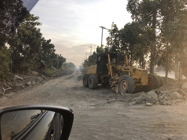 A grader in action.
I will post more photos later from the next time I pass by the area. From what I’ve hear so far, traffic has eased along the expanded Barkadahan Bridge but there are still bottlenecks to address along this alternative route. There will also be a need to have a higher capacity, less friction connection between C-6 and C-5 as traffic along C-6 increases and it’s become quite obvious that Taguig’s narrow streets cannot handle this increasing travel demand between the two highways. It makes sense to have a higher quality, limited access road for this purpose since Taguig roads are already congested and through traffic poses a safety hazard to the residential areas where vehicles travel through.
–
Congestion along C-6 and potential for a public transit corridor
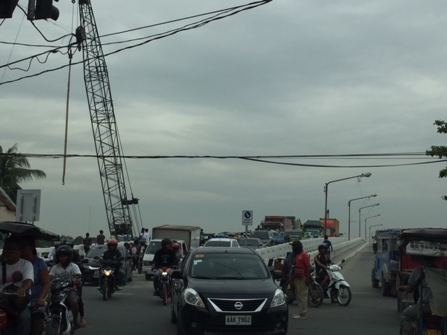
We begin February with a post on a road that’s becoming more popular as a major (as opposed to alternate) route to Bonifacio Global City (BGC) and Makati CBD – Circumferential Road 6. I took the following photo at the approach to the Nagpayong Bridge that is current has only 2 lanes (1 per direction). Another bridge is being constructed along the existing one that will increase capacity for the Pasig River crossing to 2 lanes per direction. This is similar to what was done to the Barkadahan Bridge crossing the Manggahan Floodway in Taytay, Rizal.
The volume of road vehicle traffic is steadily increasing along C-6. The adjacent land use offers a lot of potential for development (hopefully planned) that will feed more traffic along what will become a major thoroughfare in the near future. The land I am referring to are the reclamations on the side of Laguna de Bai along C-6 that are under the jurisdiction of Taguig and similar developments on the opposite side on what was once swampy or marshlands. One wonders if Taguig has a plan for all this or if the city is turning a blind eye and just letting developers do what they want. Most seem to be residential subdivisions and industries-related with a sprinkling of mainly small to medium-sized commercial developments.
Again, I think national and local governments should consider making this a public transport corridor by introducing formal public transport in the form of a scheduled bus service stretching from, say, Bicutan Interchange to Taytay Public Market. The demand along this corridor is steadily rising and only a better connection to C-5 limits an even steeper increase in traffic volume along C-6. The time is now in order to condition commuters about the system and to the unwanted congestion experienced along major roads in the metropolis.
–
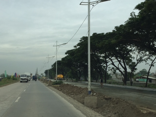
C-6 expansion and upgrading on the way…
The opening of the second Barkadahan Bridge prodded me to post something about C-6. It is a work in progress but currently you can see the progress that is quite noticeable unlike before. Here are a couple of photos we took while en route to BGC last weekend.
 Ongoing paving along C-6 for the westbound side of the highway. The photo shows recently completed PCCP slabs for 2 lanes. Forms are visible in the photo.
 Other sections have had their base compacted and ready for concrete pouring.
As a regular user of C-6 since 2014, I am one of those who look forward to the completion of its expansion and upgrading. There is also something to look forward to for cyclists and pedestrians/joggers/runners as there is a wide bikeway and segregated walkway being constructed along the side of right side of the future eastbound side of the highway. This should encourage non-motorised traffic along this corridor that directly connects Taguig, Pateros, Pasig and Taytay and extends to serve the southern part of Metro Manila, Makati City and the province of Rizal.
–
The newly opened 2nd Barkadahan Bridge
A new bridge had been under construction beside the older Barkadahan Bridge. Instead of expanding the existing bridge, the proponents decided to build another bridge likely so as to reduce disturbance of traffic along the already congested first bridge. This is the same strategy for the bridge across the Pasig River in Nagpayong/Napindan that will reduce the potential bottleneck for when C-6’s expansion is completed. Unfortunately, the bridges don’t seem to include provisions for exclusive bicycle lanes that are clearly incorporated along much of C-6.
 I took this photo as we were in queue at the approach to the intersection of Highway 2000 and the Manggagan Floodway’s East Bank Road. The new bridge can be seen here bearing eastbound traffic. The alignment at the intersection has not been addressed and so requires through traffic to basically swerve towards the entry to Highway 2000.
 Here’s the intersection and the newly opened bridge. Note the vehicles coming towards my position as they follow a trajectory from the bridge to the narrow exit leg of Highway 2000.
 Instead of a single lane along each direction, the two bridges now allow for at least 2 lanes of traffic either way. I say at least because a case can be made for 3 lanes to be indicated (there are no lane markings yet). The issue here though is that there is significant truck traffic crossing the bridge and two trucks traveling beside each other easily occupies the entire bridge. Thus, maybe a wide two lanes can be designated for both bridges with an opportunistic third lane forming depending on the traffic.
–
Some updates on C-6
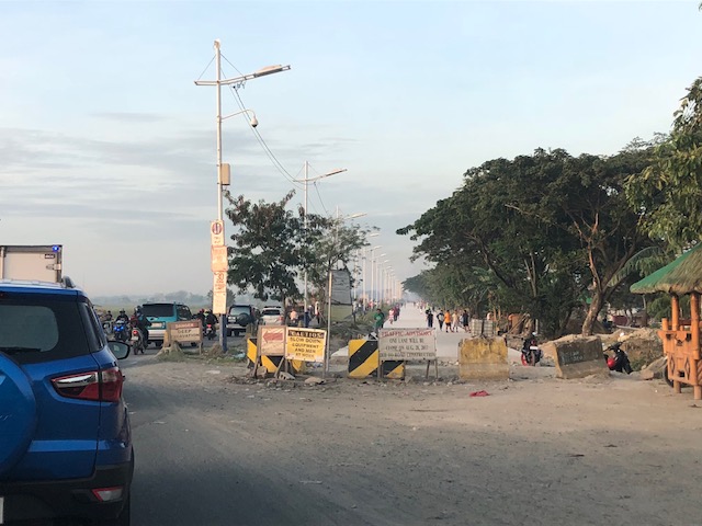
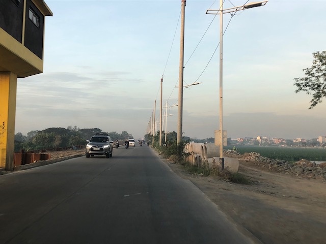
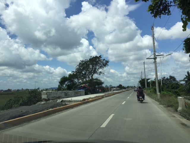
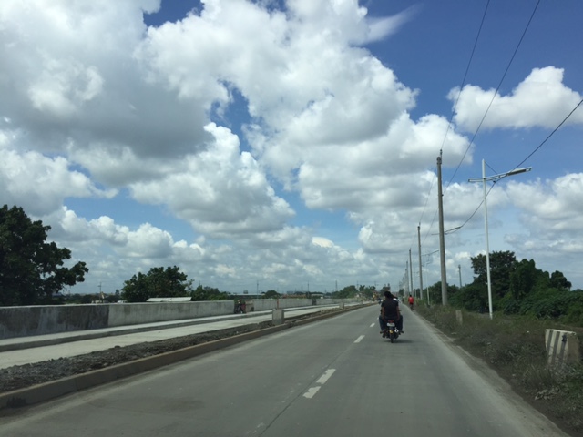
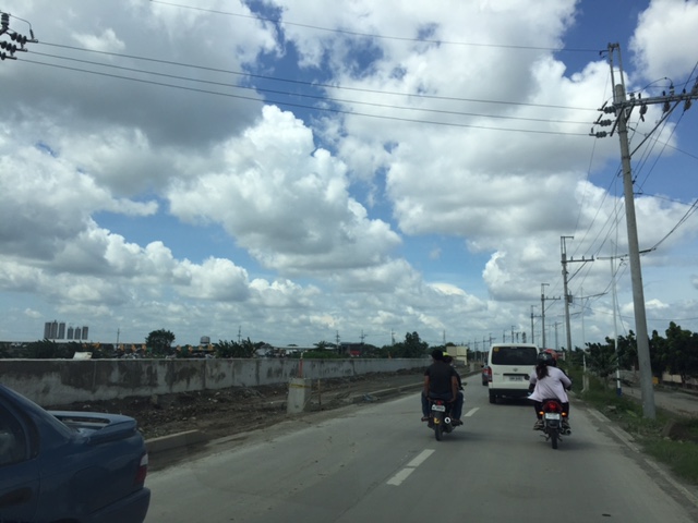
It seems late but there seems to be no really significant changes to the state of Circumferential Road 6 as the rains seem to have slowed down work on sections of the highway. We took these photos 3 weeks ago showing the nice 2-lane/2-way section on the side of the Laguna de Bay that’s been opened to general traffic. Previously, most vehicles had to use the beat-up, crater-plagued older section of what was a dike road. We were heading to SLEX via Bicutan so we were able to take a lot of photos for the entire stretch of C-6. I won’t be annotating all the photos anymore but suffice it to say that the series starts just after the Napindan Bridge in Pasig and ends prior to Taguig City’s bayside park at Lower Bicutan. Vehicles bound for C-5 or BGC via Ruhale Street should get off the newer section and negotiate a short but very bumpy road that’s not a good experience if you’re using a car. Just after the Ruhale “exit” all vehicles would have to return to the old road and have to be patient with the bad conditions of the pavement on both sides of the road.


–
Some issues at Barkadahan Bridge
Perhaps one of the worst places to be in terms of traffic during the morning peak is Highway 2000, and particularly the approach to the Barkadahan Bridge that crosses the Manggahan Floodway. Traffic management at the intersection of the East Bank Road and Highway 2000 is so atrocious that everyone passing the junction would likely incur delays of more than 30 minutes.
The congestion in the area is also attributable to the fact that you have major roads carrying traffic from all over the eastern town of Rizal that are bound for Makati and Taguig (Bonifacio Global City), mostly for offices in those CBDs. These commuters likely use the completed C-6 sections including those at Lupang Arena and the expansion along the Laguna de Bay coast.
 Barkadahan Bridge is a 2-lane structure with significant local traffic such as the tricycles in the photos
 On either side are narrow walkways and it no uncommon for people to walk on the carriageway itself .
 The bridge’s expansion is underway but, from my observation, is taking too much time. Perhaps the contractor is having problems with the foundations for the posts? Or maybe the funds aren’t flowing as required for the effective implementation of the project?
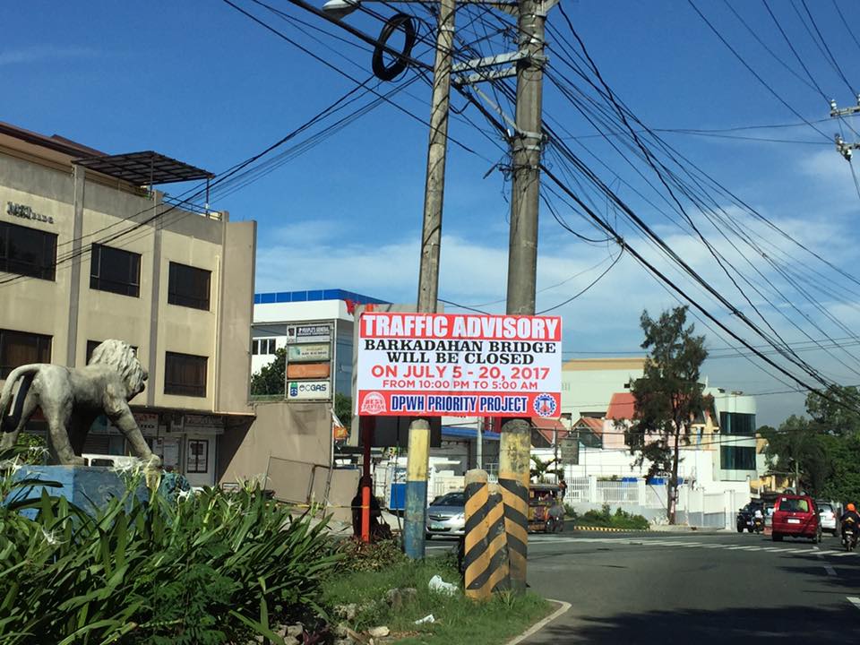 This is an ‘old’ sign now as July 20 is already more than a week ago.
A lot of people look forward to the completion of the bridge but the bigger issue is still the traffic management at the intersection that is also influenced by factors such as the tricycle terminal near the junction and the undisciplined local traffic. The situation is exacerbated by those who counter flow along Highway 2000 and generally get away with it. Perhaps the Municipality of Taytay should get some help in improving their capabilities for traffic management?
–
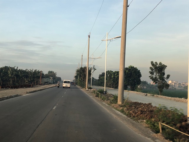
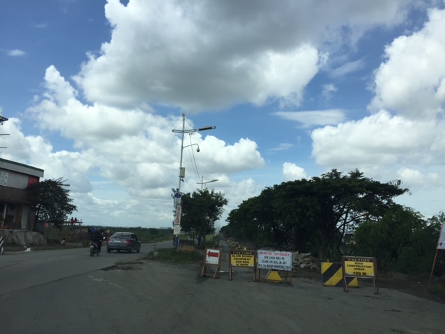
Some updates on C-6
I have not used Circumferential Road 6 in a while. And so a couple of weeks ago, I was happy to see that work has resumed on the sections at Lupang Arenda in Taytay, Rizal, which is also known as Sampaguita Street. Here are some photos of the wide C-6 section. I guess there’s an opportunity here to have service roads on either side of the highway in order to manage/control local traffic. C-6, after all, is a highway and is designed for typical national highway speeds (i.e., 60 kph). The adjacent land use, however, requires slower traffic mainly due to safety concerns.
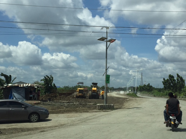
 Cordoned-off section where a contractor is preparing the sub-base prior to placing the steel reinforcement and pouring concrete
 Another photo of the section showing form works for the slab. Note the parked vehicles along the side on the left.
 Some sections are already flooded from the heavy rains
 The completed section towards Nagpayong, Pasig is a wide 4 lanes. At left is a nice view of the Laguna de Bai.
 Section to Nagpayong near the boundary of Taytay, Rizal and Pasig City.
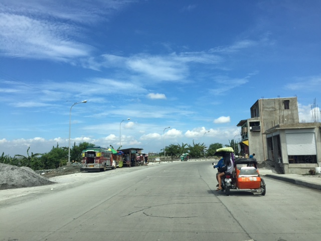 That’s a habal-habal (motorcycle taxi) terminal on the left and in front of a parked jeepney.
Two very important things about C-6 though. One concerns the Barkadahan Bridge over the Manggahan Floodway, which is too narrow for the traffic that cross it. There’s a new bridge beside it that seems to be taking too long to build. And then there’s the long stretch from Nagpayong, Pasig to Lower Bicutan, Taguig which remain in bad condition. The new section along the lakeside is already usable for Pasig-bound traffic but needs to be allowed to carry two-way traffic for the older section to be rehabilitated. C-6 is becoming a major alternative route for a lot of travelers from Rizal to and from Makati and Taguig (esp. BGC). It needs to be improved immediately as it can help decongest the Ortigas Ave. – C5 route that most Rizalenos use to go to their workplaces.
–
Newly opened sections of C-6
I have been wanting to post these photos of the newer sections of Circumferential Road 6. The section was constructed months ago and is part of a project that seeks to widen the current stretch of C-6 from Taguig (Lower Bicutan) to Pasig (Napindan) from the old 2-lane, 2-way road into a 4-lane, divided road. The new section opened to general traffic along the southbound side (to Taytay) and has improved traffic along the section that’s provided people from Rizal an alternative route to Makati and BGC through Taguig. Only, light vehicles are allowed along the new section and trucks and other heavy vehicles take the old road, which is quite battered by the traffic. Only one lane is currently available as there are barriers along the section as shown in the following photos. Traveling along the section also afford people a nice view of the Laguna de Bay to the right.


–
Opposition to C-6
There had been no significant developments for the Circumferential Road 6 (C-6) not counting the road widening and concreting along the sections at Lupang Arenda in Taytay, Rizal. Meanwhile along its lakeside alignment in Taguig, a 2-lane road has been constructed apparently as part of the widening of the section for what maybe a future 4-lane road with a median island dividing opposing flows of traffic.
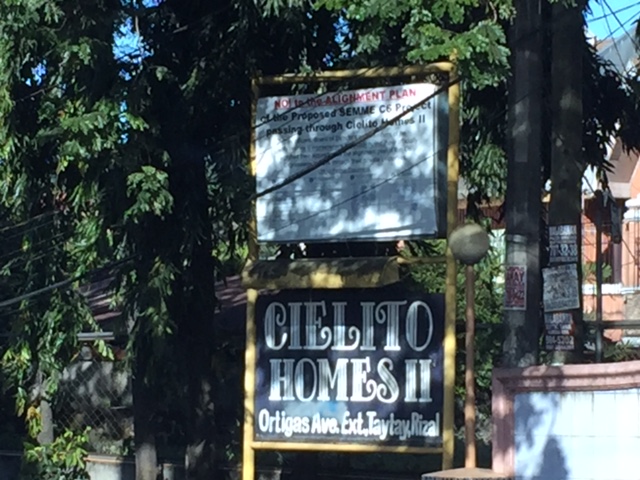 Sign apparently put up by this residential subdivision’s homeowners’ association
 Close-up of the sign shows opposition by the residents to the proposed C6 alignment to pass through their homes.
I haven’t heard or read about anything new or updates about C-6. It seems to be tied to other projects including a proposed elevated tollway along the shores of the Laguna de Bay. The alignment though to the north seem to be unresolved and will definitely be a big concern for many developed residential areas including those in the Province of Rizal.
–
