
Home » Posts tagged 'Cainta' (Page 4)
Tag Archives: Cainta
Ortigas Ave. Extension choke points
One alternative route for my daily commute is Ortigas Avenue. While there are several choke points along this road, I will focus on those between the Ever mall and Cainta Junction. Congestion is also usually experienced between the Manggahan Bridge and Ever but these are mostly due to traffic interruptions because of vehicles turning to and from the many subdivisions whose access/egress line up along Ortigas Ave.
The Ever mall is already a given as a significant traffic generator in the area. However, there is something about its circulation particularly the flow of vehicles in and out of the complex that detrimentally affects Ortigas Ave. traffic. While through traffic along the eastbound direction should use Ortigas Ave., many opt to go through the wide driveway of Ever in order to bypass the choke point that is the exit driveway of the mall. Many of these exiting vehicles are jeepneys turning left into Ortigas westbound (their routes terminate here and make their turnaround via Ever’s driveway). These effectively block the flow of traffic along Ortigas eastbound especially in cases when the westbound direction is also congested (i.e., due to sheer volume as well as stopping vehicles across the mall).
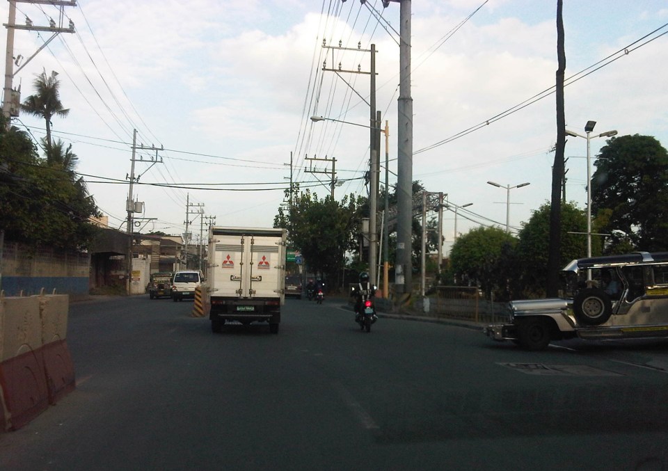 Vehicles exiting from Ever and turning left to Ortigas westbound
Once eastbound vehicles are freed from the blockage of left-turning vehicles, they have to merge with significant right-turning traffic from Ever that includes buses and mostly through traffic vehicles whose drivers were ‘wise’ to have taken the driveway instead of Ortigas to get through the choke point. The situation results in another choke point right after the first one as the traffic along two lanes of Ortigas eastbound merge with the traffic equivalent to 2-3 lanes turning right from Ever. The total of 5 lanes of traffic squeezing into 2 lanes immediately after is a prime example of a bottleneck.
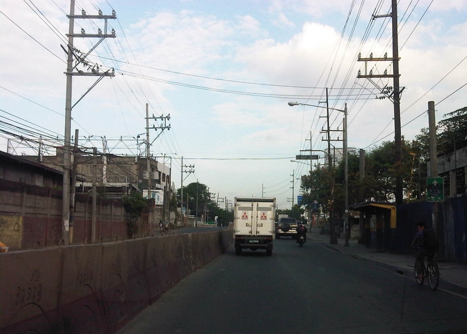 Narrow eastbound two-lane section – additional space should be expropriated to widen Ortigas at this section
Right after the short 2-lane section is a sudden widening of Ortigas Ave. in front of BF Metals. I have heard it said that this is the ideal road width for Ortigas Ave. considering the volume of traffic passing through this major corridor connecting Rizal province with Metro Manila. There are practically 4 lanes for each direction at this short section so its easy to project these lanes on maps to see what properties would need to be expropriated if the objective is road widening. (Of course, the best option should still be to pursue a mass transit system along this corridor.)
 Ideal road width – Ortigas Avenue at its widest is the section across BF Metals. Vehicles here spread out along the many lanes suddenly available. But then people will eventually and immediately realize this is the mouth of a funnel. Note the sign indicating that vehicles are entering the Province of Rizal from this point.
 The eastbound section in front of BF Metals is usually parking lot in the evenings. This is due mainly to the 4 lanes almost abruptly constricting into 2 lanes just past BF Metals. Compounding things is the U-turn slot located here where many jeepneys whose routes end at Cainta Junction make their turnaround. Turning vehicles are assisted by “tambays” earning their money by blocking eastbound vehicles to make way for U-turning vehicles.
Finally, there is Cainta Junction itself, which is a signalized 4-leg intersection that handles a tremendous volume of traffic all-day. I am sure that there are efforts for the traffic signal settings to be optimized but more often there is human intervention for traffic management at the intersection. Whether this causes more severe congestion is quite obvious to many travelers going through this intersection. Queues along Imelda Ave./Felix Ave., for example, can reach way past Village East even reaching Vista Verde on a bad day. This only shows that the intersection is already severely saturated and conventional traffic management or signal settings can no longer handle the traffic. Perhaps the next stage of engineering intervention for this intersection is grade separation or the construction of a flyover or two at the intersection. Notably, such a project should including strategic widening along Ortigas Ave in order to balance the number of lanes feeding into and receiving traffic from the intersection.
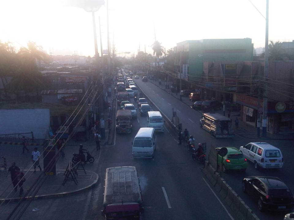 A view of the traffic approaching Cainta junction – there are only 2 lanes along the eastbound side of Ortigas and public utility vehicles stopping here only exacerbates the congestion along the road.
Is road widening the ultimate solution to Ortigas Ave congestion? I personally don’t think so. As I have mentioned earlier in this post and in previous posts the key is still to come up with a mass transit system to serve this eastern corridor. Yes, there will eventually be a Line 2 along Marcos Highway, the main alternate (or competing?) route to Ortigas but is is obvious that even with a railway line along Marcos Highway and connecting to Aurora Blvd., there will still be an urgent need for a similar capacity line along Ortigas. The buses and jeepneys can no longer handle the demand and their poor levels and qualities of service have given rise to a proliferation of UV Express and pushed people to purchase cars and motorcycles. Congestion can be reduced significantly with a mass transit system along Ortigas. Without this transit system, Ortigas will just continue to be congested even if the entire corridor is widened; except perhaps if it is widened like Commonwealth Ave. in Quezon City. I don’t think that is possible and practical.
–
All roads lead to Antipolo: rerouting for the Alay Lakad
The Rizal Provincial Government and the Antipolo City Government recently posted traffic rerouting schemes on their Facebook pages. Lalawigan ng Rizal was the first to post schemes that affect traffic in at least 3 major local government jurisdictions – Antipolo, Cainta and Taytay. The schemes affect the two major corridors that basically lead to Antipolo’s National Shrine of Our Lady of Peace and Good Voyage (or Antipolo Cathedral to many) – the Ortigas Avenue corridor and the Marcos Highway-Sumulong Highway corridor. There are many major and minor routes connecting to these corridors and are clearly seen in the maps.
Within Antipolo, there are also re-routing schemes, which the Antipolo City Government posted along with a “clearer” re-posting of the maps from the Rizal FB page. The Antipolo FB page includes information/maps on the rerouting within the city center. These schemes will affect traffic circulation including public transport routes. Critical would be the permanent and temporary terminals and parking areas set-up around the city that should be able to accommodate the thousands of vehicles that are also expected to be used by people who won’t be walking or cycling.
What the maps basically say is that from 4:00 PM today, Maundy Thursday, to 6:00 AM tomorrow, Good Friday, the stretch from Cainta Junction to the Shrine will be closed to traffic. This is to allow the hundreds of thousands expected to make the trek to Antipolo to have the road for themselves. What the maps don’t say is that motorcycles and tricycles would likely be allowed, too. I can understand that motorcycles could easily squeeze into the throngs of people but then allowing tricycles to operate among the walkers and bikers would be risky given their drivers’ behavior. Add to this that they would be making a killing out of charging opportunistic fares.
Technically, the rerouting schemes don’t appear to be as well thought of as can be expected from the LGUs. Baka ito lang nakayanan ng staff o ng consultants nila, and surrender na agad ang Rizal and Antipolo with regards to the coming up with more options for people to travel to the Antipolo Shrine? Not all people can walk or cycle but are willing to an could take public transport for their pilgrimage. The maps themselves are a bit crude and the Province of Rizal and City of Antipolo could have done much better maps given the resources of these LGUs. There are open source tools now available as well as your basic software like PowerPoint or Photoshop (even Word!) that can be used to render good quality images to guide people making the Alay Lakad. This is a regular event and though it happens once a year then perhaps the LGUs could have better plans especially to transport people who cannot make the walk to Antipolo. The objective after all is to convey the masses to and from the shrine safely and efficiently – something a mass transport system can do whether via Marcos/Sumulong or Ortigas corridors.
One reminder to all doing the Alay Lakad: keep your garbage to yourselves if you cannot find a proper waste bin. Do not dispose of your waste along the route and make a dumpsite out of Ortigas Avenue, Marcos Highway, Sumulong Highway or whatever roads you are taking! Kasalanan din po ang irresponsableng pagtatapon ng basura. While you might be forgiven for these “sins” through the Sacrament of Reconciliation (which many will likely take at the Cathedral), nature will have a way of getting back at you for your environmental travesty. –
Tutok – tailgating
A common practice of motorists along Philippine roads is tailgating. This is not only common in congested traffic, when vehicles are practically “bumper-to-bumper,” but also in free flowing traffic where drivers or riders tailgate for a number of reasons (e.g., to put pressure on the one ahead of them, to display skills in following closely behind another vehicle, etc.), all of which are dumb. There is always the risk that the driver or rider of the vehicle in front will brake to slow down or stop and the driver/rider of the vehicle behind will not be able to brake in time to hit (rear-end) the one ahead. Both time (reaction, headway) and space (distance between vehicles) are factors here as driver or rider reaction times vary and will affect the outcome of the chain of events should the leading vehicles suddenly slow down for any reason.
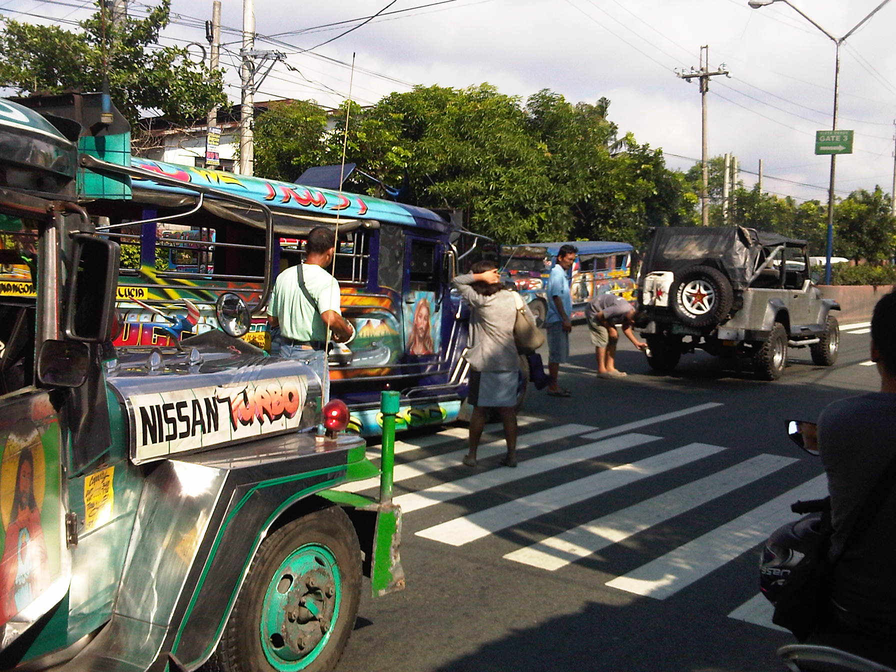 A passenger can only scratch her head as she tries to get back her fare from the conductor after alighting from a jeepney involved in a collision with another vehicle. Meanwhile, the driver of an owner-type jeepney inspects the damage to his vehicle as the driver of the jeepney that hit him looks on.
I was just explaining about Stopping Sight Distance (SSD) to a class of senior students and SSD very much applies to tailgating. Given varying traffic conditions along the roads, tailgating compromises the safe distance between vehicles and therefore too often leads to situations that lead to road crashes. Rear-end collisions in turn often lead to traffic congestion and raise the costs brought about by such incidents. In most cases, this happens because authorities are unable or incapable of managing the aftermath of the incidents where parties involved often argue in the middle of the road without regard for other road users plights. These cases need to be resolved quickly and efficiently in order to remove these obstacles from the road.
–
Another killer highway: Marcos Highway
Marcos Highway, stretches from the Marikina River at Santolan, Pasig to the Sierra Madre Mountains of Antipolo and Tanay in Rizal Province. It is one of the major thoroughfares connecting the towns of Rizal with Metro Manila with traffic already comparable to if not exceeding the volumes along Ortigas Avenue. It is wider that Ortigas Avenue for the sections along the more populated areas (i.e., Pasig, Marikina, Cainta and Antipolo) and connects to other major roads like Amang Rodriguez, Imelda/Felix Ave., Angel Tuazon, and Sumulong Highway. Widening of the highway is currently underway between Masinag Junction (Marcos-Sumulong intersection) and Cogeo. The increasing traffic volume seems to have also led to an increase in the incidence of road crashes. The past few days saw two fatal crashes along the highway – one near Masinag and another at the Filinvest East main gate.
The wife was able to take a couple of photos of the overturned truck and one of the vehicles it hit as the driver lost control of the truck. The area at the main gate of a large residential subdivision in Antipolo/Cainta usually has a lot of people due to the subdivision, the school beside it (shown in the photo) and the commercial and other residential developments beside and across from it.
 A wayward truck lies on its side at the exit of Filinvest East along Marcos Highway just a few meters from a jeepney stop and a school.
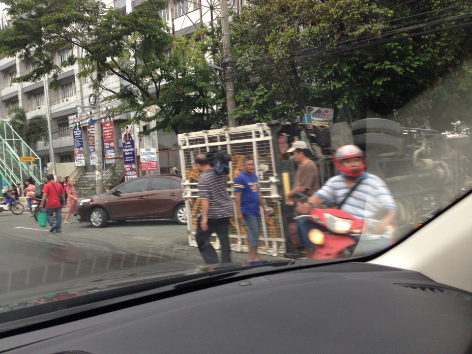 The truck with one of the vehicles (brown sedan) it hit before turning on its side.
I travel along Marcos Highway almost everyday and notice that there are many (and likely increasing numbers) of aggressive public transport (e.g., patok jeepneys) and truck drivers. Many of these people operating the vehicles are definitely not qualified to drive public utility vehicles based on their behavior on the road. Then there are also the motorcycle riders many of whom weave along the highway, often cutting in the path of other vehicles. Many split the lanes during congested periods and who knows how many vehicles have been damaged by motorcycle riders bumping or sideswiping into them. Many have back riders (riding in tandem?) including children. There are also what looks like entire families riding a single motorcycle with children often not having any protection (usually they are sandwiched between parents). I can only wonder how safe the riders think they are and if they thought about risking the lives of their loved ones before each journey.
A friend mentioned that there are regular drag races along Marcos Highway during the wee hours of the morning when the volume of traffic is at its lowest during the day. This goes on despite the police checkpoints along the highway. Are they turning a blind eye to these races? Or are they also involved somehow?
Perhaps the LGUs along Marcos Highway should work together to arrest the trend of increasing road crashes. Even the Provincial Government of Rizal should have a say in ensuring safe travel along this arterial as many of its constituents use the road every day. This is a very urgent matter that needs to be addressed in order to prevent the incidence of more crashes in the future. Simple observations of traffic along Marcos Highway show that there are many crashes waiting to happen. Prevention through timely intervention is what’s needed for this road so that we can save lives and limbs.
–
The need for mass transit to the east of Metro Manila
I wanted to use a title stating “the demand for mass transit to the east of Metro Manila” but the word “demand” for me seemed a bit technical (I associated it with the supply and demand concepts for transport.) and would need some numbers to support it. So I settled for the word “need” instead of “demand” so I could be flexible (i.e., more qualitative) with the way I wrote this article. “Need” is a more pedestrian term that can easily be understood and imagined, and there is no lack for images of this need for more efficient and higher capacity modes along the main corridors to the east of Metro Manila. The main corridors are Ortigas Avenue and Marcos Highway, which have the highest road capacities among other roads (i.e., higher capacities than A. Bonifacio Avenue in Marikina, the Batasan-San Mateo Road, or C-6/Highway 2000). These are also the corridors along which most public transport services may be found. Such connects the eastern towns (e.g., Cainta, Taytay, Antipolo, etc.) to the transport hubs of Cubao and Crossing, which are major transfer points for many people taking public transport. Of course, there are UV Express services from these eastern towns that go directly to CBDs like Makati and Ortigas.
You can observe the crowds at Katipunan and Santolan Stations of the LRT Line 2 as well as the people waiting for their ride home along Marcos Highway. I have observed that there are also lots of people along Ortigas Avenue from Tikling Junction to C-5 who religiously and patiently wait for their rides to school, office or home. This happens everyday and this regularity seems to be a never-ending sacrifice of time and patience. These people do not have much of a choice except taking whatever public transport is available to them. Many probably can afford to have a car or already have a vehicle in their household. Unfortunately, that vehicle is not usually enough for their commuting needs and so they are captive users of an inefficient public transport system (there are some who question if what we have can really be called a system).
 People waiting for a ride in front of Robinsons Metro East along Marcos Highway in Pasig City – these have occupied 3 lanes of the highway as they position themselves for the next available jeepney. There is a UV Express terminal at the mall and another at the nearby Sta. Lucia mall but these are not for the destinations these people are going to.
News that the LRT Line 2 Extension from Santolan to Masinag would finally be constructed was initially met with speculation. Such news have been circulating for so many years but no actual work could be seen along Marcos Highway to convince people that the project was underway. Now, that the soil test samplings have been completed, people are anxious about the actual construction of the extension. I think this is a project long overdue and the question that needs to be answered is if the line needs to be extended further, perhaps until Cogeo. I believe there is a tremendous market for this mass transit system along this corridor where a lot of residential subdivisions and relocation sites have sprouted over the years. The DPWH recognised this as a high capacity corridor and is already widening the road from Masinag to Cogeo.
Hopefully, the Ortigas Ave.-Manila East Road corridor can also have its own mass transit line. The regular bus services along this corridor is no longer sufficient and operations are not so efficient despite what appears as competition among 2 bus lines. There had been a Bus Rapid Transit (BRT) Line proposed for this corridor but there seems to be no progress towards the realisation of that project. Whichever of rail or BRT would be the option for the corridor though, it doesn’t take a genius or too many consultants to determine the need for a good mass transit line along this corridor. When that will be is a question with an answer that is still up in the air. Perhaps the local governments of Rizal, especially the province, should push for such transit systems. The governor and mayors should champion such systems that will definitely benefit their constituents and translate into real revenues for their LGUs from the certain business that will come along these corridors.
–
Anxious about the LRT Line 2 Extension
Among the overdue projects that have generated much attention and, quite recently, some excitement is the extension of the LRT Line 2 from the current end station at Santolan, Pasig to Masinag Junction in Antipolo. This is a 4 kilometer stretch that has been viable for quite a long time now but somehow has not been constructed for various reasons. It was among the low hanging fruits that the current administration should have picked that could have been completed and operating now if it were started sometime 2011 (i.e., factoring in the transition in government after the 2010 Presidential elections). For some reason, government officials had to get proof that there was passenger demand for the extension by considering having another study undertaken just for this purpose. As I’ve mentioned before, one only needs to observe the situation at Santolan Station and perhaps the Sta. Lucia/Robinsons Metro East area to understand just how many people will benefit from the extension to Masinag. I would even dare say that you can even justify extending the line further to Cogeo. Following are a few photos I recently took along Marcos Highway along with some comments pertaining to the Line 2 extension construction.
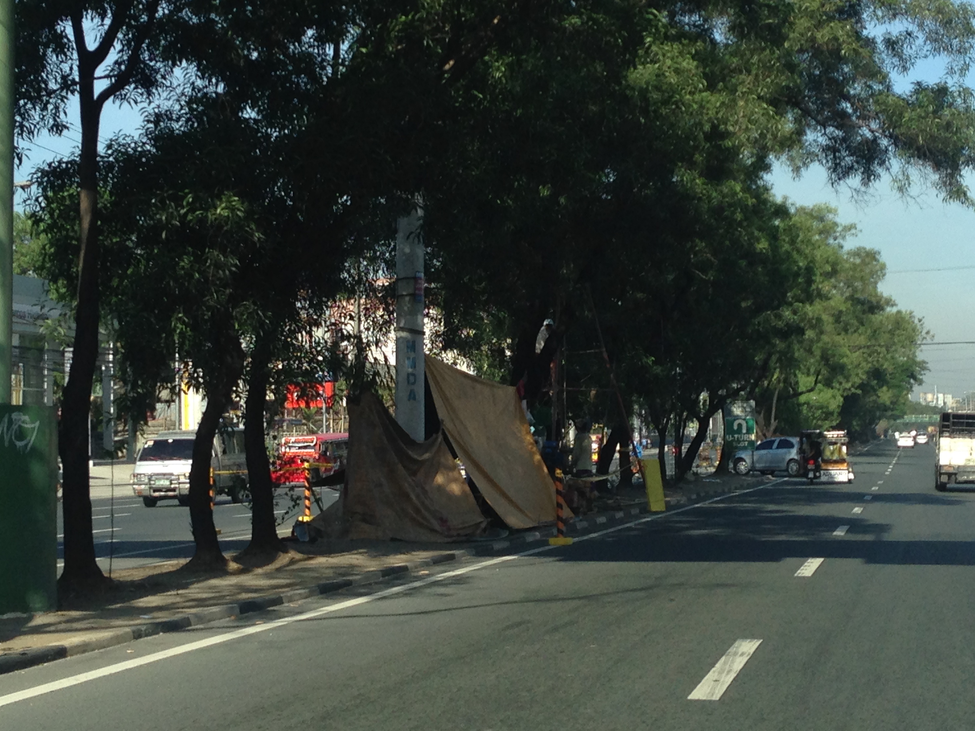 Soil testing site along Marcos Highway in Pasig City – these activities preclude the designs for the superstructure, which include the elevated tracks and the stations (there will be 2) along the Line 2 extension.
 Another soil test site – each location roughly correspond to the location of the columns that will be constructed to support the elevated tracks and stations.
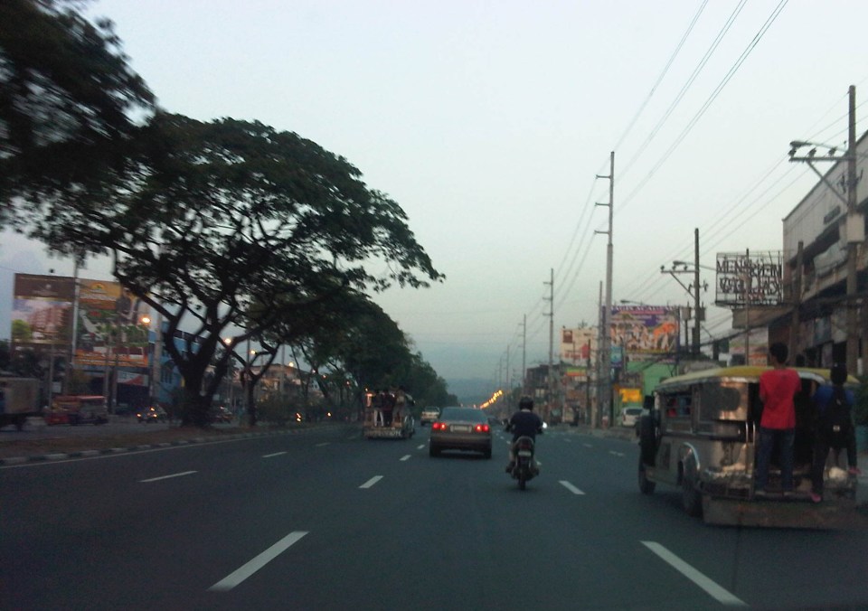 Scenes of overloaded jeepneys should no longer be the norm once the Line 2 extension is completed. However, such would probably be common for jeepneys coming to or from the last station at Masinag. There are no other choices for people taking public transport beyond Masinag except jeepneys bound for destinations like Antipolo Simbahan, Cogeo, Tanay and Marikina.
 Pedestrian overpasses such as this relatively new one near the Filinvest East main gate would have to give way to the elevated Line 2. Another option is for this and other overpasses to be reconfigured with respect to the future line. I just hope this will be done with utmost care so we won’t have overpasses similar to those along EDSA that go above or below the elevated tracks of the MRT 3.
 This overpass will like be removed to give way to the future end station of the Line 2 extension. The overpass in front of SM Masinag will have to be integrated with the station to be located in this area.
–
Daang Bakal and Antipolo’s attractions
I recently wrote about the old railway line that used to run between Manila and Antipolo via a route passing through the town of Cainta that used what was probably the gentlest slope at the time – through what is now Valley Golf, Victoria Valley and Fairmont Subdivisions. Here are some more photos along Daang Bakal, the old Manila Rail Road line that is now a road.
 Daang Bakal is a scenic route and one can only imagine how this place looked like when it was still a railway line and the areas along it were still undeveloped.
 Hinulugang Taktak has been designated as a National Park and the areas along Daang Bakal at least have been preserved. Users of this road are quite limited to residents of exclusive subdivisions with gates along the road and trips generated by the Immaculate Heart Parish near the Fairmont gate. Public transportation is provided by tricycles that have a terminal at the intersection of Daang Bakal and Taktak Road.
 The temporary fence that was made out of tarpaulin material is now in tatters. There is road construction work ongoing though but mainly for the access roads connecting to Pinagmisahan. The concreted area at the right side of the road in the photo seems to be for parking rather than road widening. Traffic is low along Daang Bakal and will probably not require road widening for the foreseeable future.
 The main entrance and facilities for Hinulugang Taktak are still closed and there seems to be no activity to indicate that the rehabilitation project is not moving at all.
–
Floods and traffic
Transport and traffic problems take a backseat to the flooding problem during this time of the year in the Philippines. Since there are practically only two seasons (dry and wet) in the country, floods become a genuine concern once monsoon rains arrive and these are usually complicated by a high frequency of typhoons between August and November. Many major roads in Metro Manila are prone to flooding including Espana Avenue, Araneta Avenue, Gil Fernando Avenue, Ortigas Avenue, and EDSA. Flash floods often lead to traffic congestion and commuters and motorists alike would have a hell of a time traveling yet it seems very little has been done to address a situation that’s been here since the Spanish period. This is a perception by many people and a reasonable one given the historical evidence of flooding in the area and elsewhere in the country.
 Pedicab ferrying passengers in a flooded residential area
There are many images on the current floods in Mega Manila that one can find in various reports online and on TV. The Telegraph provides good photos for describing the situation around Metro Manila and the surrounding areas, and especially in the low-lying areas like Marikina, Malabon, Rodriguez and Cainta. These images could have been taken in any other year in the past and the images would probably be the same with slight changes in some buildings that could have been improved (e.g., additional floor?) in response to the flood experience.
Floods and possible solutions have been the topics of discussions every year and usually during this rainy season. While there have been efforts to address this problem, these are usually and obviously not enough and a more comprehensive approach is needed. Quite obviously, too, solutions that tend to dig up faults in urban planning throughout Metro Manila have led nowhere as legitimate residents and other locators in these areas are not in a position to give up their properties just like that. Relocating informal settlers and others who have encroached from waterways and other critical areas is a start but will have limited impacts in part because Mega Manila does not have a good drainage system in the first place.
Expensive as they are, engineering solutions like perhaps what Tokyo has done in this underground wonder. Of course, this example is a kind of ultimate solution and would require tremendous resources to realize. But then this is also like the transport and traffic problems we are experiencing where years (or decades) of inaction and hesitation due to resource and technical questions have led to the despicable transportation we have now The reality is that solutions will not get cheaper as we continue to balk at the cost of the required solutions. Floods and traffic will not be solved overnight. It will take years to improve the lives of many people in flood prone areas and implementing solutions should have started yesterday.
Another look at Imelda Avenue traffic
A reader brought to my attention some traffic problems encountered along a section of Imelda Avenue in the vicinity of a major retail chain’s branch. There are experiences of traffic congestion along the section fronting the SM Hypermarket from across the Village East subdivision. However, the commercial development and the traffic generated is not really new since the hypermarket replaced another similar establishment (Makro). Arguably though, the trip generation rates of SM developments can be higher than their competitors considering their branding and customer preferences based on traffic experience around SM malls. Following are some specific observations and comments for the case of Imelda Ave. in the vicinity of the SM Hypermarket along the highway.
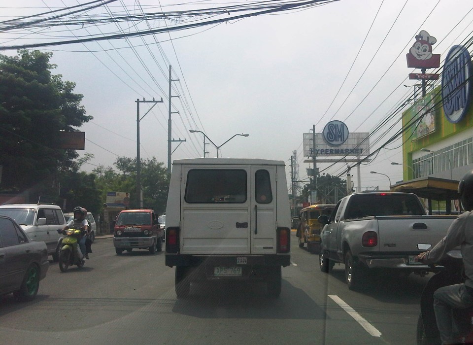 Slow-moving traffic in front of the SM Hypermarket along Imelda Avenue in Cainta, Rizal
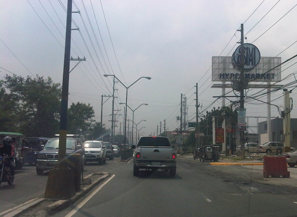 Congestion in the previous photo turned out to be caused by jeepneys loading and unloading passengers in front of the commercial development. Jeepneys tend to occupy the outer lane of the highway, significantly reducing road capacity thereby causing a bottleneck leading to congestion propagating upstream. There is actually a loading/unloading bay on the Hypermarket side of the road but jeepneys do not use this and almost always stop in the middle of the road.
 There are also tricycles using Imelda Ave. despite the regulations prohibiting them from national roads. The tricycles serve the residential subdivisions along the highway but used to be the main mode of transport along an unfinished Imelda Ave. from the 1970’s and competed directly with the jeepneys from the 1980’s one the connection between Ortigas Ave. and Marcos Highway had been made, leading to the opening of new jeepney routes through Imelda Avenue.
 The bottleneck for this section is along both directions as jeepneys stop not only for the Hypermarket but also for the residential subdivision (Village East) that is located just across from SM. The gate of the village opens toward SM with traffic generated significant enough to create a 3-leg intersection at the subdivision access/egress. This is an unsignalized intersection that has no enforcer to manage traffic, leaving it up to the motorists to determine acceptable gaps for conflicting movements. Compounding the situation are pedestrians crossing just about anywhere along the road like the people shown in the photo above.
The issues mentioned above are not all unique to the location but are often the case for many other places where there are major traffic generators such as malls, supermarkets and even residential developments. In fact, middle class villages are major traffic generators due to the car ownership but they are usually predictable in terms of peak periods. That is, the morning and afternoon/evening peak are well-defined according to office or school hours associated with residents (i.e., “to school,” “to work,” and “to home” trips). The solution, of course, is quite basic though not so simple – traffic management in the form of personnel who will enforce traffic and manage intersection flow. It is basic because it is a solution that’s definitely “in the box” and traditional or conventional. It is not simple because often, there is a lack of qualified personnel who can manage traffic full-time, and competent to firmly enforce traffic rules and regulations in order to effect behavioral change (for the better) among motorists and pedestrians. Granted, the commercial development should take the initiative to manage traffic and these may be recommendations already made when a traffic/transport impact assessment was conducted prior to the construction of the Hypermarket. Such assessments should have included traffic forecasting (estimating future traffic) in order to determine potential traffic congestion in the area and the formulation of site specific and appropriate mitigation measures. Perhaps there is a document somewhere (EMB?) that Cainta may use as a guide for how to address transport and traffic problems in the area due to the presence of the supermarket. If none, then the burden will be on the local government to study the traffic and come up with a strategy on how to lessen the detrimental traffic impacts of development in the area.
–

