
Home » Posts tagged 'DPWH' (Page 2)
Tag Archives: DPWH
Another roadblock for active transport?
The Metro Manila Development Authority (MMDA) recently released what they claim to be their counts of bicycle traffic along major roads in Metro Manila from 2020 to 2023.
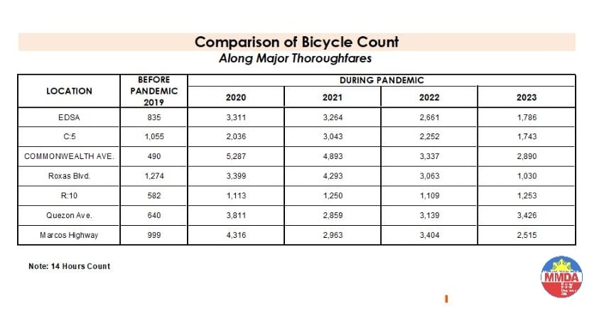
These are supposed to be official data as it is issued by the government agency in-charge of traffic management for Metro Manila roads (aside from its other functions and roles). What are not stated, and are actually very important details, are the locations of the counts and when the counts were conducted. The Traffic Engineering Center (TEC) that was under the DPWH and currently with the MMDA used to publish traffic volume maps for major roads in Metro Manila. So along EDSA, for example, the volume per section are shown on the map. The same for other major roads like Commonwealth, Quezon Avenue and SLEX. The thicker lines mean higher volumes along those sections, and vice versa. However, they did not consciously count bicycles (only motor vehicles) and perhaps MMDA only started counting during the pandemic (i.e., 2020). So there is no one value to represent a road. And counts vary over time of day, day of the week and even throughout the year (i.e., monthly variations).
There were many reactions to the MMDA’s posting of the data and most were critical and even derided the agency for what to them appeared to be inaccurate data. The problem is that it seems there are no other counts that can validate and perhaps refute the MMDA data. Previous bike counts were not conducted according to how the MMDA and DPWH count vehicles. That is, counts are typically done over a 14 or 16-hour period and ideally on several days in a year. Expansion and conversion factors are applied based on established stations along major roads that are supposed to have more frequent if not continuous counts. This methodology is how Annual Average Daily Traffic (AADT) is computed. Call it car-centric if you like but the methodology is very much applicable to bicycles as well. Peak hour counts for bikes are not enough and the peak hour factor for motor vehicles does not apply to bicycles (if this is to be used to expand/convert peak volumes to daily values). In fact, if you go into the math, there should be a peak hour factor for each type of vehicle considering each vehicle’s volume will vary differently over time. So yes, the solution here is to conduct bicycle counts according to how MMDA or DPWH counts vehicles and these should be done along several stations along major roads (e.g., those in the table above) to validate the MMDA counts.
More on this topic in the next post!
–
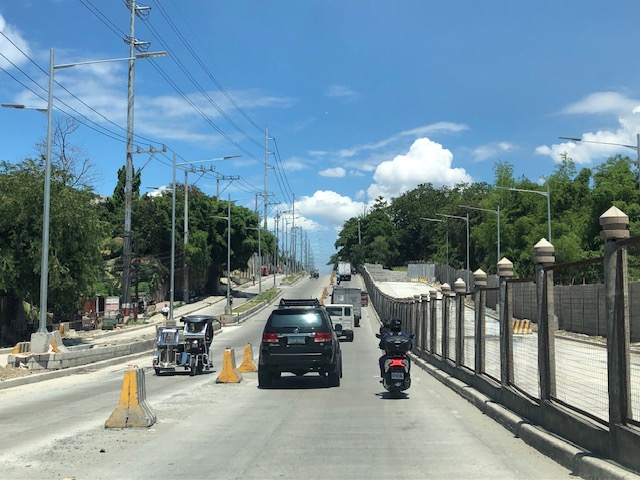
Widening of Gen. Santos Avenue, Taguig City
This is a very late post. I saw this draft that I made more than 7 months ago when I passed by General Santos Avenue in Taguig en route to Laguna where I was to attend a nephew’s wedding. General Santos Avenue is the road connecting C6 with the South Luzon Expressway (SLEX).
 Fence dividing traffic along either side of the road
 The fence stretches along a significant length of the avenue, effectively preventing people from crossing the street anywhere.
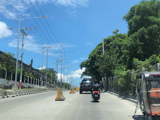
 Unfinished section (should be done by now) showing the original carriageway on the left. The new lanes due to the road widening project is on land acquired from the DOST lot on the right.
 It becomes clear in this photo that the median of the widened road is actually where the walls of the DOST compound used to be. Note the dead end where DOST land has not been expropriated yet for the road widening project.
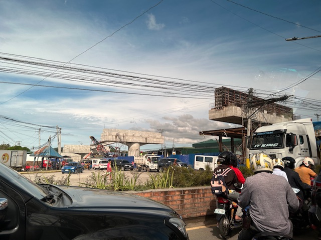
 Either side of the road are DOST lands. The main compound is at right while the left is the MIRDC compound.
 The experimental Automated Guideway Transit (AGT) is found at the MIRDC compound.
More on similar cases in future posts. Road widening projects are very popular with the DPWH, and the agency has been criticized for being somewhat lazy or applying a non-imaginative approach to solve traffic problems. The project is a good example of DPWH fulfilling its mandate. Never-mind that this is not a sustainable approach to addressing transport problems.
–
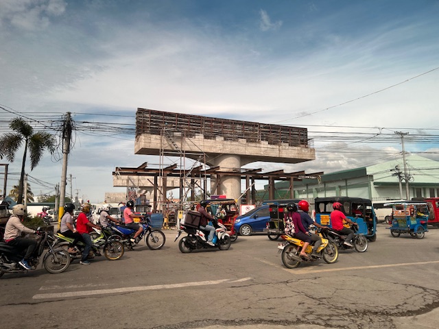
Zamboanga’s first flyover
We passed by the construction site of Zamboanga City’s first flyover at the intersection of the Pan Philippine Highway (AH 26) and Veteran’s Avenue. I recall there was a lot of pressure from DPWH for the city to approve its construction. The previous mayor didn’t want to approve the project because the perception was that it was not required and there were other options to consider before a flyover was to be constructed. However, many people including the then congressman and now mayor probably thought the flyover would be the solution to the congestion experienced at the intersection. Add to that the perception that the flyover is also somewhat a symbol of progress.
We won’t know until its completion and the ‘normalization’ of traffic in the area to determine whether the flyover has ‘solved’ traffic congestion in the area. The problem with this approach to ‘solving traffic’ is that it is usually a short-lived alleviation of a symptom of the real problem, which is transportation. Zamboanga City has deferred rationalization of public transport routed despite analysis and plans pointing to a streamlined and optimized transportation system if this was pursued. The City commissioned a Transportation and Traffic Management Plan Study in the previous administration but the plan and its recommendations have been shelved, another example of such being casualties of a change in administration of an LGU.
–
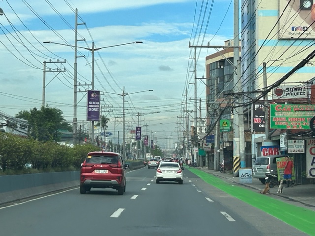
Westbound bike lane along Ortigas Avenue Extension, Cainta, Rizal
I was not able to post these photos of the westbound bike lane along Ortigas Avenue Extension immediately after I shared photos of the eastbound bike lane. The bike lanes, as can be seen from the photos, are painted green.
 Bike lane past Valley Golf and STI
 Bike lane approaching Brookside (Sunset Drive) with the CK Square as a landmark
 Still a big issue for bike lanes is the presence of electric and communication poles/posts that have not been relocated after so many years since Ortigas Avenue had been widened.
 Bike lane across from Tapsi ni Vivian
 These photos were taken before the solar studs were installed to delineate the bike lanes and make them more visible at night or when its dark.
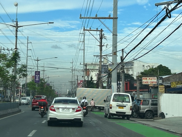 Also, challenges and concerns for cyclists are parked vehicles and those maneuvering from the various establishments along the road. This photo pretty much captures those two concerns – a parked UV Express van and a truck maneuvering out of a store occupying the bike lane.
 Cyclist pedaling along the bike lane approaching the Shell Gas Station (where there is also a McDonald’s)
 Bike lane in front of the Ortigas Hospital just outside the Brookside Gate 1 and near Cainta Junction
More photos of the bike lanes soon!
–
Incorporating bike lanes along local roads – an example in Taguig City
I have not used an old route that we usually take to go to BGC from our place in Antipolo. This is via the Manila East Road, Highway 2000, Barkadahan Bridge and C6. From C6, we usually take Ruhale instead of Seagull Avenue as the former provided a shorter route towards Levi Mariano Avenue and C5. So it was only last weekend that I was able to see the improvements along Ruhale Street and how bike lanes were incorporated along this road. I am sharing the following photos showing a two lane road and Class 2 bike lanes.
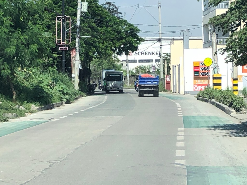 The green pavement markings indicate an intersection or driveway.
 Noticeable are the electric posts that remain along the bike lanes. These need to be transferred so they will not pose danger to all road users.
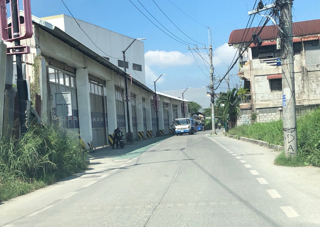 More electric posts along the bike lanes
 Bike lanes in front of an industrial establishment
 Close-up of a post in the middle of the bike lane.
 Bike lane across another industrial establishment. Again, note the green pavement marking across the driveway of the establishment.
 Bike lanes along a predominantly residential area along Ruhale.
I would consider this as a good practice example that can be replicated elsewhere. Of course, it is not perfect and as shown in the photos, there is much room for improvement including the transfer of electric posts that pose as hazards to all road users. The bike lanes are wide enough that installing bollards for the perception of physical protection vs. motor vehicles can be considered. Ruhale is generally a low speed, low volume road so perhaps the current state with no barriers would be enough for now. Also, we need to appreciate that these are already gains or wins in as far as active transport is concerned. A few years ago, this would not have been implemented by national or local governments.
–
Central Luzon Link Expressway (CLLEx)
The recently opened Central Luzon Link Expressway (CLLEx) is a freeway spanning the provinces of Tarlac and Nueva Ecija towards the Cagayan Valley side of Luzon. With the ends at Tarlac City, Tarlac and San Jose City, Nueva Ecija, Phase 1 currently terminates at Aliaga town; connecting to the Guimba-Aliaga Road. That is 18 kilometers of the planned 30.7 kilometers of the first phase, which is to end at Cabanatuan City, Nueva Ecija. Here are some photos taken by colleagues as they traveled to Tuguegarao this weekend.
 Section of SCTEX leading to the junction where the road branches to either the TPLEX or the CLLEx. SCTEX is a tollway operated by Metro Pacific via its Manila North Tollways Corp. while TPLEX is a tollway operated by San Miguel Corp. CLLEx is currently a freeway under the DPWH.
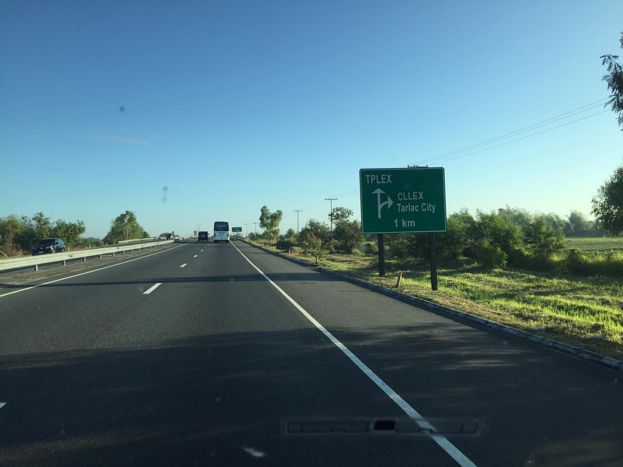
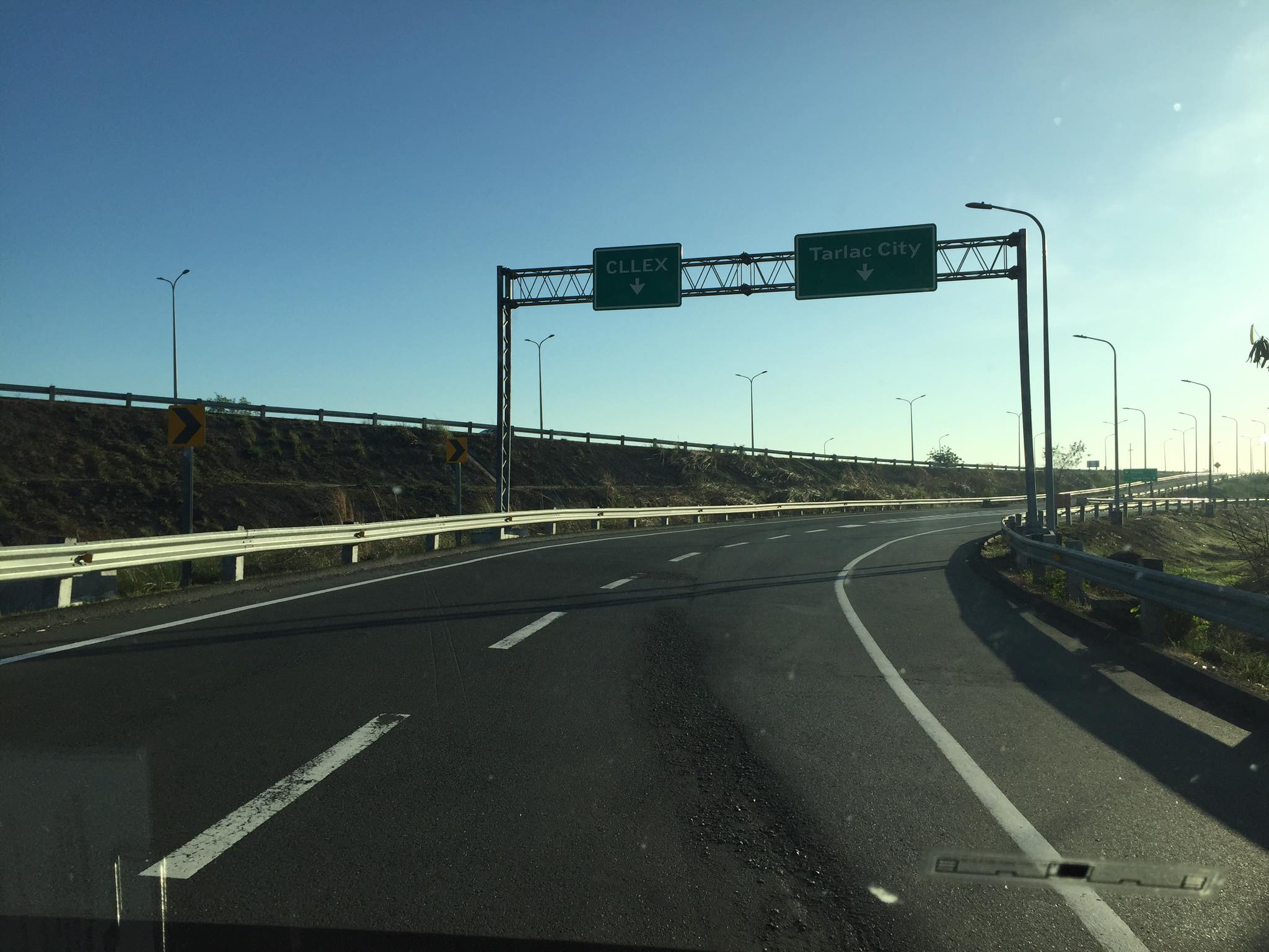 SCTEX off-ramps to CLLEx (left) or Tarlac City (right)
 The expressway currently has 2 lanes per direction plus shoulder along either direction. The median barrier is a post & rail semi-rigid structure.
 Many of the traffic signs have yet to be installed
 Not so much traffic along the freeway as shown in the photos. These were taken on a Sunday though and we wonder if there will be more vehicles during the weekdays.
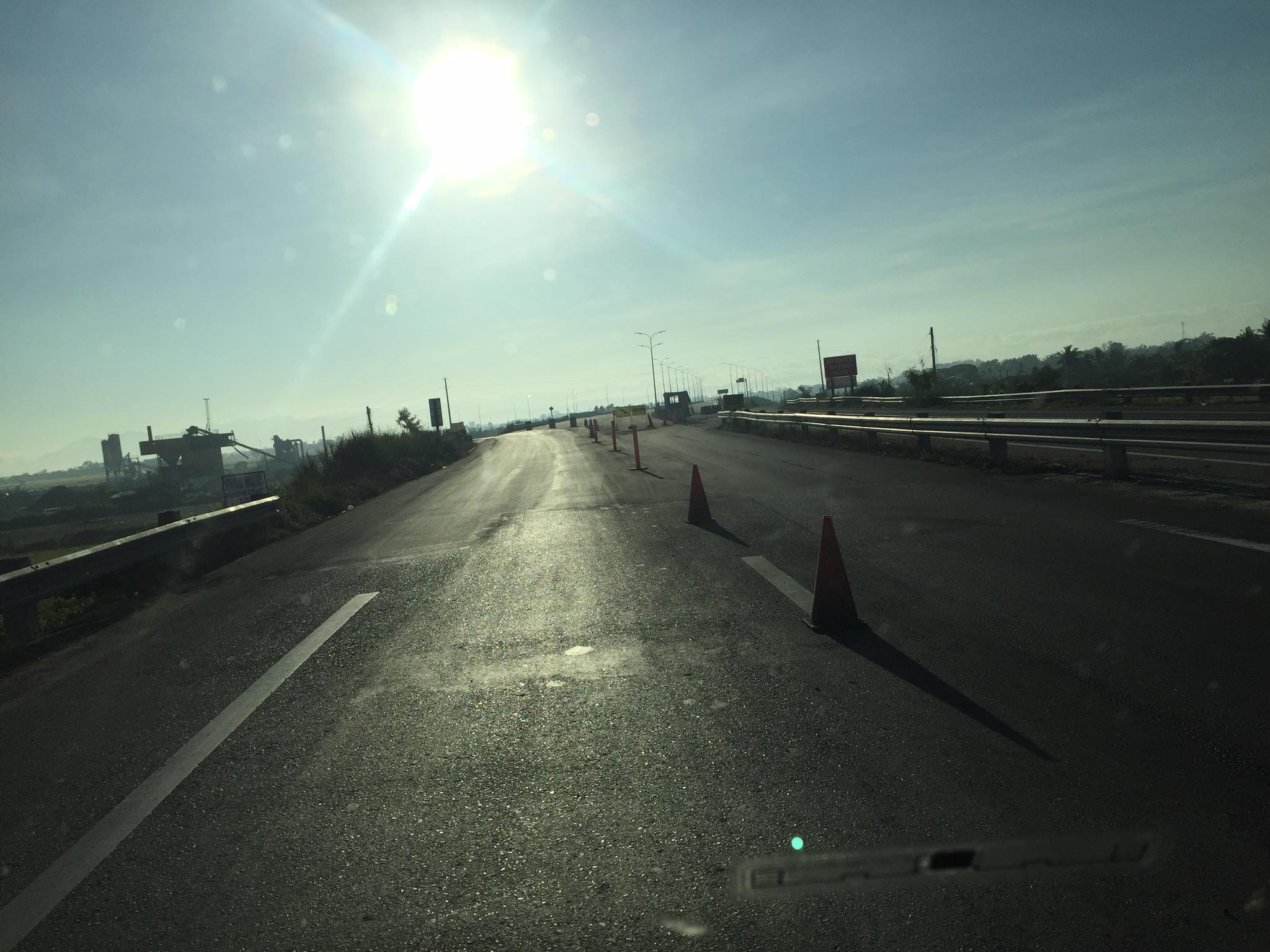 As the freeway is still uncompleted, the end section in Nueva Ecija is two lane-two way with only cones and bollards separating opposing traffic.
 Exit ramp towards the Guimba-Aliaga Road
There are no stops yet along the freeway. I am not aware if there is a timetable for it to become a tollway. Traffic is still quite low so perhaps making it a tollway will take some time as it might be difficult to have a profitable operation. It would be good to have it as a limited access freeway to establish demand and use for the road.
–
On addressing global warming
Here is another quick share of an article; this time on “warming”. The evidence for global warming is strong and we need to address this pressing issue if future generations are to survive a planet that is heating up fast.
Litman, T. (August 31, 2022) “Cool Planning for a Hotter Future,” Planetizen.com, https://www.planetizen.com/blogs/118535-cool-planning-hotter-future?utm_source=newswire&utm_medium=email&utm_campaign=news-09012022&mc_cid=ead7ee914a&mc_eid=9ccfe464b1 [Last accessed: 9/5/2022]
To quote:
“Many of these strategies provide significant co-benefits. For example, reducing road and parking supply with more efficient traffic and parking management helps reduce infrastructure costs and traffic problems, and by reducing impervious surface area it reduces stormwater management costs. Planting more urban shade trees helps create more attractive neighborhoods and increase wildlife habitat. Improving natural ventilation creates more comfortable and healthier buildings, as summarized below.”
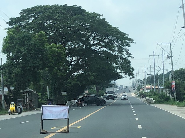
I recall people calling for more trees to be planted along roads and how our city streets can become something like Orchard Road in Singapore. I agree with having more trees and other plants, landscaping, along our roads. I also lament the times (and it continues) when the DPWH chopped so many old trees along national roads for road widening projects that didn’t need to destroy so many that gave those roads shade as well as character. We need more change in mindsets particularly when we design highways and streets towards sustainability and yes- reducing heat.
–
The wide Roman Highway, Bataan
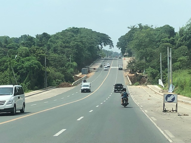
As it is National Heroes Day today, I thought it would be nice to feature a road in an area that witnessed the experiences and sacrifices of many heroes. I traveled to Bataan last July and took some photos of the roads there including the Roman Highway, which is the main corridor connecting many of the province’s major towns. Also called the Roman Superhighway, the highway originally had 2 lanes (bi-directional and undivided) with shoulders along both side of the road. Eventually, it was widened and extended to 4 lanes (2 per direction) with wide shoulders. The current Roman Highway has been expanded to 6 lanes with shoulders but for most parts appear to effectively have only 4 lanes and paved shoulders.
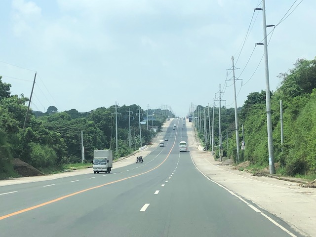 The wide Roman Highway does not carry much vehicular traffic
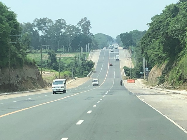
 The road widening is not complete as most bridges have not been widened. These produce bottlenecks like the one in the photo where the additional lane is effectively relegated to a shoulder.
 The highway is practically straight but presents many examples of sags and crests. For those into highway engineering, images like the ones I share in this post are textbook examples for sight distance topics.
 Another sag vertical curve with a bridge near or at the lowest point in the sag. Again, notice that the additional lanes are currently discontinuous at the bridge and there’s a barrier (orange) to warn motorists and guide them back to the original carriageway.
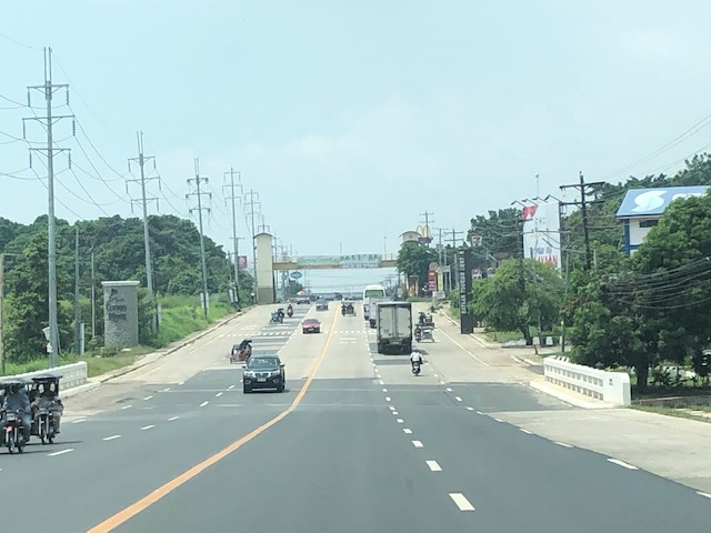
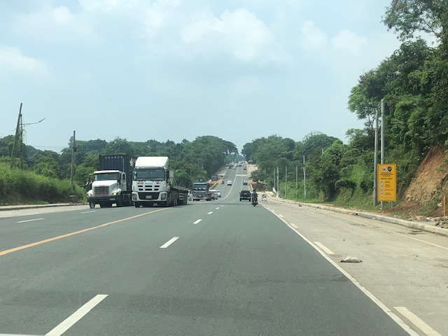 The highway is used by many trucks as there are industrial centers located along the highway including the PNOC in Limay and what used to be called the Bataan Export Processing Zone (BEPZ now the Bataan Freeport) at the end of the highway in Mariveles.
 The widening of the Roman Highway includes the addition of one lane per direction and a narrow shoulder just before the sidewalks. The shoulder could easily be configured into a bike lane but that third lane can easily be designated for bicycles considering the traffic is usually light at most sections of the highway.
 A section where the bridge has already been widened features 3 wide lanes per direction. The shoulders are still there but are not included in the bridge.
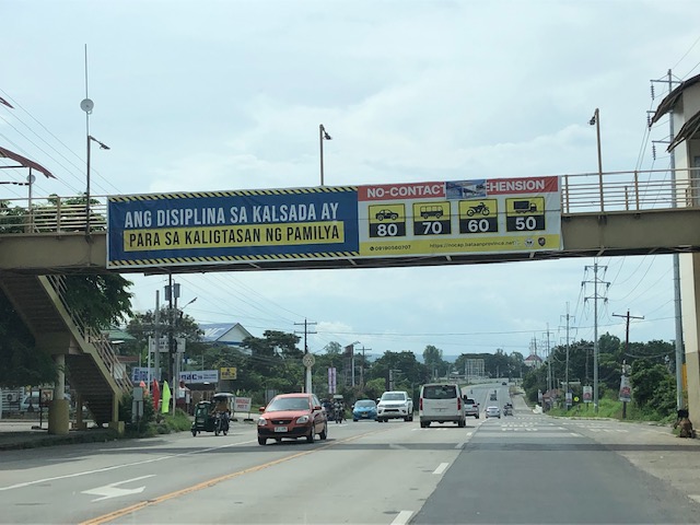 LGUs are joining the No-Contact Apprehension bandwagon
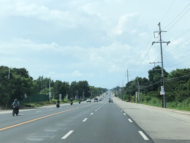 Another view of the wide highway
More on Bataan roads in a future post. I also took photos of the Gov. J.J. Linao National Road (Pilar – Bagac Road), which is the main access road to the Mt. Samat Shrine.
–
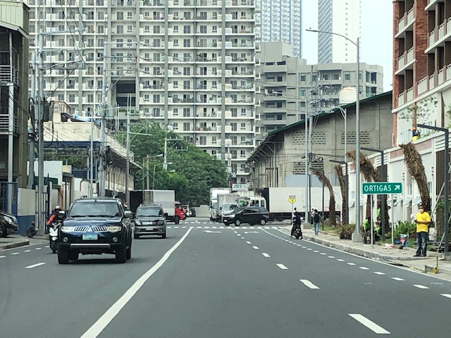
Counting cars…and other vehicles as well
I saw a couple of these counting instruments set-u by the DPWH, one along Ortigas Avenue Extension and another along Sumulong Highway. These are mobile counting machines that are used to count vehicles along both directions of the roads. These are supposed to be calibrated to be able to distinguish among the various types of vehicles using the roads. I assume the classifications would be according to the types used by the DPWH and not simply a general count of the number of vehicles. I wonder though if these can accurately count smaller vehicles like motorcycles, bicycles and PMD’s like the one in the photo below.

If these can be calibrated to count bicycles and PMDs, it would allow for the establishment of baseline numbers and expansion or seasonal factors for what are now termed as micromobility modes. The recent bicycle counts done through volunteers and during peak hours cannot be expanded simply because there are no reference factors that can be used for this purpose. The available expansion or seasonal factors with DPWH derived from 24-hour counts at strategic locations along national roads only account for motor vehicles. These cover the variations of motor vehicle traffic over long periods of time (e.g., 24/7) that allows one to determine Annual Average Daily Traffic (AADT) as well as typical traffic during certain days of a week (e.g., traffic on a Monday or a Sunday).
–
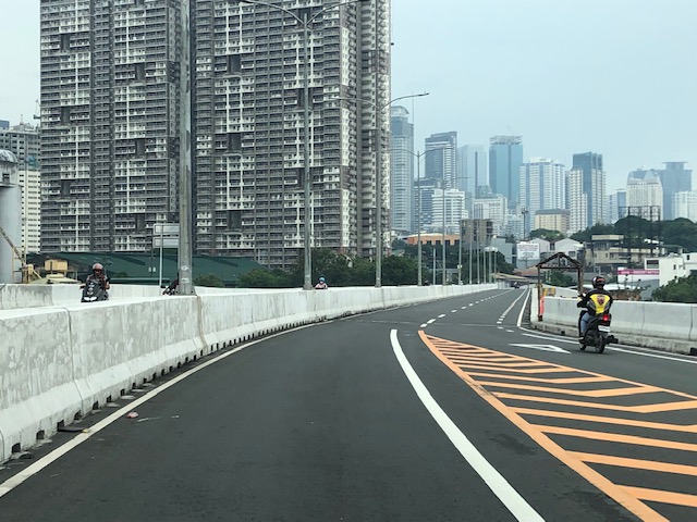
Kalayaan Bridge (BGC – Ortigas Center Link)
The Kalayaan Bridge, also known as the Bonifacio Global City (BGC) – Ortigas Center Link opened about a year ago and was supposed to ease traffic along the usual routes along EDSA and C5 that crossed the Pasig River. The new bridge is located between the EDSA and C5 bridges and is a more direct route to and from BGC if you reside in Pasig and choose the route to/from BGC via Pasig/Shaw Boulevard.
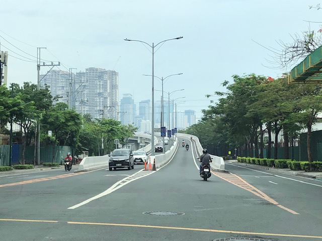 The approach ramp to the bridge from the BGC side is in the vicinity of the Uptown part of BGC. The bridge goes over Kalayaan Avenue, which is one of the major access roads to BGC from C5 or EDSA, and J.P. Rizal Avenue Extension but there is access and egress to Kalayaan Avenue.
 The ramp is practically a single lane with painted bike lanes on either side of the bridge. There is noticeably no space for pedestrians on this bridge. That is only a curb on the right side. This lack of pedestrian provisions is a major flaw of this bridge.
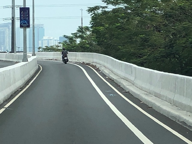
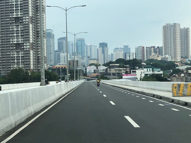
 A lone cyclist traversing the bridge – the merge for traffic from BGC and vehicles from Kalayaan Avenue is seen downstream.
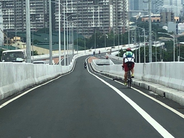
 Approaching the merging section (from this perspective; its diverging on the other side) of the bridge.
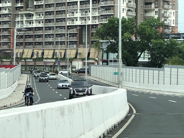
 A motorcycle merges with the traffic from BGC. Notice the chevron markings separating merging flows as well as the yield marking for vehicles coming from Kalayaan (i.e., priority is for vehicles coming from BGC). The bridge from this section becomes two lanes per direction. There is, however, a risky part for cyclists who will cross paths with vehicles coming from Kalayaan. Cyclists from BGC will have to cross a lane to get to the bike lane on the outer side of the bridge. There is no space for pedestrians along this bridge.
 There is only this part of the bridge where there appears to be a sidewalk. Was this really the design for this bridge? It is very obvious that many people failed in both design and implementation of this project.
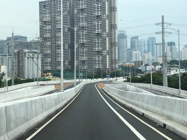
 The view towards the Pasig side of the bridge. There are two lanes per direction and narrow bike lanes along the curbsides.
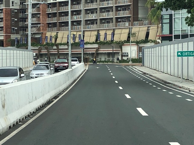 There is an intersection at the end of the bridge but the road immediately at the right is closed to incoming traffic so right turns are currently prohibited despite the pavement markings that indicate they were allowed at one time.
 The road leads to this intersection which is in area generally referred to before as ‘Pioneer’. The area hosts many warehouses or storage buildings and I remember going here many years ago to check out the imported wood furniture and office surplus items. Turning right leads one to the area generally known as ‘Unilab’ because that was where United Laboratories had their plant and offices. It retained the property where now stands an events venue. Further on leads you to Kapitolyo and the Estancia Mall.
–
