
Home » Posts tagged 'floods'
Tag Archives: floods
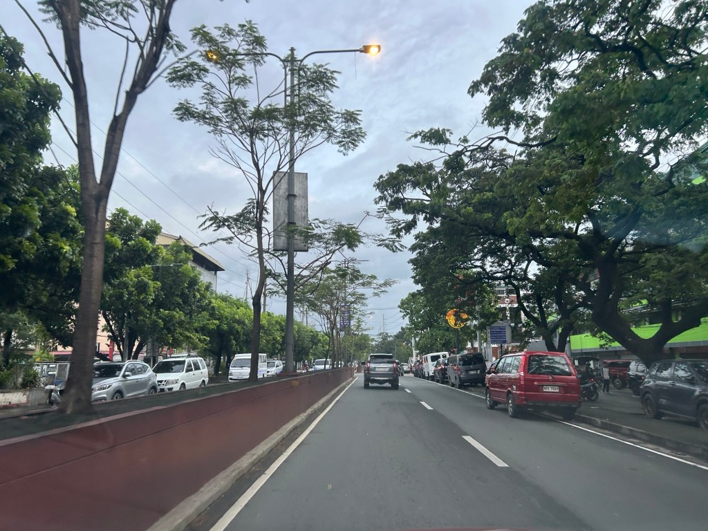
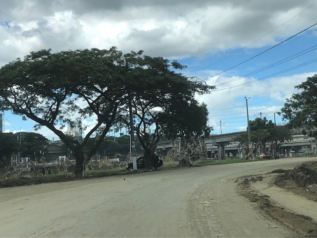
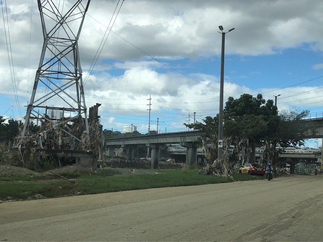
Vehicle refuge during floods
Passing Felix Avenue one early morning this week, I saw familiar scene. There were lots of vehicles parked along Felix Avenue (formerly Imelda Avenue) including the service roads along either side of this major road connecting Marcos Highway and Ortigas Avenue Extension.
These vehicles are owned by residents of subdivisions along the avenue whose areas are prone to flooding. These include Vista Verde, Metroville, Kasibulan, Karangalan and the two Green Parks. I didn’t see this along the stretch so the other flood prone villages like Village East and Country Homes. Perhaps they have been able to adapt better?
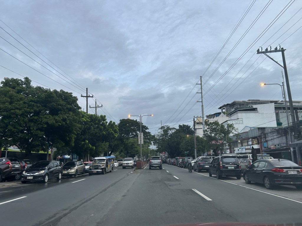
Car-centric discussions aside, when you go the ‘east’ you will notice a lot of people using SUVs. One reason probably is because many Rizal towns including Antipolo City, and Pasig and Marikina Cities are prone to flooding. Can you imagine over 50 years of flooding in these areas? And then with the current investigations concerning flood control projects, have you wondered if the ‘east’ really got their taxpayers’ money’s worth in terms of interventions?
–
Flash floods in Quezon City
The rains poured again this afternoon and it was quite intense for more than an hour in Quezon City. We had floods at the UP campus and along Katipunan Avenue. Reports from various sources stated that there were also floods along EDSA and other major roads in the city. The floods come at a time when QC flagged flood control projects undertaken by the DPWH without the city’s blessings.
The flash floods were probably proof of the shoddy work associated with DPWH and its contractors. While QC residents and the LGU should share the blame for these, the scale and frequency of the floods indicate drainage issues.
The floods have led to intense traffic congestion and commuters being stranded due to public transport vehicles not being able to turn around. The latter is one of the cases where public transport appears to be lacking. Their numbers may not be lacking at all but the traffic conditions prevent their turnaround to address the demand for transport.
–
On transportation and floods
Some people say transport and traffic concerns take a backseat to floods and related concerns, which affect other aspects of our lives aside from our commutes. The heavy rains the past days have rendered many streets impassable to most types of vehicles. That means people cannot go to work, school or come home. Lives are disrupted by floods this way. But even more disruptive and disastrous are the damages brought about by flooding in many communities. Homes are submerged. Properties are damaged, many beyond repair or replacement. There is also the psychological aspect of floods especially for those who will experience them for the first time. These will surely add to the already fragile mental health of people still reeling from the effects of the COVID-19 pandemic.
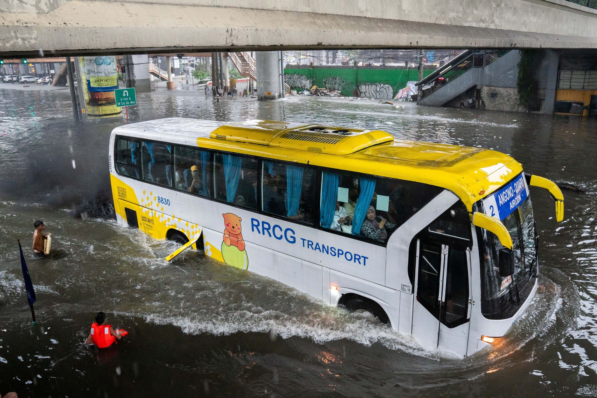
As I write, the Marikina River has breached and many areas of Metro Manila and surrounding provinces of Bulacan, Rizal, Laguna and Cavite are flooded. The floods are now being mentioned along with those brought about by Ondoy (Ketsana) in 2009.
Here are some photos from the internet being shared by various social media accounts including the official pages of Rappler and Inquirer:
–
Musings on rainy day commutes
I sympathize with a lot of people whose activities were disrupted by the inclement weather the past days. The rains from the other night and today resulted in floods around Metro Manila and Rizal (where I live). The forecast of more rains during the past days made government suspend classes at all levels for both public and private schools. However, many and particularly students have already traveled to their schools as some announcements came late or not early enough for those who usually leave home early to avoid the usual traffic congestion around schools.
I myself used to leave our home early to go to school. As I took public transportation to the university, I had to leave before 6:00 AM (even earlier if it was raining) to be able to get a jeepney ride and have a comfortable trip (shorter travel time than when I leave later in the morning). I had one transfer at what used to be the K-Mart terminal. Both legs of the trip were via jeepneys. I recall silently cursing the guards at Ateneo for prioritizing what seemed to be an infinite number of cars entering and exiting that university via their Gates 2 and 3. At the time, Ateneo still operated the blue school buses and you can see few students on those buses. I observed already then that most of their students probably had their own vehicles to take them to school. Once past the gauntlet of Ateneo and Miriam (which was Maryknoll before), traffic was smoother. And to think that there was no C.P. Garcia yet and Katipunan at the UP Diliman and MWSS areas was not as wide as it is now. The old Katipunan section was basically a two lane road with UP on one side and MWSS on the other. What is now a center island with large acacia trees used to be the frontage of MWSS. UP’s walls were lined with eateries and small stores catering to students and workers.
My commutes during the wet season can be quite difficult as you can’t simply hang on to the jeepney (at the back) when it’s pouring. And when the weather’s particularly bad, there were flooding along my route, not to mention where I resided. I also remember wading in floodwaters along Katipunan (yes, there were floods along Katipunan before) because the road was impassable to vehicles and the only way to get home was to walk from UP to Aurora Boulevard. Our home in Cainta was often flooded during typhoons, and I also waded in floodwaters along portions of Felix/Imelda Avenue an in our village. The flood experiences probably deserve separate articles here and I will share some stories as soon as I can organize my thoughts and memories of these. Of course, I will relate these to transportation as there were lots I learned from these experiences. The frustration though is that it seems we have yet to do in order to address climate’s and weather’s impacts on transportation.
–
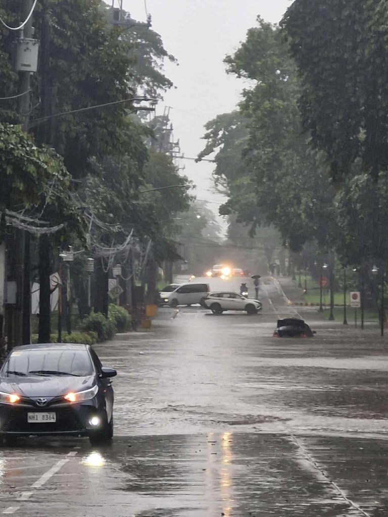
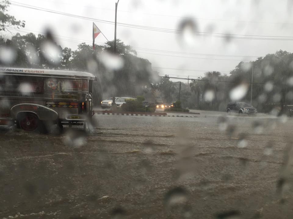
On floods, transport and traffic, again
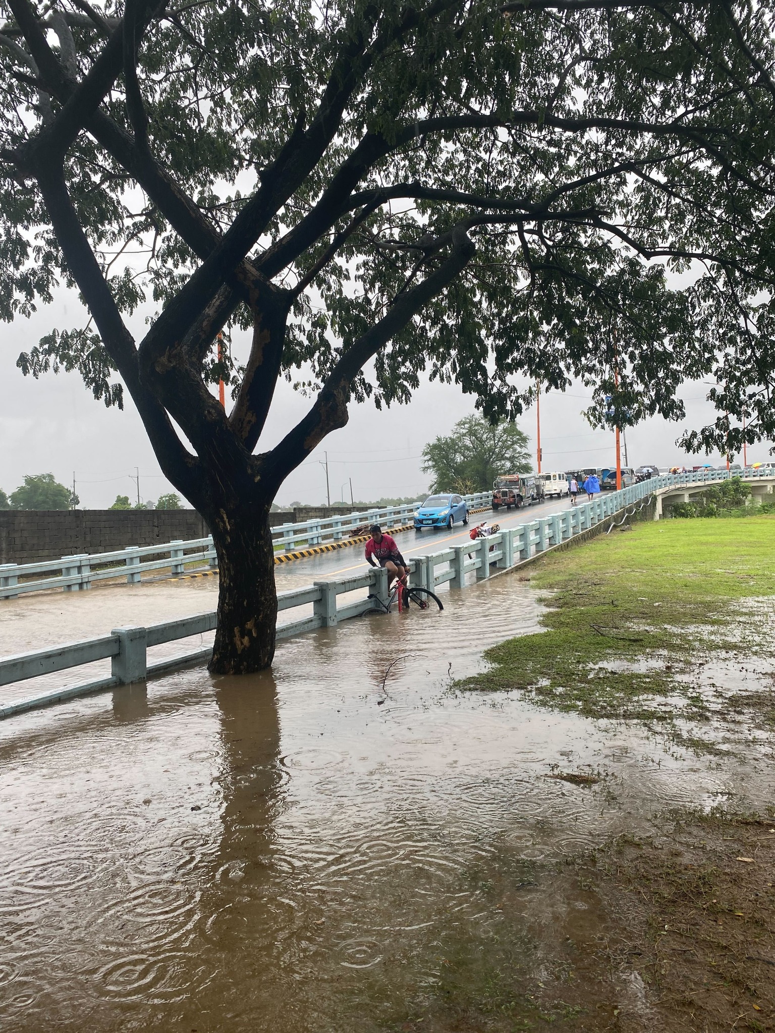
It’s that time of year again when the heavy rains lead to flash floods along many roads. I took the following photo as we slowly progressed towards Cainta Junction early this week. The Felix Avenue approach was flooded after more than an hour of heavy rains fell upon Cainta and neighboring towns. We learned later that the rains fell on a larger area as EDSA and other major road in Metro Manila also experience flash floods. These cause traffic to slow down if not outright stoppage. Many commuters can get stranded when PUVs are not able to run due to the floods. Deeper waters mean light vehicles including motorcycles and bicycles cannot proceed along certain roads, further exacerbating the traffic situation.
 Motorcyclists emerge from their shelters to travel along flooded roads. A common sight when there are downpours are motorcyclists huddling under overpasses, bridges, or whatever shelter may be available to them. Many bring rain gear but opt to just stop and wait it out until the rain stops.
 A cyclist braves the floods – while pedestrians will likely stop and wait it out for the rains to stop or for the floods to subside, cyclist might just pedal on. They just have to be more careful as potholes and other dangers may be hidden by the floodwaters.
 Cainta Junction has been submerged by so many floods over so many years. Even with the new drainage constructed under and along Ortigas Avenue Extension, Felix Avenue and Bonifacio Avenue, it seems their capacities are not enough to handle the rainwaters. That or perhaps their intakes need to be redesigned to more efficiently take on the heavy rains and the resulting runoff.
–
Post-typhoon BFCT and SM Marikina area
Still on the aftermath of Typhoon Ulysses (Vamco) though this is already a late post about it, here are some photos at the river banks level on the side of SM Marikina and the vicinity of the transport terminal constructed and operated by the former MMDA Chair and Marikina Mayor’s company. The area is basically a flood plain and in other countries would not have been suitable for building. Rather, these are often used as open spaces like parks, football fields or baseball diamonds, among other possible uses.
 There were garbage and mud everywhere. By the time I passed by, the mud had dried up and turned into fine dust that blanketed the area.
 Trash were everywhere and you can see how deep the water was by the garbage still on the power line towers and the trees.
 Underpass leading to SM Marikina – bulldozers and payloaders were busy moving mud and garbage to clear the roads. There were no signs of the work in progress so I ended up making a U-turn seeing the way to SM’s parking was blocked by mud and debris.
 On the way back to Marcos Highway, you can see the large trees that were transferred to this area from Katipunan Avenue (when it was widened by way of removing the service road to give way to the MMDA’s U-turn scheme). It is heartening to know these survived the river’s onslaught.
–
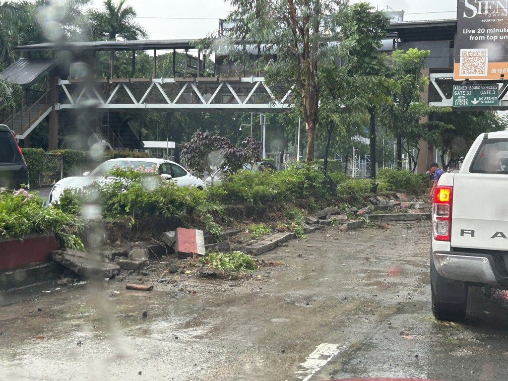
The FVR Road and Bridge after Typhoon Ulysses
This is a continuation of the feature on the aftermath of Typhoon Ulysses (Vamco). I am posting this here as part of my archives on the floods in the Marikina Valley.
There’s a road branching off from Marcos Highway that links to a bridge crossing the Marikina River and connects with the FVR Road along the Marikina Riverbanks. The following photos speak for themselves in as far as the mud and garbage that was left after the floods subsided.
 Descending from Marcos Highway, only one of two lanes are passable after heavy equipment moved tons of mud and garbage to the roadsides. The fences trapped a lot of garbage, too, as seen in the photo.
 Piles of mud and garbage at the service road leading to the east bank of the Marikina River and the SM Marikina access road.
 Under the Marcos Highway Bridge, garbage, mostly plastics, remain on the wire fences. This area was totally submerged during the height of the floods with water reaching the underside of the bridge. Fortunately, the bridge seems undamaged.
 Even lamp posts and electric poles caught a lot of garbage.
 The Olandes housing development was surely affected by the swelling of the river.
 The FVR Road leading to C-5 is already clear for 2-lane traffic but you can see the mud and garbage all around. The dried mud has turned into dust (alikabok) that blows away as vehicles pass through the road. There is also mud on the plants in the median planters as this area was also submerged during the height of the typhoon.
–
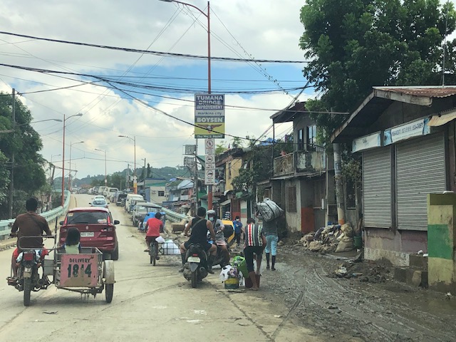
Tumana during and after the flood
I was heading to the office the Monday after Typhoon Ulysses had devastated wide areas in Luzon. I was aware of the congestion along my usual routes so I used Waze to guide my trip. Waze took me to Tumana instead of Marcos Highway, which I assumed would have been less congested. I took the following photos in the Tumana area:
 Congested main road due to heavy equipment like bulldozers, backhoes and dump trucks clearing the mud and trash in the area. There were also lots of parked vehicles along each side of the road including Marikina service and emergency vehicles.
 There was trash all around that included what looked like the belongings of people residing in the area. Many people were busy clearing their homes of items destroyed or damaged by the floodwaters.
 Despite being cleared for traffic, you can see the mud and water still in the area and signs of how deep the flood waters were by markings on the buildings.
 At the foot of the bridge connecting to Quezon City, you can see that there is still so much mud in many areas especially those closest to the river. Sidestreets were so narrow that the heavy equipment cannot enter them and cleaning the mud had to be done entirely manually.
 Here are what looks like the vehicles that survived the floods. I thought people must have rushed to get their vehicles on the best positions atop the bridge when they realized the waters were rising fast. It was likely few if anyone left their vehicles there during the height of the typhoon. That’s because the winds were so strong that perhaps people though it would be unsafe to leave their vehicles exposed to the winds.
The following photos from Facebook shows the extent of the flooding that reached the other side of the river – Loyola Grand Villas and another subdivision that’s directly along the banks of the Marikina River. The first photo shows the submerged end of the bridge from the LGV side in the foreground and Tumana in the background at the other end of the Tumana Bridge. The second photo is atop LGV and shows many submerged homes and cars.
 Only the cars on the bridge likely survived the floods.
 This was definitely at the level of the floods of Typhoon Andy (Ketsana) given the spread and depth of the floods.
One wonders what is now the return period for these typhoons. Ondoy was 11 years ago and the monsoon (Habagat) rains that also brought heavy rains and floods were in 2012 (8 years ago). Such floods cannot be solved by improving drainage systems alone but have to go to the root cause of flooding while also addressing how people could cope with these phenomena. Infrastructure alone cannot solve this and certainly will cost a lot for any initiative to provide some relief from such.
–
Improving road drainage to prevent flooding
Road drainage seems to be a most suitable topic given the heavy rains the past few days due to a powerful typhoon that hit the northern Philippines. With or without typhoons, however, the frequency of flash flooding has increased the past few years in part due to the heavier than usual monsoon rains but mainly due to the poor state of road drainage in our cities. The photos below show an example of flash flooding due to a sudden downpour in Cebu City.

What is noticeable along the road is a lack of storm drains that could have prevented the accumulation of water on the carriageway. If there were storm drains at strategic points along the road, it is difficult to judge from the photo. I also suspect that road construction may have adversely affected the slopes required for the water to travel to the drains. These are surely stated in the road design but are somehow lost or deficient upon construction of the road. There are similar situations in other cities as well and especially in Metro Manila where flash floods often cripple road traffic around the metropolis as critical sections of major arterials like EDSA, C-5, Espana Blvd. and E. Rodriguez become flooded.
We were traveling back to Quezon City along Sumulong Highway after a meeting in Antipolo City. We noticed the road widening projects along the highway; effectively increasing the number of lanes and the capacity of the road. Included in the project are the construction of sidewalks and drainage along both sides of the road. Below is a photo of the section near the Sumulong gate of Valley Golf clearly showing the newly constructed lane and sidewalk along the Masinag-bound side of the highway.
Note in the photo the size and intervals of storm drains along the the highway. Compare this with what we have along most Metro Manila roads including overpasses and it shouldn’t be a surprise why there are frequent flash flooding in Metro Manila. Of course, the capacity of the culverts is a factor (and many are already clogged or barado with garbage and mud) but then it starts with the drains for water to go to the culverts. Many newly rehabilitated roads in Metro Manila have small drains spaced at long intervals. With heavy rainfall, these cannot take in the amount of water given the rate at which they drop from the skies. Perhaps a quick fix to address flash floods is to make these storm drains larger and spaced more closely like those shown in the photo of Sumulong Highway. And then, of course, there should be increased efforts to make sure these drains are not blocked/clogged and that garbage, dirt and other debris will not go straight into the culverts.
–
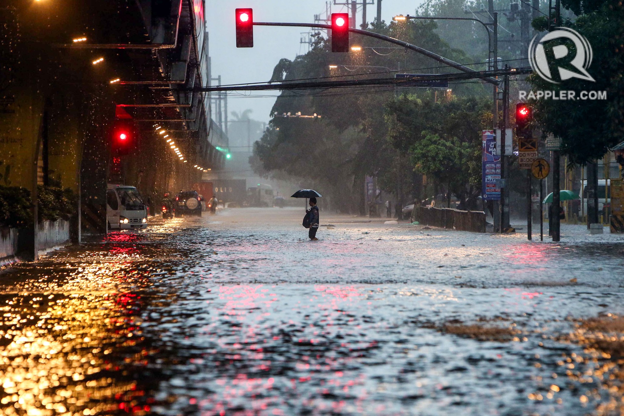
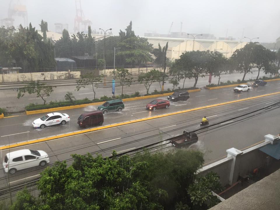
Rains, floods and traffic
The wet season is here and with it the now typically heavy rains in the afternoons. Last week, the heavy rains brought upon flash floods in Metro Manila and adjacent towns. There have been no typhoons yet so these are mainly monsoon rains (Habagat), which we expect to be daily occurrences. Many of these floods are along major roads including EDSA, C5, Espana, and Quezon Ave. that transformed these roads into parking lots as most light vehicles are unable to traverse flooded streets.
 Vehicles run along the flooded Elliptical Road in Quezon City
 Jeepneys and SUVs (at right in the photo) take on the flooded Elliptical Road-Quezon Avenue intersection
Due to the traffic congestion resulting from the floods, many public utility vehicles especially jeepneys and UV Express vehicles were not able to go back and make their round trips.
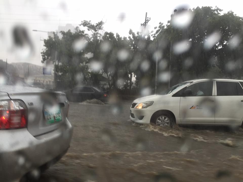
 Cars risk the floods along Elliptical Road – the deepest waters are, ironically and curiously, along the section fronting Quezon City Hall where there is a pedestrian underpass connecting city hall with the Quezon Memorial Circle. Since the underpass is not flooded then it can be concluded that there’s something wrong with the drainage for Elliptical Road.
The weather is a very significant consideration for transport planning for cities in the Philippines. For Metro Manila it is almost everyone’s concern about how they can travel between their homes, offices, schools and other destinations without them and their things getting wet. This is what a lot of people advocating for road sharing seem to forget or choose to forget in their arguments for walking and cycling. A person residing in Fairview in Quezon City and working in Makati City will most likely not walk or cycle between his home and office because of the weather. This is a reality that could be solved by good public transportation, which, unfortunately, we also don’t have (yet) so people are ‘forced’ to do what they can to improve their plight. Unfortunately, too, what they are forced to do is purchase a car (or more). The proposal to build infrastructure to enable walking and cycling especially over medium to long distance is in the same dilemma as those for mass transit. And the latter is the more urgent matter needing action for the sheer volume of people they can carry and therefore benefit.
–
