
Home » Posts tagged 'Marikina' (Page 4)
Tag Archives: Marikina
More nuts on the road and a simple solution for traffic congestion
I have written recently about reckless drivers including one that drove as he was “busy” with his girlfriend in the car. The latter, however, is more an exceptional case rather than one you’d commonly find in our roads. Perhaps the most annoying behaviour by what I term as “nuts” on the road, is counter-flowing. Counter-flowing often happens along undivided roads (no median islands or barriers to split opposing traffic). Traveling home one afternoon, we took the bridge from C5 and the Marikina Riverbanks Road to Santolan, Pasig.
 I think we all thought that the driver of this Honda Civic was bold enough to have been able to cover a long distance before opposing traffic collectively forced the driver to back off.
While counter-flowing is dangerous and obviously a traffic violation, there seems to be few if any apprehensions regarding this behaviour. Such non-enforcement of traffic rules and regulations lead to more drivers and riders to be encouraged to counter-flow just so they could get ahead of all the others before them who did follow traffic rules by queuing properly. For one, there are issues of police or enforcer visibility in many areas, and when they are visible they are usually busy managing traffic at intersections and or watching out for number coding violations rather than enforcing all the other traffic rules and regulations that can be more or equally important than number coding violations in terms of their impacts on traffic. One such violation is counter-flowing that often leads to severe traffic congestion as counter-flowing vehicle block opposing traffic and force their way in front of queued vehicles. I think this has caused a lot more problems, congestion and safety-wise than number coding violations, and deserve to get more attention from traffic enforcers and managers looking for solutions to the traffic mess we encounter everyday.
–
Walking vs. cycling?
I remember an episode in an old series, The West Wing, where White House staff had to meet with various proponents of renewable energy. The very same proponents advocated for the RE they thought should get the most attention, and therefore funding support from the government. They ended up criticising each other’s advocacies, even pointing to the flaws of each and basically putting each other’s proposals down. The POTUS (ably played by Martin Sheen) had to intervene and scolded these people for working against each other rather than working together to push a common RE agenda.
This is pretty much where we are now with many proponents of sustainable transport initiatives. People and certain groups would advocate for walking, cycling, BRT, rail transit, etc. as if these are exclusive from one another. The results have often been haphazard facilities such as entire pedestrian facilities being painted and designated as bikeways and regular bus services being mislabeled as BRT. I have some friends who insist that cycling is the way to go simply because they cycle between their homes and workplaces, not fully understanding that this mode is not for everyone especially with the various issues in urban sprawl affecting our choices of residence. Clearly, what is good for one person is not necessarily applicable to everyone else, and that is why we should have options for travel or commuting. These options would have to be integrated, complementary, affordable and people and environment-friendly.
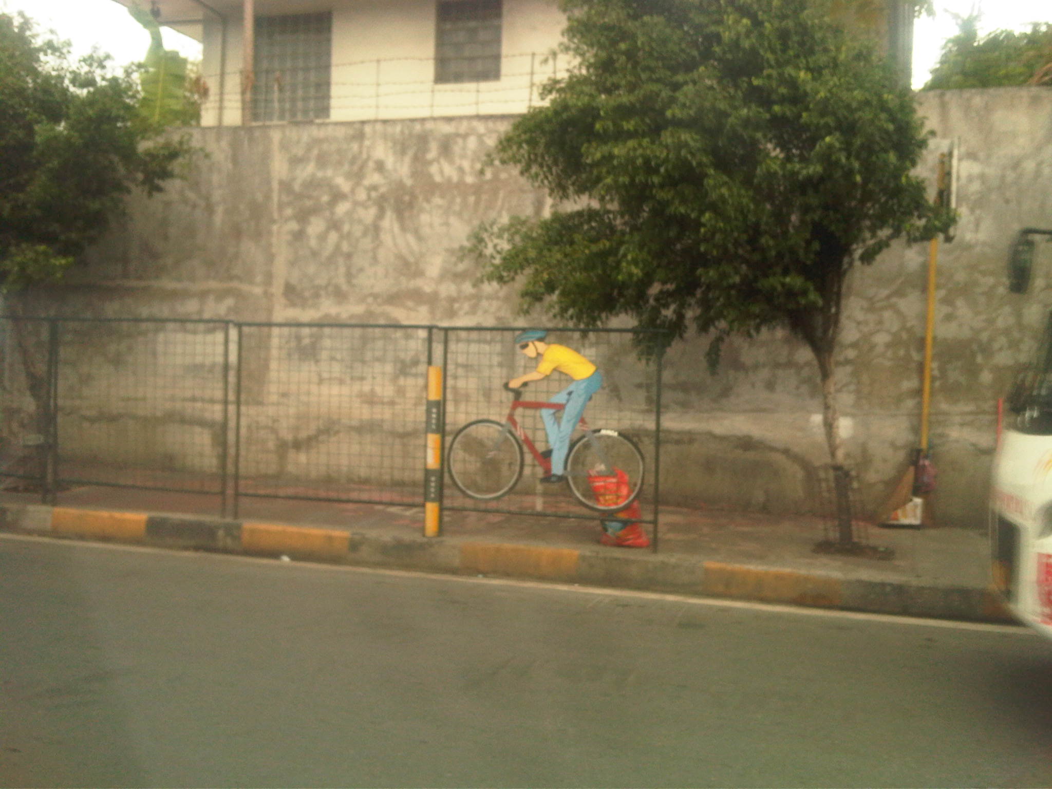
 The MMDA fenced off entire stretches of sidewalks and painted the pavement red to designate them as bikeways. This basically alienates pedestrians and while the wire mesh fence has its benefits from the perspective of safety, it also effectively constricts the space that cyclists and pedestrians have to share. Note also the trees and poles that pedestrians and cyclists would have to evade or risk injury.
 Along EDSA, the same treatment of fences and coloured pavements was applied ahead of Temple Drive/Corinthian Gardens. The space is just too constrained for sharing given the trees and poles and then you have the smoke belching buses adding to the misery of people using these facilities.
While there have been some quick wins for pedestrians and cyclists, it seems to me that many if not all do not seem to be as sustainable as we want them to be. Many cases are classic for their being “pwede na yan.” There is no innovation in design or no design involved at all much like what we typically see as best or good practices abroad. Marikina still has the best examples so far for integrated bikeway and walkway design though there are many examples of good pedestrian facilities around including those in Makati and Bonifacio Global City (I tend to resist saying Taguig because that city practically has no say in how BGC is developed.). Quezon City (along Commonwealth) had a little promise and the UP Diliman campus but perhaps that can be realised with the rise of a new CBD in the North Triangle area. Of course, we look forward to developments in Iloilo City what with the bikeways being constructed along the long Diversion Road. Still, I believe that there should be a conscious effort not just from the private sector but from government agencies, especially the DPWH, to come up with new designs and guidelines that LGUs could refer to. That agency so far has not measured up to the expectations of many for it to take a lead in revitalising our roads so that facilities can be truly inclusive and environment-friendly.
–
The need for mass transit to the east of Metro Manila
I wanted to use a title stating “the demand for mass transit to the east of Metro Manila” but the word “demand” for me seemed a bit technical (I associated it with the supply and demand concepts for transport.) and would need some numbers to support it. So I settled for the word “need” instead of “demand” so I could be flexible (i.e., more qualitative) with the way I wrote this article. “Need” is a more pedestrian term that can easily be understood and imagined, and there is no lack for images of this need for more efficient and higher capacity modes along the main corridors to the east of Metro Manila. The main corridors are Ortigas Avenue and Marcos Highway, which have the highest road capacities among other roads (i.e., higher capacities than A. Bonifacio Avenue in Marikina, the Batasan-San Mateo Road, or C-6/Highway 2000). These are also the corridors along which most public transport services may be found. Such connects the eastern towns (e.g., Cainta, Taytay, Antipolo, etc.) to the transport hubs of Cubao and Crossing, which are major transfer points for many people taking public transport. Of course, there are UV Express services from these eastern towns that go directly to CBDs like Makati and Ortigas.
You can observe the crowds at Katipunan and Santolan Stations of the LRT Line 2 as well as the people waiting for their ride home along Marcos Highway. I have observed that there are also lots of people along Ortigas Avenue from Tikling Junction to C-5 who religiously and patiently wait for their rides to school, office or home. This happens everyday and this regularity seems to be a never-ending sacrifice of time and patience. These people do not have much of a choice except taking whatever public transport is available to them. Many probably can afford to have a car or already have a vehicle in their household. Unfortunately, that vehicle is not usually enough for their commuting needs and so they are captive users of an inefficient public transport system (there are some who question if what we have can really be called a system).
 People waiting for a ride in front of Robinsons Metro East along Marcos Highway in Pasig City – these have occupied 3 lanes of the highway as they position themselves for the next available jeepney. There is a UV Express terminal at the mall and another at the nearby Sta. Lucia mall but these are not for the destinations these people are going to.
News that the LRT Line 2 Extension from Santolan to Masinag would finally be constructed was initially met with speculation. Such news have been circulating for so many years but no actual work could be seen along Marcos Highway to convince people that the project was underway. Now, that the soil test samplings have been completed, people are anxious about the actual construction of the extension. I think this is a project long overdue and the question that needs to be answered is if the line needs to be extended further, perhaps until Cogeo. I believe there is a tremendous market for this mass transit system along this corridor where a lot of residential subdivisions and relocation sites have sprouted over the years. The DPWH recognised this as a high capacity corridor and is already widening the road from Masinag to Cogeo.
Hopefully, the Ortigas Ave.-Manila East Road corridor can also have its own mass transit line. The regular bus services along this corridor is no longer sufficient and operations are not so efficient despite what appears as competition among 2 bus lines. There had been a Bus Rapid Transit (BRT) Line proposed for this corridor but there seems to be no progress towards the realisation of that project. Whichever of rail or BRT would be the option for the corridor though, it doesn’t take a genius or too many consultants to determine the need for a good mass transit line along this corridor. When that will be is a question with an answer that is still up in the air. Perhaps the local governments of Rizal, especially the province, should push for such transit systems. The governor and mayors should champion such systems that will definitely benefit their constituents and translate into real revenues for their LGUs from the certain business that will come along these corridors.
–
Anxious about the LRT Line 2 Extension
Among the overdue projects that have generated much attention and, quite recently, some excitement is the extension of the LRT Line 2 from the current end station at Santolan, Pasig to Masinag Junction in Antipolo. This is a 4 kilometer stretch that has been viable for quite a long time now but somehow has not been constructed for various reasons. It was among the low hanging fruits that the current administration should have picked that could have been completed and operating now if it were started sometime 2011 (i.e., factoring in the transition in government after the 2010 Presidential elections). For some reason, government officials had to get proof that there was passenger demand for the extension by considering having another study undertaken just for this purpose. As I’ve mentioned before, one only needs to observe the situation at Santolan Station and perhaps the Sta. Lucia/Robinsons Metro East area to understand just how many people will benefit from the extension to Masinag. I would even dare say that you can even justify extending the line further to Cogeo. Following are a few photos I recently took along Marcos Highway along with some comments pertaining to the Line 2 extension construction.
 Soil testing site along Marcos Highway in Pasig City – these activities preclude the designs for the superstructure, which include the elevated tracks and the stations (there will be 2) along the Line 2 extension.
 Another soil test site – each location roughly correspond to the location of the columns that will be constructed to support the elevated tracks and stations.
 Scenes of overloaded jeepneys should no longer be the norm once the Line 2 extension is completed. However, such would probably be common for jeepneys coming to or from the last station at Masinag. There are no other choices for people taking public transport beyond Masinag except jeepneys bound for destinations like Antipolo Simbahan, Cogeo, Tanay and Marikina.
 Pedestrian overpasses such as this relatively new one near the Filinvest East main gate would have to give way to the elevated Line 2. Another option is for this and other overpasses to be reconfigured with respect to the future line. I just hope this will be done with utmost care so we won’t have overpasses similar to those along EDSA that go above or below the elevated tracks of the MRT 3.
 This overpass will like be removed to give way to the future end station of the Line 2 extension. The overpass in front of SM Masinag will have to be integrated with the station to be located in this area.
–
Floods and traffic
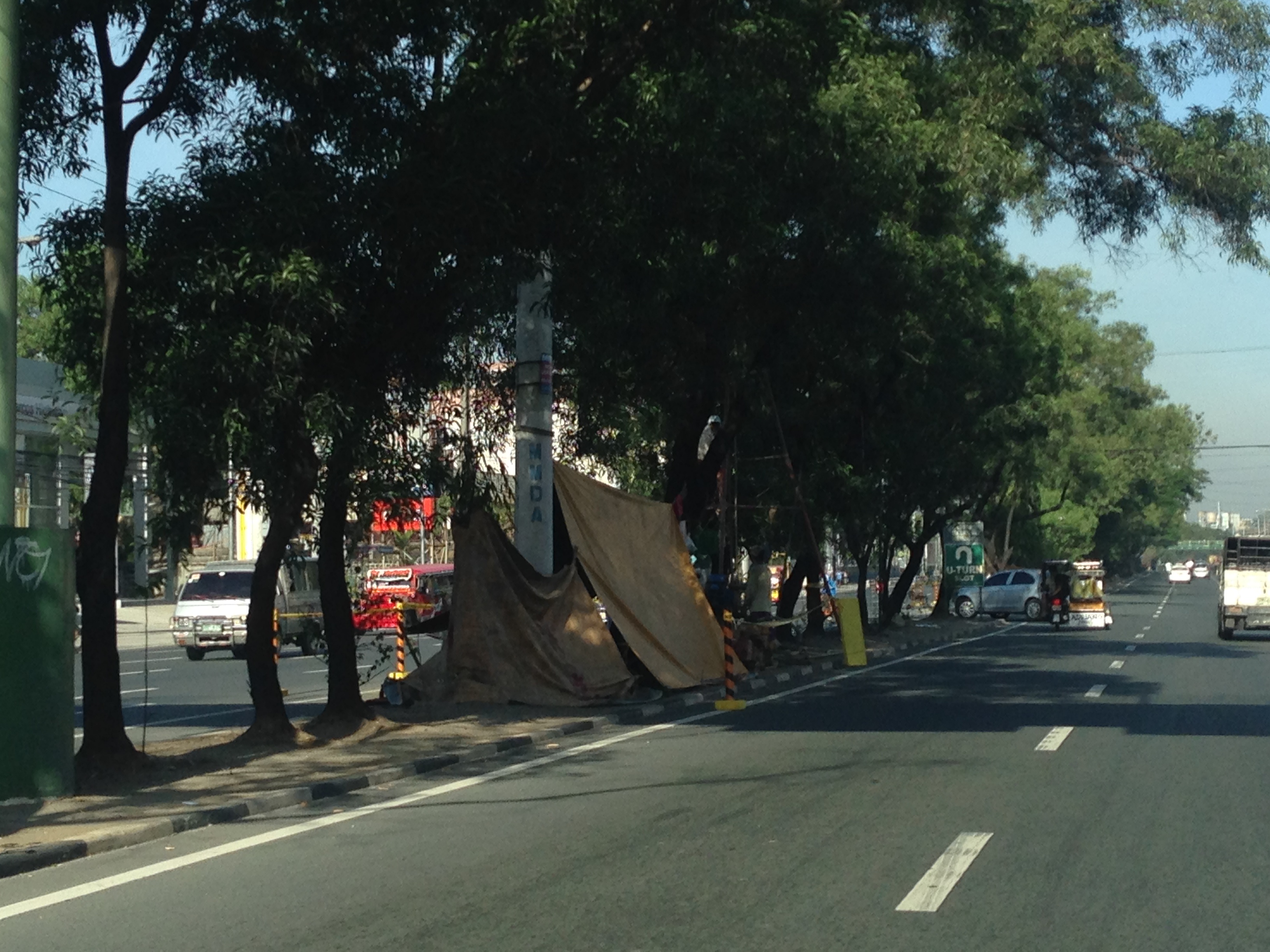
Transport and traffic problems take a backseat to the flooding problem during this time of the year in the Philippines. Since there are practically only two seasons (dry and wet) in the country, floods become a genuine concern once monsoon rains arrive and these are usually complicated by a high frequency of typhoons between August and November. Many major roads in Metro Manila are prone to flooding including Espana Avenue, Araneta Avenue, Gil Fernando Avenue, Ortigas Avenue, and EDSA. Flash floods often lead to traffic congestion and commuters and motorists alike would have a hell of a time traveling yet it seems very little has been done to address a situation that’s been here since the Spanish period. This is a perception by many people and a reasonable one given the historical evidence of flooding in the area and elsewhere in the country.
 Pedicab ferrying passengers in a flooded residential area
There are many images on the current floods in Mega Manila that one can find in various reports online and on TV. The Telegraph provides good photos for describing the situation around Metro Manila and the surrounding areas, and especially in the low-lying areas like Marikina, Malabon, Rodriguez and Cainta. These images could have been taken in any other year in the past and the images would probably be the same with slight changes in some buildings that could have been improved (e.g., additional floor?) in response to the flood experience.
Floods and possible solutions have been the topics of discussions every year and usually during this rainy season. While there have been efforts to address this problem, these are usually and obviously not enough and a more comprehensive approach is needed. Quite obviously, too, solutions that tend to dig up faults in urban planning throughout Metro Manila have led nowhere as legitimate residents and other locators in these areas are not in a position to give up their properties just like that. Relocating informal settlers and others who have encroached from waterways and other critical areas is a start but will have limited impacts in part because Mega Manila does not have a good drainage system in the first place.
Expensive as they are, engineering solutions like perhaps what Tokyo has done in this underground wonder. Of course, this example is a kind of ultimate solution and would require tremendous resources to realize. But then this is also like the transport and traffic problems we are experiencing where years (or decades) of inaction and hesitation due to resource and technical questions have led to the despicable transportation we have now The reality is that solutions will not get cheaper as we continue to balk at the cost of the required solutions. Floods and traffic will not be solved overnight. It will take years to improve the lives of many people in flood prone areas and implementing solutions should have started yesterday.
More bikeways please!
After the construction of a bikeways network in Marikina City, the city became a poster child for sustainable transport in the Philippines. The bikeways was initiated with assistance from the World Bank for the pilot route and was later expanded by the city under the leadership of its Mayors, the former MMDA Chair Bayani Fernando and his wife Marides Fernando. The bikeways were promoted as a good practice example for non-motorized transport (NMT), with the National Center for Transportation Studies (NCTS) of the University of the Philippines Diliman involving the Marikina City Bikeways Office (MCBO) in its studies and advocacy work on Environmentally Sustainable Transport (EST).
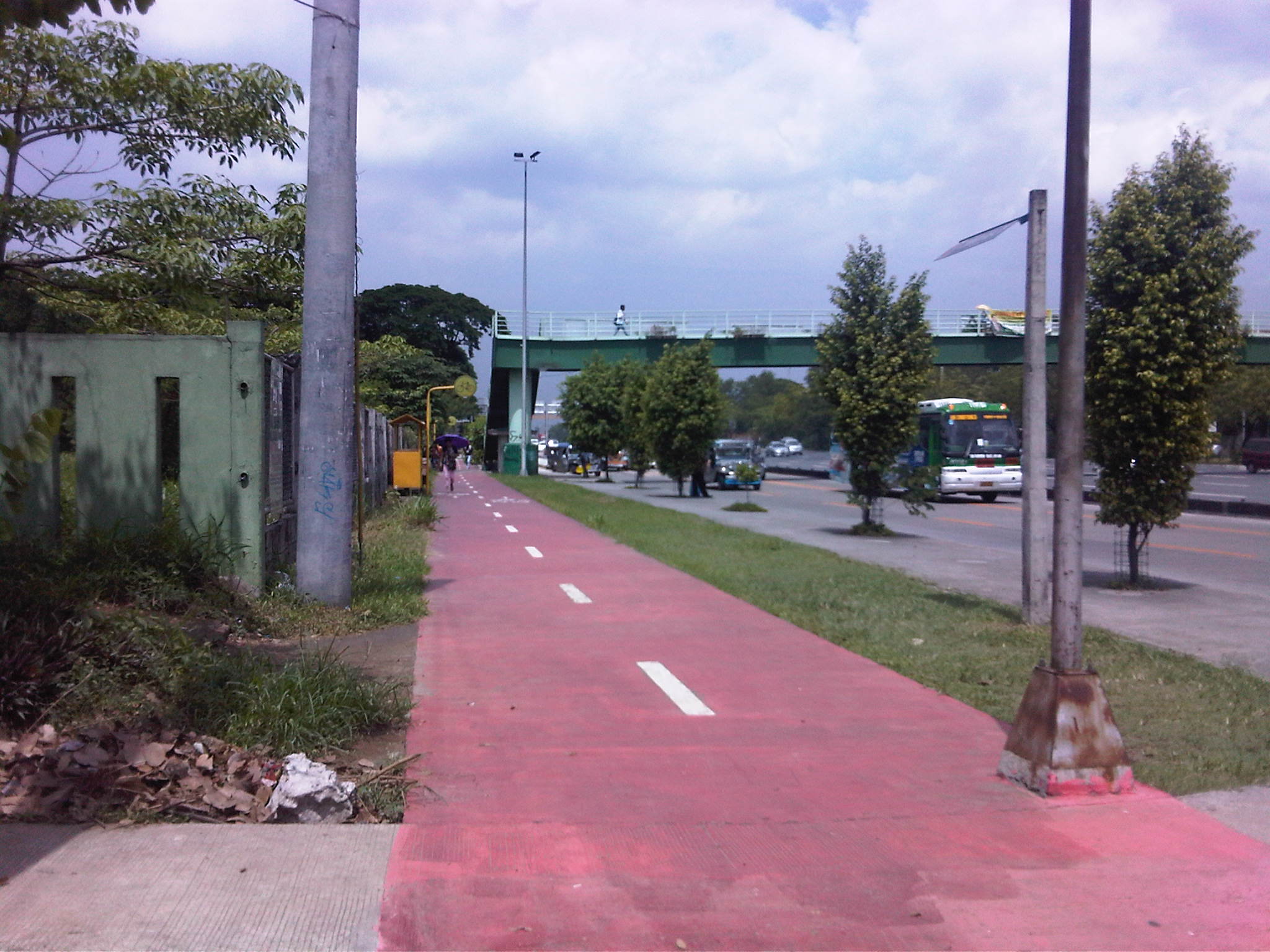
 Bikeways between pedestrian walkway (red pavement) and parking slots in Marikina City.
 Bike lane along the Academic Oval at UP Diliman in Quezon City.
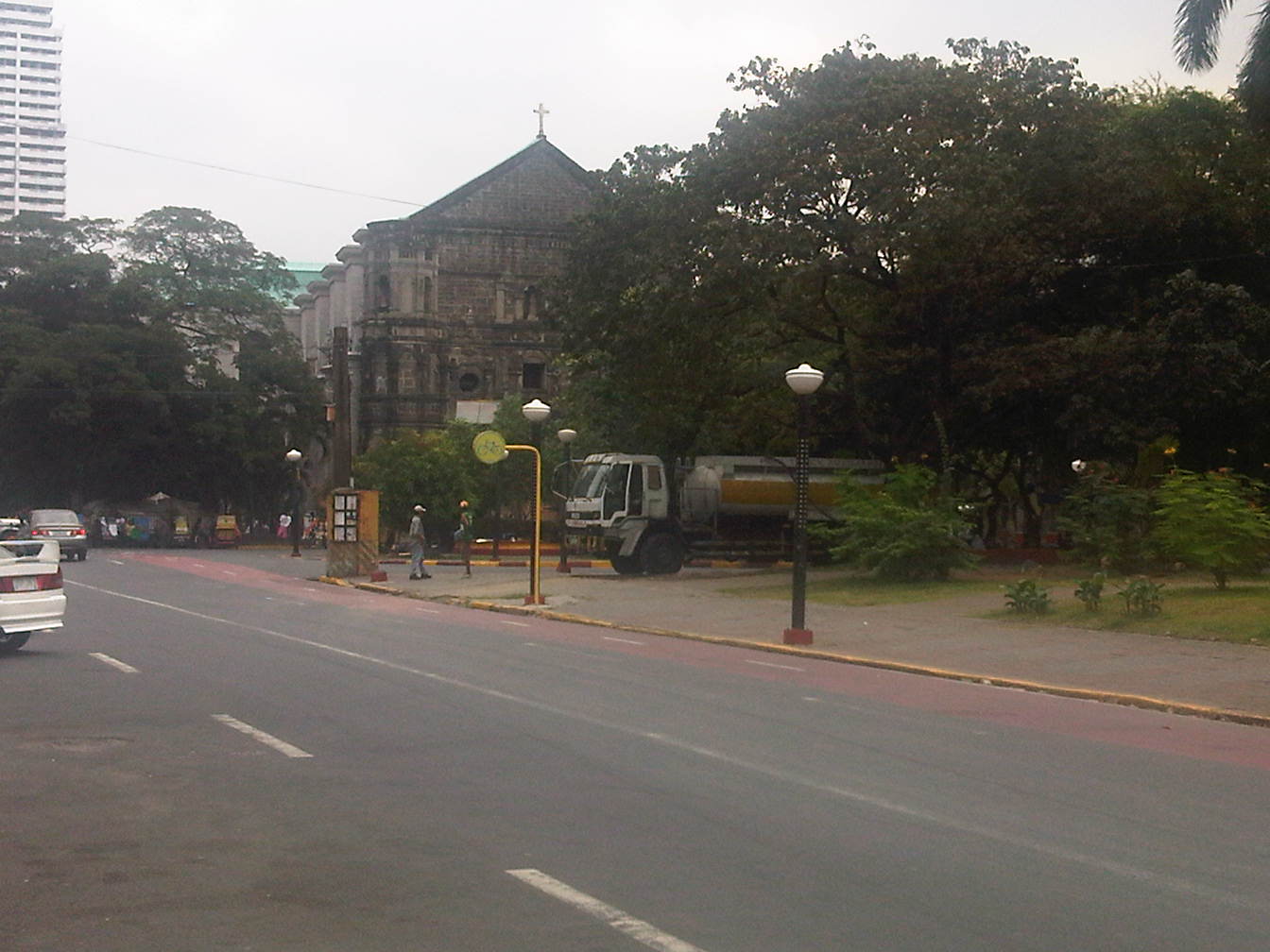
 Bike lane integrated into the sidewalks along Marcos Highway in the cities of Marikina, Pasig and Antipolo.
 Bike lanes (red pavement) in Malate, Manila.
 Bike lanes integrated with the sidewalks along Commonwealth Avenue in Quezon City.
 Bike lanes integrated with the sidewalks along Commonwealth Avenue in Quezon City.
This is obviously not a comprehensive list of bike lanes and bike ways in the Philippines. I am sure there are similar projects in other cities and I am aware that cycling is becoming more popular around the country. These are but examples of what has been accomplished so far and it is clear that we need to do more to promote cycling not just as a sport or for recreation but, more importantly, as a means for commuting. Integrating cycling into one’s daily routine is a healthy and money-saving option, and segregated bikeways and bike lanes ensure the safe travels for cyclists. This, of course, is in consideration of the little respect cyclists (and pedestrians) get from motorists who believe road space is theirs alone.
–
A. Bonifacio Avenue in Marikina
The main road leading to Marikina City from Quezon City is one that branches from Aurora Boulevard. A. Bonifacio Avenue is one of two roads diverging from Aurora, the other one being Marcos Highway. The avenue eventually becomes Sumulong Highway at its junction with Angel Tuazon Ave. (Gil Fernando Ave.) at the Blue Wave mall.
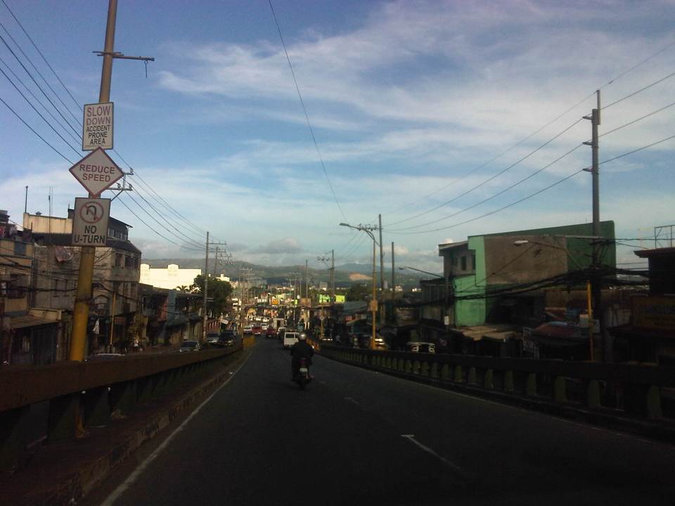 View from the overpass from Aurora Blvd to A. Bonifacio Ave. – in the horizon are the Sierra Madre mountains and closer to the flyover is of course a view of the Marikina Valley.
 A. Bonifacio is a 4-lane, 2-way undivided road
 Section at the exit from Riverbanks
A. Bonifacio Ave. is the main access road to Loyola Memorial Park and so it gets quite congested during the Undas period (All Saints and All Souls Days). The road and adjacent land is flood prone and along the road is the main gate to Provident Village, which was one of the most devastated private subdivisions during Typhoon Ondoy (Ketsana) in 2009 and the heavy rains of Habagat (southwest monsoon) in 2012.
–
Another look at the Marcos Highway bikeways and pedestrian walkways
The improvement of Marcos Highway included provisions for pedestrian walkways and bikeways along both sides of the highway. The inclusion of such provisions was a welcome development as both sides of the highway, particularly along the stretch from Dela Paz to Santolan, lacked pedestrian facilities. This situation has forced a lot of people to walk on the carriageway, putting them at risk of being sideswiped by motor vehicles like jeepneys and cars that are often speeding along Marcos Highway. I experienced this walking from SM Marikina to Robinsons Metro East one time I couldn’t get a ride from the Santolan Station. One had to watch out for puddles and canals in addition to watching one’s back for speeding vehicles that often come close to the roadside.
 Concrete barriers along the curbside of the highway – the intention seems to be to protect pedestrians or cyclists from wayward motor vehicles in addition to the preventing the same vehicles from mounting the sidewalks
 Pasaway? – taxis at an LPG station parked or standing along the bikeways and pedestrian sidewalks.
 Taxis maneuvering as if all the space is for them including the space designated for pedestrian and bicycle use.
 Spacious walkways and bikeways along westbound side of Marcos Highway. Lamp posts are installed to provide sufficient illumination not just for motor vehicles but for pedestrians and cyclists as well.
 Obstructions? – some lamp posts seem to be in the middle of the walkways and bikeways , posing hazards to cyclists. This issue can be addressed at the very least by painting the posts so that they will be visible especially at night time.
I will be writing more about walking and pedestrian facilities in the coming weeks in order to highlight good practices in the Philippines. I am currently looking forward to a trip to Thailand where I hope to collect photos of transport and traffic in Bangkok. It’s been a while since I last traveled to Bangkok so I am quite eager to see how Bangkok looks like particularly considering the destructive floods of last year when the waters of the Chao Praya River breached its banks.
–
Sumulong Highway: Marikina to Masinag
Sumulong Highway stretches from its intersection with A. Tuazon Ave. and A. Bonifacio Ave. in Marikina City, Metro Manila to the intersection with the Taktak Road or M.L. Quezon Ave. in Antipolo City in the Province of Rizal. It serves both as an arterial (for Marikina and Antipolo) and a feeder (with respect to Marcos Highway).
The following photos show the stretch from Marikina to Masinag that shows typical conditions along the highway. These conditions are quite different from those along the stretch from Masinag to Taktak Road in upper Antipolo City.
 Sumulong Highway has a total of 4 lanes (2 per direction) but a lack of pavement markings make it difficult to ascertain the center of the road and the space allocation for traffic. This makes travel less safe as motorists assume they are traveling along the correct space on the road.
 The asphalt-surfaced road has no lane markings but has very good pavement conditions. There is also significant on-street parking as most establishments along the highway have no adequate off-street parking spaces. The section shown above is right in front of a sabungan or coliseum for cockfights.
 There are pedestrian crossings though, near intersections and where there are schools along the highway.
 Only the traffic lanes have asphalt overlay, the shoulders have the concrete surface exposed thereby distinguishing them from the traveled way.
 The shoulders are used as parking spaces for establishments along the highway as shown in the photo. Such practices are also common along national highways around the country.
 Even the barangay hall of Bgy. Mayamot utilizes road space for parking as shown in the left. The Mayamot Barangay Hall is see on the left in the photo. This effectively reduces road capacity leading to traffic slowing down at such sections.
 Another pedestrian crossing, this time in front of a public school right after the barangay hall.
 Some sections have sidewalks for people to walk along but these are also usually blocked or occupied by stuff from the establishments along the street.
 Waiting shed along the highway. I could not say its typical because the more recent ones usually have names or initials of politicians on them. This shed is likely to be old and uses clay tiles for roofing.
 There are also tricycles along the road due to the sidestreets and subdivision entrances connecting to the highway. Public utility tricycles are supposed to be prohibited from using national roads but are common in most provincial areas and CBDs where they are the main mode of transport. In this case, tricycles should be prohibited from using the highway as they are already competing with jeepneys, serving larger areas aside from what should be individual subdivisions or residential districts.
 There are many auto repair and supply shops along this stretch of Sumulong Highway. Such shops typically have many customers who also park along the highway, often occupying road space and causing congestion.
 Approaching the Masinag junction, which is the intersection of Marcos and Sumulong Highways, one sees more commercial establishments on either side, mostly small stores or shops. At the junction is the Masinag Wet Market, which is now in decline after major commercial developments have been constructed in the area including the most recent SM City Masinag.
 Steel barriers placed along the center of the highway to discourage jaywalking – some barriers have been moved by pedestrians to create space for illegal (and risky) crossings such as what is seen just downstream in the middle of the photo (notice the person with the red umbrella?).
 Barriers forcing all traffic to turn right to Marcos Highway – seen across is the approach of Sumulong Highway from Antipolo
Portions of this section of Sumulong Highway are prone to flooding including the intersection with V.V. Soliven Avenue, which leads to SSS Village and other subdivisions. The more recent floodings were due to the heavy monsoon rains from a couple of weeks ago that effectively isolated residential areas in Marikina and Antipolo as vehicles could not exit the subdivisions to major roads like Sumulong and Marcos Highways. It’s quite interesting to note that the drainage systems along these roads including Sumulong have not been upgraded to be able to accommodate run-off from what is turning to be heavier rains due to climate change. Thus, it may be expected that the same sections will be flooded should there be heavy rains particularly due to typhoons and other major weather systems affecting Metro Manila and its environs.
–
