
Home » Posts tagged 'Pasig' (Page 3)
Tag Archives: Pasig
On the Pasig HOV traffic experiment
Someone shared a post about a traffic scheme they will be implementing along Julia Vargas Avenue in Pasig City. The proposal is for the avenue to have a high occupancy vehicle (HOV) lane where vehicles with 4 or more occupants are to take one lane and all other vehicles the other. I am not entirely sure about the objective other than to promote high occupancies for vehicles. However, it would be nice to see how travellers will be behaving (e.g., complying) and how Pasig (with MMDA?) will be enforcing this scheme.
This is what a segment of Julia Vargas currently looks like with 2 wide lanes designated for motor vehicles (separated by the solid yellow line) and one narrow lane for cyclists (adjacent to the shoulder):
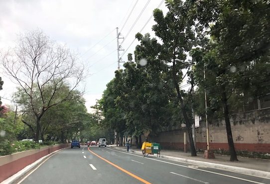
The intent is good but as a major link the scheme can be quite confusing especially for those who are not necessarily frequent users of this road. I assumed the yellow line was painted by the DPWH but it seems it was by Pasig. Perhaps they should have removed the old markings? Or maybe better if they rationalised the carriageway width to accommodate 3 lanes for motor vehicles and 1 wider lane for bicycles? From the photo above, it appears to me that it is possible to have 2 narrow lanes for general traffic and one wider lane for HOVs (in this case defined as having 4 or more occupants) and public utility vehicles. This configuration maximises the capacity of the road while having a the “best” lanes allocated for HOVs and bicycles.
I wish them success on this social experiment. Perhaps there can be valuable learnings from this including the need for connectivity to other links as well.
–
Congestion along C-6 and potential for a public transit corridor
We begin February with a post on a road that’s becoming more popular as a major (as opposed to alternate) route to Bonifacio Global City (BGC) and Makati CBD – Circumferential Road 6. I took the following photo at the approach to the Nagpayong Bridge that is current has only 2 lanes (1 per direction). Another bridge is being constructed along the existing one that will increase capacity for the Pasig River crossing to 2 lanes per direction. This is similar to what was done to the Barkadahan Bridge crossing the Manggahan Floodway in Taytay, Rizal.
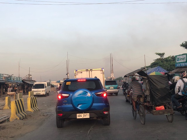
The volume of road vehicle traffic is steadily increasing along C-6. The adjacent land use offers a lot of potential for development (hopefully planned) that will feed more traffic along what will become a major thoroughfare in the near future. The land I am referring to are the reclamations on the side of Laguna de Bai along C-6 that are under the jurisdiction of Taguig and similar developments on the opposite side on what was once swampy or marshlands. One wonders if Taguig has a plan for all this or if the city is turning a blind eye and just letting developers do what they want. Most seem to be residential subdivisions and industries-related with a sprinkling of mainly small to medium-sized commercial developments.
Again, I think national and local governments should consider making this a public transport corridor by introducing formal public transport in the form of a scheduled bus service stretching from, say, Bicutan Interchange to Taytay Public Market. The demand along this corridor is steadily rising and only a better connection to C-5 limits an even steeper increase in traffic volume along C-6. The time is now in order to condition commuters about the system and to the unwanted congestion experienced along major roads in the metropolis.
–
C-6 expansion and upgrading on the way…
The opening of the second Barkadahan Bridge prodded me to post something about C-6. It is a work in progress but currently you can see the progress that is quite noticeable unlike before. Here are a couple of photos we took while en route to BGC last weekend.
 Ongoing paving along C-6 for the westbound side of the highway. The photo shows recently completed PCCP slabs for 2 lanes. Forms are visible in the photo.
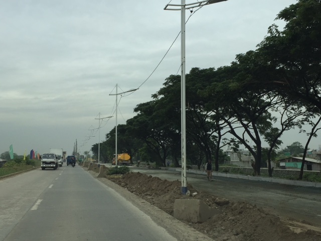 Other sections have had their base compacted and ready for concrete pouring.
As a regular user of C-6 since 2014, I am one of those who look forward to the completion of its expansion and upgrading. There is also something to look forward to for cyclists and pedestrians/joggers/runners as there is a wide bikeway and segregated walkway being constructed along the side of right side of the future eastbound side of the highway. This should encourage non-motorised traffic along this corridor that directly connects Taguig, Pateros, Pasig and Taytay and extends to serve the southern part of Metro Manila, Makati City and the province of Rizal.
–
Some updates on C-6
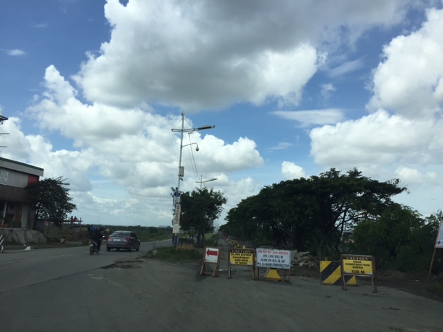
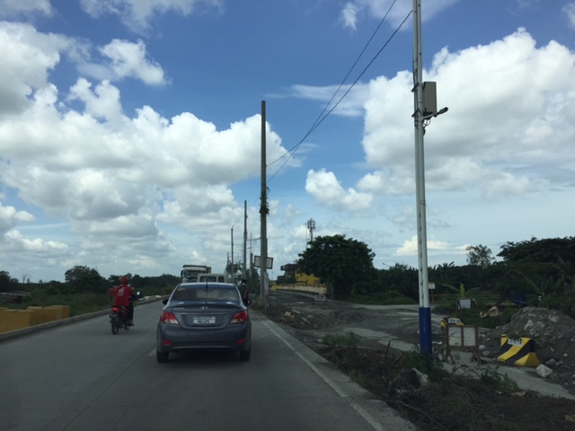
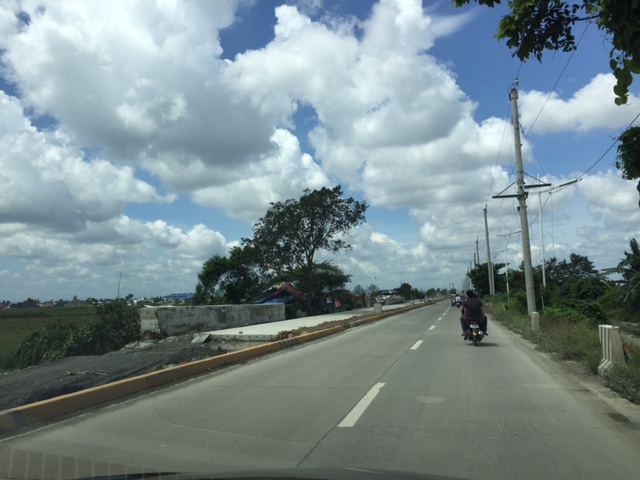
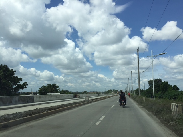
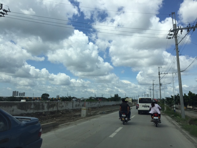
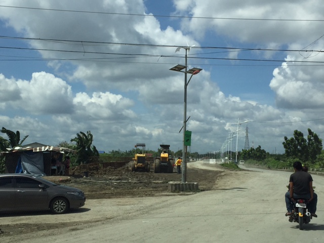
It seems late but there seems to be no really significant changes to the state of Circumferential Road 6 as the rains seem to have slowed down work on sections of the highway. We took these photos 3 weeks ago showing the nice 2-lane/2-way section on the side of the Laguna de Bay that’s been opened to general traffic. Previously, most vehicles had to use the beat-up, crater-plagued older section of what was a dike road. We were heading to SLEX via Bicutan so we were able to take a lot of photos for the entire stretch of C-6. I won’t be annotating all the photos anymore but suffice it to say that the series starts just after the Napindan Bridge in Pasig and ends prior to Taguig City’s bayside park at Lower Bicutan. Vehicles bound for C-5 or BGC via Ruhale Street should get off the newer section and negotiate a short but very bumpy road that’s not a good experience if you’re using a car. Just after the Ruhale “exit” all vehicles would have to return to the old road and have to be patient with the bad conditions of the pavement on both sides of the road.









–
Marcos Highway-Felix Avenue-Gil Fernando Avenue pedestrian overpass
Here’s are some photos of the pedestrian overpass structure at the intersection of Marcos Highway, F. Felix Avenue (formerly Imelda Avenue) and Gil Fernando Avenue (formerly A. Tuazon Avenue).
 Here’s a view of Marcos Highway and the elevated Line 2 Extension from the structure crossing Felix Avenue between Soliven/Tropical and Sta. Lucia. Also shown is the overpass crossing Marcos Highway.
 View towards Sta. Lucia and Robinsons Metro East
 Stairs to Sta. Lucia – notice the gap in the railings along the elevated Line 2 superstructure? That is where the Emerald Station will be constructed.
–
More major traffic generators along Ortigas Ave. Extension?
There’s another mall being constructed along the westbound side of Ortigas Avenue Extension just before the Lucky Gold Plaza and across from the One Oasis residential enclave. That area is already very congested as will be attested to by the thousands who pass this way especially during the morning rush. Here’s a photo of the mall that is currently under construction as seen from the bridge crossing the Manggahan Floodway. The steel frame on the left and behind the pedestrian bridge is the mall’s.
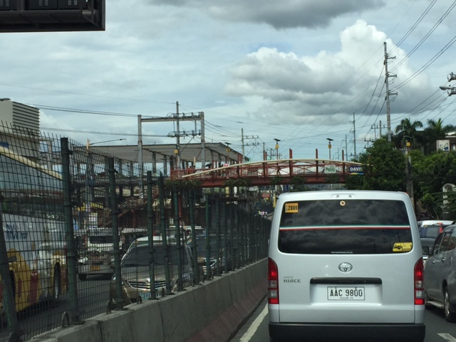 That’s another mall being built across the Bali Oasis near the Manggahan Floodway
Among the future major traffic generators that will likely make traffic congestion along Ortigas Avenue worse are the following:
- Residential development across Countryside subdivision
- Town center development near Valley Golf
Commuters using this corridor will likely find traffic worsen (could it really get worse than what it is now?) and traffic schemes by the LGUs along the corridor (i.e., Pasig, Cainta and Taytay) will not be enough to alleviate traffic over the medium to long term. Only a dedicated mass transit line can provide significant improvements for travel along this corridor.
I am still wondering about the mass transit solution for this corridor. There are arguably more people traveling along Ortigas Avenue compared to Marcos Highway that already has Line 2 under construction. I’m sure if you asked people when a mass transit line’s needed along Ortigas, they will reply “years ago”. Being one who has traveled along this corridor since the 1970s (I was a resident of Cainta and then of Antipolo), I can say that traffic indeed has worsened over the last 3 decades. Travel demand management (TDM) measures such as number coding and transport systems management (TSM) schemes such as Pasig’s one-way scheme will not be enough to address the growth along the corridor as they were and are not enough in the first place.
–
Some updates on C-6
I have not used Circumferential Road 6 in a while. And so a couple of weeks ago, I was happy to see that work has resumed on the sections at Lupang Arenda in Taytay, Rizal, which is also known as Sampaguita Street. Here are some photos of the wide C-6 section. I guess there’s an opportunity here to have service roads on either side of the highway in order to manage/control local traffic. C-6, after all, is a highway and is designed for typical national highway speeds (i.e., 60 kph). The adjacent land use, however, requires slower traffic mainly due to safety concerns.
 Cordoned-off section where a contractor is preparing the sub-base prior to placing the steel reinforcement and pouring concrete
 Another photo of the section showing form works for the slab. Note the parked vehicles along the side on the left.
 Some sections are already flooded from the heavy rains
 The completed section towards Nagpayong, Pasig is a wide 4 lanes. At left is a nice view of the Laguna de Bai.
 Section to Nagpayong near the boundary of Taytay, Rizal and Pasig City.
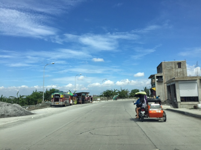 That’s a habal-habal (motorcycle taxi) terminal on the left and in front of a parked jeepney.
Two very important things about C-6 though. One concerns the Barkadahan Bridge over the Manggahan Floodway, which is too narrow for the traffic that cross it. There’s a new bridge beside it that seems to be taking too long to build. And then there’s the long stretch from Nagpayong, Pasig to Lower Bicutan, Taguig which remain in bad condition. The new section along the lakeside is already usable for Pasig-bound traffic but needs to be allowed to carry two-way traffic for the older section to be rehabilitated. C-6 is becoming a major alternative route for a lot of travelers from Rizal to and from Makati and Taguig (esp. BGC). It needs to be improved immediately as it can help decongest the Ortigas Ave. – C5 route that most Rizalenos use to go to their workplaces.
–
Newly opened sections of C-6
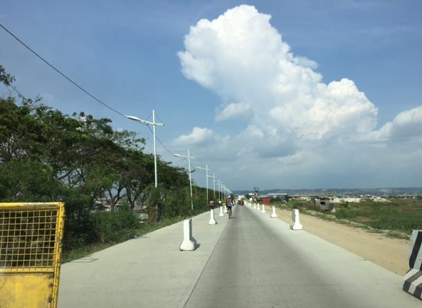
I have been wanting to post these photos of the newer sections of Circumferential Road 6. The section was constructed months ago and is part of a project that seeks to widen the current stretch of C-6 from Taguig (Lower Bicutan) to Pasig (Napindan) from the old 2-lane, 2-way road into a 4-lane, divided road. The new section opened to general traffic along the southbound side (to Taytay) and has improved traffic along the section that’s provided people from Rizal an alternative route to Makati and BGC through Taguig. Only, light vehicles are allowed along the new section and trucks and other heavy vehicles take the old road, which is quite battered by the traffic. Only one lane is currently available as there are barriers along the section as shown in the following photos. Traveling along the section also afford people a nice view of the Laguna de Bay to the right.




–
Responding to the transport impacts of road crashes
Last March 9, traffic was terrible along Marcos Highway and roads connecting to it including Imelda Avenue and Sumulong Highway due to a truck that slammed into the scaffolding of the Line 2 Extension across the Sta. Lucia Mall, and barely missing the newly constructed column supporting the girders and elevated tracks of Line 2.
 [Photo not mine but sent by an officemate who was glad to have taken his motorcycle that day instead of commuting by car.]
Following are comments I captured from Waze as I tried to get information about the traffic situation:




It is very clear from travelers’ comments that most were frustrated and many were angry about what seemed to be a very slow response from authorities in clearing the crash site and getting traffic to move faster. I myself wondered how a crash like this with its impacts manifesting in severe congestion along major roads was not dealt with as urgently as possible by so many entities that were not without capacity to act decisively. The front liner should have been the Metropolitan Manila Development Authority (MMDA) and there were at least four local government units directly affected by the congestion: Pasig, Marikina, Cainta and Antipolo. Surely, these LGUs could have done more if the MMDA couldn’t, in order to resolve the problem? If the availability of heavy equipment was an issue, weren’t there available equipment from Line 2 contractor, DMCI, or perhaps from the construction sites nearby (Ayala is constructing a huge mall near the area.)? Surely, they could lend a payloader or mobile crane that can remove the truck or at least help unblock the area?
I finally decided to turn back and work from home instead that day. Later, I learned that authorities had to stop traffic along Marcos Highway around 11:00 AM in order to tow the truck and clear the area for traffic to normalize. I hope this serves as a lesson in coordination among government entities and that future incidents like this will not results in a “carmaggedon” like Friday’s congestion. One thing that also became obvious is that travelers passing the area are all dependent on road-based transport and the primary reason why a lot of people were affected by the crash. The expanded operations of the Line 2, whenever that will be, will surely change transport in these areas and for the better.
–
Where exactly will the Line 2 Extension stations be?
A good friend asked me about where the two additional stations of the Line 2 Extension will be. Most articles state that there will be a station at Masinag and at Emerald but since work on the stations has not commenced then many are still speculating on the final locations and how the station will be laid out with respect to the elevated tracks. However, if you look closely, you will see something like a hint to where the stations and their platforms will be laid out. Following are two photos; each showing features of the elevated tracks that taper off at what looks like the start and end points for the stations.
 Future Emerald Station in front of Robinsons Metro East?
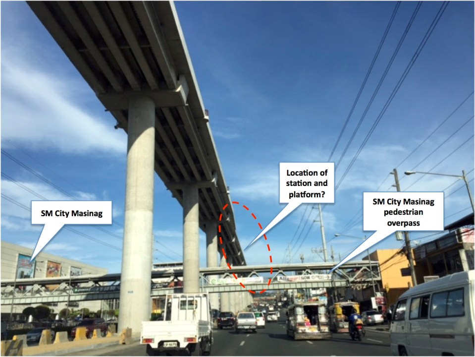 Future Masinag Station across SM City Masinag
Another observation and particularly at Masinag is how tall the structure seems to be. The platforms appear to be already at the 4th level if you compare the elevated tracks to the pedestrian overpass that represents the 2nd level. It seems that the Masinag Station will be quite a tall one and invites more questions from observers especially prospective and current users of Line 2. Perhaps it will be 4-storey building with commercial spaces for shops and restaurants? How massive will this structure be? Will there be a connection with SM other than via the existing pedestrian overpass? How will the inter-modal needs be addressed by the station design? Will there be more parking or maybe park-and-ride facilities? Hopefully, these questions can be answered soon.
–

