
Home » Posts tagged 'Quezon City' (Page 3)
Tag Archives: Quezon City
Re: traffic congestion along Katipunan
Yesterday was a holiday in Quezon City so most offices and schools were closed. It was not a holiday elsewhere so through traffic along Katipunan Avenue would have been “normal.” This is assumed especially for trucks that have been blamed as the cause of the severe congestion. I was curious about how traffic would be with the holiday in QC and through traffic could practically be “isolated.” There still was significant traffic generated by establishments like restaurants and cafes along Katipunan. It was a regular weekday and not like it was a Sunday. Following are photos that were taken around 2:00 PM when the truck ban is not enforced in the area.
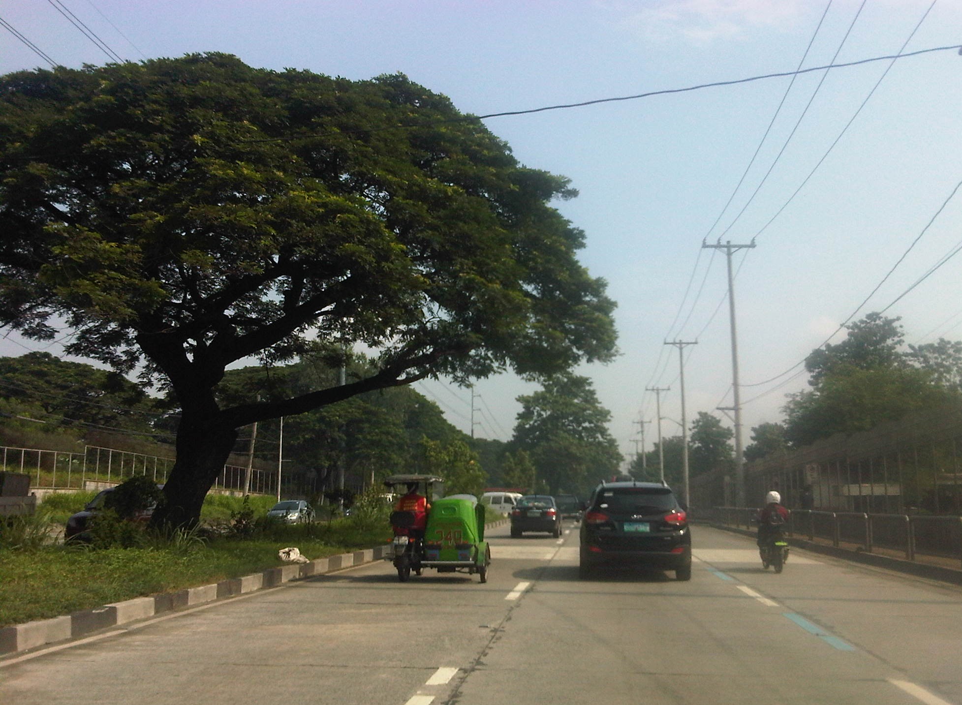
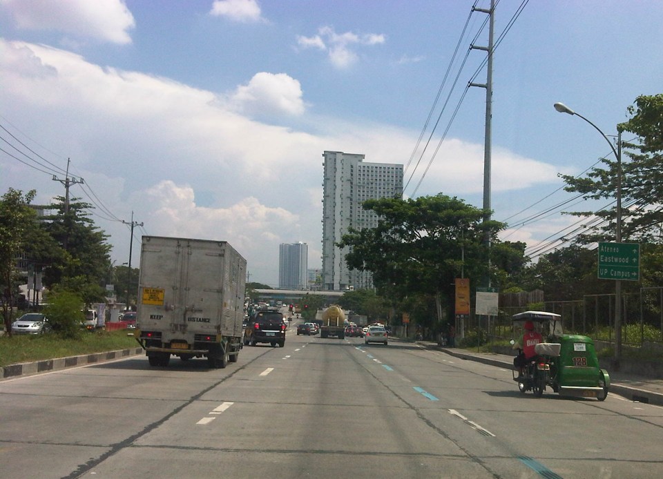 Free-flowing traffic along the section across from the UP Town Center – There were no long queues at the approach to the Katipunan-C.P. Garcia intersection.
 Free-flowing traffic along Katipunan across from Ateneo – the two universities generated few private car traffic yesterday during a period when there’s usually a lot coming in and out of the campuses due to the dismissals in the early afternoon.
 Free-flowing traffic along the Katipunan-Aurora overpass – in the early afternoons, the northbound side of Katipunan is usually full of vehicles mainly private cars and trucks. While there were many trucks yesterday, their numbers were not enough to cause traffic jams.
I think the traffic situation yesterday provided a clear picture that the major traffic generators along Katipunan are mainly the reason for traffic congestion along the stretch from Blue Ridge to Balara. These are mostly the schools (Ateneo, Miriam and UP) that generate so much private vehicle traffic on weekdays and Saturdays. Sundays are different because there’s no school nor work at offices on this day. With the QC holiday, the through traffic was still there owing to work and school in other cities (e.g., Residents of QC would still have to travel to Makati or Ortigas if their workplaces are located there. Similarly, students residing in QC whose schools are in the University Belt in Manila would have to travel.). This means there is really a need to understand why there is congestion and what causes it. A lot more effort is needed for this understanding and to ultimately reduce traffic congestion along this stretch of C5. Pointing fingers among agencies and simply putting the blame on one sector of traffic (e.g., trucks) will not get us anywhere. The solution will require strong cooperation among stakeholders and will definitely be not a painless undertaking for many.
–
The inconvenience of pedestrians
Walking is our most basic mode of transport and yet it seems that we have failed to design facilities that would make us walk more conveniently and comfortably. Many Philippine cities have been developing their transport systems that favor road transport and motorized vehicles while generally neglecting the needs of pedestrians. Metro Manila cities have been quite inconsistent in the way they deal with the needs of pedestrians (i.e., walking) and often pass on the blame to the DPWH. While that agency also is definitely responsible with a lot of issues pertaining to suitable designs of transport infrastructure, I think LGUs should also be responsible and take up the challenges with respect to design of people friendly facilities. There are a lot more local roads than the national roads under the DPWH. And so LGUs, especially the more developed cities have a bigger role in developing their transport infrastructure to be more people oriented.
 Pedestrians can no longer cross at-grade at the intersection of Quezon Avenue and Araneta Avenue. Note the vendor in the photo (with umbrella) crossing counter-flow with his pedicab full of plastic merchandise. The cyclists in the photo are risking their lives and limbs in crossing the intersection. Fortunately for them, there seems to be no traffic enforcers around to apprehend them. The “yellow box” has been replaced by a “red box” in many intersections including this one.
 The pedestrian overpass at Quezon Ave.-Araneta Ave. as seen from the sidewalk along the Q.C.-bound side of Quezon Ave. The sidewalks are often obstructed by vendors but fortunately the overpass itself is not clogged by vendors unlike other overpasses.
 This overpass along EDSA is the outcome of pedestrian crossings being only an afterthought (some would say aftermath) of the EDSA MRT design. It is an example of the “pwede na yan” (this will do) attitude of many engineers and architects when it comes to transport systems.
All of the above examples are found in Quezon City. That city is among the most wealthy cities in the country and there have been a lot of transport-related developments in the past few years that are more people oriented. These include the construction of sidewalks, overpasses and underpasses outside those typically under the MMDA. However, there are still a lot to build and may I say correct in order to promote walking and other non-motorized transport in the city. Quezon City and other cities can be walkable cities and walkability should not be limited to CBDs that are often (and again) passed on to the private sector for development. LGUs should not be too dependent on what the private sector can offer in terms of infrastructure for walking and cycling. There are not many responsible private companies out there who would commit resources towards walkable and cycling-friendly developments. Often they are tempted to maximize space for buildings, even sacrificing space for parking and motor vehicles, and ultimately at the expense of the general public. This is where LGUs, and not even national government, comes in to put things into order. However, the caveat here is that LGUs should have a plan to guide them in development and again, there are few LGUs that have this capability and capacity to plan and implement such plans. And here is where national agencies like the DOTC and the DPWH can provide help to LGUs given their resources and expertise.
–
Walking vs. cycling?
I remember an episode in an old series, The West Wing, where White House staff had to meet with various proponents of renewable energy. The very same proponents advocated for the RE they thought should get the most attention, and therefore funding support from the government. They ended up criticising each other’s advocacies, even pointing to the flaws of each and basically putting each other’s proposals down. The POTUS (ably played by Martin Sheen) had to intervene and scolded these people for working against each other rather than working together to push a common RE agenda.
This is pretty much where we are now with many proponents of sustainable transport initiatives. People and certain groups would advocate for walking, cycling, BRT, rail transit, etc. as if these are exclusive from one another. The results have often been haphazard facilities such as entire pedestrian facilities being painted and designated as bikeways and regular bus services being mislabeled as BRT. I have some friends who insist that cycling is the way to go simply because they cycle between their homes and workplaces, not fully understanding that this mode is not for everyone especially with the various issues in urban sprawl affecting our choices of residence. Clearly, what is good for one person is not necessarily applicable to everyone else, and that is why we should have options for travel or commuting. These options would have to be integrated, complementary, affordable and people and environment-friendly.
 The MMDA fenced off entire stretches of sidewalks and painted the pavement red to designate them as bikeways. This basically alienates pedestrians and while the wire mesh fence has its benefits from the perspective of safety, it also effectively constricts the space that cyclists and pedestrians have to share. Note also the trees and poles that pedestrians and cyclists would have to evade or risk injury.
 Along EDSA, the same treatment of fences and coloured pavements was applied ahead of Temple Drive/Corinthian Gardens. The space is just too constrained for sharing given the trees and poles and then you have the smoke belching buses adding to the misery of people using these facilities.
While there have been some quick wins for pedestrians and cyclists, it seems to me that many if not all do not seem to be as sustainable as we want them to be. Many cases are classic for their being “pwede na yan.” There is no innovation in design or no design involved at all much like what we typically see as best or good practices abroad. Marikina still has the best examples so far for integrated bikeway and walkway design though there are many examples of good pedestrian facilities around including those in Makati and Bonifacio Global City (I tend to resist saying Taguig because that city practically has no say in how BGC is developed.). Quezon City (along Commonwealth) had a little promise and the UP Diliman campus but perhaps that can be realised with the rise of a new CBD in the North Triangle area. Of course, we look forward to developments in Iloilo City what with the bikeways being constructed along the long Diversion Road. Still, I believe that there should be a conscious effort not just from the private sector but from government agencies, especially the DPWH, to come up with new designs and guidelines that LGUs could refer to. That agency so far has not measured up to the expectations of many for it to take a lead in revitalising our roads so that facilities can be truly inclusive and environment-friendly.
–
“Sharing the road” – bandwagons and fads? Let’s hope not!
There seems to be a lot of talk about “sharing the road” and the initiatives to have more bikeways. I hope I am proven wrong but it seems to me as if these current programs and projects are more of a fad. A lot of people (and local governments) join the bandwagon with little understanding of what needs to be done. It’s usually because of the good PR they get out of these that they agree to coming up with the token carless street or the haphazardly implemented bicycle lanes. More than PR, some cities are aware of the opportunities that come with such initiatives as international agencies and groups are willing to spend money to support such programs and projects. The question really is on sustainability and doing the right thing not only on initiating things or coming up with programs but on the substance itself. And by substance I mean that programs should also go into the details of designs. Too often, the “pwede na yan” approach is taken and this just won’t do.
 The MMDA painted the sidewalks in White Plains and designated them as bikeways, in a way alienating pedestrians.
A vision for what people want to have is there but it is ultimately how the achieve the vision that needs a lot of work. For example, bills are being filed in congress to force the creation of bicycle lanes along major highways. (And mind you there are a lot of similar bills filed in congress that upon closer inspection actually have little substance.) The premise here seems to be that if you build them then people will start cycling. That was not the experience in Marikina, which boasts of the country’s only bikeways network that includes many off-street sections. These bikeways were built at a time when the perception and analysis pointed to a critical mass of cyclists in that city that was thought to be surely the tipping point in terms of non-motorised transport. Nowadays, the same bikeways are used by motorcycles and tricycles and most cyclists we see are not commuters (e.g., cycling between home and work/school) but recreational cyclists. It would take Marikina some effort to promote commuting by bicycles and much effort in enforcement to correct the misuse of the bikeways. The “new” bikeways in Quezon City appear to be poorly conceptualised as the MMDA decided to paint the sidewalks along EDSA northbound without addressing the obstacles like electric posts. Still, it is an effort to put NMT in the consciousness or awareness of the general public (thanks in part to media’s making these news worthy items).
Cities like Pasig and Taguig like to show-off Ortigas Center and Bonifacio Global City, respectively, as their faces when in fact the cities have not done much in their original cores. The running joke is that the real Taguig is not the areas to the west of C-5 but the old Taguig, which is to the east. This Taguig is the one plagued by narrow streets and the proliferation of tricycles. It was not so long ago that a former mayor imposed e-tricycles on BGC (where they were not suitable) while not doing much to lift a finger in the mayhem of tricycles in old Taguig (e.g., along Gen. Luna). As for Pasig, you just have go along the Pasig River and the Manggahan Floodway to see what it has accomplished so far in those areas.
There are no quick fixes to the transport and traffic problems our cities are facing. In the case of Metro Manila, much is at stake for the long-delayed mass transit projects. And the DOTC’s announcements of projects being formulated or proposed are no longer taken seriously as they have not delivered on any of these despite 4 years of this current administration. For other cities, it is important to learn the hard lessons from the experience of Metro Manila. There is also a need for a drastic change in transport and traffic policies in our cities. Iloilo, for example, has built an expensive bike lane along Ninoy Aquino Avenue (Diversion Road) and has marketed its Esplanade as a haven for pedestrians and cyclists. Yet the city has not acted on the clamour to revisit the overpasses along Gen. Luna (Infante and Jalandoni flyovers). The latest information I got from the city is that there are issues in the design of the bikeway along the Diversion Road as the surface (they used pavers) is not suitable for cycling. It seems, also, that the city and cyclists were not consulted by the DPWH when the bikeway was designed and constructed resulting in many cyclists using the Diversion Road itself for traveling. This last example is a lesson for our local governments and national agencies that they need to cooperate with each other and turfing has no place in transport and traffic if we are really serious about bringing solutions to problems we encounter everyday.
–
Off-street parking along Tomas Morato
Not too long ago, the Quezon City government constructed off-street parking slots throughout the city. These included spaces along major roads such as Visayas Avenue, Mindanao Avenue, Quezon Avenue, West Avenue and Timog Avenue. Tomas Morato as well as the streets connecting to it were also included in the project, which benefited many people, whether they be car-users or taking public transport. I took a couple of photos last week as the wife picked up some food at a panciteria along Morato. It was early an early afternoon so traffic was free-flowing and many parking spaces are available along the avenue. Morato is well known for having many restaurants and cafes lined up along either side of the street and during their off-periods, Morato would usually be an easy drive.
 The off-street parking spaces along Tomas Morato are free and are not allocated for any specific establishment. In practice though, the spaces in front of certain restaurants, shops, banks, etc. are “reserved” by their staff for their customers/clients.
 Many newer establishments along Tomas Morato have no provisions for off-street parking for their clients. This means the burden for parking continues in being passed on to the local government and, likely, at the expense of taxpayers.
I still believe that establishments that are required under law to provide at least the minimum number of parking spaces as per national building code should be made to compensate for the city’s construction of parking spaces to solve on-street parking issues along streets like Morato. I understand that they pay local taxes but that is an entirely different requirement that is not related to their being required to provide parking spaces for their customers/clients. It’s really a matter of doing the right thing for both city and these establishments but such cases are often muddled and are not tackled as the general public is usually not interested in these somewhat unpopular topic of parking.
–
Cubao Aurora
Cubao is one of the busiest areas in Metro Manila where a lot of public transport routes converge. It is a major transfer point for road and rail transport particularly near the junction of three major roads – EDSA, Aurora Boulevard, and E. Rodriguez Avenue, which is only a few meters from EDSA. I took a few photos when I was in the area one time and here they are:
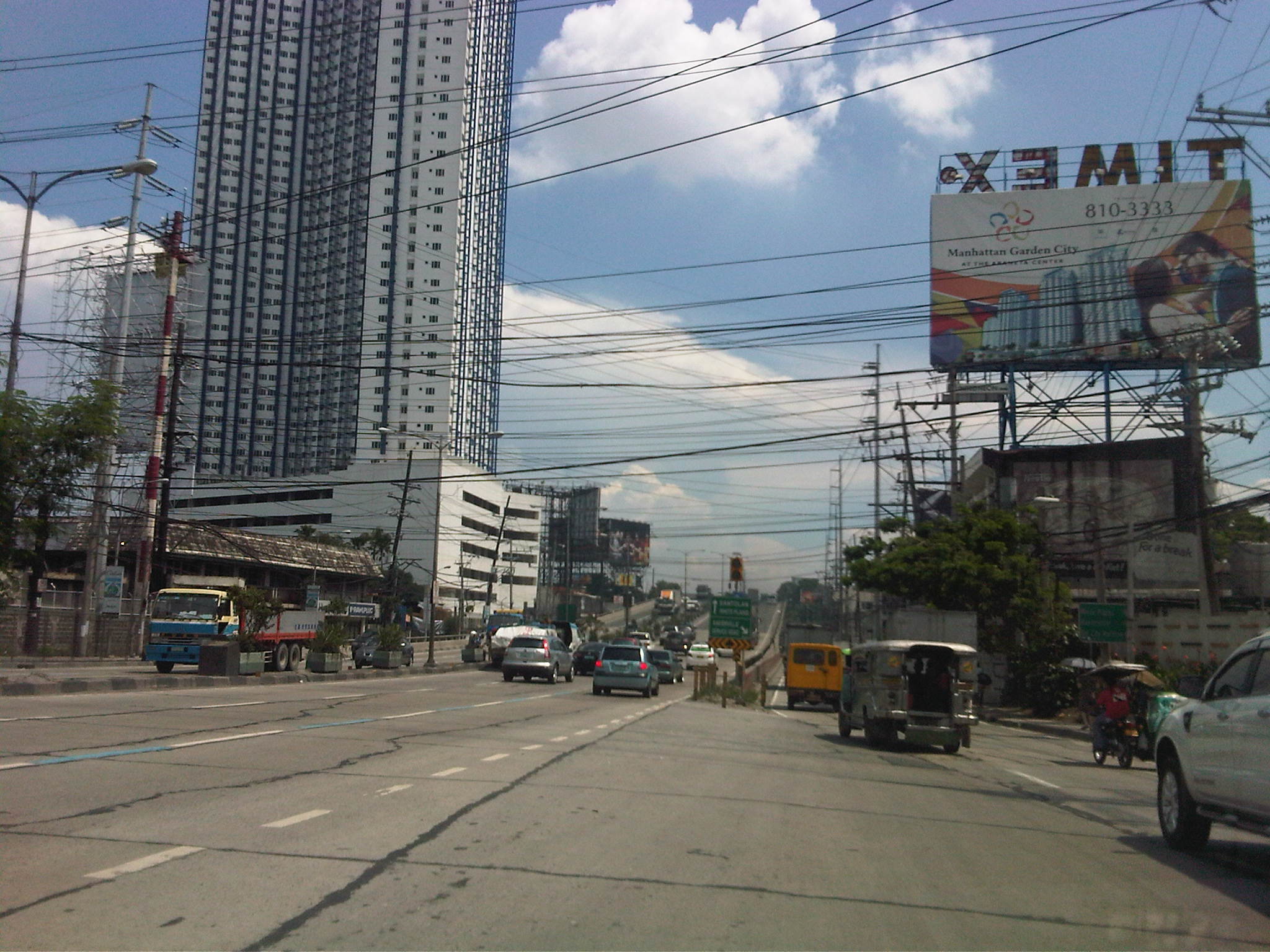
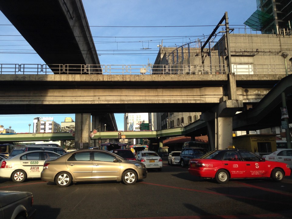 EDSA and Aurora Boulevard intersect at ground level. There is, however, an underpass along EDSA bypassing the at-grade intersection. Shown in the photo are the two rail transit lines passing through the area – EDSA MRT 3 at the 2nd level and LRT Line 2 at the 3rd level.
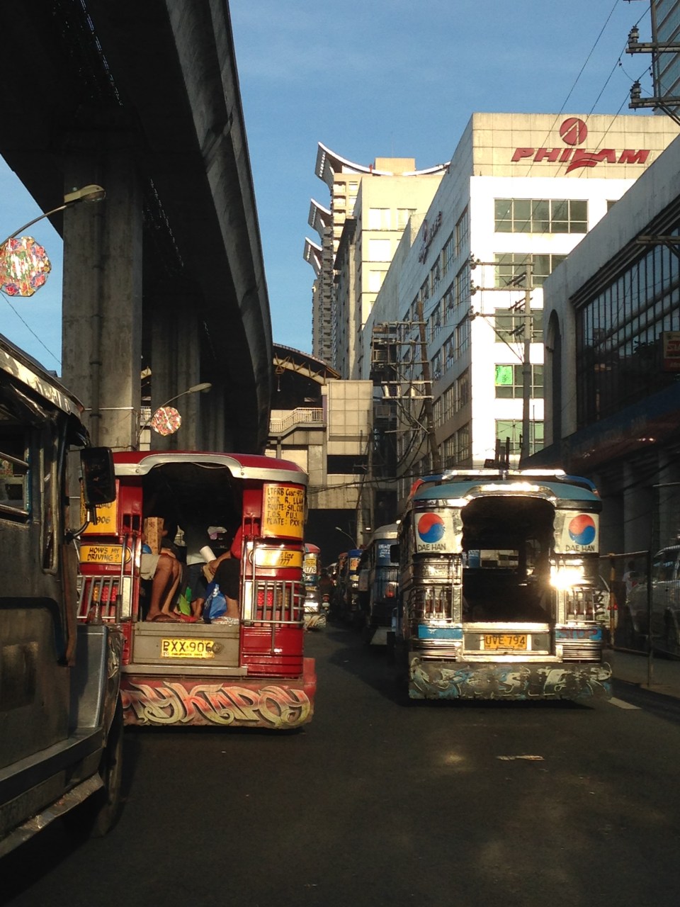 After crossing EDSA, eastbound jeepneys approach the LRT 2 Cubao Station, which is beside the Gateway Mall of the Araneta Center. Traffic along this section of Aurora Blvd. is typically slow as jeepneys bound for different destinations in the east congregate here. Meanwhile, on the other side of EDSA, the same situation is experienced as jeepneys line up along informal terminals on the street. This usually leads to congestion and low throughput along Aurora at the intersection.
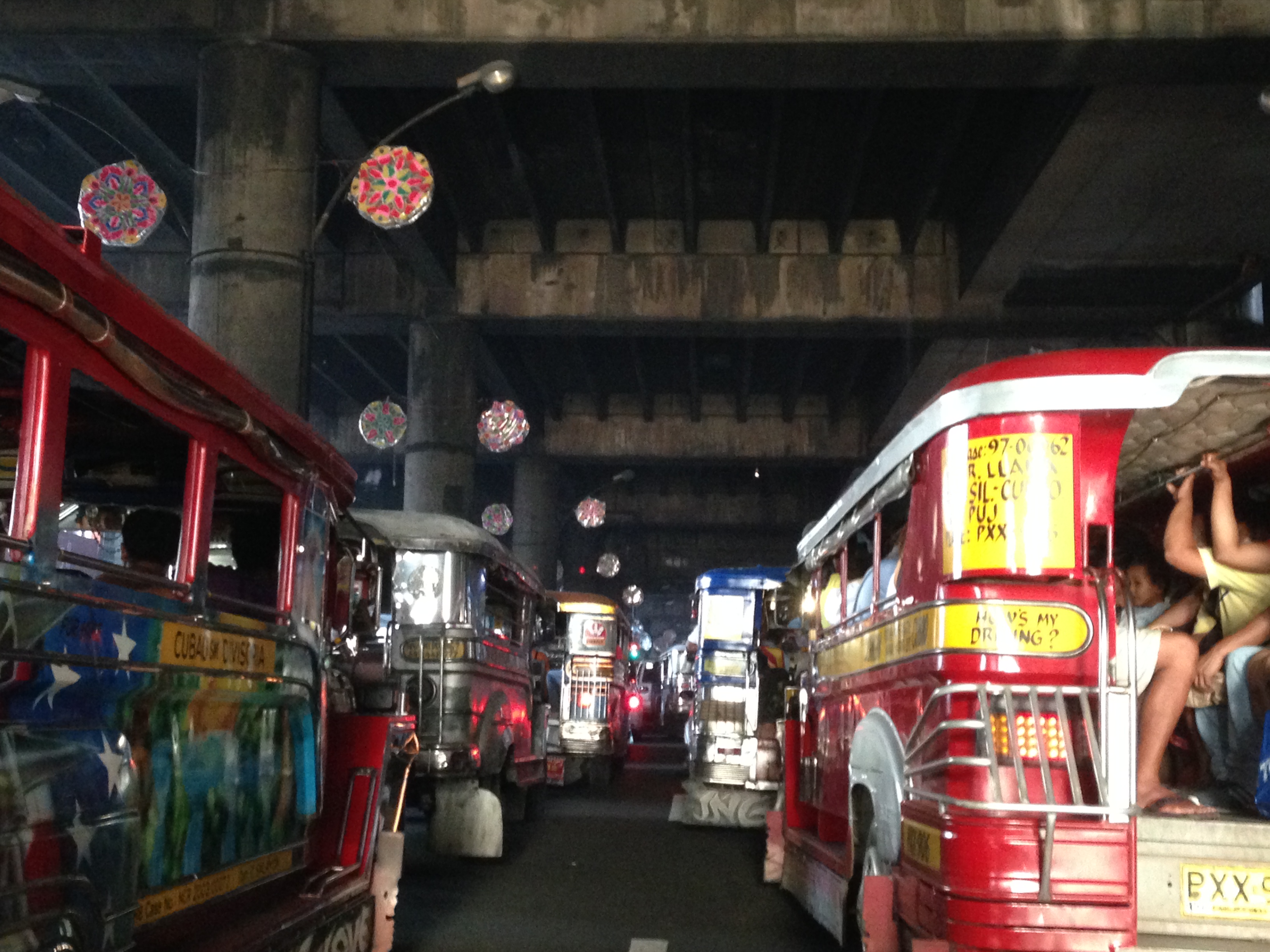 Jeepneys tend to linger under the LRT 2 station and occupy practically all the lanes with most jeepneys deliberately moving at snail’s pace as they try to get passengers. This is the case along both directions of Aurora Boulevard, which makes one wonder why many people don’t take the LRT instead. Of course, for eastbound passengers, the answer is simply that the LRT ends at Santolan Station in Pasig (along Marcos Highway and just after the Marikina River). Most passengers would rather take a single, direct jeepney ride from Cubao to their destinations rather than make the difficult transfer at Katipunan (for Marikina-bound passengers) or Santolan (for Rizal and Pasig-bound commuters).
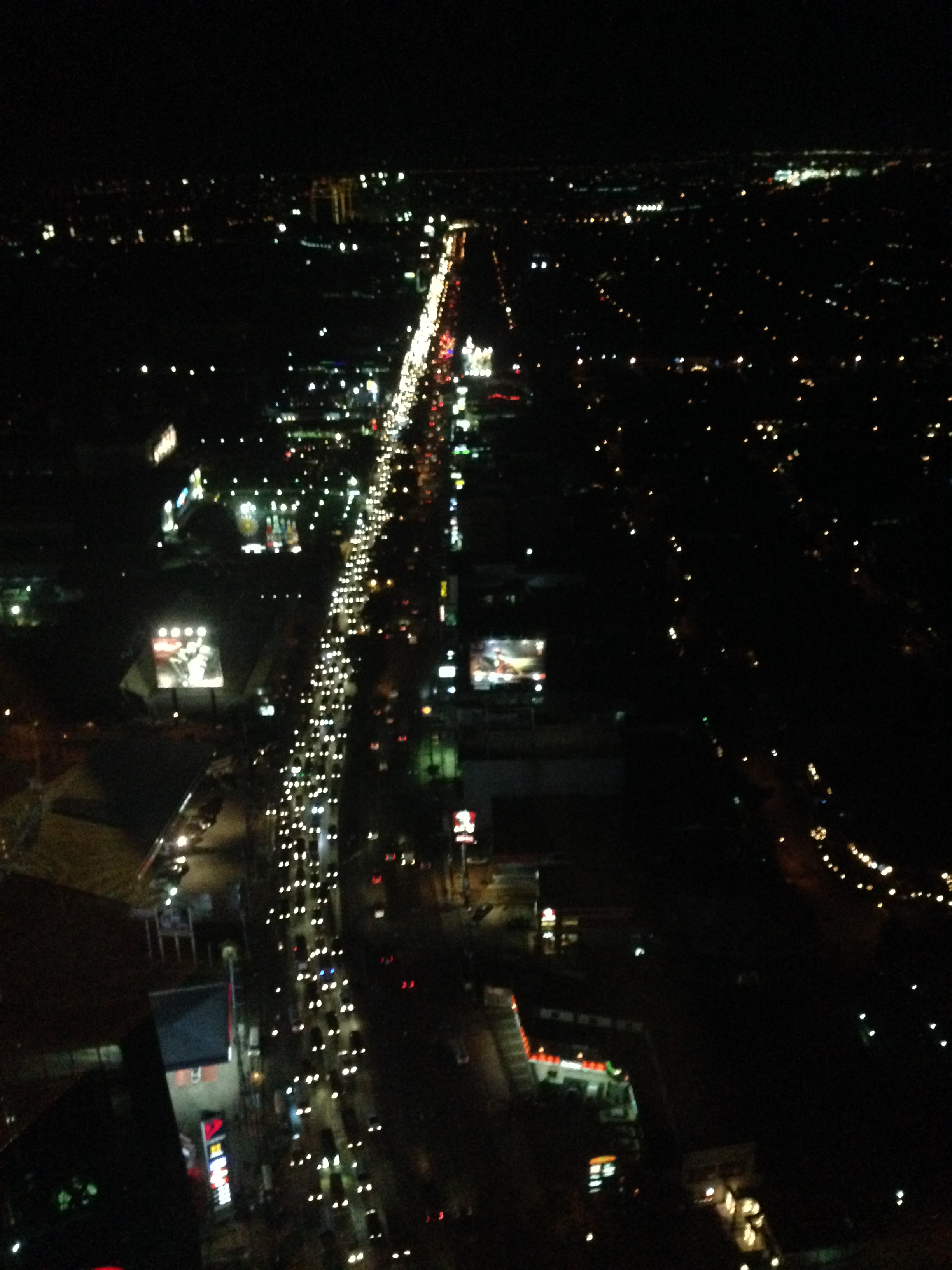
I wanted to take some photos during the night time one time we were passing under LRT 2 along Aurora Boulevard near the Gateway Mall. The area wasn’t well lighted though so all the photos didn’t come out right. This blight is similar to the situation along the LRT Line 1 corridor stretching from Caloocan to Pasay, and affecting areas along Taft Avenue and Rizal Avenue. The areas including the rail superstructure are so dirty mainly because of the emissions from road vehicles, particularly jeepneys, buses and trucks with surplus and generally poorly maintained engines. Hopefully, the local governments and MMDA can address problems of bright with a campaign to install pocket and hanging gardens like the ones already along EDSA. The plants, if cared for properly, will surely help improve both air quality and aesthetics in these areas darkened by design and soot.
–
Christmas season traffic jams
Traffic jams are a common occurrence in most cities. In some they are predictable, usually during peak hours in the morning and the afternoon or evening. These peak periods may range from less than an hour or stretch to a couple or even longer hours depending on the characteristics of the area. In many cases, congested are main corridors (Commonwealth, Ortigas, Marcos Highway, McArthur Highway, SLEX, etc.) leading to or from the city center or central business district (e.g., Makati, Ortigas, Cubao, etc.). In Metro Manila, it can be a corridor connecting CBDs like EDSA or C-5.
 Traffic congestion along the northbound side of Circumferential Road 5 seems much worse this December though it is always bad from the late afternoon to late night on weekdays. Congestion is usually worst along the stretch between Bonifacio Global City and Pasig River though it is also usually bad along the stretch from Ortigas Ave. to Eastwood in Quezon City. Traffic along the southbound side is usually bad in the mornings especially in the Pasig area.
 Traffic congestion along Tramo on the way to the airport – traffic can really be bad in the vicinity of airports during this season but then the way the terminals of NAIA are situated and the conditions along airport roads also contribute to the congestion. For example, along Tramo in Pasay City you will find a lot of bus terminals and informal settlements. There are tricycles and pedicabs operating in the area, and parked vehicles along the road that reduce capacity. I always wonder what local authorities are doing to address these issues considering NAIA is our prime gateway to the world.
Unfortunately, the Christmas season in the Philippines is perhaps the longest in the world so Christmas traffic starts to build up in September (the first of the ‘ber’ months). Worst are days in December when everyone seems to be at their busiest. Aside from the work being done due to deadlines at the end of the year, there are shopping mall sales and Christmas parties.
So how do we know if December is indeed the busiest month of the year in terms of traffic? What evidence can we show as proof to this long-standing perception that is accepted as fact by many? I was asked these questions in a recent interview but unfortunately, I didn’t have the figures to show that December indeed is the busiest month in terms of traffic. Unfortunately, too, our government agencies do not conduct data collection to determine traffic volumes throughout the year so what you can get from the DPWH is Annual Average Daily Traffic (AADT). Perhaps the evidence is with our toll operators, which conduct daily counts through their detectors and their toll booths. The cumulative volume of vehicles per month can be derived from data on tolls collected to validate the notion that December is highest in terms of traffic volumes.
Meanwhile, there might also be video evidence from the cameras installed by the MMDA and other local governments monitoring traffic. Footage taken from January to December can be compared to show which months are the busiest. Taking this to another level, image processing software for traffic are now available or can be developed to determine vehicle volumes from video.
It is reasonable to argue that indeed December is the busiest and we experience more traffic congestion during this month as there are more activities, especially those related to shopping, during this month. Ask anyone on the street and surely they will say that traffic and commuting is worst this time of year but many will also say they aren’t really complaining given the situation of other people (e.g., those affected by the earthquakes in Bohol and Cebu, and those affected by Typhoon Yolanda/Haiyan in the Visayas). For many, this is still a season for joy and we generally don’t let traffic get in the way of happiness.
Merry Christmas to all!
–
Tricycles in the Philippines – Part 2
In a previous post on tricycles, I featured some photos taken from various trips I’ve taken around the country. Closer to home are tricycles that provide some convenience to commuters along a stretch of C-5 that is more commonly known as Katipunan Avenue. The example below is of a typical tricycle traveling along a section that cuts through lands of the University of the Philippines Diliman.
 Tricycle along Katipunan Avenue
Tricycles do not necessarily just roam around to get passengers like what we usually see. They do have formal terminals though the informal ones outnumber these and typically cause problems due to the spaces they tend to occupy. These spaces include road space, the consequence of which is a reduction in road capacity, and sidewalks, which deny pedestrians space for walking. The first causes or exacerbates congestion while the second mainly puts people at higher risk as pedestrian safety is compromised. Following are photos of tricycle terminals taken from recent trips north of Manila in the provinces of Tarlac, Pangasinan and La Union.
 Tricycle terminal at the Moncada Public Market
 Tricycles still dominate traffic along the Manila North Road in Urdaneta, Pangasinan where they have terminals around the public market and at the intersections of side streets.
 Roadside tricycle terminal in La Union where the newly paved shoulders are occupied by tricycles waiting for passengers from a nearby public school.
 Tricycle terminal in front of the Civic Center in Agoo, La Union and just across the church.
More on tricycles and their terminals in succeeding posts!
–
U.P. Town Center
Passing along the University of the Philippines’ part of Katipunan, one will see a new development at the area where the UP Integrated School (UPIS) is currently located. The UP Town Center is being promoted as part of a university town center concept and is the second major Ayala development on UP land after the Technohub in the north side of the 493-hectare campus. The surrounding area to the newly built Town Center will most likely host business process outsourcing (BPO) including call centers that currently populate Technohub.
I learned that the development’s design was reviewed on the UP side by a team that included faculty members from UP Diliman’s College of Architecture and School of Urban and Regional Planning. I assume that they were able to cover most if not all the aspects of the design for this particular development and the rest that will follow once UPIS moves to the main campus and the entire lot is developed much like into what Technohub is at present. I would assume that they provided recommendations to Ayala and that these recommendations were used to improve on potential issues with the development. However, my worry is that the transport or traffic component of the design (i.e., transport impact assessment) was not sufficient for the traffic that will be generated by the development. While Technohub had no serious problems regarding traffic as it was along the wide Commonwealth Avenue, the Town Center was located in the narrower C-5 that is the route for much private traffic as well as trucks.
Let us look at the potential problems for the UP Town Center in relation to transport and traffic. For one, the development is close to a major intersection, the junction of Katipunan-CP Garcia. The current traffic signal cycle for the intersection allows for continuous through traffic for the northbound side of Katipunan. Thus, traffic in front of the development, which is along this same northbound side of C-5 will be continuous. Vehicles slowing down to enter the parking lots at either end of the building will likely slow down traffic along C-5. Meanwhile, there are no driveways or bays for transport to load/unload passengers in front of the building. Instead, the driveway is right after Katipunan-C.P. Garcia intersection and does not appear to be designed for jeepneys, taxis and cars will, instead, likely stop on the road and such will mean one lane of C-5 will be occupied, contributing to a decrease in the capacity of the roadway.
Another thing is the parking. Currently, there are limited spaces as understandably the area is still being developed and the lots are temporary facilities. I presume that there will be more spaces available soon considering the parking generation characteristics of such types of developments that tend to attract car-owning people though perhaps the target is a broader range of customers.
And then there are the issues regarding walking and cycling. One friend was asking if there were bicycle racks at the Town Center. I saw none (yet?) but perhaps there will be facilities for cyclists. As for walking, this section of Katipunan is more walkable compared to the segments in front of Ateneo and Miriam where cars seemed to be parked or standing everywhere and pedestrians are forced to walk on the road. Along the side of the U.P. Diliman campus, there are sidewalks where pedestrians can safely walk. On the Town Center’s side, there are also sidewalks and we hope these can still be improved once construction is at full swing. Perhaps what requires attention for both pedestrians and cyclists are crossings. With the increased traffic along C-5 due to the opening of the Luzon Avenue overpass crossing Commonwealth, it has become more dangerous to cross C-5. As such, there is a need to address such issues as surely there will be significant pedestrian traffic crossing to and from the Town Center.
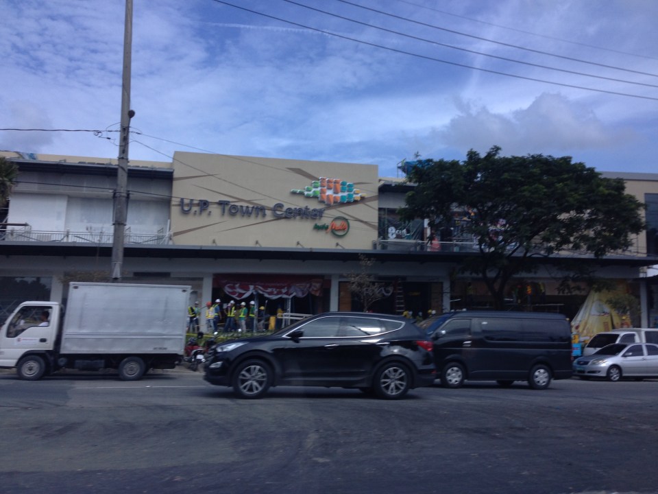
 No driveways or bays for public transport? Construction work continues for the soon to open UP Town Center even as the fences are taken down to reveal a modern building that will host restaurants and shops.
 The UP Town Center is already attracting traffic as some restaurants and shops have already made “soft” openings.
A colleague once made the comment that the Town Center was not really for UP but, like the Alabang Town Center, was for the posh residential subdivisions in the area. These include nearby La Vista, Loyola Grand Villas and Ayala Heights subdivisions. Also, it will likely attract more car users than public transport users as locator restaurants and shops are mainly upper-middle to upper class. There are no Jollibees, Chowkings or McDos here. For now, the developer and UP Diliman deserves to be given the benefit of the doubt in as far as the development’s design is concerned. Perhaps the issues I mentioned above will be addressed once the entire area leased to Ayala would have been fully developed. And until then, there would be opportunities to check and ascertain if the development is indeed people friendly and something that can be called a university town center and not just another commercial development that attracts traffic.
–
Floods and traffic
Transport and traffic problems take a backseat to the flooding problem during this time of the year in the Philippines. Since there are practically only two seasons (dry and wet) in the country, floods become a genuine concern once monsoon rains arrive and these are usually complicated by a high frequency of typhoons between August and November. Many major roads in Metro Manila are prone to flooding including Espana Avenue, Araneta Avenue, Gil Fernando Avenue, Ortigas Avenue, and EDSA. Flash floods often lead to traffic congestion and commuters and motorists alike would have a hell of a time traveling yet it seems very little has been done to address a situation that’s been here since the Spanish period. This is a perception by many people and a reasonable one given the historical evidence of flooding in the area and elsewhere in the country.
 Pedicab ferrying passengers in a flooded residential area
There are many images on the current floods in Mega Manila that one can find in various reports online and on TV. The Telegraph provides good photos for describing the situation around Metro Manila and the surrounding areas, and especially in the low-lying areas like Marikina, Malabon, Rodriguez and Cainta. These images could have been taken in any other year in the past and the images would probably be the same with slight changes in some buildings that could have been improved (e.g., additional floor?) in response to the flood experience.
Floods and possible solutions have been the topics of discussions every year and usually during this rainy season. While there have been efforts to address this problem, these are usually and obviously not enough and a more comprehensive approach is needed. Quite obviously, too, solutions that tend to dig up faults in urban planning throughout Metro Manila have led nowhere as legitimate residents and other locators in these areas are not in a position to give up their properties just like that. Relocating informal settlers and others who have encroached from waterways and other critical areas is a start but will have limited impacts in part because Mega Manila does not have a good drainage system in the first place.
Expensive as they are, engineering solutions like perhaps what Tokyo has done in this underground wonder. Of course, this example is a kind of ultimate solution and would require tremendous resources to realize. But then this is also like the transport and traffic problems we are experiencing where years (or decades) of inaction and hesitation due to resource and technical questions have led to the despicable transportation we have now The reality is that solutions will not get cheaper as we continue to balk at the cost of the required solutions. Floods and traffic will not be solved overnight. It will take years to improve the lives of many people in flood prone areas and implementing solutions should have started yesterday.
