
Home » Posts tagged 'roads' (Page 2)
Tag Archives: roads
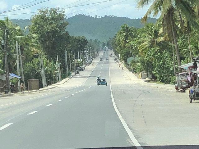
Are roads really designed just for cars?
The answer is no. Roads were and are built as basic infrastructure for transport no matter what the mode. However, the standards for dimensions (i.e., number of lanes, widths, etc.) are based on the motor vehicle capacity, and structural standards (i.e., thickness, strength, reinforcement, etc.) are based on the weights they are supposed to carry over their economic lives. The pavement load as it is referred to is usually based on the cumulative heavy vehicle traffic converted in terms of the equivalent standard or single axles or ESA. An ESA is 18,000 pounds or 18 kips in the English system of measurements or 8.2 metric tons in the Metric system.
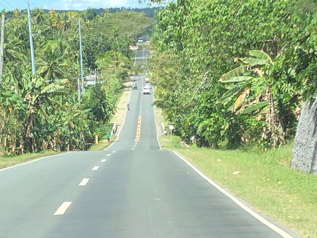
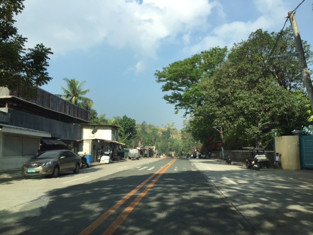
 A typical local road – is it really just for cars or is it also for walking and cycling? Or perhaps animal drawn transport?
A colleague says many of the posts in social media pitting bicycles with cars are already quite OA (overacting). I tend to agree as I read how people generalize roads being car-centric. Roads have been built basically to serve a avenues for transportation. They were improved over time in order to have more efficient ways to travel by land. It didn’t hurt that vehicle technology also developed over time and bicycles somehow became less popular than the cars and motorcycles. The motorcycle itself evolved from bicycles so in a way, it is the evolved and mechanized form of the two-wheeler.
In a perfect world, people would be sharing the road space and it would be equitable among different users. In a perfect world perhaps, it won’t be car-centric as there would probably be better public transport options and transit will be efficient, reliable, comfortable and convenient to use.
The reality, however, is that we do not live in a perfect world and transformations like the ones being pitched on social media are nice but are also not as inclusive and equitable as their advocates claim them to be. I’ve always said and written that you cannot simply change transportation without also implementing changes in land use and housing in particular.
Why do we need wide roads connecting suburbs and urban areas? Why is there sprawl? Why do people live in the periphery of CBDs or the metropolis? It is not just about transport though it seems easier to focus on this. Even transportation in Japan, with Metropolitan Tokyo and its equivalent of NCR plus as a subject, needs to be properly contextualized for land use and transport interaction and development. It seems that even with a comprehensive and efficient railway network, there are still shortcomings here and there. We don’t have such a railway network (yet) so we need to find ways for easing the currently long and painful commutes many people experience on a daily basis. That means continued dependence on road-based transport and trying to implement programs and schemes to improve operations.
–
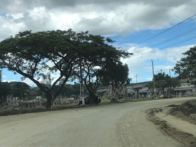
Post-typhoon BFCT and SM Marikina area
Still on the aftermath of Typhoon Ulysses (Vamco) though this is already a late post about it, here are some photos at the river banks level on the side of SM Marikina and the vicinity of the transport terminal constructed and operated by the former MMDA Chair and Marikina Mayor’s company. The area is basically a flood plain and in other countries would not have been suitable for building. Rather, these are often used as open spaces like parks, football fields or baseball diamonds, among other possible uses.
 There were garbage and mud everywhere. By the time I passed by, the mud had dried up and turned into fine dust that blanketed the area.
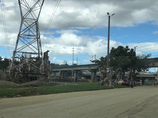 Trash were everywhere and you can see how deep the water was by the garbage still on the power line towers and the trees.
 Underpass leading to SM Marikina – bulldozers and payloaders were busy moving mud and garbage to clear the roads. There were no signs of the work in progress so I ended up making a U-turn seeing the way to SM’s parking was blocked by mud and debris.
 On the way back to Marcos Highway, you can see the large trees that were transferred to this area from Katipunan Avenue (when it was widened by way of removing the service road to give way to the MMDA’s U-turn scheme). It is heartening to know these survived the river’s onslaught.
–
Paved paradise? On pollution due to asphalt roads and parking lots
Here’s another quick share of an article mainly about asphalt as a material used for roads, parking lots and roofs:
Pullano, N. (2020) “Sun-heated streets can lead to air pollution strikes – study”, Inverse, https://www.inverse.com/science/summer-streets-beat-the-heat?link_uid=15&utm_campaign=inverse-daily-2020-09-03&utm_medium=inverse&utm_source=newsletter [Last accessed: 9/6/2020]
While we have a significant number of roads with asphalt paving or surfacing, the majority of roads are of Portland cement concrete (PCC). Most lots are also PCC or gravel. And unlike in the US, most roofs here are made of galvanized iron (GI) sheets or even clay tiles.
–
A little bit of history – on how the US interstate highway system came to be
Here’s one of those quick shares that I usually post here. I am a bit of a history buff and mixing that with transport will likely lead to a post like this. Here is a short article about an event in the history of the US Army that happened 100 years ago:
editor@aashto.org (2019) Celebrating Highway History: The US Army’s 1919 Cross-Country Convoy, aashto.org, https://aashtojournal.org/2019/07/12/celebrating-highway-history-the-u-s-armys-1919-cross-country-convoy/ [Last accessed: July 12, 2019]
The article was particularly interesting for me because of two items: the road conditions and the man behind the US inter-state highway system. It took them a little over 2 months to cross the continental US because of poor road conditions. Many people have no sense of history and appreciation of what has been accomplished over the years and how difficult it was to travel at the time. I haven’t done the cross country trip but I have close friends who’ve done it and are thankful for the generally good roads they could use for the experiential road trip. Meanwhile, the person in the article – then Lt. Col. Dwight D. Eisenhower – is a man who made his mark in history at first as the Supreme Commander of the Allied forces in the European Theater in World War 2, who would later on become President of the US. I read elsewhere that the US interstate highway system was designed so aircraft may use them as runways in cases when the US were at war and the enemy had bombed their airports and airfields (just like what the Japanese did in the Pacific).
Do we have similar accounts for our roads and bridges in the Philippines? Were there key persons who may or may not be larger than life figures instrumental in developing our road infrastructure with their vision and leadership (Marcos doesn’t count because of his bogus military record and corrupt regime)? It would be nice to compile these and perhaps it should be a collaboration between the Department of Public Works and Highways (DPWH) and the National Historical Commission (NHC). They could even get the history departments of local universities involved for us to understand the evolution of transportation in this country.
–
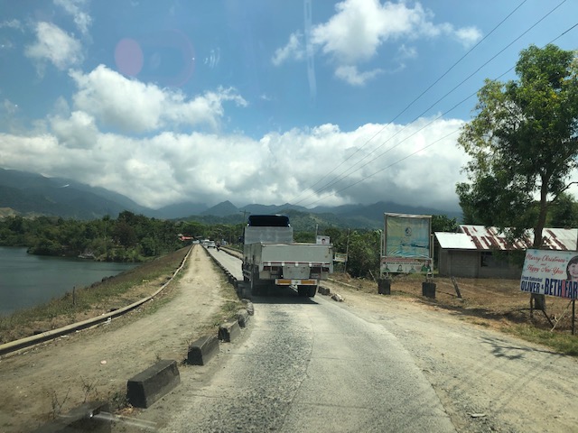
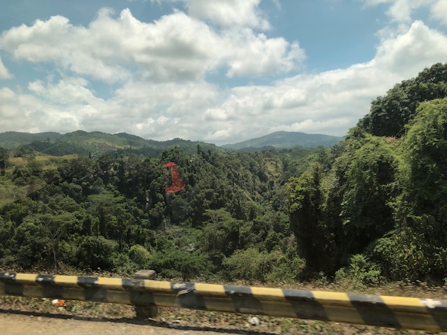
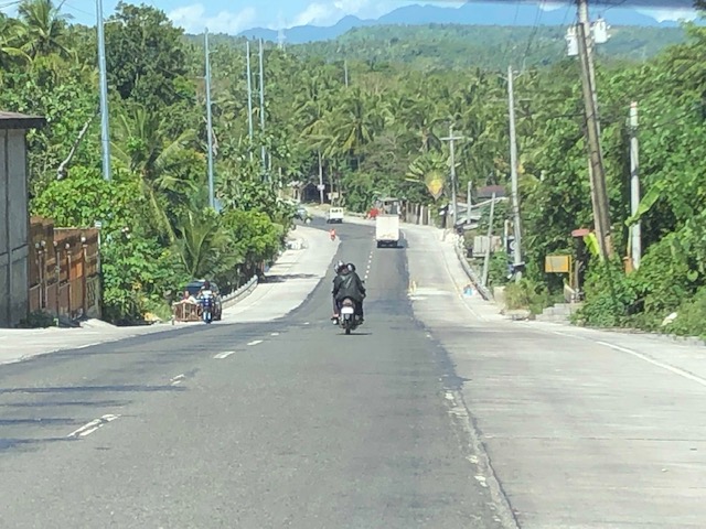
Reservoir roads – Part 2
Previously, I posted about the reservoir roads we crossed when we traveled to Baler, Aurora last April 2019. It’s been a while since that post so before I forget, here are more photos of those reservoir roads taken during our return trip from Baler.
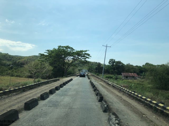
 The two lane highway becomes a single lane section at the Diayo River Reservoir road
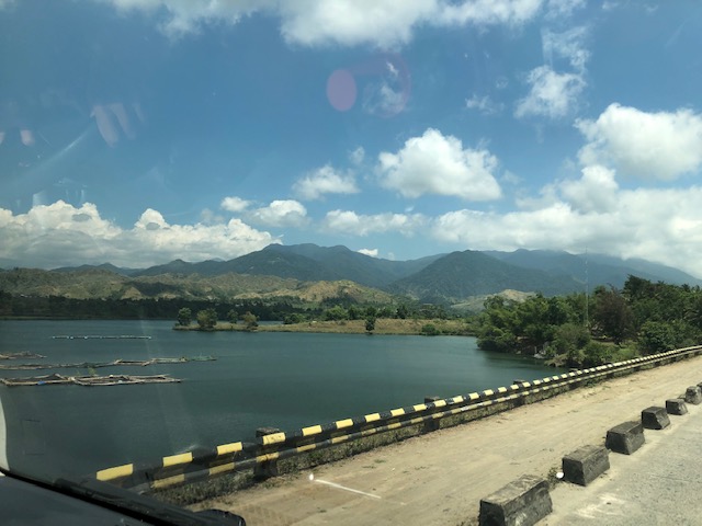
 A view of the fish pens at the Diayo River reservoir
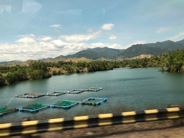 Pristine waters with the Sierra Madre mountain range in the background
 Approaching the end of the Diayo reservoir road
 There is a checkpoint at the 2-lane section bridging the Diayo reservoir road with the Canili River reservoir road
 Vehicles entering the Canili reservoir road – this again is a one-lane, one-way section where vehicles from either direction would have to give way to either.
 Shoulder and fish pens
 Waters of the Canili River Reservoir with the Sierra Madre mountains in the background
 Fishermen on a banca – they looked like they were inspecting their fish pens
–
Reservoir roads – Part 1
I remember posting about “submersible bridges”, dike roads and the like. There were two roads atop 2 dams that were part of 2 reservoirs in : the Canili River Reservoir and the Diayo River Reservoir, which are dwarfed by the much larger Pantabangan reservoir and dam nearby. These two reservoirs are at the border of Nueva Vizcaya (Alfonso Castaneda) and Isabela (Maria Aurora), which also happens to be the border of Regions 2 and 3 (Cagayan Valley and Central Luzon, respectively). Here are photos of the roads atop the dams that are part of the Pantabangan-Baler Road.
 Vehicles may only pass a single lane with shoulders on either side of the lane. And so there are people posted at either ends of the sections to manage the one-way traffic.
 The reservoir is visible on the left side of the photo
 Forested area and ravine on the right side
 Some fish pens on the Canili reservoir side
 A view of the east end of the Canili reservoir road where westbound vehicles await their turn to traverse the section.
 The eastern end of the Canili reservoir road
 There’s a short two-lane segment between the Canili and Diayo reservoir roads
 Traveling along the Diayo reservoir road
 Fish pens at the Diayo Reservoir
 The other side of the dam
 The eastern end on the Diayo reservoir road where the single lane road transitions into a 2-lane road.
More photos in Part 2…soon.
–
Vertical curves along the Pan Philippine Highway
We start the month of March with a compilation of photos of vertical curves (mostly sags). These were taken along the Andaya Highway, which serves as the main bypass road in Camarines that allows travellers to bypass, for example, Daet.


These photos do not have captions and I leave it to my readers to have an appreciation of the features of these sections. These include wide carriageways with paved shoulders. There are also sections that have no shoulders. For most photos, the pavement appears to be in good condition. However, the same cannot be said for much of the highway, sections of which are being rehabilitated along with several bridges.
–
Newly opened sections of C-6
I have been wanting to post these photos of the newer sections of Circumferential Road 6. The section was constructed months ago and is part of a project that seeks to widen the current stretch of C-6 from Taguig (Lower Bicutan) to Pasig (Napindan) from the old 2-lane, 2-way road into a 4-lane, divided road. The new section opened to general traffic along the southbound side (to Taytay) and has improved traffic along the section that’s provided people from Rizal an alternative route to Makati and BGC through Taguig. Only, light vehicles are allowed along the new section and trucks and other heavy vehicles take the old road, which is quite battered by the traffic. Only one lane is currently available as there are barriers along the section as shown in the following photos. Traveling along the section also afford people a nice view of the Laguna de Bay to the right.


–
Pinagmisahan Street, Antipolo City
A couple of weeks ago, traffic had to be rerouted from a section of the city’s Circumferential Road (also known as the Sen. Lorenzo Sumulong Memorial Circle) between the intersection with Taktak Road and Pinagmisahan Street to Pinagmisahan Street. This was due to the preventive maintenance work that had to be done to the pavement. As such travelers including myself had to use Pinagmisahan to travel between Sumulong Highway and Ortigas Ave. Extension. It was not my first time along Pinagmisahan but it was my first to traverse the road from end to end. Following are photos showing sections of Pinagmisahan Street from the Clinica Antipolo end to the Daang Bakal end (i.e., northbound).
 Pinagmisahan Street on the left with ‘No Entry’ signs for the Circumferential Road section being maintained.
 On a typical weekday, there are many school service vehicles parked along the road. Many of these are for the Montessori school across from Clinica Antipolo, which does not have sufficient parking for vehicles it attracts.
 Pinagmisahan used to be a narrow 2-lane road. It has been expanded recently into a 4-lane road with Portland Cement Concrete Pavement (PCCP).
 While the expansion included the construction of sidewalks, many electric posts remain in their original positions and pose safety hazards to motorists.
 White Cross, which is a popular destination during the Lenten Season and especially during the Holy Week is accessible via this road.
 There appears to be many informal settlers living in communities along the road. They have encroached on the RROW and hamper the completion of the expansion of the road.
 I think this part of the road is practically the highest in terms of elevation. There should be a good view of the surrounding areas including the city center and Hinulugang Taktak from this area.
 Another section of Pinagmisahan showing informal settlers
 Curved downward section towards Daang Bakal and Taktak Road – the fence on the left is for Fairmont Subdivision.
 Straight section approaching Daang Bakal
 Approach to intersection with Daang Bakal – the other lanes of the road is used as parking for visitors of Hinulugang Taktak
 Daang Bakal with Hinulugang Taktak on the left
I’m featuring Pinagmisahan here as I thought its timely given a lot of people will be using it this Holy Week to go to White Cross, which has life-size images for the Stations of the Cross.
–
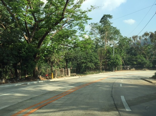
Road widening along Sumulong Highway
Sumulong Highway is the main road connecting Antipolo City with Marikina City and ultimately to Cainta, Pasig and Quezon City via Marcos Highway. It is basically a 4-lane, 2-way undivided road with several sections that have 3 lanes total probably due to ROW acquisition issues when the highway was widened from the original 2-lane road. I came back from a trip recently to find road works along my commute and took some photos of what would definitely be an improvement to the highway. The uneven number of lanes along several sections of Sumulong has led to road crashes and surely many near misses among motorists and cyclists using the highway. There is also a need to provide space for pedestrians and others on foot considering the highway is one of the major routes to the Shrine of Our Lady of Peace and Good Voyage – a major pilgrimage site for Filipinos.
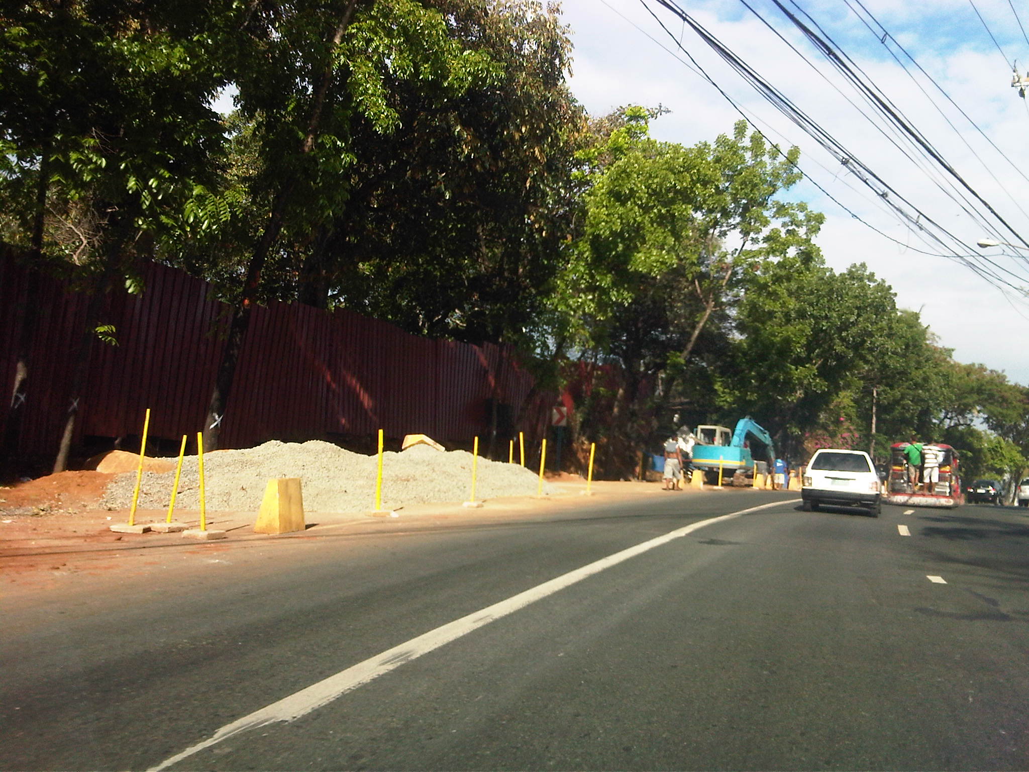 Road widening for an additional lane along the inbound lane approaching Sumulong’s intersection with Olalia Road
 Construction along the inbound direction of Sumulong Highway include drainage works aside from the construction of an additional lane to make the number of lanes even (2 per direction). At present, there are 2 lanes along the outbound direction and a single lane (shown clearly in the photo) along the inbound lane. The section shown is near the Garden of Gethsemane and Palos Verdes subdivision.
 Completed lane, drainage and sidewalk along the outbound direction of Sumulong Highway right after Metro View subdivision.
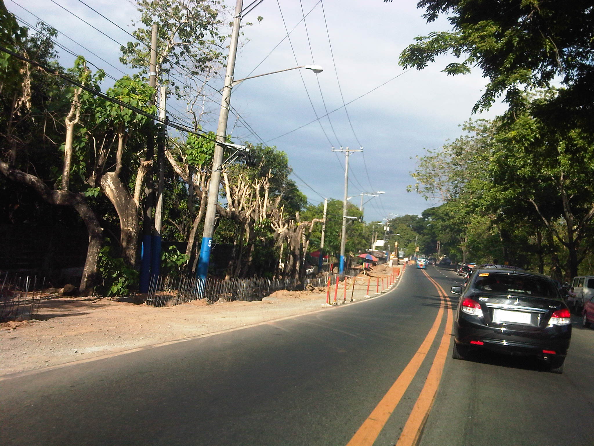
 Widening along the outbound direction between Metro View and Valley Golf includes drainage works. There will be a sidewalk on top of the drainage that should enhance safety for walking/trekking.
 There are many informal settlers as well as formal ones encroaching on the RROW. Part of the project is to remove these and other obstructions. I just hope that the sidewalks and the curbside lane will remain clear of obstructions.
The completion of the road widening project is expected to improve the flow of traffic along Sumulong Highway as there will be a continuous 2 lanes available along either direction for safe and effective passing. The additional lane also means public transport may stop along the roadside without blocking through traffic. Trucks and slow moving vehicles (tricycles?) may also be required to take a designated lane. Moreover, since there is a significant volume of bicycle users along Sumulong Highway, there will be enough safe space for them to travel. The current volume of motorised vehicle traffic along the highway requires only 1 lane per direction (2 lanes total) and these are the innermost lanes of the road. Traffic slows down usually because of trucks or tricycle operations/maneuvers. In theory, the 2 outer lanes can be used only for overtaking, stopping and cycling. These should be clear of parked vehicles particularly along areas where there are communities and businesses (e.g., vulcanising, auto repair shops, etc.) along the roadside.
–
