
Home » Posts tagged 'Taytay' (Page 3)
Tag Archives: Taytay
On the severity of traffic congestion along Ortigas Avenue and the necessity of a mass transit line
With the worsening congestion along Marcos Highway due to the construction of the LRT Line 2 Extension to Masinag, I have been using Ortigas Avenue as an alternate route to go home. Granted, the stretch from the Park Place gate near Cainta Junction and Brookside is currently undergoing roadworks elevating that entire section (which is prone to flooding), and this is the main cause of much congestion as fewer lanes are usable to traffic. However, what is perceived to be relief from traffic once the project is completed will eventually and surely revert to a very congested Ortigas Avenue.
Traffic congestion along Ortigas Extension is primarily due to a dependence on road transport, particularly private vehicles, by people living along Ortigas Ave. and the roads feeding into it. The Manila East Road, for example, passes through the most populous towns of Rizal outside of Antipolo City. The dependence on road transport (especially private vehicles) is due to limited options for public transport. There are buses, jeepneys and UV Express but these, too, contribute to congestion due to their increased numbers and limited capacities given the high demand for public transport. Among the infrastructure proposed along this corridor is an overpass along Ortigas Ave. at Cainta Junction. A mass transit system has also been required along this corridor for a very long time but for some reason, such infrastructure has not been provided.
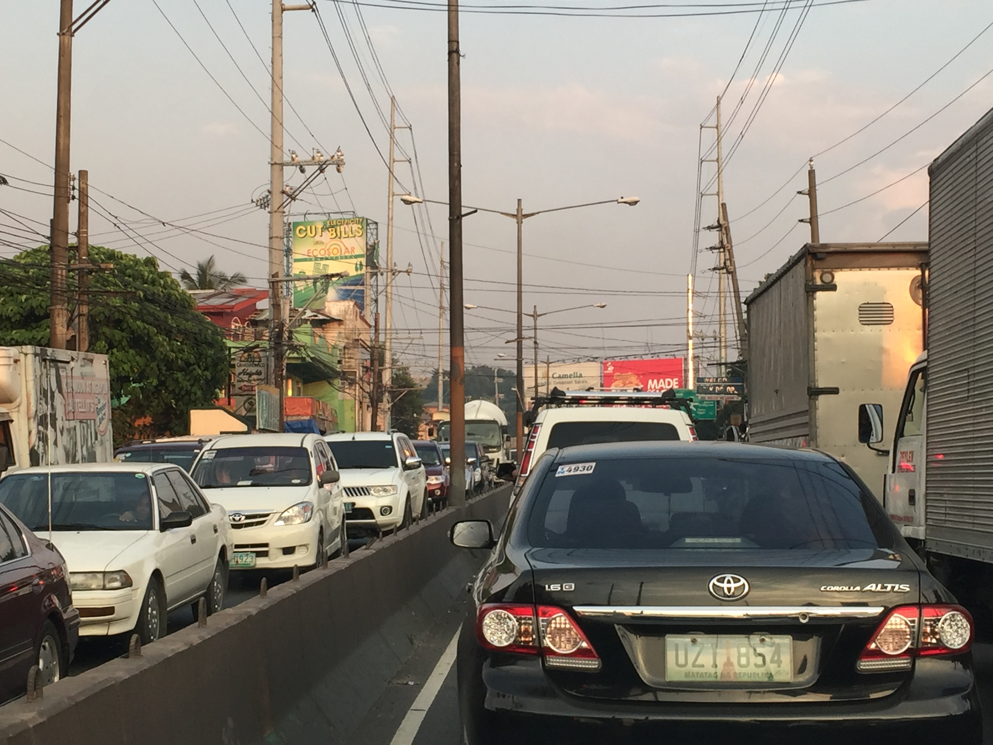 Severe traffic congestion along both directions of Ortigas Avenue Extension
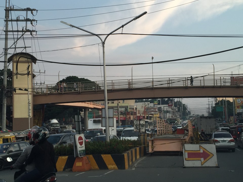 Congestion stretches all the way along the Manila East Road
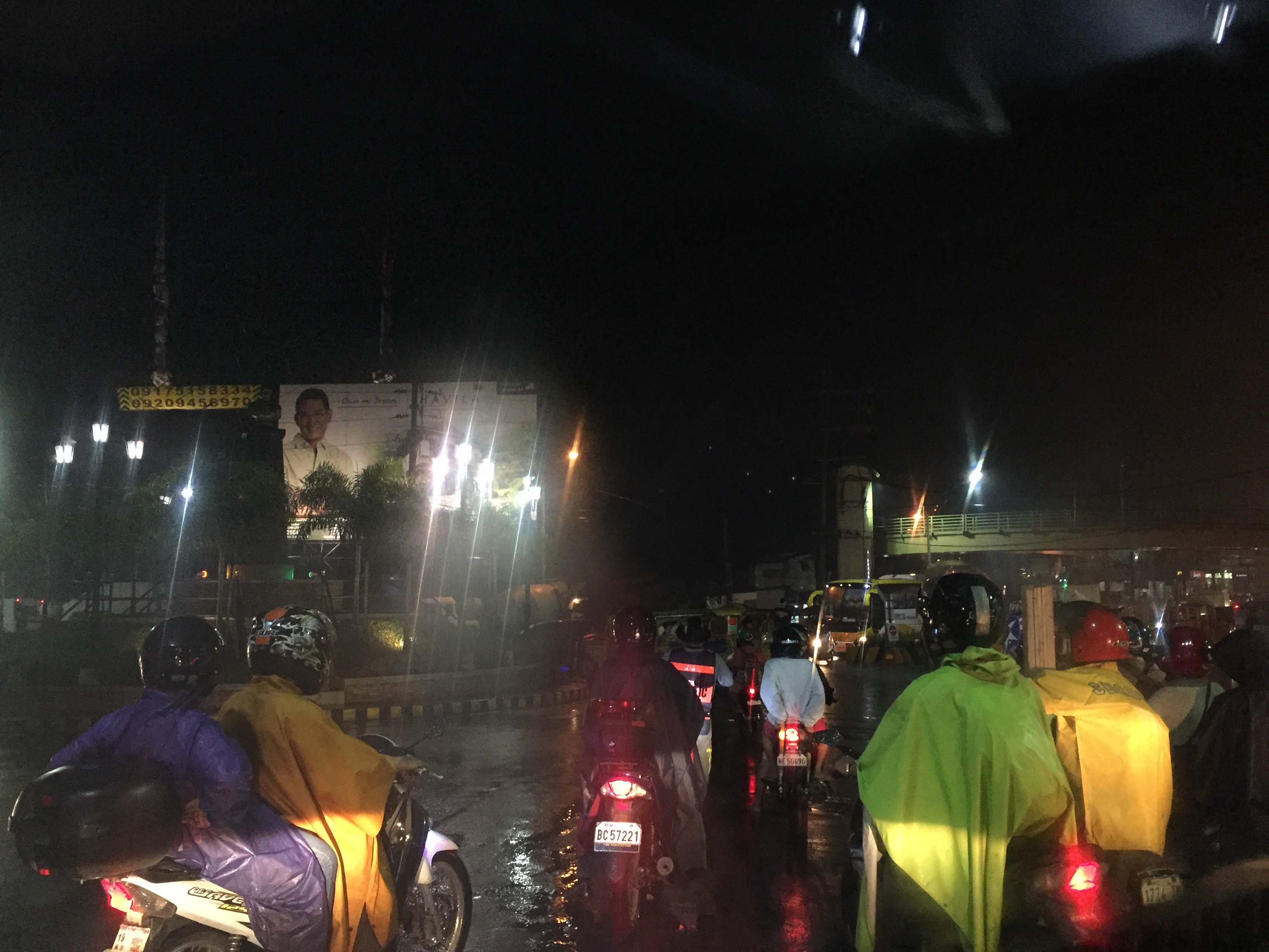 Night-time traffic congestion at the Tikling Junction
There is a proposal for a mass transit system along this corridor. Following are references to the project:
From the PPP Centre: https://ppp.gov.ph/?ppp_projects=ortigas-taytay-lrt-line-4-project
From CNN Philippines: http://cnnphilippines.com/metro/2015/07/22/neda-approves-naia-lrt-ppp-projects.html
I found it quite odd that the stations are not referenced according to the more common place names for the locations. For example, ‘Bonifacio Avenue’ should be ‘Cainta Junction’ and ‘Leonard Wood’ should be ‘Kaytikling Junction’. Nevertheless, this is the least of our concerns pertaining to transport and traffic along this corridor.
Perhaps the conditions are ripe now to finally implement transport infrastructure projects along this corridor. The proposal and approval of a rail transit line by NEDA means the corridor has the national government’s attention. The local government leaders along this corridor are also more progressive and aggressive than their predecessors. These include a very dynamic mayor in Cainta and the former governor-turned mayor in Antipolo. A collaboration towards better transport among these two LGUs alone would be influential and instrumental to improving travel along Ortigas Avenue.
–
Proposals for EDSA and some alternate roads
The hellish traffic congestion along EDSA and other roads in Metro Manila spawned a bunch of ideas for alleviating congestion. Among those that were offered as solutions are the following:
- Odd-Even Scheme – suggested by the Philippines President himself in a speech delivered in Mandaluyong City
- Car-pooling (and HOV lanes) – suggested by the DPWH Secretary in another forum
- Bus Rapid Transit (BRT) and/or express bus – proposed and being studied by the DOTC
What seems to have been forgotten was a proposal to have two lanes of EDSA, one on either direction, devoted to bicycles. This proposal now seems to be the most viable compared to the above three and could have the potential for major behaviour change towards a departure from motor vehicle use. Cycling along with walking does not require fuel and these modes also promote healthy lifestyles. Also, this could become the ultimate example for road diets, which can also be applied along other roads as well. What sounds or reads like an outrageous idea (i.e., bicycle lanes along EDSA) might just be revolutionary and result in what could be a tipping point for sustainable transport in the midst of traffic mayhem.
EDSA has become the proverbial battleground representing the war with traffic congestion. However, EDSA is just one part of our arterial network comprised of circumferential and radial roads. There is also C-5 (also known for its sections – Katipunan, E. Rodriguez, C.P. Garcia), which is also a very congested road but along which there are few fixed route public transport services. It is a primary alternative route (to EDSA)for people traveling between the northern and southern halves of Metro Manila. It also serves as a collector and distributor, being connected with major radial roads like Aurora Boulevard, Ortigas Avenue and Shaw Boulevard as well as to the South Luzon Expressway. C-5 is a major truck route, however, and so carries a lot of heavy vehicles during the permitted times under the truck ban scheme being implemented in Metro Manila. C-5 is already ripe for a mass transit system and should have one along it. The quickest to put up would be a bus system on exclusive lanes. Strategically though, a rail transit line (likely elevated) should already be planned and implemented and with as seamless as possible connections to current and future lines along major corridors.
There are other routes that can be considered which I think have been overlooked (too much focus on EDSA?). C-6, for example, badly needs to be improved and this has started but is being implemented at a slow pace. This could have significant positive impacts on traffic coming from the east (towns of Rizal province) that are bound primarily for Makati and BGC. But then there also has to be a good road bypassing the narrow and already congested streets of Taguig and Pateros that are currently the only roads connecting C-5 and C-6. The roads on the Rizal side (attention: Cainta and Taytay) also need to be improved including Highway 2000 and the Barkadahan Bridge. Perhaps the Rizal Provincial Government should also get involved in this as such routes are in the best interest of Rizalenos. And then there is also the highly urbanized city of Antipolo that is a major destination and already is the 7th most populous city in the country, whose residents also use this route, which is often a faster option to Ortigas and C-5 despite the poor conditions of roads.
–
Causes of congestion along Ortigas Ave. Extension
I have written about the common causes of congestion along Ortigas Avenue. The past articles mentioned the undisciplined loading and unloading along the entire stretch of the road and particularly at either ends of the Manggahan Floodway bridge in Pasig City. I have also written about the congestion caused by private vehicles generated by a private school just a stone’ throw away from DOTC headquarters. This time, I focus on Ortigas Avenue Extension, particularly the stretch from Cainta Junction to Valley Golf.
The current and more critical choke points along Ortigas Ave. Ext. are along the stretch of the road between Cainta Junction and Valley Golf. These are due to the road and drainage works along that section that effectively made the westbound side of Ortigas a single lane road between Brookside and Park Place. There are also road and drainage works along the eastbound side between Brookside and Valley Golf where the entire road section is being elevated. This section is flood prone and has been problematic during the wet season when heavy rains often result in flash floods.
 Counter flow along Ortigas Avenue Extension – this scheme has been the only option for the section between Valley Golf and Park Place Subdivision as the work proceeds one lane at a time. At the time, I took this photo, the counter flow lanes allowed for 2 lanes each for both the eastbound and westbound directions of this corridor. The past week, however, I noticed that during the afternoons and evenings, I noticed that two lanes were allocated for westbound traffic while only one was for the eastbound direction. This should not be the case as the peak direction in the afternoon to the evening is eastbound when people are home bound mainly from work and school.
 The section across from STI is another choke point as the area is one of the ends of the project raising the elevation of the avenue as well as improving the drainage along the road. The traffic along this area has improved much though vehicles still have to slow down to transition between the old pavement and new pavement sections, as well as vehicles turning towards Hunters ROTC Road.
 Unfinished sections – at the time this photo was taken, work along the site was intermittent. Commuters making the observation are often frustrated and much disappointed when they see none working along the construction site. The Mayor of Cainta did very well by talking to the contractor and apparently discussing with the latter how to improve traffic conditions as well as how to expedite the implementation of the project. My own observation was that conditions did indeed improve after that meeting (which was related by the Mayor in his Facebook page) and people could see workers busy with the project even at night time.
Traffic will continue to be bad along Ortigas Avenue Extension until this project is completed. While there should be some significant improvement in traffic flow after completion, congestion will again steadily worsen for this corridor whose private vehicle traffic continues to grow. Public transport is provided by buses, jeepneys and UV Express (whose numbers have ballooned during the last 5 years) and these have contributed a lot to congestion because of their drivers’ behavior particularly when they stop for passengers at areas like Valley Golf, Brookside, Cainta Junction, Ever, Countryside, Manggahan and Rosario.
There is hope though as news proclaim that the NEDA Board has approved the LRT 4 project along this corridor. A mass transit system is indeed necessary and this was required perhaps over a decade ago already. I do hope that this ‘LRT’ is more like the current Line 2 trains and stations than the Line 3 kind. Line 2 is a heavy rail system while Line 3 is light rail. The Ortigas corridor requires a heavy rail system considering the passenger demand in the areas that will be served by the transit system. I also hope that Line 4 is implemented like Line 2 with the government taking responsibility for constructing the system. I have maintained my view that the current administration is too fixated with Public Private Partnerships (PPP) that it had practically given up its responsibility to the general public to provide an efficient and equitable means of public transport for commuting. I just now wonder what became of the proposed BRT line along this same corridor. Perhaps the BRT option has already been abandoned by the DOTC in favor of rail?
–
Alternative to Highway 2000, Taytay, Rizal – Part 2
The stretch of Don Hilario Cruz Avenue between Megawide and the Manila East Road is paved and generally wider than Highway 2000. While there are residential villages along this stretch as well as a significant traffic generator in Club Manila East, which is a resort, traffic is usually light. There are actually few establishments and informal settlements along the road, which retains its exclusive subdivision feel.
 Section in front of Club Manila East
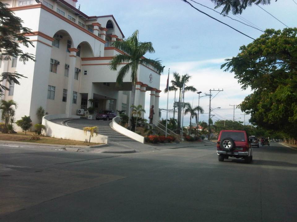 Taytay (Rizal) Municipal Hall – the Land Transport Franchising and Regulatory Board (LTFRB) office is just beside the municipal hall and often you could see taxis lined up along this road to have their meters calibrated and sealed.
 This entire area used to be an exclusive subdivision and Don Hilario Cruz Ave. was a private road. The old guardhouses are still there and heavy vehicles may not use this road without paying a toll fee.
 On-street parking is prevalent along the section connecting to the Manila East Road because of the clothes/garments market on either side of the road. Taytay, Rizal is well-known for its garments factories and tailors.
 Section approaching the Manila East Road
The only setback when traveling using this alternate route to Highway 2000 is that stretch beside Megawide. It very dusty during the dry season and muddy during the wet season. The road can be quite rough and will damage cars over time. You definitely cannot speed up along this section even if you are on an SUV and are familiar with the bumps along the road. Hopefully, the Taytay could address this issue and the Rizal Provincial government can also facilitate the paving of this section, which is used by many Rizalenos heading to work or school in Metro Manila.
–
Alternative to Highway 2000, Taytay, Rizal – Part 1
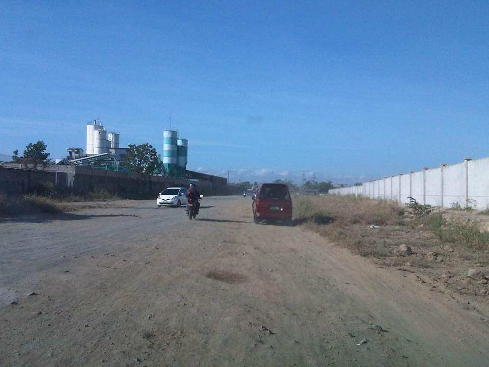
An alternate route to the poorly maintained Highway 2000 in Taytay, Rizal that leads to Barkadahan Bridge and Circumferential Road 6 (C-6) is via Don Hilario Cruz Avenue, along which is the new Taytay Municipal Hall, the Land Transportation Office in Taytay, and Club Manila East. While most of Don Hilario Cruz is paved, there is a significant section that remains unpaved. It is very dusty during the dry season and muddy during the wet season.
 The road section is unpaved but appears to be graded (probably by the tires of all the vehicles using it everyday). The wall on the right is Megawide’s. Megawide is a major contractor.
 Motorcycles are the fastest along these types of roads. Other vehicles including trucks need to slow down so their suspensions will not be damaged by the rough road.
 I have wondered whether Megawide has considered contributing to paving the road considering their stature in the construction industry. This can be their CSR project and one where a lot of people will be very appreciative with the results.
 Intersection with Velasquez Street, which connects to the Manggahan East Service Road to the north and the Manila East Road to the south.
–
All roads lead to Antipolo: rerouting for the Alay Lakad
The Rizal Provincial Government and the Antipolo City Government recently posted traffic rerouting schemes on their Facebook pages. Lalawigan ng Rizal was the first to post schemes that affect traffic in at least 3 major local government jurisdictions – Antipolo, Cainta and Taytay. The schemes affect the two major corridors that basically lead to Antipolo’s National Shrine of Our Lady of Peace and Good Voyage (or Antipolo Cathedral to many) – the Ortigas Avenue corridor and the Marcos Highway-Sumulong Highway corridor. There are many major and minor routes connecting to these corridors and are clearly seen in the maps.
Within Antipolo, there are also re-routing schemes, which the Antipolo City Government posted along with a “clearer” re-posting of the maps from the Rizal FB page. The Antipolo FB page includes information/maps on the rerouting within the city center. These schemes will affect traffic circulation including public transport routes. Critical would be the permanent and temporary terminals and parking areas set-up around the city that should be able to accommodate the thousands of vehicles that are also expected to be used by people who won’t be walking or cycling.
What the maps basically say is that from 4:00 PM today, Maundy Thursday, to 6:00 AM tomorrow, Good Friday, the stretch from Cainta Junction to the Shrine will be closed to traffic. This is to allow the hundreds of thousands expected to make the trek to Antipolo to have the road for themselves. What the maps don’t say is that motorcycles and tricycles would likely be allowed, too. I can understand that motorcycles could easily squeeze into the throngs of people but then allowing tricycles to operate among the walkers and bikers would be risky given their drivers’ behavior. Add to this that they would be making a killing out of charging opportunistic fares.
Technically, the rerouting schemes don’t appear to be as well thought of as can be expected from the LGUs. Baka ito lang nakayanan ng staff o ng consultants nila, and surrender na agad ang Rizal and Antipolo with regards to the coming up with more options for people to travel to the Antipolo Shrine? Not all people can walk or cycle but are willing to an could take public transport for their pilgrimage. The maps themselves are a bit crude and the Province of Rizal and City of Antipolo could have done much better maps given the resources of these LGUs. There are open source tools now available as well as your basic software like PowerPoint or Photoshop (even Word!) that can be used to render good quality images to guide people making the Alay Lakad. This is a regular event and though it happens once a year then perhaps the LGUs could have better plans especially to transport people who cannot make the walk to Antipolo. The objective after all is to convey the masses to and from the shrine safely and efficiently – something a mass transport system can do whether via Marcos/Sumulong or Ortigas corridors.
One reminder to all doing the Alay Lakad: keep your garbage to yourselves if you cannot find a proper waste bin. Do not dispose of your waste along the route and make a dumpsite out of Ortigas Avenue, Marcos Highway, Sumulong Highway or whatever roads you are taking! Kasalanan din po ang irresponsableng pagtatapon ng basura. While you might be forgiven for these “sins” through the Sacrament of Reconciliation (which many will likely take at the Cathedral), nature will have a way of getting back at you for your environmental travesty. –
Repair C6 now!
The existing roads that comprise what has been designated as Circumferential Road 6 is an important link that serves as an alternate route for people and goods traveling between the eastern towns of Rizal province and Metro Manila to urban centres in Makati (Ayala CBD) and Taguig (Bonifacio Global City) as well as the southern areas of Metro Manila all the way to Laguna and Cavite. During the last dry season or summer, the roads conditions have been quite good such that travellers from Rizal could easily reach BGC or Makati in less than an hour give and take typical congestion during the peak periods.
The situation has significantly worsened since the onset of the wet season as the pavement quickly deteriorated with the combination of heavy rains and heavy vehicles utilising the road. Highway 2000 from Taytay, Rizal was already in bad condition during the summer so it became only worse once the rains came. However, it is the C6 segment from Pasig to Taguig that has deteriorated and is now in a state of disrepair. Following are photos that show how bad the conditions are and which have led to travel times worsening to more than double than what it should be if the roads were in good condition.
 Section in Taguig along the shores of Laguna de Bay where even large trucks avoid the deep holes along the road. These situations along C6 constrict traffic everyday.
 C6 section in Pasig City where what used to be asphalt is now a muddy mess.
 Another section in Pasig City where C6 passes through a relocation area (Lupang Arenda) where local traffic affects through traffic and C6 is probably at its narrowest.
The section from Pateros to Taguig was built as a road dike protecting these areas from floods brought about by the increasing level of Laguna de Bay during the wet season. While it is basically a secondary road compared to the other circumferential roads, traffic has significantly increased along C6 due to many people discovering that you can travel faster between Rizal and Makati or BGC via this road. Sadly, there seems to be little or no attention given to its current state.
I understand that the DPWH has a process for determining whether a road needs to be repaired and given limited resources, the agency also applies a process for prioritisation of road repairs (i.e., there are many other roads that also need repairs). However, there should be a way to allocate resources for the repairs of the road and this includes involving the LGUs whose constituents benefit from the use of the road. Rizal province and towns and Pasig City should take the initiative to find ways to improve the conditions along C6. It is also in the interest of Taguig to improve this road as many of its residents use it, too. Hopefully, the road will be repaired sooner rather than later and travel times will improve again. Of course, this should be the case whether or not the proposed C6 expressway is realised.
–
The need for mass transit to the east of Metro Manila
I wanted to use a title stating “the demand for mass transit to the east of Metro Manila” but the word “demand” for me seemed a bit technical (I associated it with the supply and demand concepts for transport.) and would need some numbers to support it. So I settled for the word “need” instead of “demand” so I could be flexible (i.e., more qualitative) with the way I wrote this article. “Need” is a more pedestrian term that can easily be understood and imagined, and there is no lack for images of this need for more efficient and higher capacity modes along the main corridors to the east of Metro Manila. The main corridors are Ortigas Avenue and Marcos Highway, which have the highest road capacities among other roads (i.e., higher capacities than A. Bonifacio Avenue in Marikina, the Batasan-San Mateo Road, or C-6/Highway 2000). These are also the corridors along which most public transport services may be found. Such connects the eastern towns (e.g., Cainta, Taytay, Antipolo, etc.) to the transport hubs of Cubao and Crossing, which are major transfer points for many people taking public transport. Of course, there are UV Express services from these eastern towns that go directly to CBDs like Makati and Ortigas.
You can observe the crowds at Katipunan and Santolan Stations of the LRT Line 2 as well as the people waiting for their ride home along Marcos Highway. I have observed that there are also lots of people along Ortigas Avenue from Tikling Junction to C-5 who religiously and patiently wait for their rides to school, office or home. This happens everyday and this regularity seems to be a never-ending sacrifice of time and patience. These people do not have much of a choice except taking whatever public transport is available to them. Many probably can afford to have a car or already have a vehicle in their household. Unfortunately, that vehicle is not usually enough for their commuting needs and so they are captive users of an inefficient public transport system (there are some who question if what we have can really be called a system).
 People waiting for a ride in front of Robinsons Metro East along Marcos Highway in Pasig City – these have occupied 3 lanes of the highway as they position themselves for the next available jeepney. There is a UV Express terminal at the mall and another at the nearby Sta. Lucia mall but these are not for the destinations these people are going to.
News that the LRT Line 2 Extension from Santolan to Masinag would finally be constructed was initially met with speculation. Such news have been circulating for so many years but no actual work could be seen along Marcos Highway to convince people that the project was underway. Now, that the soil test samplings have been completed, people are anxious about the actual construction of the extension. I think this is a project long overdue and the question that needs to be answered is if the line needs to be extended further, perhaps until Cogeo. I believe there is a tremendous market for this mass transit system along this corridor where a lot of residential subdivisions and relocation sites have sprouted over the years. The DPWH recognised this as a high capacity corridor and is already widening the road from Masinag to Cogeo.
Hopefully, the Ortigas Ave.-Manila East Road corridor can also have its own mass transit line. The regular bus services along this corridor is no longer sufficient and operations are not so efficient despite what appears as competition among 2 bus lines. There had been a Bus Rapid Transit (BRT) Line proposed for this corridor but there seems to be no progress towards the realisation of that project. Whichever of rail or BRT would be the option for the corridor though, it doesn’t take a genius or too many consultants to determine the need for a good mass transit line along this corridor. When that will be is a question with an answer that is still up in the air. Perhaps the local governments of Rizal, especially the province, should push for such transit systems. The governor and mayors should champion such systems that will definitely benefit their constituents and translate into real revenues for their LGUs from the certain business that will come along these corridors.
–
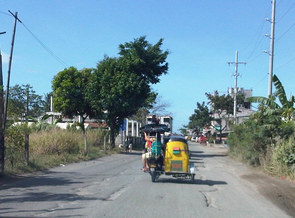
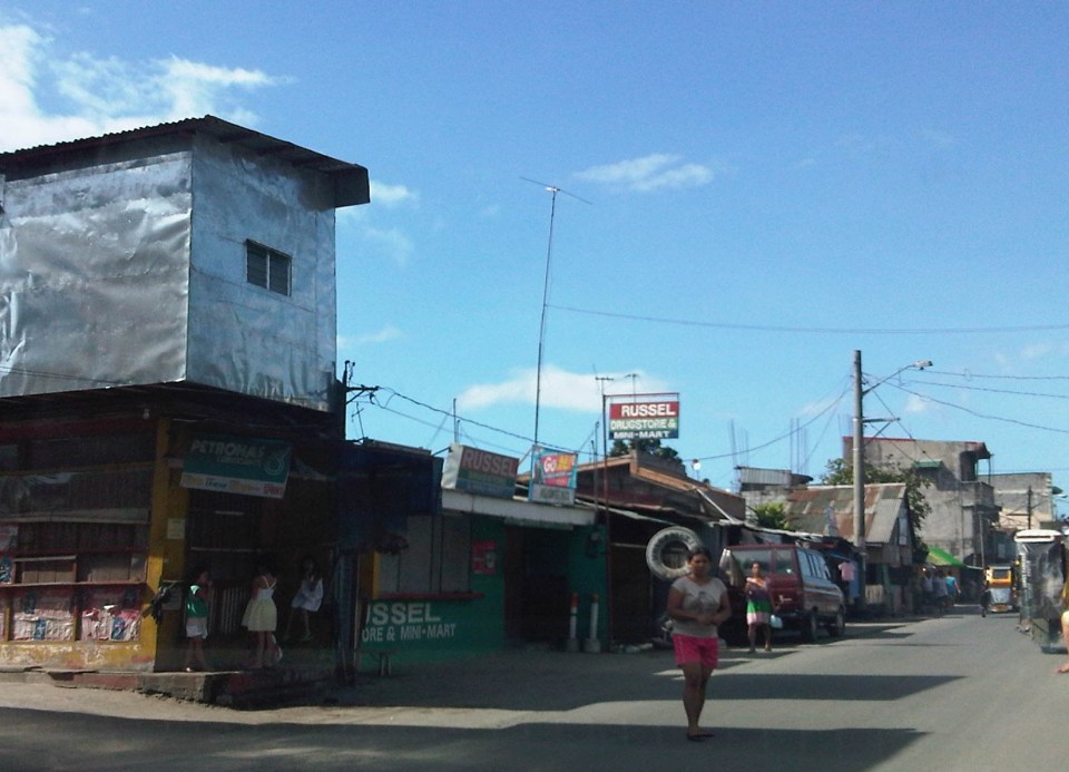
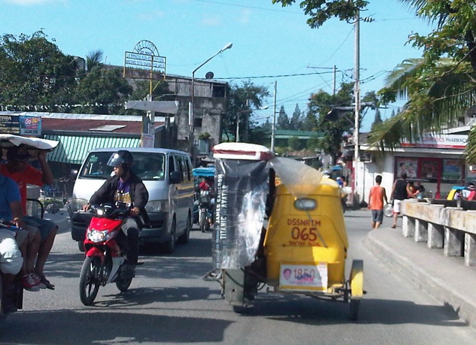
Highway 2000 and Barkadahan Bridge
There is an alternate route from the towns of Rizal Province to Taguig and Makati. The route will allow people to avoid the congested Ortigas Avenue, C-5 and EDSA, which is the typical route between the Makati CBD and Bonifacio Global City and the Rizal Province towns along Ortigas Avenue Extension and the Manila East Road including Cainta, Taytay, Antipolo, Angono and Binangonan. The alternate route utilizes a road that was constructed as part of a network of roads intended to encourage development in idle lands in Taytay that came out of the reclamation that was part of the Manggahan Floodway project.
 One-way section beside the Taytay Public Market
 Parts of the market were under renovation
 Past the market, Highway 2000 becomes a 2-way road. There are no lane markings and the pavement shown in the photo indicates a poorly maintained road.
 Along the road are subdivisions, a few commercial establishments, a columbarium under construction, informal settlers and much open space.
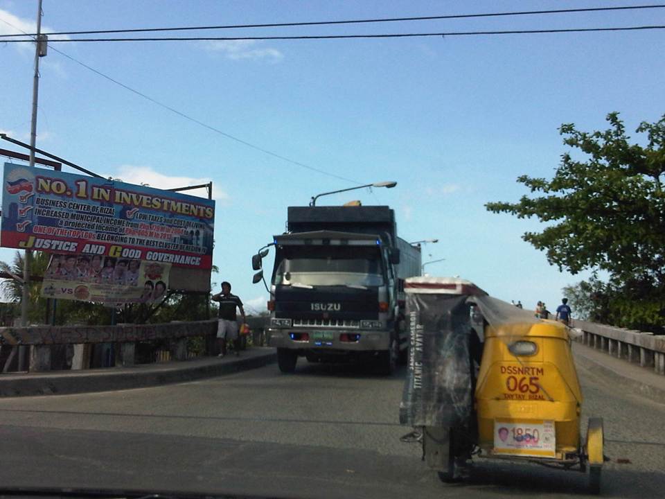
 Junction with the Manggahan East Bank Road and approach to the Barkadahan Bridge
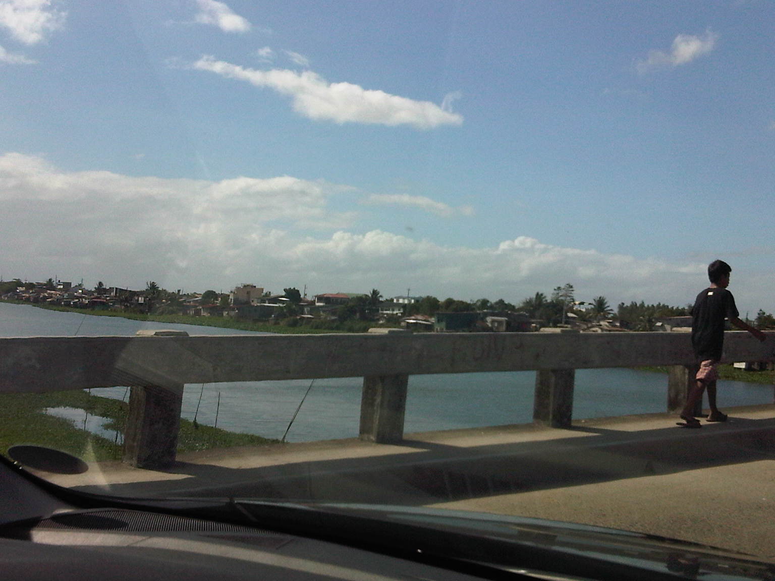
 Crossing the East Bank Road to the 2-lane Barkadahan Bridge, you can immediately notice the narrow sidewalks along each side of the bridge. I think they should have designed this to be wider considering the significant number of people crossing the bridge on foot.
 One can have a good view of the southernmost end of the Manggahan Floodway from the bridge.
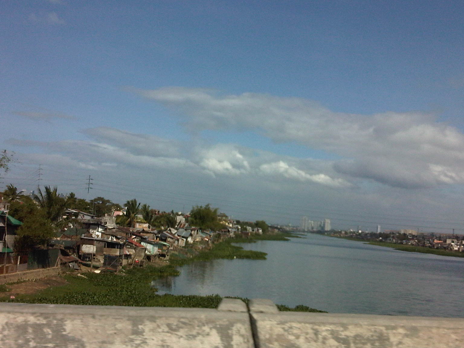
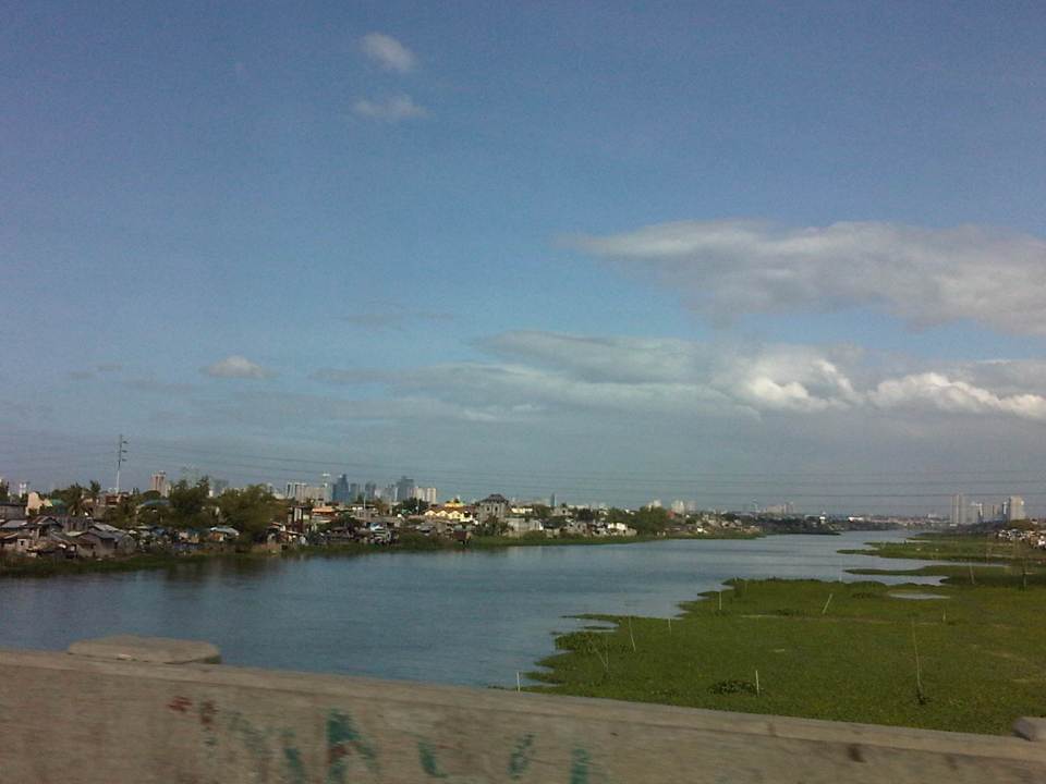 The view shows a lot of informal settlers along both the west and east banks of the floodway and a lot of water lily and kangkong on the waters, which lead to the Laguna de Bay.
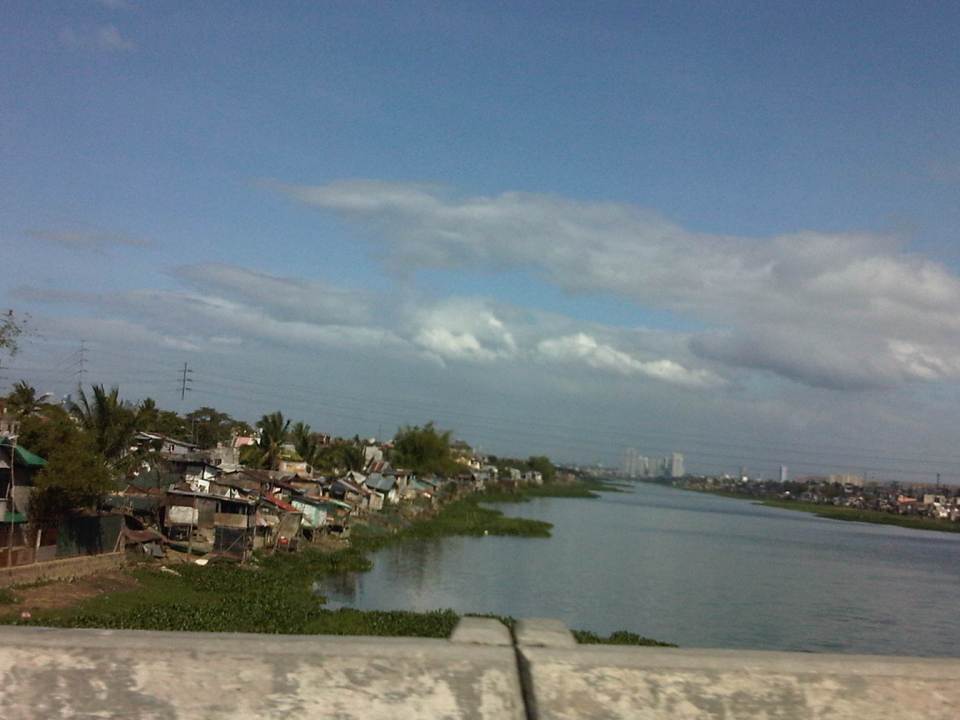 Shanties along the west bank of the floodway. The tall buildings in the horizon and downstream from the bridge are located in Quezon City’s Eastwood along Circumferential Road 5. Behind Eastwood is the Marikina River, which connects to the Manggahan Floodway via the Rosario Weir.
 The other end of the Barkadahan Bridge is a junction with the Manggahan West Bank Road and a generally residential area that is still part of Taytay, Rizal.
The same route can also be used by those residing in Pasig and Marikina cities to the east of the Manggahan Floodway as there is a direct connection to Highway 2000 and the Barkadahan Bridge via the East Bank Road of the Floodway.
–
