
Home » Posts tagged 'tollways'
Tag Archives: tollways
On C-6 and the proposal for another expressway, Part 2
The recent announcement and launch of the Southeast Metro Manila Expressway (SEMME) included this map showing the (very) rough alignment for the proposed tollway. The map also shows the proposed locations of interchanges including one in Tikling and another in Masinag. There is also another in Tumana. From the looks of this, the SEMME will be a skyway or elevated expressway/tollway.
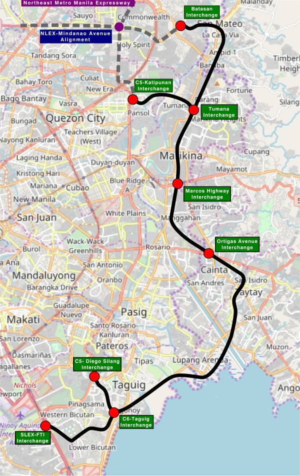
My first impression is that this elevated tollway will pass through predominantly residential areas with columns rising from private subdivisions. It doesn’t help that the topography also means the columns will be built along hilly or mountainous terrain, thereby making construction more challenging than the elevated tollways in Metro Manila.
Do we really need another circumferential road and particularly another tollway? I think that is a very important question that not only needs to be asked but also answered the right way. I, for my part, don’t believe we need another tollway, elevated or not, as this will not solve the so-called traffic problem. In fact, it creates more problems than what is supposed to be solved with the induced traffic this will generate and its promotion of car-centricity. For the price and effort of such an infrastructure, you will get more bang for your buck with a mass transit line or lines. Road congestion can only be solved by constructing the public transport system we needed decades ago.
–
Another look at the Candaba viaduct’s new lanes
I recently wrote about the new lanes along the Candaba viaduct and my thoughts about them being used as variable lanes (i.e., more lanes assigned along the peak or heavier traffic direction). Only this January 2, I observed that the lanes were being used instead for the southbound traffic as the older southbound viaduct appeared to be closed to traffic. Perhaps that side is up for rehabilitation or maintenance work?
 The new lanes between the two viaduct structures are now in use.
 These are assigned to southbound traffic while the original lanes appear to be closed off.
–
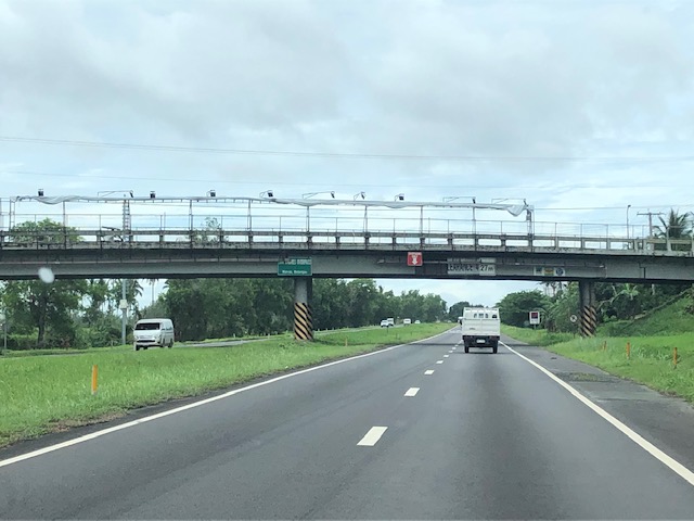
New lanes along the NLEX Candaba Viaduct
Heading to Baguio, I noticed the new lanes in the middle of the NLEX viaduct. The viaduct was actually two bridges constructed over the Candaba Swamp. The soil being too soft for a normal road, the viaduct allowed for two way traffic with each bridge carrying northbound or southbound vehicles. The recall that the original bridges each had 2 lanes plus a shoulder lane. Each now have 3 lanes plus shoulder after expansion years ago. The additional lanes in the middle probably required additional columns to be built with more modern foundations than the original viaduct. The new structures had to be integrated with the older viaducts. Here are photos of the completed sections:


You can go to Google Maps if you want to see what the lanes looked like under construction. Here is a screenshot:

Screenshot
The middle lanes look like they can be used as variable lanes. That is, all or some of the lanes may be used to serve the direction with the heavier traffic. The directions can change depending on the time of day, day of the week or the season. I don’t know at this time though how exactly this can or will be implemented as there are no signs to guide motorists for variable lanes. What signs am I referring to? Here are examples from Bangkok showing overhead signs assigning lanes for the direction with heavier traffic:
 A close up of the signs designating lanes for traffic
 In the example above, 4 lanes including one counterflow lane are assigned to traffic along the southbound direction.
–
Skyway to the south
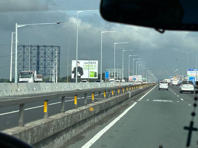
Instead of going via C5 and then SLEX en route to Tagaytay last week, we opted to take the Skyway via Quezon Avenue. The travel was smooth between 6:30 AM and 7:30 AM maybe because it was a Thursday and regular classes have not yet resumed (i.e., less trips). Note the counter flow lane adjacent to the median? This is implemented likely due to the experience of heavier traffic along the northbound (Metro Manila-bound) direction during the mornings. I wonder if the reverse is implemented in the afternoons/evenings.


Note that there was more traffic as we traveled between Makati and Muntinlupa. The traffic represented commuters residing in the south and traveling to Metro Manila for work purposes.
PAREX or PARES?
Much has already been written and said about the proposal by San Miguel Corporation (SMC) to build an elevated expressway atop (or along the banks) of the Pasig River. The project is called the Pasig River Expressway or PAREX. Although it has caught the attention of the public quite recently, the idea or concept is something that was already brought up and studies even before SMC took it up. I recall seeing this concept and even discussing about this with a close friend who was involved in modeling the traffic for an elevated highway along the Pasig River during the PNoy administration for the Metro Manila Development Authority (MMDA). The MMDA then was chaired by someone who is now a senator of the country. There was apparently no opposition then for this project that probably was dismissed or shelved as it had no takers at the time. Fast forward to the present and the concept was picked up or somehow fell into SMC. The latter did some work on it, pitched it to government and, one way or another, got it approved. Being a major project under a high profile company pitched to a government that went by its “build, build, build” slogan, it wasn’t so difficult to get this hyped.
Opposition to the PAREX comes from a broad mix of professionals, environmentalists and civil society groups who questioned not just the idea or concept but the process that led to government practically giving the green light for this project. Some have countered that perhaps, instead of PAREX there should be PARES. PARES would be a Pasig River Esplanade, inspired by the Iloilo River Esplanade. Maybe this is a better option. Maybe we could even have a tramline along the river if the ROW permits it. Or, perhaps instead of an elevated expressway (with the BRT and bike lane add-ons that were obviously included to soften the image of the tollway) there can be a elevated monorail along the Pasig River. This can be designed to have a minimal footprint and could certainly have branches such as one along the Marikina River. These two options alone provide alternatives that SMC should at least consider and study very well. The options might give the company a way to save face (literally and figuratively).
–
On the STAR Tollway, some recent photos
A trip earlier this year allowed me to take a few photos of the STAR Tollway. STAR stands for Southern Tagalog Arterial Road, which was what the expressway was before it became a tollway. I have memories of this being a regular highway in the early 1990s. Then, it was still a two lane road and there were even animals walking around and at times crossing the highway. Later, even after it became an expressway, the ROW was still not secured (i.e., fenced) so motorists would regularly encounter animals creating unsafe situations to both.
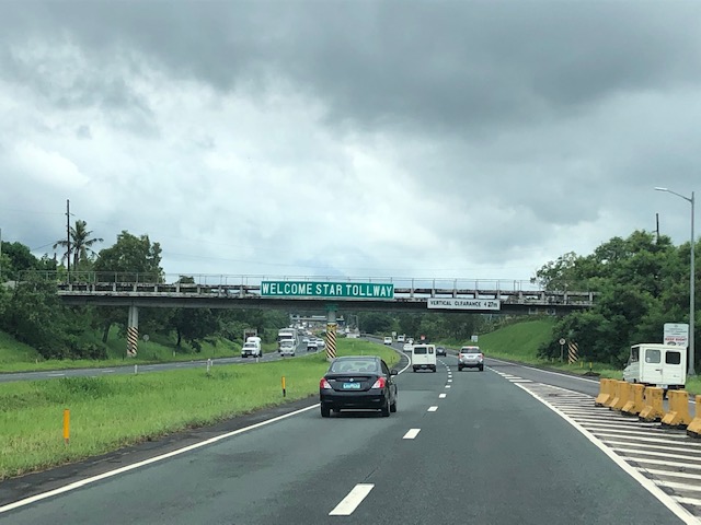

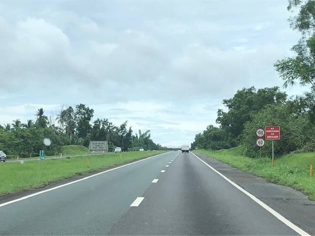

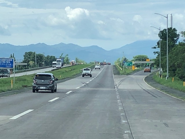
Noticeable in the photos are the wide medians. These are typically used for expansion (i.e., additional lanes) when the time comes that the capacity of the tollway is no longer enough to cater to the demand. Both the NLEX and SLEX used to have these wide medians that are now part of the motorway. Are there alternate uses or purposes for this median? Perhaps, and this has been done abroad, one could fit bicycle paths there? Or maybe install solar panels to generate power? Or maybe do both?
–
In defense of expressways
Expressways have been on the receiving end of criticisms and bad press lately mainly due to the recent much publicized proposal of a Pasig River Expressway (PAREX) by a private corporation. While I also do not agree with the alignment of this proposed tollway, I take exception to the generalization of expressways as sort of a manifestation of evil.
There seem to a lot of information being posted about and vs. expressways. However, it is important to sort through the hype as well as the misinformation that people tend to post about expressways. Yes, there are expressways being demolished or that have been demolished in other countries. These were probably so because they were ill-planned in the first place as are many other elevated pathways (e.g., poorly planned and designed footbridges), and many of the cities removing them have also developed their transport systems to be more efficient in terms of their people’s mobility. That is the case with Seoul and that certainly is the case for Tokyo. In fact, Tokyo had been moving their surface railways underground for the past decades. And now it seems they will be doing so for certain expressways. Does Tokyo have an efficient transport system? It does and perhaps is among the densest if not the most extensive rail and road system in the world.
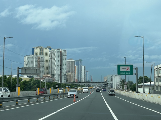
It is important to have context to the matter. NLEX and SLEX, for example, were developed as relatively free-flowing, high capacity, high-speed roads that were the alternative to the national highways that directly connected many municipalities and cities. The latter had many intersections or junctions with other national roads as well as carry mainly local traffic including public transport such as tricycles and jeepneys. Expressways are built to be part of the primary arterial network and not as local roads. They are built for access rather than mobility.
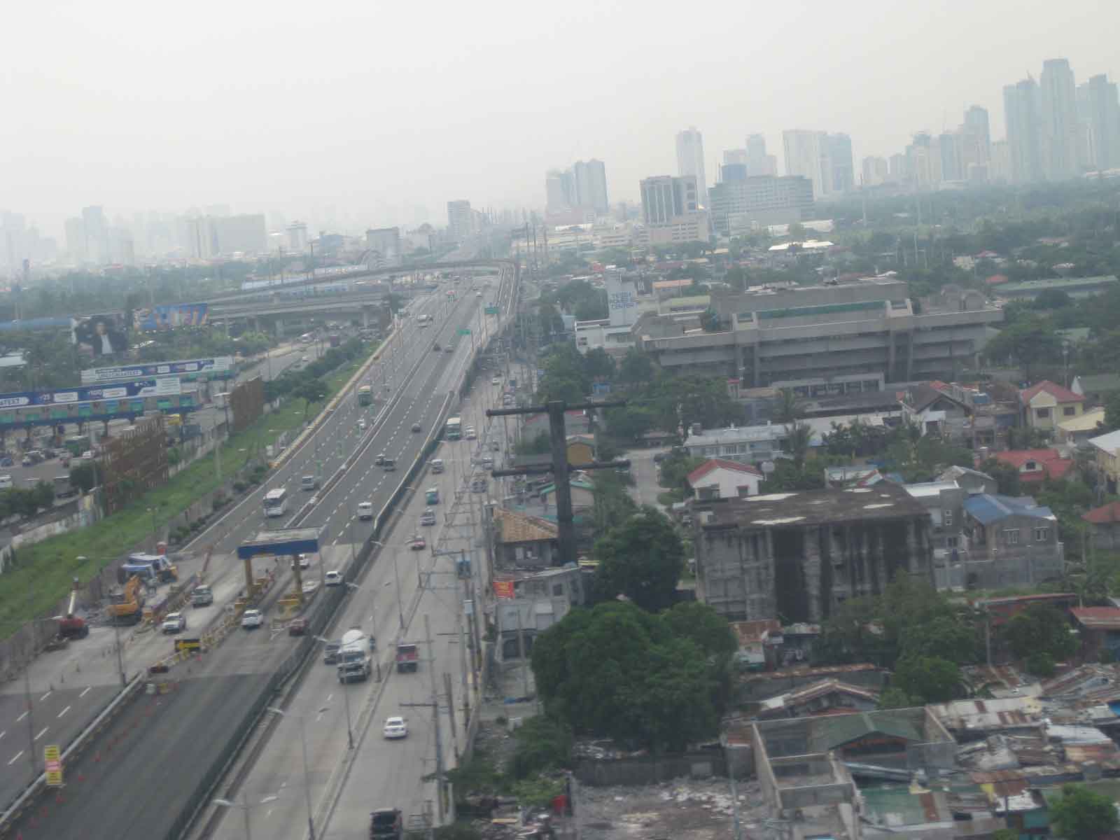 From L-R: SLEX, Skyway, and the East Service Road. The Skyway connects the NAIA-X to the left and the NLEX connector section onwards through. SLEX eventually becomes the South Super Highway, which is an urban street.
So, are expressways anti-pedestrian? Basically, no. Though they clearly were not developed or constructed with walking in mind. In fact, expressways are generally built along secured right-of-way and are limited access facilities. In the Philippines, all expressways are tolled; meaning you have to pay to use them. Expressways are built more for long distance travel and not for the shorter ones where walking is most appropriate.
Are they car-centric? Not necessarily so because they provide a less congested alternative for long distance transport of people (buses and vans) and goods (trucks). Would you rather take the Manila North Road (McArthur Highway) to Baguio City and endure over 7 hours travel time? Or would you take the 4-hour trip via 3 expressways (NLEX, SCTEX and TPLEX)?
Are expressways supposed to reduce traffic on local roads? Yes and no. Yes, because they actually do reduce traffic at the local level when you divert long distance travel to expressways. The math tells us there is subtraction there. However, it is a no in terms of local traffic increasing over time, which should not be charged to expressways, as they are a function of other elements coming into play including population increase and economic growth. This includes a contribution to induced traffic or new trips generated by the perception of infrastructure being adequate and having the capacity to cater to more trips that are not necessarily borne by cars.
Do we need more expressways? Probably, but not in the locations or alignments like the one proposed for PAREX. Incidentally, there is another expressway being planned that seems to have escaped the attention of those against PAREX. I am talking about the Laguna Lakeshore Expressway that will be a combination of at-grade (over reclaimed land) and elevated (viaduct over the Laguna de Bai) sections leading to heart of Laguna and towards Quezon province. But that’s another story…
–
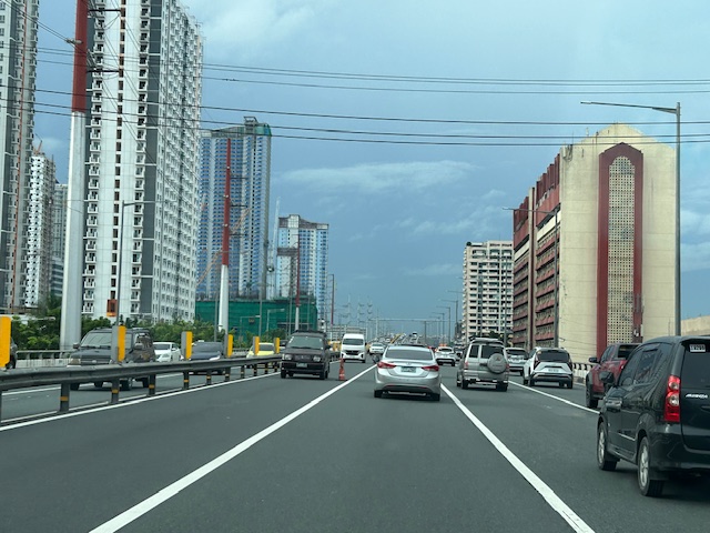
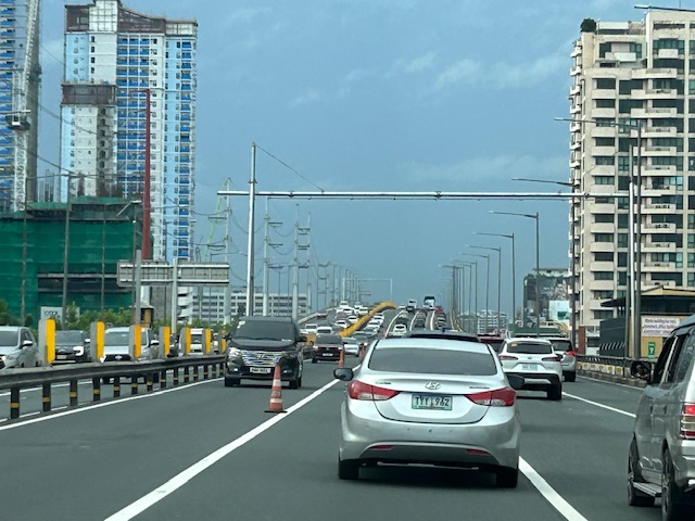
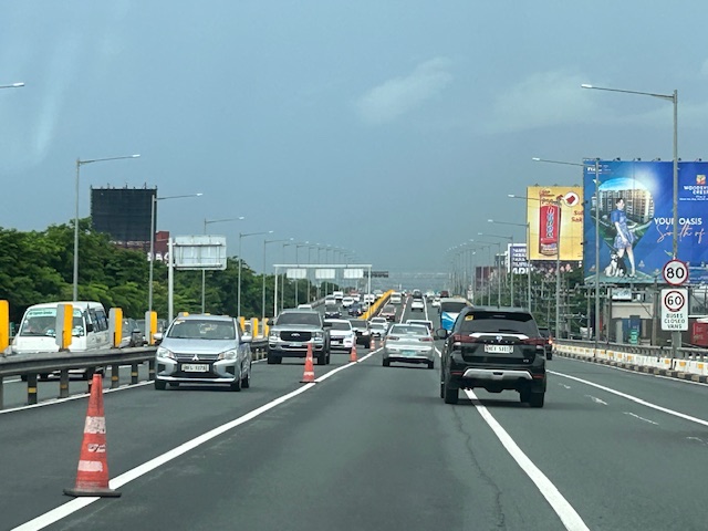
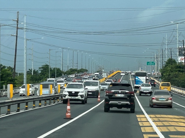
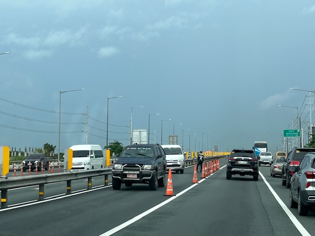
On congested tollways during the pandemic
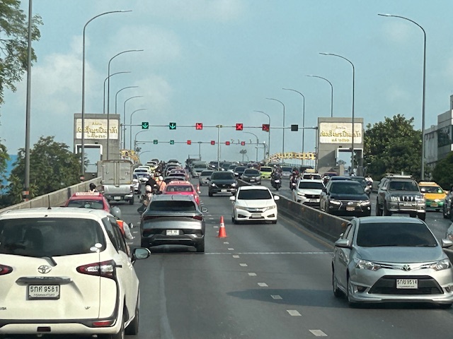
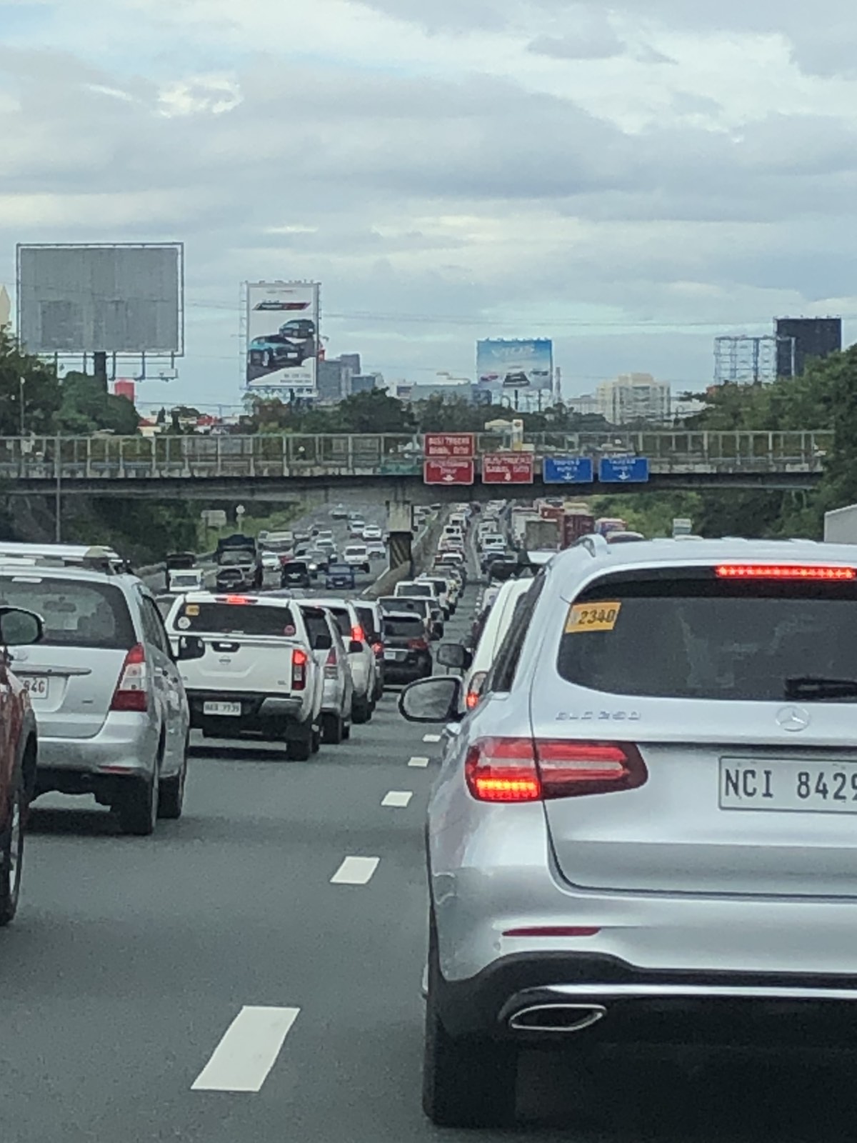
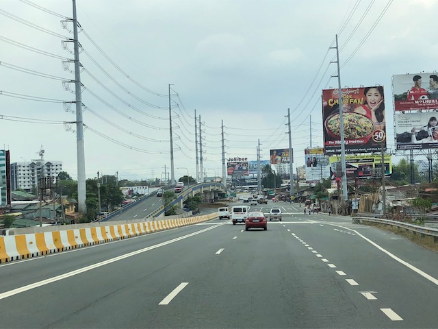
I finally was able to go on a long road trip yesterday as friends invited us to go on an excursion to Quezon to a prominent pottery artist’s place in the town of Tiaong. I first thought we would be going via the backdoor of Rizal since we were already in Antipolo but it turned out that it would be faster via the tollways route. Both Google and Waze recommend our route via C-6, SLEX and STAR to get to our destination. It could have been longer via the Manila East Road but which is a more scenic route. While it took us only 2.5 hours to get to our destination, it took an additional hour on the way back. Part of it was the congestion along the national highway between Tiaong and Sto. Tomas, Batangas but I was also a bit surprised about the congestion along SLEX on the way back (photo below) but saw that this was mainly due to vehicles filing towards the Skyway ramp in Alabang.
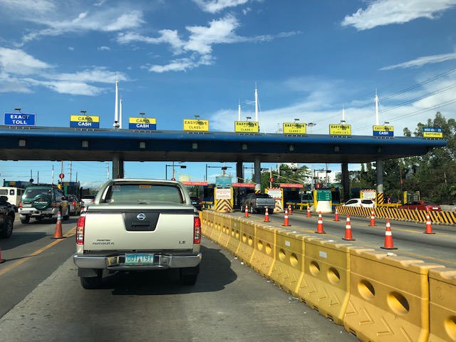
There was the expected congestion at the toll plazas as vehicles still need to slow down. It is not like the seamless, structure-less system in Singapore where their sensors can detect vehicles running at high speeds. The toll barriers are still there and the channels for one are relatively narrow. Then, there are travelers that seem hard in understanding that there are specific booths for cash payments. Also, there were occasions when the barriers did not lift immediately for one reason or another. That tends to slow down the processing of queued vehicles – a problem that my undergraduate students could probably take on after their lessons in queuing theory.
–
On the RFID fiasco
Early December 2020, Metro Pacific Corporation suddenly had to deal with jam-packed toll plazas and queues that affected roads connecting to the North Luzon Expressways. Fast-forward and Valenzuela City apparently had enough of it and revoked the tollway corporation’s business permit. Later, matters were resolved with the tollways reverting to mixed toll collection to manage the queues at the toll plazas.
Prior to this, tollways corporation scrambled to meet the deadline set and re-set by the Department of Transportation (DOTr) through the Toll Regulatory Board (TRB) for contactless, cashless toll payments. The question is if there was enough time for tollway operators to acquire the best (not just the minimum required) system for this endeavor. There are some opinions that this was basically required on short notice and for the government to get some brownie points for this.
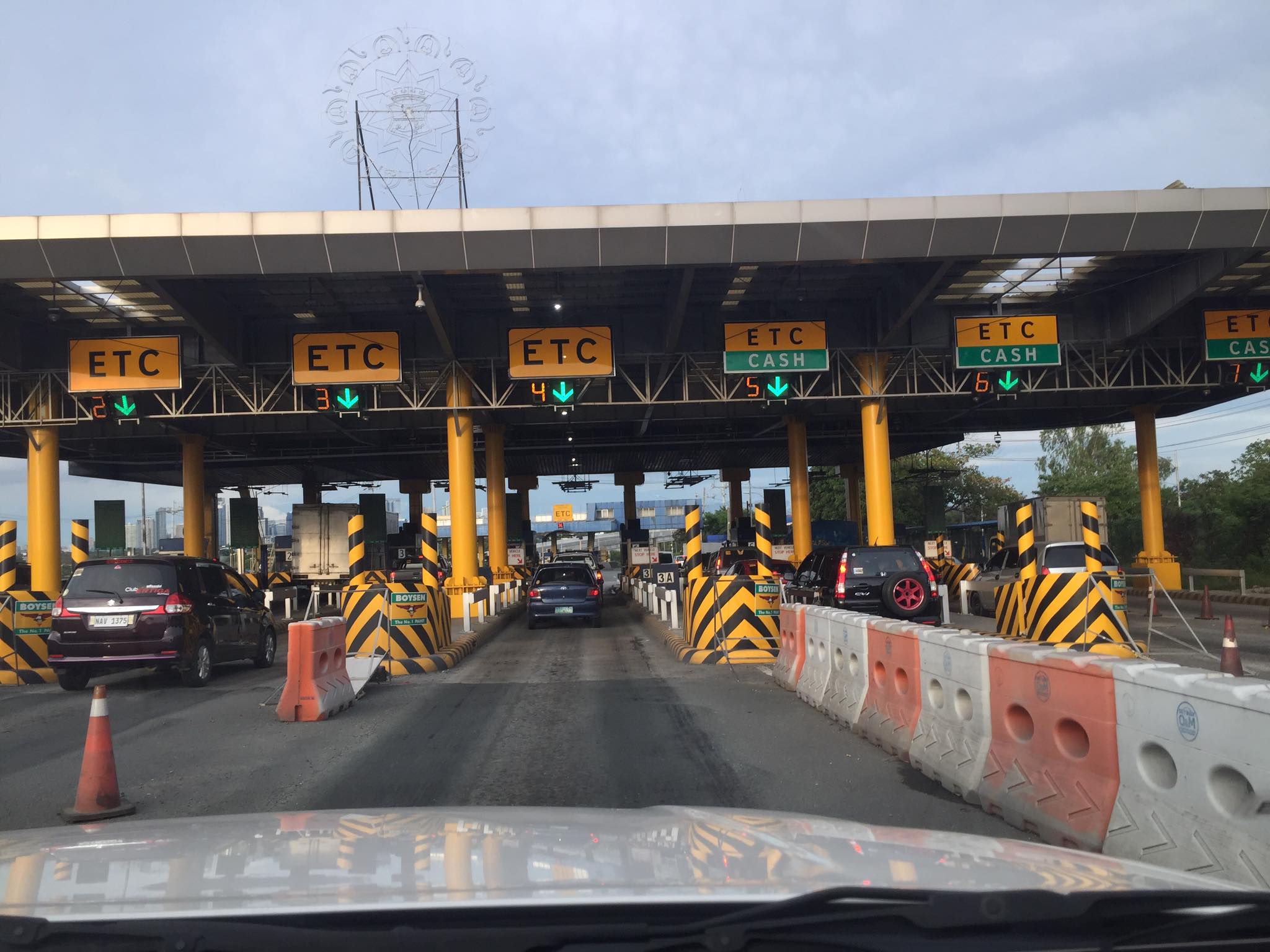
Were there issues about technology and the corresponding costs to the acquisition and deployment of the necessary devices for seamless, contactless, delay-free (in relative terms) transactions for tollways? Probably so. Those RFIDs and the readers installed at strategic locations along tollways (i.e., entries and exits) were certainly not state of the art or the best available out there. Singapore, for example, uses a more sophisticated system for their expressways where you no longer have toll plazas and you won’t have to slow down to be detected by the system. That system has corresponding costs but is perfect for the city state given that most roads are tolled anyway because of their road pricing policy. In the case of our tollways, not all travelers are actually going to utilize the tollways as frequently as it would necessitate them having to get either the Easy Trip or Auto Sweep tags. That is obvious from the relatively low penetration rates for electronic toll collection (ETC). So it still makes sense to have hybrid booths for those not availing the ETC option. Anyway, travelers will have to exercise disinfection protocols to ensure infections are prevented.
–
Cavitex
I had wanted to post about the Manila-Cavite Expressway (Cavitex) but kept putting it off as I had few photos of the tollway. Formerly known as the Coastal Road, it is now operated by the Metro Pacific group, which also operates the North Luzon Expressway (NLEX), the Subic-Clark-Tarlac Expressway (SCTEX) and the Subic Freeport Expressway (SFX). Here are photos I took last February this year when we went to Bacoor with our Japanese research lead. Most of the photos show sections towards Cavite (southbound).
 The tollways has 3 lanes along each direction.
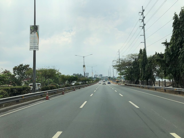
 On one side is the bay where reclamation projects are proposed or currently under way.
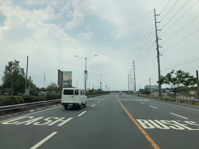 Lane markings in an attempt to position vehicles towards the toll plaza, which is visible from afar in the photo
 Vehicles queuing at the toll plaza – it can get very congested here during the peak periods and seasons.
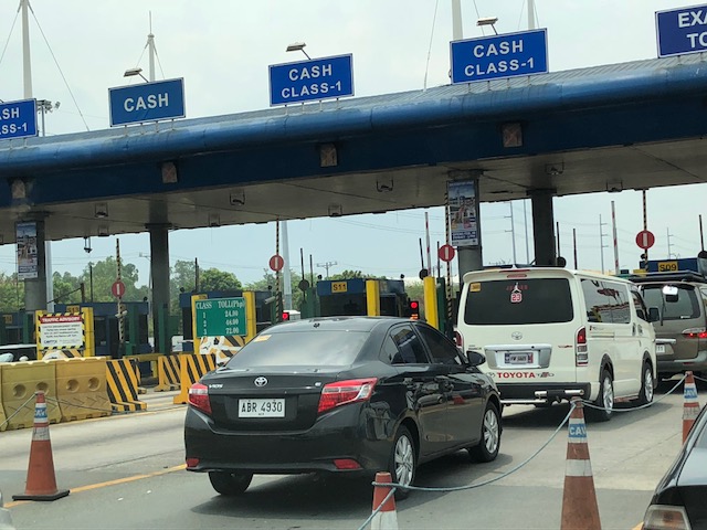 Cavitex toll plaza
 There is basically one toll plaza for the tollway for either direction.
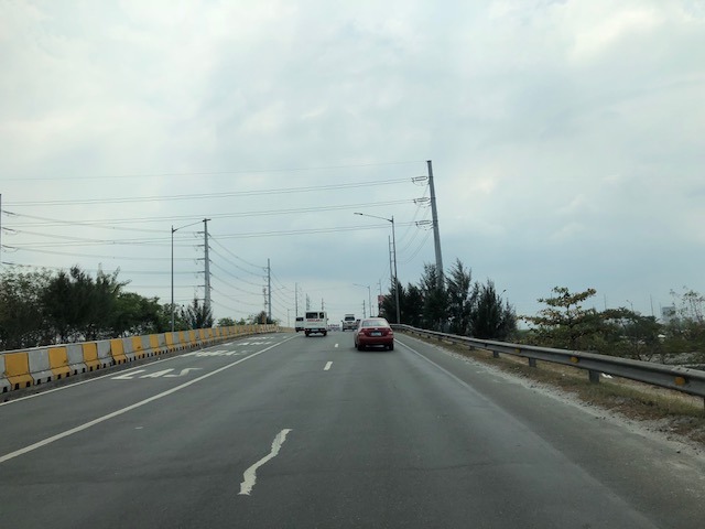
 Free-flowing traffic during an off-peak period
 Approaching the interchange where vehicles bound for Bacoor, Imus and Las Pinas take the right side of the road to exit via the trumpet ramp shown ahead at right. Other vehicles bound for Kawit and Cavite City go straight.
 Climbing the ramp to exit towards Bacoor, Cavite
 Off-ramp to Bacoor, Imus and Las Pinas
 Where expressway meets the national highway
 Overpass towards the tollway
 Toll plaza for the northbound (to Manila) direction
–
