
Home » 2013 (Page 6)
Yearly Archives: 2013
P. Casals Street and Ayala Boulevard
This is a continuation of an earlier post about Manila streets. Legarda eventually becomes Pablo Casals Street and then Ayala Boulevard after the Ayala Bridge. There are many prominent academic institutions along the road including the Technological University of the Philippines and the Philippine Normal University.
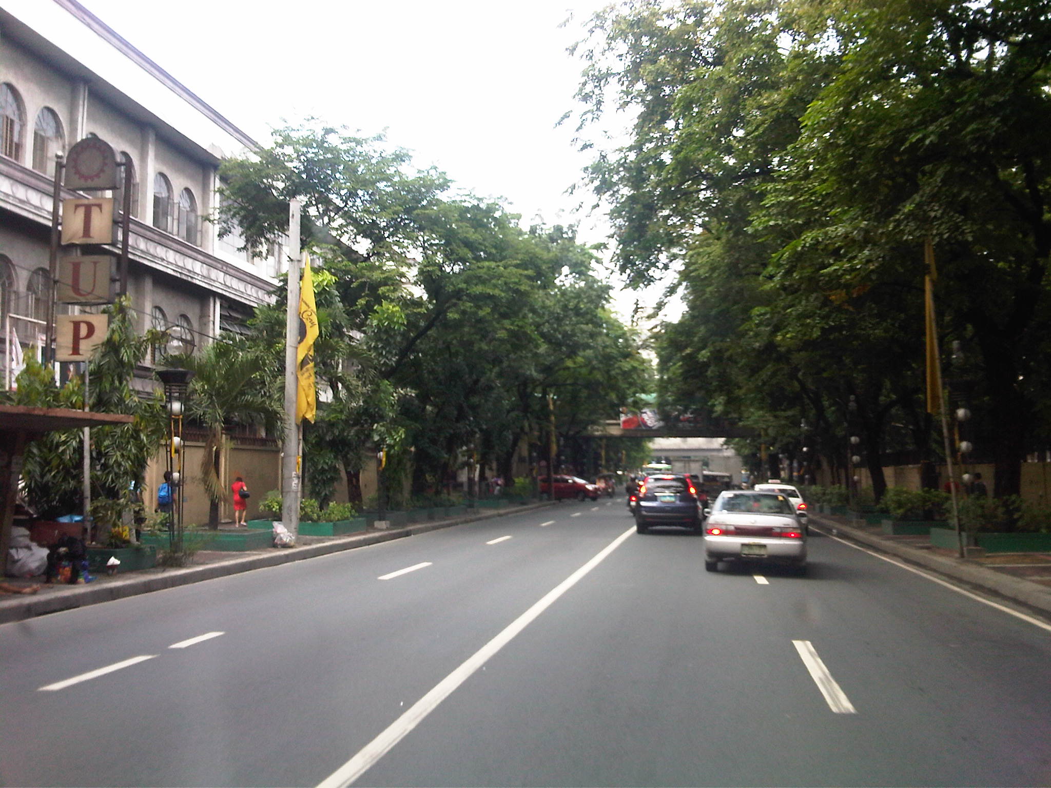
 Technological Institute of the Philippines (TIP) has a branch along P. Casals St.
 Bridge across a tributary to the Pasig River is full of shanties. This is in the San Miguel district of Manila that is near Malacanan Palace. It is between the Quiapo area and the Palace and the tributary leads to the Golden Mosque to the right.
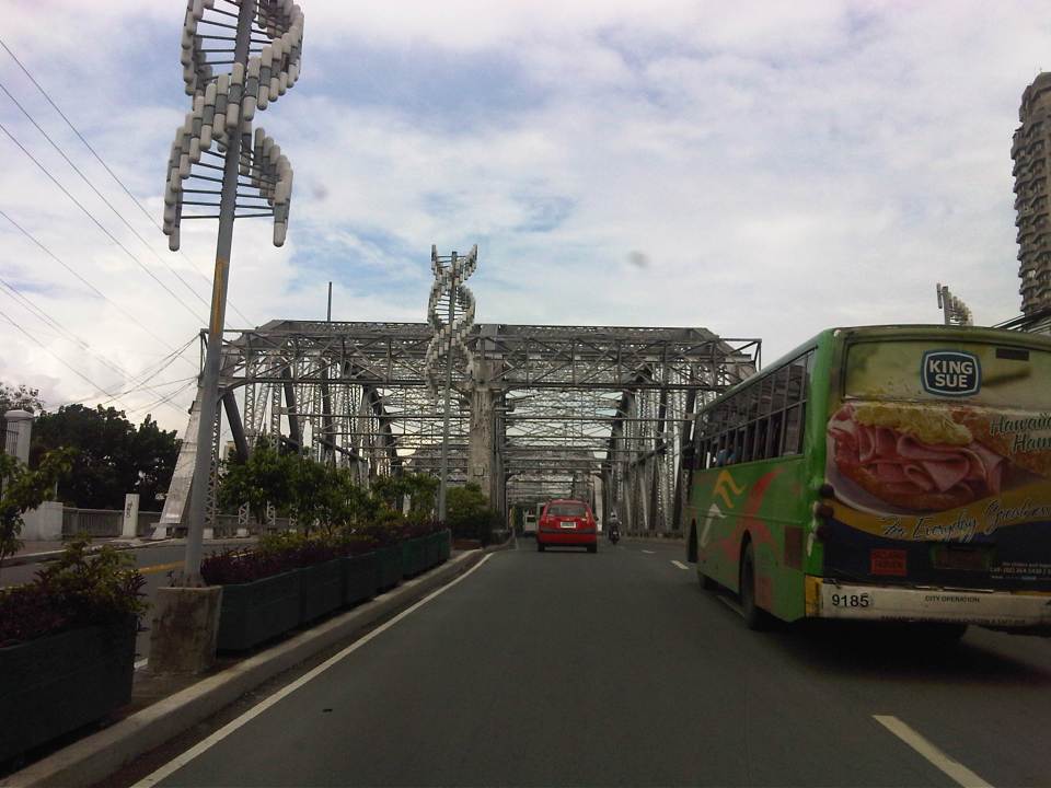 Ayala Bridge where P. Casals Street ends and becomes Ayala Boulevard on the other side of the Pasig. I think the street lamps are quite odd and more decorative than functional. I’ve seen these at night and they look more like lanterns than street lights. At one side of the bridge (on the left in the photo) is the Isla de Balut and the Hospicio de San Jose.
 Ayala Boulevard is a 4-lane, undivided road. The southwest direction (downstream) leads to Taft Avenue.
 Just pas the bridge is an intersection with San Marcelino Street, which is part of a major truck route. Along San Marcelino is Adamson University and what was the old St. Theresa’s College Manila campus whose buildings have been integrated with Adamson.
 There are two major institutions of higher learning along Ayala Blvd. These are the Technological University of the Philippines and the Philippine Normal University.
A bit of trivia: These institutions (TUP and PNU) together with the University of the Philippines (UP) and the Polytechnic University of the Philippines (PUP) formed the pillars of professional and technical education introduced by the Americans to a post-Spanish Philippines. TUP used to be the Manila Trade School (1901) and then the Philippine School of Arts and Trades (1910) under the Americans. The PNU was Philippine Normal School during the American Period (1901) and later became the Philippine Normal College after the Second World War (1949). The PUP was the Manila Business School (1904) and later the Philippine School of Commerce (1908) during the same period. The University of the Philippines was the first state university established by the Americans in 1908. TUP was established to provide education and training in various trades (vocational school). The PUP was established to provide education and training for business/commerce. The PNU was established to provide education and training for teachers. And UP was established to provide education and training to professionals in the fields of engineering, law and medicine.
–
Walking around Ginza
The Ginza District in Tokyo is one of the most prominent areas for both shopping and offices. It is reputed to be upscale as many of the world’s top brands such as LV, Chanel and Hermes have big shops here aside from the more recognizable Japanese shops like Matsuzakaya and Mikimoto. From a transport perspective, it is a very accessible area with metro lines having several stations here and the district being a few minutes walk from the JR Lines. Sidewalks are wide and therefore a boon to pedestrians and cyclists. There are no jeepneys, tricycles or pedicabs here that are used in the Philippines as modes for almost door-to-door transport and for short travel distances. Instead, you have to walk between buildings and metro or JR stations or bus stops.
 Cyclists making a turn at an intersection in Ginza.
 Taxis patiently wait for pedestrians to cross before making a left turn (Japan’s using the right hand drive system) – you will hear no horns from motorists as they give way to pedestrians and cyclists cross the streets unlike Metro Manila and elsewhere in the Philippines where motorists will run over people despite the latter having the right of way.
 Vehicles crossing a busy intersection in Ginza. Turning vehicles position themselves for the turn phase of a signal in anticipation of the green light and would give way to crossing pedestrians including stragglers who made the cross at the last instance.
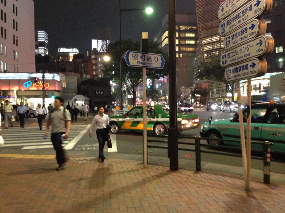
 Navigating in Ginza – newcomers can get lost in any city and especially something as large and seemingly complicated as Tokyo. Fortunately, we now have map apps in our smart phones and we can more easily determine the way to our desired destinations. This is a friend and his daughter consulting the map on our way to our dinner venue.
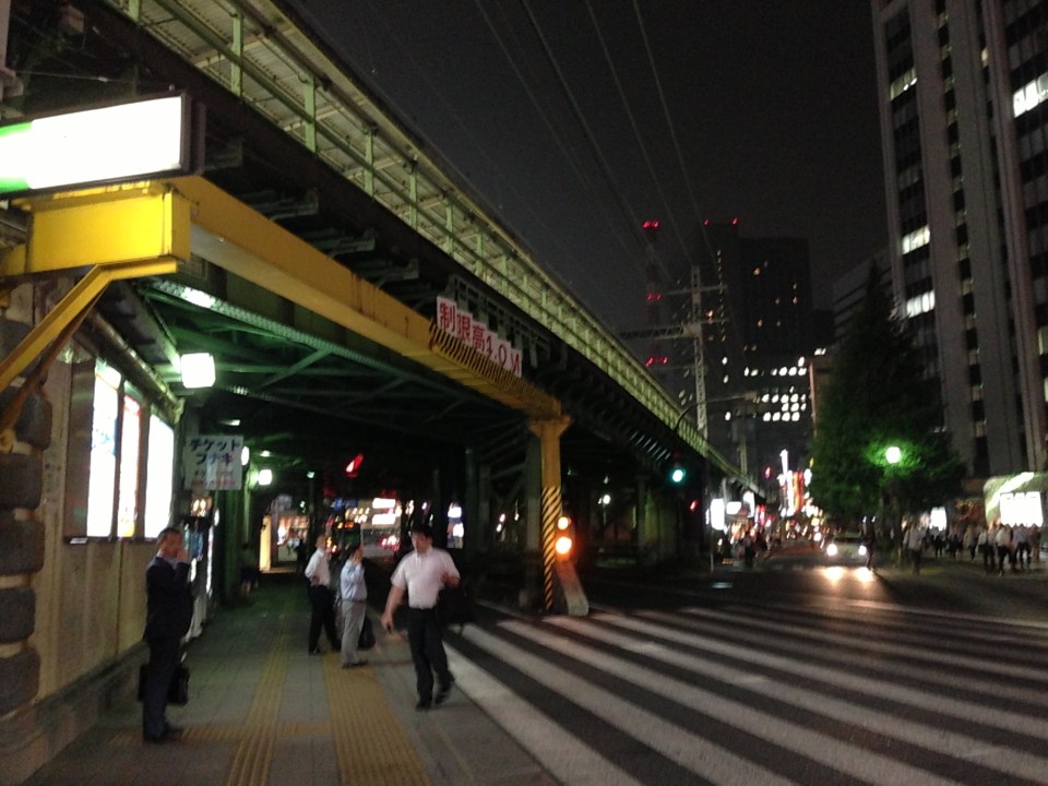
 This fuzzy photo was taken as we crossed the street to get to the Higashi Ginza subway station where we parted with some of our company. The bright building at the center of the photo is the Kabuki Theater.
 Access to the Hibiya Line’s Higashi Ginza Station – note again the wide sidewalks.
 A quick shot of a street in Ginza with buildings and signs all lighted up.
 The lights and signboards reminded me of Shibuya (remember the movie Lost in Translation?) and Shinjuku, in other parts of Tokyo. I was not able to go there on my recent trip but will surely go next time I’m in Tokyo.
 Another look at a street as we crossed it to reveal a long line of buildings with the shop and store signs lit up.
 A large electronics store, Bic Camera, near the JR Yurakucho Station. Japan is well known for electronics and Tokyo is dotted with a lot of electronics stores selling the latest gadgets and appliances. Of course, there is the Akihabara “electric town” where there are stores and shops everywhere selling the same plus games and collectibles for hobbyists. But that, as they say, is another story to be told in a future post.
 Wide pedestrian crossing at the JR Yurakucho Station. The area is host to many offices and generally has high pedestrian volumes.
–
Special lectures on transportation after the 2011 tsunami in Japan
We recently had the honor of hosting two professors from the Tokyo Institute of Technology (Tokyo Tech). Prof. Tetsuo Yai was an adviser to two (2) faculty members of the Institute of Civil Engineering of UP Diliman and Dr. Daisuke Fukuda was adviser to a former student of ours who is now with De La Salle University. While both are in the transportation field, their laboratories are located in different campuses of Tokyo Tech. Prof. Yai’s laboratory is at the Suzukakedai campus in Yokohama while Dr. Fukuda’s lab is at the main campus in Ookayama where Prof. Yai used to have his laboratory.
Prof. Yai delivered a lecture on “The Progress of Miyako Recovery Plan from Tsunami Disaster” while Dr. Fukuda presented on the “Impacts of Rolling Blackouts on Railway Transport Service in Tokyo Metropolitan Area after the 2011 Tohoku Earthquake.” The lectures were held at the Toyota Training Room of the National Center for Transportation Studies (NCTS) with an audience comprised mainly of graduate and undergraduate students of Civil Engineering.
 NCTS Director Sean Palmiano opening the lectures and introducing Prof. Yai to the audience.
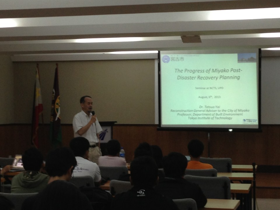 Prof. Yai introducing his topic and talking about the earthquake and tsunami that hit the Tohoku region in 2011.
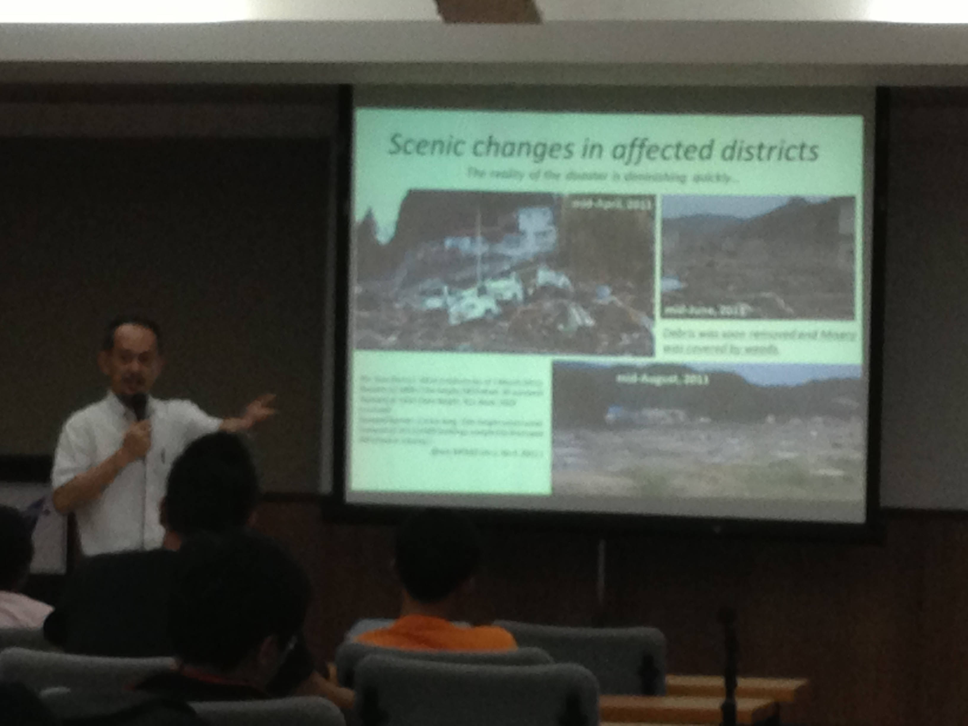 Prof. Yai explaining about the effects of the tsunami on Miyako City and the initiatives for recovery.
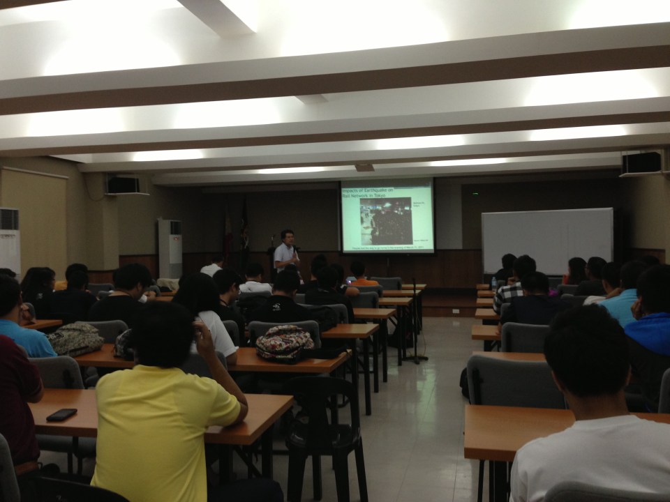
 Dr. Fukuda describing the urban rail network in the Tokyo Metropolitan Area.
 The lectures were well-attended.
 Dr. Fukuda explaining on the impacts of blackouts on rail transport and commuting times in Tokyo and its surrounding areas.
–
Airport limousine bus at Narita
There are several options for passengers to travel between Narita Airport and their destinations in the Kanto area. There are many train services connecting the airport to Tokyo, Yokohama, Chiba or other destinations. These include the Narita Express (N’EX), the Airport Narita trains of the JR Yokosuka-Sobu Line, and the Keisei Skyliner. Another option is to take limousine buses from the airport, which includes the Airport Limousine bus from Narita. Information on fares and schedules are available from the internet links I provided.
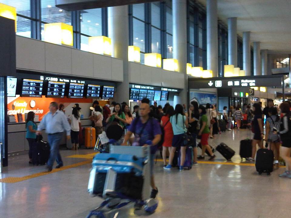
 The Airport Limousine counter at the arrival area where passengers may inquire about services and purchase tickets.
 Bus stops are located just outside Narita Terminal 1
 The information boards on Airport Limousine stops provide information for the next bus for a particular destination in both Japanese and English.
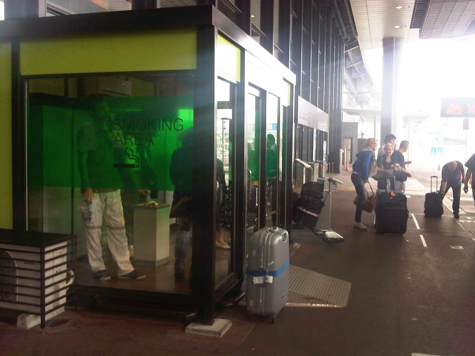 Smoking areas are located outside the airport and are enclosed. There is air-conditioning for ventilation.
 A Limousine Bus bound for the Yokohama City Air Terminal (YCAT) is shown loading passengers. I used to take this bus as an alternate for going to Yokohama. My other option was the Airport Narita trains of the JR Yokosuka-Sobu Line.
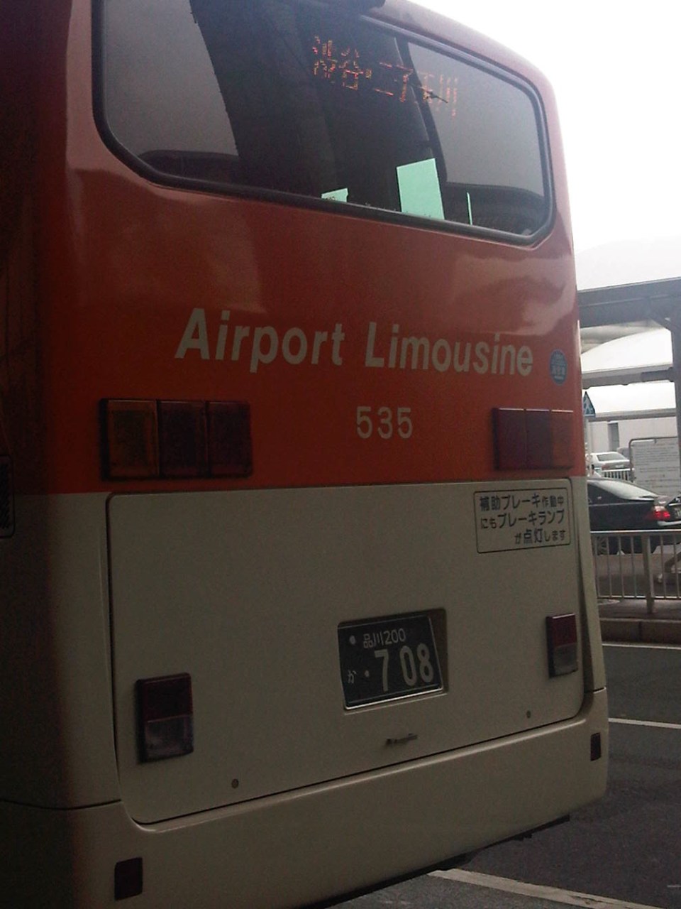 Back of a bus bound for Shibuya and Futako Tamagawa in western Tokyo.
 Airport Limousine Bus ticket from Narita to Akasaka
 Baggage claim stub
When I was still residing in Yokohama, I usually took the train to Narita and the bus when returning from the airport and via YCAT. This was because I usually travelled lighter when going to Manila than when I was returning since I brought back some food items for times when I was feeling homesick and longed for something familiar to eat. Cost-wise, the airport limousine bus service cost a bit more but was more convenient for my return trips. Later, in my stays at Saitama, the obvious choice was the bus to and from Narita through Omiya Station as traveling by rail was more complicated due to the transfers. The additional cost is easily justified by the convenience and comfort provided by the bus service.
–
More pedestrian facilities please!
I took a couple of photos one late afternoon on a weekday on my way home. I wanted to have a picture of typical jeepney overloading during the afternoon peak. Typically, jeepneys would allow “sabit” or passengers hanging from behind the jeepney. This practice is actually prohibited and carries a fine if jeepney drivers are apprehended. And that is usually a big “if” considering enforcers turn a blind eye to the practice especially during peak periods when it is difficult to get a ride.
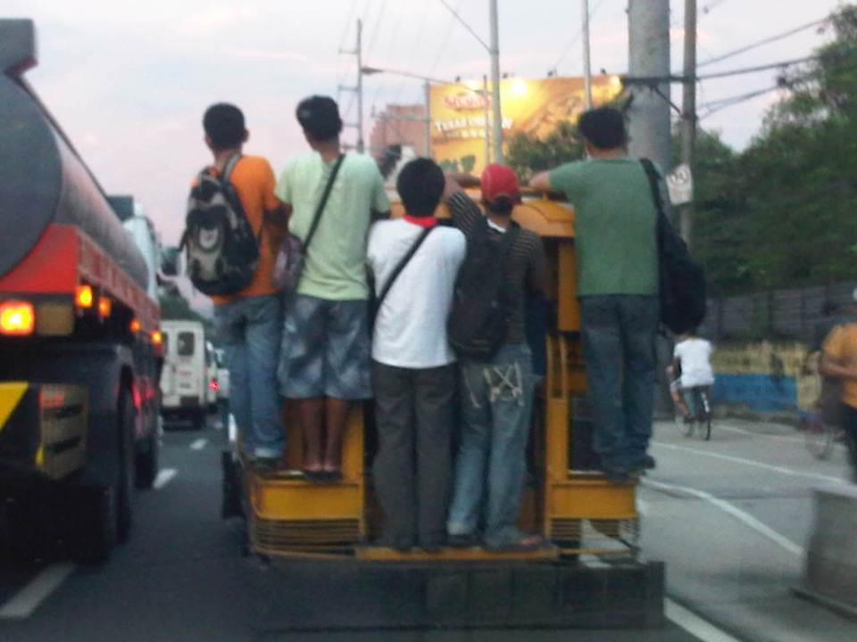 Jeepney full of sabit or hangers-on in heavy traffic along the eastbound side of a major highway
I also happened upon an opportunity to take a photo of the overloaded jeepney together with pedestrians walking along the walkway at the roadside. Though the photo was not so clear, it captured the image I wanted with people opting to walk while others took a risky ride on a jeepney. The cyclists in the photos were just bonuses and added to the visual of alternatives for mobility.
 Pedestrians and a cyclist along the widened walkway/bikeway along Marcos Highway
Walking remains as the mode of transport with the highest share when all modes, motorized or non-motorized, are compared. While there is a strong clamor from cyclists for bikeways and for cycling to be taken up by more people as an option for commuting, the reality is that cycling is not really for everyone. It is a viable and healthy mode but should also fit in a hierarchy of modes. Most people walk and walking should be encouraged over distances where it is most suitable. Facilities for walking need to be provided and properly designed so that people can walk safely and most efficiently like the example in the following photo taken during another weekday late afternoon.
 People walking along Marcos Highway
Local governments help promote walking by making sure sidewalks are provided and clear of obstructions. Perhaps walkability can be used as an indicator or parameter for a city to be qualified as livable and true to the advocacy of sustainable transport. Walking should be encouraged to promote healthy living as it incorporates exercise in our daily routines. More people walking should also increase awareness for the advocacy for clean air and help initiatives to improve air quality, particularly efforts to reduce harmful emissions by motorized vehicles. Thus, it is not difficult to understand how investing in pedestrian facilities and promoting walking is not a smart move and a beneficial one for any politician’s constituency.
–
Getting reacquainted with the Tokyo Metro
After almost 5 years since my previous trip to Japan, I was excited to go around Tokyo during our free time after our meetings. With all the information available online now, it is quite easy to do a desk review of public transportation in Tokyo. Since our hotel and meeting venue were near subway stations, it was practical to know about the metro lines near us. Whenever I was in Tokyo, I always took the trains whether it was by subway or by Japan Railways (JR) lines. There are two companies operating the subways in Tokyo. One is Toei and the other is Tokyo Metro. I seldom, if ever, used the bus or taxi preferring to walk between train stations to/from my meetings or appointments.
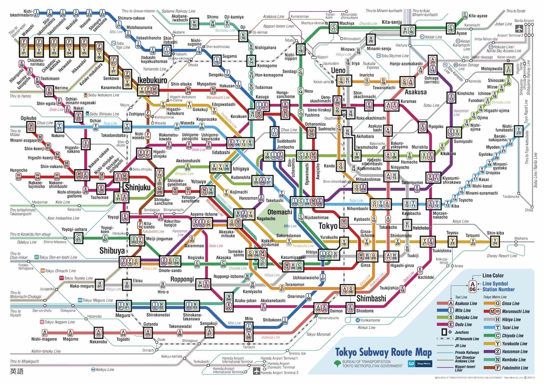 Tokyo subway map downloadable from the internet
 One can purchase tickets at the station using these machines. These have bilingual features so you only need to press the button to have the interface in English. Maps overhead provide guidance about stations and fares.
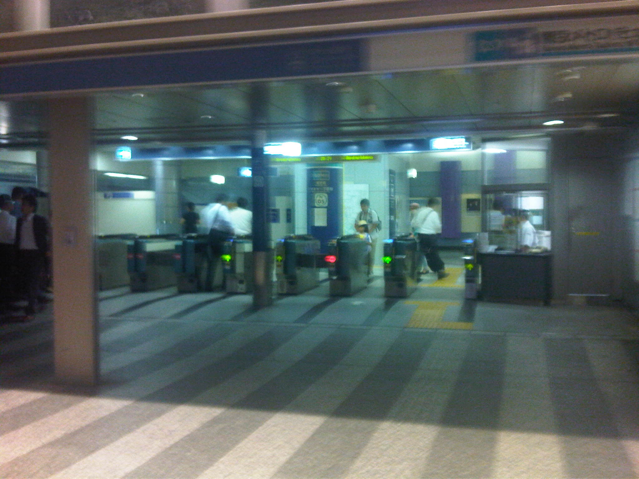 Subway turnstiles where passengers enter and exit for the platforms
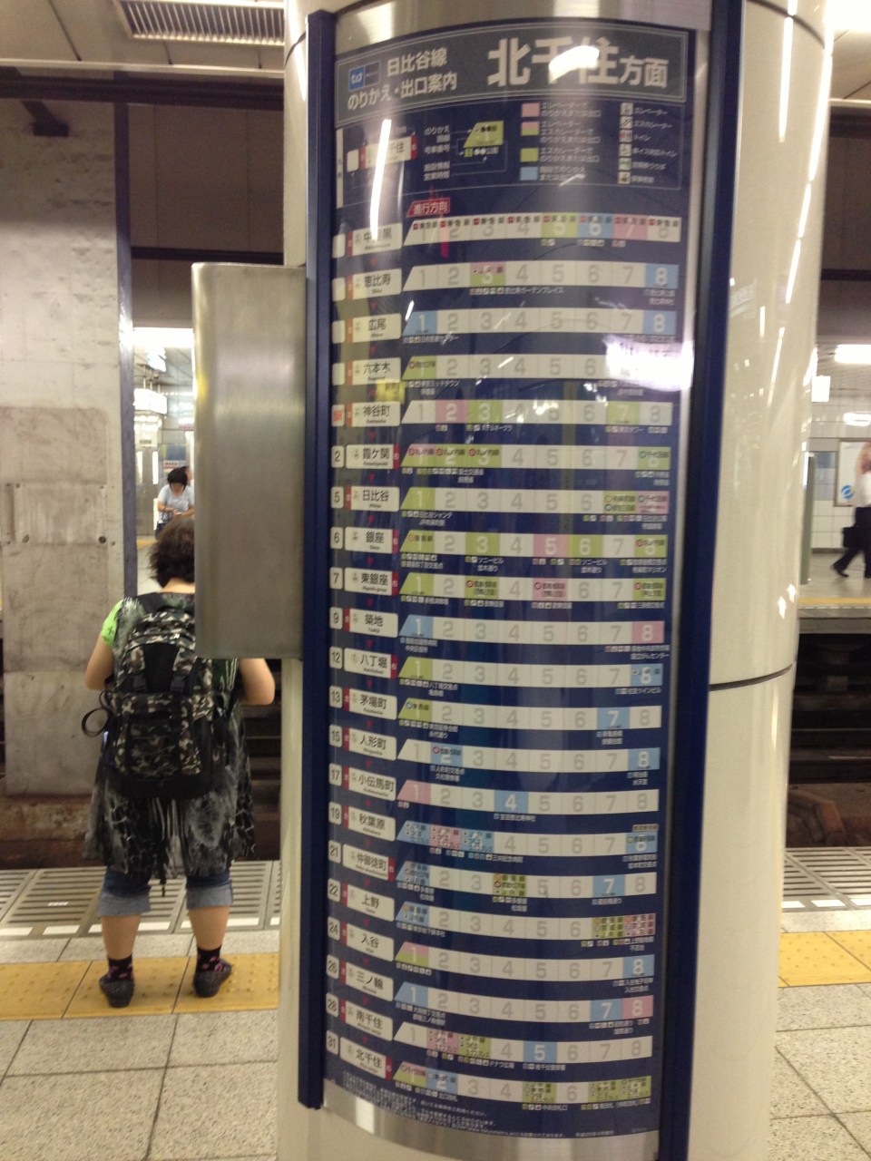 Information on transfer stations and the cars nearest the stairs. This information is helpful so passengers can easily position themselves in the car to minimize transfer time from one train to another.
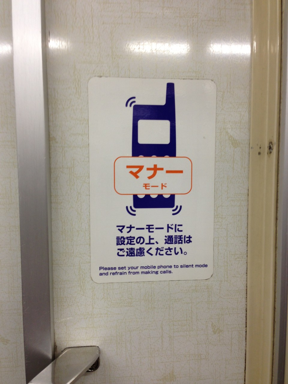 “Manner mode” sticker on the subway train near the door advises passengers to refrain from making calls while on the train. This is considered rude and annoying to fellow passengers.
 Metro line information overhead at the train doors include a line map and a message board announcing the next station in Japanese and English.
One can also purchase special tickets or passes from the stations. Ticket vending machines may also have the capability to issue the popular Pasmo or Suica IC cards that can be used in almost all transport modes in Tokyo and other cities. Information on these cards are easily found in the internet. There are also online route or travel planners that people can use to plan their trips. One such tool, which I recommend, is Hyperdia, which provides information on lines, transfers, travel time and fares.-
Narita arrival
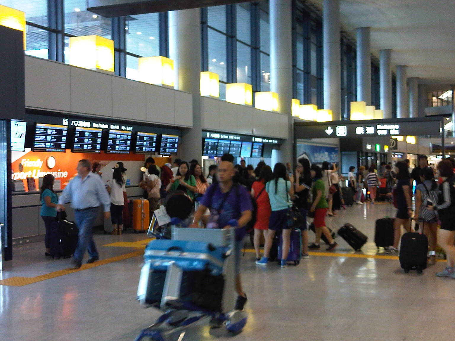
Back in Japan after 5 years, I made sure I could take photos upon my arrival at Narita International Airport. I was not sure how strict they were at the airport regarding taking photos so I was cautious and tried not to inconvenience others as I took a few pictures. Of course, taking photos at the immigration area is prohibited so I did even attempt to take any pictures there. All the photos in this post are in public places and gives an idea about how the airport looks like from the perspective of an arriving passenger.
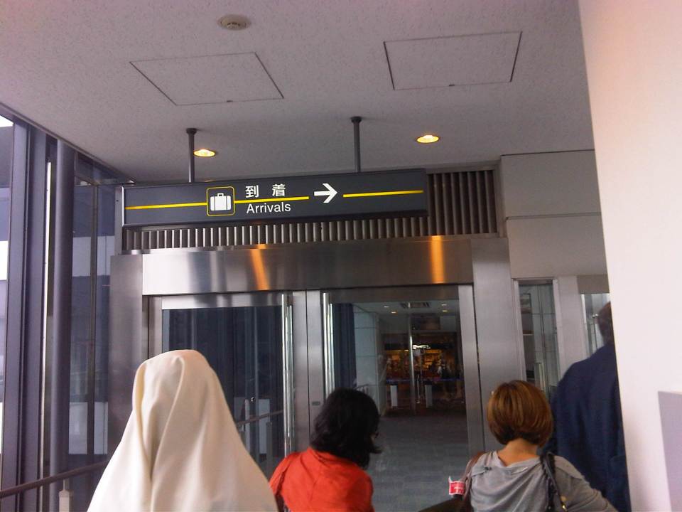 Upon deplaning, passengers are guided to proceed towards the arrival area where passengers with connecting flights are likewise guided to the transfer area.
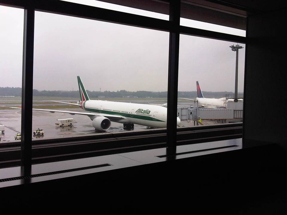 While walking towards the immigration area, I took a photo of some of the aircraft docked at Narita. This is an Alitalia plane using its familiar logo and livery from way back. I don’t remember if they’ve changed or “updated” their logo and livery recently.
 Narita Terminal 1 is large and so to proceed to the arrivals, transfer areas passengers may use the moving walkways for their convenience.
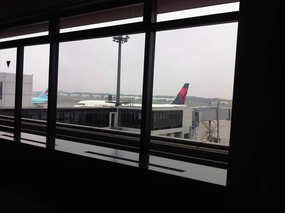 I took a photo of our plane, a Delta 747-400. Delta took over NorthWest, which I used to take for trips home when I was studying in Japan in the 1990s. Their fares are less expensive than JAL, ANA and PAL among full service airlines connecting Manila and Narita.
 After splitting up with passengers with connecting flights, we were guided to the immigrations area at the airport. Prior to the area, passengers have to go through quarantine, which is a standard check they do at airports to make sure people are not bringing in some disease that could be spread to the general population.
 After clearing immigrations, passengers descend to the baggage claim area. Passengers connecting to domestic flights bound for other destinations in the Japan are advised to take their luggage before proceeding for domestic travel check-in.
 Luggage carousel at Narita Terminal 1
 Here’s another photo of the luggage carousel. Notice the signs advising passengers against taking their carts too close to the carousel. This allows for space for people taking their bags from the belt rather than have the area congested with carts.
 After clearing customs, arriving passengers might want to change their money to Japanese Yen before purchasing tickets to travel to their intended destinations or to buy some refreshments after a long flight. There are banks proving currency exchange services at the arrival area.
 Signs at the airport gates guide passengers to the locations of bus stops and taxi stands. There are also guide signs for trains serving the airport.
 Information board for arrivals at Narita Terminal 1
 Airport Limousine Bus services are available and you can purchase tickets at their counters at the airport arrival area. While more expensive than rail transit, limousine bus services may be the most convenient in terms of routes and destinations. The service is recommended to people staying at hotels along the bus routes.
 Information on Terminal 1 North Wing arrivals and domestic departures at Terminals 1 and 2 are provided at the airport.
 For those taking their cars or taxis to their destinations, road traffic information for expressways are shown. Segments in red indicate traffic congestion, which is quite common when approaching central Tokyo.
 A small cafe inside the airport for passengers or well-wishers wanting to have a hot meal or coffee/tea.
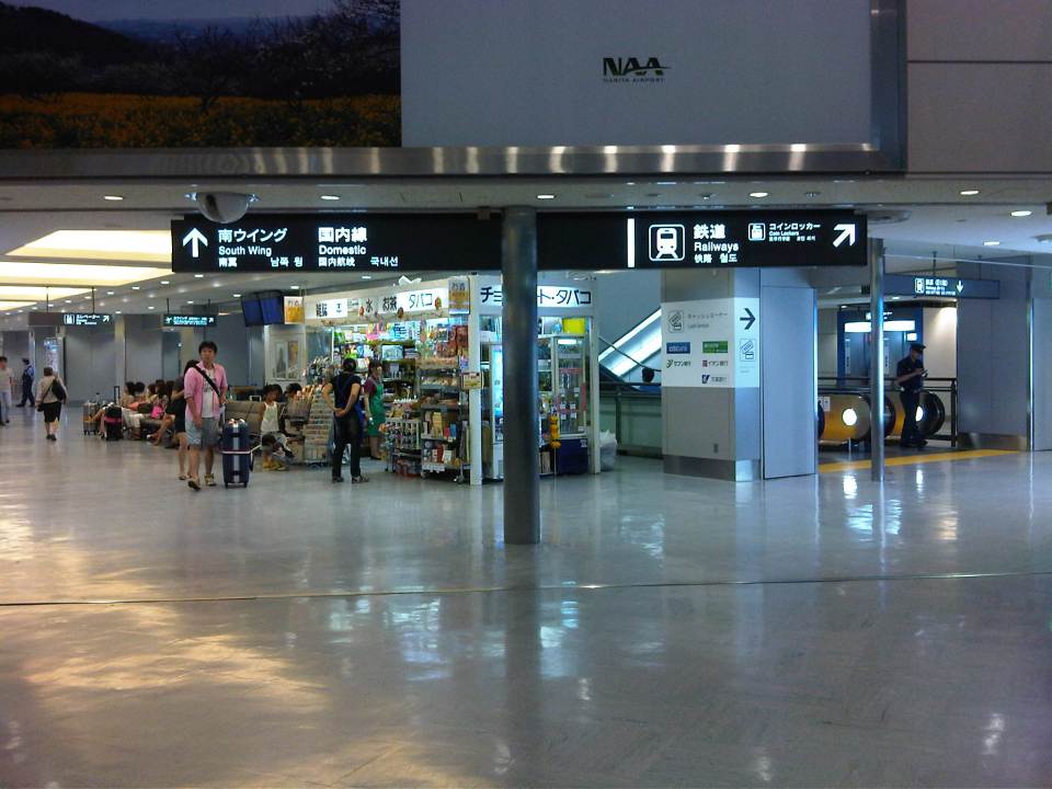 Shops at the airport sell snacks, sweets, drinks, newspapers and magazines, and some souvenirs. These are not the Duty Free shops, which are at the departure level of the airport.
I was also able to take a photo of luggage transport services counters at Narita. Unfortunately, the photo was blurry so I decided not to post it here. These transport services allow travelers with large bags or many pieces of luggage to have these delivered to their homes or hotels, allowing passengers to travel light using the trains or bus. Two of the most popular and reliable services are JAL-ABC and Kuroneko Takkyubin [with the black cat (kuro neko) logo].
–
Manila’s bus experiment
Manila recently banned provincial and city buses from entering the city stating this is because many of them do not have franchises and/or terminals in the city. Those without franchises are the ones labeled as “colorum” or illegally operating public transport vehicles, which really don’t have a right to convey people in the first place. It’s become difficult to catch them because many carry well-made falsified documents. But it’s not really an issue if the LTFRB, LTO and LGUs would just cooperate to apprehend these colorum drivers. The LTFRB and LTO are under the DOTC, and so the agency is also responsible for policies and guidelines to be followed by the two under it. LGUs (and the MMDA in the case of MM) are tasked with traffic enforcement and so they can apprehend vehicles and act on traffic violations including operating without a franchise.
Those without terminals are both city and provincial buses. For city buses, this can be because they “turnaround” in Manila and operators do not feel the need to have a formal terminal. For example, G-Liner buses plying the Cainta-Quiapo route will stop at Quiapo only to unload Quiapo-bound passengers, and then switch signboards and proceed to load Cainta-bound passengers as they head back to Rizal. There is very little time spent as the bus makes the turnaround. It’s a different case for provincial buses, whose drivers should have the benefit of rest (same as their vehicles, which also need regularly maintenance checks) after driving long hours. Thus, if only for this reason they need to have formal, off-street terminals in the city. Following are photos I took near the Welcome Rotunda en route to a forum last Friday.
 Commuters walking to cross the street at the Welcome Rotunda to transfer to jeepneys waiting for passengers to ferry to Manila.
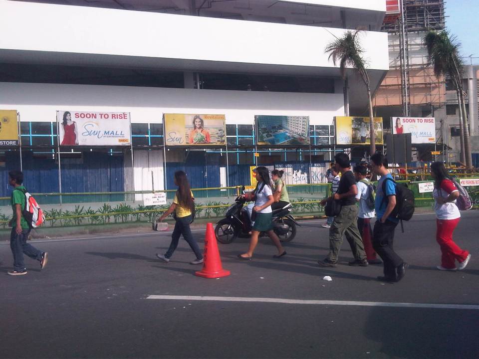
 Commuters and cyclists moving along the carriageway as there are no pedestrian or cycling facilities in front of a construction site at the corner of Espana and Mayon Ave.
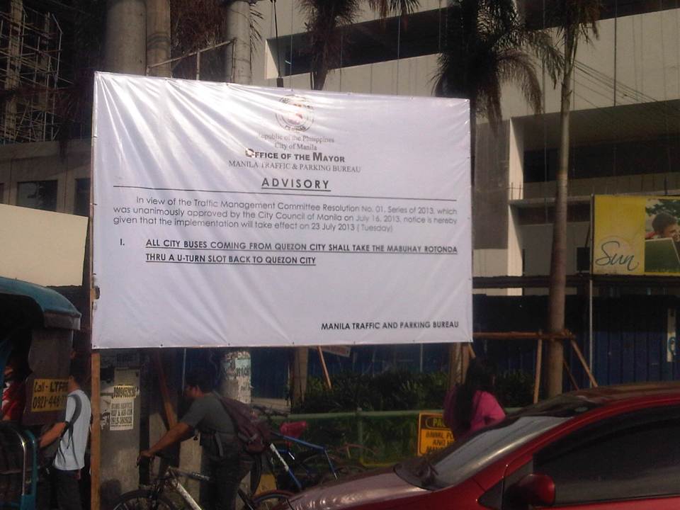 Advisory for buses coming from Quezon City
 Commuters waiting for a jeepney ride along Espana just after the Welcome Rotunda
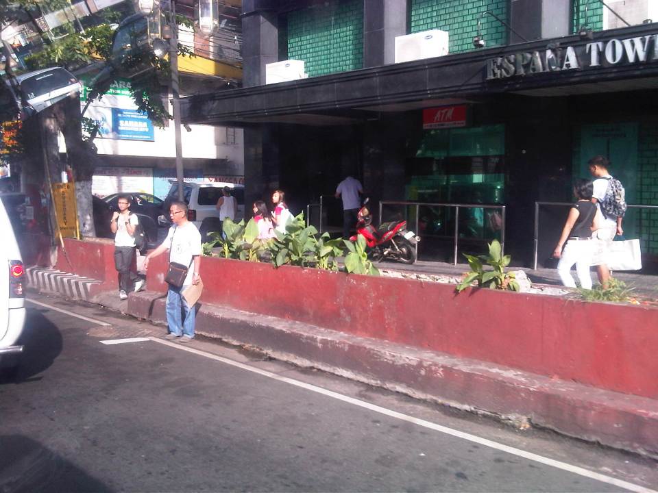 Some pedestrians opt to walk on instead of waiting for a ride. Manila used to be a walkable city but it is not one at present. Many streets have narrow sidewalks and many pedestrian facilities are obstructed by vendors and other obstacles.
So, is it really a move towards better transport systems and services in Manila or is it just a publicity stunt? If it is to send a message to public transport (not just bus) operators and drivers that they should clean up their acts and improve the services including practicing safe driving, then I’m all for it and I believe Manila should be supported and lauded for its efforts. Unfortunately, it is unclear if this is really the objective behind the resolution. Also, whether it is a resolution or an ordinance, it is a fact that the move violates the franchises granted to the buses. These franchises define their routes and specify the streets to be plied by buses. Many LGUs in the past have executed their traffic schemes and other measures intended to address traffic congestion, without engaging the LTFRB or at least ask for the agency’s guidance in re-routing public transport. Of course, the LTFRB is also partly to blame as they have not been pro-active in reviewing and optimizing PT routes.
One opinion made by a former government transport official is that this is just a ploy by the city to force bus companies to establish formal terminals in the city. This will require operators to secure permits, purchase or lease land and build terminals. And so that means revenues for the city and perhaps more traffic problems in the vicinity of the terminals just like what’s happening in Quezon City (Cubao) and Pasay City (Tramo).
Transport planning is a big part of the DOTC’s mandate and both the LTO (in charge of vehicle registration and driver’s licenses) and LTFRB (in charge of franchising of buses, jeepneys and taxis) look to the agency for guidelines and policy statements they are to implement. Meanwhile, LGUs have jurisdiction over paratransit like tricycles and pedicabs. In the case of Manila, these paratransit also include the “kuligligs,” 3-wheeler pedicabs that were fitted with engines and have been allowed (franchised?) by the city to provide transport services in many streets. Unfortunately, most LGUs do not have capacity nor capability for transport planning and so are limited or handicapped in the way they deal with transport (and traffic) issues in their jurisdictions. We have always maintained and promoted the stand that the DOTC should extend assistance and expertise to LGUs and the LGUs should also actively seek DOTC’s guidance in matters pertaining to transport. There needs to be constant communication between the national and local entities with cooperation leading to better, more suitable policies being formulated and implemented at the local level.
–
Transport in the State of the Nation Address 2013
The President of the Republic of the Philippines delivered the State of the Nation Address (SONA) last July 22, 2013. The SONA is for the mid-term as 3 years have passed since the current president was elected into office. The address was most awaited by a lot of groups. These include allies of the administration and those who have been critical of the administration. For the latter group, they would have been interested to see/hear what the SONA will report on for what seemed to them was a slow pace in the introduction and execution of reforms as well as the slow implementation of programs and projects including those regarding transport infrastructure. Of course, there is not a short supply of sycophants in Congress as in the past administrations, who would easily clap their hands at the slightest hint of accomplishment that is mentioned in the SONA. I pity their constituents who are responsible for voting them into office.
While the speech mentions a lot of gains in all fronts of the so-called war against corruption following the administration’s policy for “matuwid na daan” (straight path), the details or information most useful for people dealing with policy and technical assessments are found in the SONA Technical Report. This report is supposed to have been written based on the inputs provided by government agencies and is a more comprehensive, if not the most comprehensive, material documenting what has been accomplished so far. More importantly, it is supposed to contain material on what the administration looks forward to seeing through until the end of its term in 2016. There is the opinion that it would have been better if the report and the speech followed an outline similar to the Medium Term Philippine Development Plan (MTPDP 2011-2016) so that the reported accomplishments can be placed side by side with what the administration set out to do at the start of its term. Then, it would be possible to gauge clearly where we are and if indeed we are heading towards achieving our targets by 2016.
The transcript and video of the 2013 State of the Nation Address may be found in the Official Gazette of the Republic of the Philippines. That link is for the speech delivered in Filipino and a translation in English may be found through a link right after the end of the transcript. Similarly, there is a link SONA 2013 Technical Report found after the link to the translation.
Streets of Intramuros: Solana Street
I’m posting more photos of the streets around Mapua and Lyceum. Solana Street is behind Mapua and practically runs parallel to Muralla Street. The southeast end of the street is at its junction with Victoria Street at the Manila Science High School while the northwest end is at the junction with Muralla St. and Andres Soriano, Jr. Ave. at Plaza Espana, where located are the ruins of the Maestranza and the Intendencia.
 Intersection of Solana Street with Beaterio Street with an informal pedicab terminal at the corner.
 Real Street (view towards the southwest) as seen from Solana Street
 A newly built or renovated building is at right across from Mapua. There are many buildings hosting dormitories or rental rooms for students in the area. This is similar to buildings near institutions in the University Belt area where now stands many high-rise condominiums also catering to students.
 Intersection of Solana Street with San Francisco Street (left), which leads back to Muralla Street and the Lyceum.
 Intersection with Sta. Potencia Street – we caught an amusing sight of these two people who appear to be compacting the asphalt concrete transition between Solana’s lower pavement surface elevation with the Sta. Potencia’s new PCCP.
 Vehicles parked along Solana Street and behind the Mapua Institute of Technology
 Approaching the intersection with Victoria Street, one sees many signs of businesses geared towards the academic nature of institutions in the area (e.g., photocopying, bookbinding, computer rentals, etc.). The building on the left is Mapua’s while the ones on the right include dormitories or rental apartments on the upper floors.
–
