
Transit station connections in Singapore
The connections between transit stations in Singapore show us examples of how to encourage people to walk long distances. The links, mostly underground, are interconnected with branches to common exits to hotels, office and residential buildings. These are basically transit malls lined with cafes, restaurants and shops. There are even gyms (e.g., UFC) and play venues along some connections.
 Underground transit mall between a City Hall Station (red line) and Esplanade Station (orange line)
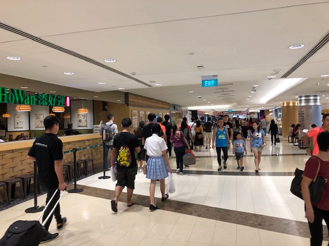 The connection is lined with restaurants, cafes and shops
Singapore’s underground connections reminded me of similar structures in Tokyo and Yokohama. You can just walk underground and come up near your destination. This is especially advantageous and comfortable during the summers when the hot weather becomes a detriment to walking outdoors. Underground transit malls or connections are usually air-conditioned or air is pumped into them for ventilation. As such, temperatures are significantly lower compared to the surface/ground. Will we have similar facilities/developments here in the Philippines and particularly in Metro Manila once the MM Subway is developed?
–
Some advantages of transit access – the case of a stadium and an arena
One of the advantages of having mass transit access to a major venue is that mass transit can carry more people than any other modes of transport to and from the venue. In the recent U2 concert held at the National Stadium in Singapore, we experienced first hand how a mass transit system is able to serve the surge in the demand to and from the Stadium Station of the SMRT’s Orange Line.
 People filing towards the station – most people calmly I say most because there were some who apparently were not so familiar with the ways in Singapore and tried to muscle their way into the crowd. Maybe its like that in their own countries?
 It was just like rush hour conditions at the station. Only, people weren’t going to work but home from the concert
Previous to this, I had similar experiences when I was residing in Japan. One time it was a surge in demand due to the popular fireworks display at Yamashita Park in Yokohama covered by three of JR Stations and the end station of the old Tokyu Toyoko Line. There was no Minato Mirai Line at the time that terminated at the park so people had only the JR Sakuragicho, JR Kannai and JR Ishikawacho Stations and the Tokyu Sakuragicho Station.
This is the weakness of the Philippine Arena, which can only be accessed via the NLEX and by road transport. The result for the larger capacity stadium’s hosting of a U2 concert resulted in horrendous traffic jams and hellish travel times for attendees. Friends stated that whatever high that they got from the concert was steadily depleted by their commutes to their homes. This will not improve even with Manila-Clark railway line because the line will be along the other side of the tollway. It won’t make sense for a branch to be constructed for the arena given the intermittent demand for the events it typically hosts in a year. But there can be a road transport connection to the nearest rail stations to at least alleviate the car traffic generated by the venue.
–
NAIA Terminal 4 parking
I have written a lot about NAIA’s Terminals 1, 2 and 3 but have featured Terminal 4 only perhaps once or twice. That’s probably because I have not used Terminal 4 as much as the others. All of my domestic flights have been via either Terminal 2 or 3 while my travels overseas are via Terminals 1, 2 and 3. And so I have had a lot of opportunities to also take photos about those terminals. The opportunity to take a few photos about Terminal 4, particularly the open parking area, presented itself last November when I fetched my wife and daughter who were arriving from a local trip one Sunday. My wife thought she had booked a Cebu Pacific flight but that turned out to be what CebGo, which used to be the Tiger Airways Philippines affiliate that Ceb Pac had acquired years ago. These operated from T4. Here are photos of the open parking area across from T4.
 Achievers Airport Hotel, which is the nearest hotel to T4
 Parking ticket at T4 parking area – the rates are the same for all NAIA Terminal parking areas
 Exit from the parking area – T4 is just across from it
 Unfinished or just unoccupied area for drivers or shops?
 View of aircraft flying overhead
The parking lot doesn’t have a lot of spaces but it was relatively easy to get a slot. I actually waited a few minutes to get a slot and immediately after I parked, a few more vehicles left. So the turnover for the parking area is high enough at least for the Sunday noontime I was there. Perhaps its proportional to the number of people using T4?
–
Commuting in Singapore
Another thing we miss about Singapore is the public transportation. It was easy to go around Singapore especially with its comprehensive, extensive rail transport network. This is complemented by even more extensive bus transit services. All these are offer convenient, comfortable and reliable public transportation. As such, there is practically no need to use your own private vehicle for transportation unless there really is a need arising for their use (e.g., emergencies).
 Passengers wait for the train to arrive at an SMRT platform
 Passengers line up before the platform gates at an underground station
The transport system in Singapore actually reminded me of how efficient and reliable it was to commute in Japan where I’ve lived in three area – Tokyo, Yokohama and Saitama – for various lengths of time. These transport systems are what Metro Manila and other rapidly urbanizing cities in the Philippines need in order to sustain growth while providing for the transport needs of its citizens.
–
Sri Lanka Airport departure – Part 2
Before I post more on a recent trip to Singapore, I backtrack a bit to the trip to Sri Lanka. Following is a much delayed second part to my feature on Bandaranaike International Airport.
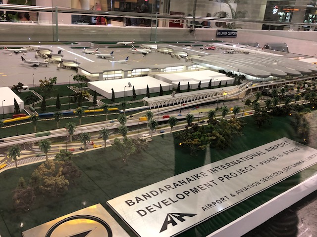 Scale model of the airport development project with this angle showing the terminal and land transport interface
 Terminal building with short pier for the gates
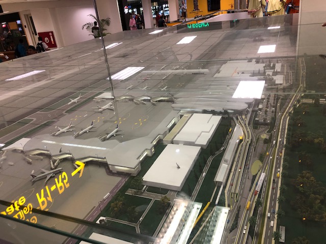
 Closer and clearer look at the interfaces with rail and road transport
 From the display we proceeded towards our gate.
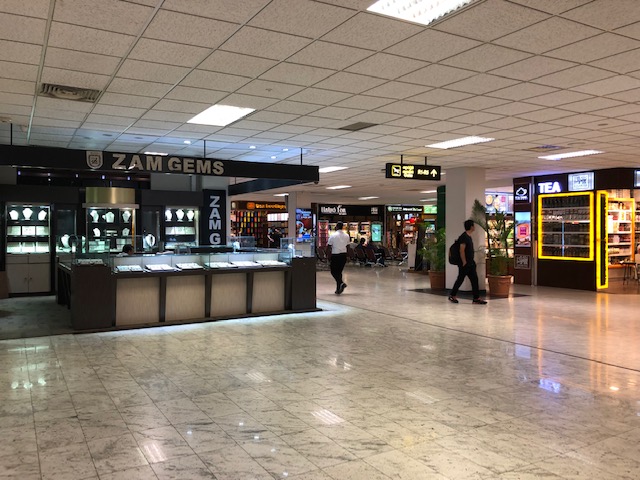 More shops mostly selling gems, jewelry or tea
 Looking out a window to see Sri Lankan Airlines planes lined up at the terminal
 Other aircraft at the terminal are accessed via transporter(i.e., bus).
 Long corridor to our gate
 Passengers head to the gates via a moving walkway. Otherwise, it would be a long walk.
 Pre-departure lounge
 Behind these seats is the smoking room
 Passengers enter the pre-departure lounge through one last security check and the boarding pass and passport check by Sri Lankan Airlines ground staff.
–
Walking in Singapore
The recent trip to Singapore was like a sentimental journey for us. We had lived in the Lion City for almost 2 years and consider this a second home (actually a close third for me because I consider Yokohama as a second home having lived there for 3 years). Among the things we truly missed about Singapore aside from friends (many of whom have already moved to other countries) and food were the public transport and the walking. Singapore is a walkable city and the excellent public transport along with the land use planning has allowed healthier commutes for people.
 The environment along Orchard Road is inviting and conducive for walks.
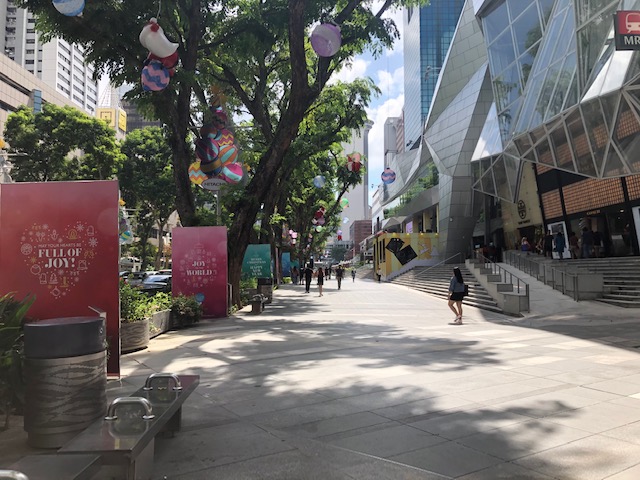 Wide sidewalks can accommodate more people and don’t make it feel so crowded even during the peak hours.
It was easy to log more than 10,000 steps per day in Singapore. In fact, I was happy to have walked an average of 11,000+ steps per day for the 3 days were there. One could only hope we can have similar infrastructure in the Philippines.
More on walking and public transport in Singapore soon.
–
Highway 2000, Taytay, Rizal
Prior to taking the photos I posted on Barkadahan Bridge, I was able to take a few photos of Highway 2000.
 Section right after the Taytay Public Market – it is basically a 4-lane road but there are no lane markings for either direction. There is only the double line indicating which sides are for opposing flows of traffic.
 Informal shops along the highway
 There are many garments and textile factories and depots/warehouses along Highway 2000 and from their names appear to be Chinese-Filipino or Chinese-owned businesses.
 There are also several gas stations along the highway including this Shell station that used to have cheaper fuel prices than others like it in Taytay and Antipolo.
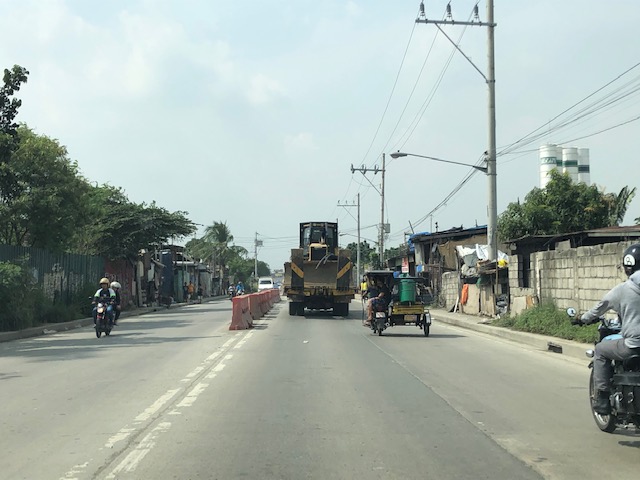
 Bikers along the highway – new pavement markings should include those for bike lanes on either side of the highway. Ideally, bike lanes or bikeways should be protected and consistent with the design along C-6.
 There seems to still be a lot of informal settlers along this road as evidenced by shanties on either side of the highway.
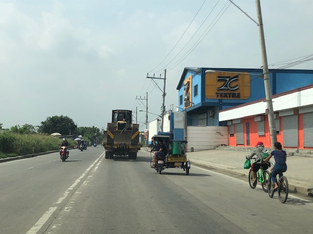
 There are many trucks using Highway 2000. Among them are those carrying tractors or heavy equipment like the one shown here hauling a bulldozer.
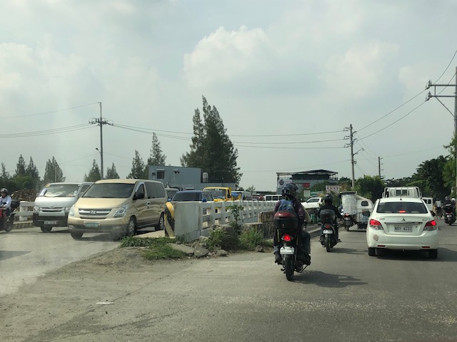
 Orange barriers delineate opposing traffic at the Highway 2000 approach to Barkadahan Bridge. The intersection before the bridge is with the East Bank Road of the Manggahan Floodway.
I posted the following photo earlier. This show the RROW acquired along the eastbound side of Highway 2000.

Highway 2000 already figures as a major link between Rizal and Metro Manila. It is part of an alternate route between Rizal and major CBDs like BGC and Makati via Circumferential Road 6. It is also a route to the south via Bicutan and eventually SLEX. Thus, it is imperative that this corridor and the Barkadahan Bridge be improved in order to carry the potential traffic (both non-motorized and motorized) that it is supposed to. Highway 2000 in particular should already feature protected bike lanes consistent with the design along C-6 in order for it to be transformed into part of a “bicycle highway” that can be the backbone for cycling as a mode for commuting.
–
Unraveling ridesharing/ridesourcing
I have been writing about ridesharing/ridesourcing/ridehailing for some time now. I have also researched on its characteristics particularly in my country where it was initially hailed (no pun intended) as a solution to transport woes in highly urbanized areas. We’ve done our research with or without the cooperation of these companies. It does not surprise me that their operations have unraveled and many are exposed to be abusive. So much for being the ‘disruptive’ initiative that was praised by many before…
Emerson, S. (2019) “Uber Drivers Protest ‘Corporate Greed’ as Billionaires Cash In”, https://onezero.medium.com/uber-drivers-protest-corporate-greed-as-billionaires-cash-in-df65a7e470a7 [Last accessed: 11/18/2019]
–
Traffic congestion due to Barkadahan Bridge rehab
Here are more photos of the situation in the vicinity of Barkadahan Bridge. Photos were taken on a late Sunday morning (around 11 AM). Photos show the traffic congestion particularly along the eastbound side of Ejercito Avenue and Barkadahan Bridge.
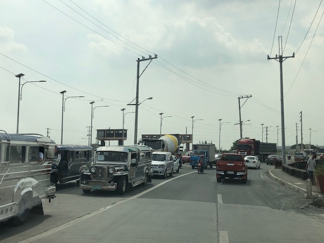
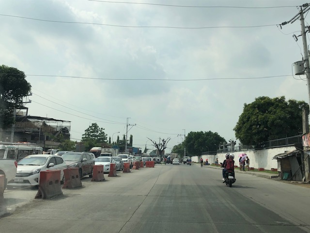 Even before completely crossing the bridge, one can see how long the queue from C-6 is. This is a photo of the queue just past the West Bank Road. The road here is names Ejercito Avenue after former Pres. Joseph Estrada whose real family name is Ejercito.
 Truck occupying an entire lane and encroaching on one of the lanes to C-6. This is due to the bottleneck caused by the wall of a residential subdivision across from the Greenwoods gate. The wall actually only contains the subdivision name and yet DPWH has been unable to expropriate the land that includes part of that subdivision’s driveway.
 Long queue extending towards Tapayan Bridge along Ejercito Avenue
 Queue along Tapayan Bridge or bridges considering there are two – one for each direction of traffic.
 Queue crossing the bridge and the bend towards C-6 and Lupang Arenda, which is a major relocation site for Metro Manila squatters during the time of then Pres. Joseph Estrada. Vehicles turn left towards C-6 while those going straight continue along Ejercito Avenue towards Pinagbuhatan, Pasig City.
 The queue reaches C-6 on a Sunday morning. It is likely worse on weekdays.
–
Sri Lanka Airport Departure – Part 1
Before I forget, I am posting the following photos of Bandaranaike International Airport when we departed for home last September.
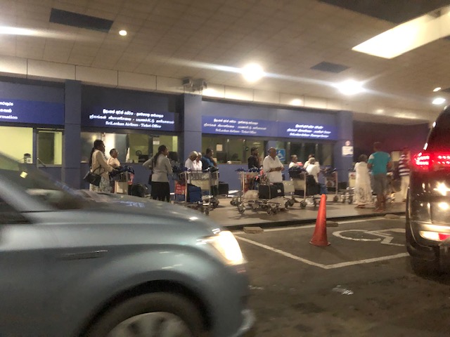 Arriving at the airport terminal driveway – it was quite early in the morning and we didn’t expect to see so many passengers
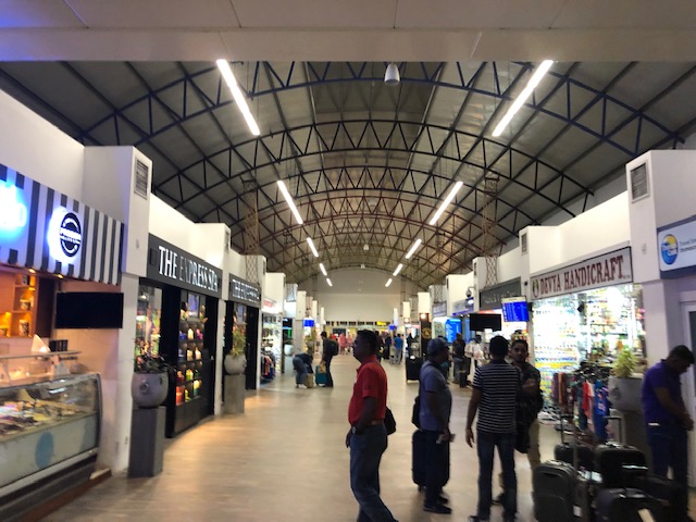 Entering the terminal, you are greeted by rows of shops selling a variety of items mostly souvenirs and foods and tea
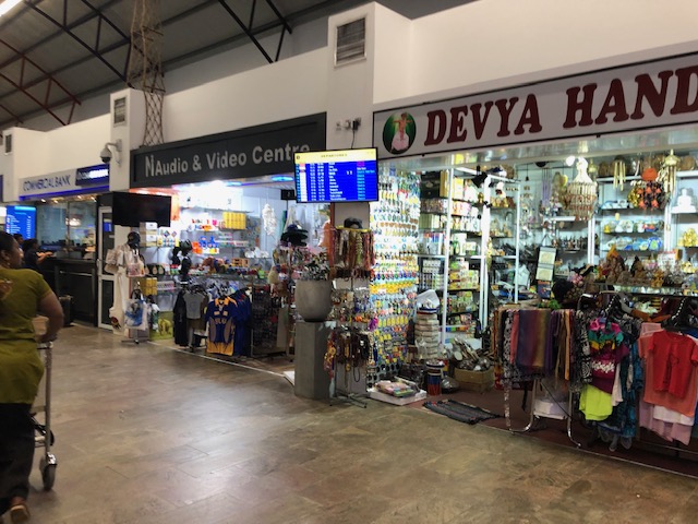 Souvenir items include clothing, tea, and electronics
 Local products including handicrafts. I bought a mask and ref magnets at one of the shops.
 The terminal has many empty spaces. I guess they still do not have so many visitors to necessitate more commerce?
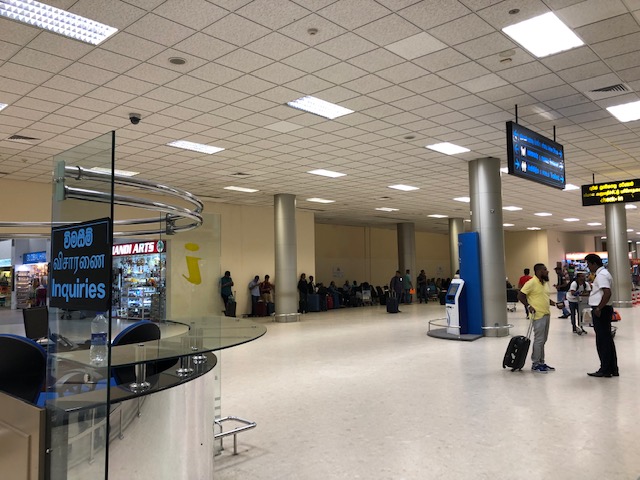 The area just before the check-in counters is spacious. We wondered if the terminal can be quite crowded during the day.
 Check-in counters for Sri Lankan Airlines – there were a lot of visitors from Arab countries due to an international Islamic convention in Colombo. Many of them were catching the earlier flights out of the country that day.
 Check-in counter for our flight
 After checking-in, we immediately entered the pre-departure area. Large screens show flight schedules and there were signs towards the gates.
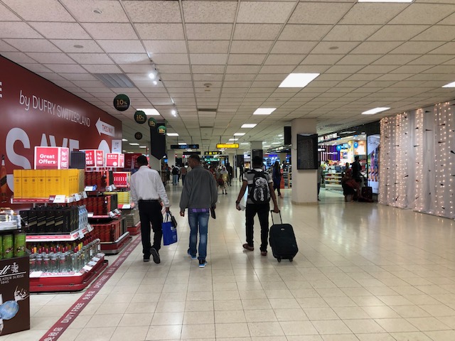
 An escalator leads to the pre-departure area where there are more shops and restaurants
 Of course, there were many shops selling teas but there were also many local products like these leather stools that also doubles as storage. These are collapsible and can easily be packed for travel. A friend brought home one for his home.
 Jewelry store at the terminal – Sri Lanka is the source for many of the world’s gemstones. Of course, the prices are very competitive and one should probably go to legitimate stores in the city instead of buying at the airport.
 Liquor and cigarettes are popular items
 More tea shops along with cosmetics and perfumes at the duty free stores
 The area between the shops and the corridor towards the boarding gates
More photos soon!
–
