
Home » Highways and Streets (Page 13)
Category Archives: Highways and Streets
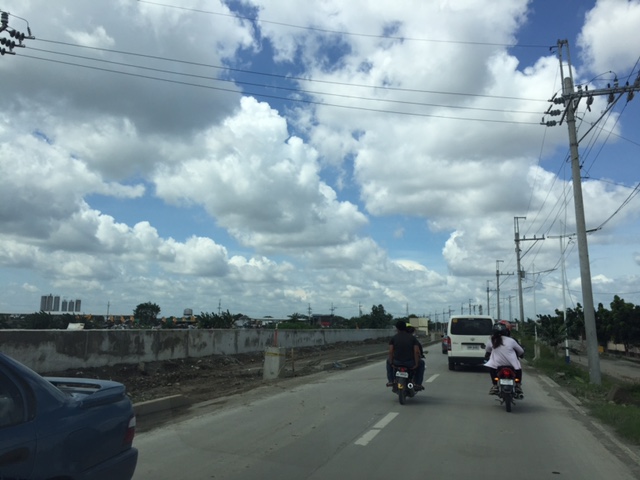
Congestion along C-6 and potential for a public transit corridor
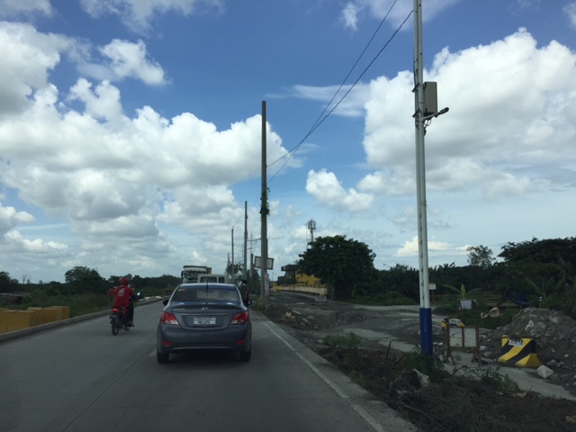
We begin February with a post on a road that’s becoming more popular as a major (as opposed to alternate) route to Bonifacio Global City (BGC) and Makati CBD – Circumferential Road 6. I took the following photo at the approach to the Nagpayong Bridge that is current has only 2 lanes (1 per direction). Another bridge is being constructed along the existing one that will increase capacity for the Pasig River crossing to 2 lanes per direction. This is similar to what was done to the Barkadahan Bridge crossing the Manggahan Floodway in Taytay, Rizal.
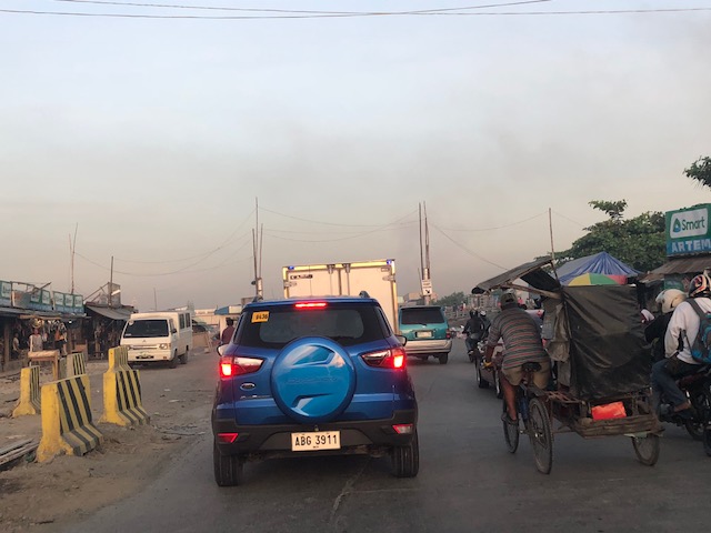
The volume of road vehicle traffic is steadily increasing along C-6. The adjacent land use offers a lot of potential for development (hopefully planned) that will feed more traffic along what will become a major thoroughfare in the near future. The land I am referring to are the reclamations on the side of Laguna de Bai along C-6 that are under the jurisdiction of Taguig and similar developments on the opposite side on what was once swampy or marshlands. One wonders if Taguig has a plan for all this or if the city is turning a blind eye and just letting developers do what they want. Most seem to be residential subdivisions and industries-related with a sprinkling of mainly small to medium-sized commercial developments.
Again, I think national and local governments should consider making this a public transport corridor by introducing formal public transport in the form of a scheduled bus service stretching from, say, Bicutan Interchange to Taytay Public Market. The demand along this corridor is steadily rising and only a better connection to C-5 limits an even steeper increase in traffic volume along C-6. The time is now in order to condition commuters about the system and to the unwanted congestion experienced along major roads in the metropolis.
–
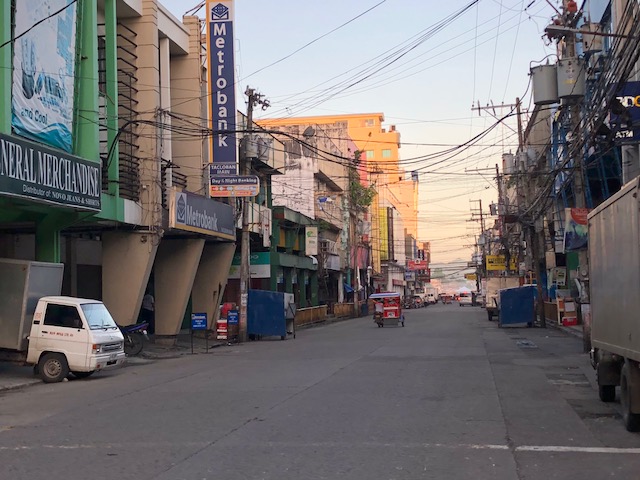
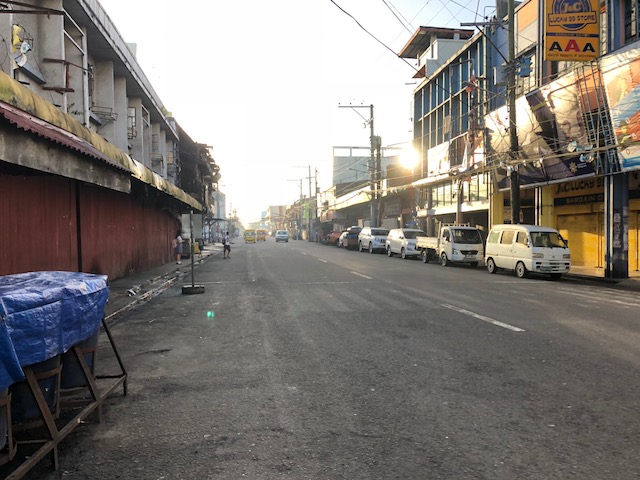
Tacloban downtown in the early mornings
Mobilizing surveyors for traffic data collection in Tacloban City’s downtown, I took the opportunity to take some photos before 6:00AM. This was before most people were at work or school on the first good weather day in the city after a week of heavy rains that brought floods and landslides to parts of the city. Schools at all levels had been suspended earlier this week with government offices also closed last Monday.
 Zamora Street towards southeast and M.H. Del Pilar Street
 Zamora Street towards northwest and Salazar Street
 Justice Romualdez Street to southwest and M.H. Del Pilar Street
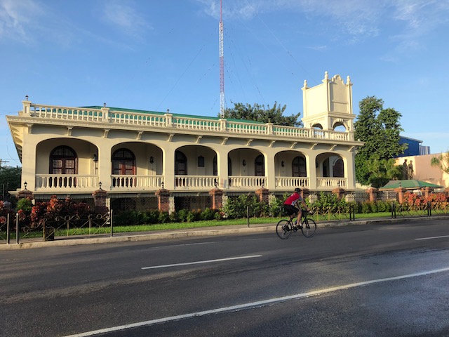 A lone cyclist along Justice Romualdez Street
There’s something about coming out to walk in the early morning in cities like Tacloban. You catch a city at a time before all the action happens, when everything seems so peaceful and calm when you see more people walking and cycling than motor vehicles dominating road space. That serenity should serve as an inspiration for what should be the vision for a city in order for it to retain its soul rather than lose it in what can be nightmarish traffic and transport conditions. Tacloban’s downtown holds so much promise for revitalisation but among the issues that need to be addressed is traffic-related. The city needs to recover spaces for pedestrians and cyclists while ensuring efficient traffic circulation for motor vehicles, particularly public transport. There seems to be spaces available for road diets and the creation of safe paths for people, and such design challenges need to be taken on in order to transform the downtown area into an example of sustainable transport.
–
Another look at the San Juanico Bridge
We have an ongoing project with the City of Tacloban and recently we went around the northern part of the city where many relocation sites were established after the onslaught of Typhoon Yolanda (Haiyan). After doing our fieldwork, we decided to cross the San Juanico Bridge into Samar island where we were told there’s a nice restaurant sitting atop a hill in the town of Sta. Rita.
Despite the rains, we managed to get some photos of the breathtaking views. Among these were this photo of the bridge as seen from Samar. Leyte and Tacloban are behind the bridge.
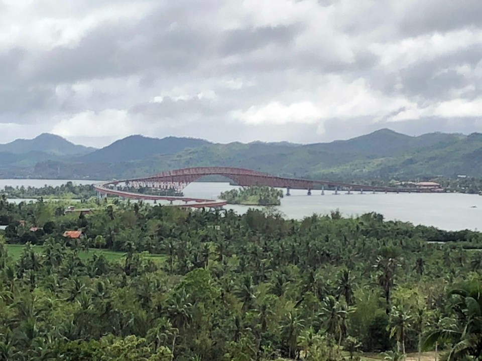 It is said that the part of the bridge on the Samar side has that distinctive ‘S’ shape while the Leyte side is a simple ‘L’ form. Trucks are weighed before they get on the bridge and the DPWH maintains a weigh station for this purpose before the Samar end. I didnt notice any from the Leyte side. Perhaps this is because most loaded trucks come via Samar rather that from Leyte?
Traffic along the San Juanico is usually light. This is despite the route being part of the eastern spine or nautical highway that is also part of the Asian Highway network. This leads me to suspect that similar (but longer and more expensive) bridges proposed for connecting other islands are unnecessary and cannot be justified when compared with other more urgent infrastructure projects including those that wil address urban congestion and promote improved mobility. The latter are more urgent and meaningful than massive structures that fewer people will use and benefit from.
–
The newly opened 2nd Barkadahan Bridge
A new bridge had been under construction beside the older Barkadahan Bridge. Instead of expanding the existing bridge, the proponents decided to build another bridge likely so as to reduce disturbance of traffic along the already congested first bridge. This is the same strategy for the bridge across the Pasig River in Nagpayong/Napindan that will reduce the potential bottleneck for when C-6’s expansion is completed. Unfortunately, the bridges don’t seem to include provisions for exclusive bicycle lanes that are clearly incorporated along much of C-6.
 I took this photo as we were in queue at the approach to the intersection of Highway 2000 and the Manggagan Floodway’s East Bank Road. The new bridge can be seen here bearing eastbound traffic. The alignment at the intersection has not been addressed and so requires through traffic to basically swerve towards the entry to Highway 2000.
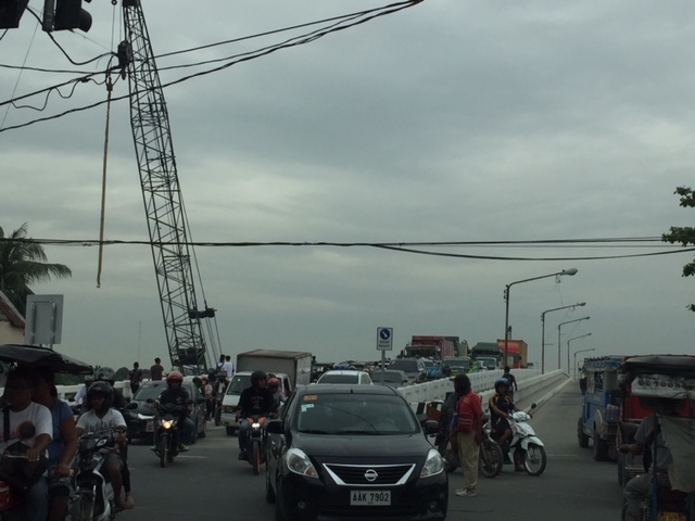 Here’s the intersection and the newly opened bridge. Note the vehicles coming towards my position as they follow a trajectory from the bridge to the narrow exit leg of Highway 2000.
 Instead of a single lane along each direction, the two bridges now allow for at least 2 lanes of traffic either way. I say at least because a case can be made for 3 lanes to be indicated (there are no lane markings yet). The issue here though is that there is significant truck traffic crossing the bridge and two trucks traveling beside each other easily occupies the entire bridge. Thus, maybe a wide two lanes can be designated for both bridges with an opportunistic third lane forming depending on the traffic.
–
New guidelines for bikeways
I want to share an article discussing new guidelines for bikeways released in the US.
Andersen, M. (2017) “Which Bike Lanes Should Be Protected? New Guide Offers Specifics,” Streets Blog USA, https://usa.streetsblog.org/2017/11/01/which-bike-lanes-should-be-protected-new-guide-offers-specifics/ (Last accessed 11/16/2017)
This is useful not only for practitioners or planners but also for academic purposes such as in transportation planning or engineering courses where future planners and engineers are molded.
–
Tacloban’s one-way traffic scheme
I was in Tacloban City last month and got to meet former participants to our training program who are working for their Traffic Operation Management Enforcement and Control Office (TOMECO). Among the topics of discussion was the traffic scheme for the central business district (CBD). Last year, the city had implemented a one-way traffic circulation scheme for the CBD as shown in the following map in the traffic advisory released by the city:

The city had to ease up on the one-way scheme, retaining it for the northwest-southeast directions and reverting to 2-way flow for the northeast-southwest directions. This decision was apparently due to the feedback the city got from various stakeholders about travel times and distances becoming longer due to the one-way scheme. This needs to be verified by collecting data pertaining to typical routes taken by vehicles, private and public utility, in order to get from an origin to a destination (e.g., from home to school). This can be simulated or estimated using field data (travel time surveys). We intend to use both as we make an assessment of the scheme and formulate recommendations for the city.
–
Some recommended references for sustainable transportation design
We conclude the month of October with the following recommended readings:
- Designing Walkable Urban Thoroughfares: A Context Sensitive Approach, An ITE Recommended Practice, 2010
- Model Design Manual for Living Streets, 2011
- Smart Transportation Guidebook, Planning and Designing Highways and Streets that Support Sustainable and Livable Communities, 2008
While these are guidelines and manuals developed and published in the United States, the principles and much of the content and context are very much applicable here.
As an additional reference, here is the latest version of functional classifications for streets that is supposed to be context-sensitive:
- Stamatiadis, N., A. Kirk, D. Hartman, J. Jasper, S. Wright, M. King, and R. Chellman. 2017. An Expanded Functional Classification System for Highways and Streets. Pre- publication draft of NCHRP Research Report 855. Transportation Research Board, Washington, D.C.
–
On one way schemes
A proposed one-way scheme for EDSA, C-5 and Roxas Boulevard raised not a few eyebrows among transportation and traffic professionals. While it seems to some that the three major thoroughfares are parallel or can be paired in such a way that EDSA can be one-way southbound, and C-5 and Roxas Blvd. can be one-way northbound, it is not as easy at it seems because these arterial carry a heckuva lot of traffic compared to the roads they are being compared to (New York?). The road network layout is also quite different. We have a circumferential and radial road network as the backbone of road-based transportation. A one-way scheme could be more effective if we had a grid type network where you have several pairs of roads that can be designated as one-way streets.
Take the case of Tacloban City, whose central business district has a grid-type network with intersections relatively closely spaced. The city implemented a one-way scheme as shown below:

Note the pairs of roads designated for one-way flow. These basically make for efficient traffic circulation provided the capacities of streets and intersections are not significantly reduced by factors such as on-street parking and other roadside friction. This can be achieved in various places in Metro Manila where streets are similarly laid out and there are multiple pairs to promote good circulation. Makati, for example, has many one-way streets in its CBD, and these are also in pairs. While having high capacities, EDSA, C-5 and Roxas Boulevard just does not have the closely spaced intersections to effect efficient circulation. In fact EDSA (or C-4) and C-5 are arterials that function to distribute the traffic carried by radial roads such as Roxas Blvd., Shaw Blvd., Commonwealth Ave, Aurora Blvd., etc.
A better option is to focus on improving road -based public transport by setting up high capacity, express bus services with exclusive lanes. These may not necessarily be full Bus Rapid Transit (BRT) systems but requires a drastic reduction and restructuring of current numbers of buses along EDSA and their deployment along corridors like C-5 and Roxas Blvd. Express means longer intervals between stops (hint for EDSA: express bus stops coinciding with MRT-3 stations), and increased travel speeds made possible by exclusive lane(s). This could have been piloted during the APEC meetings in the previous administration where 2 lanes for each direction of EDSA were appropriated for APEC vehicles. These lanes could have been used afterwards for a BRT (-lite?) system and what could have been an pilot could have also provided an appreciation or “proof of concept” for BRT in Metro Manila that we could have learned a lot from.
–
Some thoughts on Metro Manila traffic
I was going to defer posting another article this September as I reached my usual quota of at least 10 posts. Particularly, I wanted to have a series about my recent trip to Vietnam. But then the traffic congestion the past week was just so severe that I felt I just had to write another piece.
To be fair, there are so many reasons why transport and traffic are bad in Metro Manila. Among these is the lack of mass transit infrastructure, particularly a more comprehensive rail-based system. Metro Manila, with its population of over 12 million requires something like 8 to 10 mass transit lines that are interconnected and allows for seamless transfers with road transport modes. Singapore, with less people, has more efficient options for public transport. Then, there is the lack of facilities for walking and cycling that could tremendously reduce the number of trips using motor vehicles particularly for short trips (perhaps within 2 to 3 kilometers travel distance?). I won’t even go to the deficiencies of road public transport and the proliferation of private cars operating as full time taxis (ridesharing anyone?). And urban planning? Well, that deserves its own article…
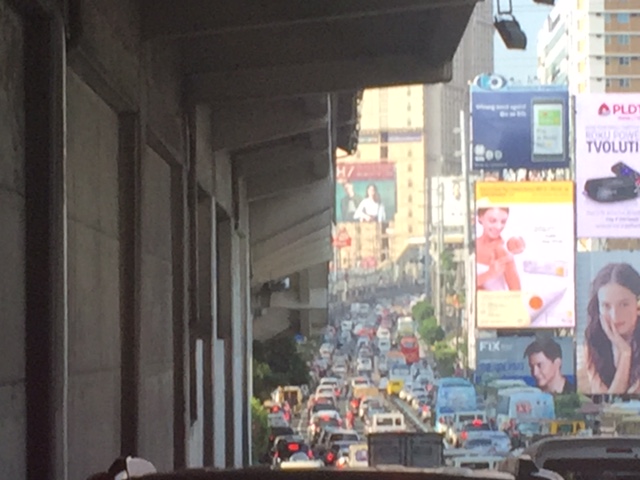 This is EDSA in the mid-afternoon. I took this photo while we were heading back to Quezon City from Makati around 3:30PM. It was not supposed to be this heavy considering people were still at their workplaces, schools or even the shopping center/malls.
There is no quick fix to Metro Manila’s problems. Obviously, the infrastructure that should have been in place decades ago need to be built albeit at a high cost. Our children and grandchildren will likely end up paying for these but there is also the reality that such infrastructure won’t get cheaper in the future. There should also be stricter policies and enforcement to improve the quality of services of public transport. As it is, private transport modes including taxis, the popularity of ridesharing/ridehailing services and the unregulated motorcycle taxis are steadily taking people away from public transport. This is perhaps among the most significant causes of more congestion for the metropolis that needs to be quantified and validated for us to understand and determine what measures need to be taken.
I conclude this post and September with a nice article on walkability:
Steuteville, R. (2017) Why walkability is not a luxury, Public Square, https://www.cnu.org/publicsquare/2017/09/28/why-walkability-not-luxury, last accessed September 29, 2017.
–
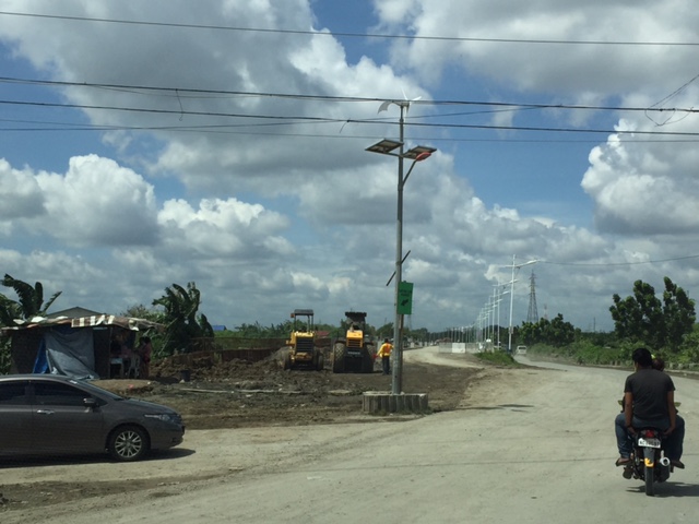
Some updates on C-6
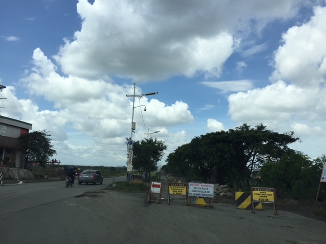
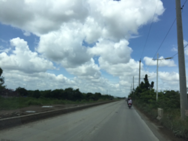
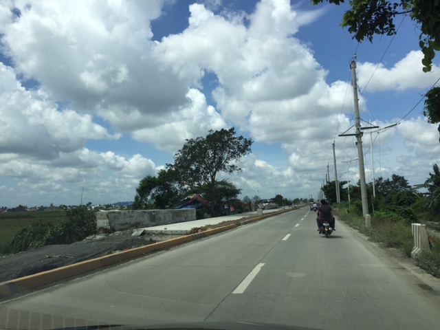
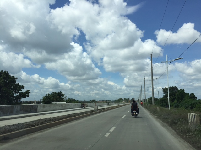
It seems late but there seems to be no really significant changes to the state of Circumferential Road 6 as the rains seem to have slowed down work on sections of the highway. We took these photos 3 weeks ago showing the nice 2-lane/2-way section on the side of the Laguna de Bay that’s been opened to general traffic. Previously, most vehicles had to use the beat-up, crater-plagued older section of what was a dike road. We were heading to SLEX via Bicutan so we were able to take a lot of photos for the entire stretch of C-6. I won’t be annotating all the photos anymore but suffice it to say that the series starts just after the Napindan Bridge in Pasig and ends prior to Taguig City’s bayside park at Lower Bicutan. Vehicles bound for C-5 or BGC via Ruhale Street should get off the newer section and negotiate a short but very bumpy road that’s not a good experience if you’re using a car. Just after the Ruhale “exit” all vehicles would have to return to the old road and have to be patient with the bad conditions of the pavement on both sides of the road.


–
