
Home » Infrastructure (Page 26)
Category Archives: Infrastructure
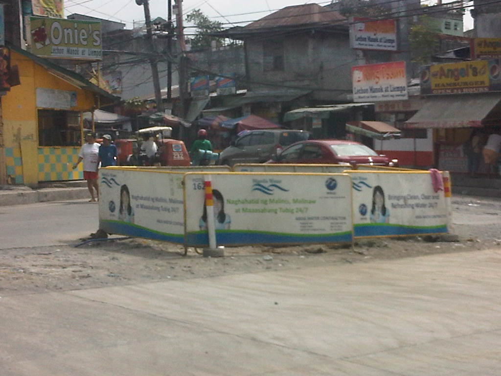
#ReliefPH: Access and needs in many other places
The buzz on the streets and on social media is the focus on Tacloban, Leyte when vast areas and many other towns and provinces have been ravaged by super typhoon Yolanda (Haiyan). This seems unfair to other cities and municipalities considering Yolanda made 6 landfalls at or near peak strength (as a Category 5 typhoon) with winds topping 225 kph and generating destructive storm surges as it hammered through the central Philippines.
If you have Facebook, one provincial government staff has posted a lot of photos describing the situation in the northern towns of Iloilo where the destruction caused by the typhoon is very clear and to many, still unimaginable. These photos along with all others that can be Googled, Yahooed or found via other search engines or news agencies show the extent of the damage brought about by Yolanda.
Some people say that the islands of Cebu, Panay, Negros and Mindoro are fortunate as principal cities in those islands like Cebu City, Iloilo City, Bacolod City, Dumaguete City and Calapan City were relatively undamaged. This is also true, and so the airports and ports in these cities provide direct access to the islands for relief work. Moreover, government agencies and private entities have been able to organize relief activities through these cities and based on various news reports, it looks like a lot of people are already involved in these activities. That goes without saying that more people are still needed to be involved in various capacities for relief, rehabilitation and reconstruction work that are expected to be undertaken over a longer term considering the extent of the damages to towns. But given the circumstances for the said islands, there is no excuse for more rapid aid not being able to reach the affected towns in these provinces. In fact, much more is expected where accessibility is no longer an issue and so faster recovery is possible for Panay, Negros, Cebu and Mindoro. In the cases of Cebu and Bohol, it is important to remember that the provinces already are also still reeling from the impacts of the Magnitude 7.2 earthquake that occurred only a few weeks ago.
On another note…Tacloban Airport is still closed to commercial aircraft but the land routes via RORO or the nautical highways are open to traffic or operational. I think the quickest way to Leyte is via the route from Cebu. There are regular RORO and Supercat services between Cebu City and Ormoc City in Leyte. There are other maritime transport services from Bogo City in northern Cebu but I am not sure those services are back to normal. Then there are also access via the Eastern Nautical Route via the Bicol Region and crossing over to Samar Island (Allen) via Matnog, Sorsogon. Many roads still need to be cleared but the main highway (Pan Philippine Highway) including the San Juanico Bridge that connects the islands of Samar and Leyte.
–
Proposal for a Special Mass Transit Support Fund
There are three bills currently being discussed at the Senate that were filed by Sen. Ralph Recto. These propose the restructuring of the special funds derived from the Motor Vehicle Users’ Charge (MVUC) in order to allocate funds for mass transportation.
Senate Bill 446 – An Act Creating The Special Mass Transit System Support Fund, Reallocating The Disposition of Monies Collected From The Motor Vehicle User’s Charge, Amending For The Purpose Sections 7 And 8 Of Republic Act No. 8794, Otherwise Known As The Motor Vehicle User’s Charge Act of 2000.
Senate Bill 611 – An Act Creating The Special Mass Transit System Support Fund To Provide Additional And Long-Term Funding To Priority Mass Transit Projects In The Greater Metro Manila Area, Amending For The Purpose Sections 7 And 8 Of Republic Act No. 8794, Otherwise Known As The Motor Vehicle User’s Charge Act of 2000.
Senate Bill 621 – An Act Creating The Special Mass Transit System Support Fund Amending For The Purpose Sections 7 And 8 Of Republic Act No. 8794, Otherwise Known As The Motor Vehicle User’s Charge Act of 2000.
The National Center for Transportation Studies (NCTS) was requested to submit a position paper on these bills by the Senate Committee on Public Works that is chaired by Sen. Ferdinand “Bongbong” R. Marcos, Jr. The Center drafted one and submitted the 4-page document to the Committee secretariat last October 16, 2013. A copy of the position paper may be downloaded from the following link:
NCTS PositionPaper MVUC 16Oct2013
The Senate Committee on Public Works held a public hearing last October 17, 2013 at the Lorenzo Tanada Room at the Senate. The NCTS Director, Dr. Hilario Sean O. Palmiano, was invited as a resource person for the hearing and joined representatives of agencies such as the DPWH, DBM, DOF, LTO and the Road Board in providing insights and comments on the proposed bills. The same agencies were also requested to provide pertinent data for the committee to evaluate the proposed changes to R.A. 8794. Such data include information on past disbursements and approved projects that used the special funds under the MVUC.
–
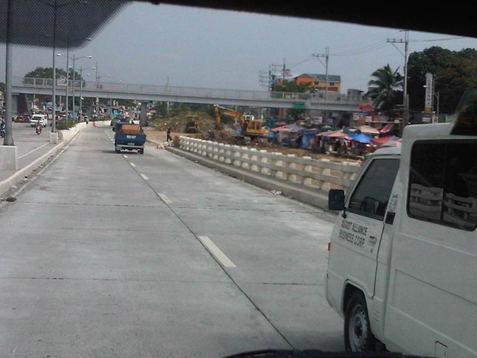
Disaster preparedness and resilience for the Philippines
The earthquakes that affected mainly the provinces of Bohol and Cebu in central Philippines this morning reminds us of the need to be more prepared for such natural occurring calamities that are practically unpredictable. I like what the Phivolcs Director Renato Solidum stated about the need to check design, materials and construction workmanship for structures in order to have these built in compliance with structural engineering guidelines covering seismic design. These apply also to transport infrastructure like roads, bridges, airports and ports. These are important for relief operations as accessibility is critical to mitigate impacts of disasters.
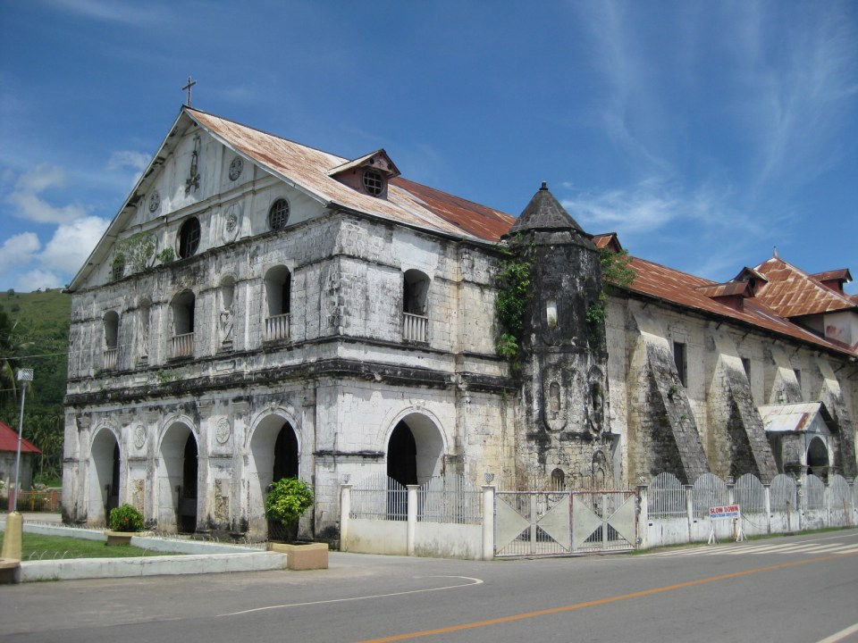
I post the photos of some of the heritage churches we were able to visit during travels to Bohol in 2008 and 2012 as a reminder of sorts of what we probably have lost in terms of cultural heritage assuming we are unable to restore these structures to their old forms. Perhaps the local (and national) chapters of architects (UAP) and civil engineers (PICE) should pitch in to make sure restoration work will be undertaken with care and of the highest quality.
 Bell tower of the Loboc Church in Bohol, which crumbled due to the earthquake
 Loboc Church, which was also destroyed by the earthquake
 Baclayon Church, also in Bohol, whose watchtower was destroyed by the earthquake
 Interior of Baclayon Church
 Facade of Dauis Church in Bohol that was also destroyed in the earthquake
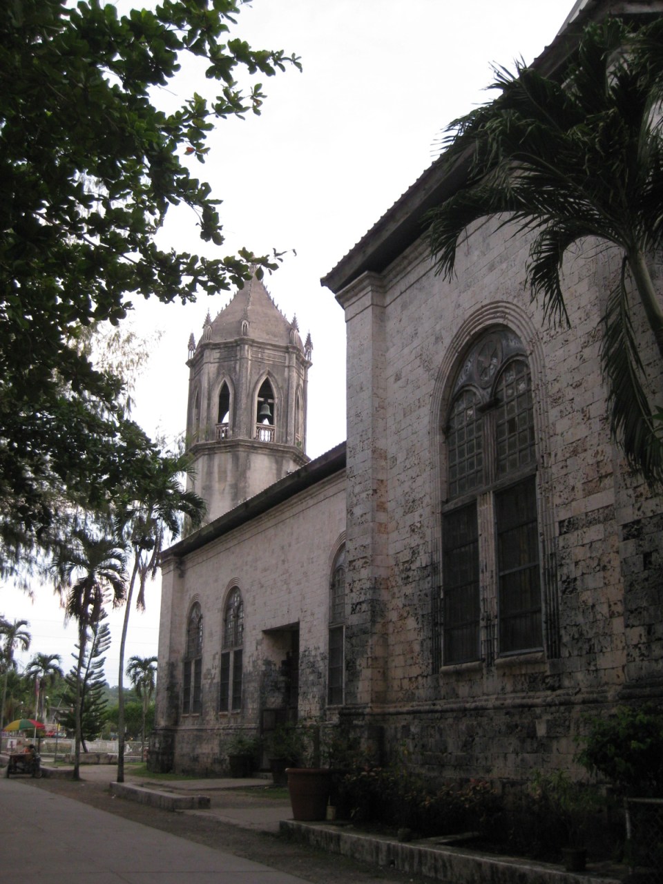 Another view of Dauis Church
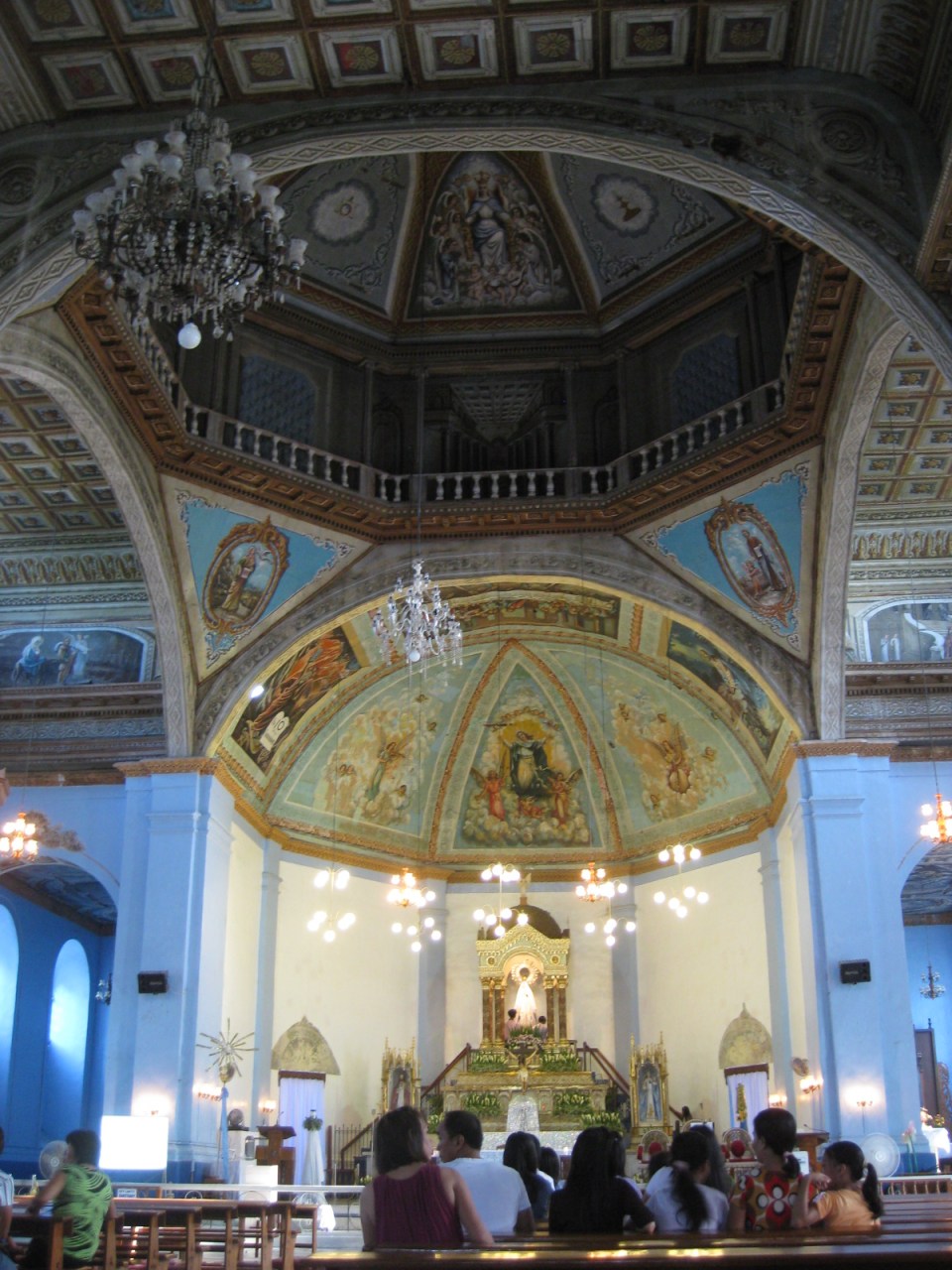 Interior of Dauis Church
.There are many heritage structures around the country and in the nearby islands of Panay and Negros alone, there are many examples of these that need to be assessed and perhaps fortified in the likely occurrence of a powerful quake in the future. In addition, the damaged roads and bridges and the landslides that have blocked many roads reminds us of the need for more disaster resilient transport infrastructure. Resilience may also mean the provision of redundant infrastructure to ensure alternate routes for relief operations.
–
Floods and traffic
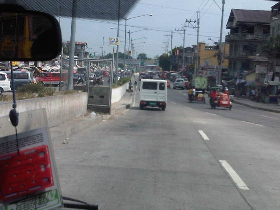
Transport and traffic problems take a backseat to the flooding problem during this time of the year in the Philippines. Since there are practically only two seasons (dry and wet) in the country, floods become a genuine concern once monsoon rains arrive and these are usually complicated by a high frequency of typhoons between August and November. Many major roads in Metro Manila are prone to flooding including Espana Avenue, Araneta Avenue, Gil Fernando Avenue, Ortigas Avenue, and EDSA. Flash floods often lead to traffic congestion and commuters and motorists alike would have a hell of a time traveling yet it seems very little has been done to address a situation that’s been here since the Spanish period. This is a perception by many people and a reasonable one given the historical evidence of flooding in the area and elsewhere in the country.
 Pedicab ferrying passengers in a flooded residential area
There are many images on the current floods in Mega Manila that one can find in various reports online and on TV. The Telegraph provides good photos for describing the situation around Metro Manila and the surrounding areas, and especially in the low-lying areas like Marikina, Malabon, Rodriguez and Cainta. These images could have been taken in any other year in the past and the images would probably be the same with slight changes in some buildings that could have been improved (e.g., additional floor?) in response to the flood experience.
Floods and possible solutions have been the topics of discussions every year and usually during this rainy season. While there have been efforts to address this problem, these are usually and obviously not enough and a more comprehensive approach is needed. Quite obviously, too, solutions that tend to dig up faults in urban planning throughout Metro Manila have led nowhere as legitimate residents and other locators in these areas are not in a position to give up their properties just like that. Relocating informal settlers and others who have encroached from waterways and other critical areas is a start but will have limited impacts in part because Mega Manila does not have a good drainage system in the first place.
Expensive as they are, engineering solutions like perhaps what Tokyo has done in this underground wonder. Of course, this example is a kind of ultimate solution and would require tremendous resources to realize. But then this is also like the transport and traffic problems we are experiencing where years (or decades) of inaction and hesitation due to resource and technical questions have led to the despicable transportation we have now The reality is that solutions will not get cheaper as we continue to balk at the cost of the required solutions. Floods and traffic will not be solved overnight. It will take years to improve the lives of many people in flood prone areas and implementing solutions should have started yesterday.
Special lectures on transportation after the 2011 tsunami in Japan
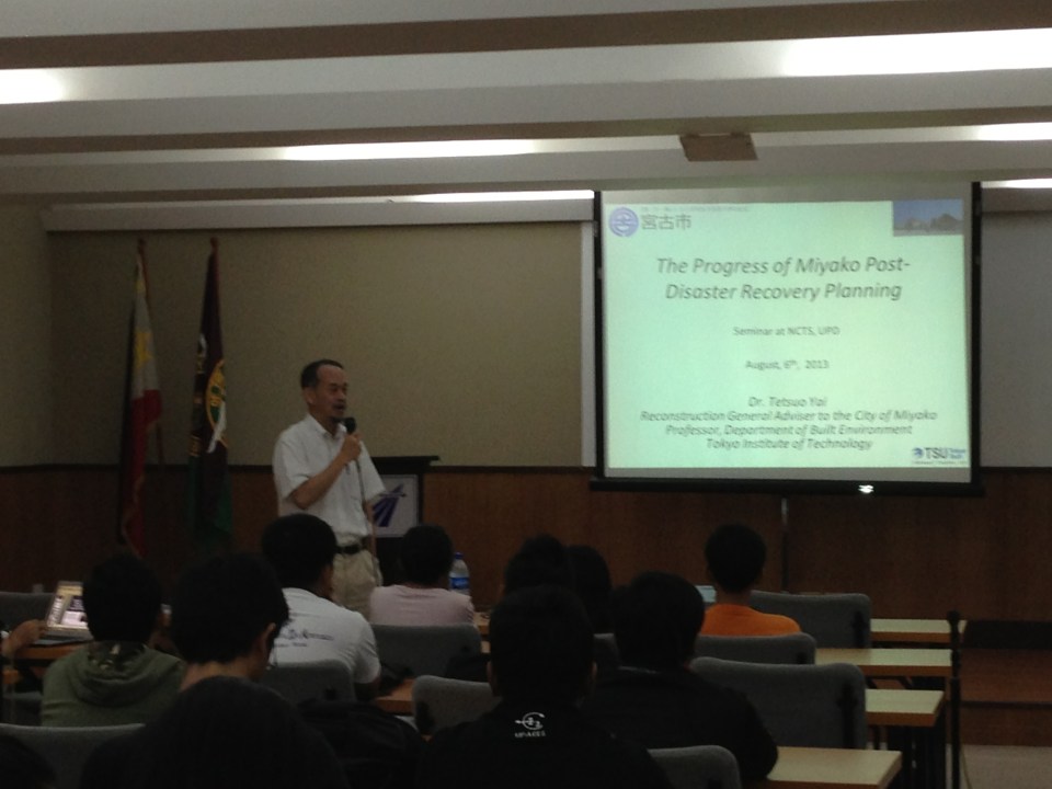
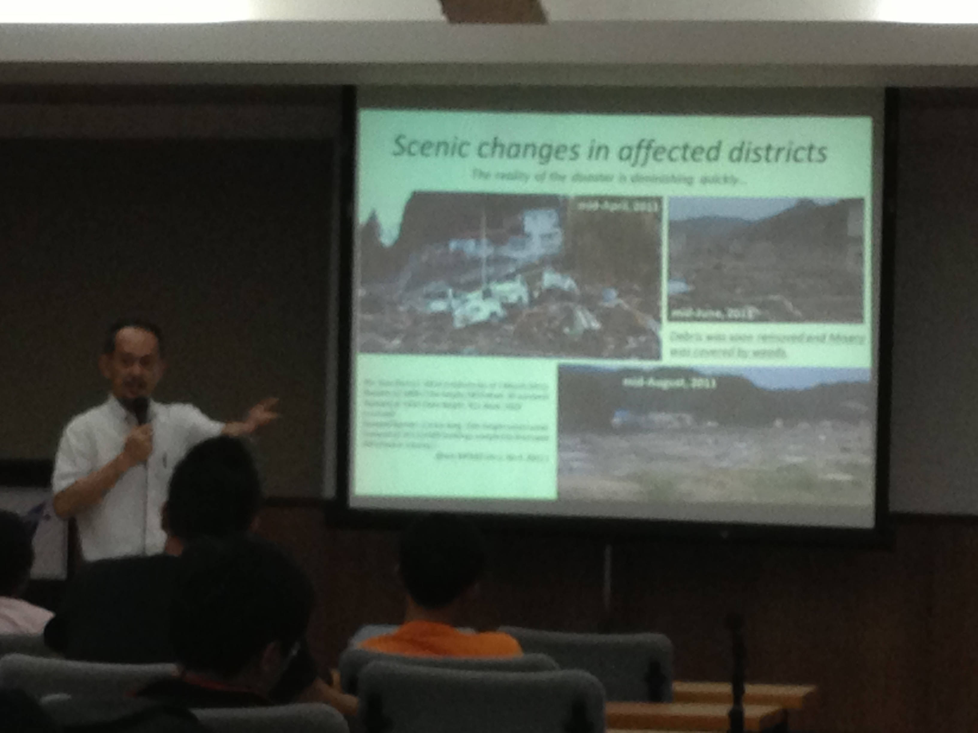
We recently had the honor of hosting two professors from the Tokyo Institute of Technology (Tokyo Tech). Prof. Tetsuo Yai was an adviser to two (2) faculty members of the Institute of Civil Engineering of UP Diliman and Dr. Daisuke Fukuda was adviser to a former student of ours who is now with De La Salle University. While both are in the transportation field, their laboratories are located in different campuses of Tokyo Tech. Prof. Yai’s laboratory is at the Suzukakedai campus in Yokohama while Dr. Fukuda’s lab is at the main campus in Ookayama where Prof. Yai used to have his laboratory.
Prof. Yai delivered a lecture on “The Progress of Miyako Recovery Plan from Tsunami Disaster” while Dr. Fukuda presented on the “Impacts of Rolling Blackouts on Railway Transport Service in Tokyo Metropolitan Area after the 2011 Tohoku Earthquake.” The lectures were held at the Toyota Training Room of the National Center for Transportation Studies (NCTS) with an audience comprised mainly of graduate and undergraduate students of Civil Engineering.
 NCTS Director Sean Palmiano opening the lectures and introducing Prof. Yai to the audience.
 Prof. Yai introducing his topic and talking about the earthquake and tsunami that hit the Tohoku region in 2011.
 Prof. Yai explaining about the effects of the tsunami on Miyako City and the initiatives for recovery.
 Dr. Fukuda describing the urban rail network in the Tokyo Metropolitan Area.
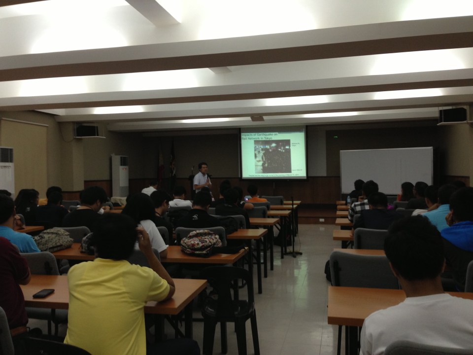 The lectures were well-attended.
 Dr. Fukuda explaining on the impacts of blackouts on rail transport and commuting times in Tokyo and its surrounding areas.
–
Transport in the State of the Nation Address 2013
The President of the Republic of the Philippines delivered the State of the Nation Address (SONA) last July 22, 2013. The SONA is for the mid-term as 3 years have passed since the current president was elected into office. The address was most awaited by a lot of groups. These include allies of the administration and those who have been critical of the administration. For the latter group, they would have been interested to see/hear what the SONA will report on for what seemed to them was a slow pace in the introduction and execution of reforms as well as the slow implementation of programs and projects including those regarding transport infrastructure. Of course, there is not a short supply of sycophants in Congress as in the past administrations, who would easily clap their hands at the slightest hint of accomplishment that is mentioned in the SONA. I pity their constituents who are responsible for voting them into office.
While the speech mentions a lot of gains in all fronts of the so-called war against corruption following the administration’s policy for “matuwid na daan” (straight path), the details or information most useful for people dealing with policy and technical assessments are found in the SONA Technical Report. This report is supposed to have been written based on the inputs provided by government agencies and is a more comprehensive, if not the most comprehensive, material documenting what has been accomplished so far. More importantly, it is supposed to contain material on what the administration looks forward to seeing through until the end of its term in 2016. There is the opinion that it would have been better if the report and the speech followed an outline similar to the Medium Term Philippine Development Plan (MTPDP 2011-2016) so that the reported accomplishments can be placed side by side with what the administration set out to do at the start of its term. Then, it would be possible to gauge clearly where we are and if indeed we are heading towards achieving our targets by 2016.
The transcript and video of the 2013 State of the Nation Address may be found in the Official Gazette of the Republic of the Philippines. That link is for the speech delivered in Filipino and a translation in English may be found through a link right after the end of the transcript. Similarly, there is a link SONA 2013 Technical Report found after the link to the translation.
Whatever happened to…?
Today, we step back and review a few items we have written about in this blog. I’ve chosen my top ten of what I thought were transport programs and projects that deserve to be checked. Here they are with notes on what went on from the year 2010 and the current state on these items. They are not arranged in any order so there is no item prioritized over the others.
Whatever happened to:
1. Wangwang – In 2010, the current administration through the Land Transportation Office (LTO) and the Philippine National Police (PNP) implemented a program practically eradicating our roads of illegal users of sirens (wangwang) that have become a major irritant (and perhaps pet peeve) to many road users. At present, there are many reports of politicians and other (feeling) VIPs employing PNP escorts to part traffic. In some cases, motorcycle police or bodyguards in escort vehicles rudely engage other motorists and there have been allegations of some pointing guns at other drivers to force them to give way.
2. LRT Line 2 extension to Masinag – In 2010, plans to extend LRT Line 2 from Santolan to Masinag were revived. The extension is supposed to be a no-brainer considering the design of the elevated line including the two stations comprising the extension could be based on the existing Line 2. The only major modifications here would be if the stations were to be connected to the shopping malls in their areas (Sta Lucia or Robinsons Metro East at Imelda Ave/P. Tuazon and SM at Masinag). Do we really need to have another study to tell us how many people will be riding Line 2 should it be extended to Masinag? The number of people waiting at Katipunan, Santolan and the Metro East/Sta. Lucia and the number of jeepneys cutting trips are strong indications of demand. In fact, I believe the line should be extended all the way to Cogeo but then the design there is more challenging as that extension would be up the mountains of Antipolo.
3. EDSA-MRT capacity expansion – The past 3 years have seen a steady increase in users of rail mass transit in Metro Manila and particularly as congestion along our roads continue to worsen. EDSA is always congested and the experience of last Monday’s monstrous congestion along the corridor reminded us of just how important a higher capacity MRT Line 3 would be to ease congestion along EDSA. The bidding for the rolling stock have been delayed and there might be a need to expand stations in the future to accommodate the longer trains required to serve the demand for this line. Needless to say, the only option now is to increase service frequencies but these have limitations.
4. Cebu Bus Rapid Transit (BRT) – Much work has been rendered for the Cebu BRT, which was touted as the less costly (compared to rail transit) solution to traffic woes in Philippine cities. After a presentation of the Cebu BRT in Malacanang, the President was supposed to have asked for a “proof of concept” for the transit system before giving his approval for the project to be implemented. This boggles our minds because it is not like the BRT is a conceptual system. In fact, there are BRTs that are currently operational in many countries including our neighbors in ASEAN. Among the most successful lines are found in Brazil (Curitiba) and Colombia (Bogota), and there is also the success story of the Lagos (Nigeria) BRT where the transit system has succeeded despite the odds it faced from the start.
5. NAIA Terminal 3 parking building – I have written about this before and it remains a pet peeve of mine considering I and the wife are frequent flyers who used Terminal 3 every month in 2011 and 2012. It’s difficult to get parking space at Terminal 3, especially slots for leaving one’s vehicle overnight or a few days (e.g., for business trips). The news is that the government is now working towards having T3 fully operational by 2014 and so there is hope that the multi-level parking facility will also be finally opened for use by the public.
6. Organized Bus Route (OBR) – Unlike the UVVRP or number coding, which has evolved little since its inception in the 1990s, the OBR has somewhat mutated but with little impact along the stretch of EDSA where it is supposed to contribute to significant improvements to traffic. The latest version is a dispatching system using computer tools. The jury is still out there regarding the success or failure of the system but the scheme still does not address the root cause of problems regarding bus operations along EDSA including the perceived over-supply of buses, colorum (illegal) buses, and overlapping routes.
7. Metro Manila BRT – The Pre-Feasibility Study for a Bus Rapid Transit (BRT) was completed back in 2006. The MMDA has attempted to come up with its version of the BRT but has failed to implement plans along EDSA and C5. In the last 2 years, however, there has been some activity with the World Bank pushing the DOTC to identify a corridor for a Metro Manila BRT line. Two corridors so far have been studied: Ortigas Avenue (Aurora Blvd to Tikling) and Quezon Ave./Espana (Philcoa to Lerma). The project so far has also been subject to the “proof of concept” challenge.
8. Clark Airport expansion – The number of flights at Clark is steadily increasing as more passengers have been using the airport for both domestic and international flights. Flights are served by budget airlines like Cebu Pacific and Air Asia, and allows passengers from Central and Northern Luzon a close airport for international travel. There is a need for a larger terminal for Clark and the master plan for the airport has called for a facility that would allow the airport to handle passengers of the magnitude currently being served by NAIA. Unfortunately, there is no pronouncement yet about whether NAIA, Clark or both will serve as the gateway(s) to the National Capital Region and surrounding regions.
9. Northrail – The rail line was supposed to provide a high speed connection between Metro Manila and Clark, connecting what is now Bonifacio Global City (Fort Bonifacio) and the Clark International Airport, which are developments that were under the Bases Conversion and Development Authority (BCDA). After so many years and several proponents, there are now plans for an airport express train connecting Metro Manila with Clark but it seems something that is still at the study stage and quite far from being implemented.
10. NAIA Terminal 1 renovations – In 2010, a group of architects and designers came up with a plan to renovate and upgrade NAIA’s Terminal 1. The government dropped this proposal in 2011 and had the project bidded out with the original designer of T1 emerging as the winner. Nothing happened after that and now the news is that the DOTC is engaging the designers to work with the winning firm to finally work on the much maligned T1. This is a project a lot of people would like to see implemented as T1 serves most of the international flights connecting to Manila. Currently, only PAL, Ceb Pac and ANA use T2 and T3. All other airlines use T1, which means most foreigners likely have a first impression of the country based on what they see in T1.
–
Luzon Avenue Flyover
The Luzon Avenue flyover spanning the width of Commonwealth Avenue is now open to two way traffic. Previously, only the northbound side was open, allowing vehicles to cross Commonwealth from Tandang Sora Ave./Katipunan Ave. to Luzon Ave. and towards Congressional Avenue. I took a few photos of the flyover and the vicinity of Luzon Avenue en route to NLEX a few days ago.
 The Luzon Avenue flyover has a total of 4 lanes, divided by a median island.
 The lamp posts indicate a well lighted road during night time. The pedestrian walkways on either side are quite narrow and I think the designers of the flyover could have widened this feature of the facility.
 A view of Commonwealth Avenue from the flyover.
 Along the other end of the flyover is Luzon Avenue, which has been widened to accommodate the flyover and the at-grade sections connecting to the QMC-bound side of Commonwealth Avenue.
 A pedestrian overpass was constructed at the foot of the Luzon Ave. flyover so pedestrians will not cross at this critical part of the flyover when vehicles would typically be picking up speed as they descend (or ascend on the other side) the flyover. There are still construction work along the northbound side of Luzon Avenue.
 Luzon Avenue, which is a 6-lane, 2-way road divided by a median, is quite crowded with either side of the road occupied mostly by informal settlers. There is also an informal wet market (talipapa) along the road.
 The pavement is elevated compared to the land on either side of the road. There are stores and shops set up by those living along the road.
 Side streets are narrow and could probably accommodate only cars or small vehicles like tricycles (also shown in the photo traveling along Luzon Ave.
 Some stalls are just along the street like this fruit stand that’s already on the carriageway. The photo also shows a better view of a side street with parked vehicles along one side of the road.
 Approach to Congressional Avenue – there is another pedestrian overpass near the junction with Congressional. Note the height of the plant box on the median that is designed to discourage or minimize jaywalking across Luzon Ave.
 Water works at the junction of Luzon Ave. and Congressional Ave. Luzon Ave. continues as a narrow 2-lane street towards the direction of Bgy. Holy Spirit.
–
The rains and traffic
Last Friday, the midday downpours resulted in flash floods around Metro Manila. The rains were not really a surprise given that PAGASA and other weather reports already stated the high probability of rain that day. It was the volume of rains that day in most parts of Metro Manila and the surrounding areas that caught a lot of people unprepared as many areas including streets experienced flash floods. Most cases were due to drainage systems unable to take in the rainwater because many were ill-designed or were clogged by debris (e.g., garbage, leaves, soil/dirt, etc.). The rains caused or worsened traffic congestion along many roads including C-5, Quezon Ave., and other flood prone streets in the metropolis. It was reported that some areas had zero visibility and so a lot of motorists were forced to slow down in order to avoid being involved in a road crash. It is good practice for all to turn on their headlights or hazard lights during times of heavy rains. If a driver has difficulty driving under such conditions, it is recommended that the driver pull off from the road and wait until the rains have weakened for safer driving.
 Atop the C-5 flyover from the Blue Ridge area and moving towards Eastwood, we couldn’t help but quip about the overpass being transformed into an elevated waterway (aqueduct?) as the drainage couldn’t handle the amount of water pouring in from the skies.
 Caught this scene of a boat on a trailer apparently en route for delivery. I thought is was at the same time humorous and ironic as rain was pouring around us and some parts of C-5 was already flooded. Perhaps we’ll need these boats to go around Metro Manila in the future during the wet seasons when heavy rains cause deluges in many areas. My colleague noted that the trailer didn’t have a license plate (Note: Trailers are required to have their own registration with the LTO.) and so wasn’t supposed to be on the road.
–
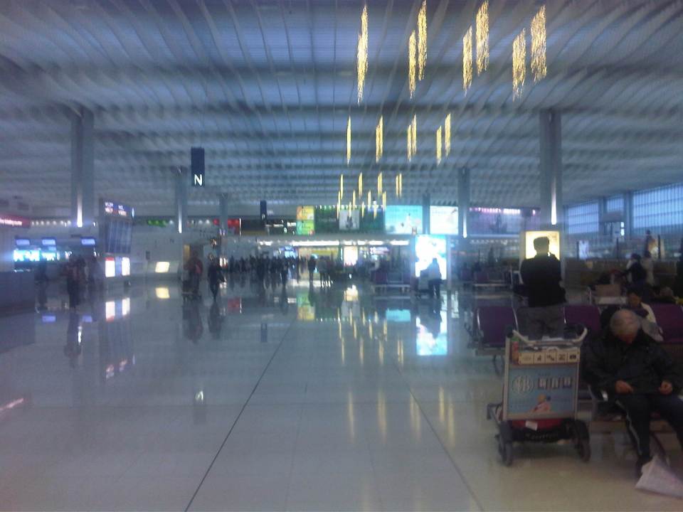
Walking around HKIA
With some time on my hand, I decided to explore HKIA after arriving via the Airport Express during my last visit to Hong Kong. I really haven’t had the chance to go around the airport in my previous trips particularly because I had to transfer between connecting flights. Following are a few photos at the HKIA taken last December 2012.
 Entering the huge HKIA terminal from the Airport Express platform
 Corridor leading to the driveway
 Check-in counters mix with shops inside Terminal 1
 Ramp towards the tunnel connecting HKIA Terminals 1 and 2
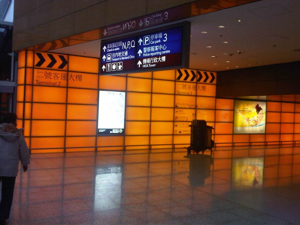 Tunnel to Terminal 2
 Counters for limousine and travel services at Terminal 2
 Shops at HKIA include branches of luxury brands. They also have Disney stores at the terminals.
 More shops and benches at a passenger waiting area at HKIA
 Information board for arrivals and departures
 Travelers can easily go around the airport terminals and information such as those shown in the photo are found in strategic locations around the terminal.
 Taking a train ride to the satellite terminal where my boarding gate was located, I took a photo of the interior of the vehicle.
 HKIA was promoting environmental awareness the last time I was there.
 Travelers, particularly children, can have a quick look and learn about the environment in this set-up inside the terminal.
 Expansive interiors of HKIA departures level makes people appreciate the space. For a very busy airport, HKIA does not look congested once you are inside the terminal.
 A photo of the tarmac taken while I was reclining on what I though was perhaps among the most comfortable chairs in an airport terminal. I was lucky have found one unoccupied and quite selfishly used it until our boarding call.
I think HKIA is indeed one of the best airports in the world. For me, it is a toss-up between HKIA and Singapore’s Changi for the top spot, even considering that Changi had a Budget Terminal. That terminal is now giving way to a larger Terminal 4, which has much expectations riding on it given the airport’s standing. Not to denigrate HKIA, which I think has better shopping and dining than Changi but there might be other factors where Singapore’s airport is better than HKIA?
–
