
Home » Land use (Page 12)
Category Archives: Land use
Rizal Avenue – Part 2: Tayuman to Pampanga Street
In the last post on Rizal Avenue, the featured photos show conditions under the LRT Line 1, which included visual evidence of certain issues like on-street parking, poor lighting and even sanitation (i.e., garbage) along the corridor. This post features more of the same and perhaps worse in some cases that are used as proof of the blight caused in part by the LRT superstructure. I say in part because LRT Line 1 is not wholly to blame for problems under and around it. Local governments and the private sector share responsibility for the decline of the areas within the direct influence of the rail line. Napabayaan. But of course, this does not absolve proponents of the LRT Line 1 for poor station design.
 Approach to Tayuman Station along the northbound side of Rizal Avenue.
 Tayuman Station – shown in the upper part of the photo is one end of the northbound platform.
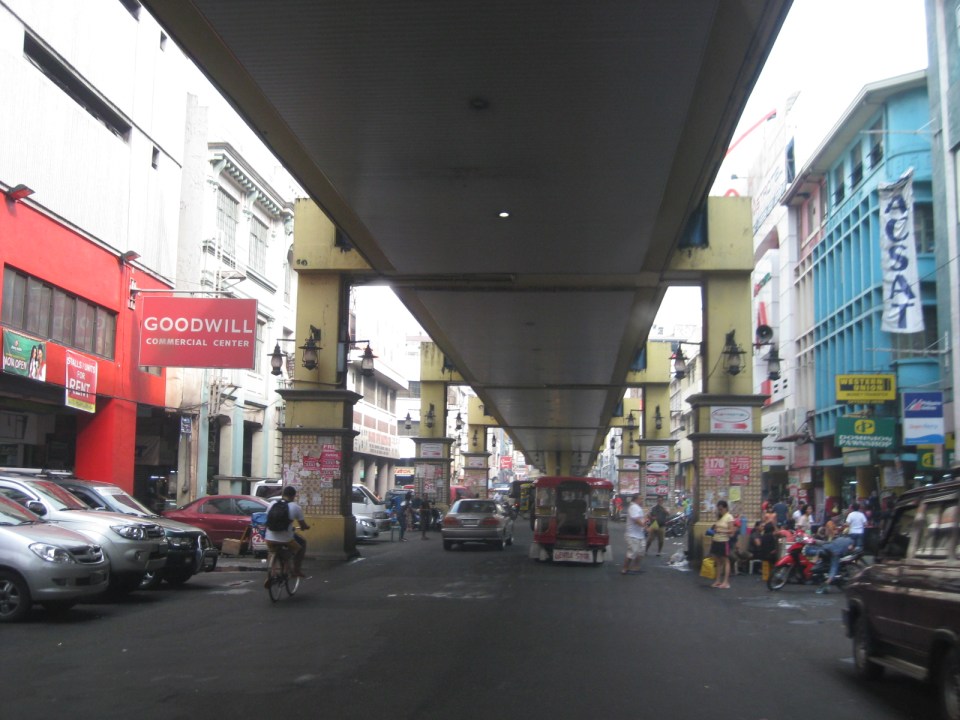
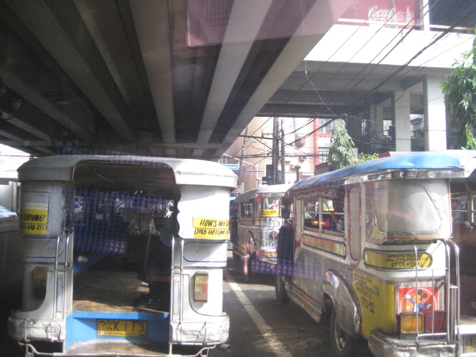 Underneath the station, jeepneys clog the lanes as they load/unload passengers. LRT Line 1 stations are poorly designed for intermodal transfers (e.g., LRT to jeepney, LRT to bus, etc.).
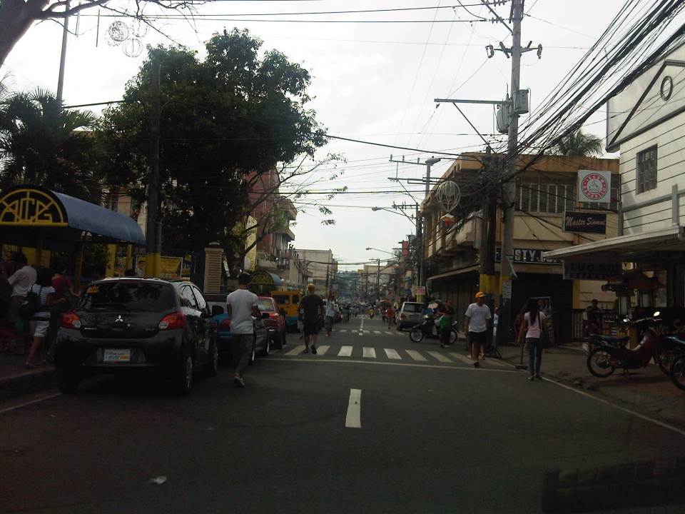
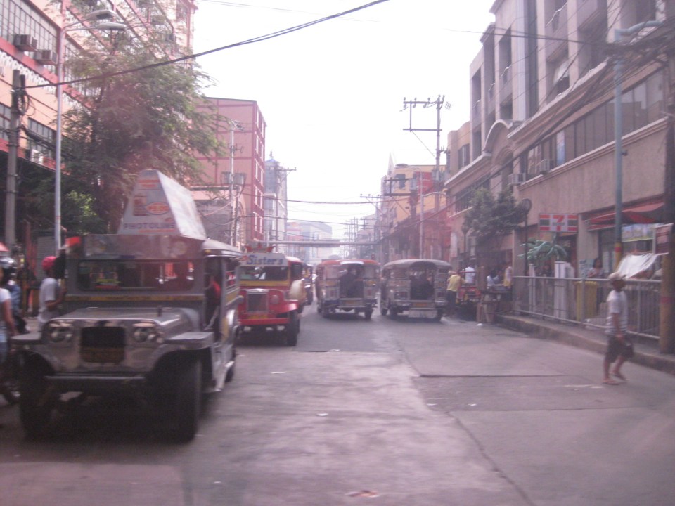 Tayuman Road is a busy street in Manila that’s served by jeepneys connecting to major streets like Lacson Avenue to the east and Abad Santos and Juan Luna to the west. The photo shows a view to the east of the LRT Tayuman Station.
 Approach to the junction with Herrera Street
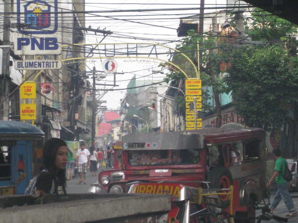
 Approach to Blumentritt Station – the station is named after Ferdinand Blumentritt, an Austrian who was a close friend of the national hero Jose Rizal. The street leads to a large public market close to the station (near the intersection) that is also named after the fellow and one of the more crowded markets in the metropolis. There are many jeepney lines with Blumentritt as part of their routes.
 Birds and other creatures being sold as pets around Blumentritt – many have been painted to attract children and other buyers curious at the colored birds.
 Vendors line the Rizal Avenue, Blumentritt and the other side streets in the area, which is usually crowded no matter what day of the week it is.
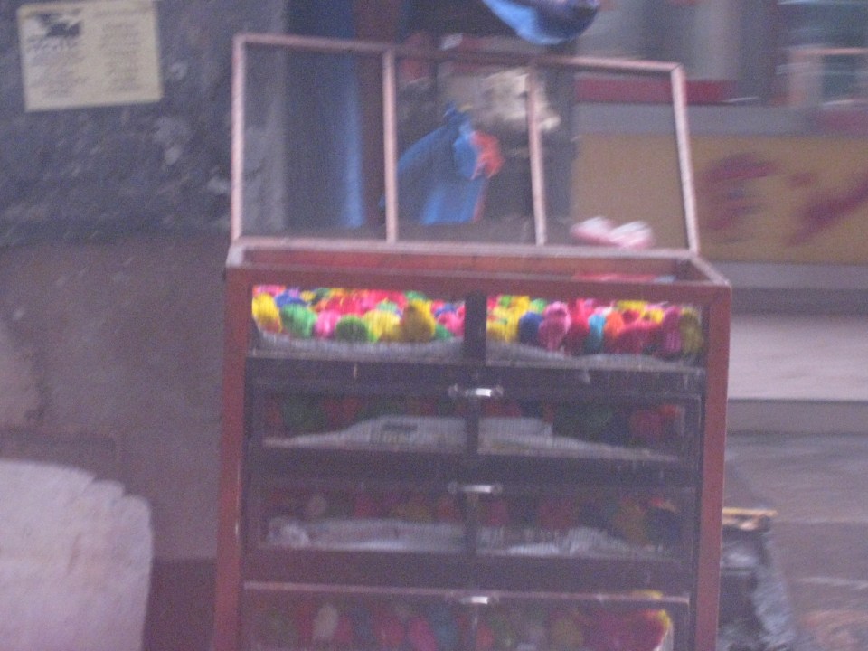 Angry birds? A closer look reveals the birds as chicken chicks colored by the vendors to attract interest. Sadly, many of these do not survive to become full grown chickens and children (and adults) will be disappointed to discover later that the color comes off pretty quick when the chicks come in contact with water.
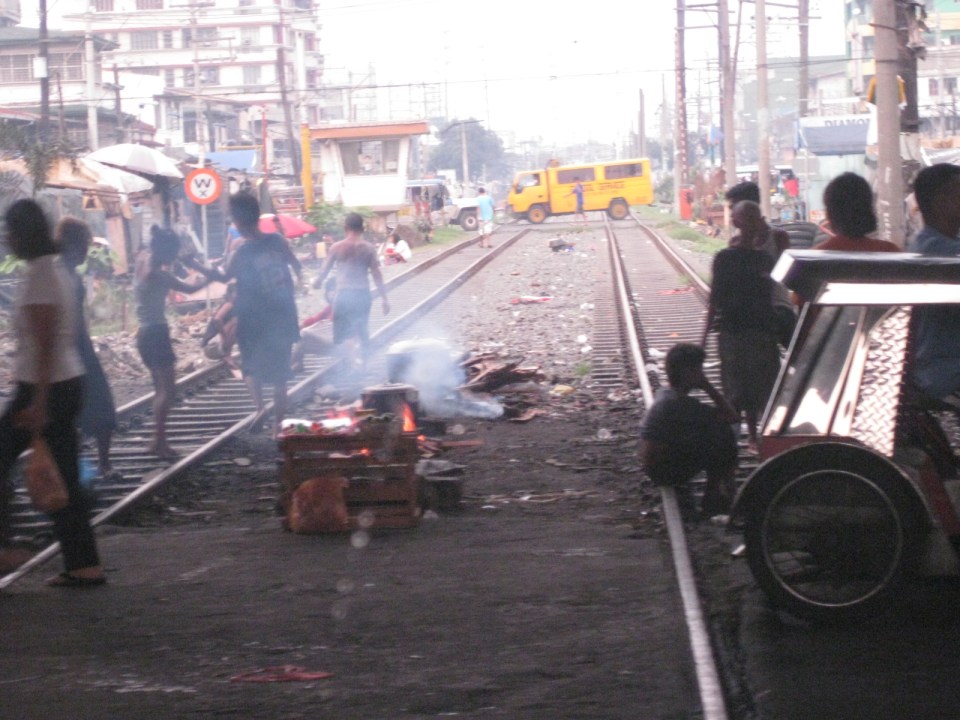
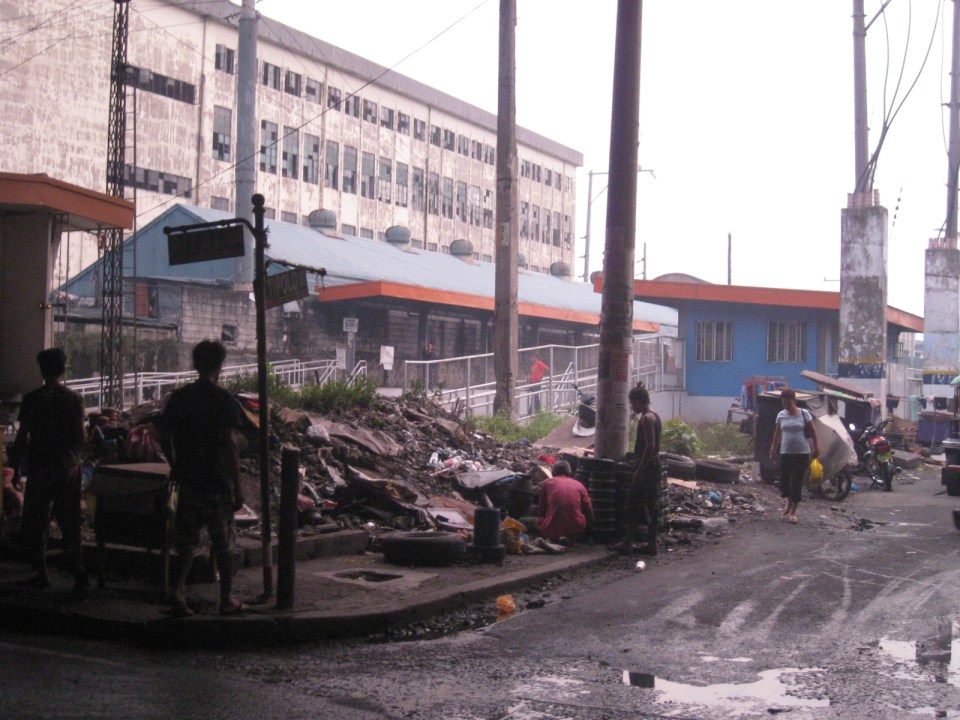 There is a PNR Blumentritt Station and unless there’s been some radical clean-up of the area, this is pretty much what you’d see around the station – garbage, dirt, informal settlers and other characters. The building behind the station is a public school.
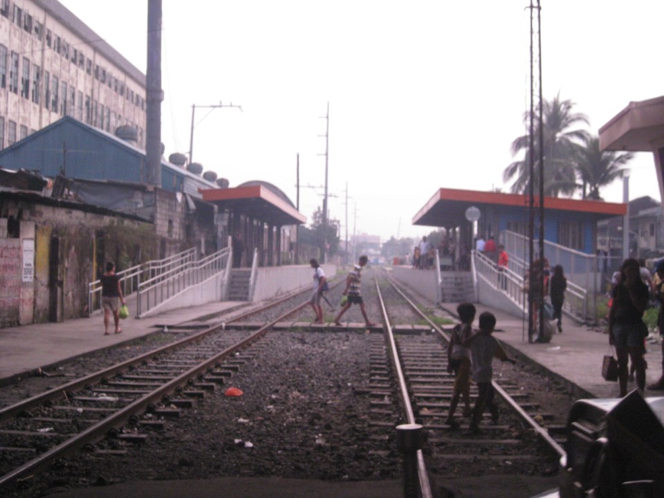 The PNR Blumentritt Station has two platforms on either side of the double track. Security is quite lax and people, including children, cross the tracks freely. Fortunately, train service frequencies are quite low (about 1 per hour) so the risk of getting hit by a train is also low. The photo shows the view to the east of Rizal Avenue.
 On the left side of Rizal Avenue is a scene where people are oblivious to the railways with some even doing their cooking between the tracks.
 Blumentritt Avenue is a very crowded street with a public school (building at right) just across the public market (at left). There are many vendors lined along the street and people as just about everywhere and without regard to vehicular traffic.
 Traffic congestion along Rizal Avenue is attributed mainly to the market and median barriers were constructed to reduce pedestrian crossings anywhere along the road. Commercial establishments line either side of Rizal Avenue, basically contributing to congestion in the area.
 Commercial establishments plus customers plus paratransit equal to traffic congestion
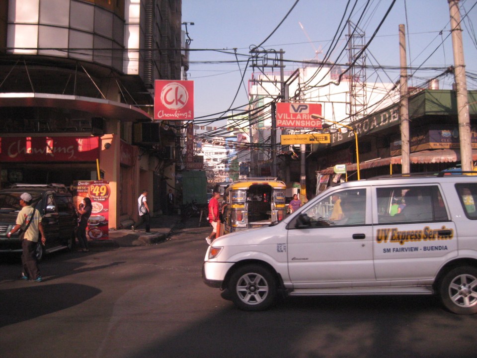
 16A busy side street in the Blumentritt area – there are no sidewalks so pedestrians and motor vehicles mix it up along the road.
 Bulacan Street serves as an informal terminal for jeepneys. The road appears to be newly paved but there are no sidewalks and tents are found along the road often bearing the names of politicians sponsoring the tents for various purposes such as wakes and parties.
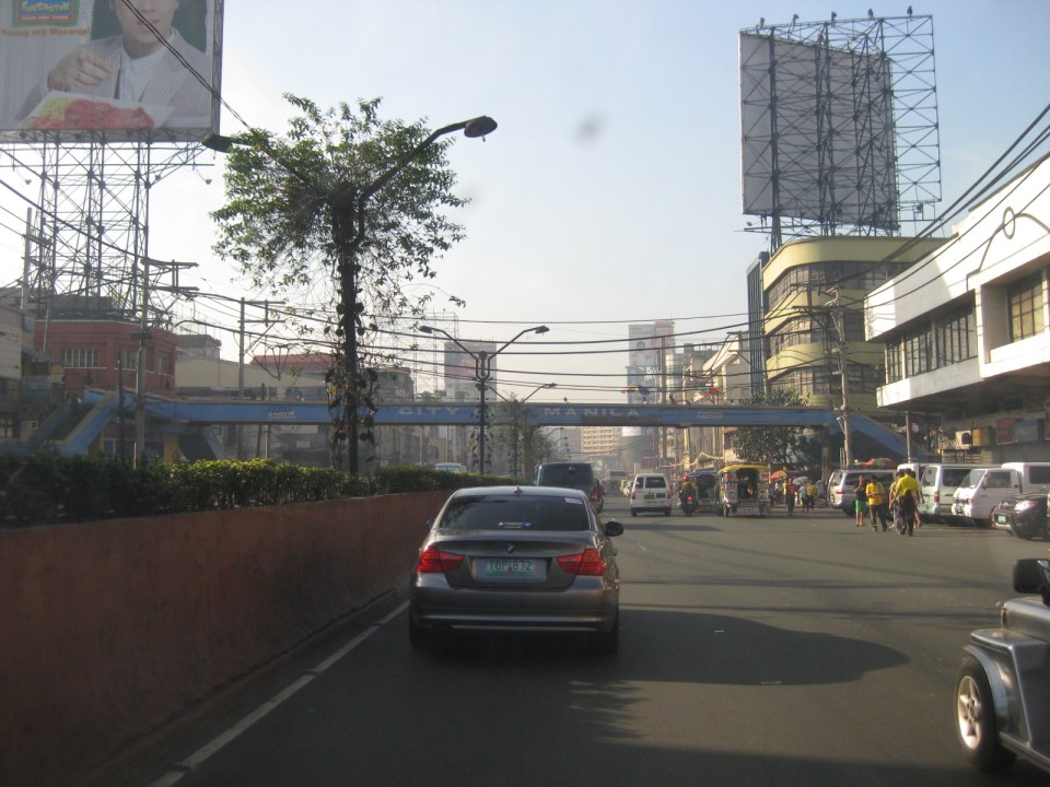
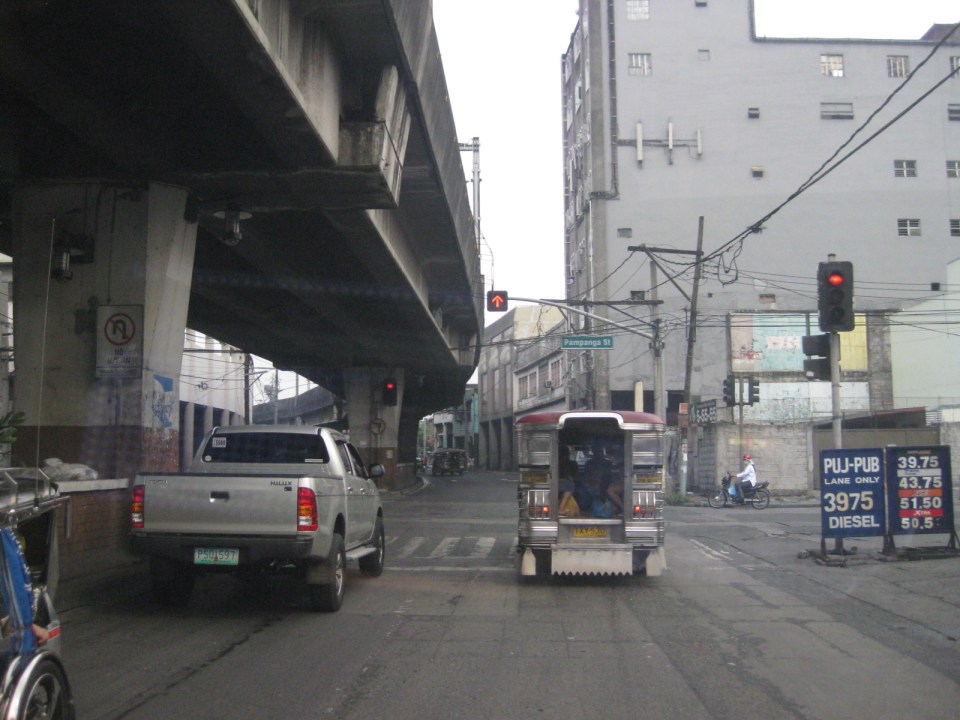 Intersection with Pampanga Street, just before Rizal Avenue and the LRT line turns towards Aurora Boulevard and proceed to Caloocan City and Monumento.
More on Rizal Avenue in future post…
–
Rizal Avenue – Part 1: Carriedo – Bambang
Rizal Avenue stretches from Manila northward to Caloocan city from Carriedo to Monumento. What used to be one of the more cosmopolitan streets in Manila was transformed (some say blighted) by the construction of the elevated LRT Line in the early 1980’s. Carriedo, for example, used to be a popular shopping street along with Escolta. Those were times when there were none of the huge shopping malls now scattered in Metro Manila and people came to Manila to shop.
The following photos were taken while we traversed Rizal Avenue as part of a recon we were conducting for a project with the Department of Transportation and Communications (DOTC) back in 2011. I’m not sure if there have been any significant changes along Rizal Avenue and I am not aware of any recent programs to improve conditions under the LRT Line 1.
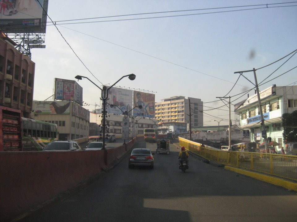
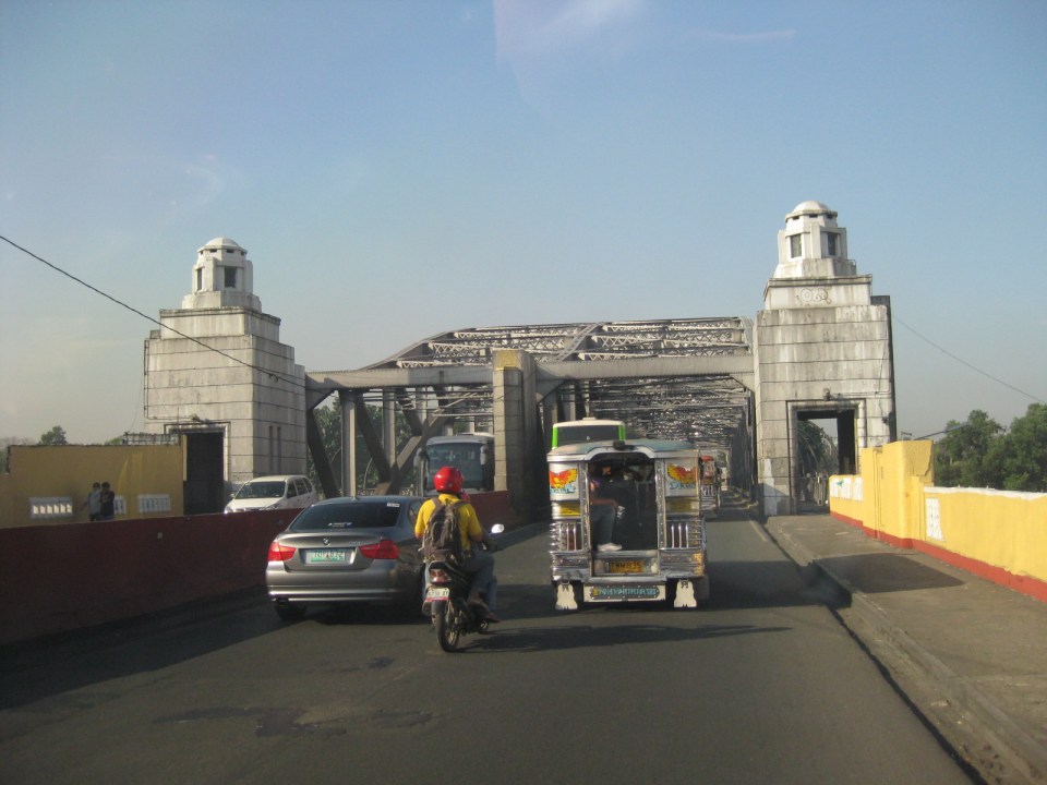
 Approaching the LRT Line 1 Carriedo Station from the McArthur Bridge
 Under Carriedo Station, one experiences first-hand what people have been saying about the area being blighted by the LRT 1 structure
 Poorly lighted? It was broad daylight outdoors when we conducted the recon but underneath an LRT 1 Station it can get quite dark. Of course, aside from the need to improve illumination, perhaps authorities can also improve the environment including the cleanliness of the area under the station. A common complaint is garbage and there are those saying the area smells of piss (i.e., mapanghi).
 Past Carriedo Station, it was brighter and perhaps the area can be developed so that stretches can be pedestrian friendly. Maybe there should also be restrictions on vehicle parking, which tends to make the area look congested. It would be good to have a strategically located multilevel facility in the area where most vehicles can park instead of along the streets as shown in the photo.
 5More roadside parking plus the presence of tricycles contribute to traffic congestion in the area. People are everywhere walking and crossing anywhere. The arcades where they are supposed to walk along are mainly occupied by vendors or merchandise of stores/shops occupying the ground floors of the buildings along the street.
 Each side of Rizal Avenue is surprisingly wide with 3 lanes per direction. One lane is effectively used for on-street parking while the other two are for general traffic. There are no lane markings at the time we passed by the area so there can be confusion as to lane assignments.
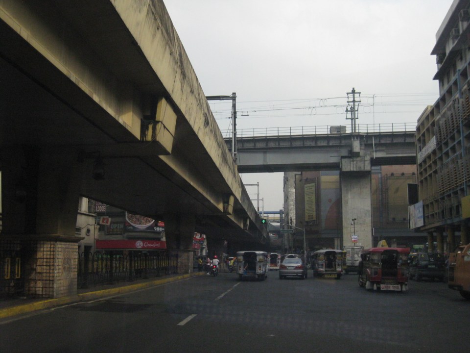 Approach to the junction with Recto Ave. and the LRT Line 2, which is also elevated and at the 3rd level as shown in the photo.
 Rizal Ave.-Recto Ave. intersection – visible downstream in the photo is Doroteo Jose Station
 Provincial bus terminal between Doroteo Jose and Bambang Stations
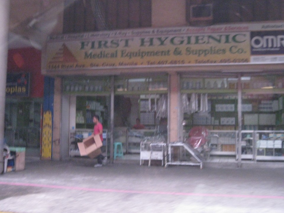 The Sta. Cruz district and particularly the Bambang area is well-known for shops selling medical equipment and supplies. Medical, nursing and other students of allied medical professions as well as professionals come to Bambang to purchase equipment and supplies from these shops, which offer items at lower prices.
 LRT 1 Bambang Station
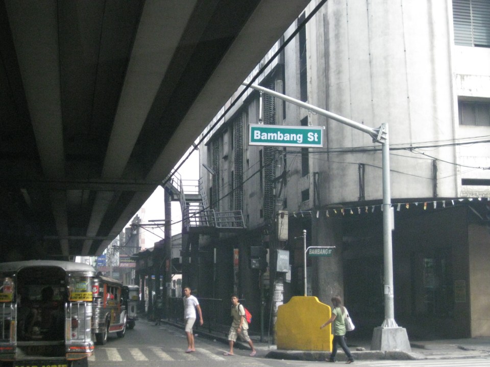 Rizal Ave.-Bambang St. intersection beneath the station
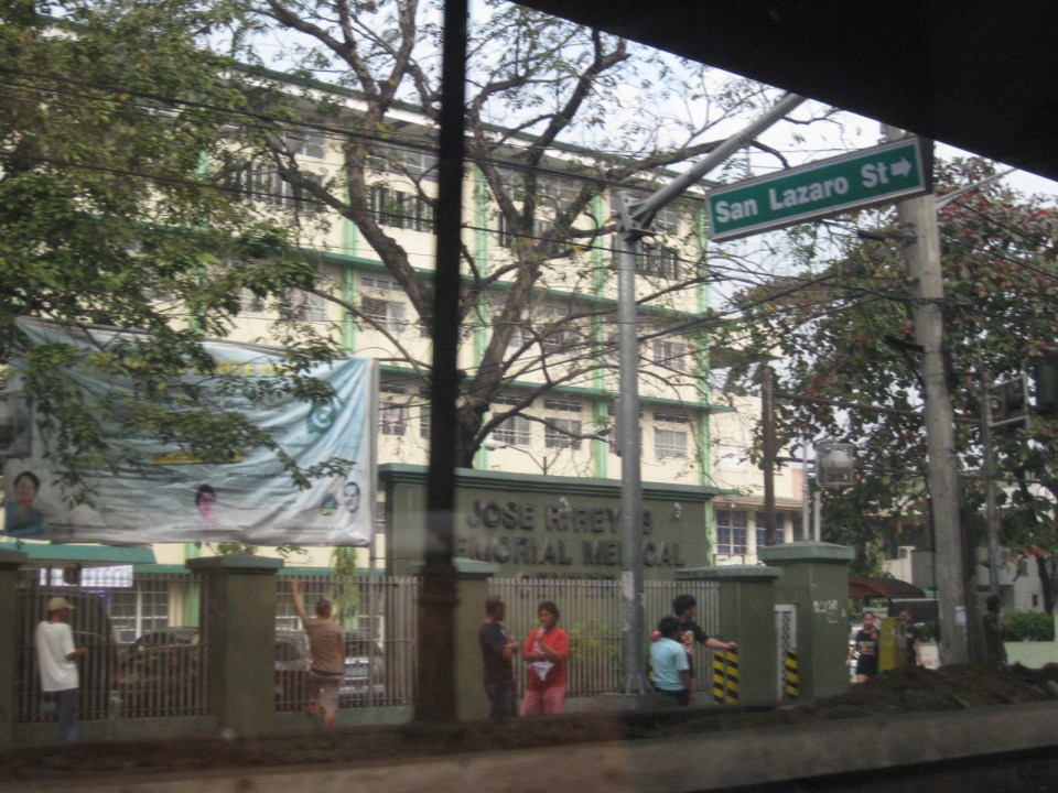 Two large government hospitals are located in the area between Bambang Station and Tayuman Station – San Lazaro Hospital and Jose Reyes Memorial Medical Center. Both are run by the Department of Health (DOH), which is located beside Jose Reyes.
–
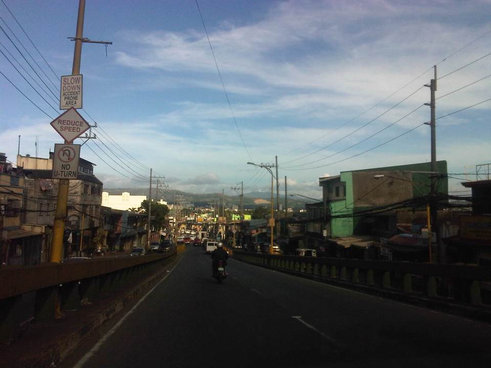
A. Bonifacio Avenue in Marikina
The main road leading to Marikina City from Quezon City is one that branches from Aurora Boulevard. A. Bonifacio Avenue is one of two roads diverging from Aurora, the other one being Marcos Highway. The avenue eventually becomes Sumulong Highway at its junction with Angel Tuazon Ave. (Gil Fernando Ave.) at the Blue Wave mall.
 View from the overpass from Aurora Blvd to A. Bonifacio Ave. – in the horizon are the Sierra Madre mountains and closer to the flyover is of course a view of the Marikina Valley.
 A. Bonifacio is a 4-lane, 2-way undivided road
 Section at the exit from Riverbanks
A. Bonifacio Ave. is the main access road to Loyola Memorial Park and so it gets quite congested during the Undas period (All Saints and All Souls Days). The road and adjacent land is flood prone and along the road is the main gate to Provident Village, which was one of the most devastated private subdivisions during Typhoon Ondoy (Ketsana) in 2009 and the heavy rains of Habagat (southwest monsoon) in 2012.
–
Quiapo, Manila
The Quiapo district of Manila is one of the oldest CBDs in the metropolis and is a major end point for public transport similar to Cubao and Divisoria. Quiapo is best known for its church, which is dedicated to the Black Nazarene, and one of the most visited by pilgrims in the Philippines along with Baclaran (Our Lady of Perpetual Help) and Antipolo (Our Lady of Peace and Good Voyage). Fridays are usually the most congested days in the area as it is the day designated for services for the Black Nazarene (Note: Wednesdays are for Baclaran.).
 Underpass along Quezon Boulevard – the Far Eastern University is at the left while the bridge downstream is the elevated LRT Line 2 that is directly above Claro M. Recto Avenue. At right are commercial and residential buildings surrounding the Manila City Jail. The building at the right behind the LRT 2 is the Isetann mall.
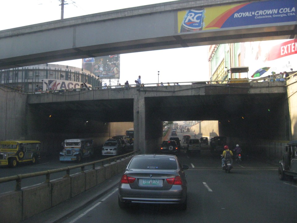 Grade separation – the Quezon Blvd. underpass running beneath LRT Line 2 and Claro M. Recto Ave. has 3 lanes per direction.
 The Intramuros-bound direction of Quezon Blvd. has five (5) lanes but these are confused due to the lack of lane markings. Effectively, there are only 4 lanes due to road-side parking and pedestrian activity. While many old buildings are designed in the arcade style where pedestrians are supposed to have right-of-way, these are usually occupied by merchandize, signs and other obstacles to pedestrian flow. As such, pedestrians walk along the carriageway as seen in the photo.
 One of the side streets in Quiapo is Raon, popular for electronics and camera shops. People came and continue to come here for good deals on music players, karaoke machines, speakers, digital cameras and other electronic goods. However, one has to be attentive or alert as there are supposedly many snatchers and pickpockets in the area.
 The Quiapo Church is a shrine dedicated to the Black Nazarene. The Feast Day every January attracts hundreds of thousands of people in a procession that now starts from the Quirino Grandstand in Rizal Park and ends at the church.
 The giant screen usually shows ads by the sponsor, a major drugstore chain, and popular television shows. The screen is quite bright at night and you can see many people gathering around for when it features primetime TV shows.
 Plaza Miranda in front of Quiapo Church has been the site of many events including the infamous bombing of a political gathering in 1972 that led to the imposition of Martial Law in September of that year. Common around the plaza are vendors peddling herbal medicines, religious items, and even religious services like praying for the client in exchange for a small fee. There are also fortune tellers and other characters.
 Past the Quiapo church is the ramp towards the Quezon Bridge. Underneath and faintly visible in the photo is an underpass along which is Carlos Palanca Street that leads to Rizal Avenue in the northwest and P. Casal in the southeast. There are many shops along this road where the Quinta Market is also located at the corner of Quezon Blvd. and Palanca Street. Among these shops are those selling handicrafts and the notorious ones selling bootleg DVD movies.
 Approach to Quezon Bridge, one of the oldest bridges in Manila spanning the Pasig River. It’s steel truss design has been an example used in many civil engineering and architecture classes.
 A closer look at Quezon Bridge.
–
Streets of Intramuros: Calle Real del Palacio
I haven’t had a good chance to take photos of the streets in Intramuros, Manila. The historic streets within what was for hundreds of years regarded as Manila deserves a more detailed treatment. Recently, I have been able to go around a little bit thanks to meetings at the DPWH and a lecture at the Mapua Institute of Technology. I took full advantage of the opportunity to take photos along some streets along the way to my meetings and am posting these in a few articles about what I think should be a good example for heritage conservation including the street names and old structures within the walled city.
The original name of Andres Soriano Jr. Avenue, the main road stretching from Plaza Mexico along the Pasig River to A. Bonifacio Drive in the Port Area, was Calle Real del Palacio. I believe they should have stuck with the original name in order to preserve this piece of history. Our politicians have a penchant for renaming streets after their kin, heroes, or for purposes like claiming that we should exorcise names associated with our colonial past. While the latter seems to be a basis for changing names elsewhere (not just in the Philippines), perhaps the remedy here is to still retain the original name under the new one.
 Ruins of the aduana or customs building, visible upon turning from the Muelle Del Rio at Plaza Mexico towards Andres Soriano Jr. Ave.
 The road is a four lane, two-way street. It is usually congested because of public transport loading and unloading operations (usually in the middle of the street) and roadside parking, which is tolerated. In fact, there are parking aides in charge of collecting fees from drivers parking along the streets. Intramuros is host to a lot of offices, commercial establishments and schools – all major traffic generators that attract so many vehicles thereby requiring a lot of parking space. The building to the left is the reconstructed building where the old ayuntamiento used to stand.
 The new building where the ayuntamiento was is now supposed to be the new offices of the Bureau of Treasury.
 The open space at left is the along which are many parked cars is the Plaza Roma, which is in front of the Manila Cathedral. The building right after the plaza is where the Palacio del Gobernador used to be. It is now the offices of the Bureau of Treasury.
 Cabildo Street, one of the side streets from across the Plaza Roma, which ultimately leads to Fort Santiago.
 6Another look at the building where the old Governor’s Palace used to be. Visible downstream along the Soriano Ave. is the gate leading to the Simeon de Anda monument located at a roundabout along A. Bonifacio Drive.
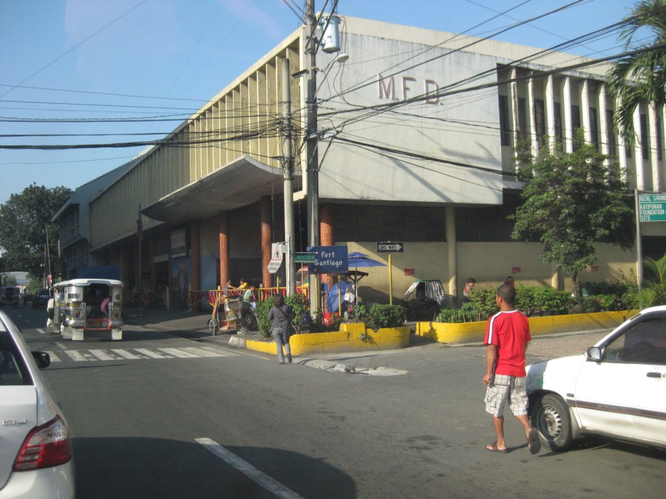 At right is Gen. Antonio Luna Street, which is another main road that has one end at Puerto Real, the southernmost gate of the Intramuros and the other at Fort Santiago. Curiously, this road was also called Calle Real del Palacio as it passed in front of the Palacio del Gobernador.
 A view along Gen. Antonio Luna Street towards Fort Santiago, which is a one-way street.
 Western entrance to Intramuros along Soriano Ave. leads to Bonifacio Drive and the Port Area.
 Arzobispo Street, which also leads to Fort Santiago but also passes along the Archbishop’s Palace, the office of the Archdiocese of Manila and with its southernmost end at San Agustin Church.
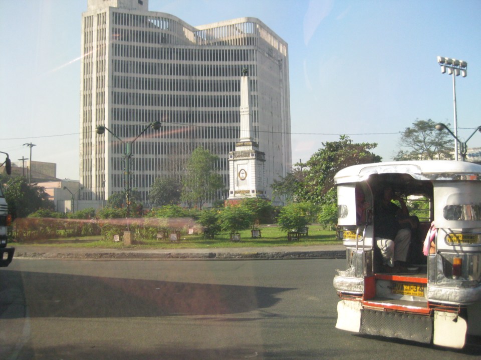 The Simeon de Anda monument at the Anda Circle along Bonifacio Drive.
–
The streets and sidewalks of Melaka
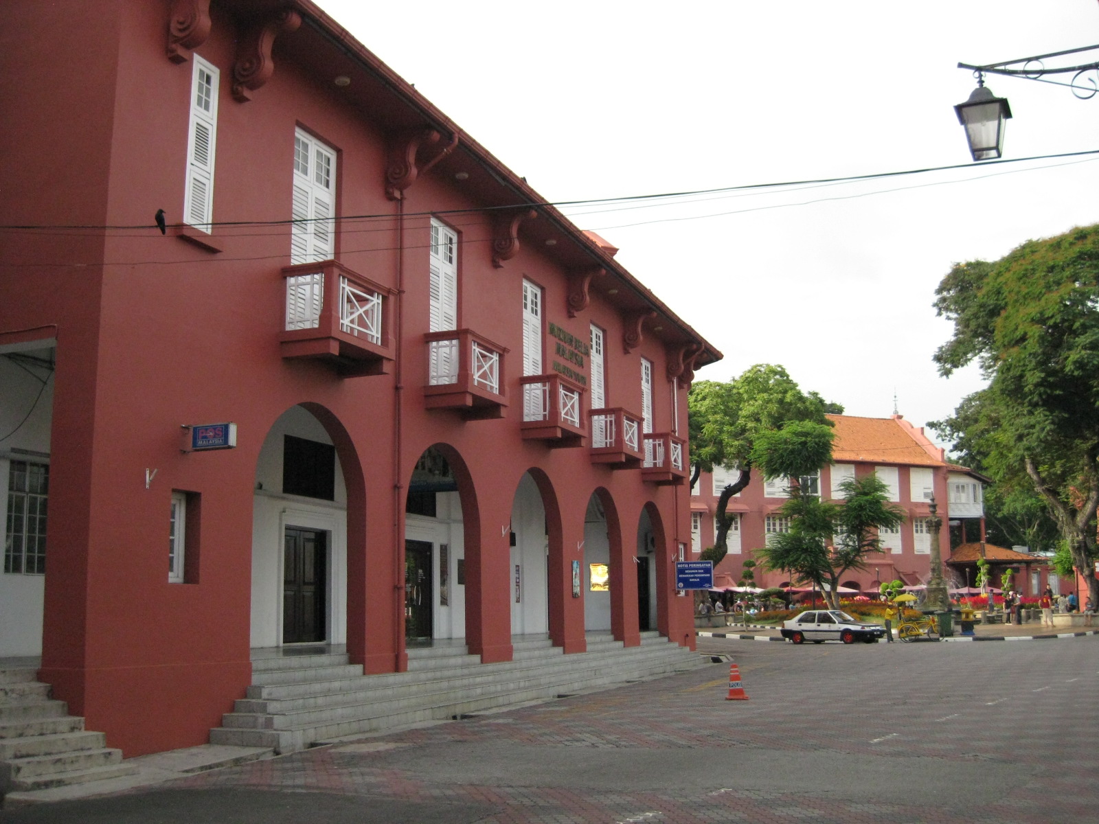 |
| View towards the plaza – the red building is part of the Christ Church complex but is now home of the Melaka Post Office |
 |
| The walkways reminded me of similar forms in Manila, Cebu and Iloilo, all old cities established during the Spanish Period when Melaka was under the rival Portuguese. |
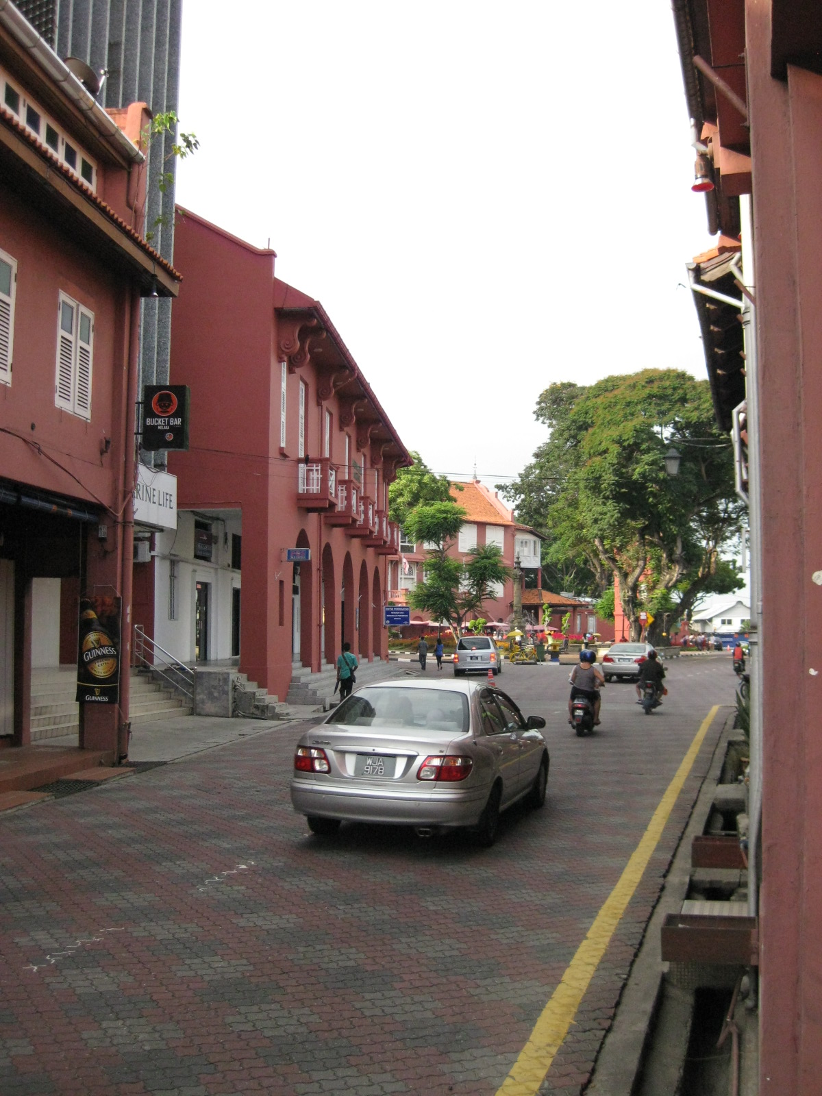 |
| The pavement was tiled but well-maintained |
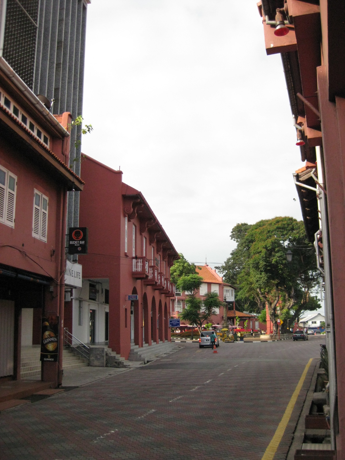 |
| Traffic was light so one could get a good shot of the street leading up to the plaza. |
 |
| The street leading to St. Francis Xavier made me imagine how old cities in the Philippines would have looked like if those cities made an effort to preserve heritage and controlled motor vehicle access to their street. |
 |
| Some buildings have been converted to restaurants and bars but they retained their nostalgic features and feel. |
 |
| Melaka made sure their signposts and lamps were designed consistent with the ambiance of the heritage city |
 |
| Another shot of the seemingly endless walkway beneath the buildings. |
Antipolo Simbahan
“All roads lead to Antipolo” is a saying that is especially true for devotees to Our Lady of Peace and Good Voyage for whom the shrine in Antipolo is dedicated. Indeed, major transport routes lead to Antipolo City and signboards on jeepneys (and buses of old) state “Antipolo Simbahan” as their destination. In much older days, the Manila Railroad Company used to have trains directly serving this route. The remnants of its right-of-way is still there but in the form of roads. These are the Daang Bakal, which stretches from Valley Golf in Cainta, Rizal until its junction with Taktak Road and Ninoy Aquino Blvd., where it becomes the Lorenzo Sumulong Memorial Circle, Antipolo’s circumferential road. A trace of this old railway line may be found in this previous post.
 From J.P. Rizal Street, which extends from Sumulong Highway, one turns left to head straight towards the Antipolo church along P. Oliveros Street. The street is a two-lane, one-way road that has been widened at some sections. The shoulders, however, are mostly used for parking as shown in the photo.
 The dome of the church becomes visible to the traveler as one comes closer. P. Oliveros St. is closed to traffic during the feast day in May. It is usually open during Lent even during the Holy Week when there are lots of people coming to Antipolo for the Visita Iglesia. Traffic during those times can be quite slow because there are also lots of people walking along the streets, many of whom are devotees who are namamanata, or have promises of sacrifice and prayers to the patron of the shrine.
 Similar to other poblacions around the country, commerce surrounds the church. Antipolo receives thousands of visitors daily and its being a natural traffic generator provides opportunities for businesses to thrive around it. Establishments around the church are proof of this and one will find most major fast food chains within a stone’s throw away from the shrine. In the photo are major chains Jollibee, Mang Inasal, Greenwich along the right and Mercury Drug(not fast food but the largest drug store chain in the Philippines) and McDonald’s on the left. There are more including banks and food stalls along M.L. Quezon Street, which is the main street of the poblacion.
 M.L. Quezon Street in front of the shrine and the main street of the poblacion, is also a two-lane, one-way street (southbound flow). There are many one-way streets here as it is no longer possible to widen streets. One side of M.L. Quezon is used for parking and a short walk from the church is Antipolo City Hall, which is the red building barely visible (obscured by the tree on the left) downstream in the photo.
 The Antipolo City Hall building is seen here at the left in this photo.
There is a proliferation of tricycles operating in the poblacion. I don’t know how many there are but they seem to be from different tricycle operators and drivers associations (TODA) that all converge at the shrine. This overlap of service areas (tricycles do not have fixed routes) suggest everyone is taking advantage of the shrine and city hall being major traffic generators. The problem is that the city has not been able to control their numbers and regulation is probably limited to registration, which brings some revenues to the city. This is certainly not sustainable from the perspective of transport
It would be nice to see the poblacion re-planned, designed and managed so that walking may be given primacy over other modes, particularly motorized ones. Antipolo should be walkable and it was in the past considering there were no tricycles and automobiles during the Spanish and early American periods. One took an animal-drawn vehicle, road a horse, or walked even when there was a train service in the early part of the last century. If parking is an issue, then perhaps the city, with the cooperation of the private sector, could find ways of building multi-storey parking facilities in the periphery and within comfortable walking distance from the shrine and city hall. There’s much potential here that is steadily being wasted due to traffic and with no design theme even for buildings surrounding the shrine. The shrine represents heritage and to preserve and enhance it, Antipolo City should find ways to introduce sustainable transport as well as applying architectural principles for the poblacion.
–
Padre Burgos, Manila
Padre Burgos Street stretches from Roxas Boulevard to Plaza Lawton and the Manila Central Post Office. Along its western side is the golf course surrounding the walled city of Intramuros. It is one of the more picturesque streets in Manila considering travelers would have a view of the walls of Intramuros on one side and historic buildings and a park on the other. Following are a few photos I took on my way back from a meeting at the DPWH Head Office along Bonifacio Drive.
 The northbound side of P. Burgos St. has 4 lanes and intersections are signalized. The street has a median island (on the left) dividing opposing traffic flows. The traffic lights shown are for the intersection with the Finance Road, which leads to the Ayala Boulevard.
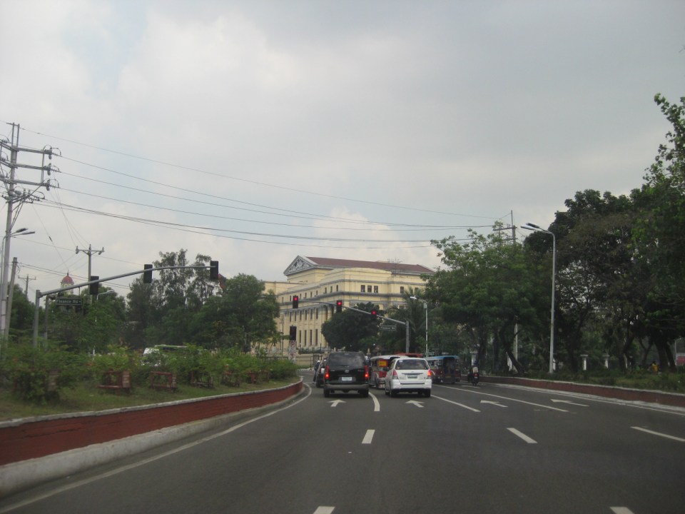
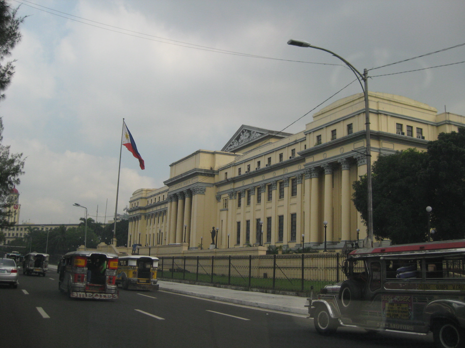 On the right, travelers will see the National Museum building, which used to host the Senate of the Republic of the Philippines.
 Past the museum, one is treated first to a glimpse of the historic Manila City Hall
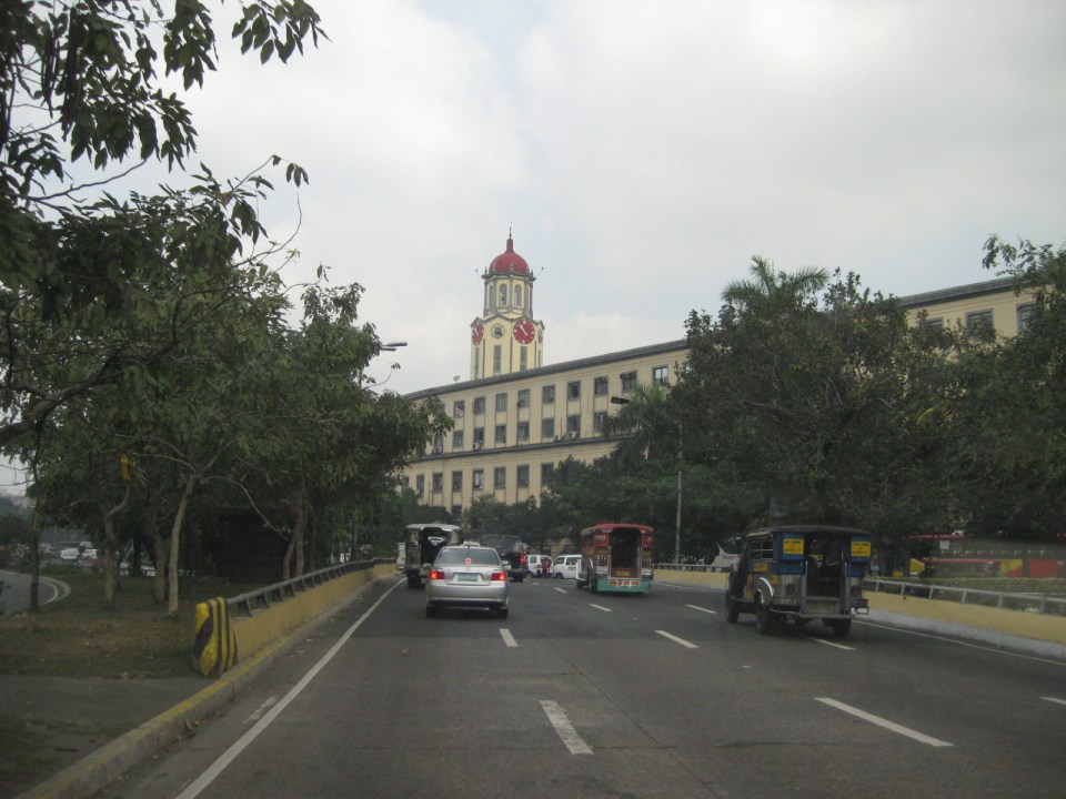 The Manila City Hall’s clock tower is one of the most familiar landmarks in Manila, seemingly unchanged through so many years.
 Right after city hall is the Kartilya ng Katipunan shrine
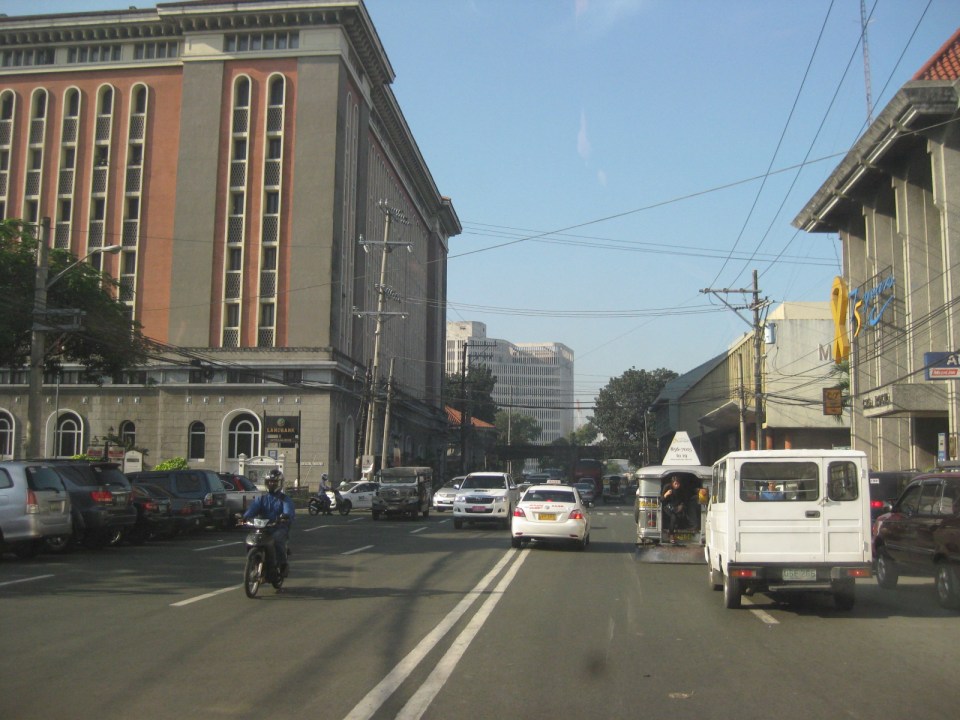
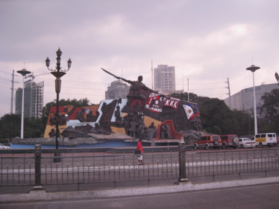
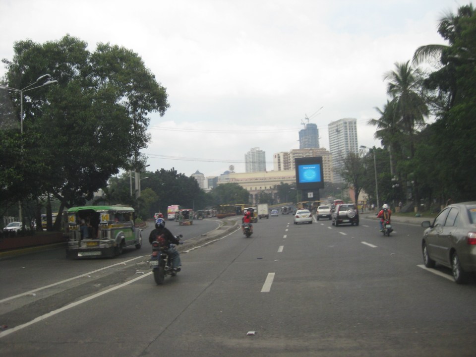 P. Burgos Street splits up into three sections, all named the same: the left leads to the Jones Bridge and Quintin Paredes Street, the center leads to McArthur Bridge and Rizal Avenue, and the right leads to Quezon Bridge and Quezon Boulevard. At center in the photo is the Manila Central Post Office building in front of which is Plaza Lawton, named after the highest ranking American officer killed in action during the Philippine American War.
 Visual intrusion? Obstruction? The video screen installed where P. Burgos splits up to McArthur Bridge and Quezon Bridge obscures what many would consider as a nice view of the Manila Central Post Office. At the right of the photo is another historic building that has been neglected – the Metropolitan Theater.
 Park and ride facility along P. Burgos St. Behind the structure is the Central Station of LRT Line 1.
–
Housing and transport in Singapore
I had wanted to write about the relationship between housing and transport. This relationship falls under land use and transport interaction or LUTI, as it is often called. But while I continue to procrastinate on writing an article on this topic, I refer my readers to another article that appeared in a regional daily. The article from The Freeman written by a good friend who is now the Manager of the Mactan Cebu International Airport and was the City Planning and Development Officer of Cebu City relates about public housing in Singapore and gives a commentary on their strategic locations in relation to Singapore’s efficient transport system. The article is part of a series that the author is writing about his observations in Singapore, and provides a peek into housing and transport in a developed city state. I believe such is an example of a best practice in public housing that the Philippines should learn from in order to solve its own housing problems.
–
Addendum: Here are the first and third parts of the series of articles by Nigel Paul Villarete for The Freeman. There are also archives of his articles under his column Streetlife. Good reads that our officials at the national and local levels should indulge in to have a grasp of solutions and best practices concerning transport and traffic.
–
Technical Papers on Sustainable Urban Transport
This is just a quick post to end this first month of the year. Following is a link to the website of the GIZ-supported Sustainable Urban Transport Project featuring the page with the latest technical papers. These represent some of the latest work on sustainable transport featuring good practices from developing and developed cities that can be used as guides or benchmarks for those dealing with transport issues in their respective cities or towns.
