
Home » Land use (Page 13)
Category Archives: Land use
Antipolo Simbahan
“All roads lead to Antipolo” is a saying that is especially true for devotees to Our Lady of Peace and Good Voyage for whom the shrine in Antipolo is dedicated. Indeed, major transport routes lead to Antipolo City and signboards on jeepneys (and buses of old) state “Antipolo Simbahan” as their destination. In much older days, the Manila Railroad Company used to have trains directly serving this route. The remnants of its right-of-way is still there but in the form of roads. These are the Daang Bakal, which stretches from Valley Golf in Cainta, Rizal until its junction with Taktak Road and Ninoy Aquino Blvd., where it becomes the Lorenzo Sumulong Memorial Circle, Antipolo’s circumferential road. A trace of this old railway line may be found in this previous post.
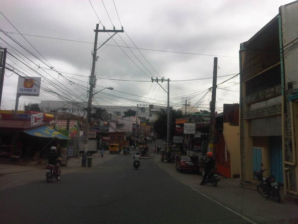 From J.P. Rizal Street, which extends from Sumulong Highway, one turns left to head straight towards the Antipolo church along P. Oliveros Street. The street is a two-lane, one-way road that has been widened at some sections. The shoulders, however, are mostly used for parking as shown in the photo.
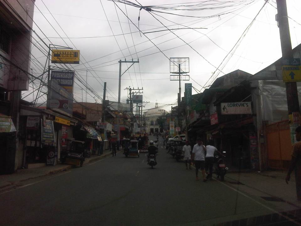 The dome of the church becomes visible to the traveler as one comes closer. P. Oliveros St. is closed to traffic during the feast day in May. It is usually open during Lent even during the Holy Week when there are lots of people coming to Antipolo for the Visita Iglesia. Traffic during those times can be quite slow because there are also lots of people walking along the streets, many of whom are devotees who are namamanata, or have promises of sacrifice and prayers to the patron of the shrine.
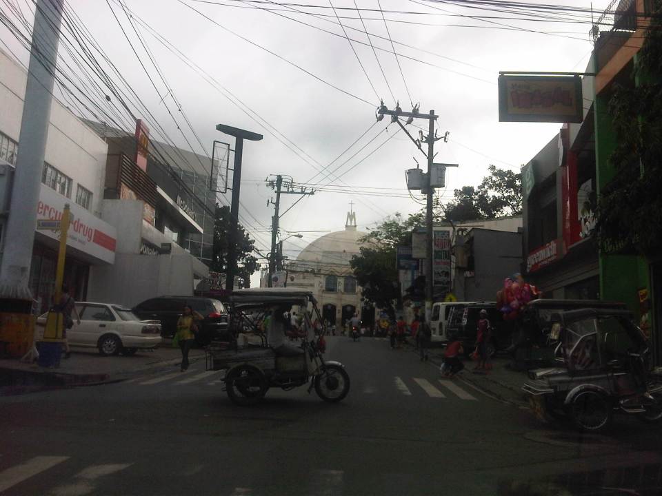 Similar to other poblacions around the country, commerce surrounds the church. Antipolo receives thousands of visitors daily and its being a natural traffic generator provides opportunities for businesses to thrive around it. Establishments around the church are proof of this and one will find most major fast food chains within a stone’s throw away from the shrine. In the photo are major chains Jollibee, Mang Inasal, Greenwich along the right and Mercury Drug(not fast food but the largest drug store chain in the Philippines) and McDonald’s on the left. There are more including banks and food stalls along M.L. Quezon Street, which is the main street of the poblacion.
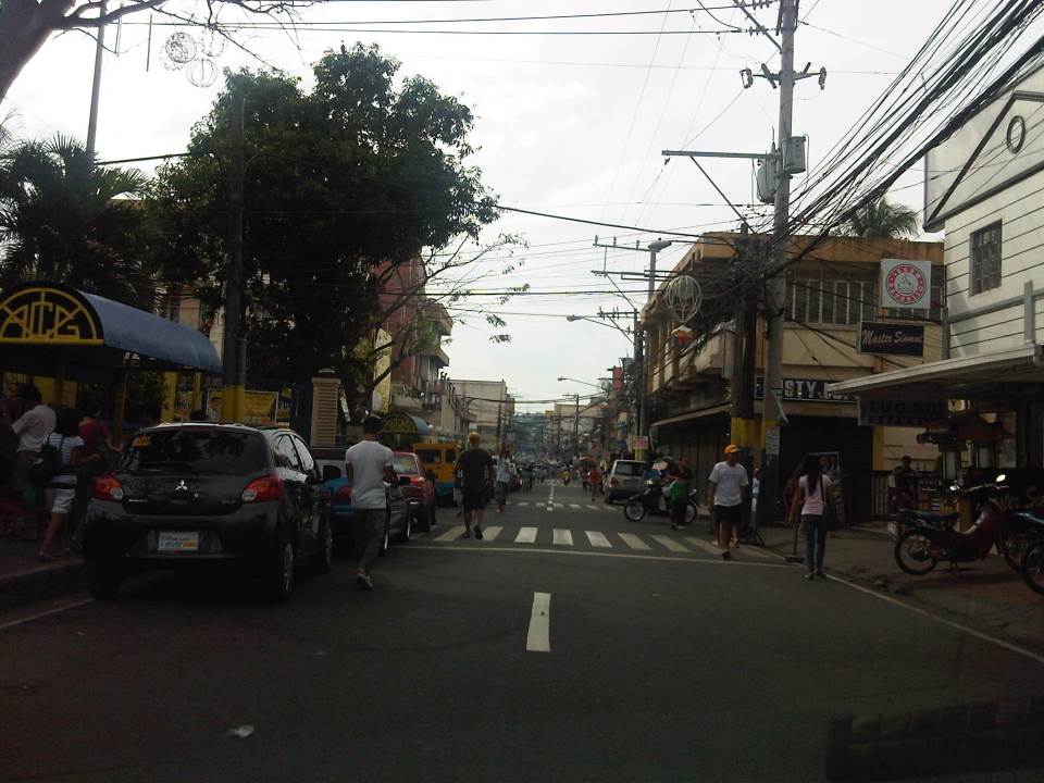 M.L. Quezon Street in front of the shrine and the main street of the poblacion, is also a two-lane, one-way street (southbound flow). There are many one-way streets here as it is no longer possible to widen streets. One side of M.L. Quezon is used for parking and a short walk from the church is Antipolo City Hall, which is the red building barely visible (obscured by the tree on the left) downstream in the photo.
 The Antipolo City Hall building is seen here at the left in this photo.
There is a proliferation of tricycles operating in the poblacion. I don’t know how many there are but they seem to be from different tricycle operators and drivers associations (TODA) that all converge at the shrine. This overlap of service areas (tricycles do not have fixed routes) suggest everyone is taking advantage of the shrine and city hall being major traffic generators. The problem is that the city has not been able to control their numbers and regulation is probably limited to registration, which brings some revenues to the city. This is certainly not sustainable from the perspective of transport
It would be nice to see the poblacion re-planned, designed and managed so that walking may be given primacy over other modes, particularly motorized ones. Antipolo should be walkable and it was in the past considering there were no tricycles and automobiles during the Spanish and early American periods. One took an animal-drawn vehicle, road a horse, or walked even when there was a train service in the early part of the last century. If parking is an issue, then perhaps the city, with the cooperation of the private sector, could find ways of building multi-storey parking facilities in the periphery and within comfortable walking distance from the shrine and city hall. There’s much potential here that is steadily being wasted due to traffic and with no design theme even for buildings surrounding the shrine. The shrine represents heritage and to preserve and enhance it, Antipolo City should find ways to introduce sustainable transport as well as applying architectural principles for the poblacion.
–
Padre Burgos, Manila
Padre Burgos Street stretches from Roxas Boulevard to Plaza Lawton and the Manila Central Post Office. Along its western side is the golf course surrounding the walled city of Intramuros. It is one of the more picturesque streets in Manila considering travelers would have a view of the walls of Intramuros on one side and historic buildings and a park on the other. Following are a few photos I took on my way back from a meeting at the DPWH Head Office along Bonifacio Drive.
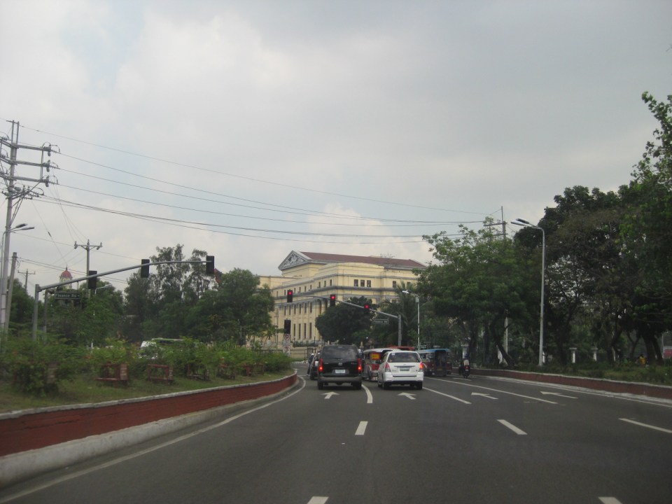 The northbound side of P. Burgos St. has 4 lanes and intersections are signalized. The street has a median island (on the left) dividing opposing traffic flows. The traffic lights shown are for the intersection with the Finance Road, which leads to the Ayala Boulevard.
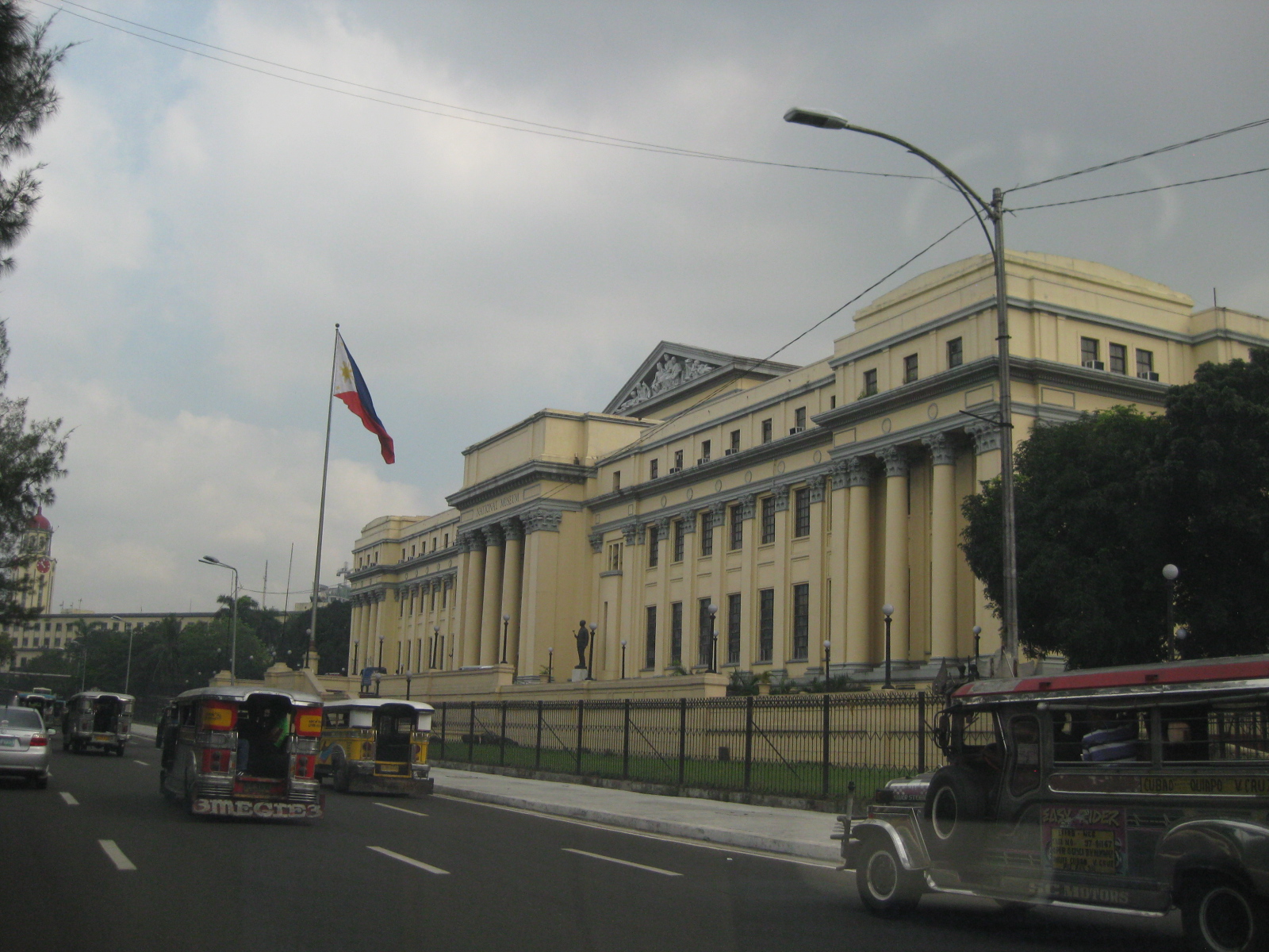 On the right, travelers will see the National Museum building, which used to host the Senate of the Republic of the Philippines.
 Past the museum, one is treated first to a glimpse of the historic Manila City Hall
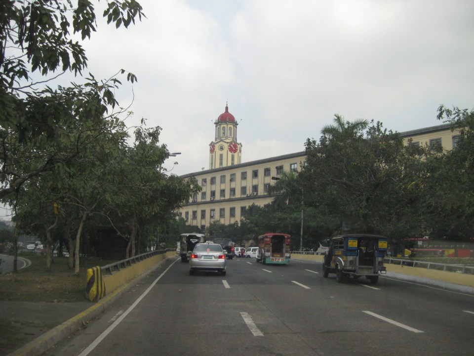 The Manila City Hall’s clock tower is one of the most familiar landmarks in Manila, seemingly unchanged through so many years.
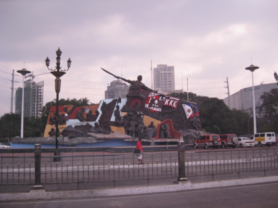 Right after city hall is the Kartilya ng Katipunan shrine
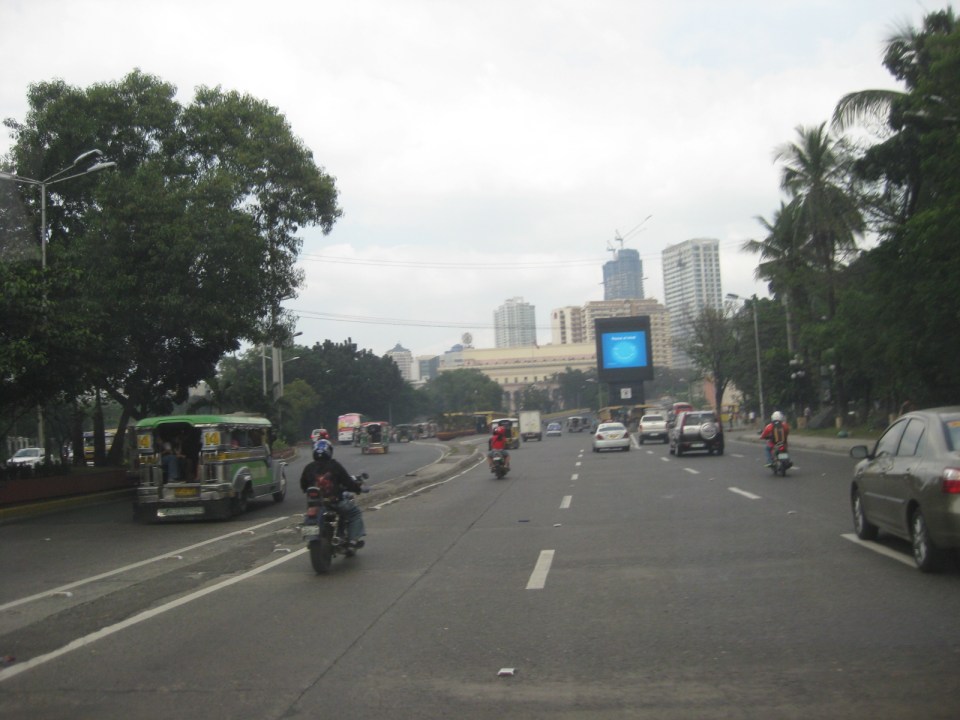 P. Burgos Street splits up into three sections, all named the same: the left leads to the Jones Bridge and Quintin Paredes Street, the center leads to McArthur Bridge and Rizal Avenue, and the right leads to Quezon Bridge and Quezon Boulevard. At center in the photo is the Manila Central Post Office building in front of which is Plaza Lawton, named after the highest ranking American officer killed in action during the Philippine American War.
 Visual intrusion? Obstruction? The video screen installed where P. Burgos splits up to McArthur Bridge and Quezon Bridge obscures what many would consider as a nice view of the Manila Central Post Office. At the right of the photo is another historic building that has been neglected – the Metropolitan Theater.
 Park and ride facility along P. Burgos St. Behind the structure is the Central Station of LRT Line 1.
–
Housing and transport in Singapore
I had wanted to write about the relationship between housing and transport. This relationship falls under land use and transport interaction or LUTI, as it is often called. But while I continue to procrastinate on writing an article on this topic, I refer my readers to another article that appeared in a regional daily. The article from The Freeman written by a good friend who is now the Manager of the Mactan Cebu International Airport and was the City Planning and Development Officer of Cebu City relates about public housing in Singapore and gives a commentary on their strategic locations in relation to Singapore’s efficient transport system. The article is part of a series that the author is writing about his observations in Singapore, and provides a peek into housing and transport in a developed city state. I believe such is an example of a best practice in public housing that the Philippines should learn from in order to solve its own housing problems.
–
Addendum: Here are the first and third parts of the series of articles by Nigel Paul Villarete for The Freeman. There are also archives of his articles under his column Streetlife. Good reads that our officials at the national and local levels should indulge in to have a grasp of solutions and best practices concerning transport and traffic.
–
Technical Papers on Sustainable Urban Transport
This is just a quick post to end this first month of the year. Following is a link to the website of the GIZ-supported Sustainable Urban Transport Project featuring the page with the latest technical papers. These represent some of the latest work on sustainable transport featuring good practices from developing and developed cities that can be used as guides or benchmarks for those dealing with transport issues in their respective cities or towns.
Roads in Pasig: Ejercito Avenue
Upon reaching the end of the existing C-6, travelers encounter an intersection at the mouth of the Manggahan Floodway that leads to Taytay, Rizal via the Barkadahan Bridge. Turning right leads to Taytay while turning left leads the traveler to Pasig City via Sandoval Avenue. C-6 and Sandoval Avenue are linked by a short road named Ejercito Avenue.
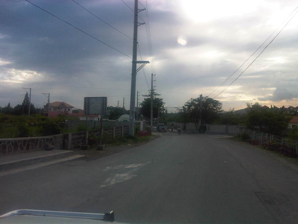 Turning left from C-6, travelers are greeted by the walls of exclusive residential subdivisions.
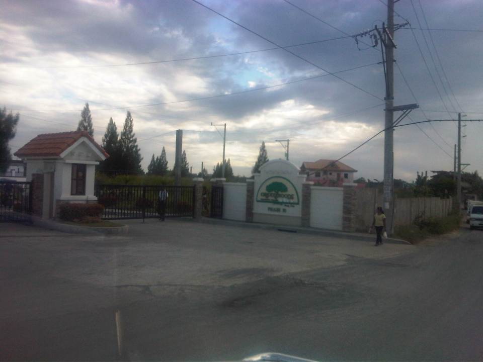 Among these subdivisions is Greenwoods, whose Phase 10 is located near C-6 and the Manggahan Floodway to Taytay, Rizal.
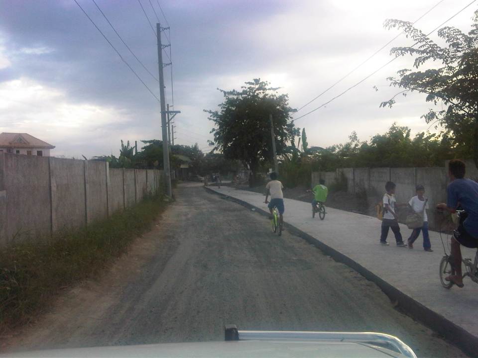 The easternmost section of Ejercito avenue was under rehabilitation when we passed the road. Only one lane, the one where the sub-base was exposed, was available to motorized traffic. The other lane is presumably still in the curing stage but is used by pedestrians and cyclists.
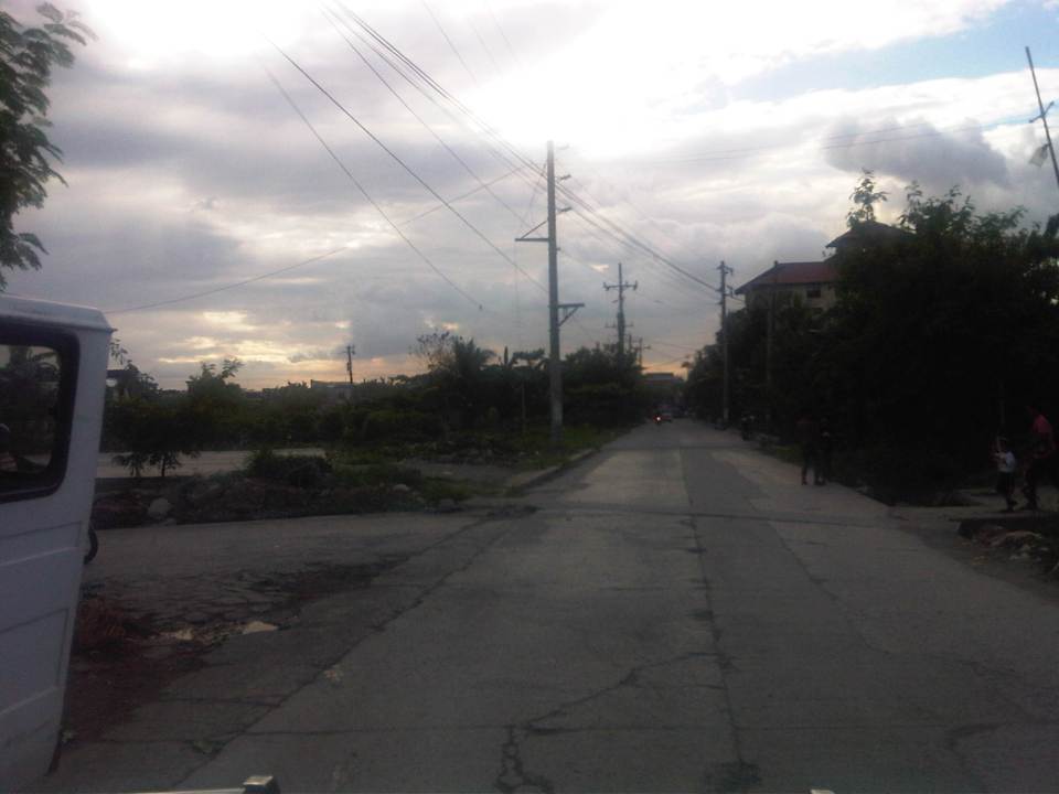 Past the section under repair is a section that’s showing a lot of pavement distresses that appear to be partly due to patch-up work by a water concessionaire (note the features of the concrete slab in the middle of the road where an excavation for waterworks used to be).
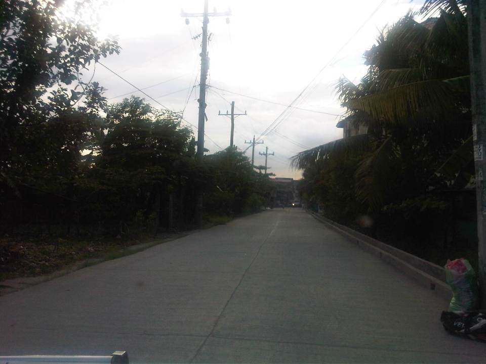 Rehabilitated section of Ejercito Avenue features what appears to be properly cured pavement but with curb only along one side.
 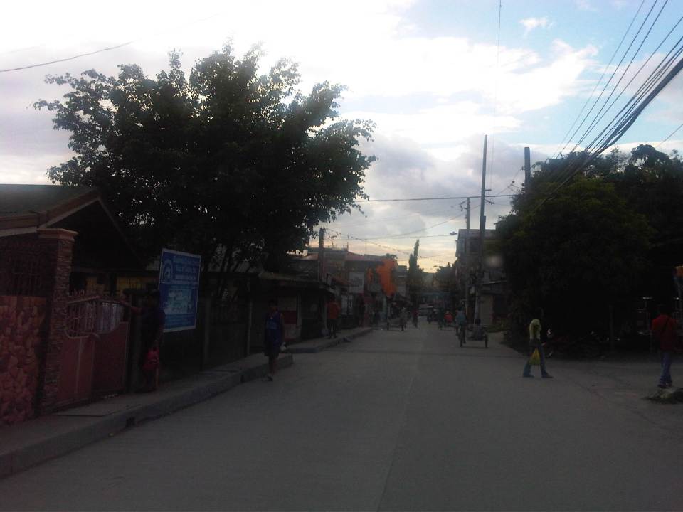 Open residential area in Pinagbuhatan, Pasig where one can see that the pavement is higher in elevation compared to the ground floors of most houses. This us usually an indication that the area is prone to flooding.
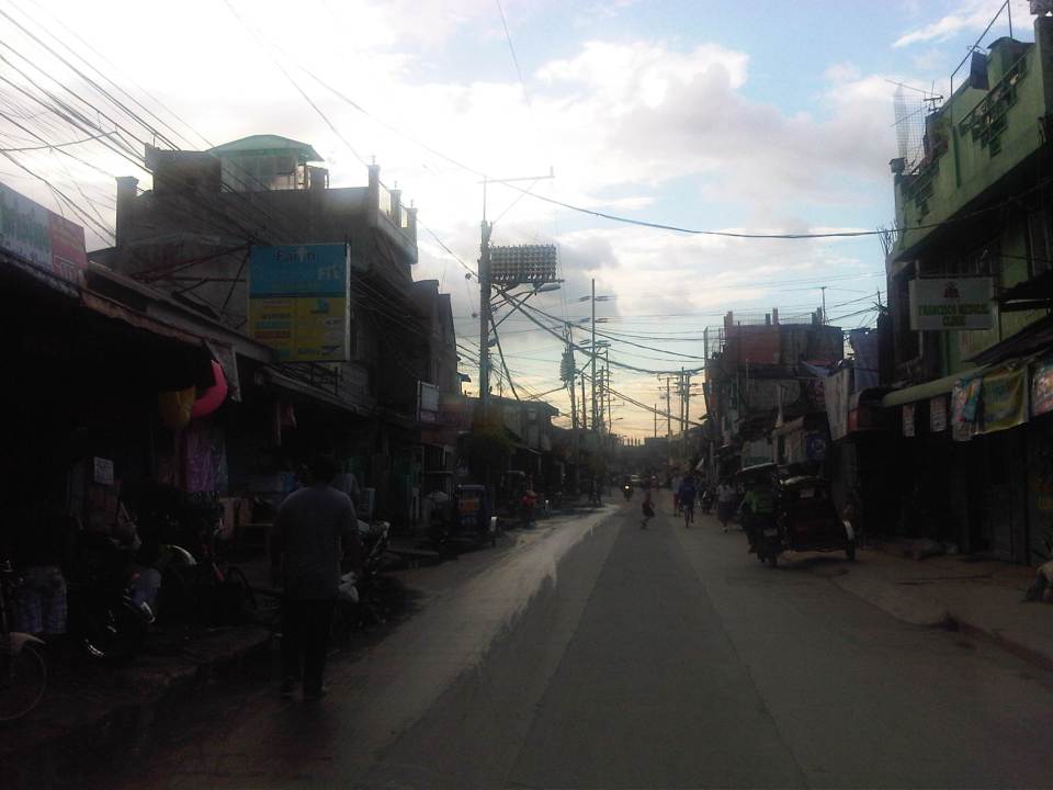 Some parts of the road pass through what appears to be unplanned developments typical of informal settlements or resettlement areas for people from Pasig and other cities of Metro Manila. Notice the bunch of meters installed by the Meralco on the post in the middle of photo? That’s another indicator associated with crowded, unplanned areas. I always wonder how Meralco staff are able to read the meters and collect payments due. I assume there are still significant losses here due to jumpers that are eventually subsidized by those who do pay their bills.
 Noticeable in this photo, the previous one and the next one are indications of previous waterworks in the area. The pipes are laid out under the middle of the road and so requires excavations in cases when maintenance works need to be undertaken.
 Ejercito Street ends where P. Sandoval Avenue begins. From what we observed this transition from one road to another is not a clear one except perhaps to those who are familiar with the area such as residents of Pinagbuhatan, Pasig City.
–
Shaw Boulevard: Kapitolyo to St. Francis
I have not been to Shaw Boulevard for quite some time so I decided to take photos en route to a speaking engagement at my alma mater, a school located along the major thoroughfare. Though I have commuted between my parents’ home in Cainta to school using this route and some landmarks remain, a lot has definitely changed in the area including the skyline along the boulevard. I have memories of vast grasslands where the buildings of Ortigas Center now stand. One could see EDSA traffic from the balcony of St. Francis Church in the 1970’s and the 1980’s as there were still no SM Megamall, Shangri-la or ADB along EDSA. The old provincial capitol site (Pasig used to be part and the capital of Rizal Province) is now being redeveloped into a commercial center after it was bidded out and the capital moved to Antipolo City. It was the Rizal provincial capitol which gave Barrio Kapitolyo in Pasig its name.
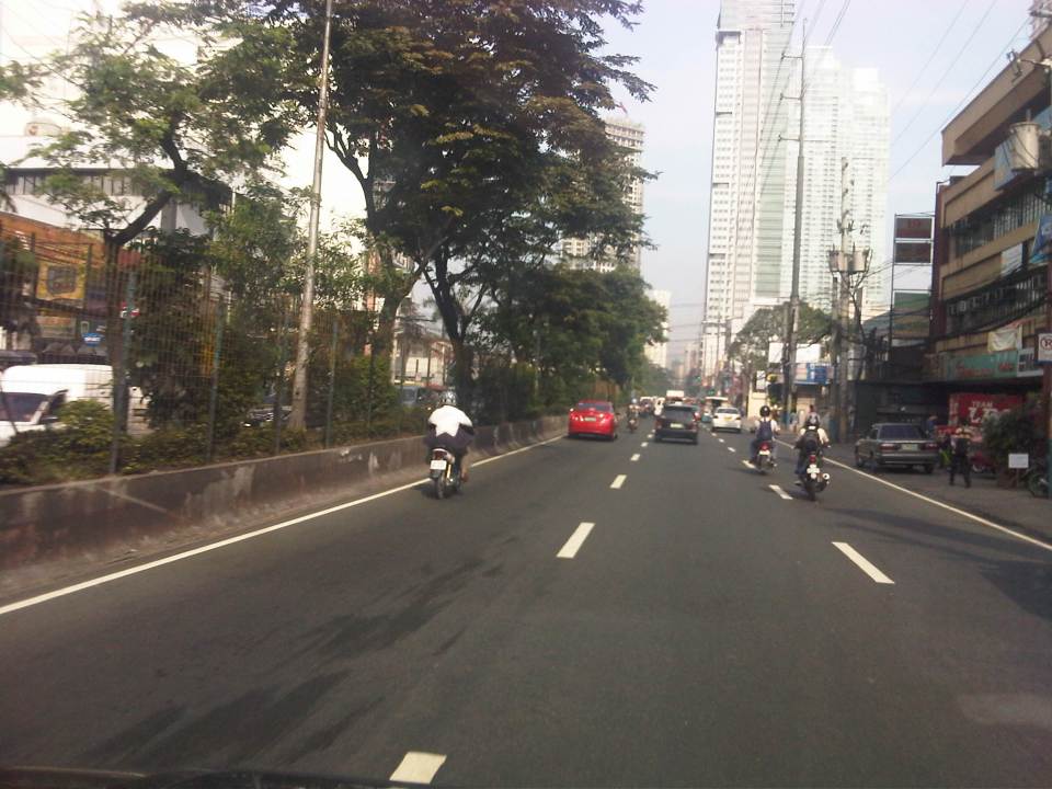 Turning from Meralco Ave, one is greeted by the view of tall buildings along Shaw Boulevard.
 Shaw Blvd is a six-lane, two-way highway with a median island separating opposing traffic flows
 The signalized intersection leads to Kapitolyo and an area that was generally called United (as seen in the jeepney sign boards). United stands for United Laboratories or Unilab, which had its main offices and plant in the area (They still have property there even after moving to their plant in Laguna.).
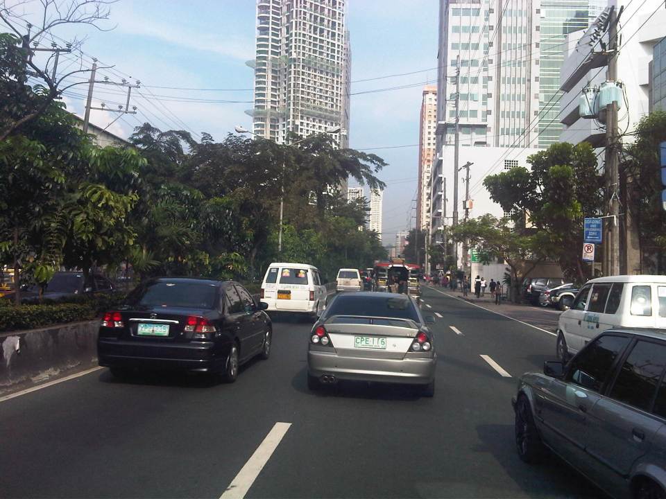 It seems more crowded now along the street because of the high rise buildings that have been constructed.
 It doesn’t help that there are also more electric wires, telephone cables and posts/poles along the boulevard.
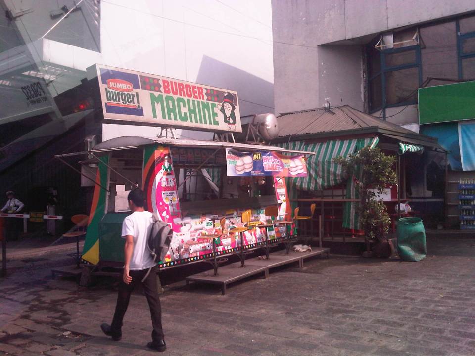 There used to be a lot of these burger stands around Metro Manila. Usually installed at gasoline stations, they provided inexpensive fast food while the big boys (Jollibee, McDo, etc.) were not yet into their aggressive expansions. The one at the former gas station where One San Miguel now stands was a Minute Burger stand. I think only Burger Machine survived from that era though there are others like that ubiquitous Big Mak that flourished in the provinces.
 Intersection with San Miguel Ave. – right after the intersection is Lourdes School of Mandaluyong and St. Francis of Assisi Church. There was a time when the school and the church were the only major structures in the area. Most of the surrounding lands were unoccupied including what is now Shangri-la, SM Megamall, ADB and all the lands in Ortigas Center where there are now tall buildings housing offices and residential units.
 Despite the sign stating that boarding and alighting is prohibited along the area, many commuters continue to defy authorities. Jeepney drivers usually oblige if they see that there are no traffic enforcers around to apprehend them. There used to be substantial sidewalk space in front of Lourdes Mandaluyong but perhaps the space was sacrificed when Shaw was widened to allow for more space in relation to the ramp of the overpass/flyover along Shaw that crossed EDSA. It doesn’t help that what little space remained is blocked by posts such as the one shown at the right in the photo. Pedestrians are forced to walk on the carriageway where they are exposed to the risks of being hit by motor vehicles.
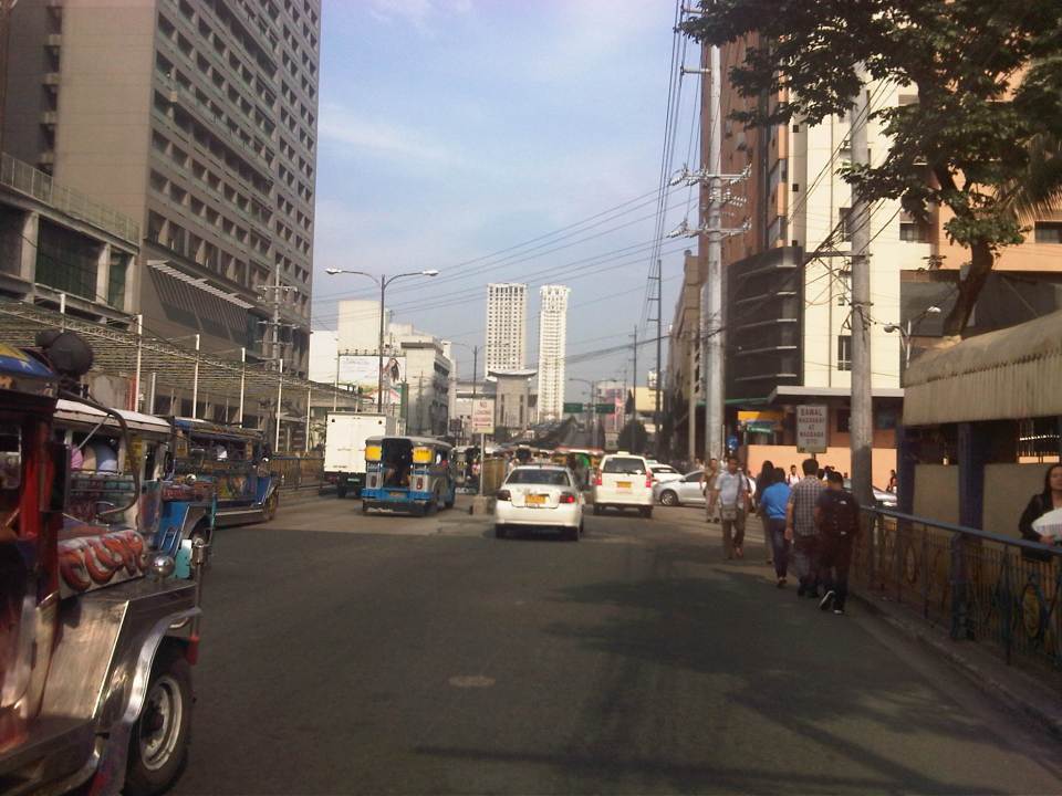 Pedestrians walk along the carriageway due to the narrow space of the sidewalk. Notice that the ramp of the Shaw flyover is practically in the middle of the intersection with St. Francis Avenue (which is in front of St. Francis of Assisi Church). The configuration of the ramp prevents vehicles coming from St. Francis from getting on the flyover and all traffic must turn right towards the at-grade, signalized intersection with EDSA. The area is usually a bottleneck as jeepneys congregate along Shangri-la mall to load/unload passengers at what becomes an informal terminal at the Crossing area.
–
Link: Measuring Transport Efficiency
I’m sharing a recent article from Todd Litman of the Victoria Transport Policy Institute. The article is entitled Measuring Transport System Efficiency that appears in the Planetizen online journal. It’s a very good read for all, even those without planning or engineering backgrounds, who want to have an understanding of how to evaluate or assess transport systems according to the various aspects of a system (e.g., there’s a difference between conventional road planning and accessibility-based transport planning). Todd is as usual very good in discussing these topics given his experience and expertise, and is able to present it in a manner that is easily understood by any reader (well, except maybe the trolls we find anywhere online these days).
Happy reading!
–
V. Luna Extension
V. Luna Extension starts from the intersection with Kalayaan Avenue runs until the boundary with Bgy. Botocan in Teachers Village where it becomes Maginhawa Street. It was mainly a residential street being practically part of the Teachers Village/Sikatuna Village area in Quezon City. The street has been widened to 4 lanes from its wide 2-lane carriageway. However, the additional lanes are not fully utilized for traffic. Rather, they are occupied by parked vehicles and, at some sections, informal tricycle terminals. Following are photos taken one weekday afternoon showing typical conditions along the road.
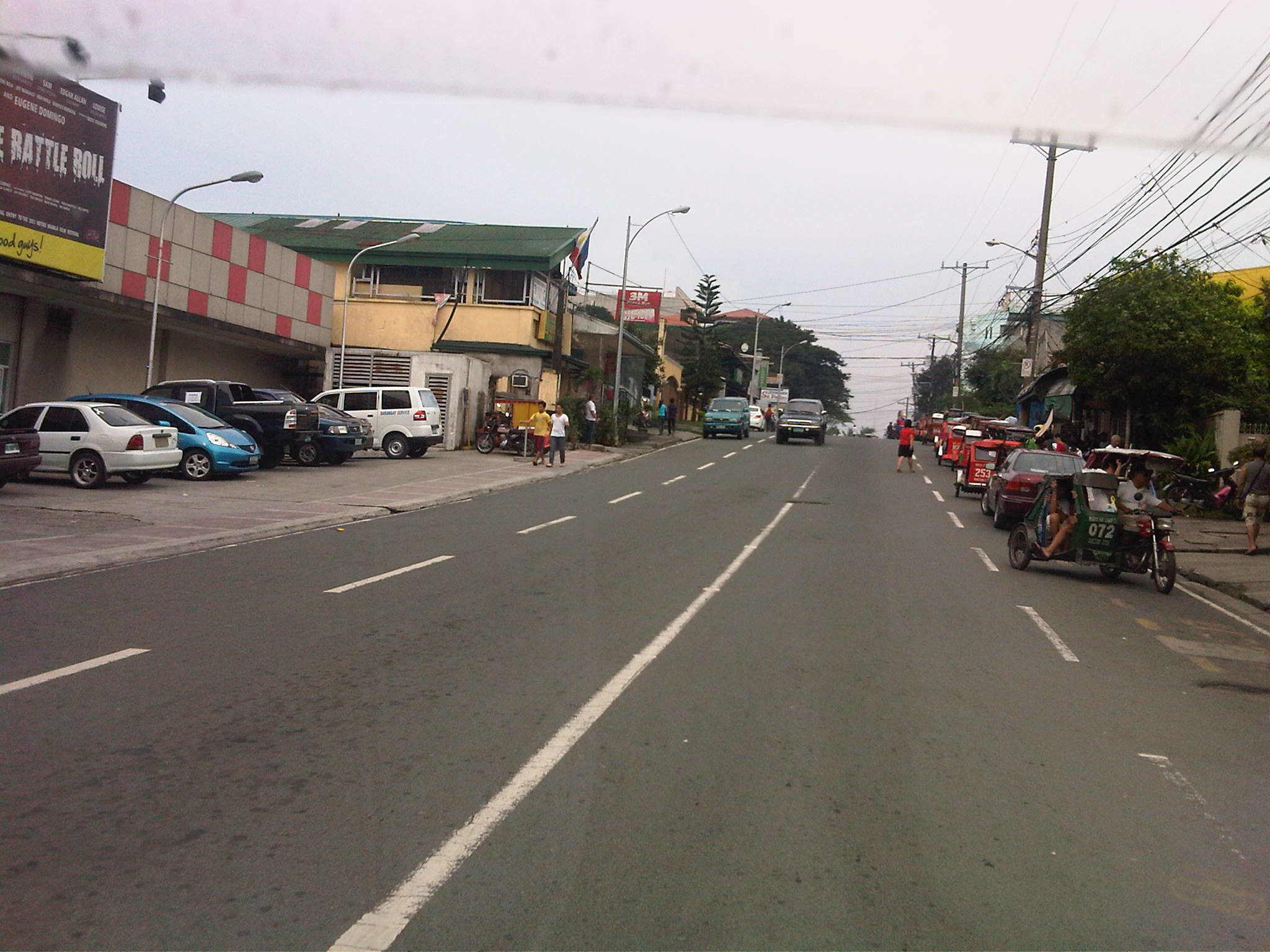 Section in front of SaveMore – while there are off-street parking spaces available at the supermarket side of the road and reducing on-street parking there, the other side’s curbside lane is occupied by a tricycle queue.
 The tricycle queue extends well beyond the head shown in the previous photo. In the picture above, on-street parking in front of residential buildings along the street are shown. There is a yellow line painted on the pavement that seems to be a guide for the tricycles. While I am sure they try their best to park close to the curbside, these 3-wheelers still end up occupying significant road space, thereby reducing traffic capacity.
 Further down the street one starts to realize that the tricycle queue seems to go on and as far as the eye could see in the photo. Note the tricycles parked on the other side of the road, probably just coming back or going around to get fares.
 End of the line – still further down the street and quire near the end of the section designated as V. Luna Extension one can already see the end of the tricycle queue. One can just imagine how many more of these tricycles are going around the village and just how much drivers take home as their net income at the end of a very competitive day. I say competitive here because for the numbers alone at the informal terminal, you get the idea that demand is quite limited and that there is an over-supply of 3-wheelers in the area. Unfortunately, these transport modes are the source of livelihood for many people and to many, a career operating these vehicles seem to be targets for many who have limited opportunities to study and eventually find better-paying jobs.
 Pedestrian crossings – from the previous photos, it is not hard to see that there are few places designated for crossings. In fact, along the entire length of this street (and others like it) people cross just about anywhere. This is possible since traffic is still typically not so heavy along this street.
 Fork in the road – V. Luna Extension continues to the left but as Maginhawa Street in UP Teachers Village. The street on the right is also a part of a residential area, Bgy. Botocan, along which is the ROW of Meralco’s power transmission lines.
–
Sumulong Highway: Marikina to Masinag
Sumulong Highway stretches from its intersection with A. Tuazon Ave. and A. Bonifacio Ave. in Marikina City, Metro Manila to the intersection with the Taktak Road or M.L. Quezon Ave. in Antipolo City in the Province of Rizal. It serves both as an arterial (for Marikina and Antipolo) and a feeder (with respect to Marcos Highway).
The following photos show the stretch from Marikina to Masinag that shows typical conditions along the highway. These conditions are quite different from those along the stretch from Masinag to Taktak Road in upper Antipolo City.
 Sumulong Highway has a total of 4 lanes (2 per direction) but a lack of pavement markings make it difficult to ascertain the center of the road and the space allocation for traffic. This makes travel less safe as motorists assume they are traveling along the correct space on the road.
 The asphalt-surfaced road has no lane markings but has very good pavement conditions. There is also significant on-street parking as most establishments along the highway have no adequate off-street parking spaces. The section shown above is right in front of a sabungan or coliseum for cockfights.
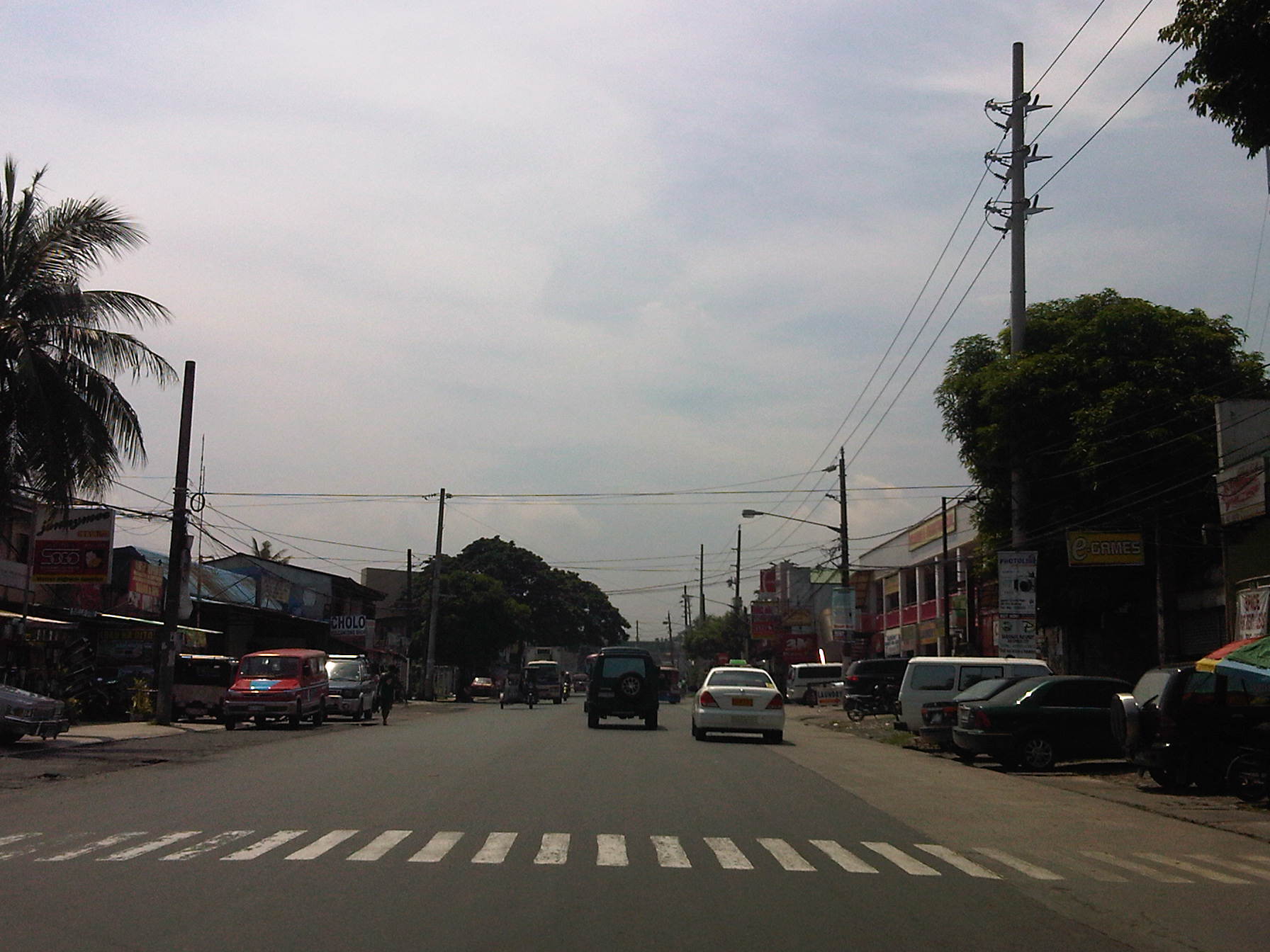 There are pedestrian crossings though, near intersections and where there are schools along the highway.
 Only the traffic lanes have asphalt overlay, the shoulders have the concrete surface exposed thereby distinguishing them from the traveled way.
 The shoulders are used as parking spaces for establishments along the highway as shown in the photo. Such practices are also common along national highways around the country.
 Even the barangay hall of Bgy. Mayamot utilizes road space for parking as shown in the left. The Mayamot Barangay Hall is see on the left in the photo. This effectively reduces road capacity leading to traffic slowing down at such sections.
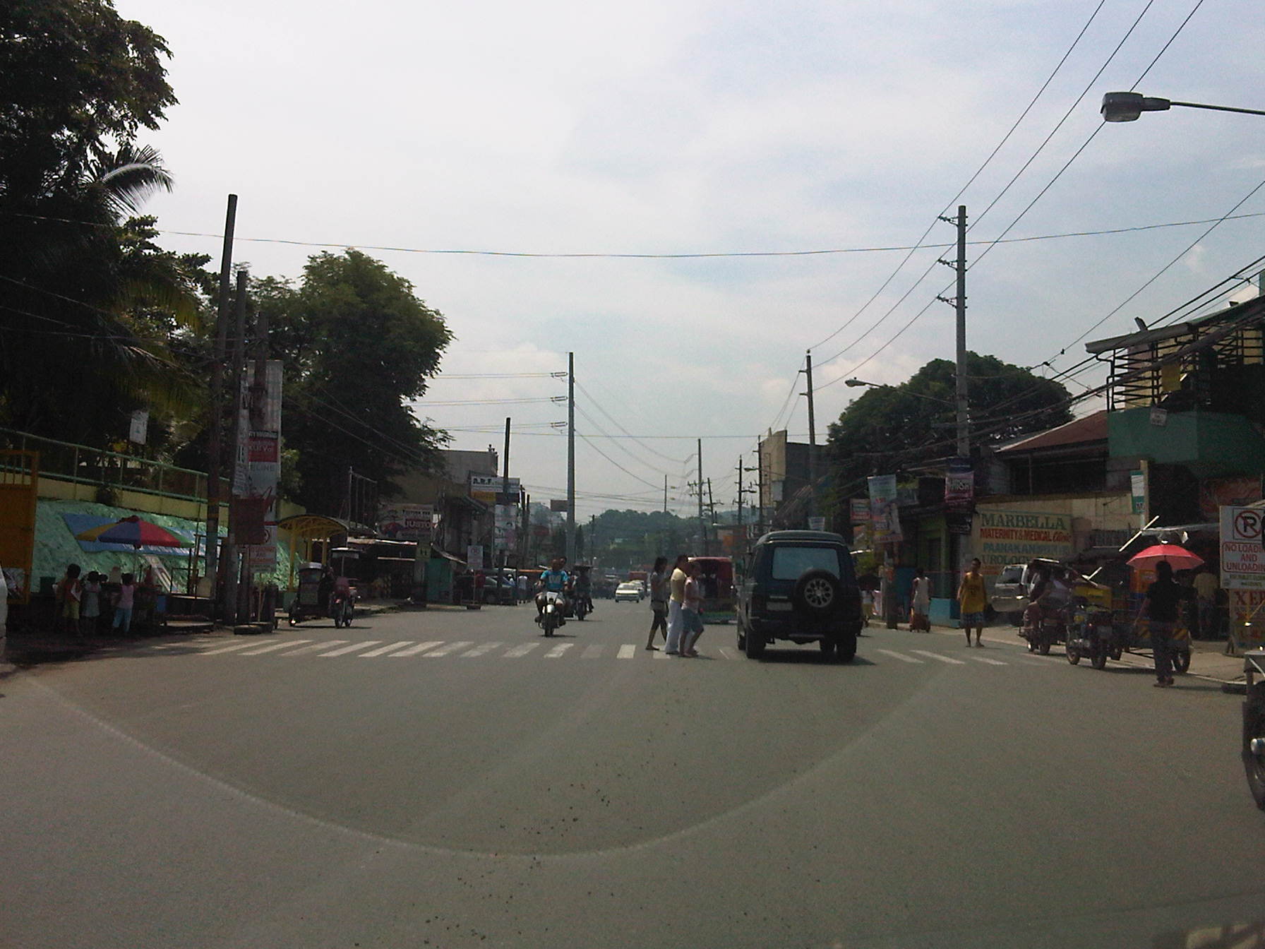 Another pedestrian crossing, this time in front of a public school right after the barangay hall.
 Some sections have sidewalks for people to walk along but these are also usually blocked or occupied by stuff from the establishments along the street.
 Waiting shed along the highway. I could not say its typical because the more recent ones usually have names or initials of politicians on them. This shed is likely to be old and uses clay tiles for roofing.
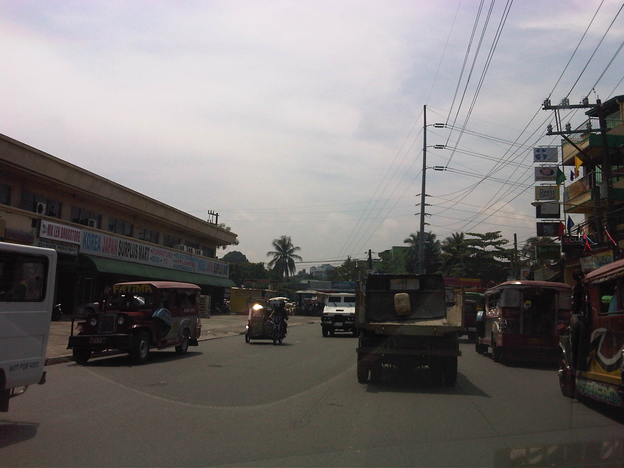 There are also tricycles along the road due to the sidestreets and subdivision entrances connecting to the highway. Public utility tricycles are supposed to be prohibited from using national roads but are common in most provincial areas and CBDs where they are the main mode of transport. In this case, tricycles should be prohibited from using the highway as they are already competing with jeepneys, serving larger areas aside from what should be individual subdivisions or residential districts.
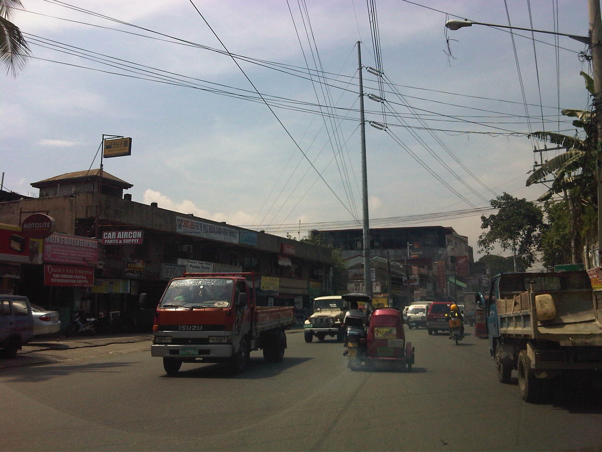 There are many auto repair and supply shops along this stretch of Sumulong Highway. Such shops typically have many customers who also park along the highway, often occupying road space and causing congestion.
 Approaching the Masinag junction, which is the intersection of Marcos and Sumulong Highways, one sees more commercial establishments on either side, mostly small stores or shops. At the junction is the Masinag Wet Market, which is now in decline after major commercial developments have been constructed in the area including the most recent SM City Masinag.
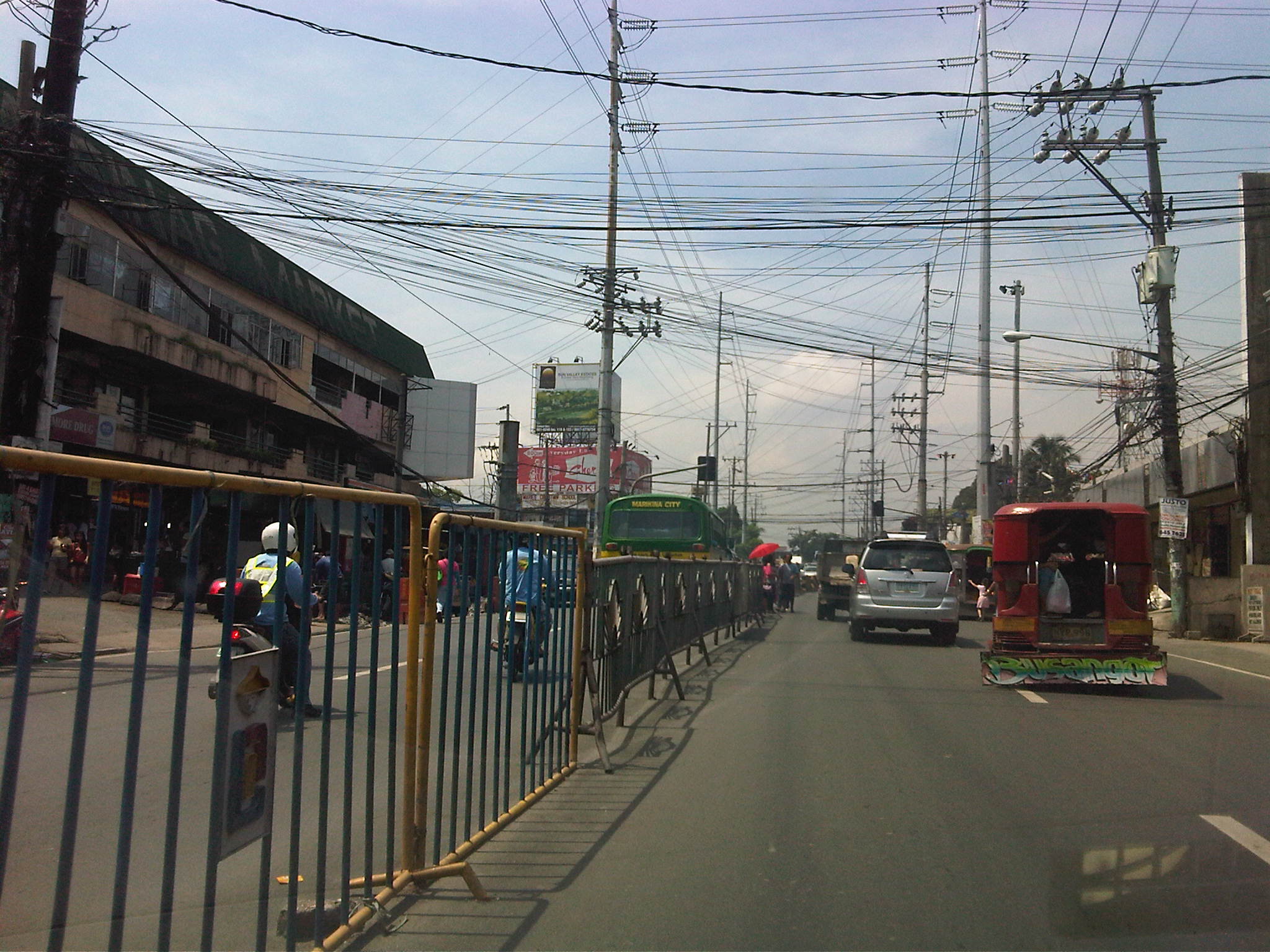 Steel barriers placed along the center of the highway to discourage jaywalking – some barriers have been moved by pedestrians to create space for illegal (and risky) crossings such as what is seen just downstream in the middle of the photo (notice the person with the red umbrella?).
 Barriers forcing all traffic to turn right to Marcos Highway – seen across is the approach of Sumulong Highway from Antipolo
Portions of this section of Sumulong Highway are prone to flooding including the intersection with V.V. Soliven Avenue, which leads to SSS Village and other subdivisions. The more recent floodings were due to the heavy monsoon rains from a couple of weeks ago that effectively isolated residential areas in Marikina and Antipolo as vehicles could not exit the subdivisions to major roads like Sumulong and Marcos Highways. It’s quite interesting to note that the drainage systems along these roads including Sumulong have not been upgraded to be able to accommodate run-off from what is turning to be heavier rains due to climate change. Thus, it may be expected that the same sections will be flooded should there be heavy rains particularly due to typhoons and other major weather systems affecting Metro Manila and its environs.
–
Road right-of-way encroachments: Samar
Going around the country for projects, we always take a lot of photos about transportation including roads, bridges and transport modes. Thank goodness for digital cameras and cell phone cameras, and special mention to memory cards that have allowed us to take photos at will often only worrying about battery life. In a previous post, I wrote about encroachments to the RROW and featured some photos from field work we did in Palawan. This time, I was able to find a few choice photos taken from another project we did; this time in the island of Samar in the Eastern Visayas. In the following photos, one will see permanent structures already built along the roads – ones that are usually the most difficult to remove and the residents a challenge to be relocated.
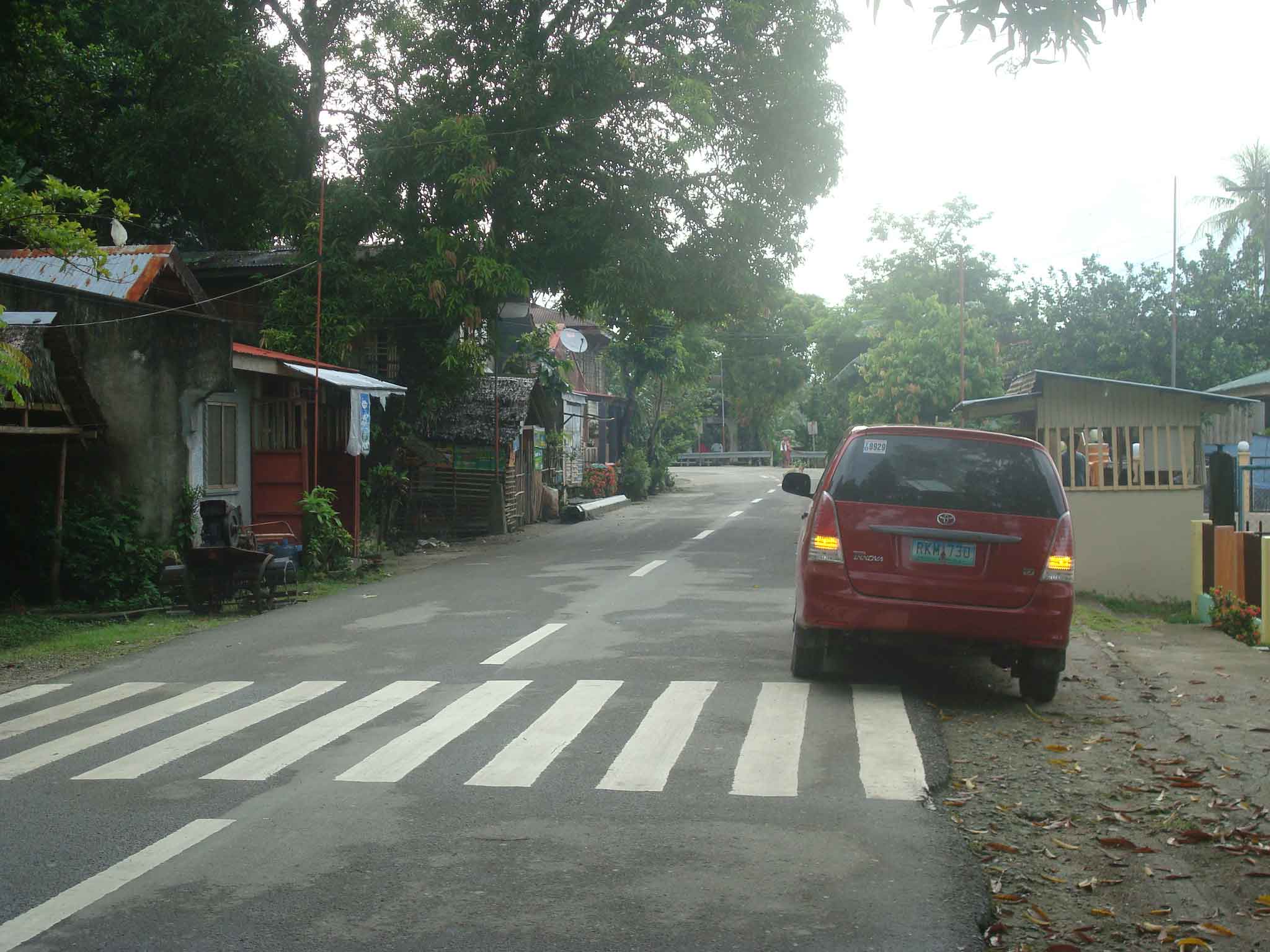 Houses built alongside the highway on what is supposed to be shoulder space. What looks like a booth in from tof the parked vehicle on the right is actually a guard post for the barangay. The barangay hall is located behind the fence visible at the right of the photo.
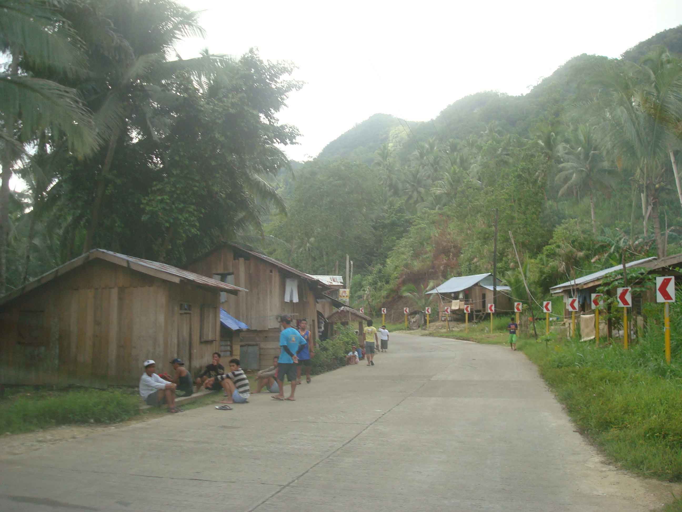 Makeshift houses along the secondary national road also on space usually where the shoulders are. Some houses are located at a hazardous part of the road (i.e., right at the curve and just behind the chevron signs).
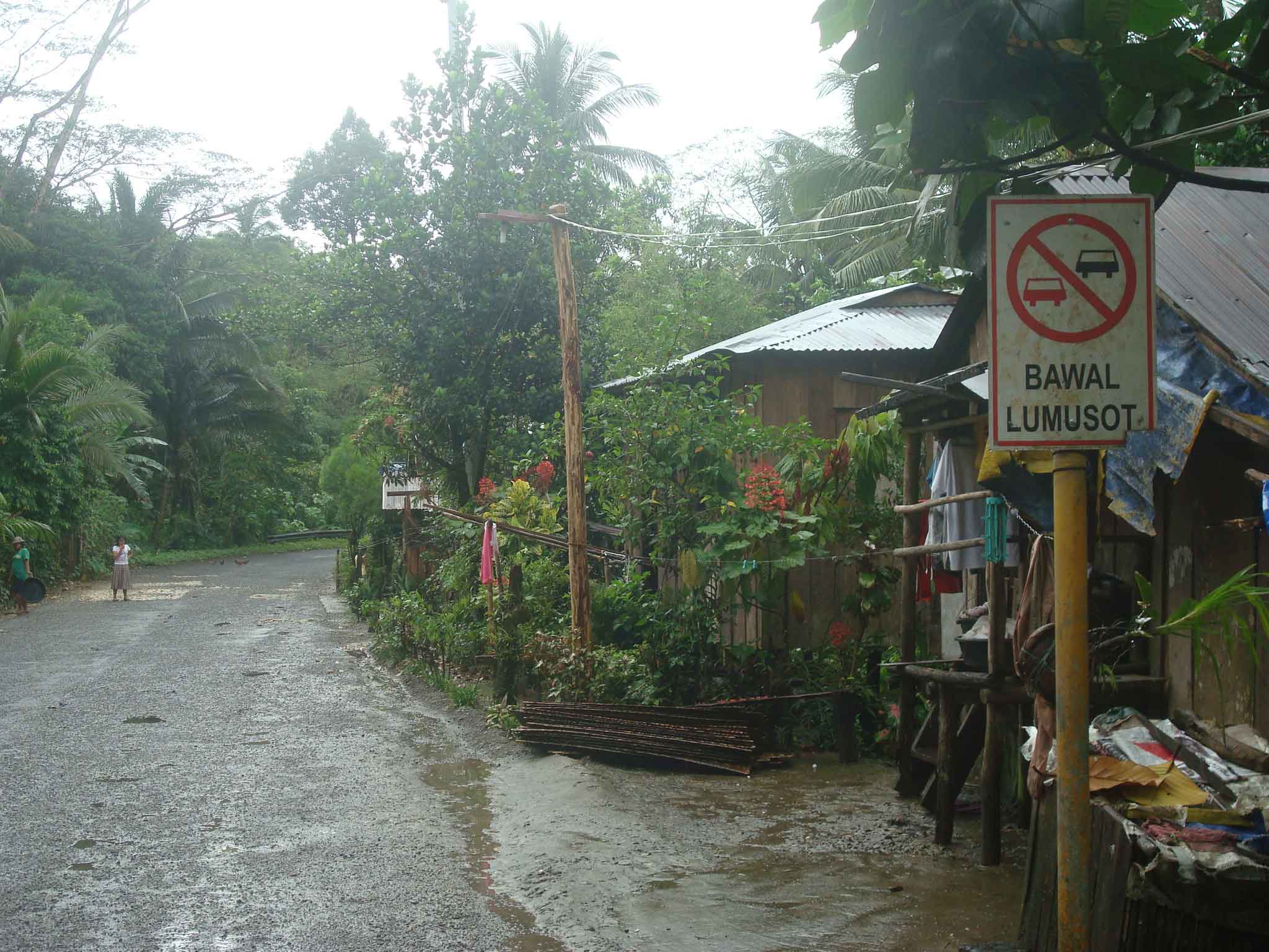 More houses with their fences encroaching on the RROW along a secondary national road in Eastern Samar – the sign on the right, while not exactly obstructed, will blend with the structures and will probably be unseen or unnoticed by motorists.
 Souvenir? – I have seen signs being stolen and displayed in some homes as trophies (actually an illegal act that can get one jailed and fined a hefty sum if caught by authorities). Some souvenirs are harder to take but can be integrated with the house interior or, in this case, as part of a store. Imagine knowing the exact location of a store in the area not through GPS but simply by knowing the exact kilometer post where the store was put up.
There are many other examples of RROW encroachments along other roads. These seem to be common along all types of highways where development along the roads are generally not regulated by local governments but present future problems when space is needed to widen roads to accommodate traffic. Is it an issue of cooperation between the DPWH and the LGUs (including the DILG)? Or is it mainly a local issue that is largely the responsibility of local authorities? Perhaps it is both and something that needs to be addressed to enhance road safety as well as to ensure that future headaches will be avoided when it is time to access the RROW.
–

