
Home » NMT (Page 18)
Category Archives: NMT
Health and commuting
Why is good public transportation especially transit important? Perhaps transport engineers and planners often get lost in trying to explain this from the perspectives of travel efficiency (e.g., reduced travel times, fuel efficiency, more capacity in terms of people carried, etc.) and environmental concerns (e.g., reduced emissions, reduced noise, etc.). Perhaps, too, there’s a need to articulate the importance of good public transport from the perspective of health. How many people do running, jogging or walking in the mornings, afternoons or evenings just to lose weight? How many go to gyms to workout? Perhaps the key to health lies in just walking everyday and integrating that healthy walk in your daily commutes. Here is a nice article from the Wall Street Journal on the link between the way you commute and a healthy life:
Your Commute Could Help You Lose Weight
Somethings I miss from living in Japan and Singapore are my regular walks to and from the transit station. I recall really good walks between the Transport Laboratory in YNU to the Soetetsu Line Kami Hoshikawa Station. You have to walk up a small mountain almost everyday from the station to the university. I also had good walking buddies back then during my 3 years in Yokohama. Later, I also enjoyed walking or cycling between the Transport Lab at Saitama University and the International House. Often, too, I would walk or cycle to the supermarket, the transit station or just around the neighborhood during free times. In Singapore, our home and the office were also near transit stations so we could take nice walks between them aside from the four flight of stairs to our apartment on the fourth floor. Such healthy commutes can be realized in Philippine cities if proper planning is undertaken and transit projects are implemented not just from the perspective of efficiency but, importantly, from the viewpoint of health. The current state of public transport is not healthy and many, especially those taking the EDSA MRT 3, will say that it is quite stressful to commute in Metro Manila. And stress is definitely not the way to lose weight. Is this true for other Philippine cities as well? Hopefully, we can work out transport solutions that include good public transport to promote healthy lifestyles.
–
Candidates for pedestrianisation?
I friend recently posted on the pedestrianisation of Intramuros and I commented that the walled city that used be equated to Manila should be a prime candidate for initiatives on pedestrianisation. Among the challenges, however, for any project that seeks to encourage walking by reclaiming roads and other spaces for pedestrians in the walled city would be the pedicabs. These are non-motorised three-wheelers that proliferate in Intramuros. There are just too many of these vehicles going around the area. I have mentioned these vehicles in past articles on some streets in the walled city including Calle Real del Palacio, Muralla Street, and Solana Street.
A city that can be used as a ‘good practice’ reference is Vigan City in the province of Ilocos Sur. Many parts of Vigan City are already pedestrian-friendly. In fact, Crisologo Street, which famously represents this city recognised as a UN Heritage Site is off-limits to motorised transport. However, the issue with Vigan is the proliferation of motorized tricycles. There also seems to be an oversupply of these tricycles that many continuously go around the city looking for passengers. The noise and emissions from these roaming tricycles alone contribute to negate part of the attraction of this Heritage City.
Baguio City can be transformed into a walkable city and focus should be on the iconic Session Road where small businesses including restaurants and shops once thrived. I say ‘once’ because the establishments along Session Road have experienced a decline during the past years since a major retail company constructed and started operating a huge mall near one end of Session Road. So much for the small city feel of Baguio and the local shops and restaurants that have suffered from the big business concept brought in by the mall.
In Makati City, the Ayala CBD has been pedestrian-friendly for quite some time now. People-centered facilities include underpasses for crossing major roads like Ayala Avenue and an elevated walkway connecting office buildings all the way to the Greenbelt mall. Unfortunately, these pedestrian-friendly features are limited to the CBD and
In Taguig City, the Bonifacio Global City is a good example where sidewalks are wide enough and there are pedestrian friendly malls like the High Street where people are prioritized over cars. Crossing the streets, however, can be very dangerous at BGC and traffic enforcers need to do more serious enforcing in order to manage speeds and aggressive driving by motorists in BGC. There are already incidences being shared on social media of pedestrians being hit by speeding vehicles or those whose drivers simply don’t give way especially when turning at corners.
In Quezon City, there are few areas that can be regarded as pedestrian-friendly. Among these are the University of the Philippines campus in Diliman, whose core is closed to motorised traffic during Sundays. There are initiatives for making Katipunan Avenue more pedestrian-friendly. However, these initiatives seem to be still far from being implemented on the southbound side of Katipunan where plenty of establishments do not have adequate parking and there are practically no sidewalks for people to walk on. This is the side where there used to be a service road that had to be sacrificed more than a decade ago when the MMDA got engrossed with a flawed traffic scheme.
What cities or streets would be your candidates for pedestrianisation?
Pedicabs in San Diego
I was surprised to see a familiar vehicle going around San Diego as I took a walk around the Gaslamp District. I had to do a double take as I saw three-wheeled non-motorised transport (NMT) along a busy road. Many were brightly decorated or sported lights that made them noticeable among the vehicles on the streets when it got dark. Many drivers were also dressed to attract passengers. Many wore helmets or some head gear (hats or caps for others). Motorists seem to be well-adjusted to these pedicabs running along San Diego roads but then traffic in the CBD appears to be lighter compared to downtown Los Angeles or San Francisco.
 Bicycles and cycling are very popular in San Diego so pedicabs seem to be a natural extension of that
 Three-wheeler with a smiley
 Pedicabs could carry 2 to 4 passengers depending on their seating configuration
 A pedicab decked with rope lights is followed by one with well-dressed passengers. The pedicabs were quite popular with delegates/participants of the INTA conference held at the San Diego Convention Center.
 I like this photo I took of a pedicab ferrying a passenger to the historic Sta. Fe train station. A San Diego trolley is also in the photo. The image shows the complementation among transport modes.
The pedicabs in San Diego are basically for tourism and not necessarily for commuting. They do, however, agree to carry people who would rather ride the pedicab than take a taxi or walk to their destinations. You just have to negotiate a fair price for the ride. The good thing with the pedicabs in San Diego is that their operations there provide a good example, a proof of concept if I may state, of how motorised and non-motorised options can co-exist. These options for travel include the rail-based trolley and provide people with a plethora of options for sustainable mobility. I think this should work in medium sized, highly urbanised Philippine cities as well.
–
All roads lead to Antipolo: rerouting for the Alay Lakad
The Rizal Provincial Government and the Antipolo City Government recently posted traffic rerouting schemes on their Facebook pages. Lalawigan ng Rizal was the first to post schemes that affect traffic in at least 3 major local government jurisdictions – Antipolo, Cainta and Taytay. The schemes affect the two major corridors that basically lead to Antipolo’s National Shrine of Our Lady of Peace and Good Voyage (or Antipolo Cathedral to many) – the Ortigas Avenue corridor and the Marcos Highway-Sumulong Highway corridor. There are many major and minor routes connecting to these corridors and are clearly seen in the maps.
Within Antipolo, there are also re-routing schemes, which the Antipolo City Government posted along with a “clearer” re-posting of the maps from the Rizal FB page. The Antipolo FB page includes information/maps on the rerouting within the city center. These schemes will affect traffic circulation including public transport routes. Critical would be the permanent and temporary terminals and parking areas set-up around the city that should be able to accommodate the thousands of vehicles that are also expected to be used by people who won’t be walking or cycling.
What the maps basically say is that from 4:00 PM today, Maundy Thursday, to 6:00 AM tomorrow, Good Friday, the stretch from Cainta Junction to the Shrine will be closed to traffic. This is to allow the hundreds of thousands expected to make the trek to Antipolo to have the road for themselves. What the maps don’t say is that motorcycles and tricycles would likely be allowed, too. I can understand that motorcycles could easily squeeze into the throngs of people but then allowing tricycles to operate among the walkers and bikers would be risky given their drivers’ behavior. Add to this that they would be making a killing out of charging opportunistic fares.
Technically, the rerouting schemes don’t appear to be as well thought of as can be expected from the LGUs. Baka ito lang nakayanan ng staff o ng consultants nila, and surrender na agad ang Rizal and Antipolo with regards to the coming up with more options for people to travel to the Antipolo Shrine? Not all people can walk or cycle but are willing to an could take public transport for their pilgrimage. The maps themselves are a bit crude and the Province of Rizal and City of Antipolo could have done much better maps given the resources of these LGUs. There are open source tools now available as well as your basic software like PowerPoint or Photoshop (even Word!) that can be used to render good quality images to guide people making the Alay Lakad. This is a regular event and though it happens once a year then perhaps the LGUs could have better plans especially to transport people who cannot make the walk to Antipolo. The objective after all is to convey the masses to and from the shrine safely and efficiently – something a mass transport system can do whether via Marcos/Sumulong or Ortigas corridors.
One reminder to all doing the Alay Lakad: keep your garbage to yourselves if you cannot find a proper waste bin. Do not dispose of your waste along the route and make a dumpsite out of Ortigas Avenue, Marcos Highway, Sumulong Highway or whatever roads you are taking! Kasalanan din po ang irresponsableng pagtatapon ng basura. While you might be forgiven for these “sins” through the Sacrament of Reconciliation (which many will likely take at the Cathedral), nature will have a way of getting back at you for your environmental travesty. –
Bad P.R. for road sharing
A few articles came out of Sun Star Cebu recently regarding an activity over the weekend that was supposed to promote road sharing. I read four articles by different opinion writers. These may be found in the following links:
- A crazy exercise [Bobby Nalzaro, September 28, 2014]
- Sharing narrow roads [Opinion, September 29, 2014]
- Road sharing, road rage [Eddie Barrita, September 30, 2014]
- Green Loop’s faulty premises [Bong Wenceslao, September 30, 2014]
The first three articles seem to be more like reactions of motorists to activities that seek to promote road sharing and cycling in particular. The writers missed the point in so far as road sharing is concerned and are definitely biased towards the status quo in terms of road usage. However, some of their observations need to be qualified as certain roads seem to have been closed with little advise to the general public, many of whom take public transport. The last article is the more grounded one and explains the perspective of non-bikers who are public transport users. This is the calmer opinion among the four and expresses his points in a more objective manner.
I was not there and I haven’t read yet any articles from the organizers or participants to the activity. I would like to give them the benefit of the doubt in so far as their advocacy is concerned. But then one also has to consider the valid points raised by other road users whenever road sharing is equated to cycling rather than a more balanced mix that is focused towards maximising the number of people or amount of goods transported. It is not only a question of space but of efficiency of movement. Bicycles might be efficient in energy but unfortunately it is not the most efficient in terms of the number of people carried between origins and destinations. And we can never decongest our streets in order to make more space for cyclists and pedestrians if we cannot come up with efficient public transport systems that will encourage people to leave their cars or not to buy one in the first place. It can be argued that people are actually opting for motorcycles than bicycles for commuting – another trend that needs to be understood from the perspective of people making these choices for their transport needs.
–
Let’s revisit the Marikina Bikeways
Calls for more walkable and bicycle-friendly cities and a lack of local data for these modes of transport got me thinking about Marikina. The city has its own bikeways office, the Marikina City Bikeways Office (MCBO), that was under City Planning and Development Office but borrowed staff from other offices of the city. The MCBO has gone through many challenges since the time of Bayani Fernando, who instituted the office, and his wife Ma. Lourdes under whose terms the office was downgraded. I’ve learned that the office has been strengthened recently and is implementing a few programs to promote cycling especially among school children. I wonder, though, if Marikina has been collecting and keeping tabs on cycling related data. I recall that during the conduct of the study for the Marikina bikeways network, it was established that there was a dearth of data on cycling and data collected pointed to cyclists primarily comprised of workers in factories or construction sites in the city and neighbouring areas. These are the regular commuters using bicycles instead of motorised vehicles. It would be nice to see if these increased in numbers (observations along major roads like Sumulong Highway seems to support the increase) and if there have also been shifts to motorcycles as the latter became more affordable in recent years. Enforcement is still an issue with regards to the bikeways as not all paths are segregated. As such, those lanes painted on the roads are more susceptible to encroachment by motorised vehicles. Still, Marikina is a very good example of realising people-friendly infrastructure and many LGUs could learn from the city’s experiences with the bikeways.
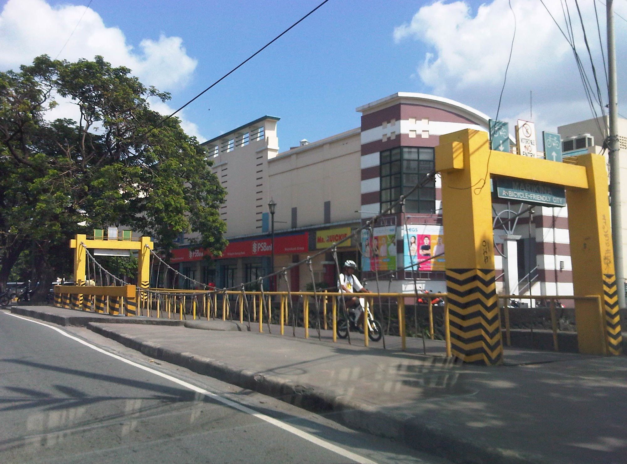 A bicycle bridge along Sumulong Highway in Marikina City
Recently, some students consulted about designing bikeways in other cities as well as in a bike sharing program being planned for the University of the Philippines Diliman campus. These are good indicators of the interest in cycling that includes what discussions on the design of cycling facilities and programs intended to promote bicycle use especially among young people. We strongly recommended for them to check out Marikina to see the variety of treatments for bikeways as well as the examples for ordinances that support and promote cycling.
–
Streets of Malabon
I happened to be in Malabon one weekend for a get-together with the wife’s relatives who lived in the area. Malabon is an old town that is often mentioned in history books (i.e., during the Spanish period). Though the name of the town is said to have been derived from the term “ma-labong,” which is short for “maraming labong” or plenty of bamboo shoots, it is likely, too, the place was named after San Francisco de Malabon. Here are a few photos we managed to take as we drove along Malabon’s streets. I was not familiar with the area but Waze and Google maps provided ample information for us to navigate our way around.
 Gen. Luna Street in the Malabon city proper is a one way street. Other streets in the CBD have also been designated as one-way streets as all (and not just a few or most) roads are narrow.
 Non-motorized transport are popular in Malabon and you will see a lot of bicycles and pedicabs along the streets. These are usually in mixed traffic and seem to blend quite well with motorized vehicles. This seems to be a good example of practicable road sharing.
 While the streets are designated one-way for motor vehicles, bicycles and pedicabs generally travel counterflow and oblivious to the risks of doing so. Still, motorists seem to be okay with this and traffic enforcers do not mind the practice.
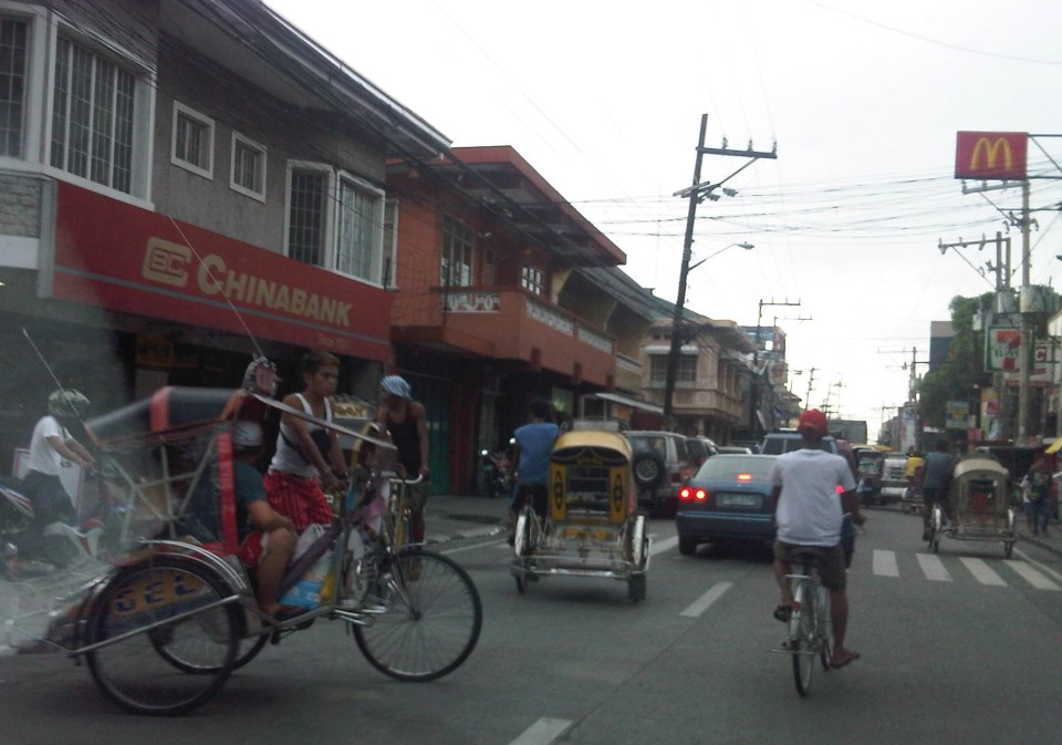 There are many people using bicycles and pedicabs in Malabon. Noticeable are the unique designs of sidecars as the bicycles used in the trikes are taller than the usual bikes elsewhere.
 One of the narrow side streets in Malabon. I think these should only be used for walking or cycling and motor vehicles (including motorcycles) should not be allowed to use these. Malabon can be developed as a walkable city and since it has narrow streets, traffic circulation needs take into consideration how to effectively use one way scheme or combinations in the network.
Malabon is a flood-prone area. Combined with its narrow streets, the area needs an all weather transport system. Non-motorized transport like bicycles and pedicabs can provide this as well as buses perhaps, though the narrow streets and tight turns at intersections can definitely be tricky for large vehicles. It would be interesting how the city will continue to develop considering the constraints. The town proper itself is challenged in terms of the area available for development and perennial flooding will always be an issue that will be quite difficult to overcome. Still, the city and its citizens persist and have been able to overcome these challenges. It can only be hoped that the city will continue to thrive amidst the challenges.
–
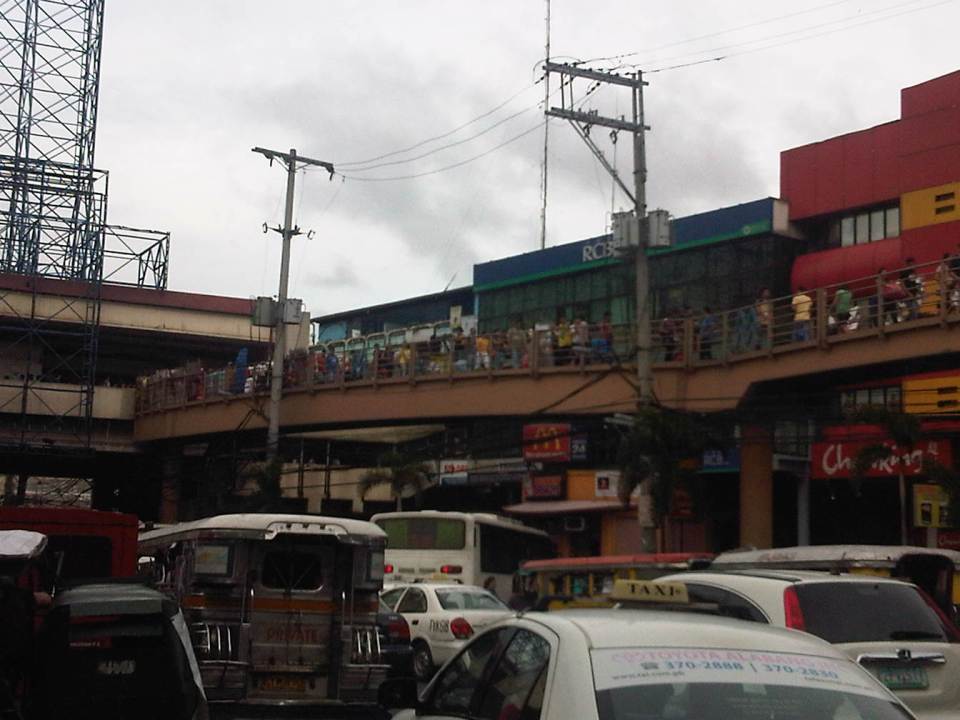
EDSA: Taft to Tramo
The EDSA-Taft Ave. intersection was in the news a few weeks ago due to the MRT3 train that derailed and overshot the end of the line along EDSA. Being a major intersection for roads as well as for rail (MRT3 and LRT1), it is a very crowded area. Nearby, too, is the Redemptorist church in Baclaran that attracts a lot of people especially during Wednesdays. Following are a few photos of the area showing the conditions on the pedestrian overpasses and at street level.
 The pedestrian overpass at EDSA-Taft is also a mall of sorts given the merchandise being sold at informal shops at the overpass.
 The overpass connects to the EDSA-MRT 3 Taft Ave. Station. This is the MRT 3’s end station and the overpass system connects the MRT 3 Taft Ave. Station with the LRT Line 1 EDSA Station. The connection was not and is still not a smooth one, which has been the subject of criticism from a lot of people.
 The overpass allows people to walk around this large intersection
 Pedicabs freely travel along this stretch of EDSA between Taft and Tramo on lanes designated for public utility buses and clearly violating regulations regarding what vehicles are allowed on EDSA. You can also see in the photo a cart full of merchandise being pushed along the curbside lane.
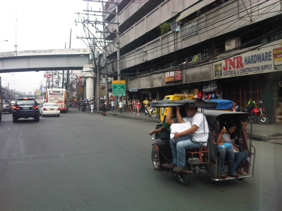 A motor tricycle ferrying passengers along EDSA just before Tramo (that’s the street above which is an overpass from EDSA southbound).
–
Practicable road sharing in Antipolo
As there are increased calls for more bikeways, we try to look at some good examples of what I’d call “practicable” road sharing. I term it “practicable” because it is something doable or is already being done or practiced. I tried to find a few good examples of practicable road sharing to show that it can be done and usually if all road users respect each others’ right to use the road. This respect can be developed over time and requires some familiarity for each users behaviors. Of course, there will always be abusive or disrespectful people on the road including drivers of different types of vehicles. Reckless or unsafe driving is not limited to public transport or truck drivers. There are also many unruly private vehicle drivers who endanger the lives of others whenever they are on the road. Then there are the motorcyclists, cyclists and pedestrians – all road users and also with bad apples or “pasaway” among them.
Road sharing happens everyday in Antipolo City in the Province of Rizal. Along Ortigas Avenue and Sumulong Highway – the two main routes to and from Antipolo, you will see motor vehicles, bicycles and pedestrians sharing what are mostly 4 lane, undivided sections of the two major roads. Antipolo is a very popular destination for cyclists so even during weekdays you will find a lot of people cycling up and down the mountain roads even during the night time and very early mornings. While many are recreational riders, many, too, are doing this for health. I would bet that a good percentage might be biking to work or school but there are no hard statistics to show this (topic for research?).
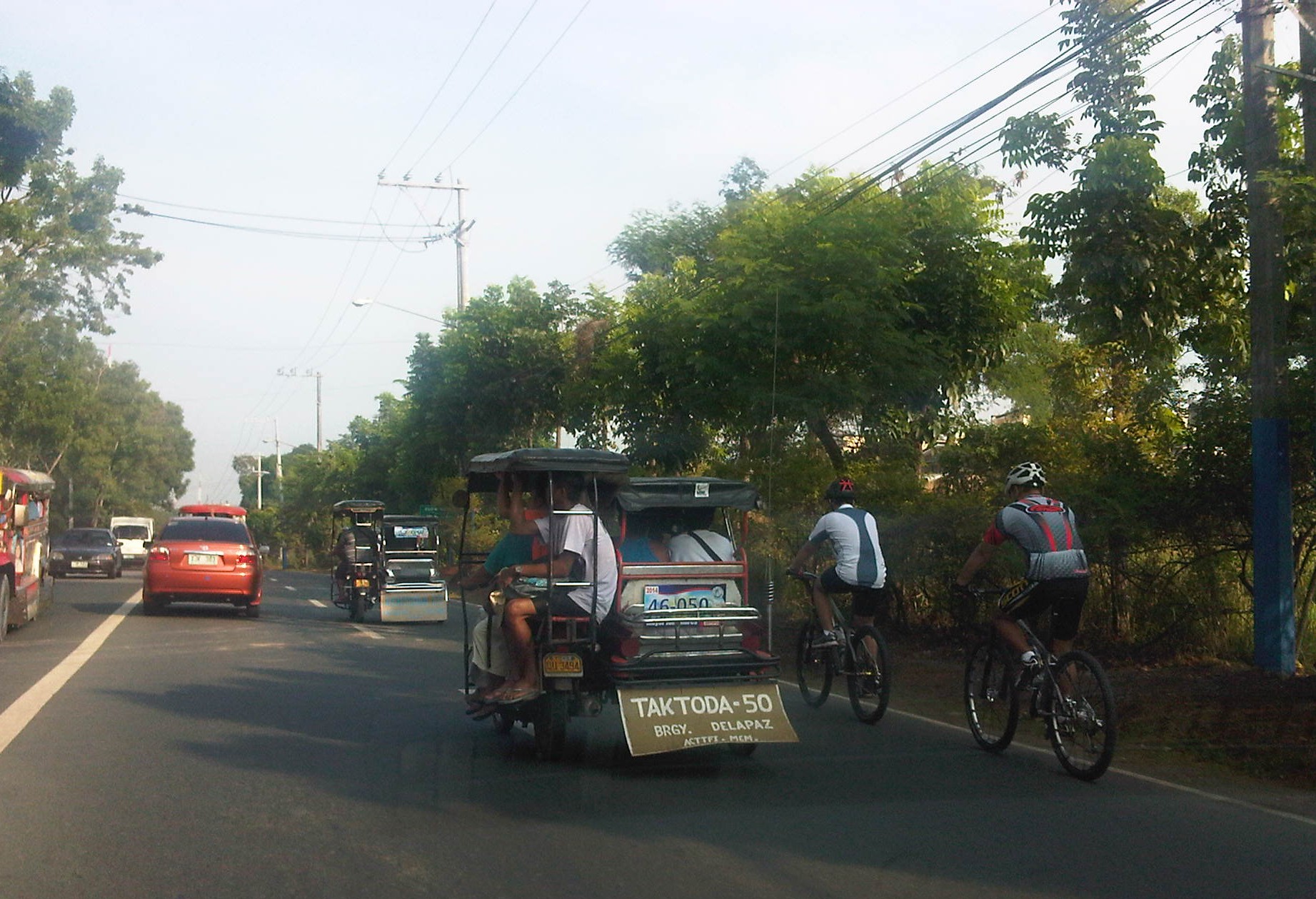 Motorists and cyclists “sharing the road” along Sumulong Highway
Sharing the road shouldn’t be too difficult. However, road users need to have respect for each other’s right to use the road. I have observed many instances where one or more road user types are guilty of “disrespect” and tend to hog the road as if making a statement that “i am king of the road” rather than “i have the right to use the road.” Here are among my pet peeves:
1. Slow moving trucks or jeepneys hogging two lanes and not giving way to other vehicles to pass them.
2. Jeepneys and private vehicles racing up or down the mountain roads and overtaking even in perilous sections (i.e., those already identified as prone to crashes).
3. Tricycles taking up the middle lanes and maneuvering anywhere.
4. Cyclists taking up the middle lanes or sometimes the entire two lanes of any direction preventing other road users to pass them.
5. People crossing anywhere along the road especially at blind sections (curves) where sight distance is limited.
There are practically no pedestrian sidewalks along most of Ortigas Extension and Sumulong Highway so pedestrians would have use the carriageway. As there are a significant number of people walking (e.g., students, workers, and even joggers or walkers), motorists and cyclists need to be careful not to hit these people. The same people, however, need to be aware of these vehicles and should exercise caution, always being alert as they use the road properly. Ultimately though, I would like to see walkways built along Ortigas and Sumulong especially since there is already an increasing demand for walking especially during the summer months when Antipolo holds its fiesta and a lot of people go on pilgrimages on foot to the Shrine of Our Lady of Peace and Good Voyage.
There is practicable road sharing in Antipolo because most road users are already familiar with each others’ behavior and accept each others’ presence and rights on the road. These road users are likely residents of Antipolo or nearby towns or regular visitors to the city. They are “nagbibigayan sa daan.” The “pasaway” people are likely the newer ones who seem to think that the way they drive or ride (i.e., unsafe) elsewhere is the norm. Of course, that goes without saying that familiarity with the roads and its users also breed risk takers who think they already know the road and have the skill and experience to drive like crazy. Here is where effective enforcement (e.g., timely apprehensions and reminders) and engineering (e.g., traffic signs and pavement markings) comes in to address the gaps in safety in order to reduce if not totally eliminate crash incidence along these roads.
–
Discouraging walking?
We were looking for suitable sites for a traffic survey along Espana the other day and had chosen the pedestrian overpass across Ramon Magsaysay High School as a possible site for a camera to record traffic flow along the avenue. Data from the video will be used to calibrate measurements from other cameras that are part of an intelligent system under development and supported by the DOST-PCIEERD. Those cameras are currently installed at a post at the junctions with Lacson Ave. and Vicente Cruz St. The system will also utilise data from the ASTI’s flood sensors near Lacson and San Diego. What we saw on the footbridge was not exactly a shocker to us as we anticipated the conditions on the overpass. However, we all agreed that the conditions of such pedestrian facilities need to be improved significantly and in such cases as this footbridge, immediately!
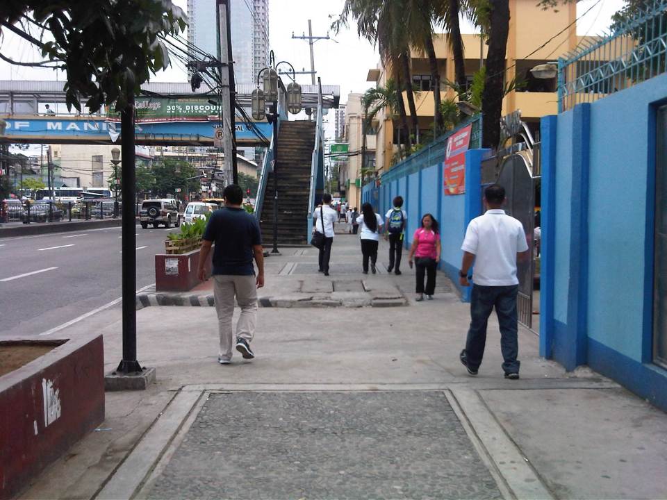 Walking to the overpass in front of Ramon Magsaysay with the school on the right.
 The overpass was partly flooded from the rains the past few days. The roofing only had the frame so anyone using the overpass on a rainy day would have to use their umbrellas for cover. The MMDA had removed the roofs of many overpasses to discourage vendors and beggars to set up on the overpasses. Spared from the campaign were overpasses that were secured by establishments like those along Katipunan with Ateneo and along Espana with UST. While there are no vendors or beggars on this overpass, it’s quite obvious from the photo that vandals have been busy defacing the facility.
 Many open overpasses like this are stinky because they are (ab)used as urinals. Who knows about the composition of these puddles aside from the rainwater during this wet season.
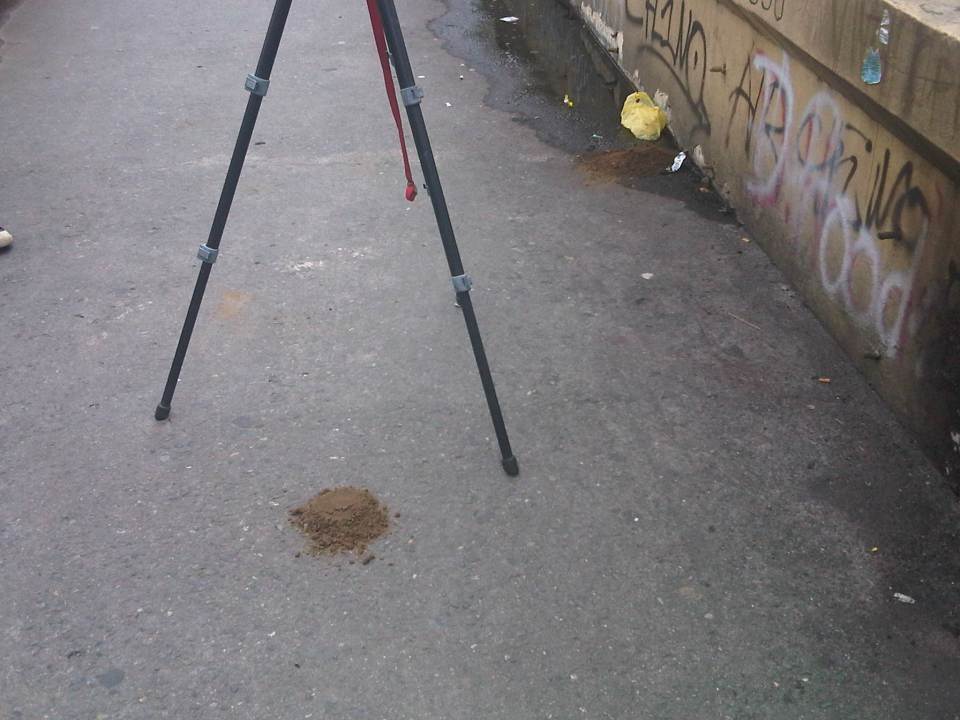 The overpass smelled of poop and that’s simply because there were poop scattered along the overpass. Neglected facilities like this, despite being used by many people (its right in front of a big public school) to cross busy streets like Espana, are often used by vagrants as toilets. Quick thinking and action by one of our staff reduced the stink when he got some soil from the (also neglected) plant boxes in the area to cover the feces that littered the overpass.
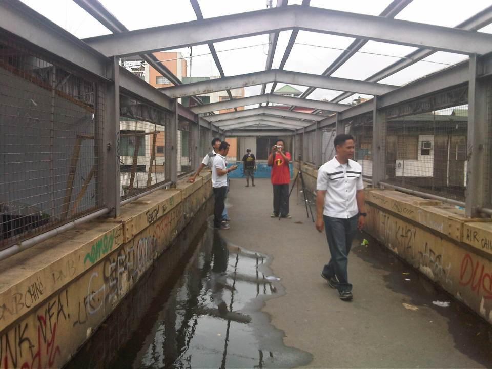 NCTS staff setting up a camera while also taking up the conditions at the footbridge.
 The stairways to/from the footbridge are quite steep. Such features need to be designed with senior citizens, children and PWDs in mind.
This overpass is located in Manila and is probably used by hundreds of students from the public school beside it aside from the other pedestrians that need to cross Espana Avenue. I think there is an opportunity here for the City of Manila and the specific barangay to improve the conditions of the facility and ultimately contribute to improving quality of life through the improvement of the quality of walking – the most basic of all modes of transport and certainly a strong indicator for a city’s health and vibrance.
–
