
Home » Public Transport (Page 43)
Category Archives: Public Transport
On Iloilo’s taxis
The talk about Uber vs taxi is a hot topic in many cities around the world and also in Metro Manila where Uber has gained a foothold and a strong following among mostly ‘former’ taxi goers. Many have stated that Uber provides the service that taxis should have been providing. Uber vehicles are supposed to be of newer models and drivers are supposed to be screened carefully. Uber even has a feedback mechanism not just for drivers but for passengers as well. Basically, Uber provides the quality of service everyone wants to have on regular taxis. The irony of course is that regular taxis are supposed to provide a higher quality of service compared to other public transport modes considering it is basically a for hire car short of a limousine service. But then this begs the question: If you had good taxi services in your city, would you still consider Uber? Or perhaps would Uber have a lot of demand in a city with good taxi services? Perhaps there will still be a demand for Uber but the clamor will not be like that in Metro Manila. And there are few cities with ‘good enough’ taxi services that can compare with Uber in terms of quality of service.
A good example of where there are ‘good enough’ taxis and there is a healthy competition not between Uber and conventional taxis but among taxi operators themselves is in Iloilo City. We have discovered many years ago that Iloilo City had one Light of Glory taxi company that is very popular among Ilonggos and visitors as the drivers were generally more honest than others and they had an efficient dispatching system including desks at the airport and a major shopping mall.
 Light of Glory Taxi at the airport parking lot
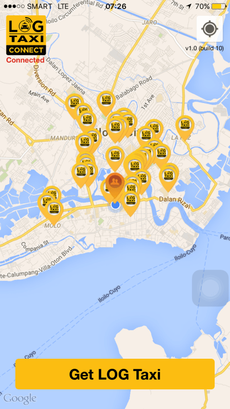 Light of Glory has its own app, which you can get for free and install on your smartphone. It is not as sophisticated as Uber’s or Grab’s apps in terms of features but it gets the job done (i.e., getting you a taxi).
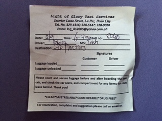 Dispatch sheet – note the attributes the company is trying to promote among its taxis: “Clean, Safe, Reliable, Comfortable, Drug Free” These are attributes we all want of our public utility vehicles whether these are taxis, jeepneys, buses or tricycles.
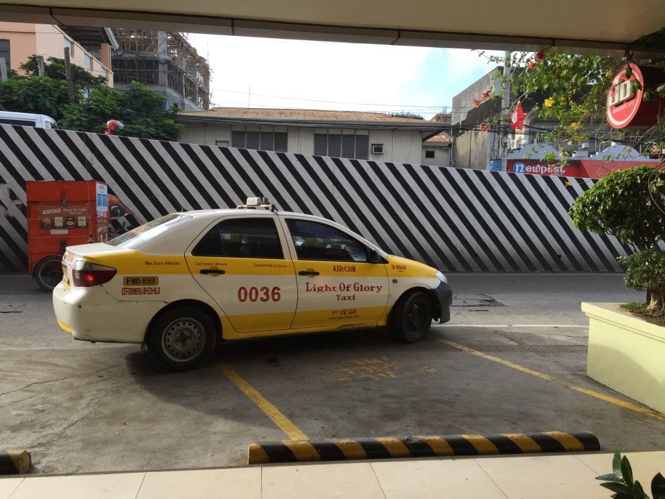 Light of Glory taxi that dropped us off at the venue of our meeting straight from the airport
The Light of Glory taxis is a well run company. Their drivers seem to be treated very well by the operator (drivers claim they have a better compensation system) and generally drive better than other taxis. Their vehicles are also seem to be better maintained compared to others except a few of the larger companies like GDR. Everyone knows about the best taxi company in Iloilo and would most likely prefer their taxis over others if the choice is given to the taxi-going commuter. To compare, I remember the Comfort taxis of Singapore and how many Singaporeans and foreigners living in SG prefer these taxis over others. Comfort taxis have a good dispatching system and you can make reservations for trips in advance. Of course, there are additional fees for on-demand services including arrangements for pick-ups and drop-offs (e.g., your residence to the airport).
–
Premium bus service schedule
For the benefit of commuters, here is the schedule of the premium express buses currently on experimental run along EDSA. The end points and routes are shown in the graphic below:
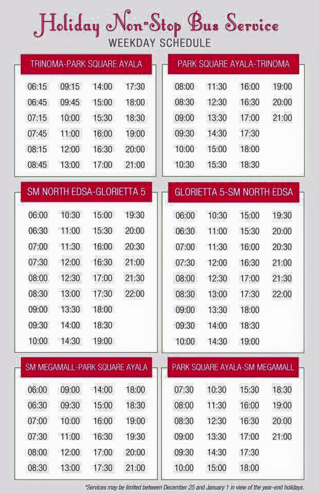
I suddenly remembered the slogan adopted by the defunct Metro Manila Transit Corporation (MMTC) for their Love Bus back on the 1970s and 1980s: “Save Gas, Ride Bus”. This is still very much applicable today and perhaps not only to consider saving gas but to save time and money by riding public transport. The express buses offer a higher quality of service than regular buses and should be promoted and perhaps expanded to include other corridors as well. I think many of us have forgotten about how good road public transport could be and should be (with the exceptions of those who have gone abroad to cities like Singapore and Hong Kong) that we fail to see a good initiative like the premium bus. It is also a proof of concept for the bus rapid transit (BRT) systems that can finally be implemented for Metro Manila and Cebu [crossing my fingers here].
–
Tricycle fares in Antipolo City
Tricycles in Antipolo City practically have no defined or restricted areas of operations. Unlike other cities, say Quezon City or Manila, tricycle operations in Antipolo is practically free ranging. You can get a tricycle in Mambugan and ride it directly to the National Shrine of Our Lady of Peace and Good Voyage (Simbahan ng Antipolo); a distance of 8 to 10 kilometers depending on the route taken. As such, there has been a tendency for tricycle drivers to overcharge passengers even though fares were subject to negotiations and there have bee established average or usual fares for certain trips. Nevertheless, there have been and are still lots of complaints about tricycle fares in the city. This is evidenced from the queries posted on the city’s social media accounts.
This situation begs an important question on whether Antipolo City has official tricycle fare rates. The answer is yes, it does have official rates and this is stated under City Ordinance No. 2009-316. I assume that ‘2009’ here refers to the year the ordinance was signed into law by the City Council. Here’s a graphic from Antipolo City’s Facebook page showing official tariffs and warnings against negotiating fares as well as the maximum number of passengers a tricycle can carry.
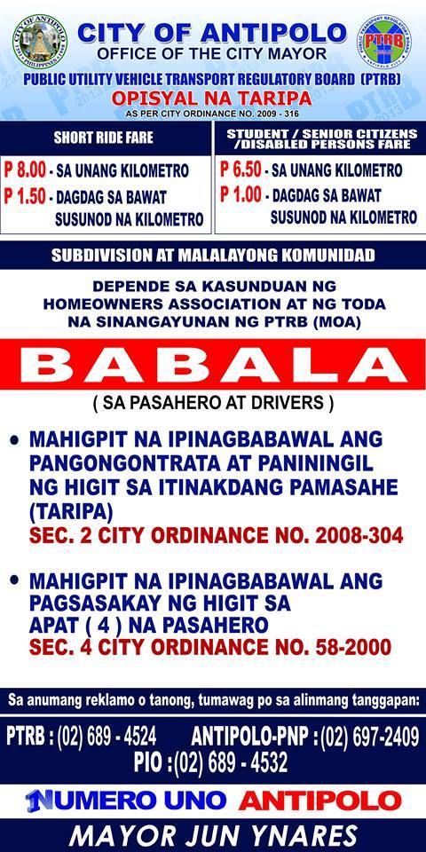 Tricycle fares based on official tariffs under City Ordinance No. 2009-316
Those two other ordinances seem to be among the most abused by tricycle drivers and likely very difficult to enforce considering the ranges of tricycles. According to netizens, many tricycle drivers still tend to negotiate fares for long trips and tricycles carrying more than 4 passengers is a common sight in the city especially tricycles that are used as school service vehicles. I tend to wince myself whenever I see a tricycle overloaded with school children negotiating Ortigas Ave Extension or Sumulong Highway. These are unsafe and put a lot of young lives at risk.
Below is an example fare matrix for tricycles posted at the New Public Market along Sumulong Highway and across from the new Robinsons mall in the same area:
 Illustrative fares to/from the New Antipolo Public Market
I think there should be similar information posted in other areas around Antipolo City. This is so that people will not be confused about the tricycle fares and so as to minimize the instances when tricycle drivers take advantage of passengers not familiar with trip distances and the fare rates.
The Antipolo City Government is working towards improving transport and traffic in this highly urbanized city. I think this should include regulating tricycle services so that the city could reduce their numbers along national roads like Marcos Highway, Sumulong Highway and Ortigas Ave. Extension. Tricycles have become a nuisance in traffic and not just for motorists but for cyclists and pedestrians as well. They shouldn’t be traveling long distances and along rolling and mountainous terrains. They tend to be noisy and, perhaps most problematic, are smoke belchers. Hopefully, this can be addressed in the next years as the city continuous to grow and become more progressive. This only means that the city should strive towards a modern, efficient and people & environment-friendly transport system.
–
Differences: pro-walking vs. anti-car
I came across this article posted at the Planetizen site entitled Pro-Walking, or Anti-Car. It is a good article that heads-on addresses the the differences of being pro-walking to that of being anti-car in terms of transport policies in cities. I think these concepts including the “nuts to crack” list provided by the author is relevant not only to cities that want to promote walking and cycling over car use, but to individuals and groups as well who seem to be following a hard line when in comes to their advocacy to recover road space in favor of pedestrians and cyclists.
Unprepared and incomplete – realizations from the APEC transport experience
Before I forget about what transpired during the holding of APEC in Manila a week ago, here’s a couple of photos I found over the internet and shared via social media.
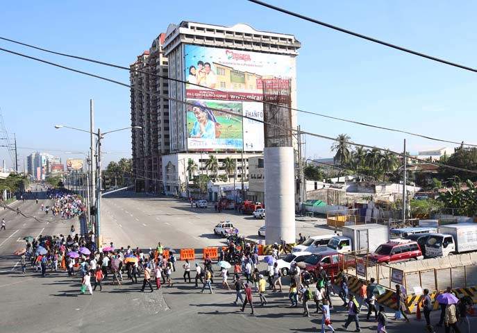 Commuters along Roxas Boulevard walk past a column of the unfinished NAIA Expressway, one of the transport infrastructure projects that has not been finished. [Photo from The Manila Bulletin]
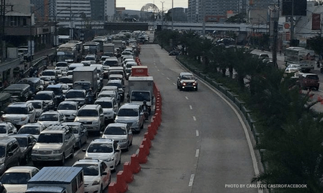 APEC lanes and severe traffic congestion along EDSA – there’s an opportunity here for a prrof of concept test for BRT. [Photo from Facebook]
I saw many memes and read some articles mentioning BRT specifically as one solution to Metro Manila’s transport problems. The second photo above was modified to replace the car travelling along the APEC lanes with a bus.
It is easy to imagine what could have been if the government decided to use the event and the lanes they allocated for APEC vehicles to do a ‘proof of concept’ run of BRT services or at least express bus services (what some DOTC people call high quality bus services). Perhaps what could have been done for part of the 10 billion PHP expended for APEC was to buy a fleet of brand new buses and provided these for free public transport for people who would need to commute during APEC. Services along two corridors would have sufficed – these two would have been EDSA and Roxas Boulevard. [The other option would have been to talk to bus operators and cooperate with them to organize express bus services along EDSA and Roxas Blvd.] Aggressively promoting these free services ahead of APEC would also have meant commuters, including those who usually used their own vehicles, could have opted for these transport services and not affected by the ‘carmageddon’ that ensued over that period. There should have been services to the airport terminals, too, but I will write about this in another article.
The dry run could have yielded essential data for assessing the feasibility of such bus services as an alternate to rail systems that would take much time to build. Incidentally, if the LRT Line 1 Extension to Cavite was built right after the current administration took over, that line could have already served tens of thousands of passengers from the south who regularly commuted to Metro Manila for work and school. The first photo above does not lie about just how many people could have benefited from that rail project. Meanwhile, MRT Line 3 remains dysfunctional and with its reduced capacity could not handle the demand for transport that it should have been able to carry if services had not deteriorated over the years.
–
Working with big data on transportation
There have been a few initiatives working on big data from government agencies whose responsibilities are primarily on transportation. Among them are past projects implemented by the University of the Philippines Diliman (UPD) and current projects being implemented by UPD, Ateneo de Manila University (ADMU) and De La Salle University (DLSU) with support from the Department of Science and Technology (DOST). While these projects are more oriented towards some specific objectives often linked to research & development (mandates of DOST and these academic institutions), there are still a lot of data out there that needs to be digitized, processed and analyzed. UPD has done this to some extent through its National Center for Transportation Studies (NCTS), which had been a repository for data and reports from DOTC and DPWH. However, the center does not have a funded program to undertake that repository or archival function it is expected to do. Despite much lip service from DOTC, DPWH and NEDA, no support has been extend by these agencies in the past many years.
I recently came upon this excellent work from a private firm specializing in data science. Here’s a link to one of their recent ‘stories’ showing us relevant statistics on road safety in Metro Manila:
http://stories.thinkingmachin.es/road-danger-pedestrians/
Their website says the data set the stats and graphs are based from are from the Metropolitan Manila Development Authority (MMDA), which maintains the Metro Manila Accident Reporting and Analysis System (MMARAS). This is good work and something road safety experts can use to be able to come up with programs and projects to improve safety in Metro Manila. I hope they could also get a hand of the DPWH’s Traffic Accident Reporting and Analysis System (TARAS) data that covers national roads. Unfortunately, the DPWH has stopped encoding TARAS data recently (the PNP still collects data though) so I am not sure how recent their data set is.
We need more of such work on a lot of data our agencies are producing including data from the Land Transportation Office (LTO) and the Land Transportation Franchising and Regulatory Board (LTFRB). Such information could be used to understand our transport systems including determining how to optimise supply and demand when combined with other data sets such as geographical information systems (GIS) and socio-economic data from the census.
–
Caught up in trAPEC
It’s a corny title to this post and perhaps is practically what people would call ‘click bait’. But then it is a very appropriate one considering it describes what happened last Monday and is still happening today and for the rest of the week affected by the Asia Pacific Economic Cooperation (APEC) forum hosted by the Philippines and held in Metro Manila. Yes, Metro Manila. And many people have been asking loudly or in their mind why the capital city when the government was supposed to be promoting and bragging about growth in other cities (inclusive growth anyone?). I would have thought and preferred to have APEC in either Subic or Clark, which have been touted as rapidly growing areas and as international gateways. In fact, Clark is being pitched as the location of a potential new city in the Clark Green City project as well as the aerotropolis currently being developed (slowly) near the airport and the SCTEX Clark South interchange.
Instead, we have the APEC forum and all its attendant activities in Metro Manila. And it seems that the forum has maximized its detrimental impacts on the economy as it practically shut (some people even say shat) down the capital because of severe traffic congestion and a lack of public transport infrastructure and services to carry commuters safely and efficiently between their homes and work places. The Manila Bulletin posted the following photo last Monday:
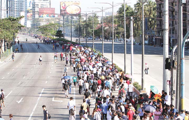 Commuters were forced to walk along Roxas Boulevard just to get to work.
Here are a few more photos courtesy of an old friend from high school:
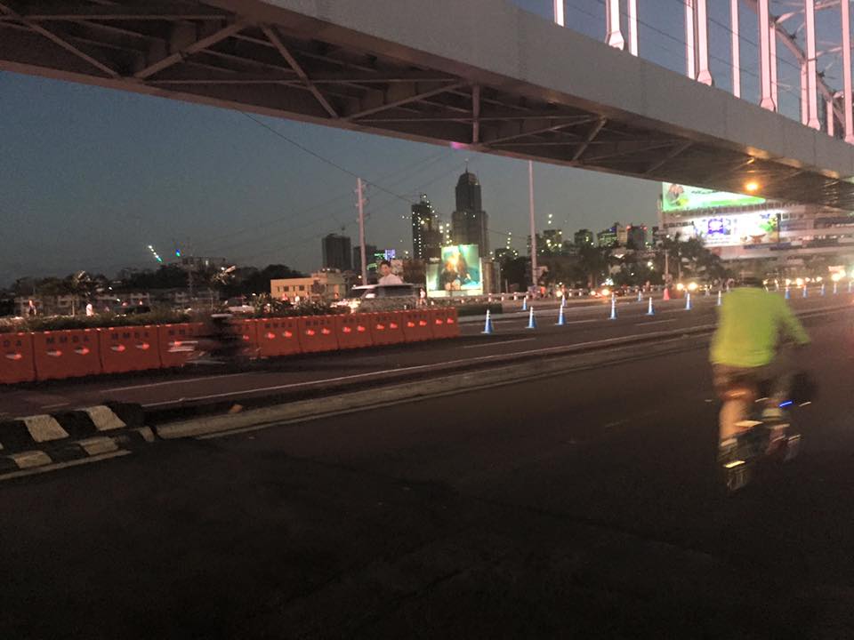 A lone cyclist pedaling along a practically empty section of EDSA (photo credit: Bong Isaac)
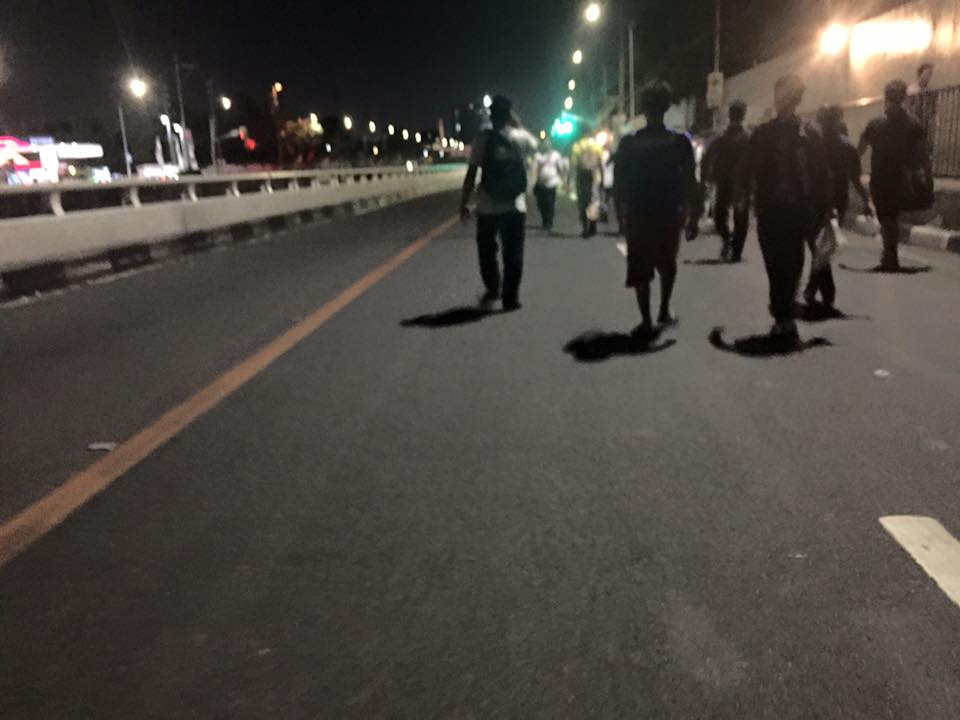 Walkers? – commuters took to walking along EDSA, one of the country’s busiest and most congested thoroughfares. I was amused of the memes about the ‘Walking Deadsa’ referring to people seemingly walking like zombies after a hard day’s work just to get home. (photo credit: Bong Isaac)
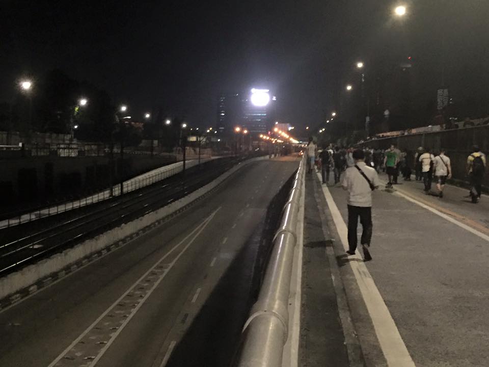 Commuters walking along a vehicle-less EDSA. The MRT 3 line at the left in the photo also seems to be ‘lifeless’ at the time (evening I was told) the photo was taken. (photo credit: Bong Isaac)
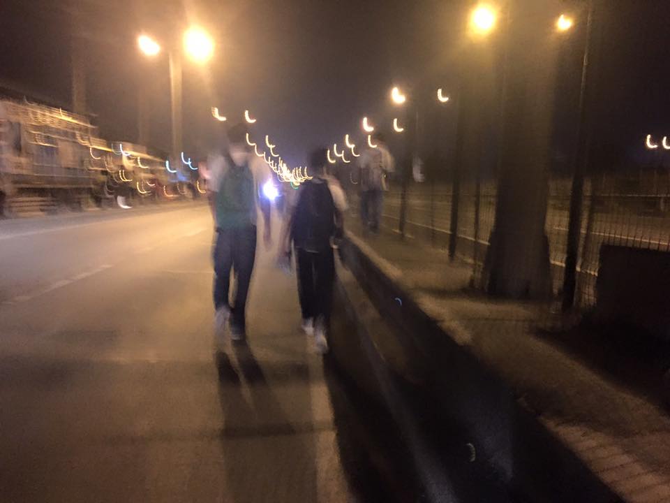 People walking along the service road along the SLEX – most affected of the road closures were people from the southern parts of Metro Manila including those from Laguna and Cavite. (photo credit: Bong Isaac)
I remember being asked once during an interview if it was possible to determine the cost of congestion due to a single event such as a road crash or perhaps a rally. I replied that it is possible given the available tools and expertise in making such assessments. What could be the cost of such a week-long event? Would the holidays for Metro Manila have lessened the economic impacts on traffic of the APEC? Or was it assumed that agreements and the media mileage we got from APEC more than enough to cover economic losses?
Could this disastrous traffic mess have been averted or at least mitigated despite APEC in Manila? Yes, perhaps, if the transport infrastructure particularly the LRT Line 1 Extension to Cavite, the upgrading of the MRT Line 3 and an airport access transit system were completed prior to APEC. These along with other major projects for Metro Manila were promised years ago and yet have not been realized. Add to this the apparent lack of contingencies (BRT-like express buses? bicycles?) that could have eased the pain of hundreds of thousands of commuters affected by APEC traffic schemes. Government has no right to tell people “I told you so” when government efforts for the benefit of its own commuting citizens have been deficient these past years.
–
Some advantages of rail over road transport
In my previous article, I mentioned how rail transport is important as part of a country’s transport system, particularly on land. I also mentioned a study conducted by our undergraduate students that was completed back in April 2012.
Our students conducted a simple survey, as part of their research, to determine the travel times and costs for public transportation between several origin-destination pairs. These O-D pairs were selected to simulate costs and travel times of commutes using either primarily rail or all road transport. Note the choices of either ‘school’ or ‘office’ paired with ‘home’ somewhere in the south of Metro Manila.
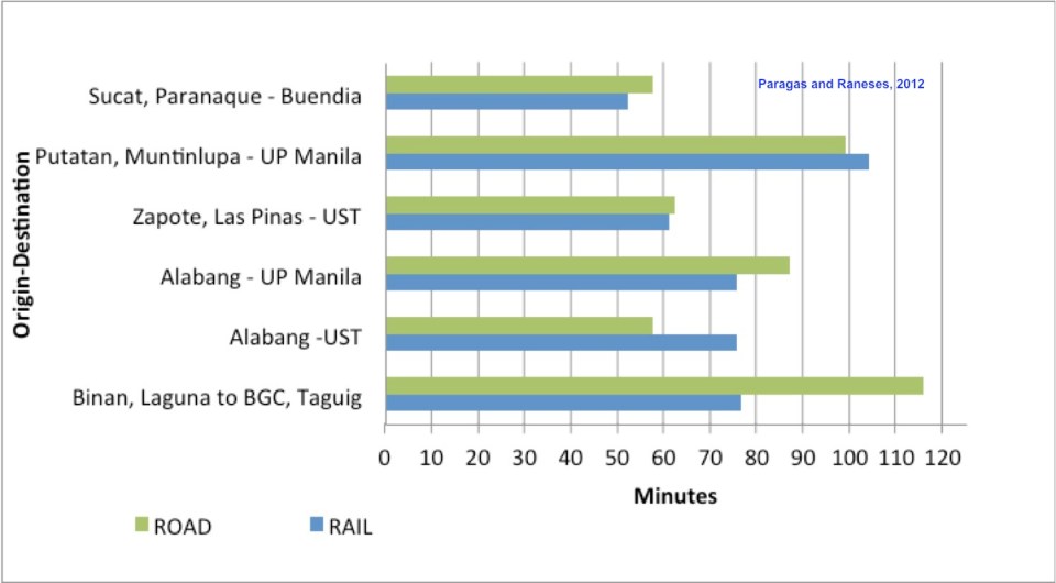 Travel time comparisons for commutes using road and rail public transportation – ‘Road’ refers to the entire commute using road-based transport (i.e., buses and jeepneys) while ‘Rail’ refers to commutes utilizing mainly the PNR but with road transport used in the end parts of the journeys (e.g., jeepney ride from near the PNR Espana Station to UST).
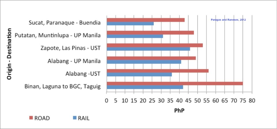 Travel cost comparisons for commutes using road and rail public transportation
Relevant to understanding the above are the following
- Fare rates have changed since 2012. However, this presents a constant change over the fares that are being compared so the basic differences will remain the same across origin-destination pairs.
- PNR services had to be discontinued for some time due to derailments because of poor conditions of tracks.
- Road traffic has worsened since 2012 with several “carmaggedon” episodes showing how vulnerable commuters are when using solely road transport.
- Road public transport services are frequent and practically 24/7. PNR services are of very limited frequency. Waiting times for the trains typically add to travel times in the form of delays, which make commuting by rail an unattractive option due to their unreliability of service.
–
On the severity of traffic congestion along Ortigas Avenue and the necessity of a mass transit line
With the worsening congestion along Marcos Highway due to the construction of the LRT Line 2 Extension to Masinag, I have been using Ortigas Avenue as an alternate route to go home. Granted, the stretch from the Park Place gate near Cainta Junction and Brookside is currently undergoing roadworks elevating that entire section (which is prone to flooding), and this is the main cause of much congestion as fewer lanes are usable to traffic. However, what is perceived to be relief from traffic once the project is completed will eventually and surely revert to a very congested Ortigas Avenue.
Traffic congestion along Ortigas Extension is primarily due to a dependence on road transport, particularly private vehicles, by people living along Ortigas Ave. and the roads feeding into it. The Manila East Road, for example, passes through the most populous towns of Rizal outside of Antipolo City. The dependence on road transport (especially private vehicles) is due to limited options for public transport. There are buses, jeepneys and UV Express but these, too, contribute to congestion due to their increased numbers and limited capacities given the high demand for public transport. Among the infrastructure proposed along this corridor is an overpass along Ortigas Ave. at Cainta Junction. A mass transit system has also been required along this corridor for a very long time but for some reason, such infrastructure has not been provided.
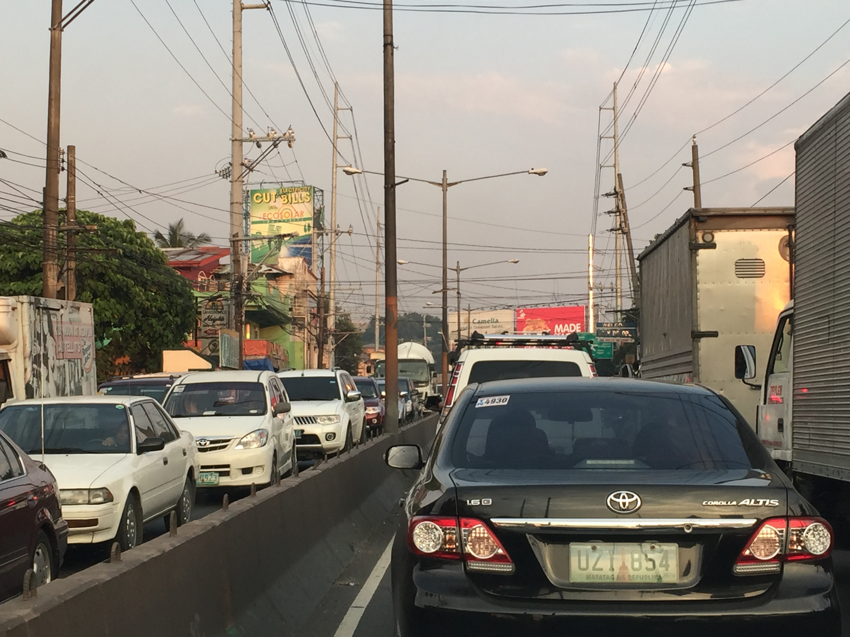 Severe traffic congestion along both directions of Ortigas Avenue Extension
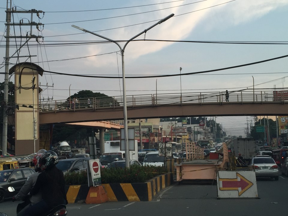 Congestion stretches all the way along the Manila East Road
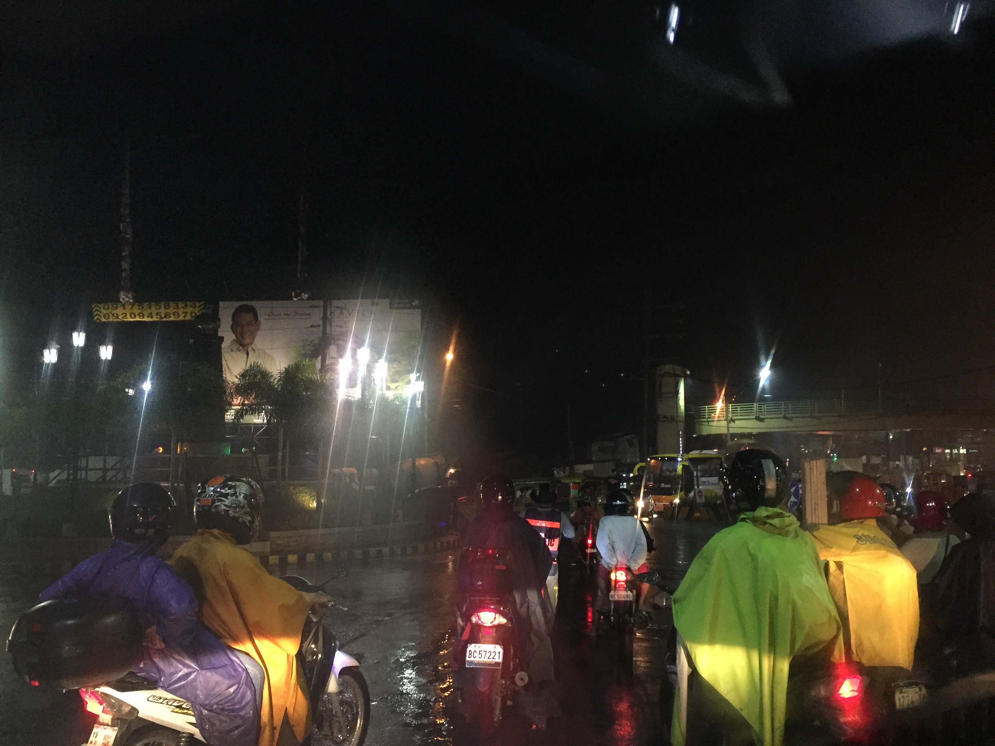 Night-time traffic congestion at the Tikling Junction
There is a proposal for a mass transit system along this corridor. Following are references to the project:
From the PPP Centre: https://ppp.gov.ph/?ppp_projects=ortigas-taytay-lrt-line-4-project
From CNN Philippines: http://cnnphilippines.com/metro/2015/07/22/neda-approves-naia-lrt-ppp-projects.html
I found it quite odd that the stations are not referenced according to the more common place names for the locations. For example, ‘Bonifacio Avenue’ should be ‘Cainta Junction’ and ‘Leonard Wood’ should be ‘Kaytikling Junction’. Nevertheless, this is the least of our concerns pertaining to transport and traffic along this corridor.
Perhaps the conditions are ripe now to finally implement transport infrastructure projects along this corridor. The proposal and approval of a rail transit line by NEDA means the corridor has the national government’s attention. The local government leaders along this corridor are also more progressive and aggressive than their predecessors. These include a very dynamic mayor in Cainta and the former governor-turned mayor in Antipolo. A collaboration towards better transport among these two LGUs alone would be influential and instrumental to improving travel along Ortigas Avenue.
–
Undas traffic
Metro Manila traffic is usually lighter during Undas – the days when we remember those who passed away. Many people go back to their hometowns and this is significant because many residing or working or studying in Metro Manila hail from other provinces. Of course, some people would rather go on a vacation during this time with many now opting to travel abroad rather than braving crowded cemeteries of their hometowns. Some do the so-called ‘staycations’ – basically staying put at home during the undas break (Sorry, staying in a hotel is technically not a ‘staycation’ as many people claim it to be.)
What are the facilities that are expected to be congested? These would be the gateways from Metro Manila to other provinces. These would be airports, sea ports, bus terminals and major roads connecting Metro Manila to the provinces. There would be similar situations in other gateways as well such as in Cebu in the Visayas and Davao in Mindanao. Of course, all roads leading to cemeteries, memorial parks and columbariums. These roads would be filled with people (mostly walking) and vehicles (mostly private cars and tricycles and pedicabs if local roads) who congregate in these areas to remember and pay tribute to their dead.
The congestion experienced in most roads during this time of year is usually manageable and local governments can and are usually prepared to address transport and traffic issues within their jurisdictions. Tollways also employ their own strategies and tactics to deal with toll plaza congestion. The Land Transport Franchising and Regulatory Board (LTFRB) issues additional temporary permits to bus companies to field more vehicles along high demand routes. Meanwhile, airports and seaports would have to deal with their own versions of congestion though it is expected that such peaking or spiking up of travel activity can be handled by many airports and ports considering that these facilities are supposed to be designed for higher than usual demands.
Here’s wishing everyone safe travels during this Undas weekend. Mag-iingat lalo na sa pagmamaneho. Huwag magpatakbo na tila hinahabol ninyo ang araw ng mga patay!”

