
Home » Public Transport (Page 57)
Category Archives: Public Transport
AGT demonstration runs at UP Diliman
The Automated Guideway Transit (AGT) project of the Department of Science and Technology (DOST) is well under way with the initial test runs already being conducted by the agency. Several demonstration runs were also undertaken to show the vehicle and provide an initial experience for various stakeholders including government official, UP faculty, the media and invited guests from the private sector. I am posting a short video taken during one demonstration run where faculty members from UP’s College of Engineering rode on the prototype and also made some initial inspections of the vehicle.
.
The first phase of tests is expected to be completed during this first quarter of 2013. The next phase, which is expected to be a joint undertaking of DOST and UP, will follow immediately and should involve a multidisciplinary team that will evaluate the prototype. Such assessments are necessary to determine and address issues and/or weaknesses. It is imperative that the AGT would be proven to be safe and sound in its specs before a scale-up in the project.
Already, there are discussions on the future applications of this vehicle, and CBDs and airports are already being mentioned where the AGT would be most applicable. Also being mentioned is the further development of the test track to connect the UP-Ayala Technohub along Commonwealth Avenue and the future University town center along Katipunan with a line along C.P. Garcia Ave. Perhaps, too, such a line would have more ridership if it is extended all the way to Ateneo along Katipunan (C-5). While there is also talk on the AGT along the lines of the existing LRT and MRT lines, the reality is that AGT’s and monorails have significantly less capacities compared to regular commuter lines that are much needed in Metro Manila and other rapidly developing, highly urbanized cities in the country.
–
Commuting on the LRT Line 2
Metro Manila’s LRT Line 2 stretches from Santolan in Pasig City to Recto in the City of Manila. It is the only suburban railway line serving Metro Manila outside the PNR, and uses trains that have the highest passenger capacities compared to the LRT Line 1 and EDSA MRT (Line 3), which uses cars that can be categorized as light rail vehicles. Line 2 employs vehicles that would elsewhere be used for metros or surface heavy rail transit. I occasionally use Line 2 for commuting between Katipunan and Cubao but I must admit I haven’t used it to commute all the way to Manila. Following are photos I took on one commute between Katipunan and Cubao.
 Going underground – descending to the station at Katipunan, there are no escalators so most people have to use the stairs.
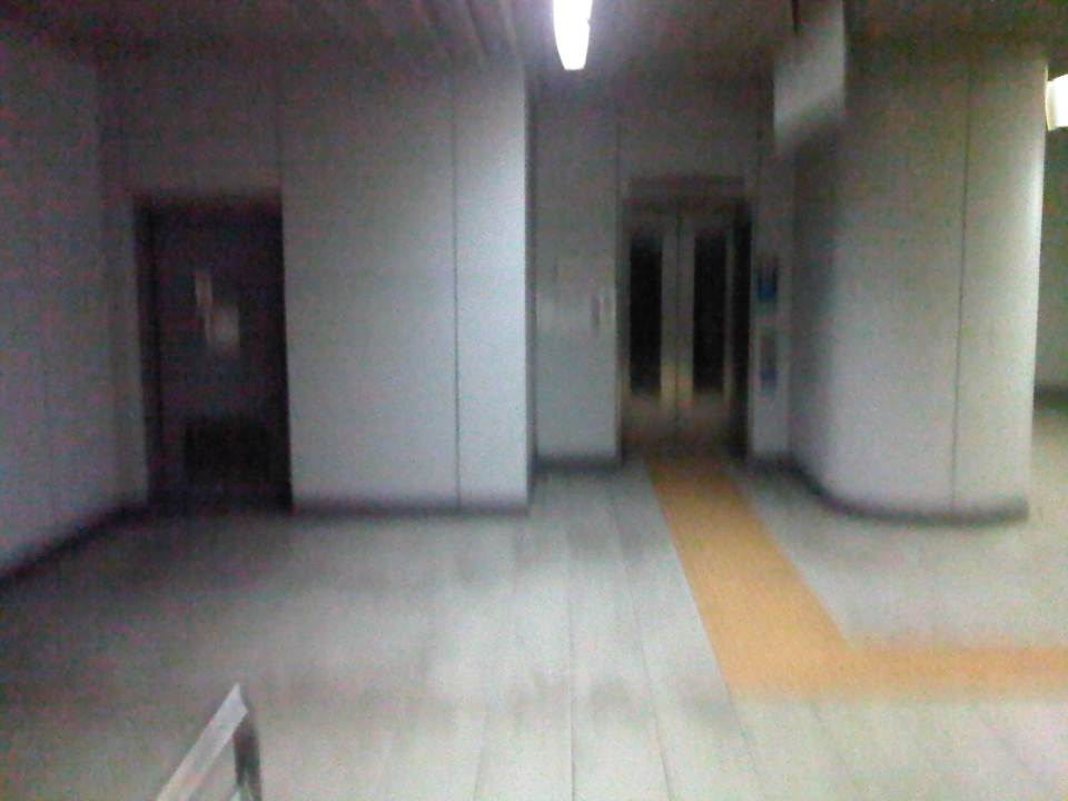 Accessibility – there are elevators for the physically-challenged including persons with disabilities (PWDs), senior citizens and pregnant women.
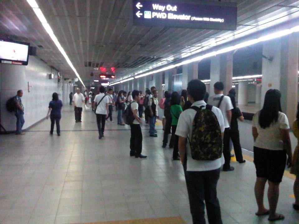 Katipunan Station platform – is underground and gives the feeling of being in a subway. There are directional signs to guide passengers but I think there should be more signs informing people about train arrivals and schedules. Note that most passengers do not form lines and are standing along and near the entire platform edge. This seems to indicate people are either undisciplined or there is little effort to establish order in boarding and alighting procedures.
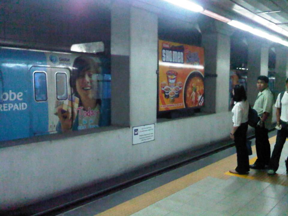 Passengers waiting along the platform form lines where the trains’ doors are supposed to be positioned once the vehicle is stopped. In other countries there are also signs along the median to guide passengers where to line up along the platform and to give way to people alighting from the trains before boarding the train. Such procedures are important for orderly operations. A train bound for Santolan Sta. is on the other side of the platform.
 Passengers boarding the train
 Stragglers hurrying to enter the train before the doors closed for departure. Like in other cities, some passengers attempt to board the train at the last second. Such situations can cause injury as people can get caught by the closing doors.
 Train leaving the Katipunan Station and bound for Recto in Manila
 Warning sign – signs inform passengers of the dangers along the tracks. In this case, the danger is in the form of high voltage wires as the trains are powered by electricity. There is a fine of PhP 50,000 (~USD 1,200) for anyone illegally going down to the tracks.
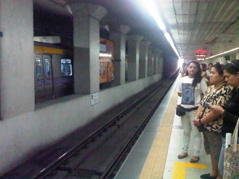 The yellow line defines the area where passengers should be safely behind and clear of the trains. There are dimples on the line, which are generally for the benefit of blind people using their canes to “feel” such lines for guidance.
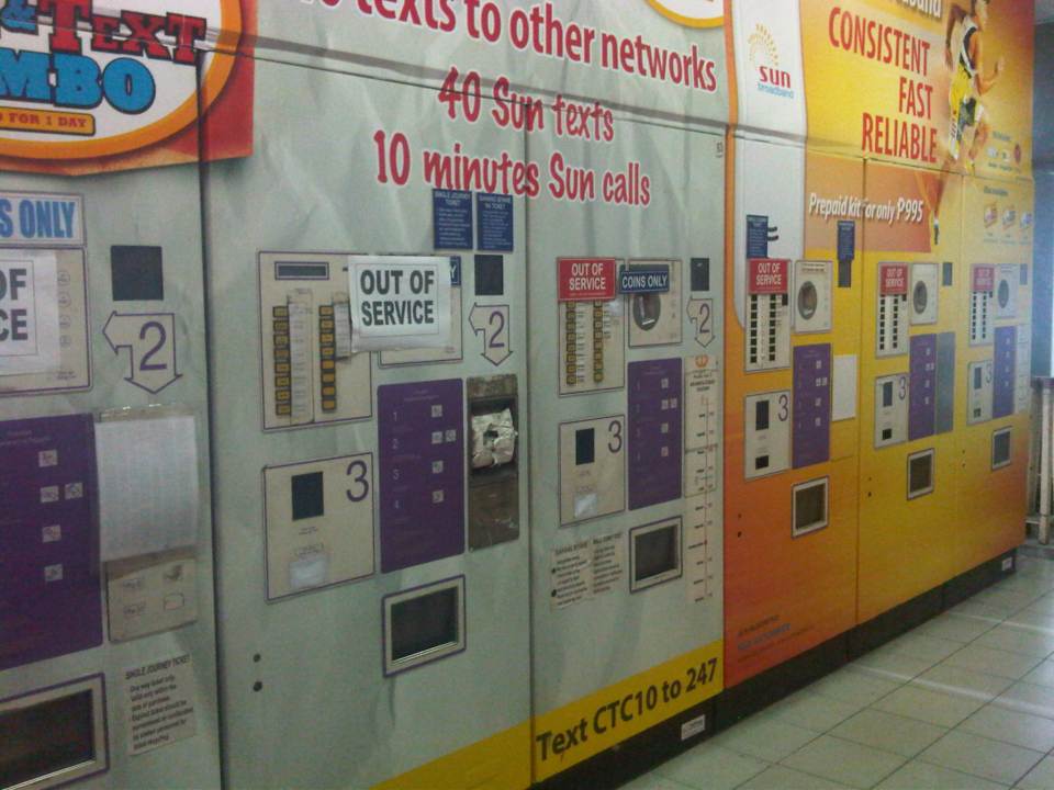 Defective – Most ticket machines were out of service. Those that weren’t marked as defective (just a few) had problems accepting coins. This issue regarding ticketing makes it inconvenient for most passengers to use the trains as they end of queuing along one or a few manned booths selling tickets at the stations. One would think that with so many options now available for fare collection (tickets, passes, cards, etc.) and the LRT’s already in operation for so many years that authorities would have already had a more efficient system in place for fare collection.
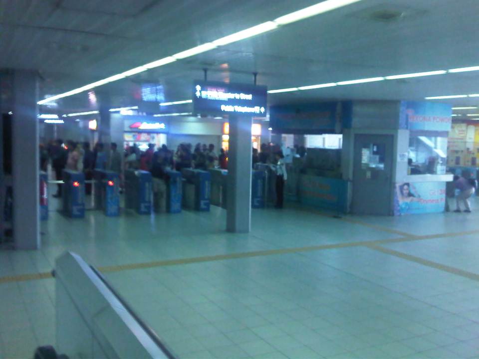 Turnstiles – there are enough turnstiles at the stations (in this case Cubao) but the queuing problem is not here but at the ticketing stage of the journey. Of course, there are also queues due to the security checks at the station but these are usually quicker compared to the time it takes for people to purchase tickets.
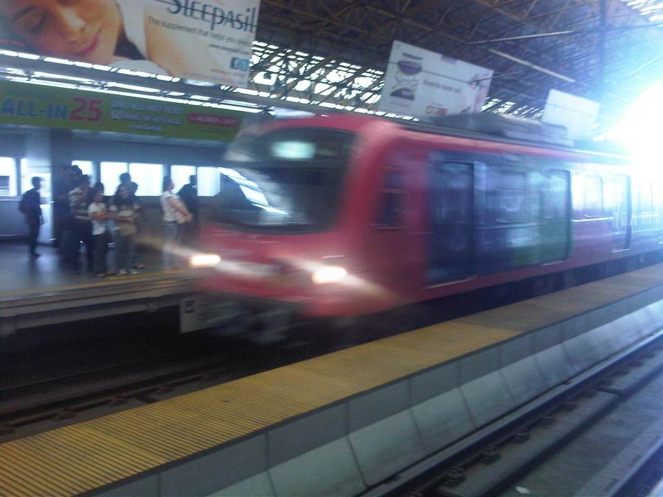 Westbound arrival – a train bound for Recto arrives at the opposite platform at Cubao Station.
 Departures – a train bound for Manila leaves Cubao Station while passengers form queues along the platform for trains bound for Pasig.
I tried to get photos of the connection between the Cubao Station and Gateway Mall but the pictures didn’t come out right (Note: I usually only use my cell phone to take quick photos.). The same was the fate of photos I tried to take between Katipunan Station (Exit at St. Bridget’s) and the UP-Katipunan jeepney terminal. In the latter case, the rains and the crown prevented me from taking photos. I will try to get better ones to post next time and perhaps that post will focus on the conditions around stations including their connectivity to other modes of transport (e.g., convenience of transfers) and other aspects such as walkability.
–
Link: Measuring Transport Efficiency
I’m sharing a recent article from Todd Litman of the Victoria Transport Policy Institute. The article is entitled Measuring Transport System Efficiency that appears in the Planetizen online journal. It’s a very good read for all, even those without planning or engineering backgrounds, who want to have an understanding of how to evaluate or assess transport systems according to the various aspects of a system (e.g., there’s a difference between conventional road planning and accessibility-based transport planning). Todd is as usual very good in discussing these topics given his experience and expertise, and is able to present it in a manner that is easily understood by any reader (well, except maybe the trolls we find anywhere online these days).
Happy reading!
–
Rationalizing public transport in the Philippines
I got a copy of the recent study “Development of a Mega Manila Public Transportation Planning Support System” conducted by UP Diliman’s National Center for Transportation Studies (NCTS) for the Department of Transportation and Communications (DOTC). The main outcome of the study was a planning support system that includes an updated database of bus, jeepney and UV Express routes for Metro Manila and its surrounding areas (collectively called Mega Manila), and a calibrated travel demand model for the region that is supposed to be used by the DOTC and the LTFRB in transport planning including the rationalization of public transport in the region. Among the notable recommendations for addressing public transport issues is the following on the classification of routes according to passenger demand, which I quote from the study:
“…routes and modes may be classified and prioritized as follows:
- Routes with Very High Passenger Demand [>160,000 passengers per day] – shall be served by high capacity modes such as rail-based transit or Bus Rapid Transit(BRT) with passing lanes.
- Routes with High Passenger Demand [100,000 to 160,000 passengers per day] – shall be served by high capacity vehicles such as Bus Rapid Transit System (BRT) without passing lanes;
- Routes with Medium Passenger Demand [10,000 to 100,000 passengers per day] – shall be served by PUVs with 60 or less passengers/seats but not less than 22 passengers (excluding driver) such as buses, CLRVs with more than 22 passengers/seats (including driver), or with 90 passengers/seats in the case of double decker or articulated buses;
- Routes with Low Passenger Demand [not exceeding 10,000 passengers per day] – shall be served by PUVs with less than 22 passengers/seats (including driver) such as jeepneys and other paratransit modes.
Under this principle, high capacity modes would have priority in terms of CPC allocation and transit right of way in a particular route over lower capacity modes with the exception of taxis. The latter, after all, operate as private cars rather than PUVs with fixed routes.
Applications to operate bus and/or minibus service in jeepney routes can be considered, but not the other way around. Similarly, bus service applications can be considered in minibus routes but not otherwise.
Based on the analysis of routes, the establishment of public transportation routes and the corresponding modes of services may be based on the following criteria:
• Passenger demand patterns and characteristics
• Road network configuration
• Corresponding road functions (road hierarchy)
• Traffic capacities and
• Reasonable profits for operation of at most 13% ROI.”
[Source: DOTC (2012) Development of a Mega Manila Public Transportation Planning Support System, Final Report.]
An interesting figure in the report is an illustration of how services can be simplified using buses and rail transport as an example. The following figure shows two maps: one showing the plotted EDSA bus routes (left) and another showing a more consolidated (and rational) route network for buses complementing existing and proposed rail mass transit systems.
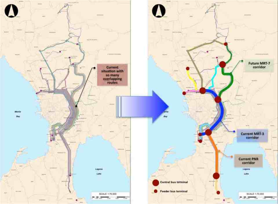 Simplifying bus transport services (source: DOTC, 2012)
What are not included in the figure above are the prospects for Bus Rapid Transit (BRT) systems for Metro Manila. Since the Final Report was submitted in mid 2012, there have been many discussions for BRT in the metropolis and current efforts are now focused on the assessment of a BRT line along Ortigas Avenue. The World Bank is supporting the evaluation of a route between Tikling Junction near the boundary of Antipolo and Taytay (Rizal Province) and Aurora Boulevard. There are also informal talks of a BRT line along Commonwealth Avenue but that would have implications on the proposed MRT-7 along the same corridor. Nevertheless, such mass transit systems have long been required for Metro Manila and their construction have been overdue. A more efficient public transport system will definitely have tremendous impacts on how we commute between our homes, workplaces, schools and other destinations. Long distances can easily be addressed by better transport options and could actually help solve issues pertaining to informal settlements, relocations and housing. That topic, of course, deserves an article devoted to this relationship between transport and housing. Abangan!
–
Transport gaps
I first learned about the concept back in the 1990’s when I was a graduate student at UP majoring in transportation engineering. The concept on transport gaps was first mentioned in a lecture by a visiting Japanese professor as he was discussing about transport modes, particularly on which was suitable or preferable over certain travel distances and which could carry more passengers. Another time later and while in Japan, I heard about the concept during a presentation of a friend of his technical paper on public transport.
The figure below is one of many possible illustrations of the concept of transport gaps. In the figure, a distinction is made for mass transport and individual transport. As the original figure is likely taken from a textbook or a paper (probably from Japan), shown with a white background are the more conventional modes of transport including subways, urban and suburban railways, walking and a mention of the shinkansen (more popularly known as the bullet train). With a gray background in the original figure is a category on new urban transit systems that include monorails, AGTs and LRTs. If we attempt to qualify local transport modes such as jeepneys, UV Express, tricycles and pedicabs into the graph, the outcome can be like what is illustrated with different color backgrounds in the figure below.

The concept of transport gaps allow us to visualize which modes are suitable for certain conditions where other established modes of transport may not be available or viable. In the original figure, the gap in Japan is filled by new urban transit systems. In our case, gaps are filled by so-called indigenous transport modes such as jeepneys, multicabs, tricycles, pedicabs and even habal-habal (motorcycle taxis).
There are gaps in the Philippine case probably and partly because of the slow development of public transport systems such as the mass transport modes shown in the preceding figure. There was a significant gap right after World War 2 when the tranvia and other railways were destroyed during the war. That gap was filled by the jeepney. There was also a gap in the early 1990’s that was eventually filled by FX taxis. Such gaps can obviously be filled by more efficient modes of transport but intervention by regulating agencies would be required and rationalizing transport services can only be addressed with the provision of mass transport options complemented by facilities for walking and cycling that will complement these modes.
–
UP-AGT test runs
Happy New Year!
I start the year with a short feature on the Automated Guideway Transit (AGT) prototype at the University of the Philippines Diliman (UPD) campus. The prototype has been featured in a number of articles in quad media in the recent weeks of November and December after its delivery and a few runs along the elevated test track at the campus. A project of the Department of Science and Technology (DOST) through its PCIEERD and MIRDC, and in cooperation with UPD, the vehicle has caught the attention of the general public and particularly those who have advocated for better public transport services in Metro Manila and other Philippine cities. Many are excited about the prospects of a “home-grown” system being constructed and operated in Metro Manila, and the buzz about the AGT replacing the IKOT jeepneys of UP Diliman is still very much alive despite clarifications by both the DOST and UP about this being a R&D project as well as questions regarding sustainability and practicality. Following are a few photos of the AGT prototype during one of its demonstration runs last December.
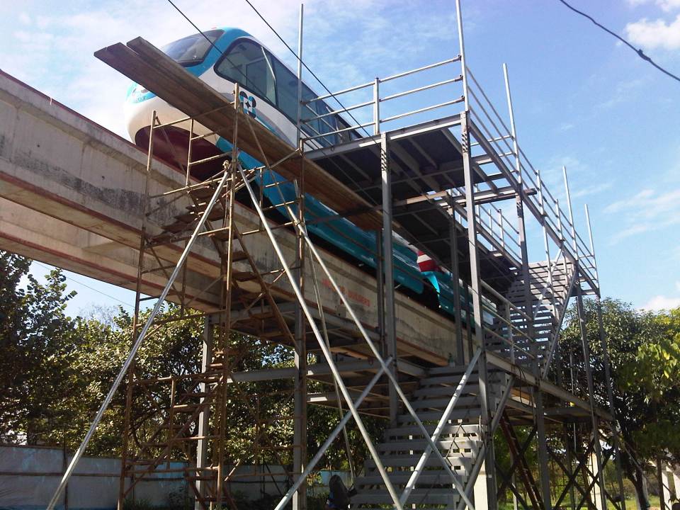 Unfinished platform at the Jacinto Street end of the test track allowing access to the vehicle’s underside and bogey and the loading platform
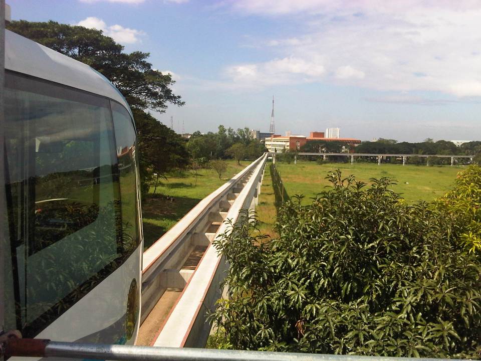 View of the test track from the platform – note again the absence of rail tracks as the AGT employs rubber tires. Wheels travel along the two concrete guideways shown in the photo. That’s the CHED building along C.P. Garcia Ave. downstream from the position of the AGT
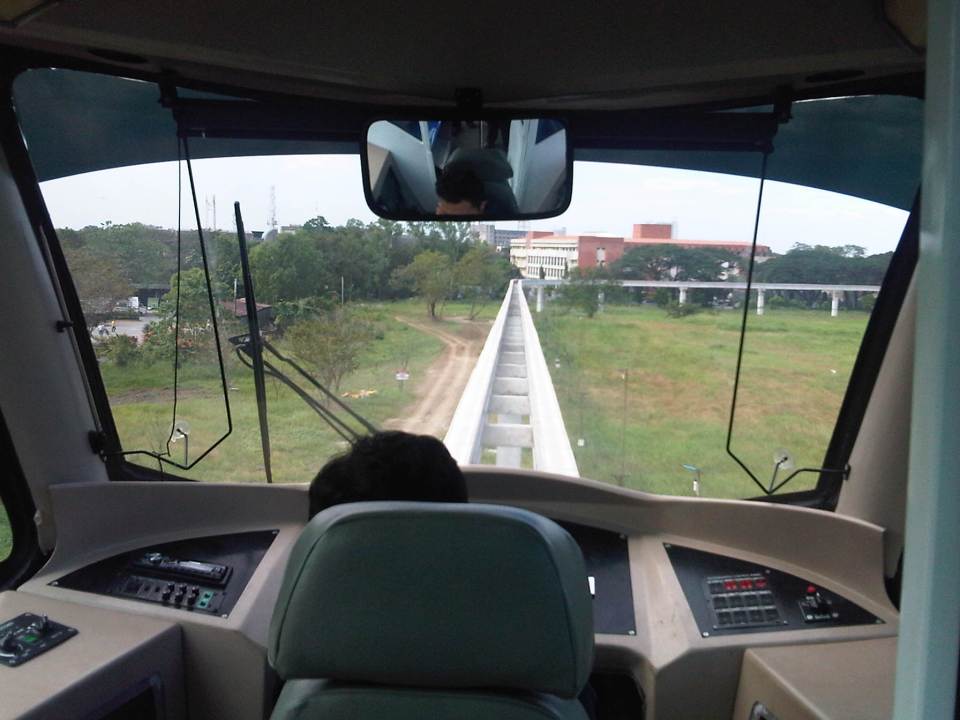 Driver’s perspective of the test track – the vehicle will eventually be driver-less (hence, automated) but for the test runs, there will initially be a driver to make sure the train operates correctly
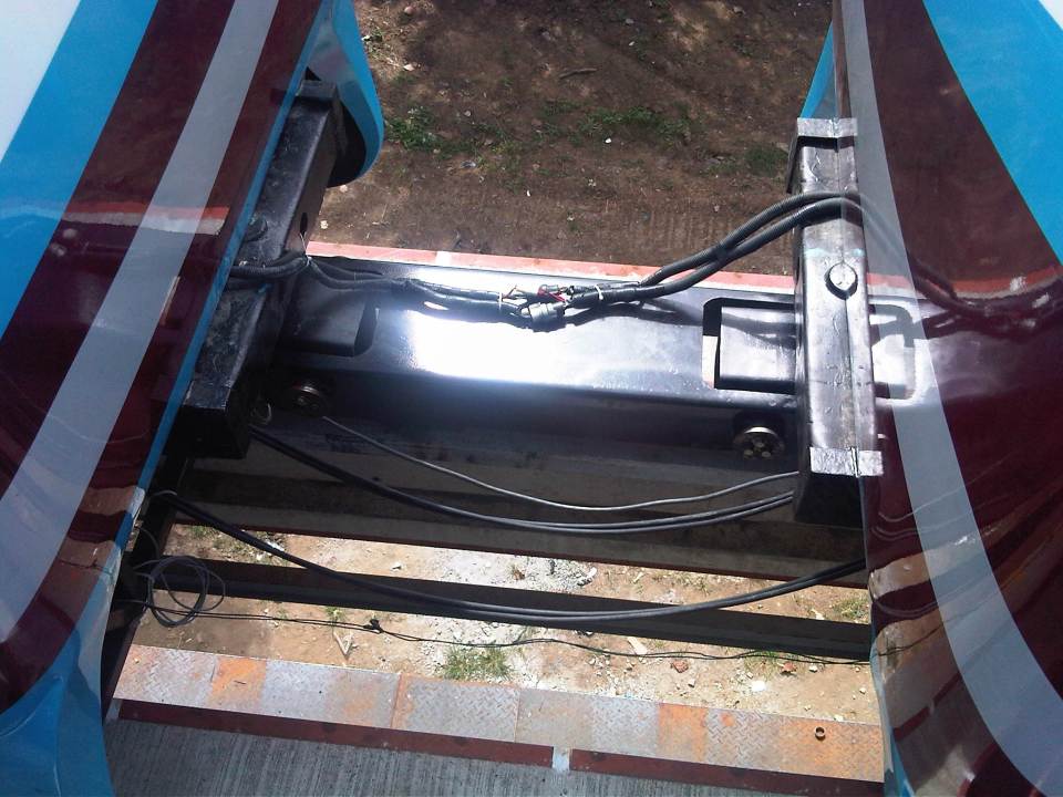 Connection – the two prototype vehicles are connected by this crude assembly that is definitely one of the things that would need to be reconsidered in subsequent vehicles. Perhaps an automatic coupler should be installed in the future?
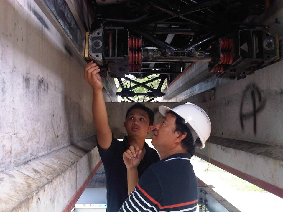 Dr. Ric Sigua of the Institute of Civil Engineering inspecting the pick-up system for the AGT prototype with DOST project staff.
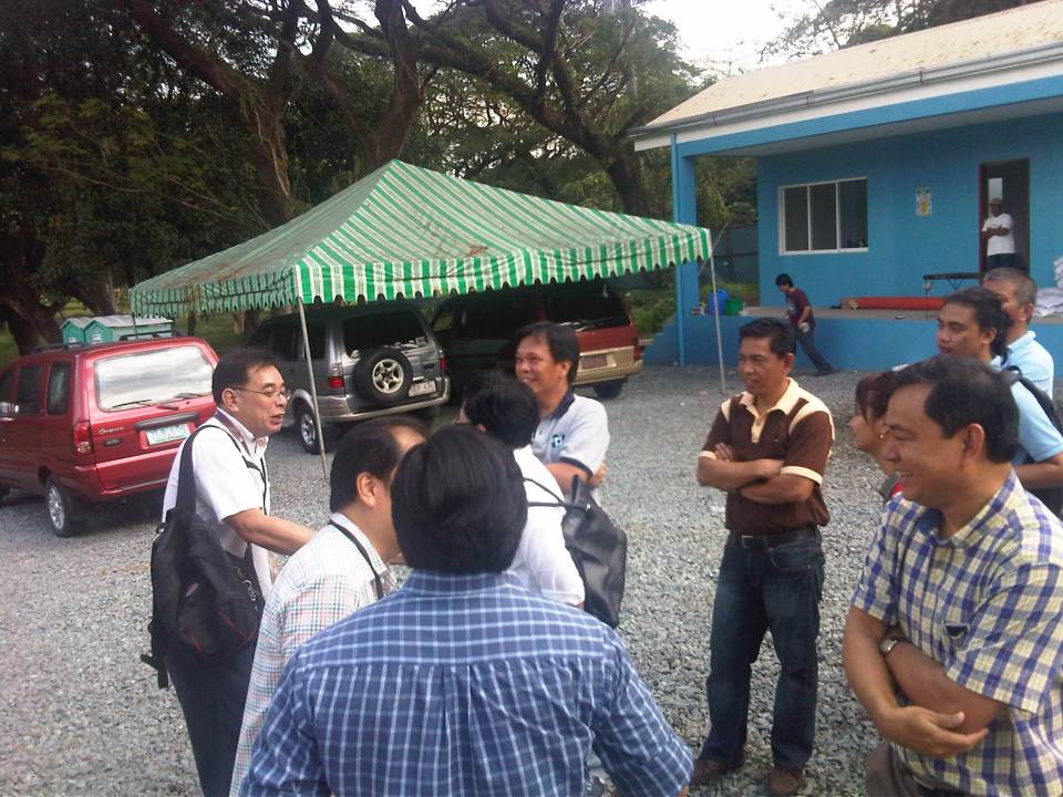 DOST-PCIEERD and UP Diliman faculty (from the Institute of Civil Engineering, Department of Mechanical Engineering, Electrical and Electronics Engineering Institute and School of Urban and Regional Planning) exchange ideas on the prototype.
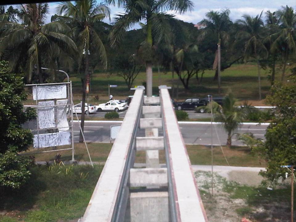 View of the end of the test track showing the two guideways employed by the vehicle and traffic along the University Avenue
The initial runs of the AGT have been exclusive demonstrations to government officials including those in national agencies, guests from the private sector, and partners with UP Diliman. The formal test runs will start in January 2013 but there are still no details on how these will be carried out in order to determine the functionality and safety of the prototype. Already, there are informal discussions on what needs to be improved in the prototype based on the initial observations and inspections conducted by faculty members from UP Diliman’s College of Engineering who will be involved in the technical evaluation of the prototype. Hopefully, such evaluations can be completed at the soonest and improvements are considered prior to a full system eventually being constructed and made available for public use. Where that system can be constructed and operated is still up in the air but should definitely be somewhere where the system is needed and where it can be a showcase for localized technology.
–
Hierarchy of transport modes
To better understand issues regarding our transportation system in the Philippines and elsewhere, I am showing two diagrams that both describe hierarchies of transport modes. The figures illustrate a concept much like our concept of the food pyramid where many if not most could easily understand in terms of what we need more of and less of in terms of proper nutrition. Transpose this concept to transport and we can understand that the most basic mode of transport is and should be on top of an inverted triangle, which represents which modes re to be prioritized over the others. The figure can also be used to symbolize mode shares. In terms of both priority and mode share, walking is the most dominant as we all walk. As such, it is only logical that facilities be provided for everyone to be able to walk safely and efficiently. These facilities include sidewalks, overpasses and underpasses that would encourage walking over other modes (especially the motorized ones). Walking is the most equitable and sustainable among transport modes and is definitely the healthiest.

For public transportation, another diagram may be constructed to show which modes can carry more people. Though the following figure is somewhat customized for Philippine public transport, it does not include multicabs, FX/AUVs, van-type services, and other paratransit modes (e.g., habal-habal, kuliglig, etc.) that are found throughout the country. There should be similar hierarchies in our ASEAN neighbor countries as they also have their indigenous modes like the tuktuks and samlors of Thailand.

Of course, each mode of transport is suitable for different trips with non-motorized public transport (particularly the 3-wheeler pedicabs, trisikad or padyak) being most appropriate for short distance trips though such trips can also be covered by walking. Jeepneys and multicabs are suitable for medium distance travel (~4 to 10 kilomemeters) where ridership is not yet viable for buses but which would have been serviced by too many tricycles. There is a reason from the perspectives of safety and efficiency why pedicabs and tricycles are not encouraged along national roads and jeepneys are not supposed to be plying routes along EDSA and C5.
Going up the hierarchy would have cost implications and rail transit is the most expensive mode in terms of capitalization, operations and maintenance. Of course, there are different type of rail transport services that include light rail to the long distance heavy rail commuter and regional services. As such, these systems require investment as well as foresight for the eventuality of a large, populous urban area ultimately requiring rail transport to carry so many passengers over longer distances. Rail alone would probably be insufficient so it needs to be complemented by bus and perhaps jeepneys as well. The emergence of Bus Rapid Transit (BRT) has provided city and transport planners with a flexible option bridging rail and bus transport in terms of cost and passenger capacities and are now being considered as immediate solutions for travel demand and public transport needs in major cities.
–
Sound bites on transport and traffic
If there was one thing I both dreaded and enjoyed during my 6-year stint as head of UP’s National Center for Transportation Studies, it is granting interviews to the media. My predecessors warned me about how some media outfits have been notorious for editing interviews to suit their needs. In certain cases, they are alleged to have spliced recordings that if taken as is would have been boring or not quite informative in order to have material that were more sensational. There are features, for example, where it seems interviewees were responding to the each other’s opinions making it look like they were arguing. And then there are those where certain statements are taken out of context when cut from a long explanation in the actual interview that took place.
I think I tried my best to be careful about what I said and how I explained or related things in my interviews. I looked at interviews as a way the Center could reach out and advance its advocacies. These were opportunities to spread the message of sustainable transport, to educate and inform officials and the public about what we should aspire and work hard towards achieving in transport and traffic. I think we had to be both progressive and aggressive with our messages because it was our duty, our responsibility not just to do research and train people but also to inform and educate people about sustainable transport. Popular mass media is an effective way to do this and we should be engaging but careful about our messages in order to be constructive and fair.
The last news interview I had before finally being relieved of being holdover Director for a month after my term ended was with GMA News. I like this interview about traffic congestion because I was able to put in some of the ideas that people in the forefront of sustainable transport have been preaching and practicing. These include the truth that in developed countries and cities, the wealthy take public transportation and that in order to improve public transportation, decision makers should themselves experience commuting.
These are not new ideas and I have to be clear that these were not my original ideas but those that I have come to embrace and advocate. I truly believe that if we don’t take public transportation, walk or cycle, we can’t really have a clear picture of what our cities need in order to solve the traffic mess and come up with services that are safe, efficient, inclusive and equitable.
The feature appearing on Jessica Soho’s State of the Nation on Channel 11 from the GMA News website.
The same report that appeared in the primetime 24 Oras:
–
Updates on the UP AGT
The prototype vehicles for the Automated Guideway Transit (AGT) project of the DOST through its PCIEERD and MIRDC were delivered last Sunday, November 25, at the test track site in UP Diliman. The two vehicles will form the train that will be mounted on the test tracks and subject to experiments to test the performance and functionality. Researchers from UP Diliman, including faculty members from its College of Engineering and College of Science, will be cooperating with the DOST to provide advise on issues that are certain to crop up once the tests are underway.
Contrary to many reports coming out that it will be an “upgrade” or “replacement” for the Ikot and Toki jeepneys currently operating inside the campus, the truth is that a Phase 2 creating a loop around the campus is not viable for the foreseeable future. For one, the system will be too expensive to build, operate and maintain for a very limited ridership that is attributed to UP Diliman, even with the increasing numbers of through trips using UP public transportation. Of course, it would be nice to have a system like this in campus but the costs cannot be covered by revenues from fares. Funds for construction (investment costs), seen from one perspective, may be of better use elsewhere where resources are in dire need to support other very important endeavors. A full system would be appropriate elsewhere and with funding coming not from the DOST or UP budgets but from airports, developers, local governments and others who can be the proponents for such systems.
 AGT vehicle delivered at the test site in UP Diliman – the streamlined body was designed by DOST project staff. The skirt helps to hide the bogey, which includes the mechanism for the vehicle to pick up power from rails embedded along the guideway.
 Inside the vehicle – there are few seats behind the driver’s cab to maximize space for (standing) passengers. This layout is very much similar to other AGTs and monorails including those serving airports where users would also have luggage with them.
 Driver’s cab – although the intention is for the vehicle to be ultimately driverless, tests will initially be conducted with a driver.
 Back seats – there are a few more seats at the back but the layout maximizes the number of standing passengers.
 Another look at the AGT vehicle – the DOST logo is prominent in the front and one side of the vehicle. The UP logo is on the other side of the vehicle.
 Test tracks – the AGT guideway is elevated and stretches to almost 500 meters. For reference, the photo was taken from near the project office/power house with the CHED building along C.P. Garcia Ave visible downstream of the elevated guideway. The line of trees on the right is along the University Avenue.
While it is understandable that certain rail aficionados have become excited about the prospects of having an operational, functional AGT or monorail, the UP-AGT is really an experimental system. It is best considered as a “proof of concept” project that will hopefully encourage the development and promotion of public transport in many of our cities that seem to be mired in having unsustainable transport modes. But of course, any transit system such as this will not survive if no rationalization in transport services are implemented and this is particularly true if an AGT or monorail would have to compete directly with buses, jeepneys or tricycles.
–
Informal transport in Metro Manila: Quezon City
Passing along East Avenue in Quezon City one morning, I couldn’t help but notice the pedicabs (non-motorized 3-wheelers) lined up near the junction from Agham Road in what is just one of the so many informal transport terminals in this city. The motorized tricycle in the photo below is just a bonus but also notable as they weren’t supposed to be running along national roads like East Avenue. They are well within the sight of the Land Transportation Office (LTO) and the Land Transportation Franchising and Regulatory Board (LTFRB) – two agencies charged with vehicle regulation though these 3-wheeled public transport modes are technically not under the LTFRB and LTO has no jurisdiction over NMTs. I suppose that the local government is well aware of their existence as their operations are legitimized through local regulations.
 Tricycles and pedicabs at the junction of East Avenue and Agham Road
The proliferation of these modes and particularly the non-motorized 3-wheelers are due to the toleration if not encouragement from the local government. These are examples of “accommodations” and tolerance due to these being a source of livelihood for many informal settlers who typically operate these vehicles. In the case of the scene in the photo above, there is the proliferation (and over-supply) of these 3-wheelers whose drivers and operators make a living out of people not willing to walk because of poor facilities or perhaps out of sheer “katamaran.” In many cases, operators and drivers are residents of informal settlements such as those along Agham Road. God forbid that some of these are unlawful people who take advantage of passengers including unsuspecting or absent-minded students and office workers.
Are these forms of transport suitable for this setting? Are they safe forms of transport? Shouldn’t there be a drive to have better pedestrian facilities and more “formal” transport services for a city’s constituents? These are persistent questions that theoretically have answers in terms of good practices found elsewhere. However, in many Philippine cases solutions are dependent on how progressive and serious LGUs are with dealing with these issues. Success is dependent on the initiatives of the LGUs who are in the front lines when addressing concerns on local public transport.
–
 Caught (up) in traffic