
Home » Public Transport » Terminals (Page 2)
Category Archives: Terminals
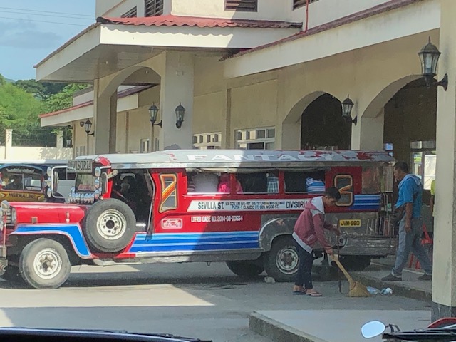
Antipolo’s bus port
I like taking photos of aircraft of various airlines in airports. Among the photos I like taking are of their tails aligned to show the different airlines docked at the terminals. As we were stopped at an intersection just across from the Robinsons Antipolo public transport terminal, the wife took this photo of buses at the terminal. To me, the terminal has become somewhat like a bus port; with buses serving the long distance routes between Cubao in Quezon City and Antipolo in Rizal province. That’s about 20+ kilometers via Marcos and Sumulong Highways.
What used to be a small amusement part has been cleared prior to the lockdown in March and the area now functions as a parking lot for buses serving the Antipolo-Cubao via Masinag Junction and Antipolo-Ortigas Center routes. The latter was already operational prior to the lockdown with P2P buses leaving every 30 minutes.
When the Antipolo-Cubao bus route first started operation when Rizal and Metro Manila first transitioned to GCQ, there were three (3) companies operating along the route – G-Liner, RRCG and EMBC. All used air-conditioned buses. Before MECQ in early August, there were additional companies including those that deployed regular or non-aircon buses. I will try to take more photos of the terminal, the buses and the paratransit providing local transport (i.e., within Antipolo). These are tricycles of different models including the conventional motorcycles with sidecar, the tuktuks, and the e-trikes.
–
The plight of commuters during GCQ
I write this on the eve of the imposition of Modified Enhanced Community Quarantine (MECQ). It is another unfinished article that was intended to be a quick post showing the typical conditions for commuters during the GCQ. Public transport supply was slow to return to adequate levels as the government took advantage of restrictions to impose route rationalization and modernization programs. The following scenes were common along my commuting routes:
 Commuters waiting for a ride near the provincial capitol
 The rains of the wet season added to the misery of the wait.
 Long queue at the public transport terminal at Robinsons Antipolo, which is the terminus for buses connecting Antipolo with Cubao and Ortigas Center.
 The queue reaches beyond the shaded areas of the terminal.
I think national government should be the one to provide for the public transport needs of frontliners (i.e., health care workers including doctor, nurses, medical technologists, pharmacists, etc.) and other essential workers. My definition of the latter are those required for logistics to function as well as those to ensure the required production or manufacturing for the rest of us who need to stay at home. Not everyone has the same, fair circumstances as there are those who can afford to stay at home and those who need to work for them to live, often on a day-to-day basis.
The pandemic has taken a toll not only on the physical but the mental health of many of us. Government rants and retorts are unnecessary and uncalled for given its dismal performance. I dare say dismal as the evidence shows certain local government units and the Office of the Vice President doing much, much more despite their limited resources. We are not in this quandary because government performed well and to the best of their people’s abilities. If that was their best then they have no business staying in their positions. If our health care system fails, then there is nothing to stop this pandemic from claiming much more than lives.
–
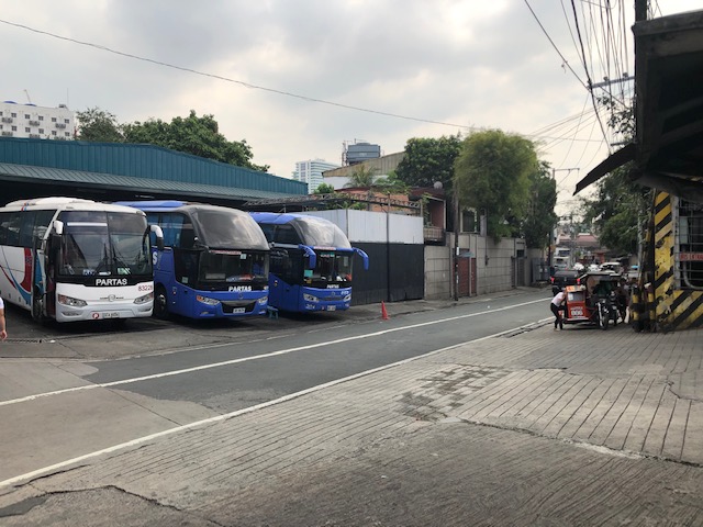
Partas bus terminal in Cubao
Prior to the lockdown, we were still able to conduct one fieldwork for a provincial bus terminal located in the Cubao district of Quezon City. We had previously conducted a study for the re-design of this terminal and the company again called on us for an update after they were not able to implement the previous study’s recommendations.
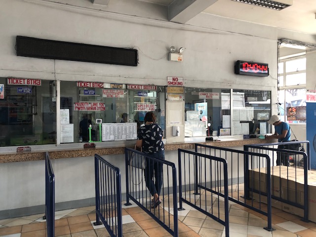 You can purchase your tickets at the terminal
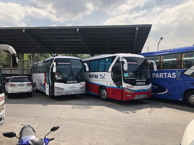 Different model buses waiting for their boarding times
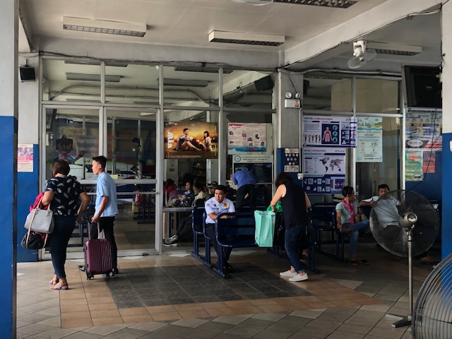 The passenger waiting lounge has indoor and outdoor seating.
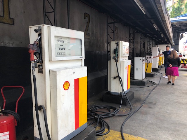 The terminal has its own fuel pumps so buses need not go to a fuel station.
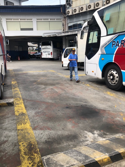 Bus parking slots are marked but there is little space between buses. The fishbone pattern parking allows for each bus’ door (front) to be accessible as shown in the second photo of this post.
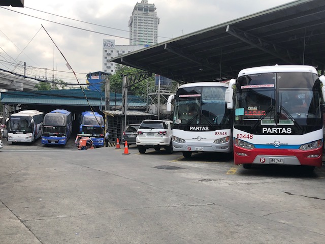 Another view of the terminal’s bus slots. The ones further in the photo are actually across the street from the terminal.
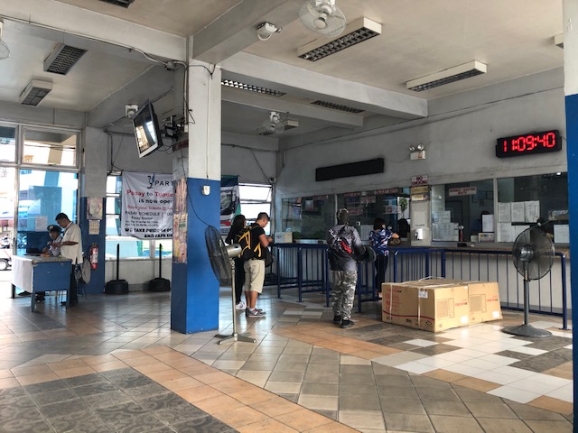 Passengers lining up to purchase tickets at the terminal lobby. The boxes are consigned freight.
 The air-conditioned passenger lounge includes shops for meals, refreshments or souvenirs.
 Here are the bus slots across the street from the terminal. That’s an informal tricycle terminal on the left. While off-street, the tricycle terminal occupies what little sidewalk is there that is supposedly for pedestrian use.
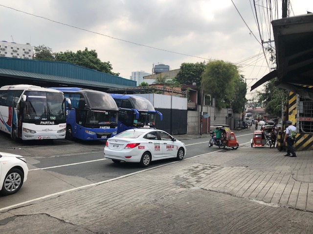 Taxi passing along the street as tricycles maneuver from their terminal on the sidewalk.
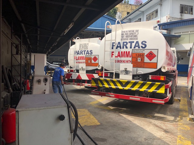 Fuel tankers are allotted slots at the terminal as they deliver fuel for the terminal’s pumps.
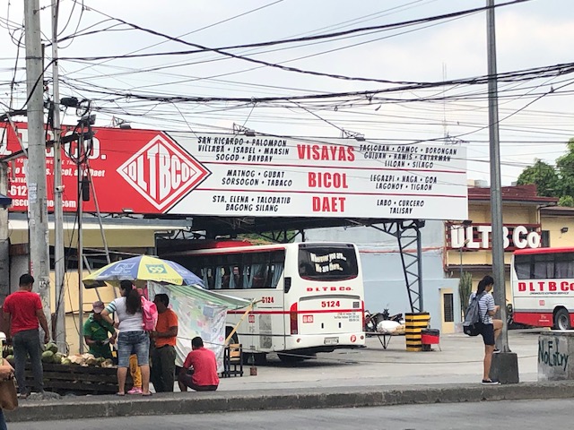 Another private provincial bus terminal across from the Partas terminal. This one’s from the resurrected BLTBCo. (now DLTRBCo.) buses that ply routes to Region 5 (Bicol) and Region 8 (Eastern Visayas via ferry between Sorsogon and Leyte).
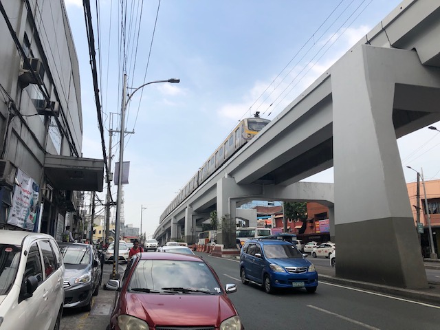 Line 2 train traveling atop Aurora Boulevard. The Partas terminal is on the left with cars parked on the sidewalk and curbside.
I think this was the last project when we did fieldwork for before the lockdowns. I wonder when we can do field work again. Transport and traffic are not the usual and the “new normal” in transportation is still evolving especially in Metro Manila.
–
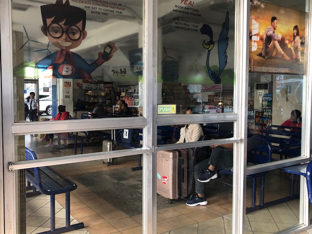
Post-ECQ at the Robinsons Antipolo transport terminal
I should probably have posted this right after Antipolo transitioned to GCQ beginning May but the transport terminal at Robinsons Antipolo was basically just a parking lot for supermarket customers for that entire month. We are still under GCQ now but most restrictions like the quarantine and barangay coding have been eased. And with Metro Manila already under GCQ, that means more people moving about especially those who have started going to their workplaces. Here are photos of the terminal taken sometime mid-May before I lined up for the supermarket in the morning.
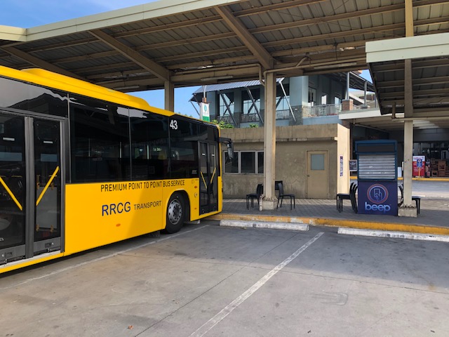 Idle P2P bus and closed booth – I usually took the P2P bus when I have meetings in the Ortigas CBD area. I usually alight at Medical City where its easy to get a ride (Grab) to my destination. If it was a meeting at ADB or somewhere near it, I just walk from Galeria.
 I didn’t know before that there were vehicles (likely vans) traveling between Antipolo and Lucena City in the Province of Quezon. Perhaps the route is via the Rizal “backdoor” (i.e., via the Rizal towns of Teresa, Morong, Tanay, Pililla, and then via Laguna through Mabitac, Siniloan, Pangil, Pakil, Paete, Lumban, Pagsanjan, and then Luisiana, Lucban and Tayabas in Quezon). This is typically a 3.5 to 4.5-hour trip depending on traffic conditions and the number of stops travelers make in between the ends.
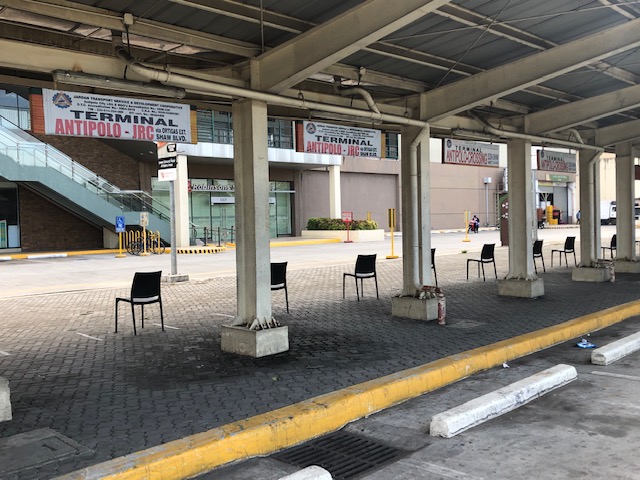 Antipolo-JRC is probably among the oldest jeepney lines connecting Antipolo with Metro Manila. JRC stands for what was Jose Rizal College. It is now Jose Rizal University or JRU but few jeepneys use JRU as most people are still familiar with JRC. I have fond memories of this jeepney line as I used to commute on these jeepneys when I was in high school. My school was located along Shaw Boulevard and I took the jeepney because it was the one that passed and stopped in front or just across from our school. Other jeepneys from Rizal turned at Capitolyo to go to the EDSA-Crossing terminal via the United Lab road. [Note: the chairs in the photo are not for the terminal but for customers who lined up for the supermarket. Note the distance between each chair.
–
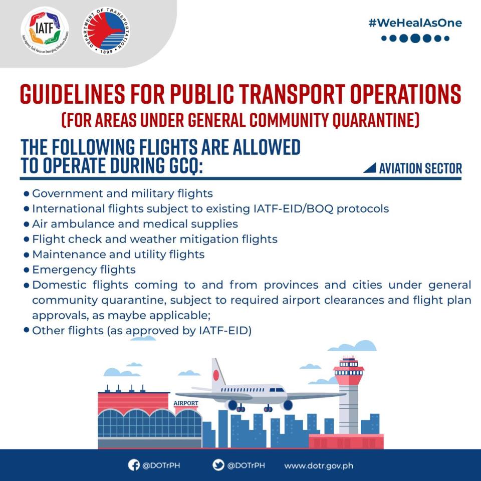
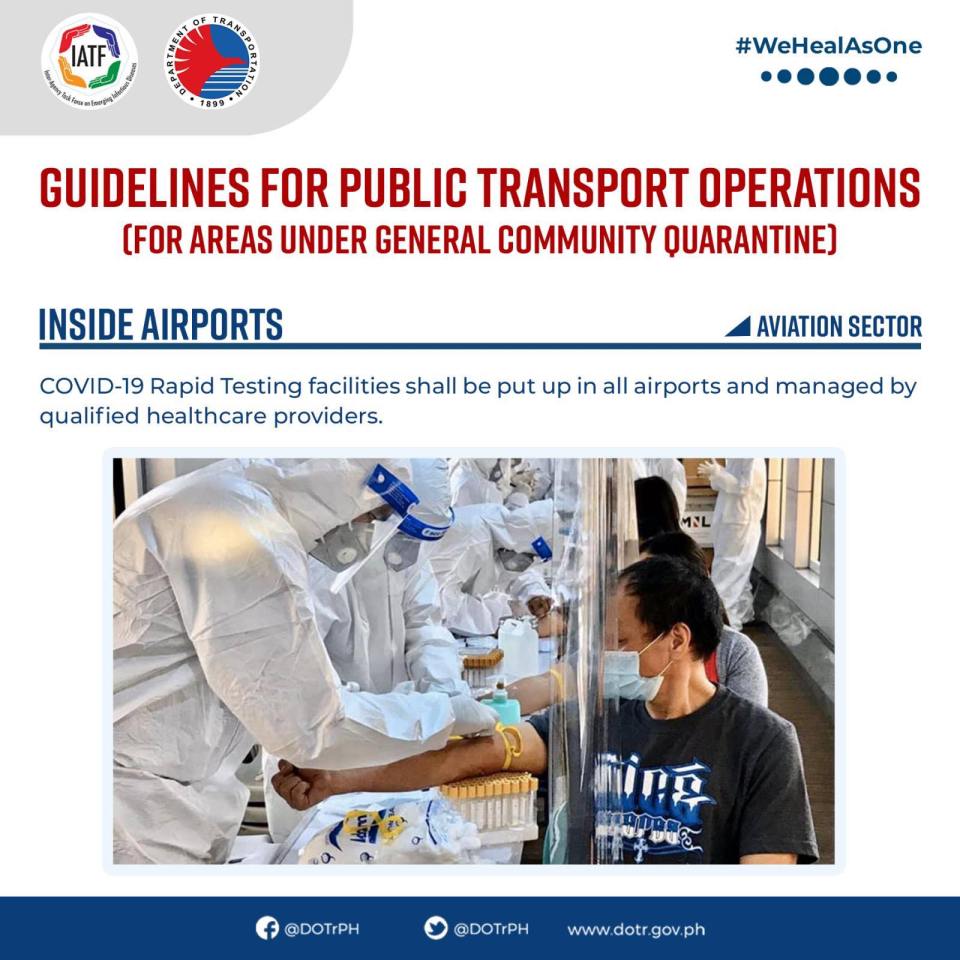
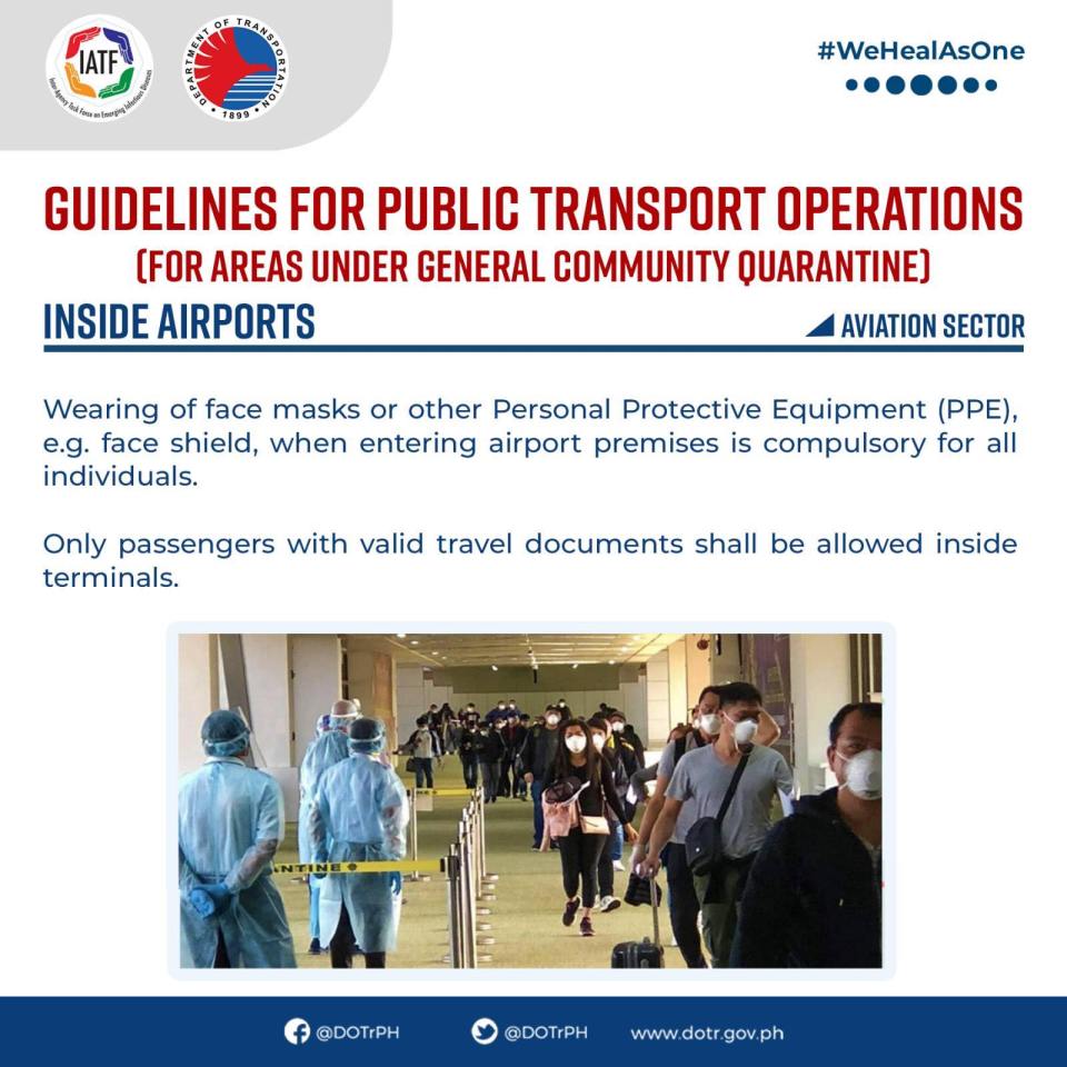
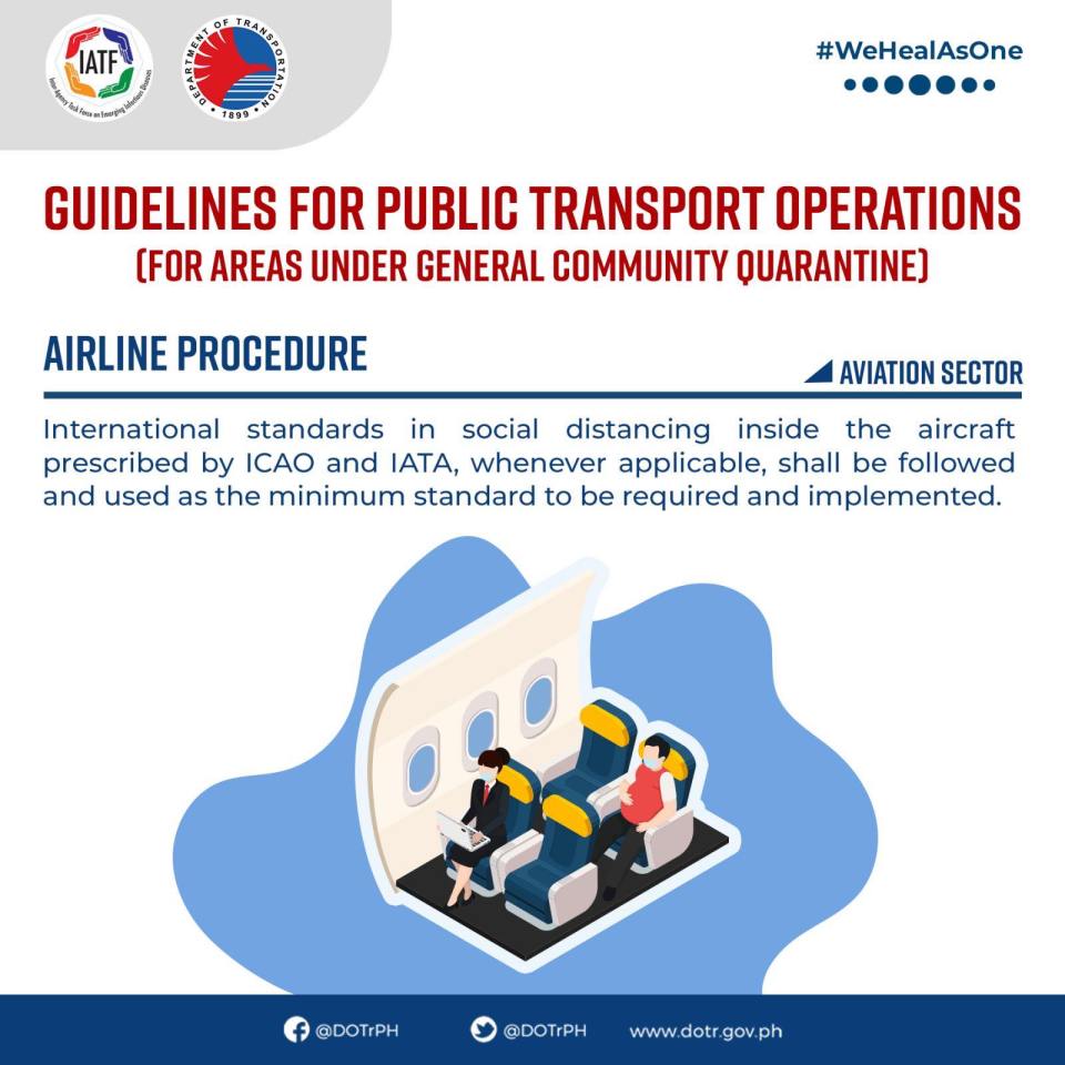
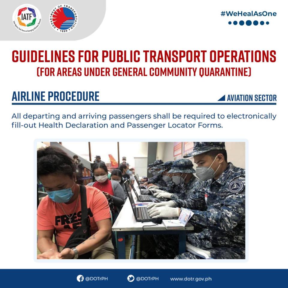
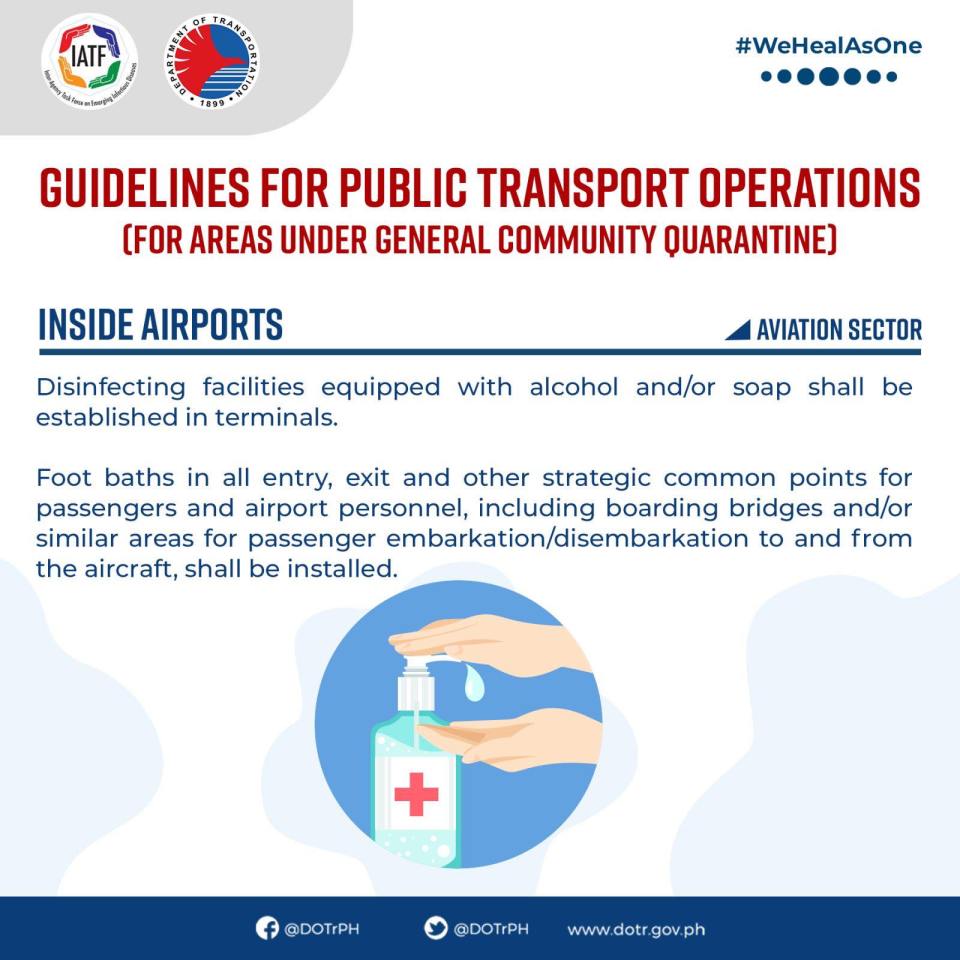
On the DOTr Guidelines for Public Transport – Aviation Sector
Here are the guidelines for the Aviation Sector. My only comment here is that many people are anxious about when they can travel again, particularly to other parts of the country mainly for business or to go home (e.g., many students have been stranded in the cities where they go to school and away from their hometowns). Part of this anxiety is the thinking that airfares will increase significantly as airlines are forced to reduce capacities for their aircraft to adhere to physical distancing guidelines. Gone, probably, are the discount fares like the Piso fare promos.


Related to this, I have received emails from 4 airlines I frequently used – Cebu Pacific, Philippine Airlines, Singapore Airlines and Japan Airlines. All provided updates on their respective efforts to ensure the future air travel will be safe, health-wise. As for the airport terminals, that’s another story…
–
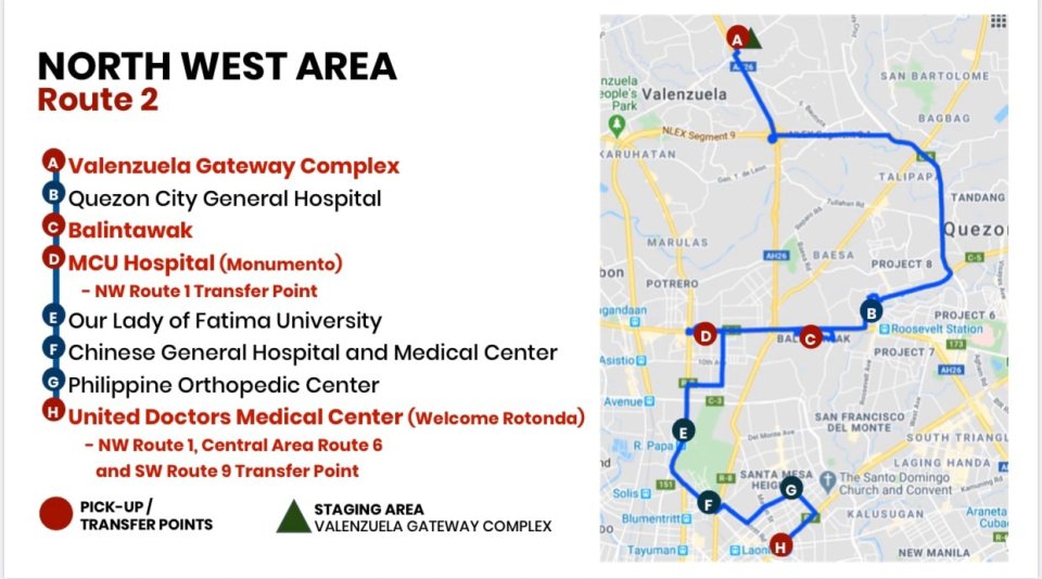
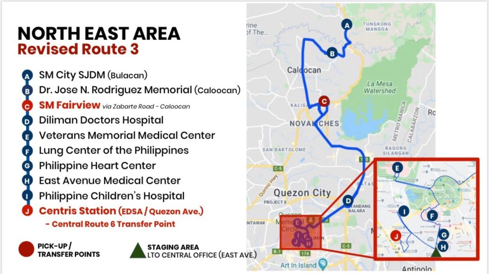
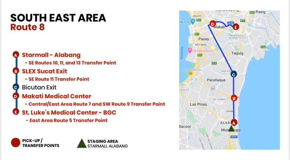
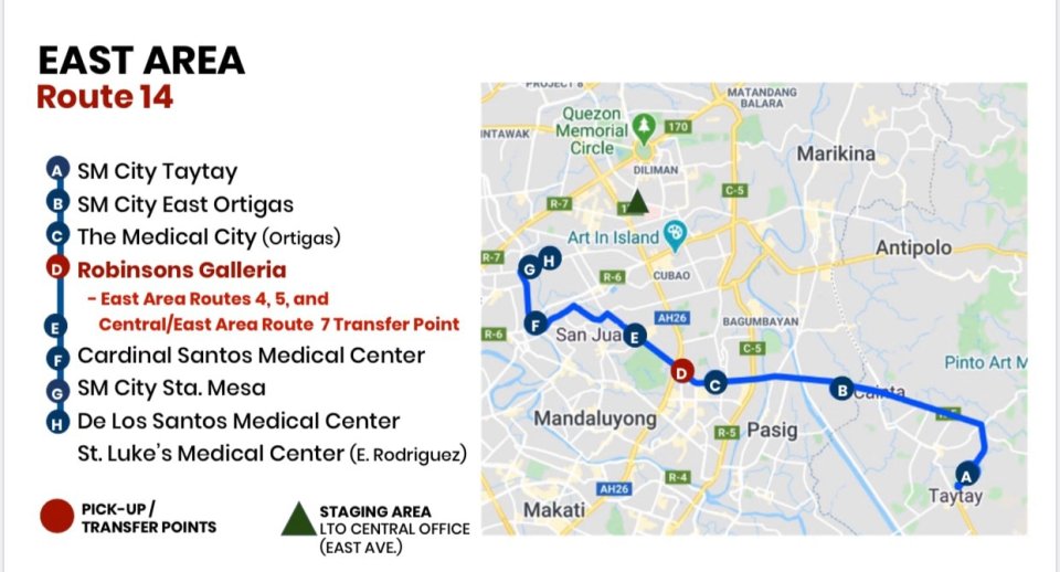
Transport route maps for Greater Metro Manila/ NCR during the quarantine period
I am sharing the following maps produced by the Department of Transportation (visit the DOTr Facebook page) and the Office of the Vice President. The details of operations are in their respective social media accounts that are being shared/circulated.
Here are the maps for 16 routes from the DOTr:
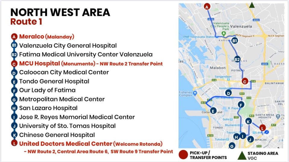


Here is a map from the OVP as well as a detailed itinerary for one of the routes they operate:


–
Manila’s PUV stops
Last week, I went to a meeting somewhere at the Mall of Asia complex and took a couple of photos of the public transport stops in the City of Manila. These seem to be the most modern designs in the metropolis and bears a slogan – Ang Bagong Maynila (The New Manila).


I’ll try to get photos of stops from other LGUs of Metro Manila to compare with the photos above.
–
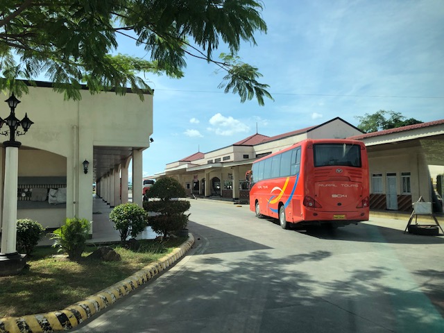
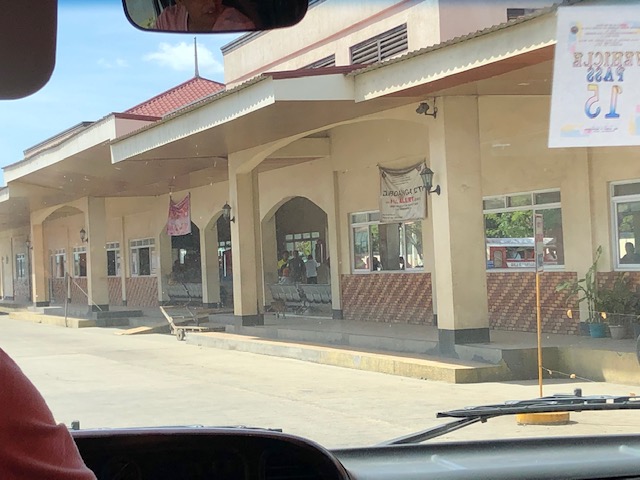
Zamboanga City Integrated Bus Terminal
I open the year by sharing photos of the Zamboanga City Bus Terminal. It is a ‘central’ terminal as most most buses terminate here and cannot proceed to the city center. At the terminal, passengers may transfer between buses, jeepneys and vans.
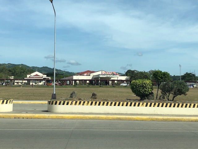 View of the terminal from the national highway. There are driveways leading to and from the terminal from the highway and one can appreciate the expanse between the facility and the main access road.
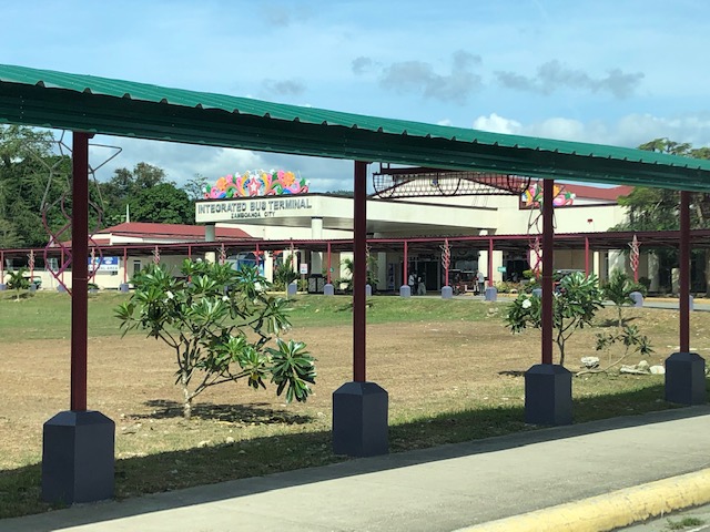 There are covered walks connecting the terminal to the national road.
 Provincial buses and long-distance vans at the terminal
 Provincial bus arriving at the terminal
 Jeepneys at the terminal
 Motorcycles parked along a shaded area. The lamp’s vintage design seems to be a good accent to the terminal.
 Close-up showing the spacious parking area shared by cars, jeepneys, motorcycles and even tricycles
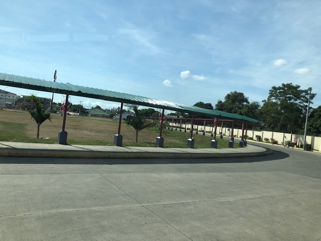 Another look at the covered walkways leading to the national highway. Not all public transport go to the terminal because of the fees and the distance for the diversion from the highway.
 Jeepneys waiting to be filled with passengers prior to departure
 A look at the front of the terminal shows a wide driveway and the connection of the covered walkway to the main entrance
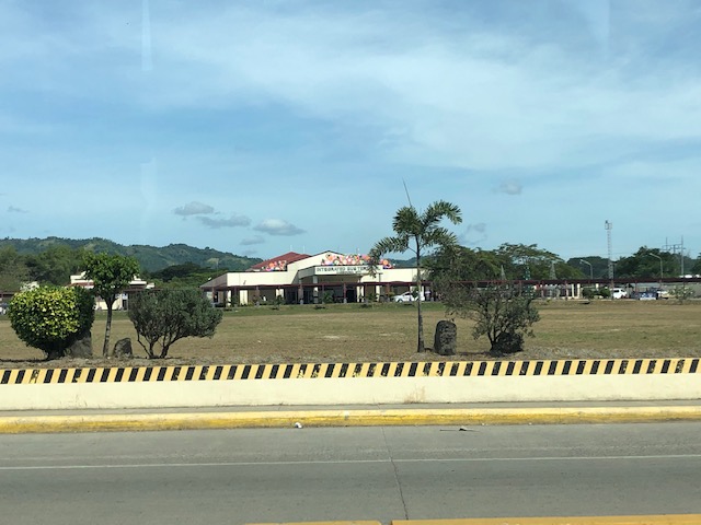 Another look at the integrated terminal from the highway
We will be evaluating the terminal soon as part of a study we are doing for the city. More photos and some assessments about its features soon!
–
Public transport terminal at the Sta. Lucia East Grand Mall
Sta. Lucia’s East Grand Mall reconfigured its transport terminal and made it somewhat more formal than it was before. Previously more like a informal terminal with jeepneys parked along their driveways, the mall relocated its terminal to be closer to the Line 2 Station currently under construction just across from the Robinsons Metro East Mall and Sta. Lucia’s main access road from Marcos Highway.
 Jeepney station for eastbound PUJs including those bound for Cainta, Taytay, Angono and Binangonan via Felix Avenue (formerly Imelda Avenue) and Cainta Junction
 There is space for 4 to 5 jeepneys depending on how they are parked. There are also seats for waiting passengers and the area is fully occupied during the peak hours in the afternoon and evening when there is higher demand and jeepneys are not able to come back as fast to pick-up passengers.
This is a welcome development as passengers have a better place to get a ride. The terminal is more secure and protected from the environment (i.e., it is practically covered as shown in the photos). Then, of course, there is the proximity from the Line 2 Station making transfers between rail and road transport more efficient. The walk between the station and the terminal is not a difficult one as there should be adequate space along the Sta. Lucia mall driveway that has an improved pedestrian sidewalk, too.
I will post more photos of this terminal soon!
–
On good transit stop designs
We interrupt our regular programming to share this good reference for designing bus stops:
Transit Center (2018) From Sorry to Superb Everything You Need to Know about Great Bus Stops, transitcenter.org, http://transitcenter.org/publications/sorry-to-superb/#introduction [October 2018]

This is a new publication and though the focus is on bus stops, the principles and guides presented are very much adaptable and applicable to other public transport modes as well, particularly the road-based modes we have in the Philippines. The article contains a link for those who want to download the entire report.
–
