
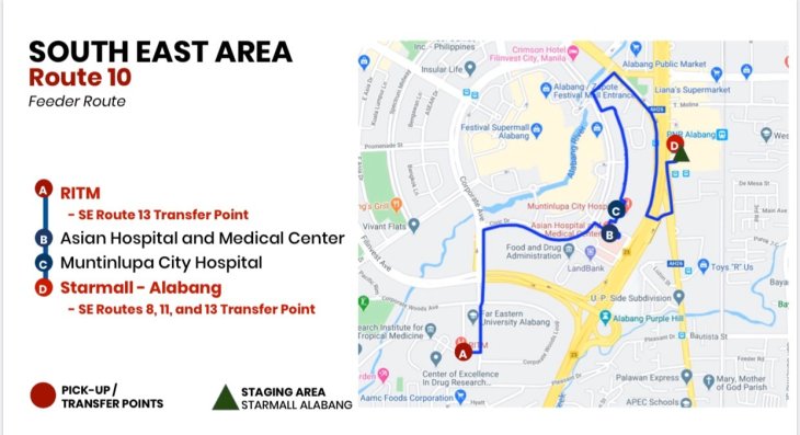
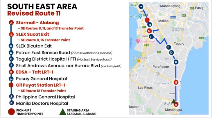
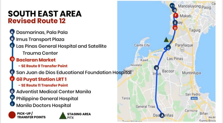
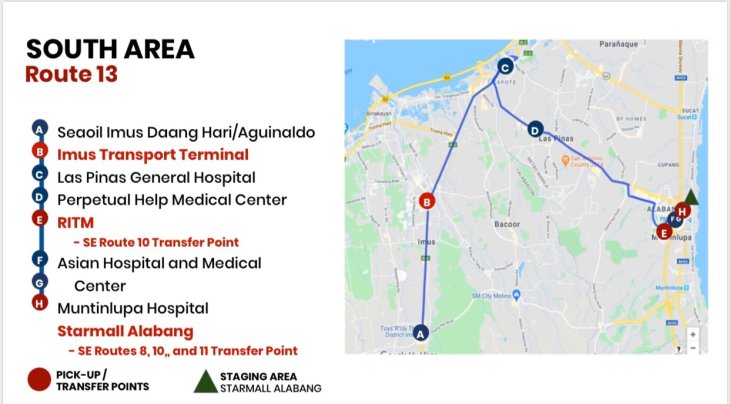
I am sharing the following maps produced by the Department of Transportation (visit the DOTr Facebook page) and the Office of the Vice President. The details of operations are in their respective social media accounts that are being shared/circulated.
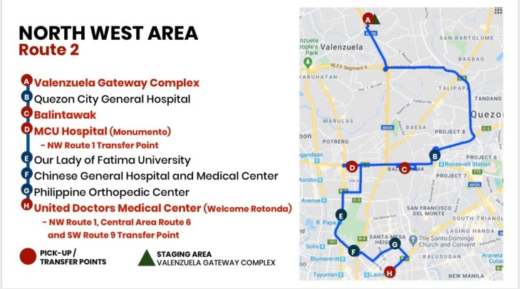
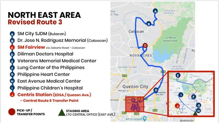
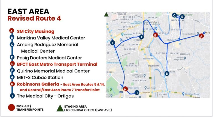
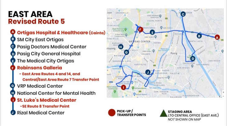
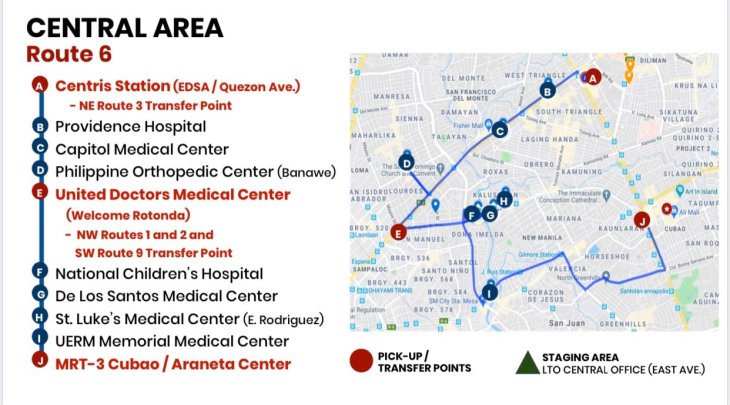
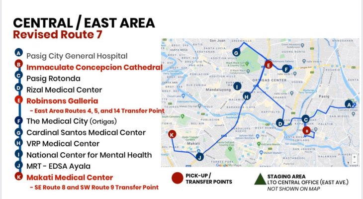
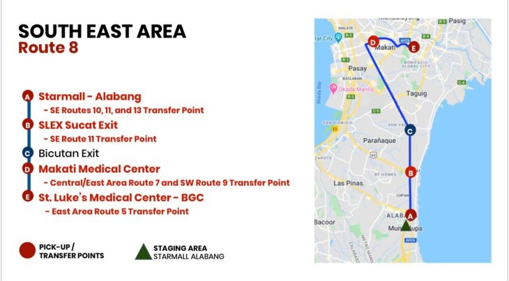
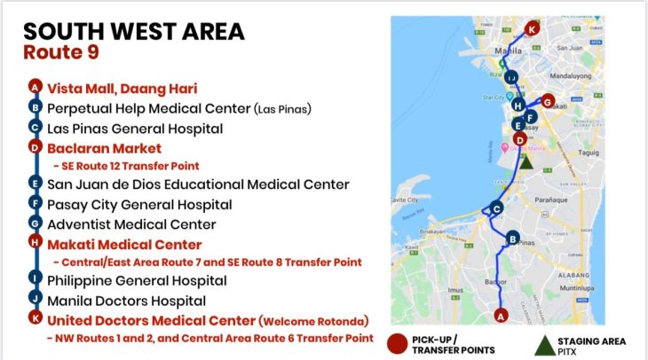
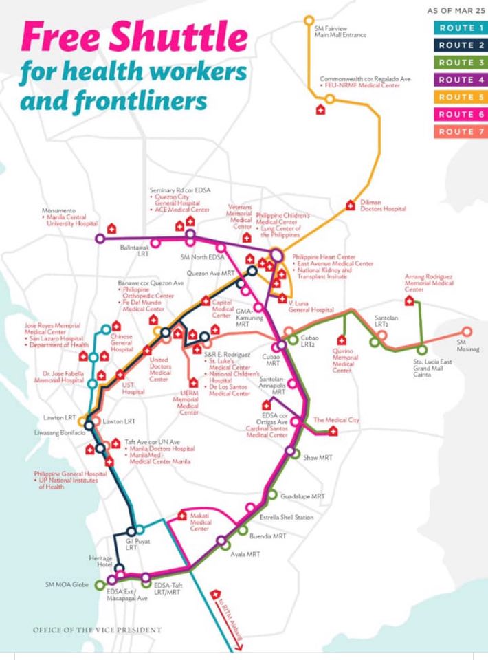
Here are the maps for 16 routes from the DOTr:

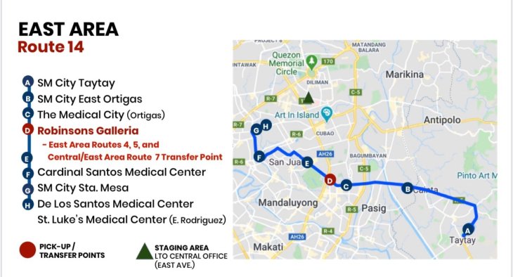


Here is a map from the OVP as well as a detailed itinerary for one of the routes they operate:

–

Combined, there are potentially 23 routes they can work from to organize the metro transport routes when this is all over and things are back to ‘normal’. All they have to do is extend these routes to the usual end points (terminals), and add more stops along the way, like maybe every 5 blocks, or big intersections.
I hear the DOTr is currently planning for the ‘normal’ case. But they still have to come up with a transition plan and ‘normal’ here shouldn’t be the same as before. The routes posted are going to be bus-based and they have yet to include jeepneys and vans in their plans. Perhaps last mile? Feeder? I hope also to see their overall game plan. 🙂