
Home » Public Transport » Terminals (Page 4)
Category Archives: Terminals
San Diego’s Sta. Fe Train Depot
A highlight of my ‘do-it-yourself’ tour of San Diego, CA was the Sta. Fe Train Depot or Railway Station. The depot was celebrating is centennial and for me represented part of America’s railway heritage being part of a railway line stretching along the US’ Pacific coastline. Following are photos in and about the Sta. Fe depot.
 The historic Sta. Fe Train Depot building as seen from the San Diego MTS trolley station.
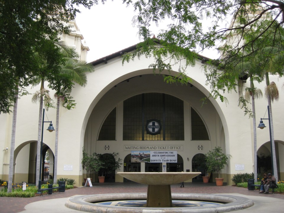 Front of the train deport showing a fountain and the main doors to the station building.
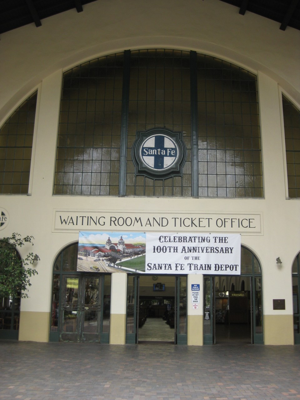 Entrance to the building, which contains the ticket office and waiting room for passengers and well-wishers.
 One is greeted by this splendid view of the building’s interior evoking a time when trains ruled in land transportation. An information booth is seen at the right while the food kiosk is at the left. The ticket windows are further at the center.
 The kiosk inside the station building provides sustenance to passengers, well-wishers and passers-by. Note, too, the mosaic designs on the columns of the building.
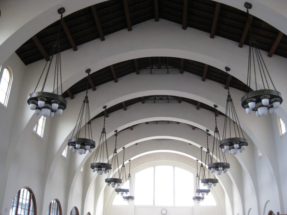 A closer look at the station’s ceiling and chandeliers shown arches emanating from the columns to support the roof. Such features are of earthquake resistant structures in this earthquake-prone region and particularly in the State of California.
 Pedicab, trolley and the Sta. Fe Train Depot
I took some refreshments at the kiosk in the station. The hotdog sandwich was good and the coffee was strong. I took the trolley from the station to explore San Diego along its commuter train lines. More on San Diego’s trains and stations in future posts.
–
Dau, Mabalacat Bus Terminal – Part 2
The first part of this feature on the Dau Bus Terminal in Mabalacat, Pampanga showed the city’s PUV Common Terminal, the bus berths from the entrance of the terminal and the many stalls lined along the terminal. This second part features more photos including some showing a tricycle terminal and an airport shuttle lounge inside the huge bus terminal.
 The interior shows an even more expansive bus terminal with more berths, a tricycle terminal and the Clark Airport shuttle station.
 Victory Liner buses berthed just after the tricycle terminal within the bus terminal
 Clark Airport Lounge in the middle of the bus terminal
 An add for a popular cracker brand states “the journey is long”
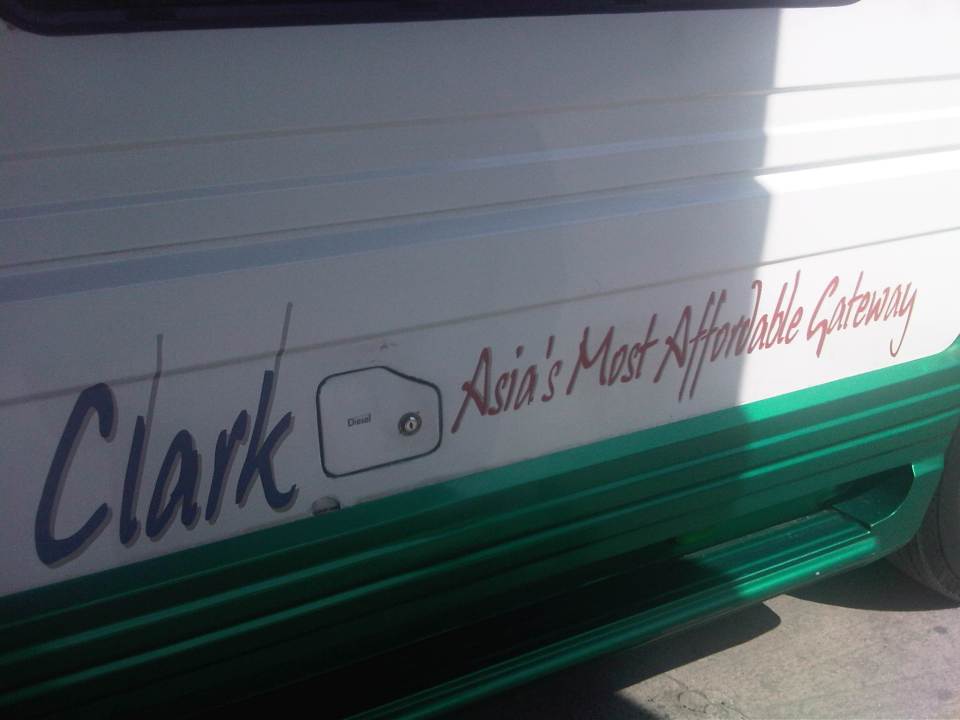 Sign on the Clark shuttle jitney
 The Clark Airport shuttle jitney is an extended or stretched Asian Utility Vehicle (AUV) that typically seats 27 people including the driver.
 The tricycle terminal at the bus terminal allows for a more direct transfer between modes (i.e., long distance, inter-provincial or inter-city transport to local transport).
 Passengers from the lounge board the airport shuttle. Luggage are also taken inside the vehicle so it can only accommodate a limited number of people rather than the 27 I mentioned earlier.
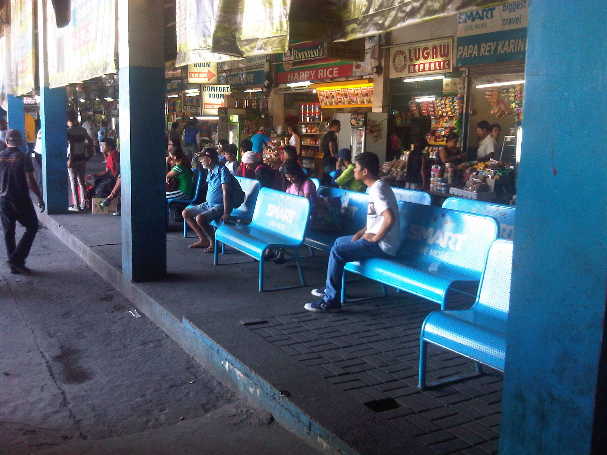 Another look at passengers waiting for their buses at the available (and limited) benches at the terminal. The benches shown seem to be ‘sponsored’ by a leading Telecom company.
 Beverage dispenser at the terminal
 Low batt? Cellular phone chargers are quite popular with passengers needing a quick battery charge while waiting for their buses to arrive at the terminal.
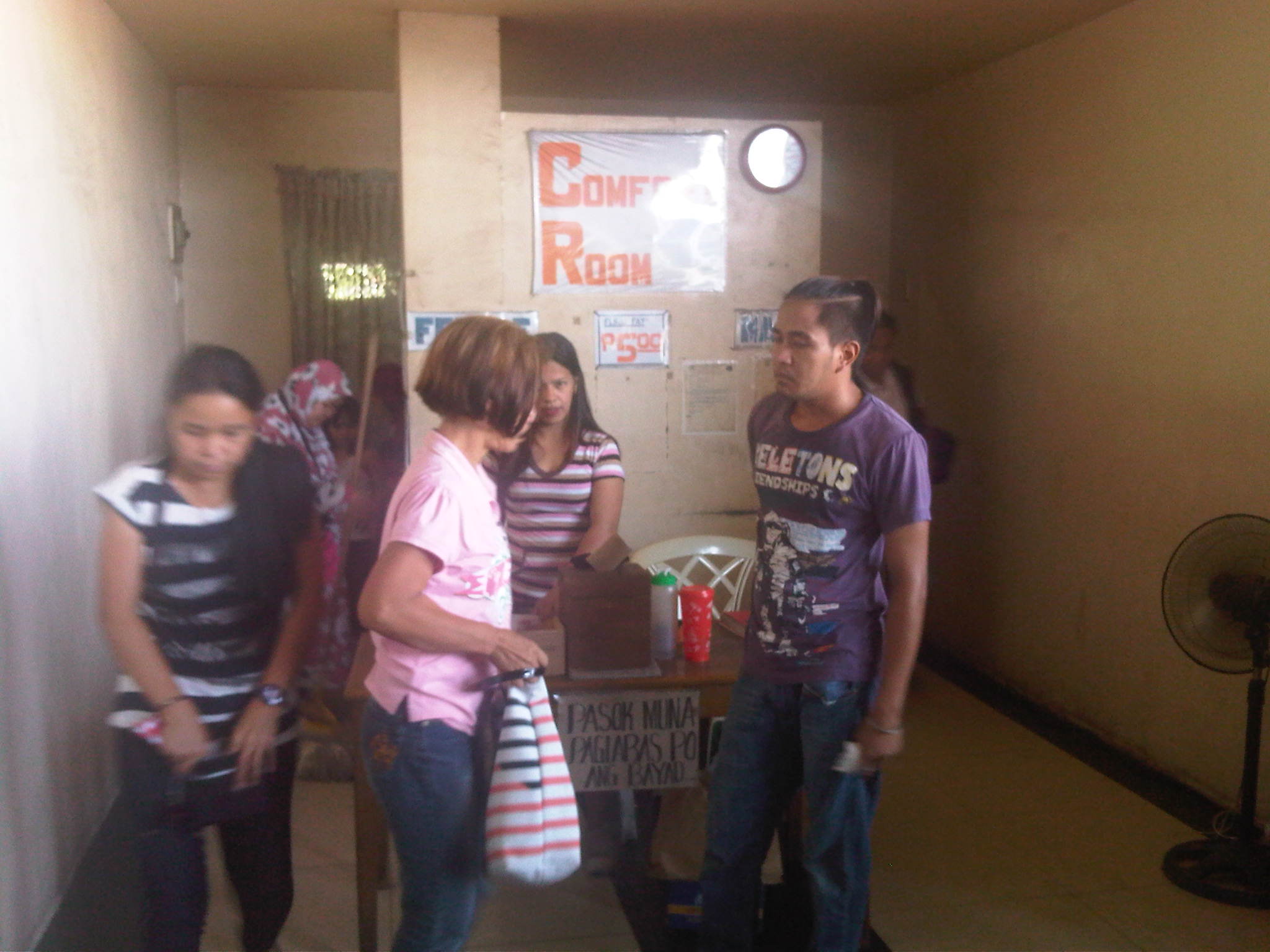 Public comfort rooms or toilets at the terminal charge 5 pesos (about 12 US cents) for each use. There’s a sign that says payments are made after use. The fees are supposed to cover maintenance of the toilets but don’t expect much in terms of cleanliness or smell.
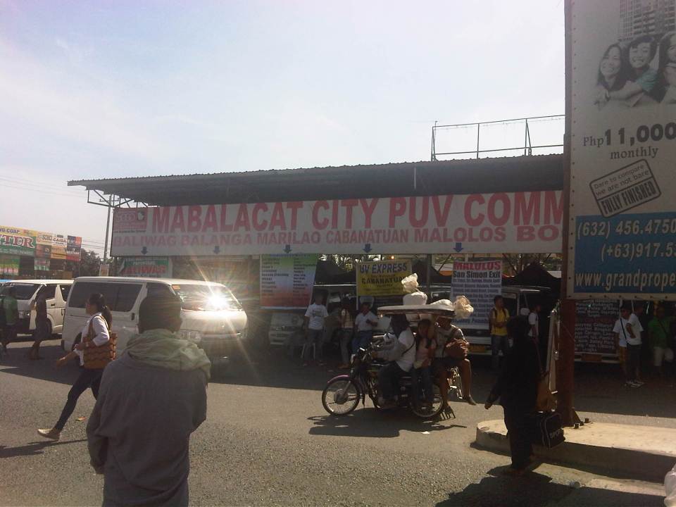
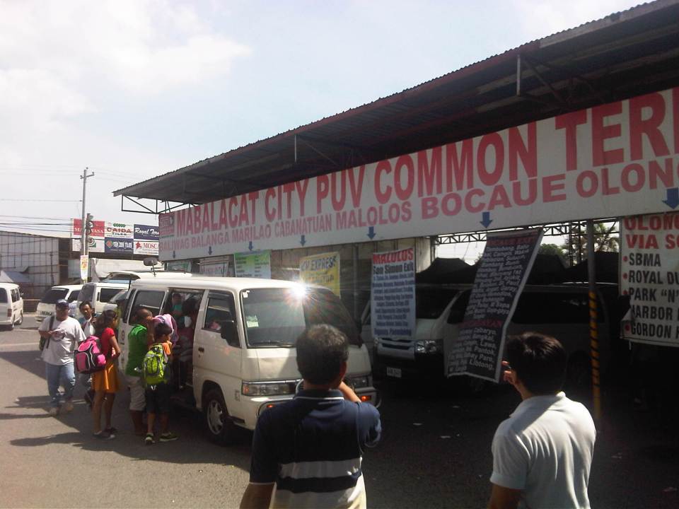 Passengers board a van at the Mabalacat City PUV Common Terminal. PUV stands for Public Utility Vehicle and basically stands for the vans running long distance express routes that are supposed to be non-stop or limited stop.
 Huge signboard at the entrance to the terminal
The huge bus terminal is a good example of a regional bus terminal in the Philippines and one that is also a multi-modal facility at least for road transport. It is relatively well-run and is a major transfer point for people traveling between much of Luzon Island including Metro Manila. There is definitely room for improvement including amenities for passengers and perhaps a more modern airport shuttle lounge. Perhaps there should be more investments to further improve this terminal used by so many passengers traveling mainly on the provincial buses calling on the terminal.
–
Dau, Mabalacat Bus Terminal – Part 1
We recently went to Mabalacat, Pampanga, which is north of Metro Manila and at the end of the North Luzon Expressway. The objectives of my colleagues were to inspect the Dau Bus Terminal and to look at the airport shuttle whose terminal is co-located and within the large bus terminal. Following is a first batch of photos I took at what is the largest bus (and intermodal) terminal in Central Luzon. There are others like it around the country like the one in Lucena City in Quezon Province (Southern Luzon) but few are as large and serve as many buses.
 The city’s PUV terminal is adjacent to the bus terminal
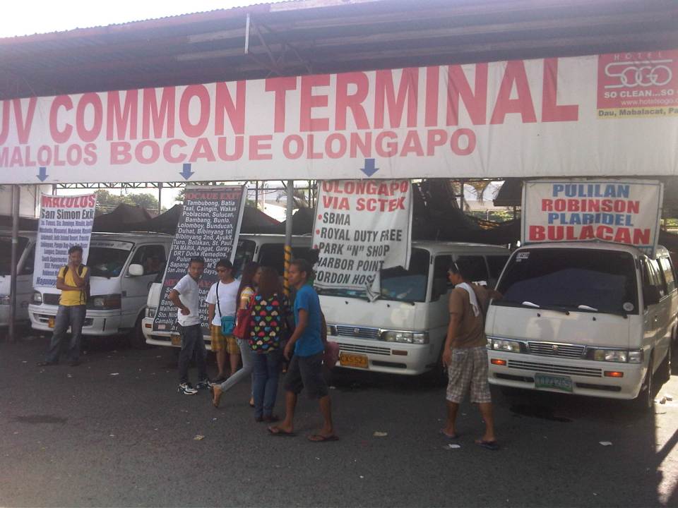 Vans bound for various provincial destinations await their passengers at the PUV terminal. These usually seat 10 passengers and directly compete with buses for the destinations indicated in the signs.
 Passengers walk towards the terminal and the berth assigned to their buses.
 People line up to congregate at the berth assigned to specific bus companies and according to their destinations
 Passengers, well-wishers, hawkers and shopkeepers mingle in what is probably the busiest terminal in Central Luzon. I am not aware of any similar terminals in other provinces in Region 3 including Bulacan, Tarlac and Nueva Ecija.
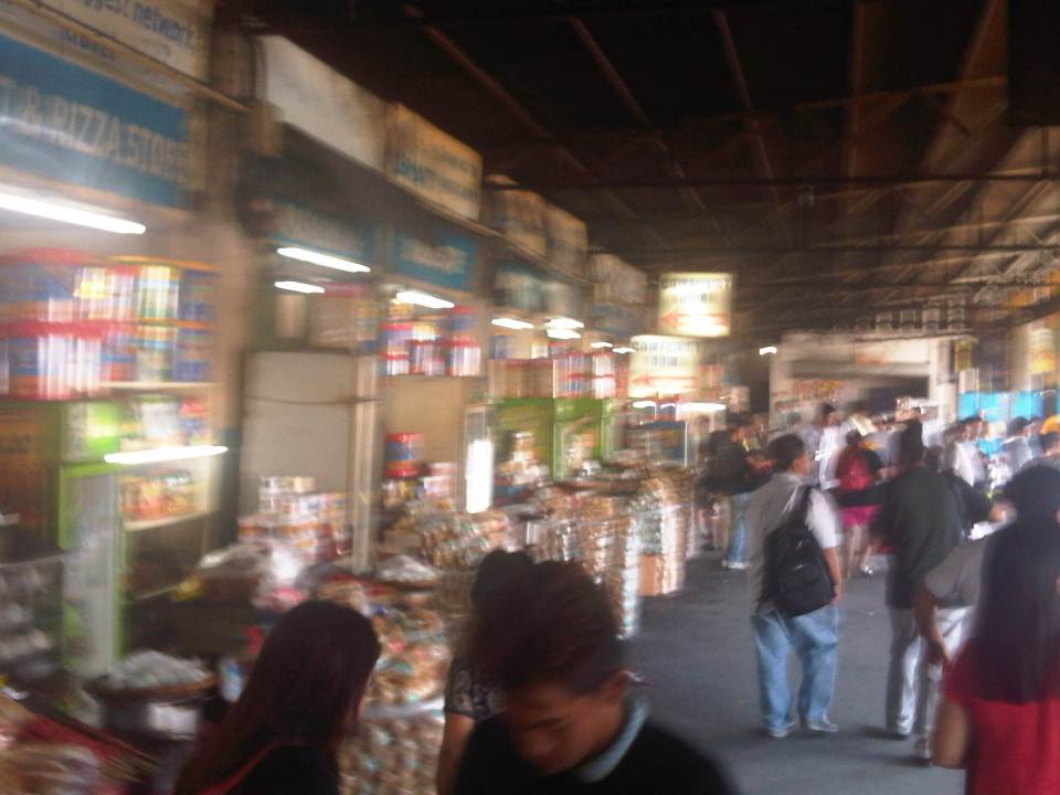 Stalls at the terminal sell mostly food and drinks including large containers of biscuits that are still popular pasalubong.
 Some areas of the terminal can be quite crowded as some bus companies are more popular than others.
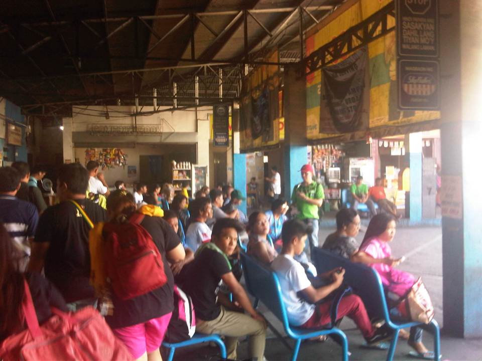
 Not all bus companies provide benches for their passengers. Some seats are actually provided by stores and eateries but only for their customers.
 Empty berths at the bus terminal
 Passengers wait for their buses on the benches or while standing and having a quick snack or smoke at one of the stores at the terminal. The guy in the photo is actually violating a national law and local ordinance banning smoking in public areas.
 A Five Star bus arrives at the terminal. Bus companies have their assigned berths at the terminal and drivers and conductors presumably have their suki eateries or stores.
More on the Dau bus terminal in a future post.
–
Compromising on the common station(s) for the Metro Manila rail lines
It seems that the issue regarding the common station for Line 1, Line 3 and the future Line 7 in the North EDSA area has not yet been resolved. The interested private sector parties, Ayala and SM, will not back down on their arguments support each’s proposal for the common station to be located at either of the giant malls that each corporation owns. Ayala’s claim is that the contract for the Line Extension to Cavite stipulates that the common station with Line 3 should be at Trinoma. Meanwhile, SM is claiming the validity of an agreement it made with DOTC on a grand central station to be located across their SM City North EDSA mall. The last one is consistent with an even earlier agreement with the proponents of the future Line 7 for an end station in front of SM.
A compromise solution to the impasse should be in the works and is the responsibility of the DOTC. What if instead of one common station, two stations are made into common ones? There will be no grand central station in the sense that all three lines will terminate as presented in SM’s version nor will there be a common station for Lines 1 and 3 at Trinoma that incorporates a very long walkway to a Line 7 station near Mindanao Avenue. Instead there can be two common stations – one at SM North for Line 1 and Line 7, and another at Trinoma for Line 1 and Line 3. Line 1 will still terminate at Trinoma but can have another stop at SM North where there can be a smooth transfer between Line 1 and Line 7, which terminates at this station. Perhaps there should still be a walkway connecting the two common stations in the interest of pedestrians although seamless fare collection systems and platform design can easily allow Line 7 or Line 3 passengers to ride Line 1 trains between stations to transfer to Line 3 or Line 7.
The common station or stations (depending on what will finally come out of this) should be designed thinking of the best interests of the public who will be using the transit systems and stations. Lost in the discussions are the plight of commuters. Parties claim that their designs are in the best interest of commuters (actually SM has the better set-up of all three lines terminating at one central station) and yet the bottomline for their arguments are very much revenue oriented – not for the transit lines but for their own commercial developments. Its basically one mall vs. another, leaving out the public as incidentals in the discussions. This is why government must intervene and this is where DOTC should show it has a spine after all and is promoting the public good and not favoring one private company over another. And so we’ll wait and see what will eventually come out of this although a lot of people continue to suffer with their inefficient commutes and are definitely becoming more impatient about mass transit systems that should have been constructed a long time ago.
–
EDSA: Taft to Tramo
The EDSA-Taft Ave. intersection was in the news a few weeks ago due to the MRT3 train that derailed and overshot the end of the line along EDSA. Being a major intersection for roads as well as for rail (MRT3 and LRT1), it is a very crowded area. Nearby, too, is the Redemptorist church in Baclaran that attracts a lot of people especially during Wednesdays. Following are a few photos of the area showing the conditions on the pedestrian overpasses and at street level.
 The pedestrian overpass at EDSA-Taft is also a mall of sorts given the merchandise being sold at informal shops at the overpass.
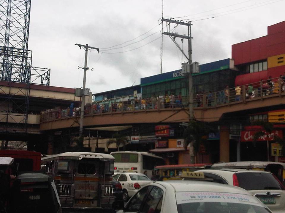 The overpass connects to the EDSA-MRT 3 Taft Ave. Station. This is the MRT 3’s end station and the overpass system connects the MRT 3 Taft Ave. Station with the LRT Line 1 EDSA Station. The connection was not and is still not a smooth one, which has been the subject of criticism from a lot of people.
 The overpass allows people to walk around this large intersection
 Pedicabs freely travel along this stretch of EDSA between Taft and Tramo on lanes designated for public utility buses and clearly violating regulations regarding what vehicles are allowed on EDSA. You can also see in the photo a cart full of merchandise being pushed along the curbside lane.
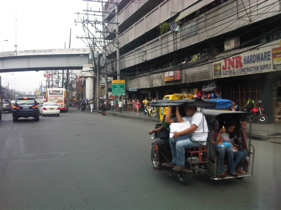 A motor tricycle ferrying passengers along EDSA just before Tramo (that’s the street above which is an overpass from EDSA southbound).
–
Bottlenecks and other traffic issues in Antipolo
Commuting between our home in Antipolo and my work place in Quezon City, I have noted a lot of issues on transport and traffic that needs to be attended to by the local government in coordination with other entities like the DPWH and Meralco. Here are some photos with my notes and comments.
 Much of Sumulong Highway have been widened to 4 lanes but many electric posts remain in the middle of the additional lanes and pose hazards to motorists and cyclists. These posts seem to have been here for quite some time now and the paint on them gives the message that they will be here for the foreseeable future. Paint or no paint, they are road hazards and have the potential to kill people on vehicles crashing into the poles. I think this is supposed to be the responsibility of the power company (Meralco) but there needs to be a firm request and coordination coming from Antipolo City Government to finally relocate these poles.
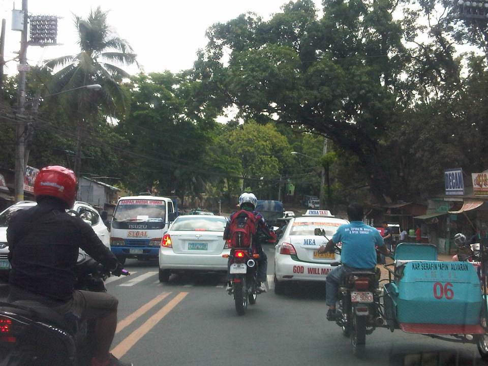 Congestion is often caused by counter-flowing vehicles forcing their way back into the right lane (like the car in the middle of the photo) upon encountering opposing traffic. It doesn’t help that there are motorcycles splitting the lanes to make for a very crowded road.
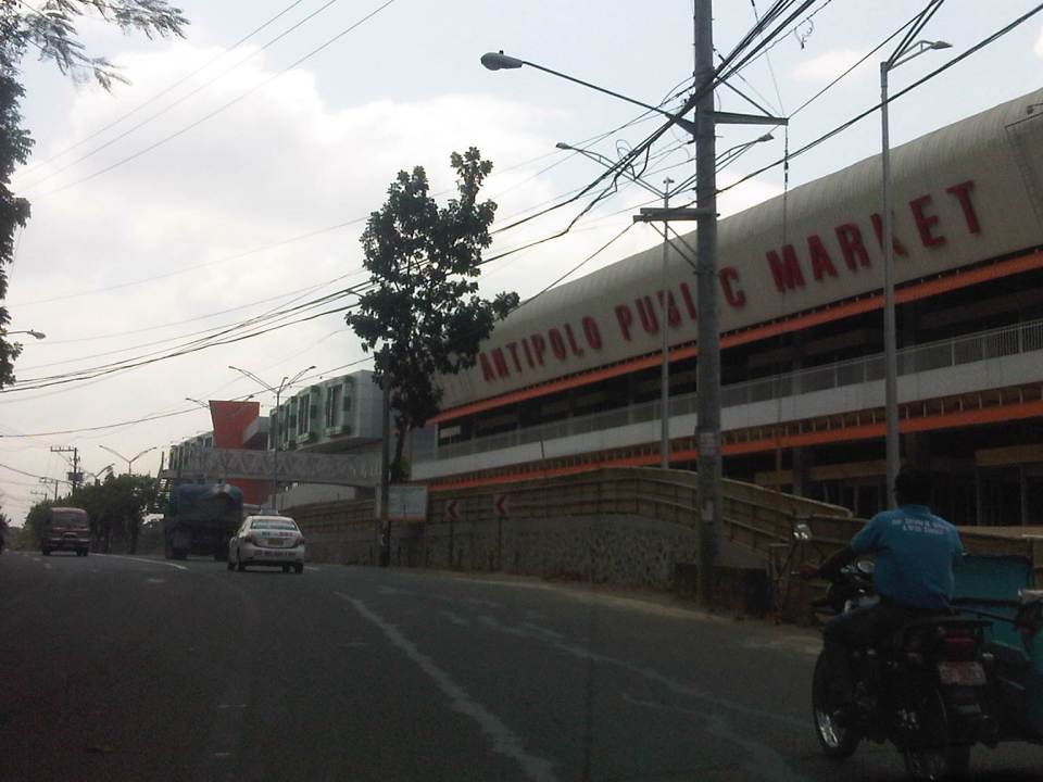 The new but still closed Antipolo Public Market along Sumulong Highway and near the intersection with Daang Bakal (the old railroad line that’s now a road). I wonder about the trip generation potential of this complex as it is not yet operational. Meanwhile, a huge Robinsons mall (looks larger than their Magnolia property) is currently under construction just across from it and will definitely be a major traffic generator in that area. The combined traffic to be attributed to these commercial complexes will surely have a tremendous impact on Sumulong Highway and other roads in the vicinity.
 Both Sumulong Highway and Ortigas Avenue Extension carry significant truck traffic. These often cause congestion as they are slow going up to Antipolo and can block the entire road as Sumulong Highway and Ortigas Extension have some narrow sections where the shoulders could not provide enough space for other vehicles to pass the slower moving ones. In certain cases like the one in the photo above, there are electric posts in the middle of the shoulder lane.
 Tricycles occupy the outer lane of Ortigas Ave. Ext./Olivares Street. Such informal and on-street terminals are illegal along national roads and yet the city tolerates them. One explanation for this is that there are informal communities along the highway on shanties built along what is supposed to be a ledge along the mountainside (shown at right in the photo). These are where tricycle drivers and their families reside.
 Tricycles from different tricycle operators and drivers associations (TODAs) seem to roam the entire city. This is contrary to the common practice in other cities and municipalities where tricycles are limited within a certain area or district that in many cases just overlap with others (e.g., UP Teachers Village-Philcoa-Krus na Ligas).
 Many tricycles serve as school service. However, the observation is that most tricycles tend to be overloaded with passengers. These are usually small children so the driver probably figured that they could cram more passengers than what is legally allowed.
 Sharing the road? Antipolo is very popular with cyclists and weekends bring a lot of them to the city as they come from all over via the main routes along Sumulong Highway and Ortigas Avenue (there should also be those coming from the east via the Antipolo-Teresa Road and Antipolo-Tanay Road). Most motorists are aware of these cyclists and give way to them. Most experienced cyclists are also aware of the ROW of other vehicles and so keep to the inner lanes. This mutual awareness and respect are vital to make roads safe for all. I think the only thing needed is to provide space for pedestrians as there are significant numbers of people walking, hiking or jogging along these roads.
–
Scenes at Aurora-Katipunan
My commute between my workplace and home includes a stop at the junction of Aurora Boulevard and Katipunan Avenue (C-5) to transfer from one jeepney to another. This is very similar to my commute when I was a university student a couple of decades ago. At the time, there was no flyover in the area and the Katipunan jeepney terminal was located at what was called K-Mart, a wet market set-up on privately owned land that was tolerated for quite some time before the market and terminal were eventually evicted from the area. The transfers when coming to the university were smoother. It involved shorter walks then and now. Meanwhile, the Katipunan jeepneys had orderly queues for passengers. There were two types of jeepneys – those that terminate at Balara and those that are allowed to travel inside the UP Diliman campus.
The transfers going home were and are still more challenging as it required longer walks and crossing Aurora Boulevard to get to the informal terminal or the loading/unloading areas for jeepneys. Back in the day, there was no terminal and the loading/unloading zone was a stretch in front of the old Sta. Clara church in what is now the LRT 2 Katipunan Station. Now, there is an informal terminal also beneath the Aurora-Katipunan flyover.
 Walking and falling in line – commuters walking past the queue for Katipunan jeepneys at the terminal beneath the Katipunan-Aurora flyover.
 A view of the Katipunan jeepney terminal from the pedestrian overpass crossing Aurora Boulevard. Aside from the terminal, there are also parking spaces for bicycles and motorcycles as well as a police assistance center. There are also many vendors in the area selling items like fruit, peanuts, cigarettes and even sandals and used clothes.
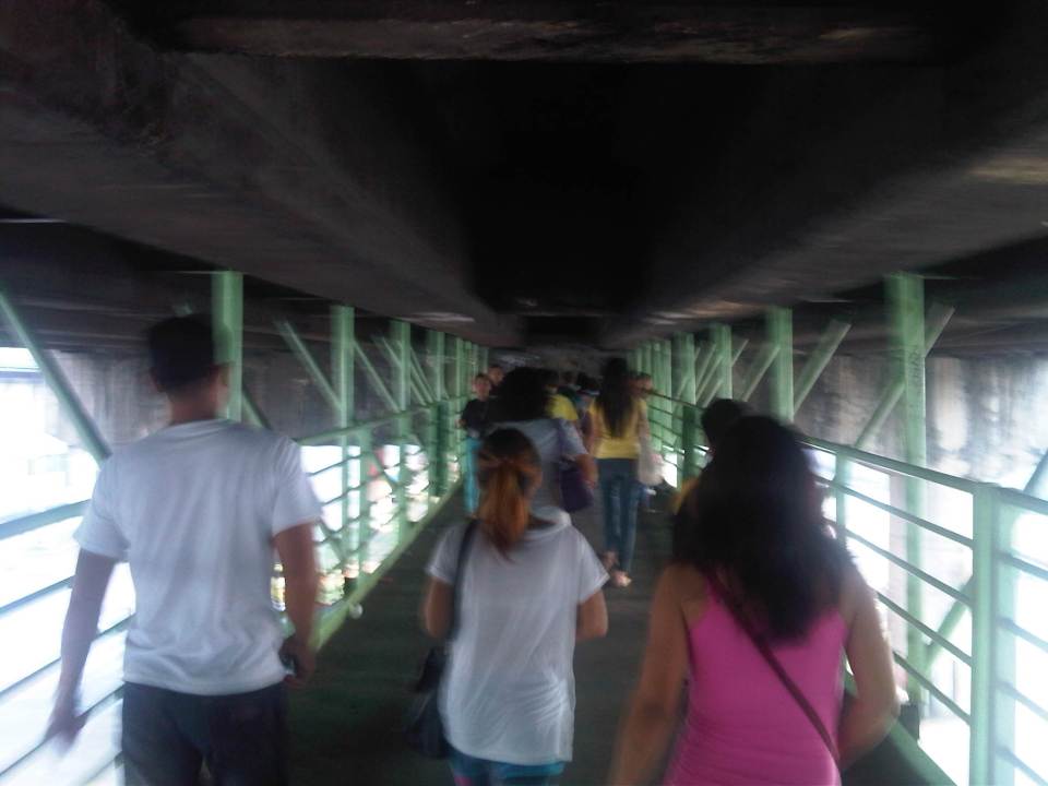 Pedestrians along the walkway hanging from under the Aurora-Katipunan flyover. The walkway is quite stable and there are no noticeable movements in the structure even with significant pedestrian traffic.
 Pedestrians descending the stairs towards the informal terminal for Rizal and Marikina-bound jeepneys.
 Informal terminal for Rizal and Marikina-bound jeepneys.
This could have been a different commute if the LRT 2 terminated in Masinag instead of at Santolan. I could have been taking the trains instead of the jeepneys for one leg of my commute. I still look forward to the day I would be taking the trains and am constantly frustrated by the inaction of those responsible for public transport in Metro Manila and this particular corridor.
–
Getting reacquainted with the JR lines in Tokyo
My recent trip to Tokyo allowed me to re-charge the wife’s and my Suica cards. We got these when we were in Japan in 2008 and rode mainly Japan Railways (JR) trains between our hotels and various destinations in Tokyo, Yokohama and Kamakura. I also used the JR Keihin Tohoku Line for trips between Saitama and Yokohama during the weekends when I would hear Mass at Yamate and then go around Minato Mirai, Shibuya, Ueno or Akihabara. It was easy for me to get reacquainted with commuting with the JR trains. It’s probably because it was so easy commuting in Japan and nothing much has changed in terms of the transport system. This is proof of an efficient public transport system and one which I have also used in Singapore and Hong Kong. Hopefully, we can have at least a bit of this efficiency in public transport and commuting in Metro Manila.
 JR East railway map for Tokyo Metropolitan area and environs (available for download in the internet)
 I found an improved/renovated JR Akihabara Station when I was in Tokyo in July.
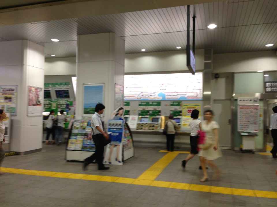 Ticket machines at the JR Okachimachi Station are bilingual. One just has to press the button for English translation/option.
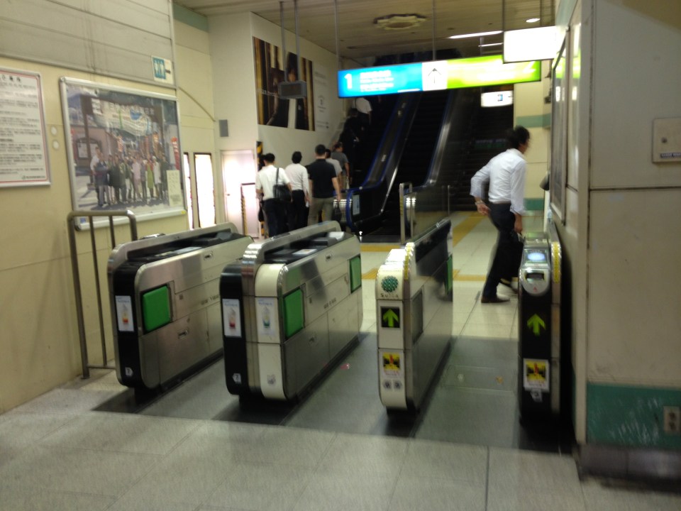 Turnstiles at a JR station
 Coin lockers at a JR station allows travelers/commuters to leave their things while going around for business, shopping or other purposes. A traveler heading to the airport, for example, who wants to do some last minute shopping may want to leave luggage using the larger lockers so he/she won’t have difficulty moving about.
 There are small restaurants and shops around JR stations. This one is a ramen shop frequented by commuters with a ticket dispensing machine to expedite orders. One purchases tickets for meals and drinks using the machine and presents the tickets to the staff inside the restaurant.
I hope to be able to go around my old haunts in Yokohama the next time I’m in Japan. Perhaps I can take a few photos then about transport in a country where I spent some significant time over the past years.
–
Some thoughts on the issues on bus bans and terminals in Metro Manila
I had originally wanted to use “Clarifying issues on bus bans and terminals in Metro Manila” as the title for this post. However, I felt it was too strong a title, and one that would be more appropriate for a government agency like the MMDA or DOTC, or an LGU like Manila. More than fault-finding and criticizing government agencies and local governments, I believe we should take a closer and more objective look at the issues (or non issues?) pertaining to the Manila bus ban and the opening of the southwest provincial bus terminal for Cavite-bound buses. Following are my comments on issues raised the past weeks about the two initiatives.
Issue 1: There were no or few announcements about the implementation of the bus ban in Manila and the southwest terminal in Cavite.
Comments: While the bus ban in Manila came as a surprise to many, the move was actually a consequence of a Manila City Council resolution. Normally, such resolutions would take time to implement and would entail announcements for stakeholders. Though we will probably never know the truth or who is saying the truth about the resolution and its implementation, it is likely that bus operators already knew about the implications but decided to call Manila’s bluff and play the media and public appeal cards rather than comply with Manila’s requirements for franchised buses and terminals as they have done before in other issues like fuel prices and fare hikes.
I find it difficult to believe that the MMDA did not do its part in announcing the opening of the southwest terminal. Perhaps people thought the announcement was over a very short period? Or maybe people didn’t mind the announcement and are also at fault for paying no or little attention to the announcement? If so, then the public is also partly to blame for disregarding the announcement from the MMDA, assuming the agency won’t push through with its initiatives to implement central terminals for buses. Next up will be another southern terminal at Alabang and a northern one near Trinoma.
Issue 2: Poor transfer facilities and services including a lack of pedestrian facilities between the bus terminal and transfer point, and lack of public transport like jeepneys to ferry passengers to their destinations.
Comments: I think it’s quite clear that the MMDA and LGUs are at fault here. Despite the construction and scheduled opening of the southwest terminal, there have been limited effort in improving pedestrian facilities. Such facilities needed to be in place prior to or upon the opening of the southwest terminal and requiring all provincial buses to terminate at the facility instead of continuing to Metro Manila. People-friendly facilities could have helped people in adjusting to the new policy though walking from 100 to 200 meters is certainly not for all, especially during this rainy season. Senior citizens and persons with disabilities (PWDs) would have specific needs that could have been addressed from day one of operation of the terminal. One approach to “bridge the gap” between the terminal and where people could take city bus and jeepney rides could have been to modify some city bus and jeepney routes to make these closer to the terminal. Ideally, the terminal could have been an intermodal facility providing efficient, seamless transfers between modes of transport.
In the case of Manila, the jeepneys were already there with routes overlapping with buses but their numbers and capacity could not cope with the demand from the buses. Since the main objective of Manila was to weed out colorum buses, it could have coordinated with the LTFRB to check the registration and franchises of buses rather than generalizing among all buses. Perhaps Manila just wanted to make a big statement? But then this was at the expense of the riding public, which obviously got the attention of many including the media. Coordination among agencies and LGUs, however, has not been a strong suit for these agencies, and this thought leads us to the next issue.
Issue 3: Lack of coordination among LGUs and agencies in implementing transport schemes.
Comments: This issue is an enduring one and has been the topic of discussions, arguments and various fora for as long as we can remember. On one hand, the DOTC and the LTFRB should provide guidelines and guidance to local governments on transport planning and services. The agencies should be proactive in their engagement of LGUs in order to optimize transport services under the jurisdiction of national agencies and local governments. On the other hand, LGUs must accept the fact that most if not all of them are ill equipped or do not have the capacity nor capability to do transport planning much less addressing issues regarding public transport. Citing the Local Government Code and its devolution of local transport to LGUs everytime there’s a transport issue certainly won’t help LGUs solve their problems.
Issue 4: Terminals required for city buses in Manila.
Comments: There should be a terminal for city buses in Manila but not a terminal for each company. There should only be one or maybe two terminals where buses can make stops prior to making the turnaround for the return trip. There is actually a terminal in Manila, which the city can start with for city buses. This is the one just beside the Metropolitan Theater and near City Hall, which can be utilized by city buses. It is also close to the LRT Line 1 Central Station so the facility can be developed as a good intermodal terminal for land transport.
Issue 5: Colorum or illegal public transport vehicles in Manila
Comments: This is actually a problem not just for Manila but for the rest of Metropolitan Manila and the rest of the country. The colorum problem is there for both conventional and paratransit services as there are illegal buses, jeepneys, UV express, multicabs, taxis, tricycles and pedicabs everywhere. Many of these are allegedly being tolerated by national agencies and local governments with many allegedly being fielded or owned by public transport operators themselves.
–
In most cases, the best time to evaluate a traffic policy or scheme is NOT during its first days or weeks of implementation but after a significant time, say at least a month, after it was implemented. This is because the stakeholders, the people involved would take some time to adjust to any scheme or policy being implemented. This adjustment period will vary according to the magnitude or scope of the scheme/policy and can be quite “painful” to many who have gotten used to the old ways. Usually, a lot of comments and criticisms are quite emotional but it is clear that the collective sentiment is the result years or decades of poor transport services and fumbling by government agencies. Transport in Metro Manila is already quite complicated with routes overlapping and services competing with each other for the same passengers. Perhaps it is time to simplify transport while also in the process of optimizing and rationalizing services. I have written about this in this previous post.
More transport issues in Manila will come about should the city train its attention on other modes of transport including jeepneys, UV express vehicles, tricycles, pedicabs and kuligligs. If the city is really intent on reforming transport services within its jurisdiction, it should consider the needs of all stakeholders and especially and particularly the riding public. Transport should be inclusive, people-friendly as well as environment-friendly and there are many good practices in other cities that Manila could refer to and study for adaption and adoption for the city. If it is successful in improving transport, then perhaps Manila could be the country’s model for transformation from being the “Gates of Hell” to being a “Portal to Heaven” to residents and visitors alike.
–
Reviving the Pasig River Ferry, again
The Pasig River Ferry is in the news again as a major corporation considers reviving the ferry. I’m just not so sure about their motivation for this as what I’ve read on news media seems to say that their plan for reviving the ferry service is linked with their real estate projects, especially one in Manila that’s shaping into Circuit Manila, on land that used to be the Sta. Ana race track. The nearest ferry terminal or station would be the Valenzuela ferry terminal, which is accessible via S. Osmena St. The same street connects to Makati City Hall. Public transport should be service oriented, which the main reason why many public transport systems, particularly rail transit, losing financial ventures and have to be subsidized by governments around the world. But note that I mentioned “financial” in the previous statement because there are definite and established benefits from economic perspective. I’m giving the benefit of the doubt, however, in so far as the track record of the company gives us hope that their entry would be good from the management and marketing perspective of the ferry system. A successful venture here would prove the viability of a water-based system that has so much potential considering it could connect Manila, Makati, Mandaluyong and Pasig directly with other towns of the provinces of Rizal and Laguna around the Laguna De Bay.
 There are many informal settlers along the stretch of the Muelle del Rio (now also known as Riverside Drive) from MacArthur Bridge to Plaza Mexico in Intramuros. Several families can be seen living under the bridges or with their carts along the linear park.
 The Plaza Mexico Station of the Pasig River Ferry
Reviving the Pasig River Ferry would take a lot of effort and that effort does not yet include the marketing required to attract passengers for the ferry. Of course, one way to promote the use of the ferry is if people can be convinced that using it could cut down their travel times between origins and destinations. While the ferry may provide a more direct route along the river, connectivity with other modes of transport (e.g., road public transport) and pedestrian facilities should increase ridership. Needless to say, affordability (i.e., fare rates) and safety/security are essential components for an attractive mode for commuting. The tourism aspect would just be a bonus in terms of users.
–
