
Home » Railways (Page 13)
Category Archives: Railways
PNR Espana
While inspecting the installation of flood sensors along Espana a few weeks ago, I wandered off our site between Antipolo and San Diego Sts. to take a few photos of the PNR trains and the PNR Espana Station surroundings.
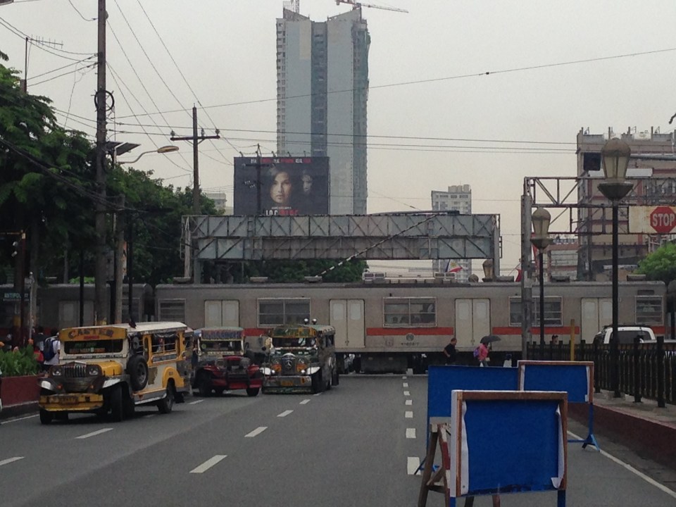 A PNR train crosses Espana as road vehicles and pedestrians pause to let the train through. One barrier is shown in the photo as not being able to go down completely to block traffic from the other side of Espana.
 A pedestrian crosses the PNR tracks as vehicles run along Espana
 The PNR Espana Station as seen from along Espana. People usually cross the tracks casually as there are few trains in operation along this line.
–
Anxious about the LRT Line 2 Extension
Among the overdue projects that have generated much attention and, quite recently, some excitement is the extension of the LRT Line 2 from the current end station at Santolan, Pasig to Masinag Junction in Antipolo. This is a 4 kilometer stretch that has been viable for quite a long time now but somehow has not been constructed for various reasons. It was among the low hanging fruits that the current administration should have picked that could have been completed and operating now if it were started sometime 2011 (i.e., factoring in the transition in government after the 2010 Presidential elections). For some reason, government officials had to get proof that there was passenger demand for the extension by considering having another study undertaken just for this purpose. As I’ve mentioned before, one only needs to observe the situation at Santolan Station and perhaps the Sta. Lucia/Robinsons Metro East area to understand just how many people will benefit from the extension to Masinag. I would even dare say that you can even justify extending the line further to Cogeo. Following are a few photos I recently took along Marcos Highway along with some comments pertaining to the Line 2 extension construction.
 Soil testing site along Marcos Highway in Pasig City – these activities preclude the designs for the superstructure, which include the elevated tracks and the stations (there will be 2) along the Line 2 extension.
 Another soil test site – each location roughly correspond to the location of the columns that will be constructed to support the elevated tracks and stations.
 Scenes of overloaded jeepneys should no longer be the norm once the Line 2 extension is completed. However, such would probably be common for jeepneys coming to or from the last station at Masinag. There are no other choices for people taking public transport beyond Masinag except jeepneys bound for destinations like Antipolo Simbahan, Cogeo, Tanay and Marikina.
 Pedestrian overpasses such as this relatively new one near the Filinvest East main gate would have to give way to the elevated Line 2. Another option is for this and other overpasses to be reconfigured with respect to the future line. I just hope this will be done with utmost care so we won’t have overpasses similar to those along EDSA that go above or below the elevated tracks of the MRT 3.
 This overpass will like be removed to give way to the future end station of the Line 2 extension. The overpass in front of SM Masinag will have to be integrated with the station to be located in this area.
–
Daang Bakal and Antipolo’s attractions
I recently wrote about the old railway line that used to run between Manila and Antipolo via a route passing through the town of Cainta that used what was probably the gentlest slope at the time – through what is now Valley Golf, Victoria Valley and Fairmont Subdivisions. Here are some more photos along Daang Bakal, the old Manila Rail Road line that is now a road.
 Daang Bakal is a scenic route and one can only imagine how this place looked like when it was still a railway line and the areas along it were still undeveloped.
 Hinulugang Taktak has been designated as a National Park and the areas along Daang Bakal at least have been preserved. Users of this road are quite limited to residents of exclusive subdivisions with gates along the road and trips generated by the Immaculate Heart Parish near the Fairmont gate. Public transportation is provided by tricycles that have a terminal at the intersection of Daang Bakal and Taktak Road.
 The temporary fence that was made out of tarpaulin material is now in tatters. There is road construction work ongoing though but mainly for the access roads connecting to Pinagmisahan. The concreted area at the right side of the road in the photo seems to be for parking rather than road widening. Traffic is low along Daang Bakal and will probably not require road widening for the foreseeable future.
 The main entrance and facilities for Hinulugang Taktak are still closed and there seems to be no activity to indicate that the rehabilitation project is not moving at all.
–
Daang Bakal
The right of way for the old railroad line going up to Antipolo is still there and is now a regular road. Daang Bakal rises from what is now Valley Golf Subdivision (Celso Tuazon Ave. and Taktak Drive) in Cainta, Rizal through Victoria Valley Subdivision (Taktak Drive), Fairmount Hills Subdivision and Hinulugang Taktak (Daang Bakal though often referred to as Taktak Road, which is actually a different road and on the other side of the river), and until part of the Sumulong Memorial Circle in the vicinity of the Antipolo Church (Shrine of Our Lady of Peace and Good Voyage). I took a few photos of Daang Bakal on our way to the Parish of the Immaculate Heart of Mary for Palm Sunday Mass. The photos have been modified as I took it at dusk. The originals were quite dark so I adjusted the brightness. Still, I can only imagine now how this route could have looked like back in the day when the Manila Rail Road line passed through this area. It could have been one of the most scenic rides as it is still a scenic route today.


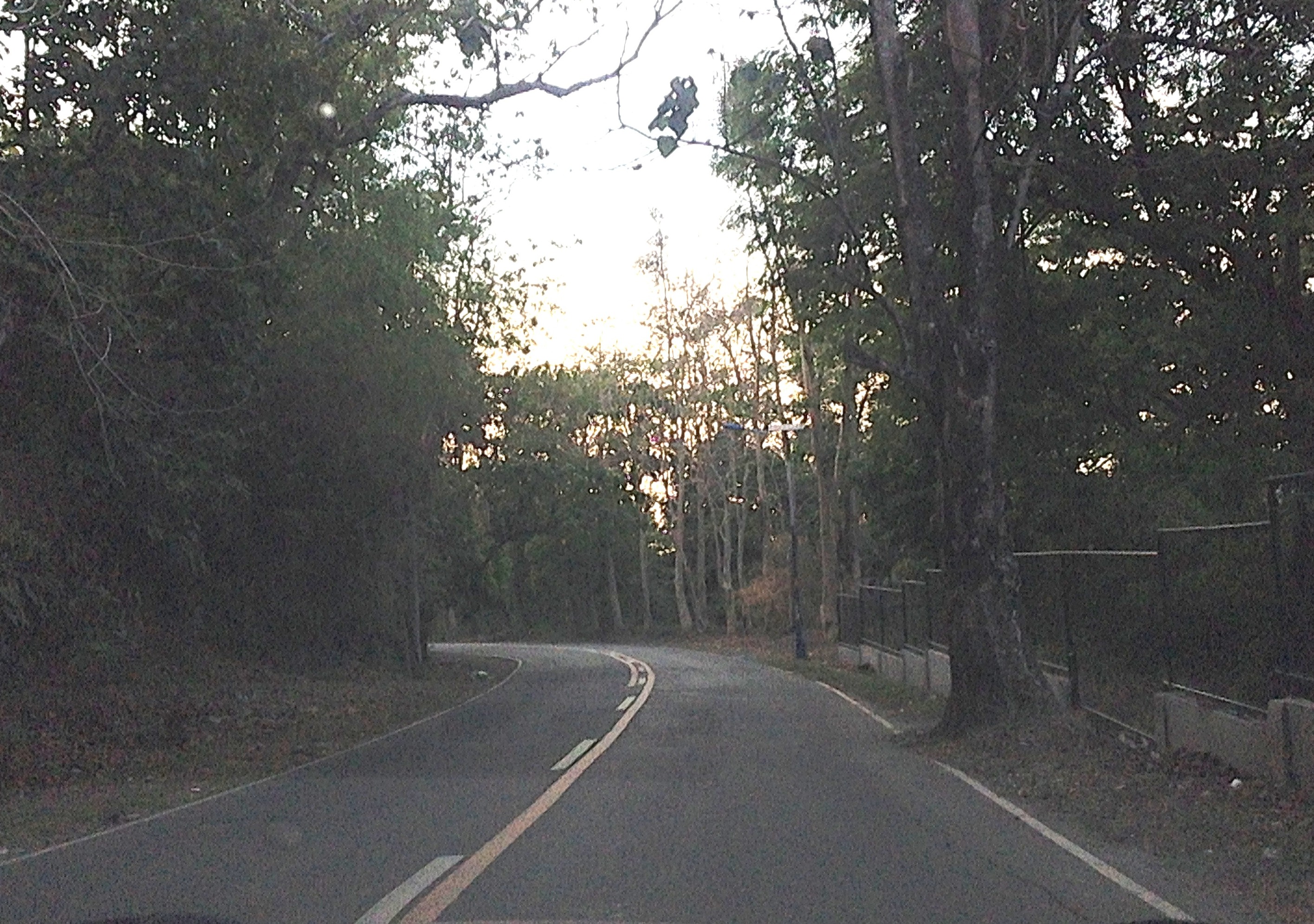
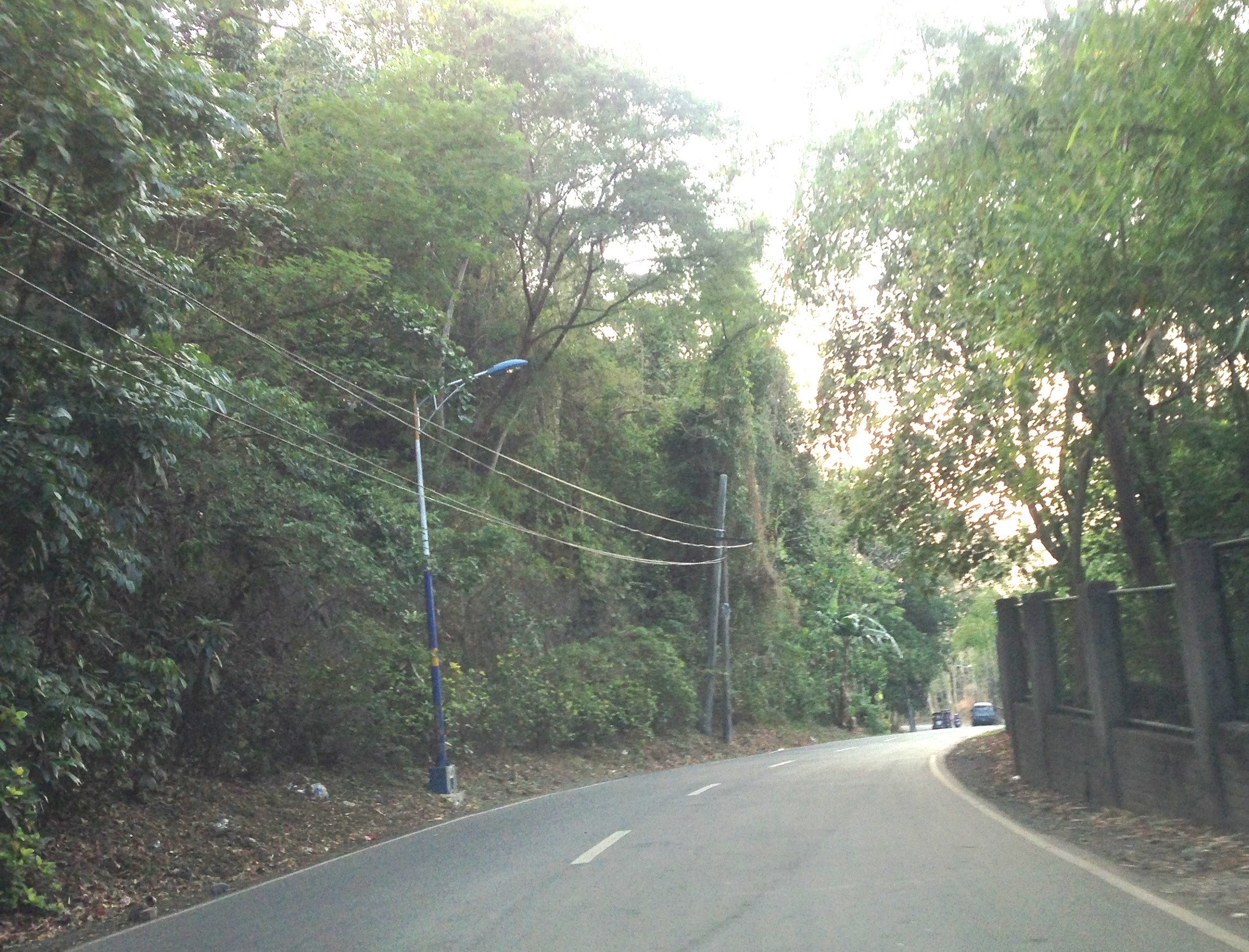
At right in the photos is a fenced property designating the Hinulugang Taktak National Park. Hinulugang Taktak refers to the water falls that used to be one of the more popular destinations in Antipolo. There is actually a popular folk song inviting people to come to Antipolo (“Tayo na sa Antipolo at doon maligo tayo…”) to enjoy the falls. The falls have deteriorated through the years as it has been affected mainly by the settlements around it. There seems to be an effort to rehabilitate the area but it is still closed to the public. The road though is in excellent condition and has low motor traffic volumes. It is popular among cyclists as well as joggers. This Holy Week, the area should have a lot of visitors because of the Parish church in the area, which has an impressive architecture and gardens. The church is perfect for those doing Visita Iglesia or perhaps people just wanting to go to a quiet place for some meditation and prayer.
–
Identifying opportunities with the MRT 7 and the LRT 1 extension
As we welcome 2014, we also look forward to major projects that will help alleviate transport and traffic problems in our cities and elsewhere in the Philippines. With the approval of the MRT 7 and LRT 1 south extension projects late last year, there should be less impedance to these much-delayed projects starting construction within the current term. These lines should have been built way back, – “ideally” in the 1980s, “practically” in the 1990s, and “urgently” in the last decade. At this time, I think the need for these lines are beyond urgent. I think perhaps we have reached the state of “desperation” is so far as mass transportation is concerned for Metro Manila and its surrounding cities and municipalities.
 MRT 7 map from a public presentation made by the line’s proponents about 5 years ago.
Opportunities that can be related to the MRT 7 and LRT 1 lines include land development that fall under the category of transit oriented development (TOD). I think the government should not be too dependent on the private sector for developments around and near the future stations of the rail lines. The prevailing assumption that the private sector will do what’s best is only applicable to themselves and not the public good. Note the difference between perspectives here where it is only to be expected that private companies will be concerned with their own bottom-lines, i.e., revenues generated towards the maximization of profits. Economic benefits are and should be treated or regarded differently from such a perspective. The latter is the responsibility of the government as it concerns the public good and interest, and with a more macroscopic and strategic scale, with a long-term vision for development.
One such opportunity concerns informal settlers and their resettlements to areas outside the CBDs. Why do these people keep on returning to the cities when they are already supposed to have been provided housing elsewhere (e.g., Bulacan, Laguna, Cavite, Rizal)? The answer seems almost automatic: they don’t have the means for livelihood where they have been relocated and access to basic services and jobs/workplaces is limited (i.e., very difficult). The government must be involved and very deliberate in developing lands for housing around or near rail stations such as those for the future MRT 7 development. It cannot rely on the private sector to push for public housing when, frankly, those companies are driven by their desires to maximize their profits rather than push for the public good. That’s a bit of reality that we must accept and we must factor in decision making. The government already lost a huge opportunity when the National Housing Authority (NHA) effectively gave away prime lands in Quezon City for an upscale development. I leave it up to the reader to check the mandate of the NHA. It could have pushed instead for a development much like the HDBs in Singapore, which are not located in the boondocks but in prime locations in the city state. It need not be purely residential but a healthy mix of commercial development should be pursued along the lines of equitable transit oriented development (TOD).
Note that it should be clear here that when I say public housing this does not necessary mean the mass housing or low cost housing we tend to associate with failed projects in the peripheral provinces to Metro Manila. These are more like multi-level, medium to high rise developments you now find in major cities in Japan, China, Thailand and Singapore, which can be the model development for replication in other cities around the country. These can be reasonably priced units that can be affordable in terms of payments over a reasonable period of time. The concept is not new as there have already been BLISS projects before and Quezon City continues to collaborate with private sector for projects like Smile, Sunny Villas and the current Bistekville. These should be extended not just to your middle class and upper class (yes, they do make investments and have their units rented out to derive income) but formulated for the lower income classes (e.g., informal settlers), which now occupy much lands with their shanties. “Formalizing” these settlements should be a priority and the best locations for such developments, I think, should be around stations. Of course, there should be clear rules regarding the neighborhood and these rules should be strictly enforced for the buildings and area to keep their integrity (e.g., no extensions to the balconies or windows).
The concept and application of land-banking is not new and has been used by the private sector especially major developers like Ayala Land, Filinvest, Sta. Lucia, SM and Robinsons. Properties are acquired based on criteria regarding their potential for development. These lands are usually of low value and in many cases the land use need to be changed in order for these to be developed (e.g., agricultural lands being converted into residential, commercial or industrial uses). The national government and local government units should also do land-banking perhaps to address issues, for example, on informal settlers. And land banking should be along transit lines that are being planned (e.g., in Bulacan for MRT 7, in Cavite for the LRT 1 Extension, in Rizal for the LRT 2 Extension, and in Laguna for the PNR Commuter Line) so that issues pertaining to access to jobs, education and other services can be addressed by such transport infrastructure.
We look forward to the government realizing such opportunities that have for so long been available yet it has not taken into serious consideration. These require both strategic and practical thinking to be able to undertake master planning for such developments and their implementation over the immediate to long terms. No easy task but if our leaders are focused and determined to see these through, there’s no reason why these cannot be implemented and operational soon. Hopeful we are for these things this 2014.
Happy New Year!
–
Crowded EDSA MRT 3 stations
There have been a lot of posts on social media about the very crowded MRT and LRT stations. These posts are not new and the situation is not because of the Christmas season when a lot of people seem to be out and about the entire day, many doing their shopping. In fact, the stations have become very crowded mainly due to the increasing number of people taking the MRT and LRT lines. Unfortunately, the LRT 1 and MRT 3 stations were not designed to handle so many people. Only LRT 2 stations, which were designed like metro or subway stations in Singapore and Japan, seem adequate for its passengers.
Below are two photos taken by a good friend, Raul, who is a regular user of the MRT 3. He took these photos sometime September of this year while heading home from his workplace. The photos don’t lie about the platforms being filled by people so much so that there’s a big risk of an incident occurring when people might fall off the platform. So far, there has been none reported. But of course, we don’t want such accidents to occur despite the conditions indicating one or more are likely to happen sometime soon if precautions are not taken.
 One cannot tell arriving from departing passengers except maybe by the direction they are going at the stairs to the platform at an MRT station.
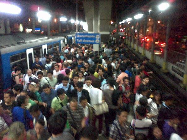 “Walang mahulugan ng karayom” translates into “nowhere a pin can be dropped” is a saying that is apt to the very crowded platform of the MRT 3’s Boni Avenue Station. Meanwhile, the conditions inside the trains are said to be like “sardines in a can.” I have even heard some of my students say it is more like “corned beef in a can” to describe how packed trains are during peak periods. I have experienced riding trains during the peak hours in Tokyo and Singapore and the experiences of my friend who took these photos (who also studied in Japan) are pretty much the same.
The obvious issue aside from platform capacity is the fact that the MRT and LRT lack the rolling stock (i.e., cars or trains) to increase their frequencies of service (or reduce the headways between trains). They cannot lengthen their trains also because they are limited by the lengths of the station platforms. It doesn’t take a genius to determine how many units more the LRTA and MRTC need to add to the rolling stocks of LRT 1 and MRT 3 to improve their services. It is also imperative that the stations be improved, perhaps re-designed, to accommodate more passengers with more sophisticated fare machines and turnstiles, and longer, more spacious platforms. This is something that could have been anticipated by the agencies responsible like the DOTC, LRTA and MRTC years ago. For some reasons, however, there have been no significant actions regarding these transport needs. The end result is what we now see as the supply side of transport being inadequate for the increasing demand.
There are many questions that commuters are asking regarding this situation with the LRT and MRT. The biggest seem to be about when the government will finally act on the issues mentioned. Is this something that requires Public-Private Partnership (PPP)? Is the government reneging on its responsibilities by not investing in mass transit? What can be done in the immediate term? Hopefully, these questions will be answered soon and agencies will have the sense of urgency to address the needs of the commuting public.
–
On vending machines at rail station platforms in Japan
Earlier, I featured some conveniences at train stations that included vending machines on the platforms. Following are a few more photos including a couple showing the newest models of vending machines. These have touch screens showing the products for sale and even shows weather forecasts.
 Passengers using the new touch screen vending machines at a JR Line platform.
 The screen displays products as well as the weather forecast. On the right are disposal bins for bottles and cans.
 Conventional vending machines and trash bins at the Enoshima Dentetsu platform.
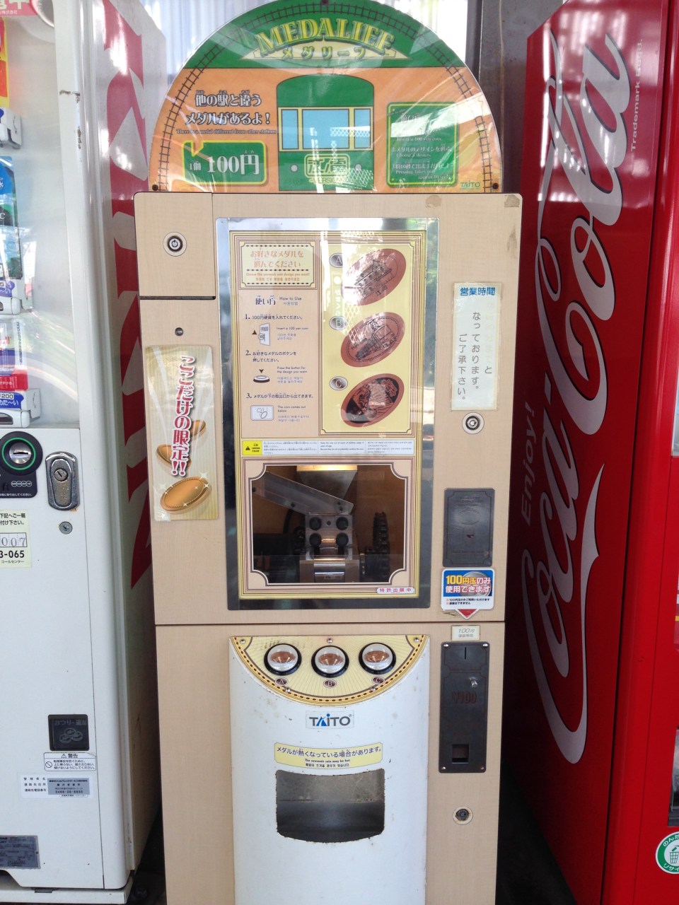 A souvenir machine featuring a metal press where the customer can choose among 3 designs.
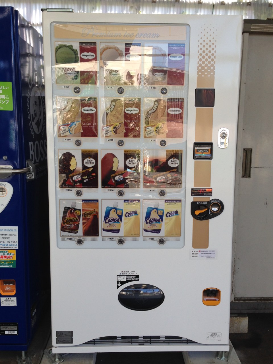 Ice cream vending machine.
–
Conveniences at the train stations and platforms
Japan is also famous for having a lot of vending machines dispensing everything from snacks, softdrinks and beer to toys and electronics, and even shirts and underwear! At the train stations there are also many vending machines in addition to the kiosks that are basically convenience stores. Here are a couple of vending machines and the garbage disposal bins beside them.
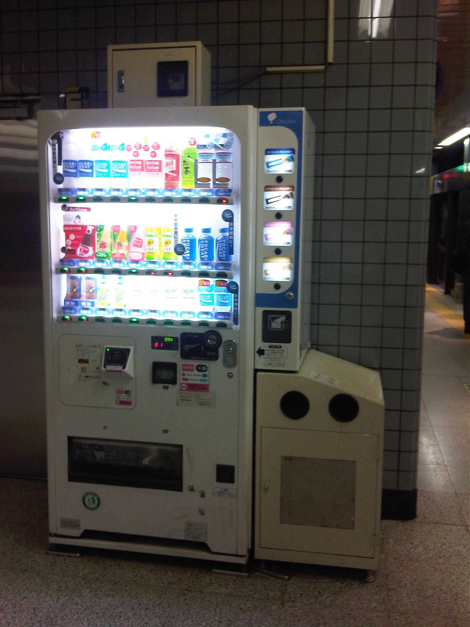 Vending machine at a Tokyo Metro platform
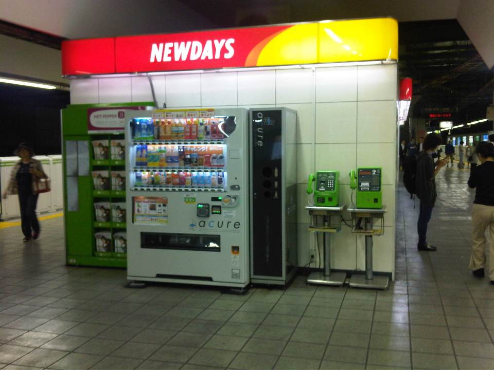 Vending machine and telephones behind a kiosk at a JR Line platform
Within the larger stations, there are also restaurants or eateries for those wanting a quick meal but happen to have already gone past the turnstiles. These are not your typical holes in the walls or fast food types. Instead there are also full service restaurants or cafes. Then there are food courts where commuters may have a good variety to choose from like the Tokyo Food Bar that I found at the JR Akihabara Station.
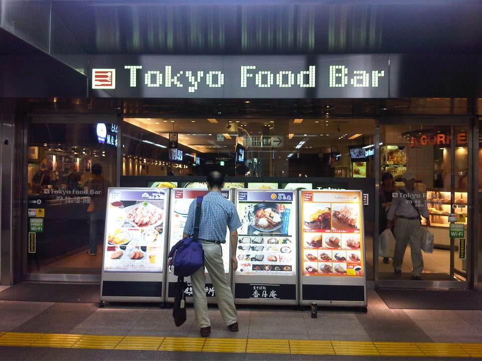 This food bar is very much like the food courts we find at malls. These offer a variety of selections for the hungry commuter. The signboards show the menus of establishments inside the food bar.
–
Rail incidents
The big news in Japan today seems to be the rail incident where a woman saved the life of a man who attempted suicide or fell unto the rail tracks of the JR Yokohama Line. Unfortunately, the woman died as she was ran over by the train as she apparently positioned the man in between the tracks. As far as I could understand, it seemed that the barriers for a crossing were already down and the alarms announcing the arriving train were also engaged when a man entered the danger zone and fell (or laid) at the tracks. People including pedestrians and those in their cars were shocked by the situation but only the woman who was with a companion in a car decided to act to save the man from the oncoming train. Following are photos I took from a TV news report on the incident.
 Simulation of train operations using JR East’s simulator to review what could have happened
 Demonstration of train approach to station
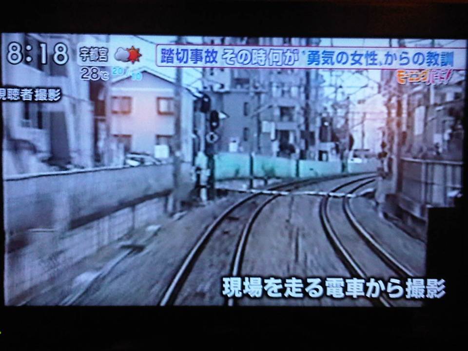 Footage of the crossing where the woman perished.
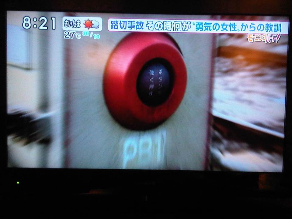 Emergency button that was supposed to be used by people in exactly such cases but people were apparently too shocked or unfamiliar with this safety device at railway crossings.
 Demonstration of the ill-fated rescue
 Photo of the heroine who, if I understood from the report, will be awarded posthumously for her effort to save another person.
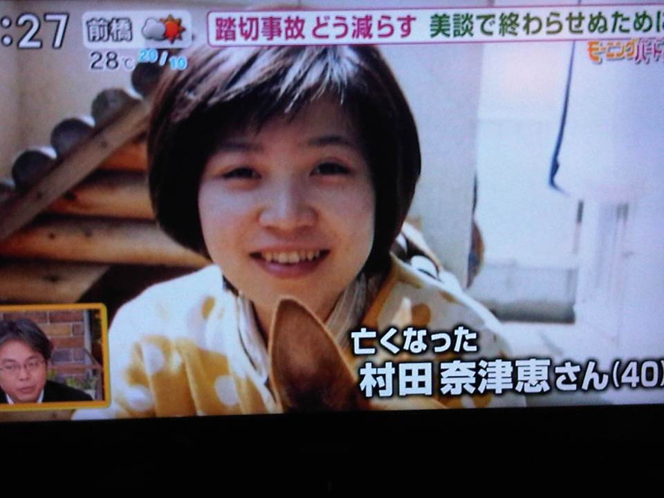 Another photo of the 40-year old woman, Murata-san.
Japan takes pride in their work towards making their transport systems safe. Rail incidents have been minimized by using modern, high technology tools including sensors and monitoring systems. However, it seems that there are cases such as these where the intervention of people (including those who might be spectators of an incident) are still necessary as these are likely beyond the capabilities of even high tech countermeasures installed at rail crossings. We salute and honor this woman who was willing to help another person at the cost of her own life. She deserves the honor and recognition for this great humanitarian act.
–
Getting reacquainted with the JR lines in Tokyo
My recent trip to Tokyo allowed me to re-charge the wife’s and my Suica cards. We got these when we were in Japan in 2008 and rode mainly Japan Railways (JR) trains between our hotels and various destinations in Tokyo, Yokohama and Kamakura. I also used the JR Keihin Tohoku Line for trips between Saitama and Yokohama during the weekends when I would hear Mass at Yamate and then go around Minato Mirai, Shibuya, Ueno or Akihabara. It was easy for me to get reacquainted with commuting with the JR trains. It’s probably because it was so easy commuting in Japan and nothing much has changed in terms of the transport system. This is proof of an efficient public transport system and one which I have also used in Singapore and Hong Kong. Hopefully, we can have at least a bit of this efficiency in public transport and commuting in Metro Manila.
 JR East railway map for Tokyo Metropolitan area and environs (available for download in the internet)
 I found an improved/renovated JR Akihabara Station when I was in Tokyo in July.
 Ticket machines at the JR Okachimachi Station are bilingual. One just has to press the button for English translation/option.
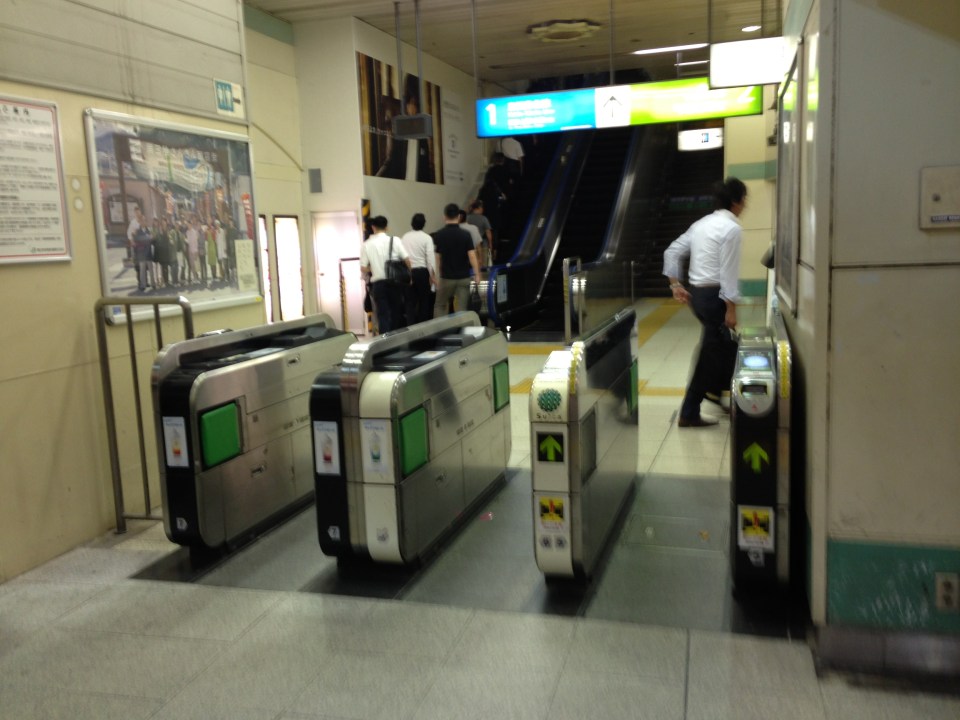 Turnstiles at a JR station
 Coin lockers at a JR station allows travelers/commuters to leave their things while going around for business, shopping or other purposes. A traveler heading to the airport, for example, who wants to do some last minute shopping may want to leave luggage using the larger lockers so he/she won’t have difficulty moving about.
 There are small restaurants and shops around JR stations. This one is a ramen shop frequented by commuters with a ticket dispensing machine to expedite orders. One purchases tickets for meals and drinks using the machine and presents the tickets to the staff inside the restaurant.
I hope to be able to go around my old haunts in Yokohama the next time I’m in Japan. Perhaps I can take a few photos then about transport in a country where I spent some significant time over the past years.
–
