
Home » Traffic Congestion (Page 18)
Category Archives: Traffic Congestion
Sound bites on transport and traffic
If there was one thing I both dreaded and enjoyed during my 6-year stint as head of UP’s National Center for Transportation Studies, it is granting interviews to the media. My predecessors warned me about how some media outfits have been notorious for editing interviews to suit their needs. In certain cases, they are alleged to have spliced recordings that if taken as is would have been boring or not quite informative in order to have material that were more sensational. There are features, for example, where it seems interviewees were responding to the each other’s opinions making it look like they were arguing. And then there are those where certain statements are taken out of context when cut from a long explanation in the actual interview that took place.
I think I tried my best to be careful about what I said and how I explained or related things in my interviews. I looked at interviews as a way the Center could reach out and advance its advocacies. These were opportunities to spread the message of sustainable transport, to educate and inform officials and the public about what we should aspire and work hard towards achieving in transport and traffic. I think we had to be both progressive and aggressive with our messages because it was our duty, our responsibility not just to do research and train people but also to inform and educate people about sustainable transport. Popular mass media is an effective way to do this and we should be engaging but careful about our messages in order to be constructive and fair.
The last news interview I had before finally being relieved of being holdover Director for a month after my term ended was with GMA News. I like this interview about traffic congestion because I was able to put in some of the ideas that people in the forefront of sustainable transport have been preaching and practicing. These include the truth that in developed countries and cities, the wealthy take public transportation and that in order to improve public transportation, decision makers should themselves experience commuting.
These are not new ideas and I have to be clear that these were not my original ideas but those that I have come to embrace and advocate. I truly believe that if we don’t take public transportation, walk or cycle, we can’t really have a clear picture of what our cities need in order to solve the traffic mess and come up with services that are safe, efficient, inclusive and equitable.
The feature appearing on Jessica Soho’s State of the Nation on Channel 11 from the GMA News website.
The same report that appeared in the primetime 24 Oras:
–
Completed Quezon Avenue-Araneta Avenue underpass
The underpass along Quezon Avenue at its intersection with Araneta Avenue was finally completed and opened to traffic last September 28, 2012. It is perhaps one of the most anticipated inaugurations of infrastructure for Metro Manila and not an anti-climactic one like what was hyped as the completion of the loop formed by MRT3 and LRT1 a few years ago. That didn’t turn out well as we now know there is no loop at all with real connection of the two rail lines. But that, as they say, is another story worth another post or two.
Based on reports from different people including our office’s drivers and some colleagues, traffic has significantly improved in the area. The only joke going around is if the underpass will not be a catchment for floodwaters should there be strong rains considering that it was flooded during construction due to its proximity to the San Juan River and the perennially flooded areas of Talayan and Espana. There are, of course, pumps that have already been installed for the underpass to reduce if not eliminate the possibility of flooding. Following are a few photos taken one Saturday mid-morning when I passed along the area.
 A view of the approach to the underpass from Banawe. The pedestrian overpass is across Sto. Domingo Church.
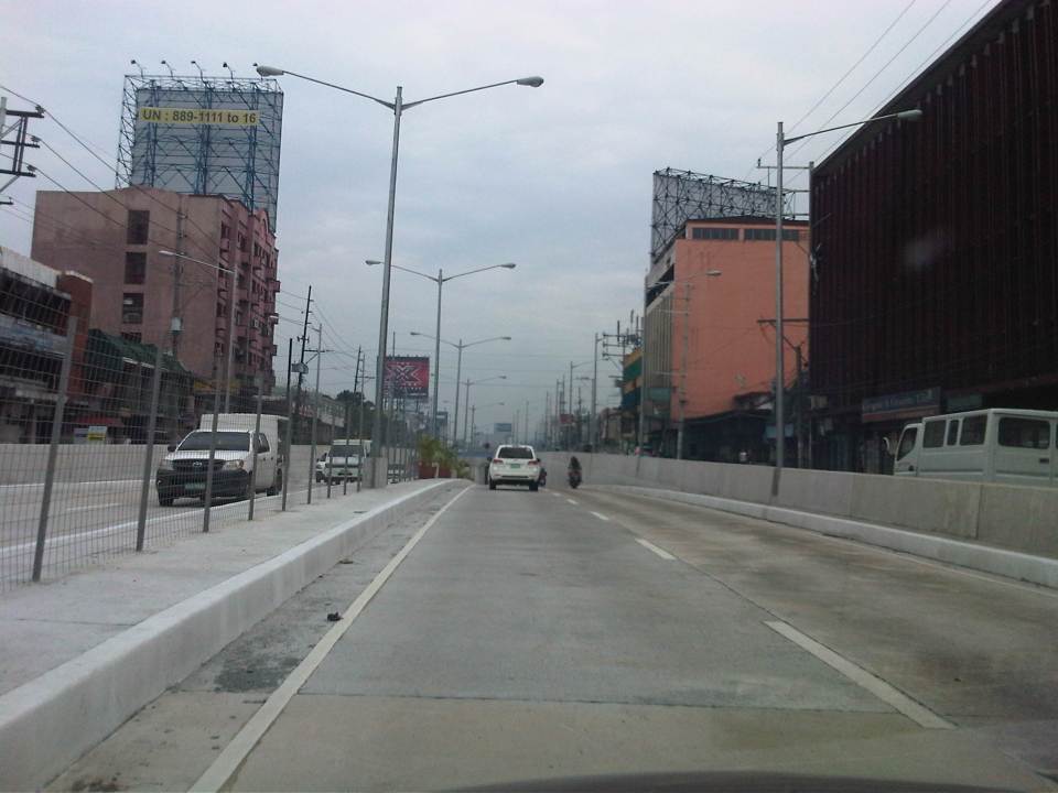 The section has 4 lanes with opposing traffic physically separated by a median island. The fence is likely to prevent jaywalking as well as maybe dissipate glare from headlights during night time.
 Potted plants have been placed along the median and though perhaps more are needed, I am glad there are no concrete balls that look like goat poop used to “decorate” the underpass. Columns and girders support the underpass walls at near the junction with Araneta Ave.
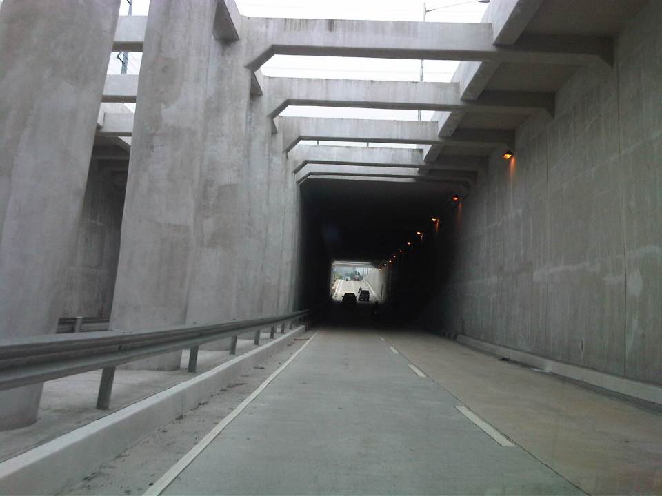 Approaching the section directly under Araneta Avenue, the first impression is that it is quite dark though motorists can see the end of the underpass. Pumps have been installed to drain water from this lowest parts of the underpass and prevent it (or reduced) from being flooded during times of strong rains.
 The end of the tunnel is practically a mirror image of the other. There are few potted plants as shown and perhaps more are needed to soften the look of the underpass as well as to reduce headlight glares.
 Back at-grade – emerging from the underpass, motorists will eventually merge with the traffic along the wide sections of Quezon Avenue. On the opposite direction, I noticed some congestion for vehicle emerging from the underpass as there is a U-turn slot a few meters from the ramp at the Banawe area.
There are traffic signals to manage flows at the at-grade junction of Quezon Ave. and Araneta Ave. It is expected that by reducing the volume of through traffic along Quezon Ave., the signals would be able to handle the remaining traffic and that the intersection will not be as congested as the case prior to the construction of the underpass. Of course, I would also like to see for myself how traffic is in the area during the regular weekdays, particularly on the typically busy days of Monday and Friday.
–
Loss of productivity due to congestion and inefficient public transport
I recently read two articles appearing in a major Philippine daily and a popular online site. The first one is an article that appeared in the Philippine Daily Inquirer – “PH economy losing $3.27B in human productivity due to traffic mess” – last September 25, 2012. The other article was posted on Rappler – “Traffic and infrastructure delays cost the Philippines” – last September 27, 2012. These were articles written after the authors’ attendance of what was an Energy and Infrastructure Forum last Sept. 25 where a transport official mentioned a recent study in his talk that estimates productivity losses of about 3.27B USD per year from Metro Manila traffic alone.
 Traffic congestion along Commonwealth Avenue
 Unusual traffic management scheme along Ortigas Avenue
The study from the National Center for Transportation Studies that was mentioned in both articles was actually first featured in a Yahoo! Philippines article – “Traffic congestion costs Metro Manila P137B per year” – that appeared a month earlier in Aug. 28, 2012. The study being referred to is actually a paper presented by Dr. Jose Regin F. Regidor in his Professorial Chair lecture at the University of the Philippines Diliman’s College of Engineering Colloquium in early August 2012. A copy of the paper may be found below:
Prof Chair 2012 JRFR 02July2012
The main reference for this paper is the study on congestion costs that was produced by the National Center for Transportation Studies back in 2000. Credits go to the core team of Dr. Ricardo Sigua (Institute of Civil Engineering of UP Diliman), Dr. Noriel Tiglao (now with the National College of Public Administration and Governance) and Dr. Val Teodoro (now in the US) for the study. The
Economic Impacts of Traffic Congestion in Metro Manila – Cover+Chap 1 and 2
Economic Impacts of Traffic Congestion in Metro Manila – Chap 3
Economic Impacts of Traffic Congestion in Metro Manila – Chap 4 and 5
Economic Impacts of Traffic Congestion in Metro Manila – Appendix
A much needed update may be possible in the next two years once the traffic model for Metro Manila is updated and calibrated using new data from Household Informations Surveys (HIS) and other transport and traffic surveys under the current MUCEP study that is supported by the Japan International Cooperation Agency (JICA). Hopefully, such a model can be updated and calibrated more often in order to assess losses due to congestion and our continuing inability to provide the necessary infrastructure to alleviate the situation. While the paper and the study mentioned above focus on productivity losses, it should be emphasized that there are other costs that should be highlighted including those related to health (respiratory diseases and road crash fatalities and injuries), energy (fuel consumption and inefficiencies), and emissions (carbon and other GHG).
–
Quezon Ave. underpass at Araneta Ave.: some expectations and issues
The underpass along Quezon Ave. at its junction with Araneta Ave. is set to open to general traffic this coming week. I got this from a reliable source who was involved in the project as well as friends from the DPWH and the MMDA. If the opening pushes through, the underpass is expected, based on analysis, to ease traffic along both major roads with Quezon Avenue’s through traffic having the most benefit from the uninterrupted flow provided by the underpass. At-grade traffic management at the intersection will still be provided mainly by traffic signals but the substantial reduction of traffic attributed to the through movements along Quezon Ave. The reduction of congestion comes as a relief to a lot of travelers as well as businesses affected by the construction of the underpass in the last year. Fortunately, there has been little delay in the construction and so it seems that lost times due to construction-related congestion (translated here as sacrifices for those who had to endure daily traffic congestion and had to adapt to the situation) will finally be compensated for. Many, indeed, have been anticipating the eventual opening of the underpass, expecting the facility to solve congestion in the area.
The area has been subject to flooding considering its proximity to the San Juan River. Official data for flood occurrences in the area can be accessed through the Department of Science and Technnology’s (DOST’s) Nationwide Operational Assessment of Hazards website where it is clear that flooding will be an enduring problem for the underpass and surrounding areas. Recent reports (from last week until today) indicate that there is still the specter of flooding that will have to be addressed given that prior to the construction of the overpass, this issue had already been flagged by various stakeholders including the Quezon City Government. It is for this reason that the underpass will have pumps to ensure that water will not accumulate and lead to the closure of the facility in times of heavy rains resulting in flash or regular flooding.
–
Predictability of school-generated traffic congestion
I have written about schools generating much traffic. The same characteristics of trip generation make congestion along streets affected by the schools quite predictable. For example, traffic congestion due primarily to the trip generation characteristics of schools along Katipunan Ave. may be observed during 6:30 – 7:30 AM as well as around 3:30 – 4:30 PM. The afternoon congestion though is exacerbated by the presence of significant truck traffic using C5 as part of their routes. Other cases would have similar predictability and I pointed this out to some guests while we were having a coffee break from our day-long meetings. The following photos were taken in the mid-afternoon and shows congestion along Ortigas Avenue in Mandaluyong City, including along an overpass affected by school traffic generation from a private school (the school is the one with the dome in the photo). Traffic is typically bad between 3:20 to 4:30 PM, after which it subsides until after 5:30 when the afternoon to evening rush from workplaces to homes take over much of the road space.
 View of the EDSA-Ortigas intersection showing the start of the build-up of traffic along the left turn overpass to Greenhills on the left side of the photo.
 View of the same flyover at around 3:36 PM. Note the long queue along both lanes of the overpass.
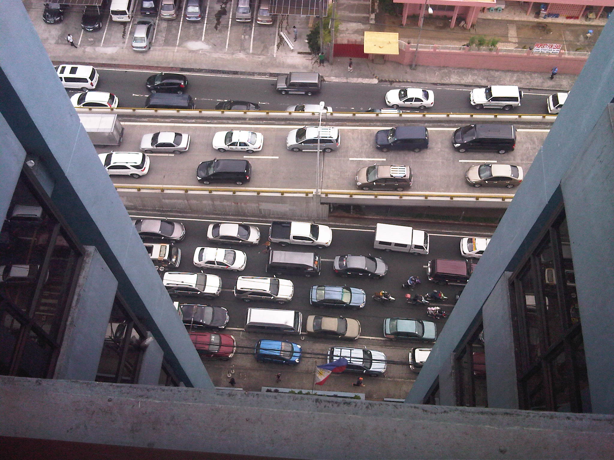 View of traffic congestion from the 16F of the building hosting the headquarters of the Department of Transportation and Communications. The overpass featured in the preceding photos is shown with vehicles descending to merge with Ortigas Avenue traffic. Both directions of Ortigas Ave. are congested.
 Congestion as seen from the street level. Vehicles descending the overpass are generally bound for San Juan while those on the foreground are bound for the EDSA-Ortigas intersection. Long queues are likely caused by a combination of high traffic volumes and non-optimal green time management at the intersection.
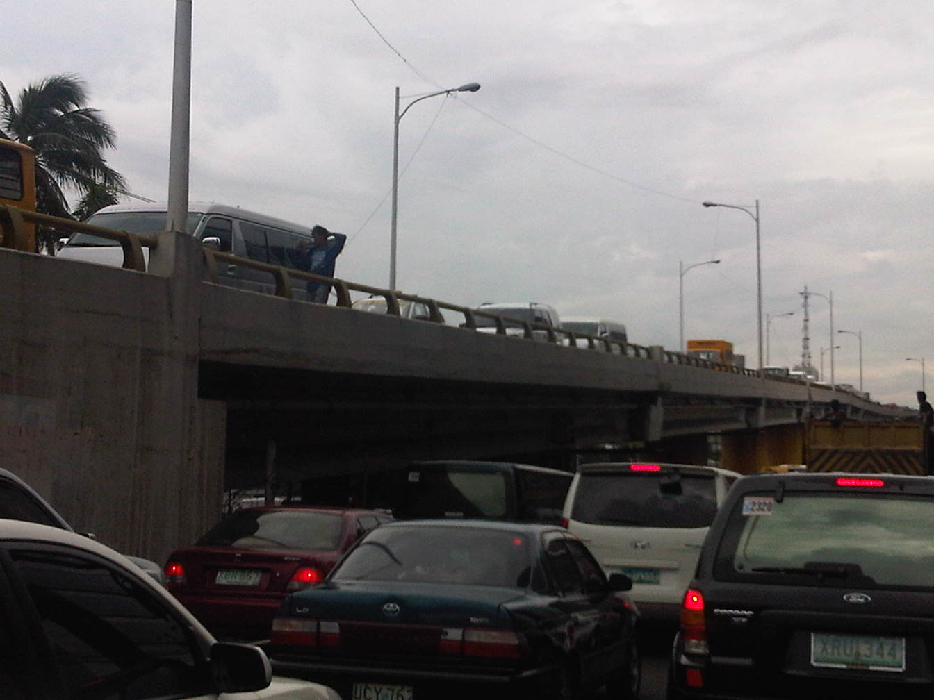 Another view of the congestion at both ground and overpass levels. Traffic is really bad when you have ambulant vendors walking along the overpass to sell their wares (e.g., cigarettes, candies, water, etc.) like what the man on the overpass near the van is doing.
Given the predictability of traffic congestion along this road, many motorists who have a choice or alternate route they can take avoid this road during such periods. Unfortunately, those taking public transport cannot avoid the congestion with passengers thereby incurring delays equivalent to wasted time. Most trips generated by such schools take private vehicles often having low occupancies (e.g., a driver plus a student = 2 passengers per vehicle). Perhaps schools should offer better school services/buses for their students? Or maybe there is a public transport option to be explored here? One thing is for sure and that is people at a young age learn that having cars is better than commuting. Such thinking is eventually carried over to when the same children become adults and an orientation favoring cars over public transport or even walking or cycling that they will eventually pass on to their own children, and so on. Perhaps our schools are in a very good position to influence the developing minds of their students and be responsible in promoting sustainable transport to their students.
–
EDSA traffic: view from the top
Traffic along Epifanio Delos Santos Avenue (EDSA) or Circumferential Road 4 is quite infamous considering it being a if not the main artery of Metro Manila and carrying much vehicular and passenger traffic between cities like Pasay City, Makati City, Mandaluyong City, Pasig City, Quezon City and Caloocan City where it has major junctions with other major thoroughfares like Roxas Boulevard, South Superhighway, Ayala Ave., Gil Puyat (Buendia) Ave., Shaw Blvd., Ortigas Ave., Aurora Blvd., East and Timog Avenues, Quezon Ave., North Ave., Roosevelt Ave., NLEX and A. Bonifacio Ave., Rizal Ave. and MacArthur Highway.
Shown in the following photos are traffic conditions along EDSA during a holiday, and typical afternoon peak and evening on a weekday. The section featured is the stretch from the Ortigas junction to Camp Aguinaldo. Visible in the photos are the high-rise condominiums along Connecticut Street (upper left) and the developments at the Araneta Center including the Araneta Coliseum in the Cubao commercial district. The green area on the upper right is Camp Aguinaldo, headquarters of the Armed Forces of the Philippines (AFP), while the rooftops at the right are of houses located in an high-end exclusive subdivision (Corinthian Gardens). In the middle of EDSA is the MRT-3’s elevated tracks.
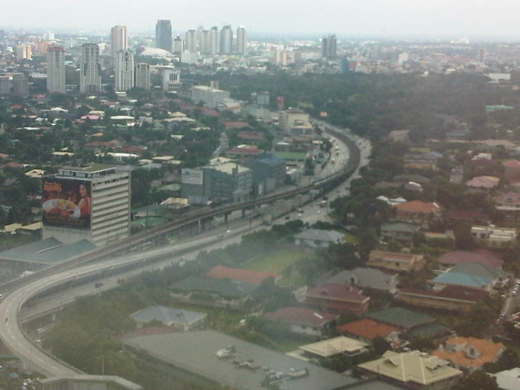 Photo taken from the 35F of the Robinsons-Equitable Tower shows light traffic along EDSA during a holiday. Traffic probably is similar during Sundays while such volumes may be observed on Saturdays only in the early mornings; before 9:00 or 10:00 AM when the shopping malls open.
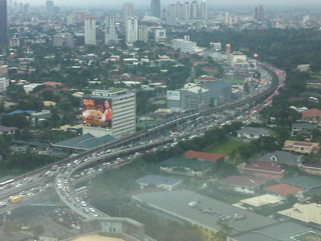 Photo taken at 5:44 pm showing traffic congestion on both directions (northbound and southbound) of EDSA including the overpasses at its intersection with Ortigas Ave. An MRT-3 train is visible in the middle of the photo.
 Photo taken at 6:16 pm with the headlights and taillights indicative of the traffic density during the early evening. Such congestion now usually extends past 8:00 pm with cases where EDSA is still congested near midnight. Such cases are more common now rather than exceptional.
–
Professorial Chair 2012 presentations on Transportation
The Transportation Engineering Group of the Institute of Civil Engineering of the University of the Philippines Diliman held a special session for its Professorial Chair Lectures last August 10, 2012 at the Toyota Training Room of the National Center for Transportation Studies. Four lectures were delivered by ICE faculty members who are also Research and Extension Fellows at the NCTS. Following are a few photos taken during the colloquium.
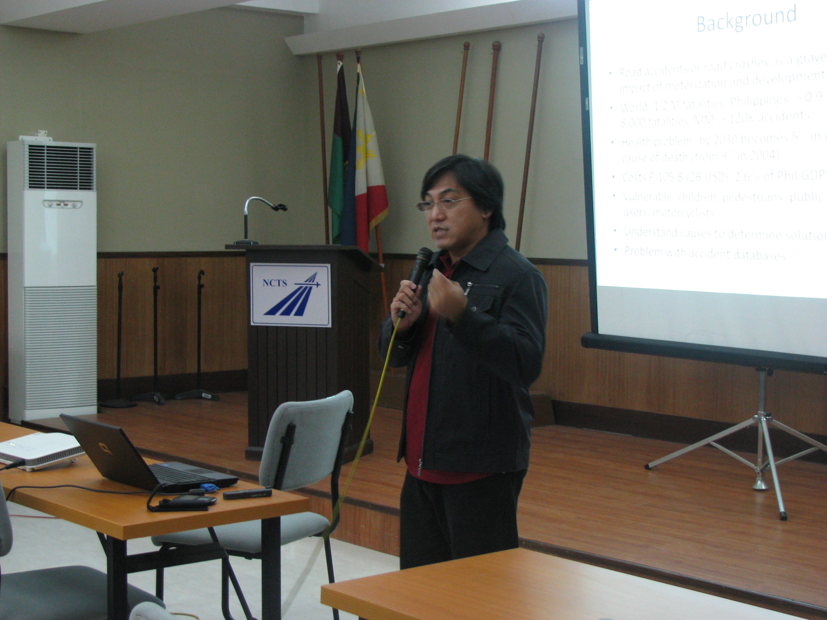 Dr. Sean Palmiano presenting on the Investigation of Road Crash Causal Factors in Metro Manila (DMCI Developers Professorial Chair)
 Dr. Karl Vergel presenting on the Design of Traffic Signal Timing and Traffic Impacts of the Re-Introduction of Traffic Signal Control at the Intersection of the University Avenue and Commonwealth Avenue (Maynilad Professorial Chair)
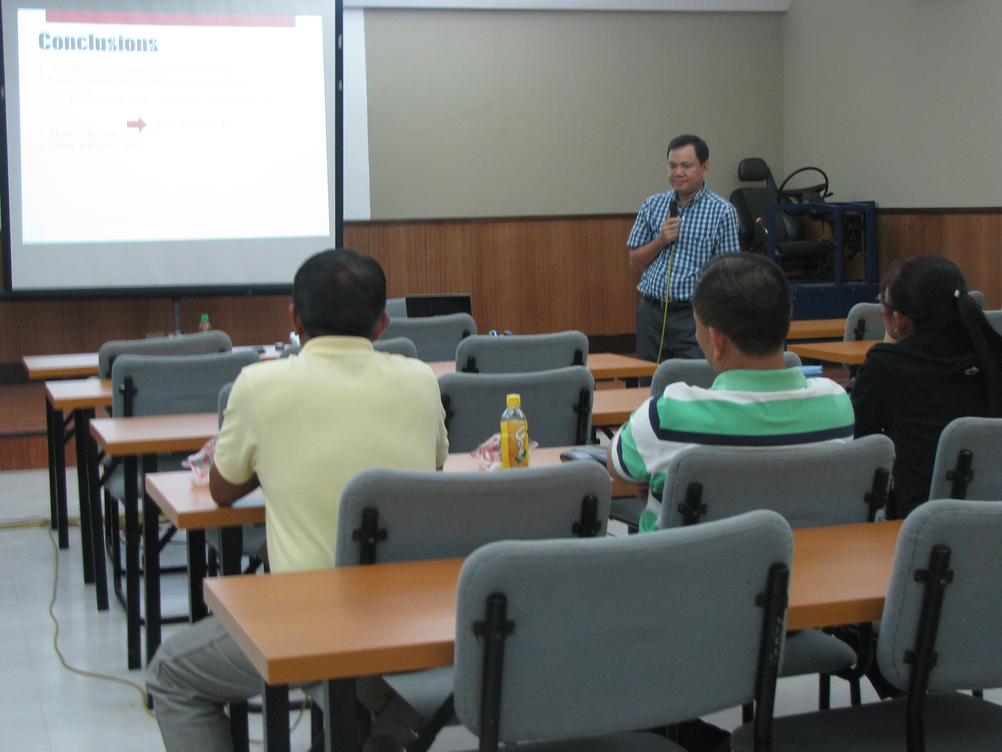 Dr. Ric Sigua presenting on Microscopic Simulation: A Tool for Evaluation of Traffic Schemes (Prof. Emeritus Norbert S. Vila Professorial Chair)
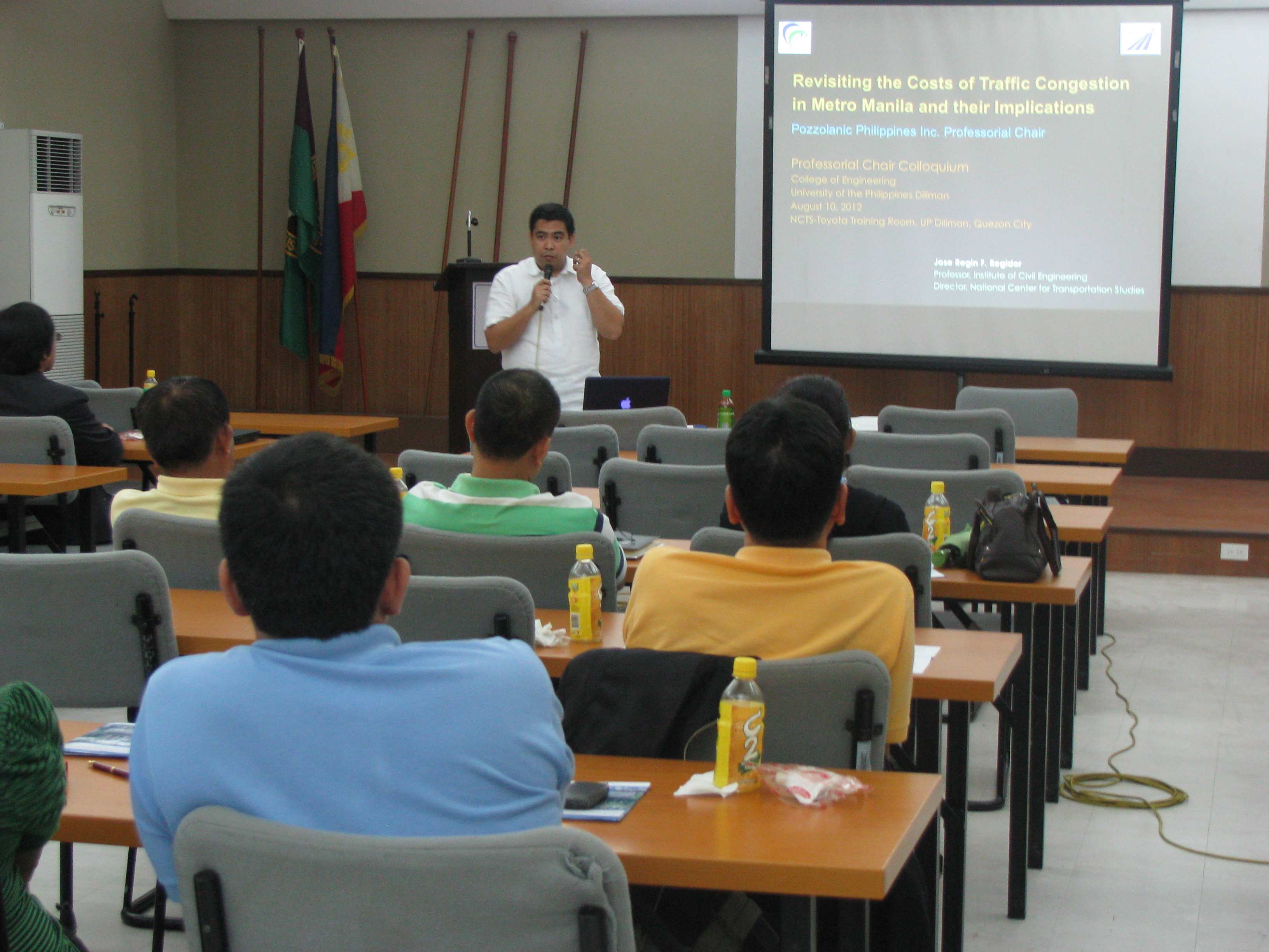 Dr. Regin Regidor presenting on Revisiting the Costs of Traffic Congestion in Metro Manila and their Implications (Pozzolanic Philippines, Inc. Professorial Chair)
 Audience consisting of various participants including those from the DPWH, DOTC and MMDA who were invited for the colloquium.
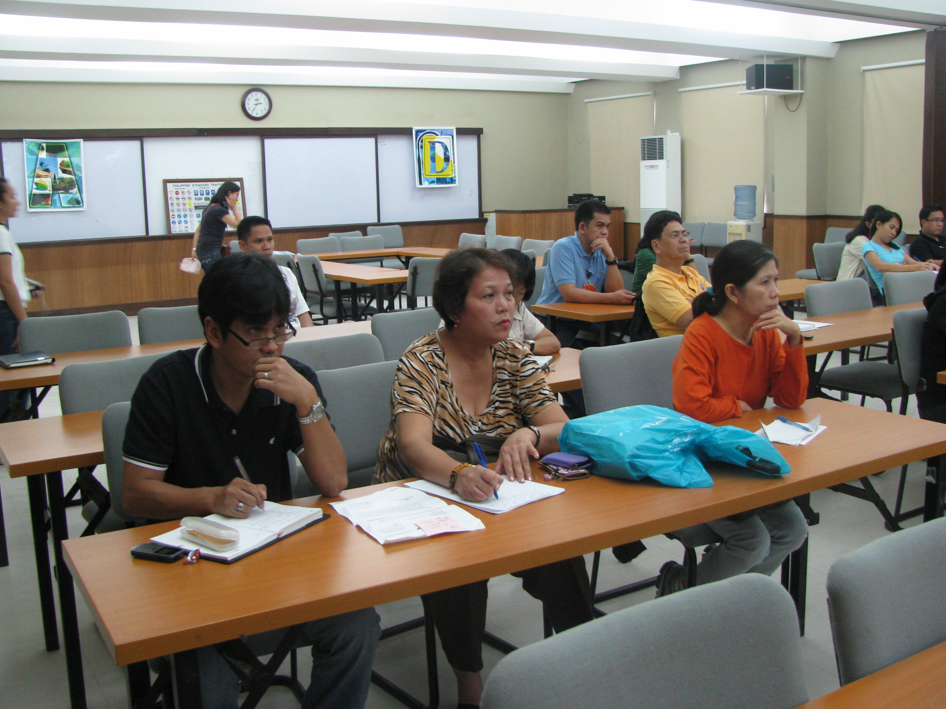 Graduate students and technical staff from the College of Engineering and the National Center for Transportation Studies also attended the lectures. Unfortunately, classes were suspended that week due to the monsoon rains that resulted in widespread flooding in Metro Manila so undergraduate students were not able to attend the colloquium.
The presentation files may be found in a previous post where links for downloading are provided. These may also be found in the NCTS website.
–
Professorial Chair Lectures on Transportation Topics – 2012
The College of Engineering of the University of the Philippines Diliman recently held its Professorial Chair Colloquium where lectures were delivered by faculty members from the various institutes and departments comprising the college. Four lectures were delivered last August 10, 2012 at a special session held at the Toyota Training Room of the National Center for Transportation Studies. The lectures were on transportation topics and presented by faculty members of the Institute of Civil Engineering who are also Fellows at the NCTS. Following are the lectures and the presentation files in PDF:
Palmiano, H.S.O., Investigation of Road Crash Causal Factors in Metro Manila, DMCI Developers Professorial Chair: Road Safety Researches HSOPalmiano 10Aug2012
Vergel, K.N., Design of Traffic Signal Timing and Traffic Impacts of the Re-Introduction of Traffic Signal Control at the Intersection of the University Avenue and Commonwealth Avenue, Maynilad Professorial Chair: Traffic Signal Timing KNVergel 10Aug2012
Sigua, R.DG., Microscopic Simulation: A Tool for Evaluation of Traffic Schemes, Prof. Emeritus Norbert S. Vila Professorial Chair: Traffic Simulation RDGSigua 10Aug2012
Regidor, J.R.F., Revisiting the Costs of Traffic Congestion in Metro Manila and their Implications, Pozzolanic Philippines, Inc. Professorial Chair: Revisiting Costs of Congestion JRFRegidor 10Aug2012
–
School traffic impacts – issues along Ortigas Ave., Part 2
I had written recently about traffic congestion along Ortigas Avenue that is due mainly to traffic generated by a private school in the area. In the previous post, the photos only show vehicles parked on the sidewalks on either side of the road. They did not show the actual traffic congestion experience. The parked vehicles seem more incidental and indirect than concrete evidence of congestion brought about by school traffic generation though they are a definite manifestations of parking generation, which is directly related to traffic generation.
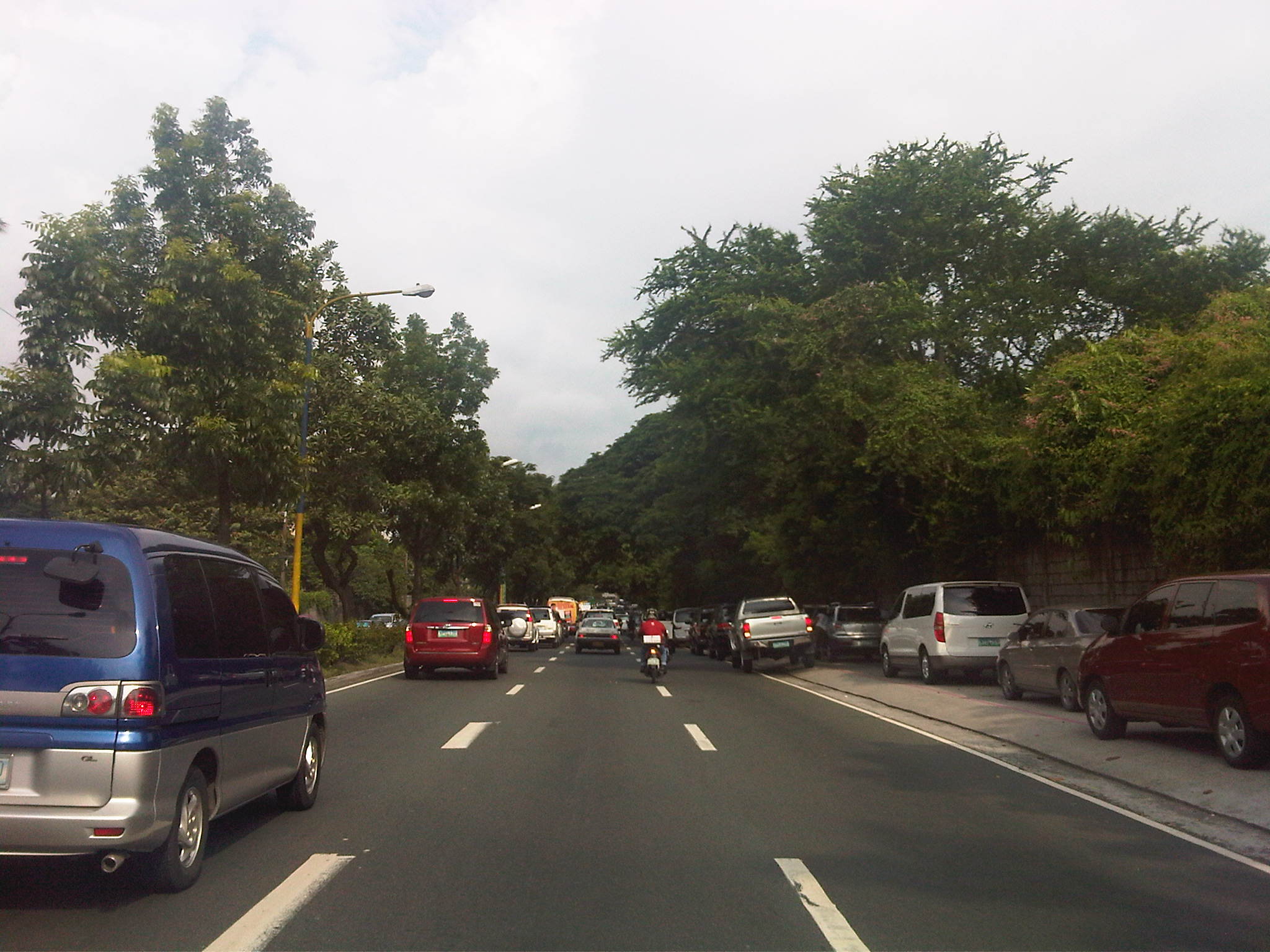 Parked vehicles on the sidewalk are seen as we approached the tail of a very slow moving platoon owing to the congestion generated by an exclusive school.
 Traffic jam with road capacity reduced by the parked and standing vehicles along the EDSA-bound side of Ortigas Ave. The trees are witnesses to the chronic traffic jams and help alleviate their impacts by absorbing emissions from the vehicle.
 Severe congestion as we approached the school – the overpass downstream in the photo is a reference for where the school is located
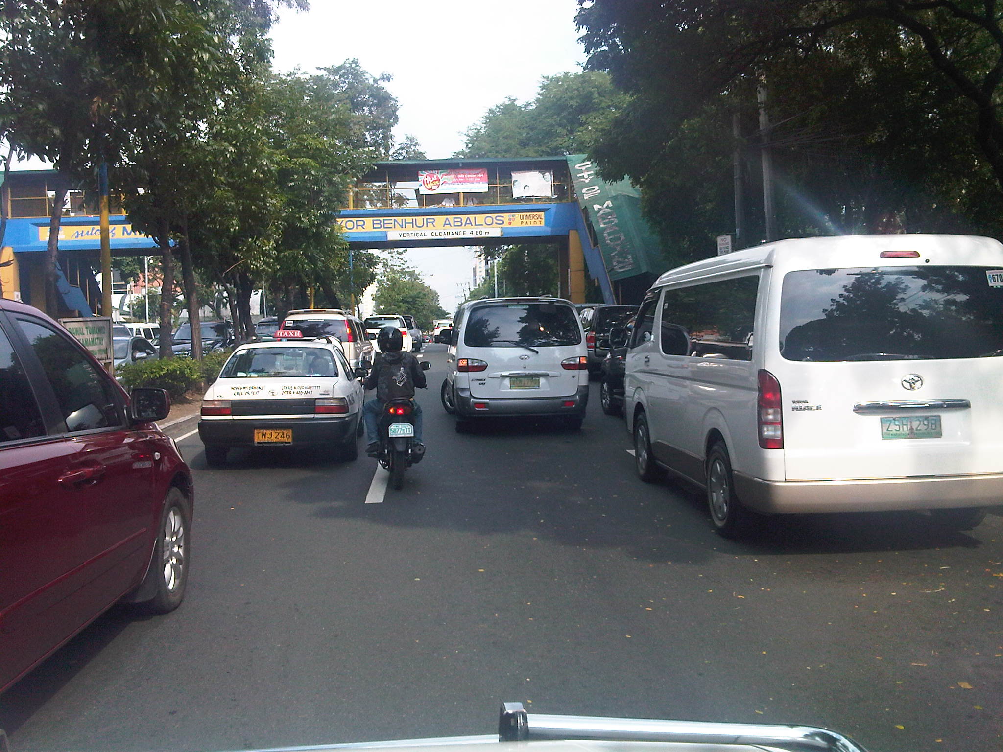 The overpass bears the name of the mayor of Mandaluyong City, where this school is located and which has jurisdiction, together with the MMDA, for traffic management in the area. At the time we passed the area though, there were no enforcers in the area despite the severe congestion. Is this because they gave the responsibility (or burden) of managing traffic to the school? Perhaps there was no need to post enforcers here as congestion is a regular thing and people seem to have been conditioned with the almost daily experience.
 The area at the foot of the pedestrian overpass actually functions as a pick-up and drop-off area for students of the school. As such, vehicles occupy not just the the sidewalk but also more than a lane of Ortigas Avenue. This effectively constricts traffic along this major road.
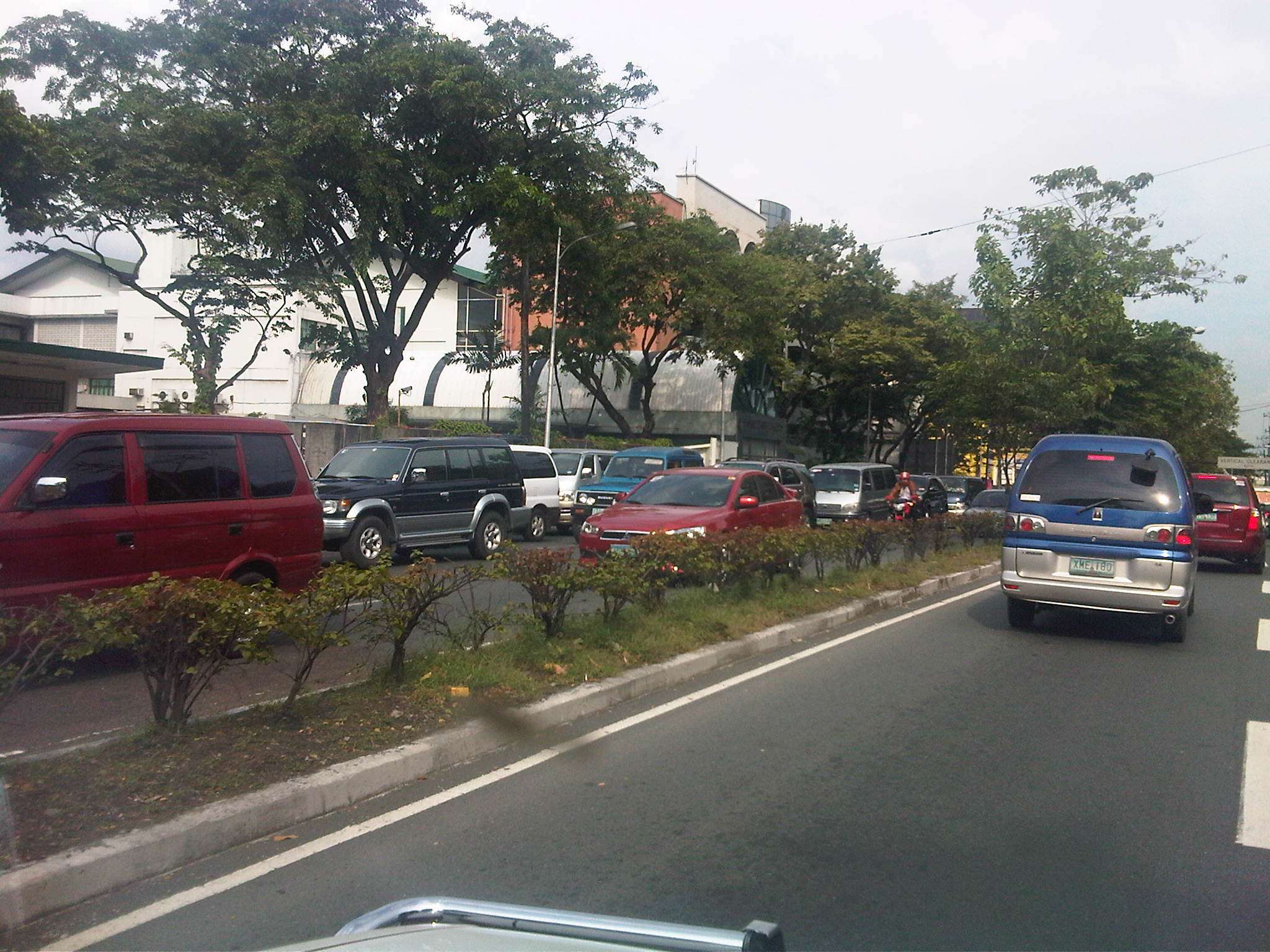 Traffic is slow along the San Juan-bound direction of Ortigas as vehicles waiting for their passengers (students of the school) are lined up and occupying the outermost and even the middle lane of the road.
 This queue is not entirely attributed to traffic generation by the school but is likely due to traffic management at the EDSA-Ortigas intersection, which is signalized. If the signal setting is not optimized or if the intersection is not cleared of straggler vehicles, traffic is backed up along all the approaches to the intersection. The tall building in the background hosts DOTC’s headquarters. I wonder if our officials are taking in the congestion that occurs almost daily (weekdays) and if they are even crosses their minds how to solve this problem and others like it around the country.
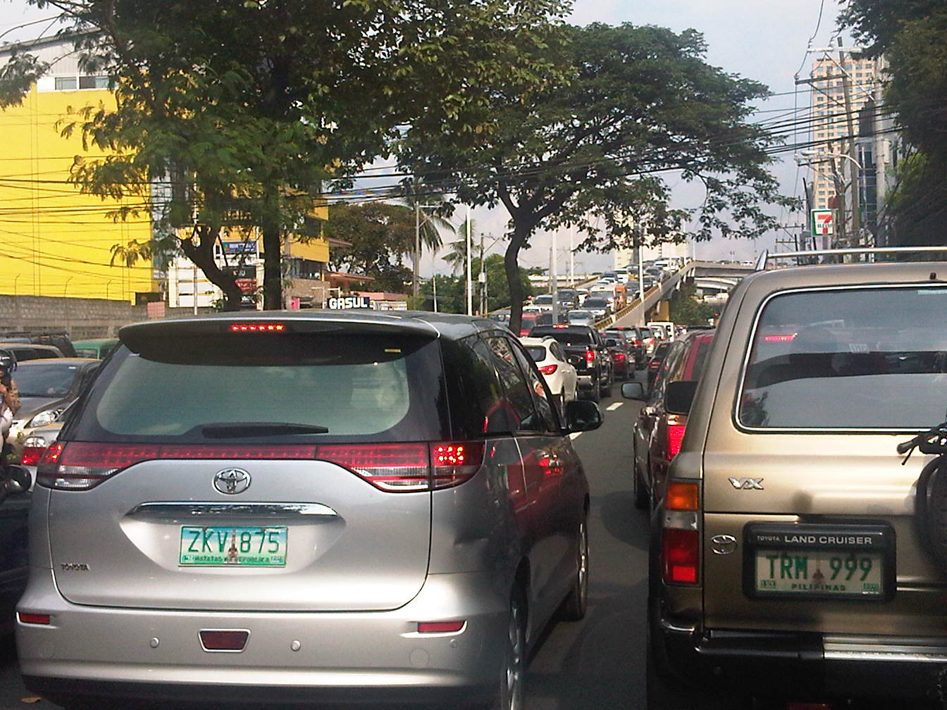 Proof that congestion is along both directions of Ortigas Ave. is seen in the middle of the photo where vehicles are also backed up along the overpass ramp coming from EDSA’s northbound side. For what it’s worth, the DOTC headquarters is right along this road at the building where the 7-Eleven (sign visible in the photo) is located.
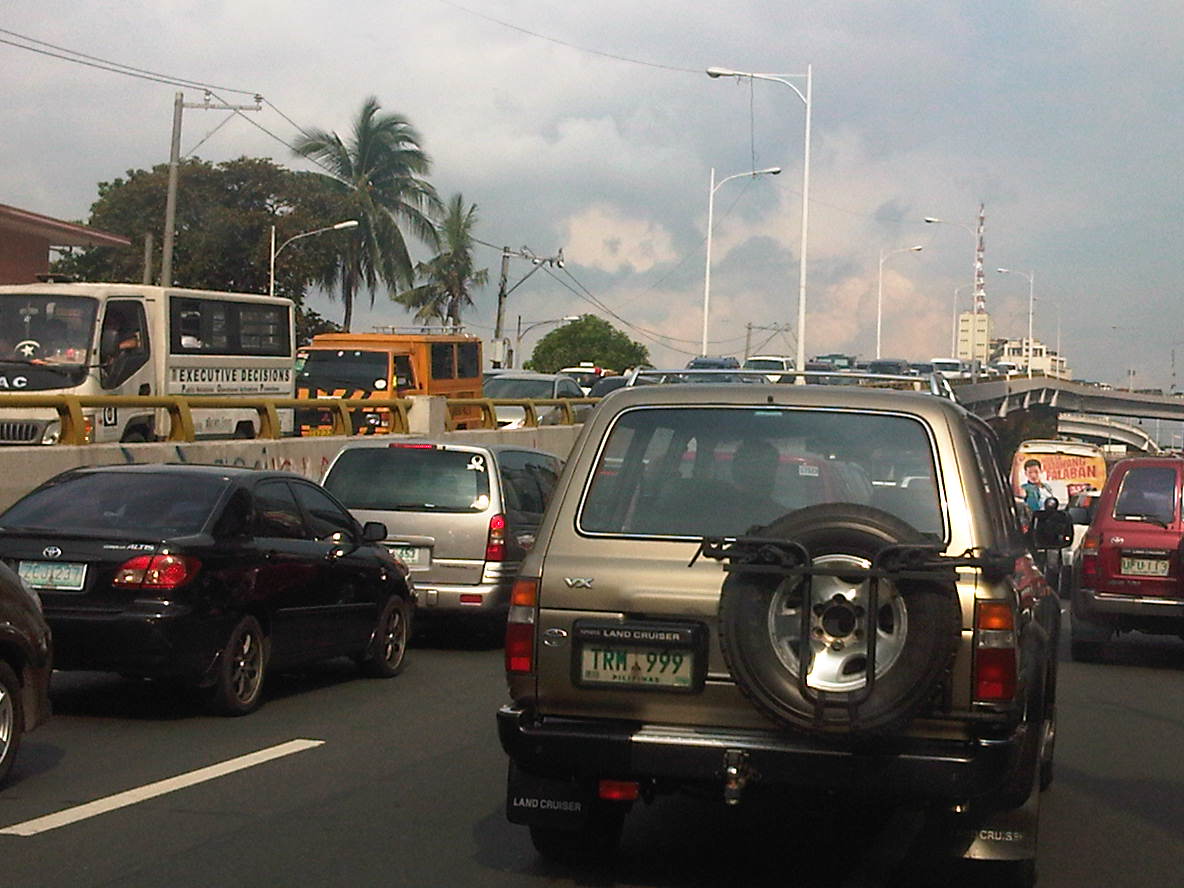 Another and even closer look of what is literally bumper-to-bumper traffic along both sides of Ortigas Avenue during the afternoon peak triggered by the exclusive school along its San Juan-bound side. Visible in the photo is the congestion along the overpass from EDSA.
–
School traffic impacts – issues along Ortigas Ave., Part 1
I have written about school traffic generation in this blog and have mentioned about the traffic congestion experiences along major thoroughfares due to the vehicles attracted by private schools. La Salle Greenhills (LSGH) is an exclusive school found along Ortigas Avenue and during the summer months of April and May, people passing through the stretch of the road from EDSA to the Greenhills Shopping Center are relieved that they won’t have to go through traffic jams due to the school-generated traffic. From June to early December and January to March, however, the area is almost always congested in the morning and afternoon. Such congestion is predictable since it occurs during a period when students come to school and when they are dismissed mid-day or in the afternoon.
Heading to a meeting at the DOTC from the University one morning, we decided to take an alternate route. Instead of EDSA or C5, we took East Ave., Tomas Morato Ave., Gilmore Street and then emerged at the westernmost end of Ortigas in San Juan. It was already 9:00 AM when we arrived at the section most affected by the traffic generated by LSGH and so we didn’t to get caught in a jam as we proceeded towards our destination. We were proven right as traffic was almost free-flowing, and I took advantage of the traffic conditions and to take a few photos of the indicators for the potential traffic congestion in the area. The following photos also show a serious parking problem and (sadly) the usurpation of space from pedestrians. For shame!
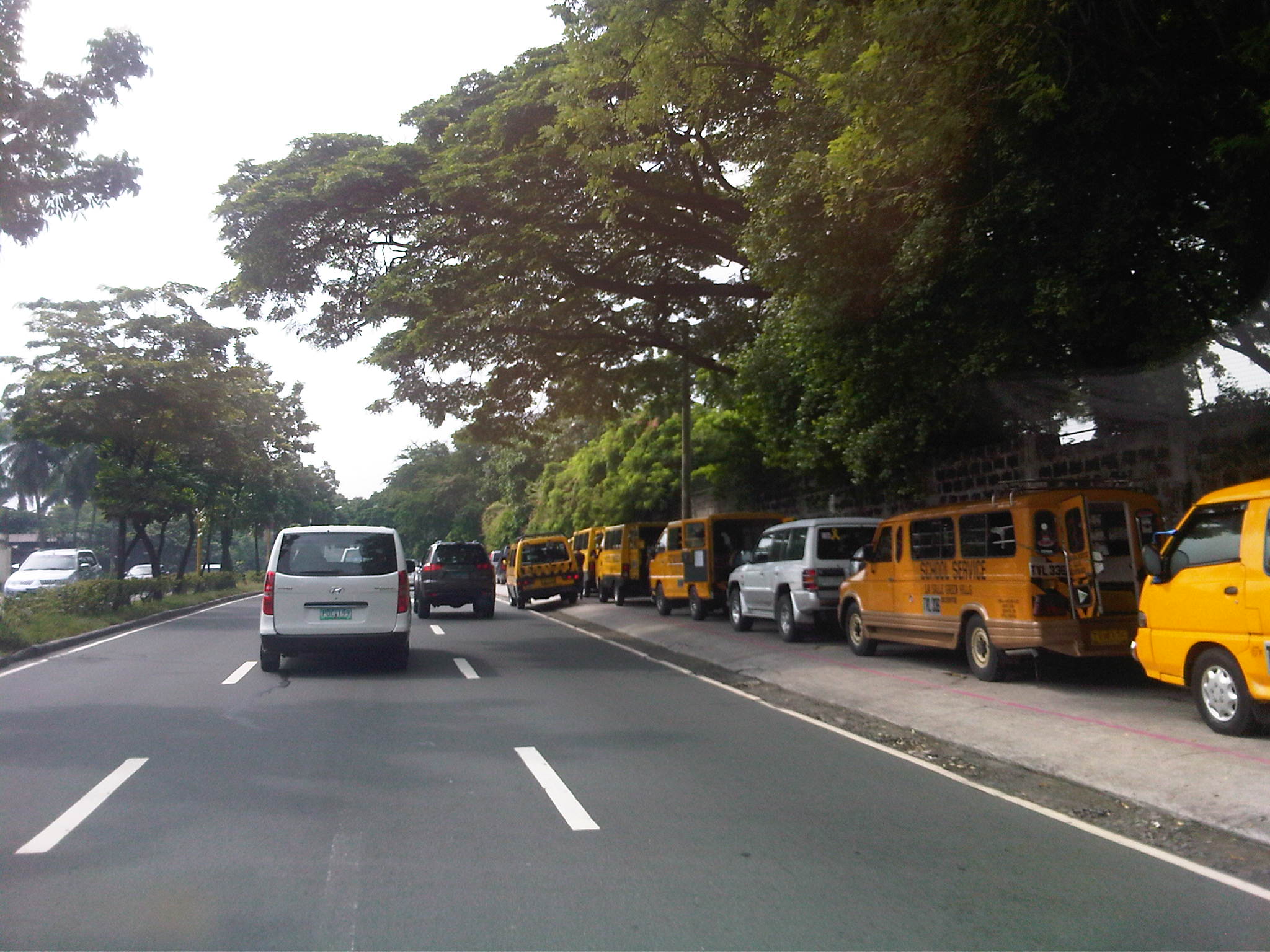 School service vehicles parked along the sidewalk along Ortigas Avenue – beyond the wall on the right is Wack-wack, a high-end residential subdivision named for the sound of golf clubs swinging at its famous course.
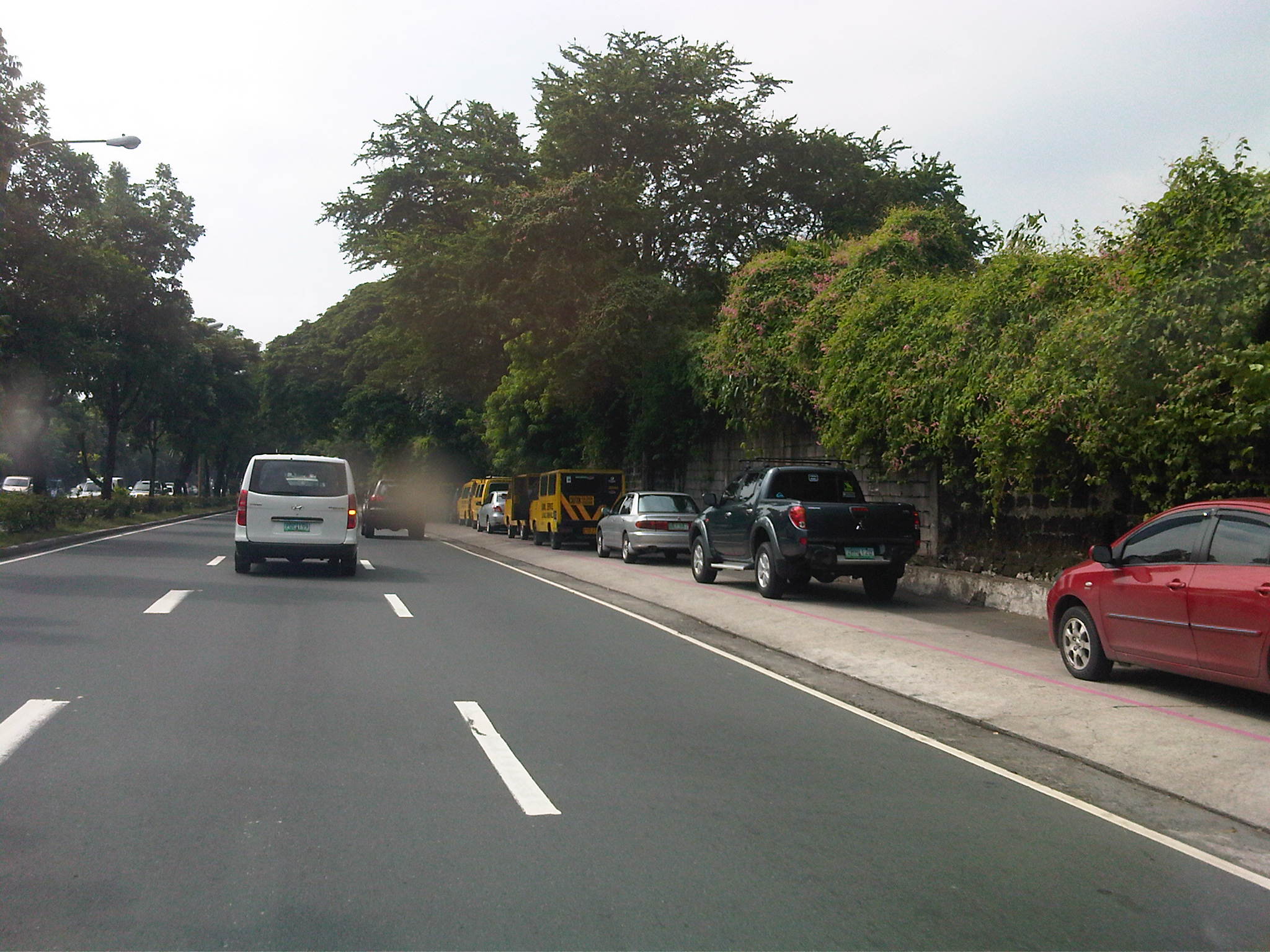 Private vehicles parked along the same sidewalk – noticeable in the photo is the pink line drawn by the MMDA to supposedly demarcate space that should not be obstructed and instead allocated for pedestrian use. It is clear in the photos that pedestrians would have to walk along the edge of the sidewalk or the outer lane of the carriageway itself, increasing the risks for them to get sideswiped by motor vehicles.
 More parked vehicles along Ortigas Avenue, mostly private vehicles that are highly likely owned by those studying at LSGH.
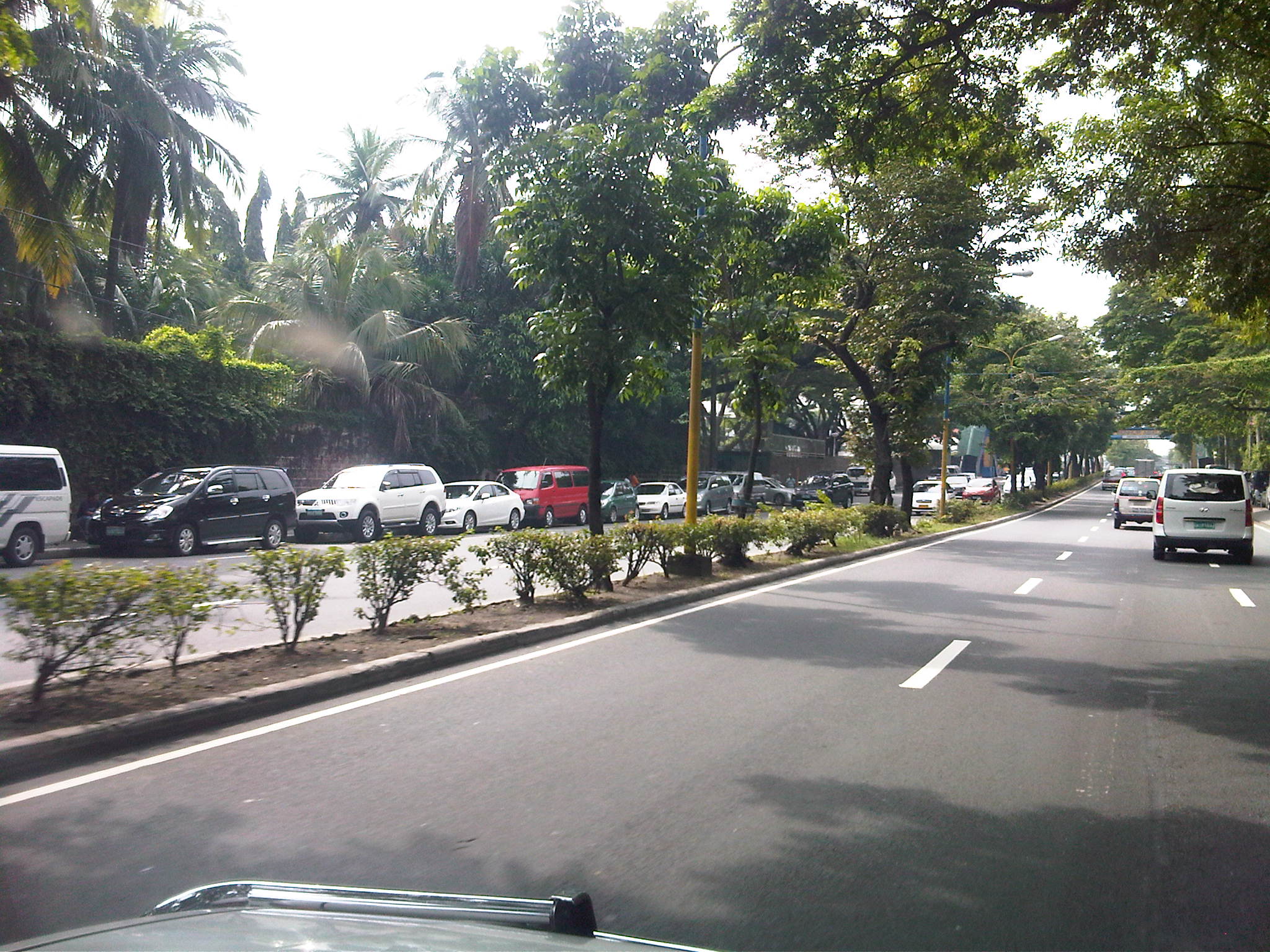 It’s actually worse on the other side of Ortigas Ave. as vehicles occupy a lane of the carriageway, effectively reducing capacity along this stretch of the road.
 It seems the main purpose of the pedestrian overpass is to allow students to safely cross the street to get from and to their vehicles. I can only imagine the congestion caused by drop-offs and pick-ups along Ortigas Ave., which for certain times of the day functions as a driveway for the school.
–

