
Home » Traffic Management (Page 21)
Category Archives: Traffic Management
Gapan-San Fernando-Olongapo Road: San Fernando
The Gapan-San Fernando-Olongapo (GSO) Road stretches across 4 provinces in Central Luzon. The road starts from the City of Gapan in Nueva Ecija and passes through the towns of San Isidro and Cabiao before crossing into Pampanga through the towns of Sta. Ana, Arayat, and Mexico, and crossing the North Luzon Expressway (NLEX) and McArthur Highway along the City of San Fernando. After San Fernando, the road heads west through Bacolor, Sta. Rita, Guagua and Lubao. It exits Pampanga from Lubao and to Bataan via Dinalupihan, and finally to Olongapo City in Zambales. It is also known along major stretches as Jose Abad Santos Avenue.
The GSO used to be the only main route towards Bataan and Zambales from the North-South corridor defined by NLEX and McArthur Highway (also known as the Manila North Road). That was prior to the construction of the Subic-Clark-Tarlac Expressway (SCTEX), which stretched from Tarlac City in the north and through Concepcion before crossing to Pampanga. The tollway proceeds southwest through Clark (in Mabalacat and Angeles City), the towns of Porac, Floridablanca and eventually crossing into Bataan at Dinalupihan. The SCTEX finally connects to the Subic Freeport Expressway (SFX), which is also known before as the Tipo toll road.
One of the justifications for the Clark-Subic component of the expressway was the need for an alternate route between the industrial centers at Subic, Hermosa, Clark and Tarlac (Luisita?). Unfortunately, the projected rapid developments of those centers were not quite realized and traffic along SCTX remains light for most of the time. Congestion apparently only occurs at the Clark exit where the toll plaza capacity is not enough to accommodate vehicle arrivals. To compound the situation, the national government improved the GSO, increasing its capacity and therefore making this free road a viable alternative to the SCTEX when traveling between Pampanga and Zambales.
Following are photos taken quite recently along the GSO Road and at San Fernando. I will post other photos later, featuring sections along other towns.
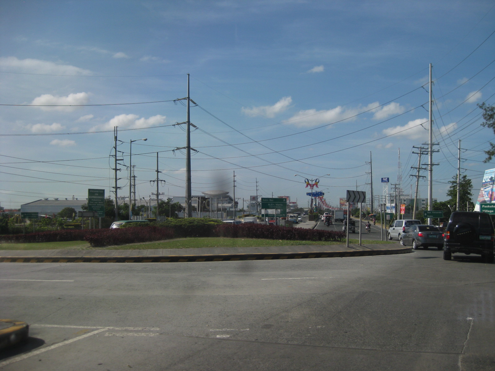 Roundabout at the interchange with the NLEX on the west side of the tollway
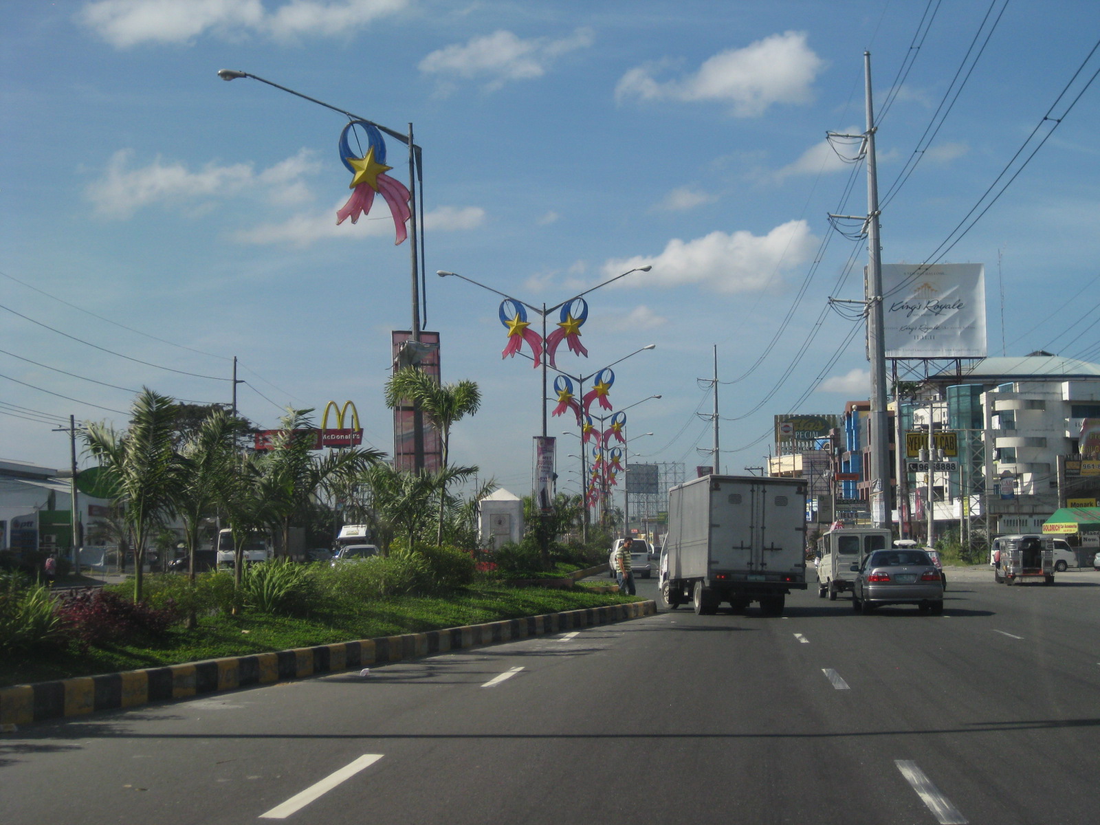 GSO section leading to what most people think is already San Fernando City proper. The old city center is actually further south along McArthur Highway and is an example of a traditional “bayan” with the municipal/city hall, church and market clustered together.
 Overpass along GSO Road over McArthur Highway – prior to the construction of the overpass, traffic junction was the main cause of congestion in the area.
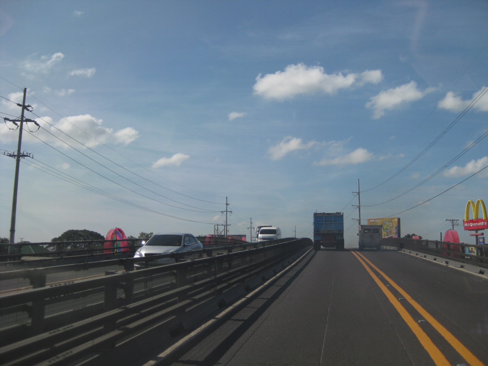 There are actually two overpasses, one beside the other, and each having two lanes and dedicated to one direction of traffic. As can be seen in the photo, there are no shoulders or space for pedestrians. The double yellow also indicates no overtaking along the overpass.
 The overpass structure is very similar to those constructed in Malolos, Bulacan and Iloilo City. Similar structures were proposed for a flyover along Quezon Avenue and crossing Araneta Avenue in Quezon City but an underpass is instead being constructed in that area.
 After the overpass, travelers pass through an elevated section of the GSO Road. The section was constructed over an embankment that was part of the response on the infrastructure side for disastrous lahar flows of the 1990’s. At the time, many sections of the GSO Road were destroyed by lahar generated by the eruption of Mt. Pinatubo in 1991.
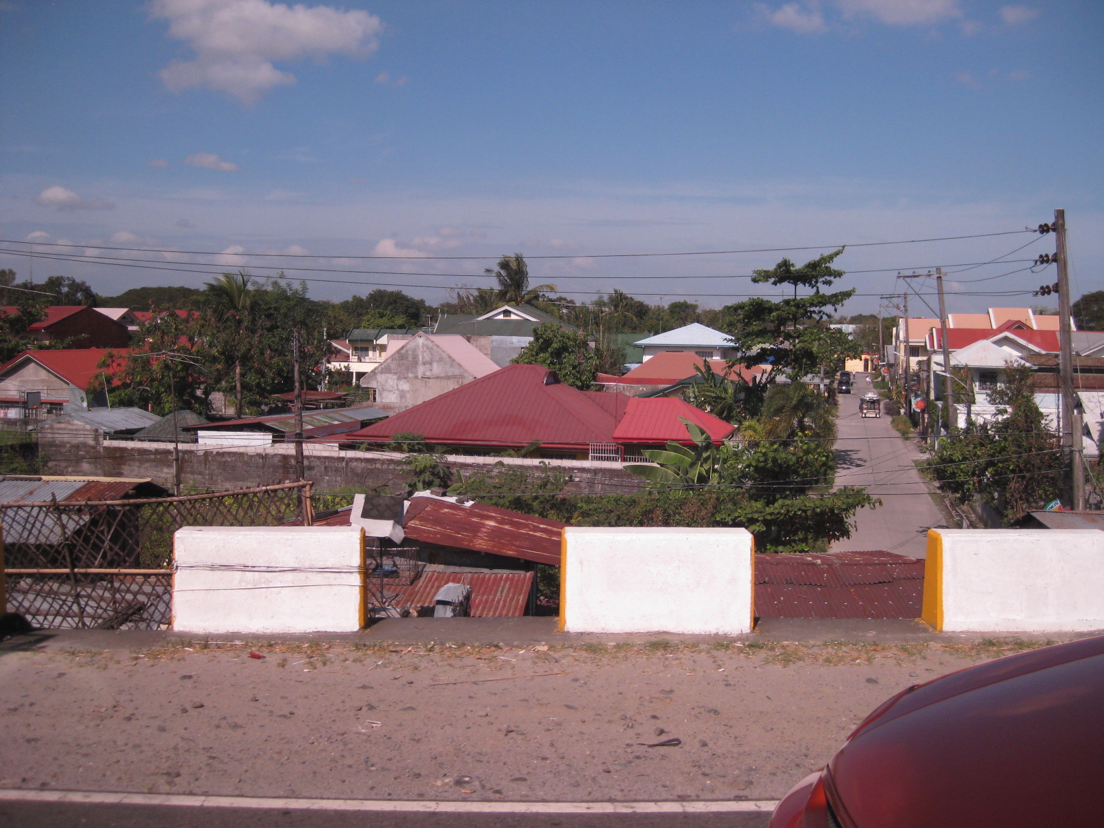 The concrete barriers are quite low and definitely not enough to prevent even a car from taking off from the road (in case of one going out of control) and unto the houses below. The photo above clearly shows how high the carriageway is with respect to the adjacent areas. Notice, too, the narrow strip serving as a shoulder for the road.
 8There was significant congestion almost immediately after descending the overpass and along the westbound direction of GSO Road. It took quite a while for us to reach the cause of the congestion – GSO Road’s intersection with Lazatin Boulevard.
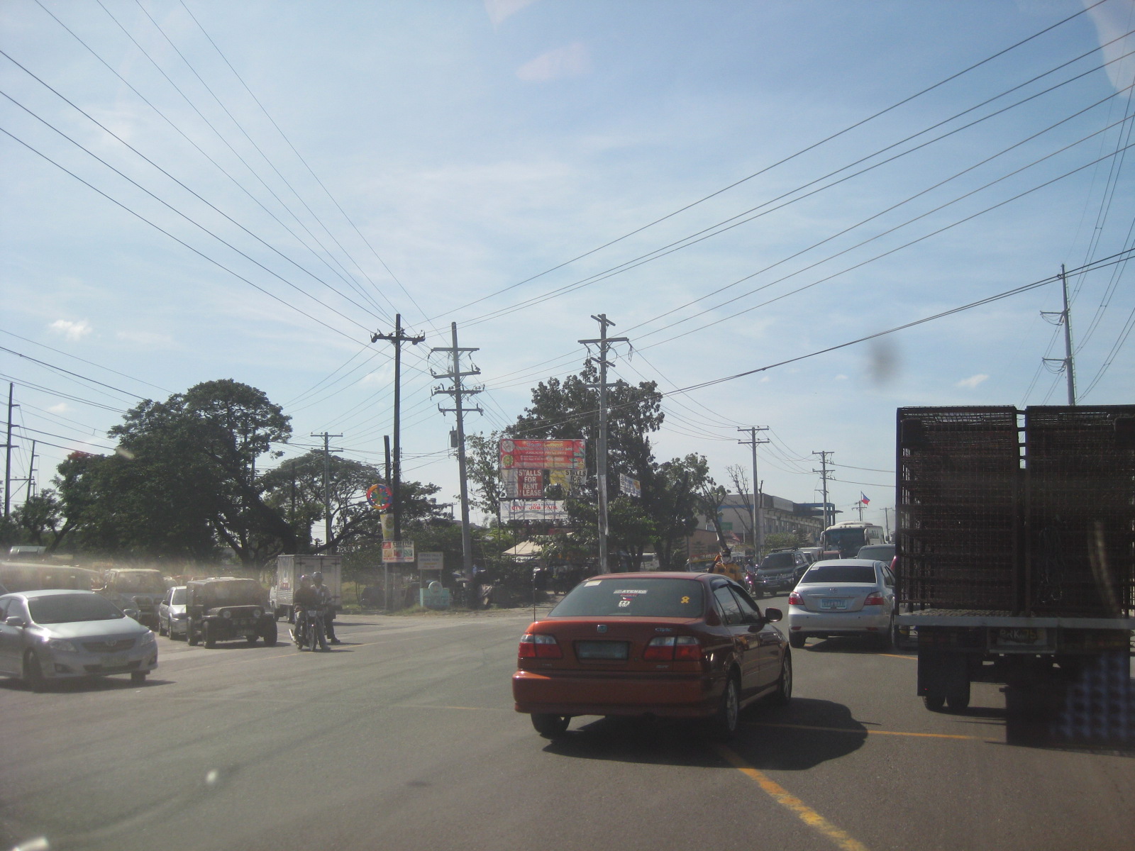 The junction is not signalized (no traffic lights) and manned by enforcers who appear to have no formal training in traffic management. I say so since they were applying the “buhos” system of attempting to dissipate queues from each approach (there were 4) without considering that in the process, longer queues were forming along the major road (GSO). Also, it seemed to us that the enforcers were prioritizing traffic along Lazatin when it was obvious that GSO was already congested.
 Traffic was practically free-flowing after passing the GSO-Lazatin junction. There were 4 lanes (2 per direction) and sufficient shoulder space on either side of the highway.
–
Carlos P. Garcia Avenue
I really haven’t written much about the other segments of Circumferential Road 5 (C-5), choosing to write about the Katipunan Avenue stretch from Aurora Boulevard to Magsaysay Avenue (UP Diliman). C-5 is officially named Carlos P. Garcia Avenue or C.P. Garcia Avenue after the 8th President of the Philippines. C-5 though is more commonly known by its many names for at least 3 long stretches of the road: Katipunan, E. Rodriguez, Jr. Avenue (Boni Serrano Ave. in Quezon City to Pasig Boulevard, Pasig City), and C.P. Garcia Ave. (Pasig Blvd. to SLEX/East Service Road). Following are a few recent photos along C5 along C.P. Garcia Ave. in Taguig.
 U-turn flyover at C-5/Kalayaan is among the much maligned projects of a past MMDA administration. There is supposed to be 3 lanes between the columns but the pavement conditions and relatively narrow lanes would usually accommodate only 2 vehicles at a time especially when one is a truck. Should it be demolished to give way to the original scheme proposed by the DPWH for the intersection? The current grade separation project at Quezon Ave./Araneta Ave. will eventually show whether such a scheme could have been better for C5-Kalayaan.
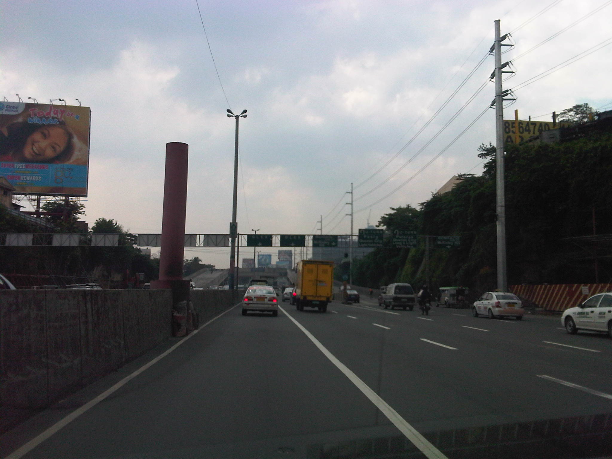 The pink column is a remnant of what used to be a pedestrian overpass at C-5/Kalayaan. There used to be a two span overpass in the area that has since been That’s the second elevated U-turn downstream that is utilized by traffic from Kalayaan (Makati) to Taguig (through traffic if the intersection was not closed to such) and to Pasig (left turn traffic).
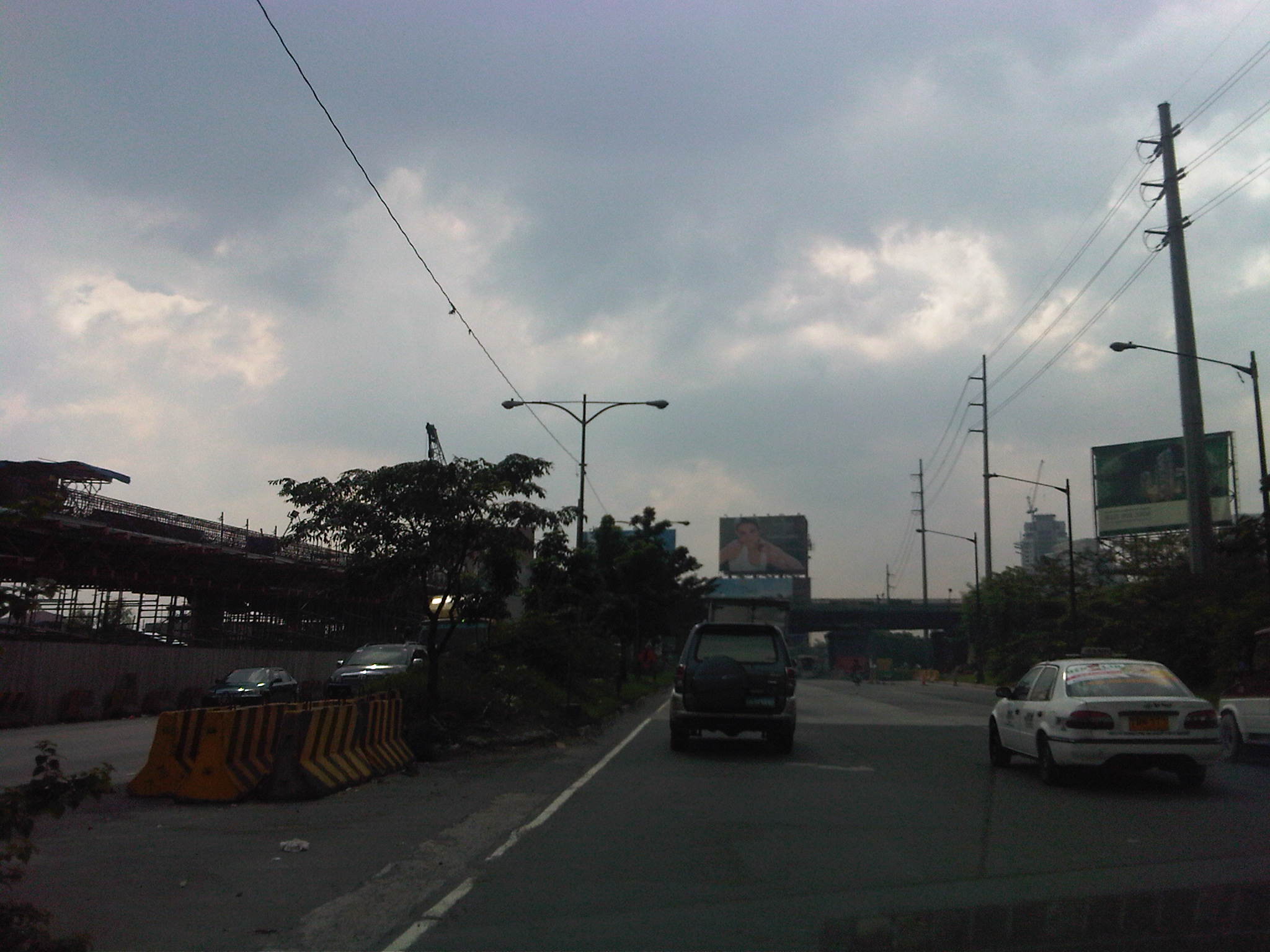 Approach to the construction site of an off-ramp/overpass from Bonifacio Global City. The flyover is supposed to ease traffic from BGC to C5-northbound currently concentrated along the overpass at 26th Street and Market! Market!
 Close-up of the flyover construction. The temporary columns and barriers in the middle of C5 can be quite tricky even during the day and the space is just enough for 2 cars to fit through the middle lanes. With trucks its again a different situation as they often require more space given the behavior of their drivers encroaching upon the adjacent lanes.
 Overpass from Market! Market! and along 26th Street. The pedestrians using the overpass and crossing to and from Target Street in old Taguig are undisciplined and do not follow traffic enforcers at the intersection with the service road. This leads to a high likelihood of pedestrian vs. vehicles collisions due to the conflicts in that area.
 The walls at the right side of the highway were constructed to separate C5 from the service roads on either side of the highway. These service roads are notorious for being used by residents of the areas along C5 for parking and jeepneys typically stop anywhere along the road to drop-off or pick-up passengers. Also, there are many incidences of people crossing C5 without care of their safety. Also, there have been cases where some vehicles have been reported to have been stoned by anonymous persons (probably from the informal settlements along the highway). The walls were interventions that are supposed to control such behavior and keep C5 as unimpeded as possible.
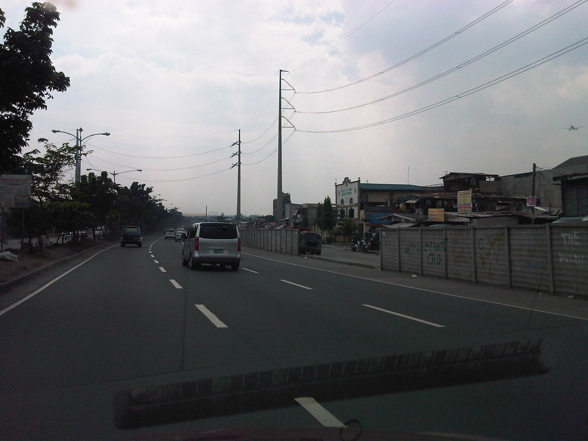 Despite objective for the walls, there are many breeches and these result in still a lot of jaywalking across C5 and jeepneys stopping to pick-up/drop-off passengers.
 A persistent issue along C5 pertains to the operations of jeepneys along the highway. There is a tendency to congregate at the designated loading/unloading areas that coincide with the pedestrian overpasses along the highway. Jeepneys typically occupy 2 lanes including the shoulder lane adjacent to the wall. The same behavior occurs at wall breeches often causing bottlenecks along the highway.
–
On high density development along Katipunan
I saw the tarp below posted along Katipunan Avenue as we drove to UP one Saturday morning. There are actually two signs: one in front of Ateneo Gate 1 and the one below just after Ateneo Gate 2. Both speak out to the Quezon City Council for issuing an exemption to SM Development Corporation (SMDC), part of the SM group of shopping mall fame, for its high-rise condominium development near the corner of Aurora Boulevard and Katipunan Avenue (C5). The development, known as Blue Residences, will not only have residential units but commercial establishments as well. By the name of the project, it is obviously a play on the nearby Ateneo De Manila University, which has blue for its standard color (e.g., Blue Eagles). [Note: For whatever its worth, there is also a Green Residences being developed by SMDC near De La Salle University, which adopts green as its banner color – e.g., Green Archers.]

The questions going in my mind after seeing the signs include the following:
1) Isn’t it too late for this, a campaign against a development that is already under construction and months after a decision has been made to approve the project?
2) What is Ateneo’s and its allies success rate for such? [The high density developments just across the university seem to be concrete evidence and reminders of such actions falling on deaf ears.]
3) Given this seemingly renewed (not new-found, I hope) interest in urban development in the area, wouldn’t it make more sense to also campaign against another development, this time by another real estate giant in Camella/Vista Land that already has set up shop across Ateneo?
4) And, as a follow-up perhaps, has that strip along Katipunan already been ceded to high density development and Ateneo and its allies have already conceded that a long time ago? [There’s SMDC’s Berkeley Residences, Prince David, Burgundy, etc.]
A colleague put forward an opinion that such developments are actually beneficial to Ateneo and its allies. In fact, many of the residents of the high rise condominiums in Katipunan have children studying at Ateneo and Miriam, their addresses being conveniently located minutes away from school. In other cases, units are rented by university students who similarly take advantage of the building’s proximity to their schools. I wouldn’t be surprised if enterprising people have purchased units not for them to reside in but to rent/lease out to students or other wishing to live near the universities or the nearby LRT 2 station (Katipunan Station).
From the traffic perspective, such developments definitely require full-blown transport or traffic impact studies due primarily to their trip generation characteristics. Such studies should clearly show how to address potential transport and traffic problems including who will be responsible (hint: the proponent should not pass on responsibility to the MMDA or local traffic enforcement) for traffic management. I reproduce below excerpts from a report submitted by a stakeholder community in opposition to a proposed high-rise, high density mixed-use (commercial, office, hotel and residential) development at the corner of EDSA and Ortigas Ave. where a huge excavation is still present and can be clearly seen when riding a Makati-bound MRT train:
“The EIS Report failed to consider the traffic impact once the project starts to operate hence necessary measures were likewise not discussed. Many projects will, at first glance, give an impression that a traffic impact study would not be required. The Skycity development, however, immediately gives the layman an impression that it would indeed have a significant and long-term impact on traffic in its direct vicinity. While its influence area can only be clarified via a thorough study of the characteristics of the development, the description and hype alone by the project proponents give us an idea that Skycity will impact people from as far as Rizal province.
In the process of attaining these objectives, this paper will identify the deficiencies and weaknesses pertaining to transportation and traffic and establish the need for detailed traffic studies, specifically the requirement of a Traffic Impact Study (TIS). The TIS will entail traffic impact analysis (TIA) to satisfy the questions or concerns regarding the traffic generated/attracted by the Skycity project and the consequent problems that will be caused by the project from its construction to eventual operation.
A traffic impact assessment (TIA) would be imperative, if truly the effects of the development would be quantified. The TIA would be able to answer the following questions, among others that would crop up in the minds of stakeholders:
- What are the transportation improvements needed to serve the traffic generated by the new development?
- How much will the improvement cost be and who will pay for them?
- Will the new project impact traffic on any existing residential streets and how will those impacts be mitigated?
- Will the new development aggravate any existing safety hazards or create new ones and, if so, how can those hazards be corrected?
- Can the proposed development be served by public transportation and does the design encourage ridesharing?
- Is the design of the development friendly towards bicyclists and pedestrians who need to access the development or who need to pass through or by the development?
- Is the on-site parking sufficient or is there an opportunity to share parking with other adjacent uses?
- How many driveways are needed, what design should each driveway have and is there a long enough throat for each driveway that is clear of parking spaces and other cross aisle traffic?
- If any driveway is proposed to be signalized, is the traffic signal really needed and can on-site circulation handle the traffic that will be queuing to wait for a green light? (
Conduct of TIA will deal with deficiencies in traffic analysis as well as provide a platform for a package of measures to deal with issues: what measures? who will pay? what level of development? Until then, it’s not possible to concretely evaluate the EIS.
Concerning traffic, the GEA letter raised the following points:
- That traffic congestion at EDSA-Ortigas intersection is already a nightmare even without the Skycity on that particular corner;
- That the traffic congestion problem can be attested by key agencies such as the Mandaluyong City Mayor’s Office, the MMDA Traffic Management Group, the Barangay 27 Wack Wack Greenhills East and the nearby DOTC, all of which are helpless in providing solution to the problem;
- That the already grave traffic congestion will even worsen due to obstructions and additional traffic during construction and operation of Skycity;
- That Ortigas Avenue is too narrow to accommodate the high volume of traffic; and
- That provision of several parking floors as presented in the EIS cannot be a solution.
“Manpower requirement will be high during the operations phase. It is estimated that about 12,000 persons will be required to for the operations and maintenance of the Skycity Project. These would include the general administration, manpower for the utilities and security, and employees for the hotel. Man power for the commercial, office establishments and other development use of the project will add a few thousand more jobs.”
The above quotation is from a report submitted as part of the response of stakeholders that scrutinized the Environmental Impact Assessment (EIA) report submitted by the proponents of the project to the DENR-EMB. The latter was presented at a stakeholder conference held as a prerequisite to the approval of the project (i.e., prior to granting an ECC). There are other aspects of the project including drainage, water supply, structure, foundation, environmental, etc. that were discussed with proponents and stakeholders arguing about the pros and cons of the project. However, the most important element here is timing since the discussions occurred prior to the granting of an ECC to the project and after the stakeholders have presented their case before the DENR-EMB’s EIA Review Committee assigned to the project. I am not aware of how SM Blue went about securing the approval for their project including the ECC and if the process was followed according to the guidelines. I am also not aware of whether there was a stakeholder conference held and if Ateneo and its allies were invited and participated in that meeting. Was this organized by the EIA RevCom or was this hosted by the QC Council (because of the zoning issue)? Such matters are important since it would help in establishing whether certain people are at fault and whether certain processes and requirements were indeed followed with regards to the project being questioned.
–
Revisiting Marcos Highway: a work in progress?
I was able to take some photos along Marcos Highway before the rains came over the weekend just to have a handle on the current state of roadworks along that road. I had written recently about the progress along Commonwealth Ave., particularly the stretch connecting to Quirino Highway. In that project, the contractors constructed a culvert across Commonwealth that took quite some time and yet has been completed many weeks ago.
Unfortunately, for those using Marcos Highway, it seems the inconvenience (to use a diplomatic word) will continue on considering the seemingly chaotic approach the contractors have been employing in digging up the pavement. Of course, it is a major project and I am sure many people will ultimately be thankful for the new drainage (hopefully, it’s maintained well) and the brand new pavement that will make travel smoother. But then the completion of the Marcos Highway works seem quite far in the horizon and has effected tremendous losses in travel time and fuel.
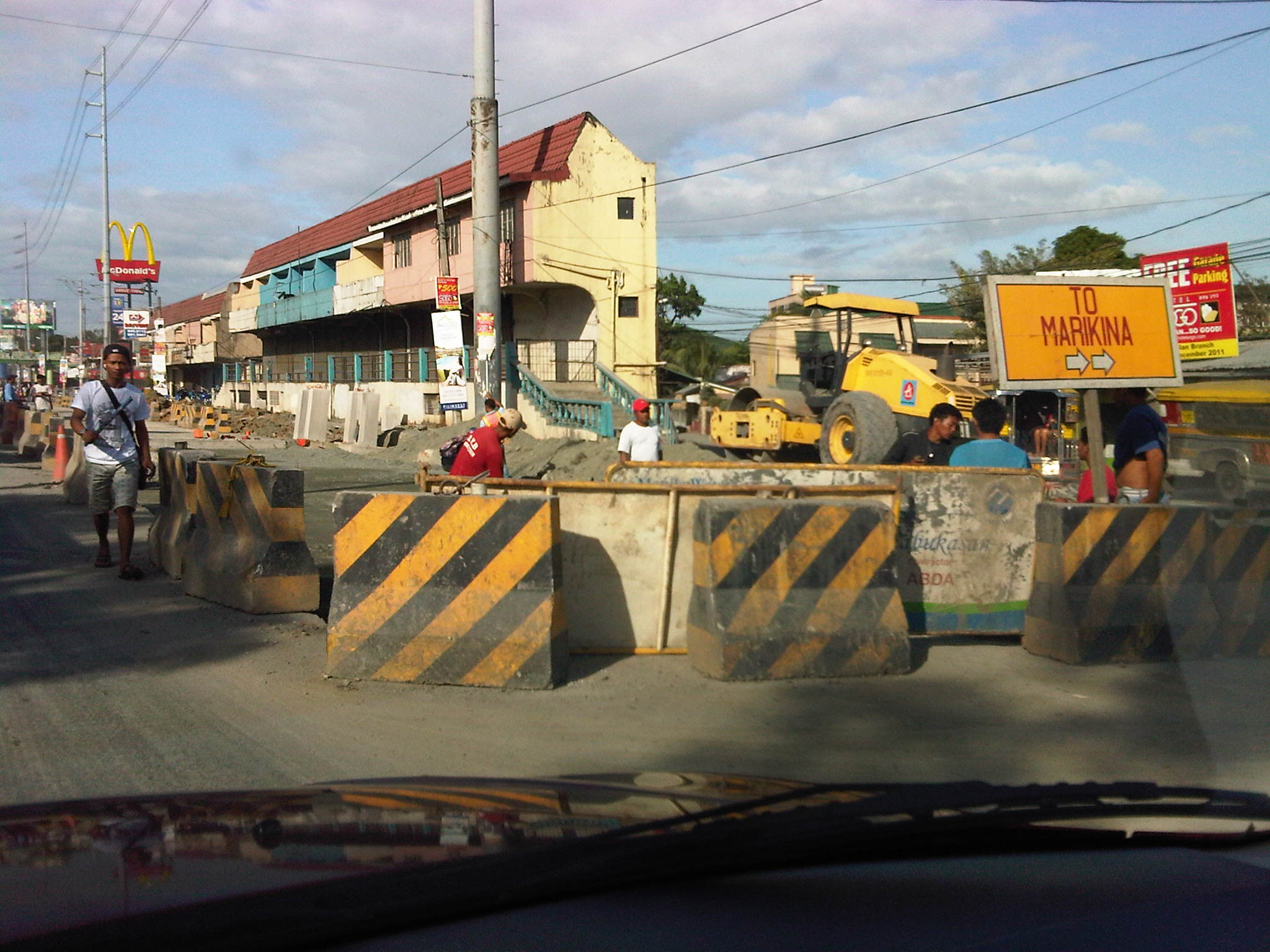 Section across Burger King and in the vicinity of a U-turn slot intended for traffic generally coming from Imelda/Felix Ave. The site is a bottleneck for traffic coming from Masinag and the villages along Marcos Highway. Due to the road works and the U-turn slot, there are only 2 lanes effectively available for through traffic that originally flowed along 4 lanes.
 Past the bottleneck, the Marcos Highway seems quite spacious with the equivalent of 3 lanes suddenly available to motorists. At right, there is the work area of a water concession who is supposed to coordinate with the road project contractor.
 Newly paved lane at the approach to the junction with Imelda Ave/A. Tuazon Ave. The works at this intersection has affected turning traffic to and from A. Tuazon Ave. At one time, right turns from Marcos Highway were prohibited due to construction affecting the entire intersection exit to A. Tuazon itself.
 After passing Dela Paz and approaching Ligaya, motorists will usually encounter another bottleneck due to the U-turn slot for vehicles generally coming from Amang Rodriguez (Pasig) and bound for Marikina. The area is usually constricted even with traffic enforcers present. These enforcers are usually found engrossed in checking for number coding violators than managing traffic. At present, there project contractor has paved the innermost lane of the section and this morning that lane is already passable to vehicles. Problem is, the same vehicles will discover that they will eventually run into the U-turn slot and motorists would have to swerve right to converge with through traffic.
 At the intersection of Marcos and Rodriguez, the traffic enforcers (probably in coordination with the contractor) made an opening to allow for counterflow during the peak periods. This is supposed to alleviate congestion at the intersection where aside from the still unfinished works, jeepneys tend to congregate and constrict the flow of traffic. Such occurs on a regular basis and one wonders how Pasig and MMDA enforcers can just stand around and not do anything about this predicament.
 After Ligaya, traffic flow is split with vehicles maneuvering left and right to avoid road works along a middle lane of Marcos Highway. The pavement on the right most lanes are newly constructed and have been passable for some time now. From the looks of the pavement on the left, these two will soon be scheduled for re-blocking. Perhaps the lane under construction now will be finished by then.
There are also drainage and road works ongoing on the other side of the highway and right in front along the LRT2 station. Often, commuters can be seen taking one lane of Marcos Highway as they try to get their rides from jeepneys who occupy yet another lane or two. During the night-time, another counterflow scheme is used for eastbound traffic with an opening just after the bridge.
Of course there is hope for those using Marcos Highway regularly. Perhaps the project will be completed before school opens in June 2012 and by then flow will be smoother and congestion more bearable. We only need to look at Ortigas Ave and its extension to know that we are still quite lucky. It is far worse along that road.
Fine-tuning the motorcycle lanes
I tried following the motorcycle lanes along Commonwealth Avenue one weekend to see if the MMDA has been able to mark the designated lane (4th lane from the roadside) throughout the entire stretch of the highway. I was optimistic considering all the hype about the lanes but still crossed my fingers given past experiences on such schemes’ implementation in Metro Manila and other Philippine cities. I wasn’t happy with what I saw while traveling along Commonwealth, particularly at points where public utility vehicles stop to drop-off or pick-up passengers. In a previous post, I already explained that where buses, jeepneys and AUVs tend to congregate, they occupy several lanes and effectively block through traffic. Among the lanes occupied are the ones designated for motorcycles. In all my observations, traffic enforcers seem always helpless and inutile against errant motorists occupying the motorcycle lane and posing danger through their maneuvers.
Following are a few photos I took along Commonwealth to “survey” the motorcycle lanes.
 Motorcycle lane along section past Toyota Commonwealth – note the “Motorsiklo” sign on the overpass indicating the lane designated for motorcycles
 Motorcycle lane along section in vicinity of Diliman Prep School – the lane is identifiable by the alternating blue and white lines, as well as the sign (“Motorsiklo”) on the overpass. While motorcycles are required to use only this lane while traversing the highway, other vehicles like the taxi shown in the photo are allowed use of the lane. I believe this is something that should be discouraged as they create situations where there is a high probability of crashes occurring.
The lane disappears after the St. Peter church and there are no markings or signs that would help guide motorcyclists to stay on the lane and perhaps also guide other motorists as well against using the lane. Many motorists, especially private vehicles, seem to respect the “blue lane,” usually and consciously leaving this lane for motorcyclists. We need more of that respect and much of courtesy in our streets and highways!
 Section past Sandiganbayan and approaching the Commonwealth and Fairview Markets – while some motorcycle riders can be observed as trying hard to follow the scheme, there are no markings to help guide them nor are there signs on the overpasses along the rest of the way. Perhaps the MMDA and the DPWH have not yet painted the markings or installed the signs along these sections? But then perhaps the implementation of the scheme is premature considering the lack of pertinent signs and markings?
 A bit of mayhem along Commonwealth and Fairview Markets – buses and jeepneys are practically everywhere here and occupy around 4 lanes as they load/unload passengers at this very crowded area. Motorcycle riders understandably veer away from the outer lanes of Commonwealth
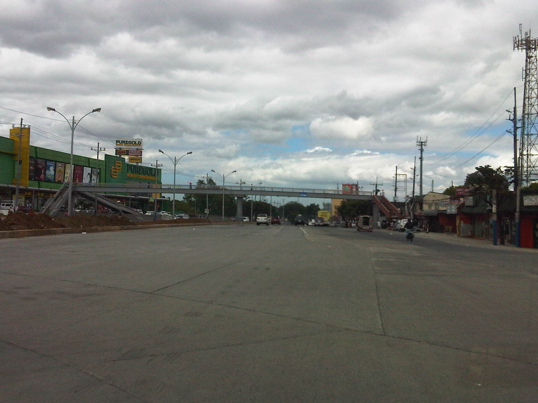 Section past the new rotonda along Commonwealth just before the overpass across the new Puregold branch – the highway was widened along this stretch and narrows to 3 lanes per direction after the overpass. There are no pavement markings yet for the newly added lanes and most of those for the previous lanes are already faded.
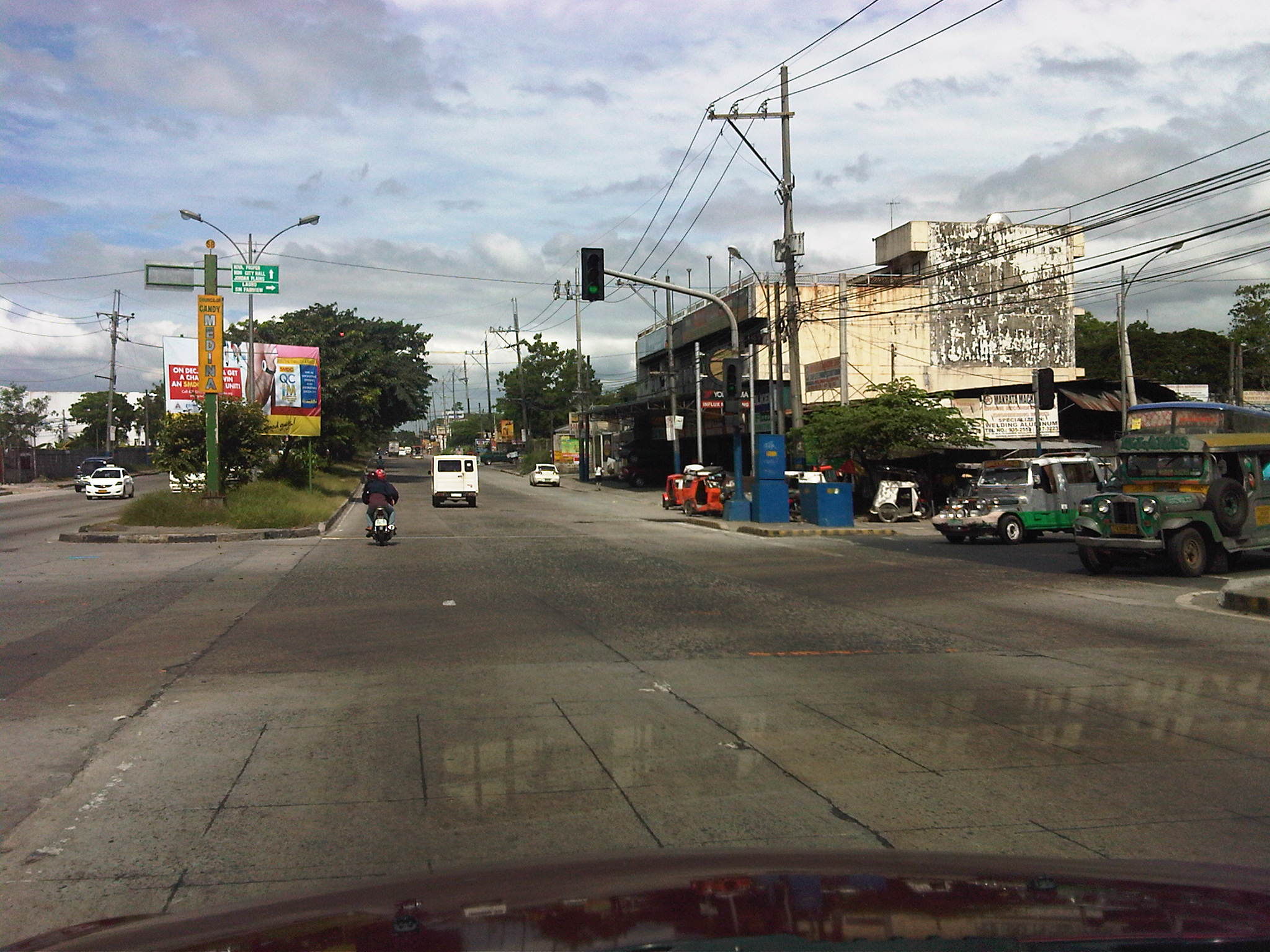 Junction of Commonwealth and Regalado – pavement markings are practically weathered and there are no indications of motorcycle lanes along these sections of Commonwealth
The formulation and implementation of motorcycle lanes along Commonwealth (and Macapagal Boulevard) are based on very good intentions (i.e., to reduce the incidence of road crashes involving motorcycles). However, the absence of pavement markings and signs to guide motorists and especially motorcyclists send the wrong signals in as far as enforcement is concerned. Add to this the serious matter of traffic management along PUV loading/unloading areas that is required to ensure that PUVs will not occupy motorcycle lanes and forcing riders to take to other lanes, thereby coming into conflict with private vehicle traveling along the inner lanes. These two issues clearly need to be addressed and fast so that the scheme can be effectively implemented throughout the entire length of Commonwealth Avenue.
The current situation pertaining to the implementation of motorcycle lanes in Metro Manila is perhaps another case where the agency implementing the scheme again “bit off more than it could chew.” As in the case of the 60 kph speed limit, effective enforcement throughout Commonwealth is limited by the availability and deployment of speed measurement equipment. As such, many vehicle still exceed 60 kph at sections where there obviously are no speed guns or radars. These situations and conditions are highly likely to lead ultimately to a ningas cogon outcome for such traffic management schemes. Such is undesirable since motorists will only become jaded (if they are not yet at this point) about traffic management in Metro Manila and elsewhere. And yet there are already indications that, like the PUV lanes, the MMDA would eventually slack on the enforcement side after realizing it needs to employ and deploy much more trained/skilled enforcers to implement all these schemes at the same time.
More congestion due to Imelda Ave. water and road works
Days before the long weekend break for the days commemorating All Saints and All Souls (Undas), I was surprised to experience severe congestion during the evenings that I drive to my home in Antipolo. To me it was quite unusual knowing from experience that traffic should be lighter considering most schools were already on semestral break and, closer to the weekend, many people would have already gone on vacation leave to return to their hometowns. I took a couple of photos of the progress of civil works as I drove, quite slowly, to my parents’ home at a subdivision along Imelda Ave. I wanted to take more photos but there was a sudden rainfall that obscured vision over my windshield and it became dangerous to take chance photos while driving in the rain.
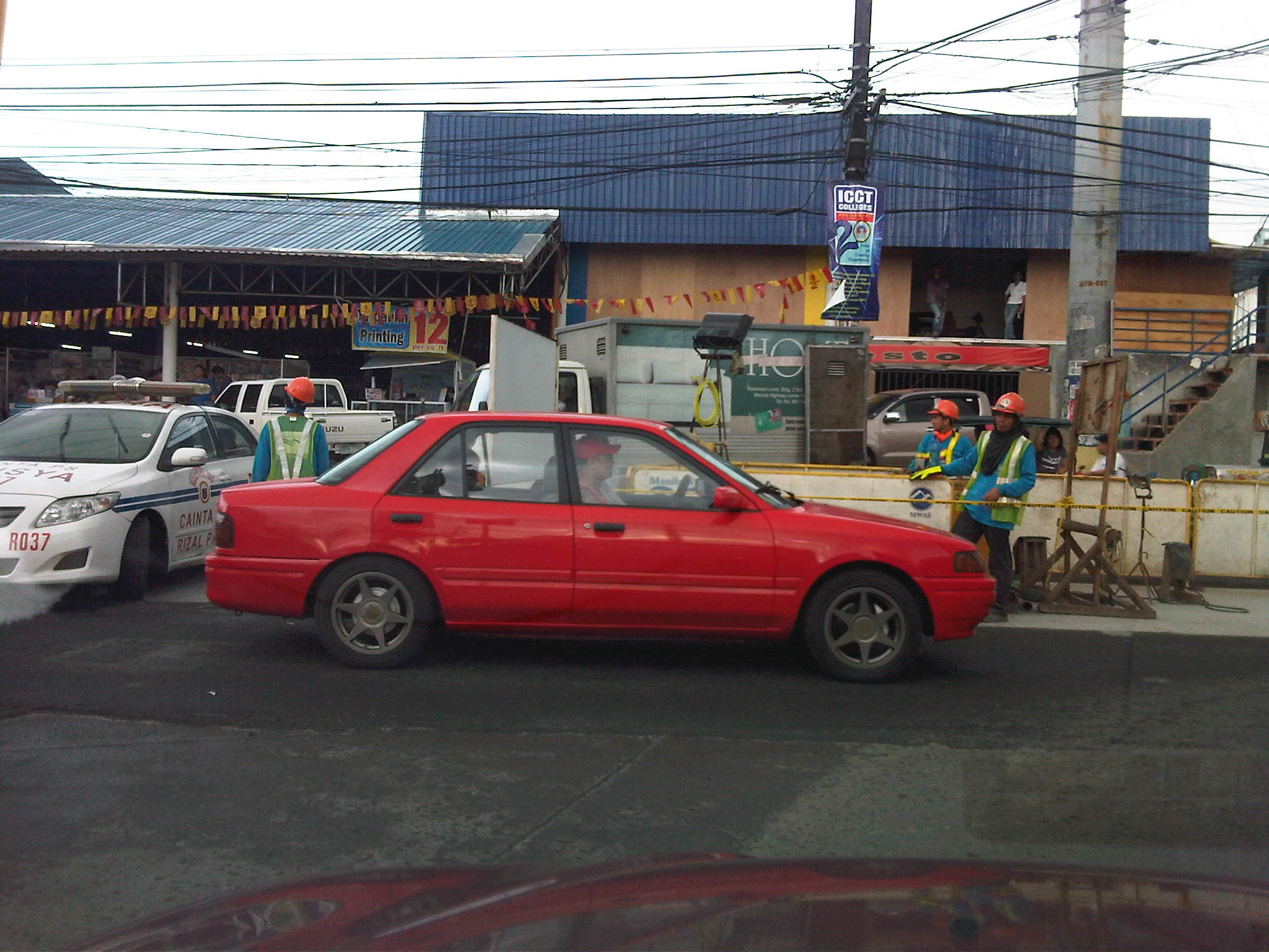 Water and road works at the junction of Imelda Ave. with the Sta. Lucia access road – the activity area effectively occupies a full lane of southbound direction of Imelda Ave. This has resulted in significant reduction in the capacity of the highway, and leads to sever congestion during the afternoon to evening peak periods. During these times, a very high volume of traffic including large trucks pass through the avenue from Marcos Highway and the resulting queues spill over and block traffic at the junction with Marco Highway. At its worst, the congestion extends towards Amang Rodriguez (Ligaya).
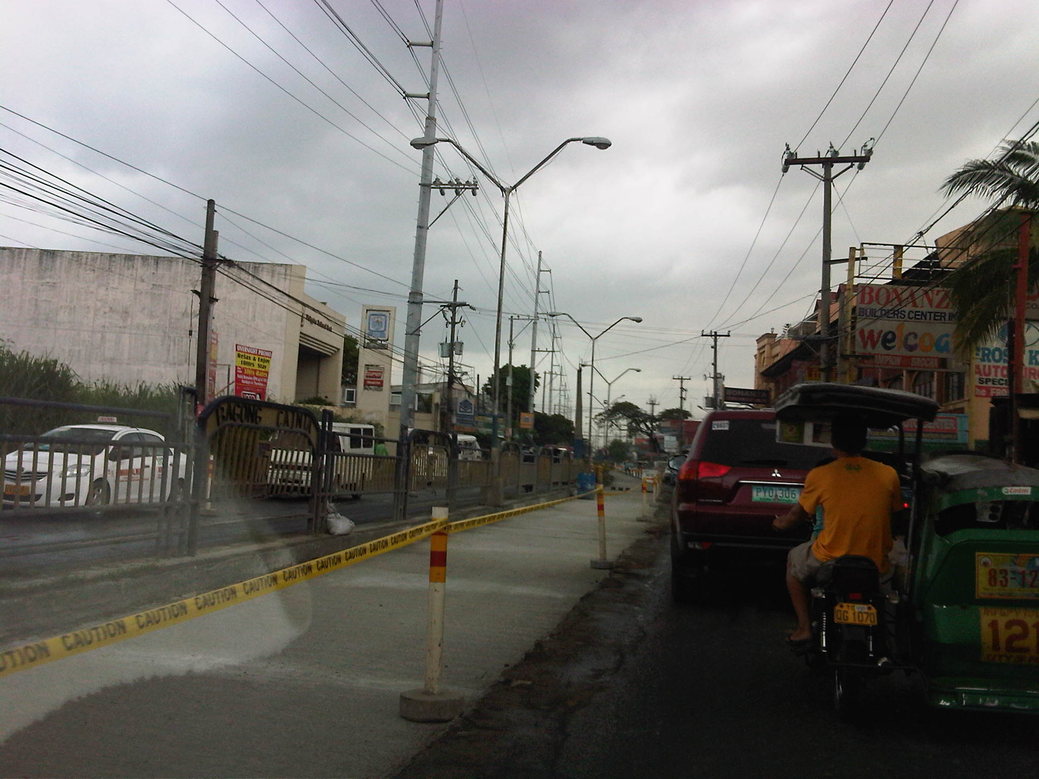 Single lane available to southbound (to Cainta Junction) traffic – all vehicles had to use one lane due to civil works being undertaken along the lane shown in the photo. New water pipes were laid down under the lane to increase capacity for the increasingly growing populations of the progressive towns of Rizal Province.
From the looks of the progress of work I’ve seen personally this weekend, I guess we can expect the congestion to start easing from the latter part of this week. The contractor tried to ease southbound traffic by employing a counter-flow scheme using one lane on the northbound side but the result was not as successful as the contractors desired as congestion quickly set in along this direction causing more misery to travelers along Imelda Ave. Apparently, the contractor underestimated the traffic along the avenue.
Motorcycle lanes – a few comments
The Metropolitan Manila Development Authority (MMDA) recently established motorcycle lanes along Commonwealth Avenue in Quezon City and Macapagal Boulevard in Pasay City. The main intention is to reduce crashes involving motorcycles by attempting to segregate them from other vehicles in traffic. Following are a few photos I took this afternoon along Commonwealth where I observed the MMDA painting blue lines to mark the motorcycle lane. In this case, the lane is the 4th from the outer edge (shoulder) of the highway.
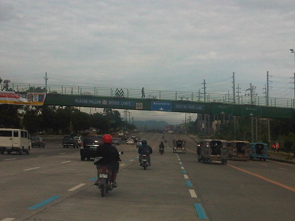 Newly painted blue lines mark the motorcycle lanes. Photo shows riders following the new policy, probably knowing that getting apprehended will lead to a 15-minute lecture on motorcycle safety. Such a penalty will only be applicable this week when the MMDA is implementing a dry-run of the policy. From Monday next week, the penalty would be a 500-peso fine for every apprehension.
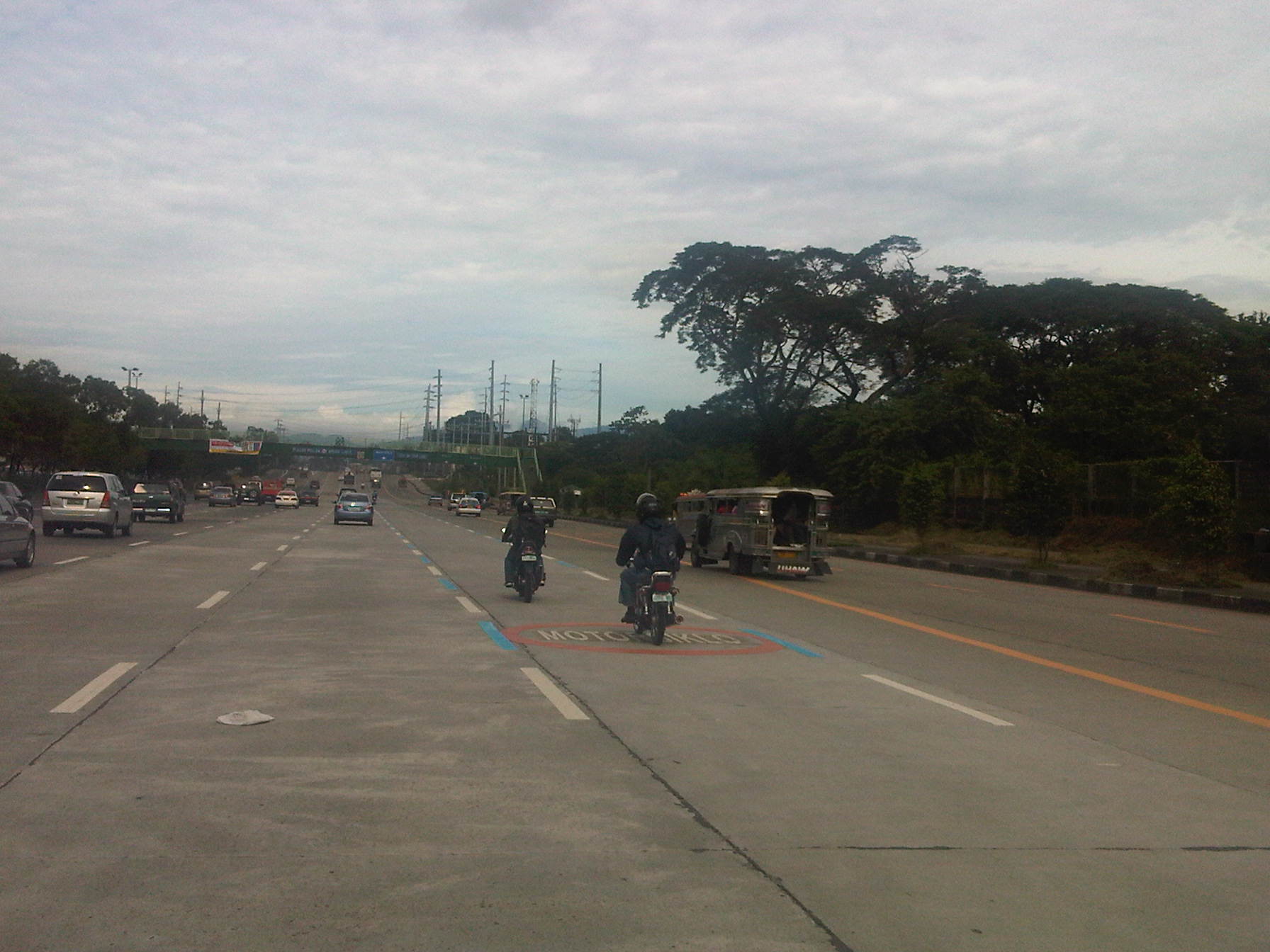 Pavement markings for the motorcycle lane along Commonwealth. Note that the lane is quite close to the lanes designated for public utility vehicles like jeepneys and buses. This situation creates a high potential for the occurrence of crashes involving motorcycles and PUVs. Of particular concern is the behavior of PUVs, especially buses that tend to encroach upon the lanes to the left of the PUV lanes including the motorcycle lane. Another issue is the fact that private vehicles are allowed along the motorcycle lanes and not just for maneuvering. I share the opinion of riders that motorcycle lanes should be for motorcycles only.
Intelligent Transport for the Philippines
The development of an App by the MMDA for use by travelers in Metro Manila is definitely a step in the right direction and represents a breathe of fresh air for the otherwise stale and irritating smog derived from the traffic. Such tools allow for travelers to be informed of the traffic conditions The app is in a sense actually quite crude considering that it is dependent on the observations of MMDA personnel from live feeds from cameras installed along roads throughout Metro Manila, as well as inputs from motorists including Tweets or Facebook messages. The results are often subjective because of the interpretation though quite accurate due to verification made via CCTV. Thus, it employs a more basic approach than what is already being used in other countries such as Japan, the UK and Germany, where traffic conditions are determined using probe cars or systems that are no longer subject to human observation or interpretation.
Vehicles equipped with GPS and communications systems much like the ones already used by the leading logistics companies to track their vehicles now routinely send information about location and such data can be used to construct real-time maps that, if compiled for 24 hours and all throughout the year, may provide a more automated and objective approach to providing travel information. Only incidents like road crashes would then require special treatment. A variation of this type of application of ITS would have been implemented for the MMDA’s bus dispatching for EDSA a couple of years ago using RFID technology to monitor the progression of bus travel along the highway. Unfortunately, after meeting opposition from the transport sector and experiencing some glitches, the project never went underway. Sayang!
Intelligent Transport Systems (ITS) has been available for quite some time now with the 1st World Congress held in1994 in Paris, France. Since then, the developments in ICT have been quite rapid though costs seem to have only reduced significantly in the past 5 years. One reason why ITS has not been able to grab a foothold in many countries is the prohibitive costs of many systems that are supposed to have more significant impacts on transport and traffic in their cities. With more resources and tools becoming available, and with many people able to acquire or access some form of tech (e.g., cell phone, internet), ITS has become available to many people though it is not necessarily cheap (how much is an iPhone?). While Metro Manila could probably afford to make investments for ITS, other cities will not have the resources for such, opting instead to put their money where it is more needed (or so we hope and assume).
Wikipedia provides a pretty decent description of ITS as derived from several sources. Depending on the reference, ITS typically has four functional components:
• Advanced Traffic Management Systems (ATMS)
• Advanced Public Transport Systems (APTS)
• Advanced Vehicle Control Systems (AVCS)
• Commercial Vehicle Operations Systems (CVO)
A fifth one, Advanced Traffic Information Systems (ATIS), is supposed to be embedded or integrated with the four. The MMDA app falls under ATIS and has applications for ATMS and potentially APTS. Leading logistics companies including local ones already employ ATIS for CVO.
I had an opportunity last year to talk about ITS when I was invited to present at the Smarter Cities Summit sponsored by IBM Philippines in December. A pdf of the presentation is found below:
SmarterCities – Transport and Traffic
ITS applications in the Philippines include the very basic ones like the parking management systems now used by shopping malls to inform about the availability of parking spaces to the more comprehensive ones like the electronic toll collection systems of NLEX and SLEX, and the SCATS traffic signal control system of Cebu City. Vehicle manufacturers now routinely use ITS in many vehicles including those sold in the Philippines. These include information on fuel consumption displayed on the dashboard, proximity alarms, and many already have navigation systems as options when purchasing the vehicle.
The 18th ITS World Congress will be held in Orlando, Florida, USA later this month. It promises to again provide participants with a taste of what has been deployed so far and how effective these systems are in addressing traffic problems. Companies participating in the congress would also be displaying products under development and perhaps postulate what can be done in the near future using technology for leverage in solving issues on transport and traffic. It should be noted, however, that ITS remains a tool that would be effective only if both authorities and stakeholders also address the roots of the transport and traffic problems in this country. Dependence on ITS alone will have very limited impacts compared to more comprehensive programs for managing transport demand and supply. Nevertheless, ITS presents a powerful tool that can tremendously enhance traditional solutions. In fact, the “full potential” for ITS combined with traditional TDM and TSM is regularly on display in Singapore with its Electronic Road Pricing (ERP) scheme. But that’s another story.
Traffic going bananas
I’ve written about land use and parking along Katipunan Avenue, which is part of Metro Manila’s Circumferential Road 5. Katipunan extends southwards to Blue Ridge, St. Ignatius and White Plains (the latter subdivisions just across the street from Camp Aguinaldo) where there are also many establishments along either side of the road. Most of these establishments are restaurants that attract significant private vehicle traffic. Note that there are no public transport routes along Katipunan/C5 in the Blue Ridge, St. Ignatius and White Plains areas. As such, establishments are more likely to attract people with cars rather than those taking public utility vehicles.
Many of these establishments are on lots formerly occupied by residential buildings (i.e., houses) considering the predominant land use in the areas. These were eventually purchased and converted for commercial use, resulting in layouts that generally do not include adequate parking spaces. The consequence of shortcomings in parking have been the propensity for on-street parking such as shown in the following photo in the Blue Ridge area.
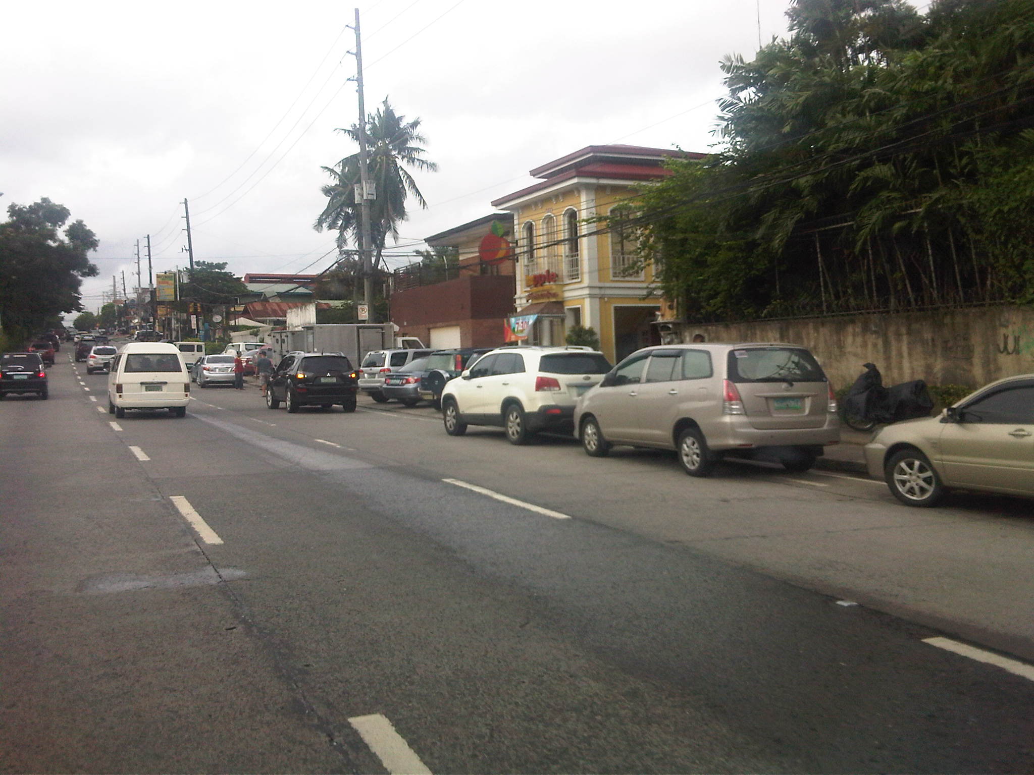 On-street parking for a popular restaurant/cafe along Katipunan/C5 at Blue Ridge.
Such case and many others like it along Katipunan (and other Metro Manila or Philippine cities roads) are the result of both poor planning and lax enforcement of traffic rules and regulations in this country. Being a primary arterial, Katipunan/C5 should be clear of such unnecessary sources of roadside friction that effectively decreases road capacities while also increasing the risk of crashes as vehicles maneuver, or in some cases wrestle, for parking spaces.
Congestion along Ortigas Ave. Extension
The severe traffic congestion experienced along Ortigas Avenue Extension these days are due partly to civil works related to a water project. This is similar to works that were implemented along Marcos Highway that coincided with the road widening and drainage project along that Highway. Ortigas Ext. traffic is always bad during the weekdays due to the limited capacity of the road combined with the sheer volume of traffic it has to carry. The highway still serves as the primary artery connecting the populous and progressive towns of Rizal Province to Metro Manila. These include Antipolo City and the towns of Cainta, Taytay, Binangonan and Angono. I’ve written a piece about traffic along Ortigas Ext. as well as the management schemes that have been employed to address peak period congestion including allowing counterflow traffic on weekday mornings. Following are a few more observations and assessments

Civil works in the middle of Ortigas Ave. Ext. in the De Castro Subdivision area – road capacity is substantially reduced along significant sections of the road due to waterworks project. Both eastbound and westbound traffic are affected as one lane each are taken up by the project. Traffic flow will surely improve once the project is completed, automatically adding two lanes (one for either direction) to increase capacity.

Sunday jam – I can only imagine how bad traffic congestion can be during the weekdays. The photo above is one I took on a Sunday afternoon showing congestion along the westbound direction typically associated with peak period traffic on weekdays. Meanwhile, traffic is practically free flowing on the eastbound side once you get past the work area across De Castro. I was a little surprised about the discipline of drivers considering only few (mostly motorcycles) dared to counterflow.

More diggings – this time 2 lanes are taken away from the wide section of Ortigas stretching from across the former Riverside Mills to the BF Metal Corp. This is where vehicles usually make U-turns because of the space available for vehicles making such maneuvers that are no longer allowed during most periods past the vicinity of Cainta Junction.

Approach to Cainta Junction – this is probably one of the most congestion or saturated intersections outside Metro Manila. Most traffic though can be attributed to Metro Manila as most vehicles are either bound for MM or are coming from it. At this Junction, Ortigas Ext. meets Imelda Ave. (formerly known also as Francisco Felix Ave.), which continues as A. Bonifacio Ave. as it extends to towards Cainta town proper. Ortigas Ext. from the eastbound approach has only 2 lanes (another 2 on the opposing direction) widening to 5 (additional lane for right turning traffic to Cainta) at the entry. Meanwhile the westbound approach from Antipolo/Taytay also has 3 lanes with one dedicated to right turning traffic, which is significant due to left turns being disallowed from the eastbound approach towards Imelda Ave. Vehicles now go through Ortigas and take a U-turn after the junction and then turn right to Imelda. At the median opening, Ortigas has been widened to allow for such maneuvers.
Cainta traffic and the MMDA has been experimenting on a number of schemes for the signalized junction. One proposal that has been on the shelf for quite some time now is for an overpass to be constructed along Ortigas to allow for continuous traffic flow along the highway. So far, there just seems to be not enough space for an overpass to be constructed and some quarters are saying that the only way to improve traffic really is to widen Ortigas to something like Marcos Highway on the other end of Imelda Ave. Such propositions could have been averted if a mass transit system was constructed along this corridor when congestion was just starting to set-in. Actually, history tells us that there was a mass transit system before with trains running regularly between Manila and Antipolo. But that is a topic we’ll reserve for another post. Abangan!
 Caught (up) in traffic