
Home » Transport Planning (Page 30)
Category Archives: Transport Planning
More bikeways please!
After the construction of a bikeways network in Marikina City, the city became a poster child for sustainable transport in the Philippines. The bikeways was initiated with assistance from the World Bank for the pilot route and was later expanded by the city under the leadership of its Mayors, the former MMDA Chair Bayani Fernando and his wife Marides Fernando. The bikeways were promoted as a good practice example for non-motorized transport (NMT), with the National Center for Transportation Studies (NCTS) of the University of the Philippines Diliman involving the Marikina City Bikeways Office (MCBO) in its studies and advocacy work on Environmentally Sustainable Transport (EST).
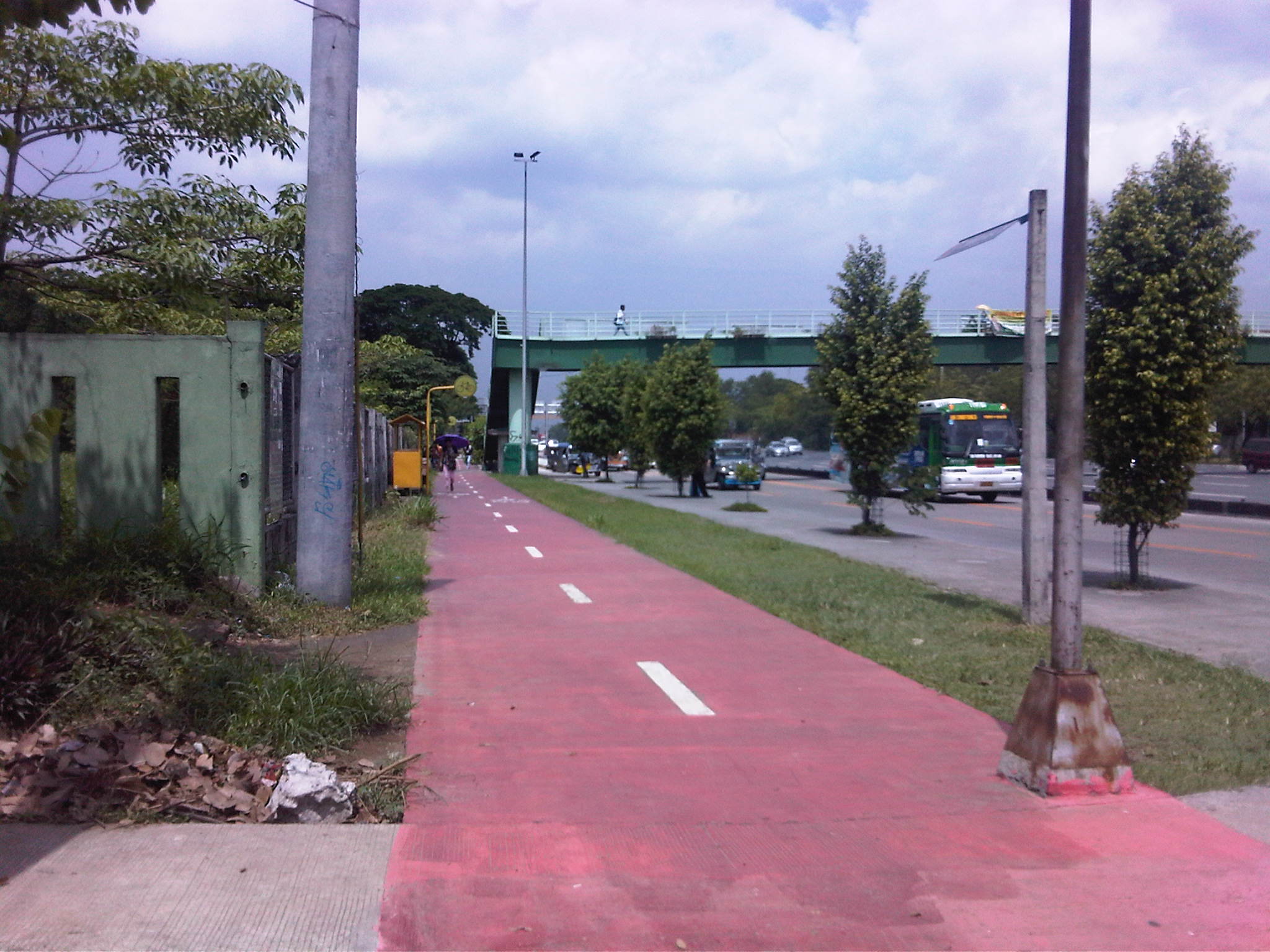
 Bikeways between pedestrian walkway (red pavement) and parking slots in Marikina City.
 Bike lane along the Academic Oval at UP Diliman in Quezon City.
 Bike lane integrated into the sidewalks along Marcos Highway in the cities of Marikina, Pasig and Antipolo.
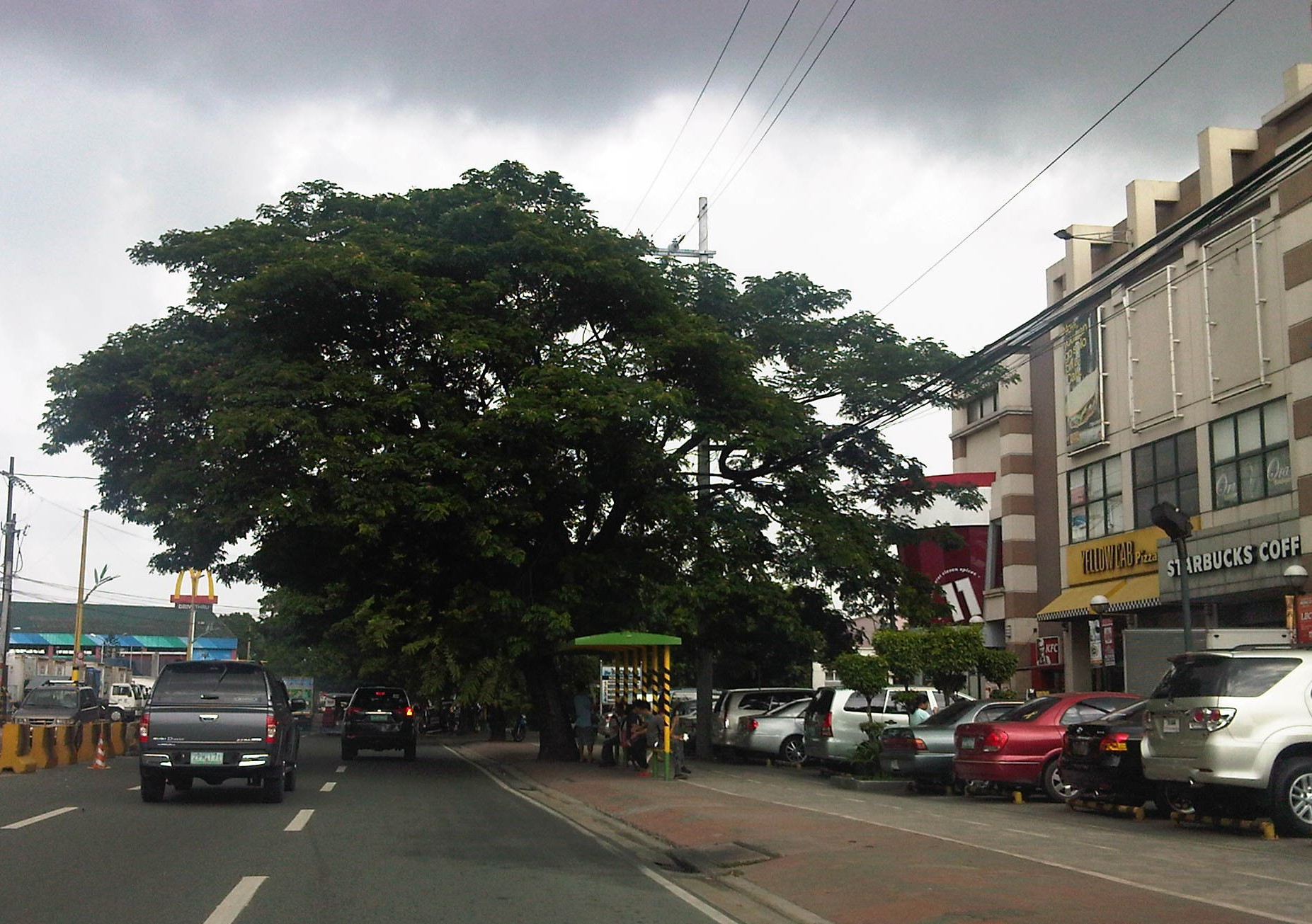
 Bike lanes (red pavement) in Malate, Manila.
 Bike lanes integrated with the sidewalks along Commonwealth Avenue in Quezon City.
 Bike lanes integrated with the sidewalks along Commonwealth Avenue in Quezon City.
This is obviously not a comprehensive list of bike lanes and bike ways in the Philippines. I am sure there are similar projects in other cities and I am aware that cycling is becoming more popular around the country. These are but examples of what has been accomplished so far and it is clear that we need to do more to promote cycling not just as a sport or for recreation but, more importantly, as a means for commuting. Integrating cycling into one’s daily routine is a healthy and money-saving option, and segregated bikeways and bike lanes ensure the safe travels for cyclists. This, of course, is in consideration of the little respect cyclists (and pedestrians) get from motorists who believe road space is theirs alone.
–
Some thoughts on the issues on bus bans and terminals in Metro Manila
I had originally wanted to use “Clarifying issues on bus bans and terminals in Metro Manila” as the title for this post. However, I felt it was too strong a title, and one that would be more appropriate for a government agency like the MMDA or DOTC, or an LGU like Manila. More than fault-finding and criticizing government agencies and local governments, I believe we should take a closer and more objective look at the issues (or non issues?) pertaining to the Manila bus ban and the opening of the southwest provincial bus terminal for Cavite-bound buses. Following are my comments on issues raised the past weeks about the two initiatives.
Issue 1: There were no or few announcements about the implementation of the bus ban in Manila and the southwest terminal in Cavite.
Comments: While the bus ban in Manila came as a surprise to many, the move was actually a consequence of a Manila City Council resolution. Normally, such resolutions would take time to implement and would entail announcements for stakeholders. Though we will probably never know the truth or who is saying the truth about the resolution and its implementation, it is likely that bus operators already knew about the implications but decided to call Manila’s bluff and play the media and public appeal cards rather than comply with Manila’s requirements for franchised buses and terminals as they have done before in other issues like fuel prices and fare hikes.
I find it difficult to believe that the MMDA did not do its part in announcing the opening of the southwest terminal. Perhaps people thought the announcement was over a very short period? Or maybe people didn’t mind the announcement and are also at fault for paying no or little attention to the announcement? If so, then the public is also partly to blame for disregarding the announcement from the MMDA, assuming the agency won’t push through with its initiatives to implement central terminals for buses. Next up will be another southern terminal at Alabang and a northern one near Trinoma.
Issue 2: Poor transfer facilities and services including a lack of pedestrian facilities between the bus terminal and transfer point, and lack of public transport like jeepneys to ferry passengers to their destinations.
Comments: I think it’s quite clear that the MMDA and LGUs are at fault here. Despite the construction and scheduled opening of the southwest terminal, there have been limited effort in improving pedestrian facilities. Such facilities needed to be in place prior to or upon the opening of the southwest terminal and requiring all provincial buses to terminate at the facility instead of continuing to Metro Manila. People-friendly facilities could have helped people in adjusting to the new policy though walking from 100 to 200 meters is certainly not for all, especially during this rainy season. Senior citizens and persons with disabilities (PWDs) would have specific needs that could have been addressed from day one of operation of the terminal. One approach to “bridge the gap” between the terminal and where people could take city bus and jeepney rides could have been to modify some city bus and jeepney routes to make these closer to the terminal. Ideally, the terminal could have been an intermodal facility providing efficient, seamless transfers between modes of transport.
In the case of Manila, the jeepneys were already there with routes overlapping with buses but their numbers and capacity could not cope with the demand from the buses. Since the main objective of Manila was to weed out colorum buses, it could have coordinated with the LTFRB to check the registration and franchises of buses rather than generalizing among all buses. Perhaps Manila just wanted to make a big statement? But then this was at the expense of the riding public, which obviously got the attention of many including the media. Coordination among agencies and LGUs, however, has not been a strong suit for these agencies, and this thought leads us to the next issue.
Issue 3: Lack of coordination among LGUs and agencies in implementing transport schemes.
Comments: This issue is an enduring one and has been the topic of discussions, arguments and various fora for as long as we can remember. On one hand, the DOTC and the LTFRB should provide guidelines and guidance to local governments on transport planning and services. The agencies should be proactive in their engagement of LGUs in order to optimize transport services under the jurisdiction of national agencies and local governments. On the other hand, LGUs must accept the fact that most if not all of them are ill equipped or do not have the capacity nor capability to do transport planning much less addressing issues regarding public transport. Citing the Local Government Code and its devolution of local transport to LGUs everytime there’s a transport issue certainly won’t help LGUs solve their problems.
Issue 4: Terminals required for city buses in Manila.
Comments: There should be a terminal for city buses in Manila but not a terminal for each company. There should only be one or maybe two terminals where buses can make stops prior to making the turnaround for the return trip. There is actually a terminal in Manila, which the city can start with for city buses. This is the one just beside the Metropolitan Theater and near City Hall, which can be utilized by city buses. It is also close to the LRT Line 1 Central Station so the facility can be developed as a good intermodal terminal for land transport.
Issue 5: Colorum or illegal public transport vehicles in Manila
Comments: This is actually a problem not just for Manila but for the rest of Metropolitan Manila and the rest of the country. The colorum problem is there for both conventional and paratransit services as there are illegal buses, jeepneys, UV express, multicabs, taxis, tricycles and pedicabs everywhere. Many of these are allegedly being tolerated by national agencies and local governments with many allegedly being fielded or owned by public transport operators themselves.
–
In most cases, the best time to evaluate a traffic policy or scheme is NOT during its first days or weeks of implementation but after a significant time, say at least a month, after it was implemented. This is because the stakeholders, the people involved would take some time to adjust to any scheme or policy being implemented. This adjustment period will vary according to the magnitude or scope of the scheme/policy and can be quite “painful” to many who have gotten used to the old ways. Usually, a lot of comments and criticisms are quite emotional but it is clear that the collective sentiment is the result years or decades of poor transport services and fumbling by government agencies. Transport in Metro Manila is already quite complicated with routes overlapping and services competing with each other for the same passengers. Perhaps it is time to simplify transport while also in the process of optimizing and rationalizing services. I have written about this in this previous post.
More transport issues in Manila will come about should the city train its attention on other modes of transport including jeepneys, UV express vehicles, tricycles, pedicabs and kuligligs. If the city is really intent on reforming transport services within its jurisdiction, it should consider the needs of all stakeholders and especially and particularly the riding public. Transport should be inclusive, people-friendly as well as environment-friendly and there are many good practices in other cities that Manila could refer to and study for adaption and adoption for the city. If it is successful in improving transport, then perhaps Manila could be the country’s model for transformation from being the “Gates of Hell” to being a “Portal to Heaven” to residents and visitors alike.
–
Special lectures on transportation after the 2011 tsunami in Japan
We recently had the honor of hosting two professors from the Tokyo Institute of Technology (Tokyo Tech). Prof. Tetsuo Yai was an adviser to two (2) faculty members of the Institute of Civil Engineering of UP Diliman and Dr. Daisuke Fukuda was adviser to a former student of ours who is now with De La Salle University. While both are in the transportation field, their laboratories are located in different campuses of Tokyo Tech. Prof. Yai’s laboratory is at the Suzukakedai campus in Yokohama while Dr. Fukuda’s lab is at the main campus in Ookayama where Prof. Yai used to have his laboratory.
Prof. Yai delivered a lecture on “The Progress of Miyako Recovery Plan from Tsunami Disaster” while Dr. Fukuda presented on the “Impacts of Rolling Blackouts on Railway Transport Service in Tokyo Metropolitan Area after the 2011 Tohoku Earthquake.” The lectures were held at the Toyota Training Room of the National Center for Transportation Studies (NCTS) with an audience comprised mainly of graduate and undergraduate students of Civil Engineering.
 NCTS Director Sean Palmiano opening the lectures and introducing Prof. Yai to the audience.
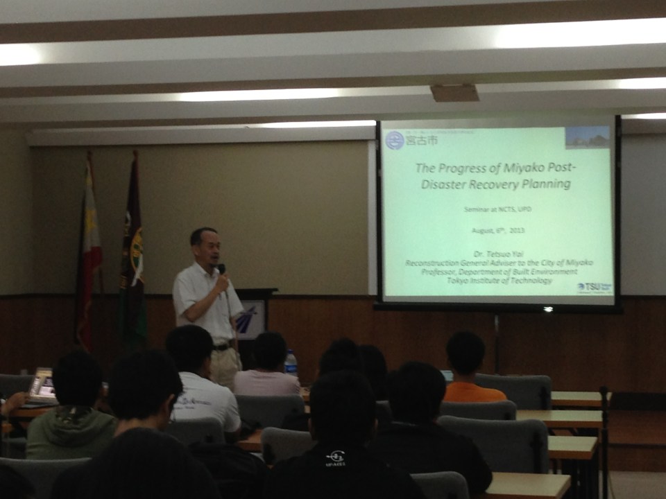 Prof. Yai introducing his topic and talking about the earthquake and tsunami that hit the Tohoku region in 2011.
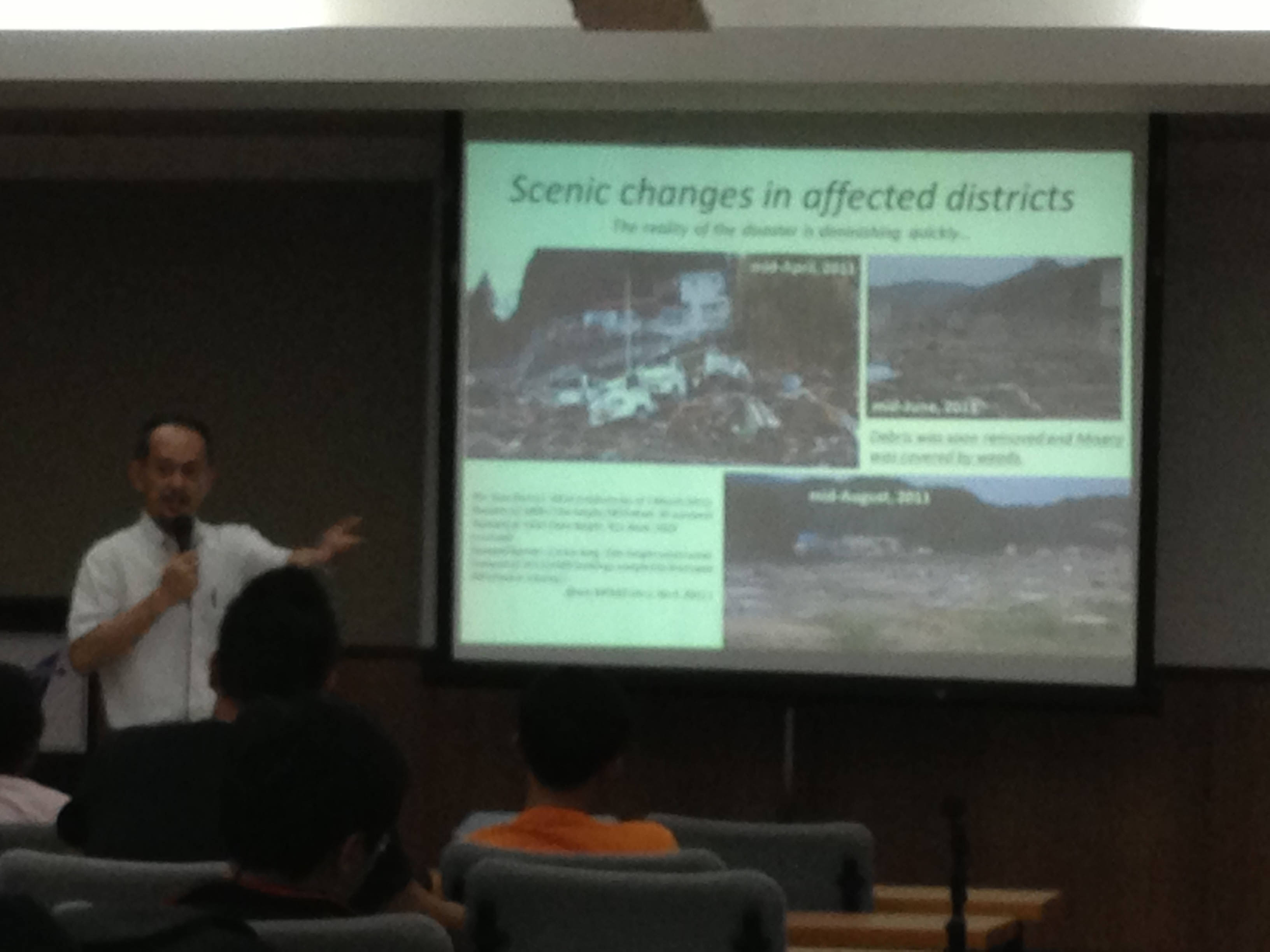 Prof. Yai explaining about the effects of the tsunami on Miyako City and the initiatives for recovery.
 Dr. Fukuda describing the urban rail network in the Tokyo Metropolitan Area.
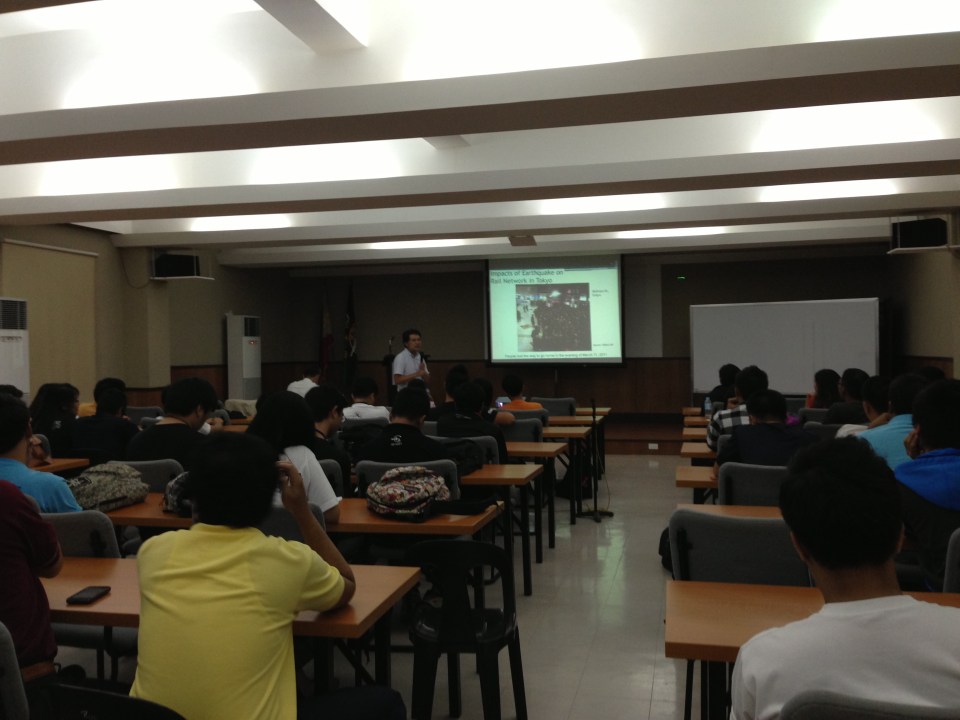 The lectures were well-attended.
 Dr. Fukuda explaining on the impacts of blackouts on rail transport and commuting times in Tokyo and its surrounding areas.
–
Dream plan for the Greater Capital Region?
A report came out last Saturday on a major daily about a JICA study estimating losses of as much as 2.4 Billion pesos per day due to traffic jams experienced in Metro Manila. Not mentioned was the 1.0 Billion pesos per day estimated losses for the Bulacan, Rizal, Laguna and Cavite areas that are at present considered part of what has been loosely defined as Mega Manila or the Greater Capital Region (GCR). That’s 3.4 Billion pesos per day of lost productivity and potential income that if reduced, could generate resources that could be distributed to the rest of the country. The JICA estimate, as reported by NEDA, is the product of a study that is in its concluding phase that looked into transport for an area comprised of Metro Manila, Region 3 (Central Luzon) and Region 4A (Southern Tagalog or Calabarzon). The main objective of the study was to come up with a Transport Infrastructure Framework and Roadmap for the GCR that would guide planners and engineers, and most importantly decision-makers (i.e., our leaders) in identifying and prioritizing transport infra projects that would ultimately improve the way we travel in the GCR.
While I am not at liberty at present to divulge the details of this study as the entirety has not been made public yet, I can say that the study was comprehensive and the conclusion an urgent reminder to what needs to be done for transport in the GCR. The latter is necessary because we have failed to deliver on the transport infrastructure required by Metro Manila and its surrounding areas since the late 1970s adn early 1980s when some decisions were made that were detrimental to public transport development and, to my view, inhibited and limited us from implementing a much more efficient transport system than what we have now. In my own conversations with the person who led the study, I can understand his own frustrations as he was himself a witness to the deterioration of transport in this country. Much of this deterioration have been attributed to a lack of political will to make the hard decisions in relation to transport. These decisions include those pertaining to the rationalization of transport services like phasing out jeepneys and tricycles where they are no longer suitable and committing to the implementation of mass transit projects that have been delayed for decades now.
 Network of recommended rail rapid transit (RRT) lines for the Manila Metropolitan area in 1973 (UTSMMA, 1973)
Perhaps we are at a crossroads in terms of transport in this country. Perhaps our leaders should listen to the clamor of their constituents for better transport systems in our cities, for more efficient ways to move about. Perhaps, too, we could finally see what’s really at the end of the tunnel rather than the proverbial light that we have always seen, frustratingly, for the past few decades. Perhaps the current administration will prove itself the catalyst for transforming transport in this country towards what it has preached as a “straight path.” Will we have a champion or champions who would push for the realization of a dream plan for transport? Whoever should step forward would definitely get my vote in 2016!
–
What is the context for electric tricycles in the Philippines?
The NEDA Board recently approved six projects that included one that will be promoting electric vehicles throughout the country. Entitled “Market Transformation through Introduction of Energy Efficient Electric Vehicles Project” (formerly Market Transformation through Introduction of Energy Efficient Electric Tricycle (E-Trike) Project), the endeavor seeks to replace thousands of existing conventional motorized 3-wheelers (tricycles) with e-trikes and to develop and deploy charging stations for these vehicles. While I have nothing against electric vehicles and have supported their promotion for use in public transport, I am a bit worried about the context by which electric tricycles are being peddled especially the part about equating “transformation” with “replacement.”
First, it is a technology push for an innovation that has not been fully and satisfactorily tested in Philippine conditions. The deployment of e-trikes in Bonifacio Global City is practically a failure and a mode that was not suitable from the start for the area it was supposed to serve (i.e., while there were already jeepneys serving the area, there were also the Fort Bus services and plans for a BRT linking the Ayala CBD and BGC. There are now few (rare sightings) of these e-trikes remaining at the Fort, as most of these vehicles are no longer functioning due to problems regarding the batteries, motors, and issues regarding maintenance. Meanwhile, the e-trikes in Mandaluyong, a more recent model, have also been difficult to maintain with one case reportedly needing the unit to be sent back to China for repairs.
Second, the e-trikes are a whole new animal (or mode of transport). I have pointed out in the past including in one ADB forum that the 6 to 8 seater e-trike model is basically a new type of paratransit. Their larger capacities mean one unit is not equivalent to one of the current models of conventional tricycles (i.e., the ones you find in most city and municipality around the country). Thus, replacement should not be “1 e-trike : 1 tricycle” but perhaps “1:2” (or even “1:3” in some cases). This issue has not been resolved as the e-trike units continue to be marketed as a one to one replacement for conventional trikes. There should be guidelines on this that local government units can use, particularly for adjusting the number of franchises or authorized tricycles in their respective jurisdictions. Will such come from the Department of Energy (DOE)? Or is this something that should emanate from Department of Transportation and Communications (DOTC)? Obviously, the last thing we like to see would be cities like Cabanatuan, Tarlac or Dagupan having so many e-trikes running around after they have replaced the conventional ones, and causing congestion in the cities. Emissions from the tricycle may have been reduced but emissions from other vehicles should be significant due to the congestion.
Third, the proliferation of e-trikes will tie our cities and municipalities to tricycles. Many cities already and definitely need to upgrade their public transport systems (e.g., tricycles to jeepneys or jeepneys to buses, and so on). Simply replacing tricycles with electric powered ones does not effect “true” transformation from the transport perspective. Is the objective of transformation mainly from the standpoint of energy? If so, then there is something amiss with the project as it does not and cannot address the transport, traffic and social aspects of the service provided by tricycles (and other modes of transport).
So what is the context for the e-trikes or conventional tricycles? They are not even under the purview of the Land Transportation Franchising and Regulatory Board (LTFRB) as they are regulated by LGUs. Shouldn’t the DOTC or the LTFRB be involved in this endeavor? Shouldn’t these agencies be consulted with the formulation of a framework or guidelines for rationalizing and optimizing transport in our cities? These are questions that should be answered by the proponents of this project and questions that should not be left to chance or uncertainty in so far as the ultimate objective is supposed to be to improve transport in the country. I have no doubt that the e-trikes have the potential to improve air quality and perhaps the also the commuting experience for many people. I have worries, however, that its promise will not be kept especially in light of energy supply issues that our country is still struggling with and deserves the attention of the DOE more than the e-trikes they are peddling.
–
Traffic congestion and the limits of quick fixes
One time last summer night, it took me 2.5 hours to get to the airport from where I reside when it should only be an hour or 1.5 hours (on a typical bad day). Very early mornings (between 2 to 4 AM), it only takes me 40 minutes between my home an the airport. The route I usually take is mainly along Circumferential Road 5 (C-5); a route that basically has sparse public transport (mostly jeepneys along different sections) but is a truck route. It was summer though and one would have thought that there would be less vehicles along the road with school still out. I was wrong in that assumption and that cost me both time and fuel that night.
Traffic congestion in Metro Manila and other Philippine cities have been issues for such a long time that one tends to assume there’s nothing being done to fix the problem. In Metro Manila, the Metropolitan Manila Development Authority (MMDA), in cooperation with the various local governments and national agencies, has implemented various schemes including the number coding, truck ban and a bus dispatch system along EDSA. Yet, congestion persists and only last week, the President got caught in traffic as he traveled from Malacanang Palace in Manila to the DOST Compound in Taguig. The news was filled with a comment that he supposedly made to the MMDA Chair about the delay he and his entourage experienced. The bad news is that this congestion will not go away and will only worsen if there are no steps taken to address the problem. And this happens not only in Metro Manila but in other highly urbanized cities in the country. Quite obviously, quick fixes are no longer enough and we have reached the limits of their applicability.
 EDSA during the morning rush hours
 EDSA during the afternoon peak, which actually extends to an evening and even nighttime traffic jam
So how do we alleviate traffic congestion? Here’s three things that come to mind as they seem to be quite logical and very obvious:
1. Build the mass transit infrastructure required – these infra include rail and bus rapid transit systems and are urgently needed in Metro Manila, Metro Cebu, Davao and other highly urbanized cities. A shift from private vehicle use to public transport will not happen if people have no attractive options for commuting. In Metro Manila, there is a backlog of mass transit projects with lines that should have been constructed and operational years or even decades ago.
2. Rationalize transport services – the long standing practice is to increase the number of existing modes of transport as the demand increases. This logic is one that is most abused as a doubling of demand is conveniently but incorrectly interpreted as requiring a corresponding doubling of the number of tricycles or jeepneys, for example. What is required is for our cities to “graduate” from low capacity and less efficient modes to higher capacity and more efficient ones. Many cities seem plagued with tricycles as their main modes of transport within their CBDs when these should have been restricted to residential areas and mainly in the periphery rather than allowed to dominate (and clog) urban streets.
3. Build more walkways and cycling facilities – its difficult to encourage people to walk and cycle if there are no space for pedestrians and cyclists to travel safely and efficiently. Most trips are actually short ones and do not require motor vehicles so it makes sense to invest in pedestrian and cycling facilities so people get the clear message of support for such options for travel. Such investment is also one for healthy living as walking and cycling are forms of exercise and it is well established that these modes of transport promote healthier lifestyles and therefore, healthier people in cities.
–
Traffic congestion along Buendia (Gil Puyat Ave.)
The Makati CBD generates a very high number of trips owing to it being arguably the largest CBD in Metro Manila in terms of offices and workers. There are several other CBDs like Manila, Ortigas, Cubao, Eastwood, Filinvest City, and Bonifacio but they generate less traffic compared to Makati. There are several major roads in the area including four intersecting roads that practically define the CBD. These are Ayala Avenue, Gil Puyat Avenue (formerly but still popularly known as Buendia Avenue), Makati Avenue and Paseo de Roxas. Both Gil Puyat and Ayala Avenue are lined with offices along either side and are often congested due to the vehicle traffic generated by the CBD. Following are a few photos of Buendia Ave.
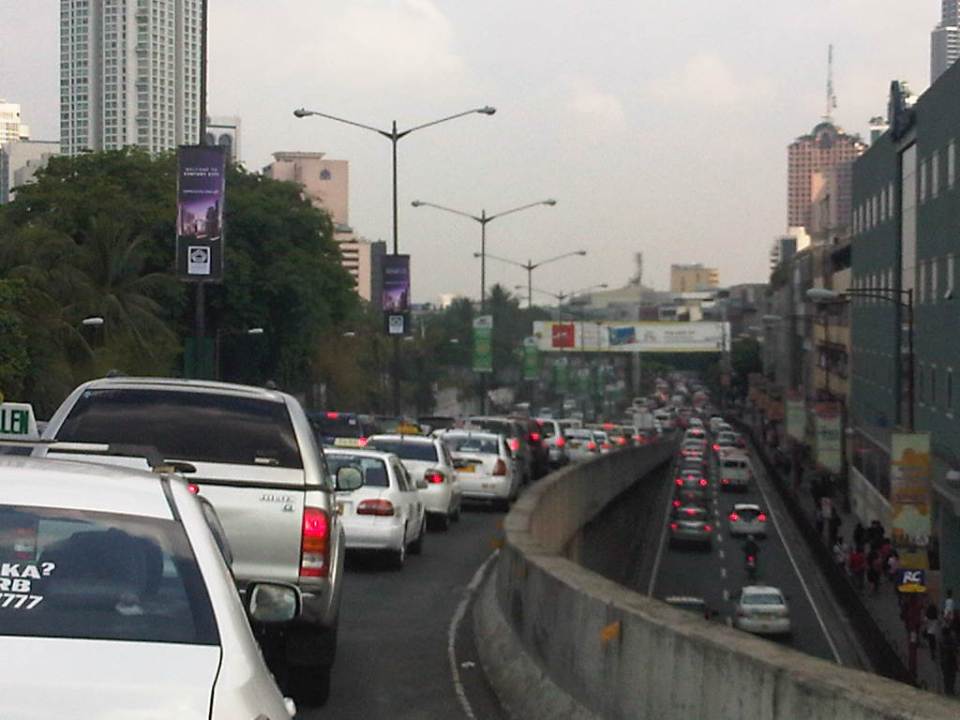 Traffic congestion along Gil Puyat Ave. as seen from the overpass from Kalayaan Ave. Even the sidewalk on the right side of the road is filled with pedestrians.
 One can see many people walking along the narrow sidewalk along Buendia. Some buildings have been renovated and refitted but many remain as they were in the last decade or more. The building in the center of the photo has so many air-conditioning units jutting outside the windows that it is quite obvious the units were an afterthought. Other buildings would likely have centralized or more strategically positioned air-conditioning units.
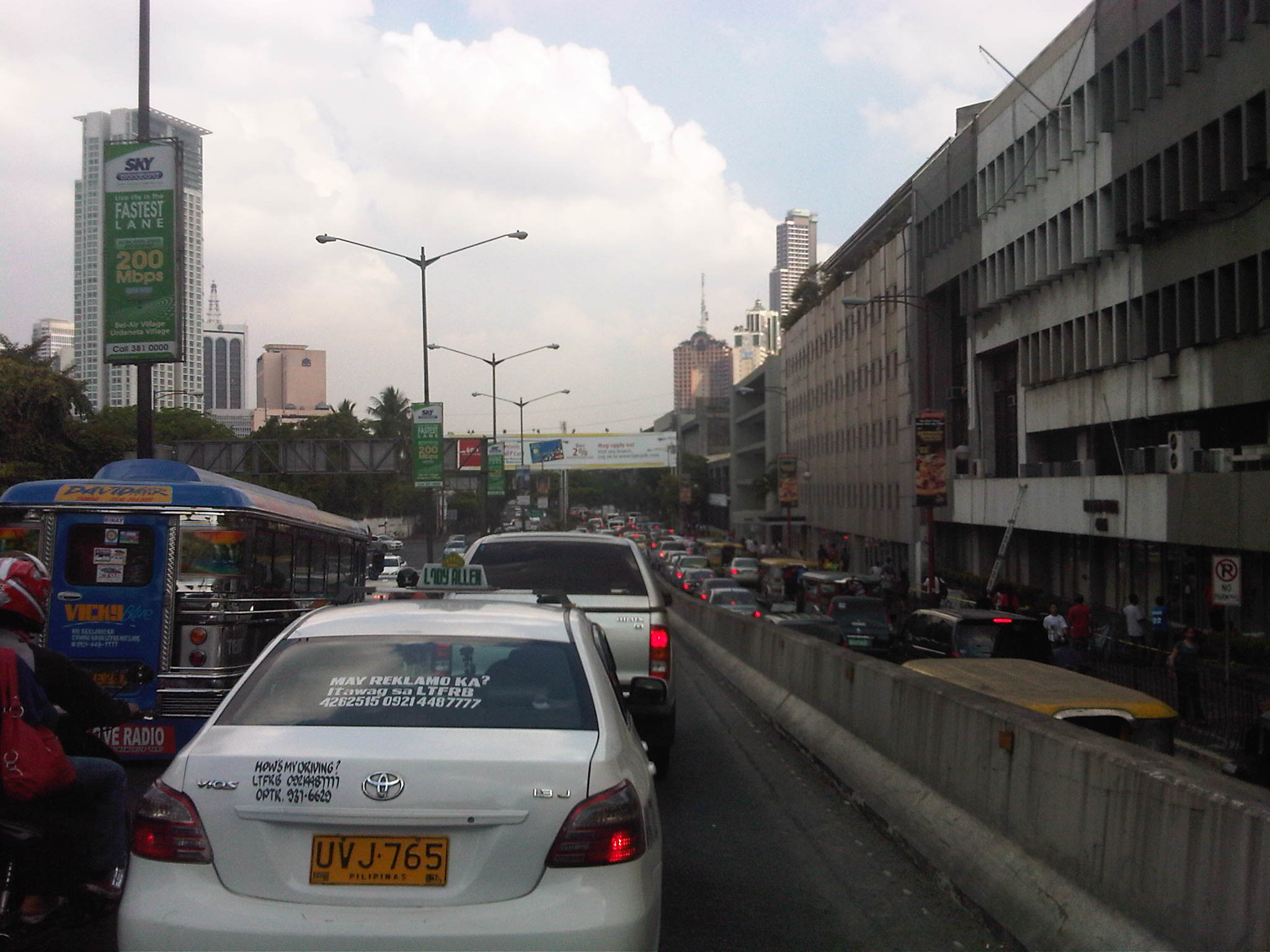 Another look at the traffic jam along one of Makati’s main roads indicate a lengthy queue from the Buendia Ave.-Paseo De Roxas intersection. The junction is signalized but saturated during peak periods. I am not sure about the optimization of the signal settings but it should be synchronized with at least two other intersections: Buendia Ave.-Makati Ave. and Paseo de Roxas-Makati Ave.
The DPWH is proposing a grade separation project along Buendia that is supposed to alleviate congestion at the intersections with Paseo de Roxas and Makati Avenue. The plan is to have an underpass along the avenue that would allow vehicles to flow through and bypassing the two major intersections. At-grade would still be signalized intersections but minus substantial through traffic along Buendia. The downside of such a project, of course, would be the expected traffic congestion during the construction phase. With very limited alternate routes and restricted space (i.e., unlike the case of the Quezon Ave. underpass at Araneta Ave.), traffic management in the area will surely be a challenge for the combined forces of Makati and MMDA traffic enforcers.
–
Daniel Romualdez Airport in Tacloban
I had been to Tacloban only once before and was not able to take some photos of the airport. This time around, I was able to get a few photos as I checked in for my flight back to Manila. Tacloban Airport is among the busiest airports in the country serving more than 1 million passengers annually. Tacloban is the regional center of Eastern Visayas and is the only airport in that region with jet airline (A319s and A320s) service. Despite the increasing demand due to growth in both industry and tourism, the airport is limited by its runway and terminal. A planeload of passengers already crowd the pre-departure area on a regular basis and conditions in the area is not at all comfortable. While there is a room for changing diapers and another for breastfeeding (thanks to DOTC’s Gender Awareness and Development program), there are few other amenities at the terminal.
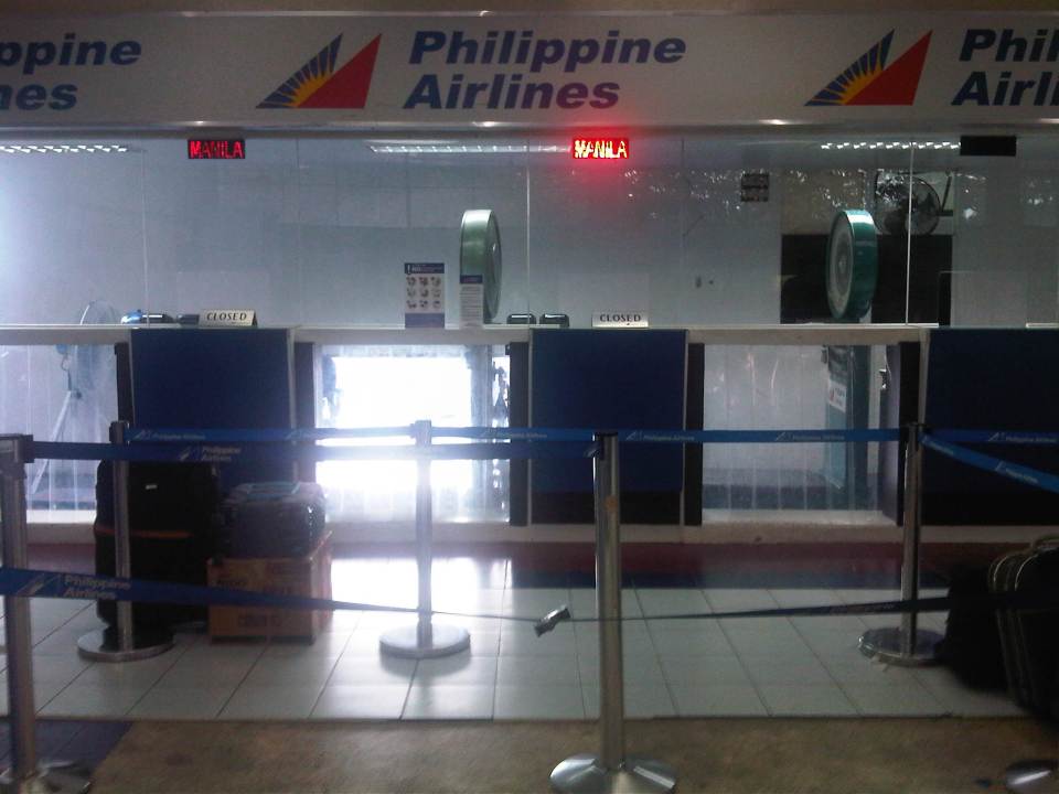 Philippine Airlines check-in counter
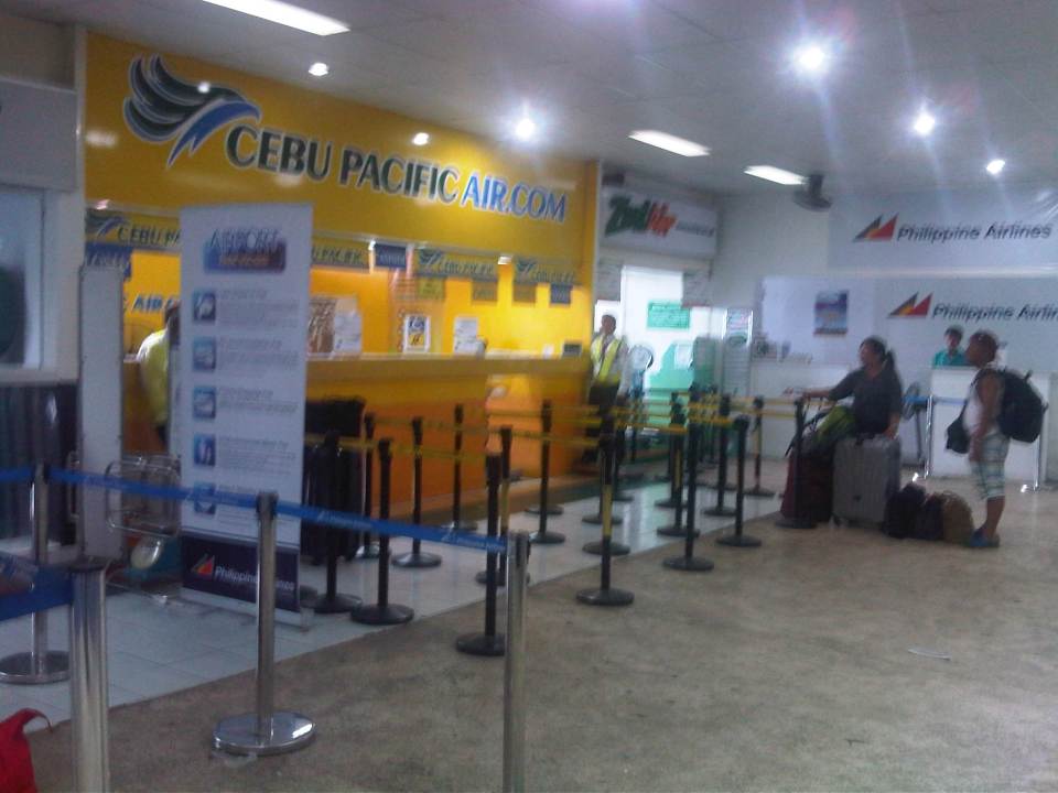 Cebu Pacific and Zest Air check-in counters
 Ceb Pac passengers waiting to board the aircraft on the tarmac
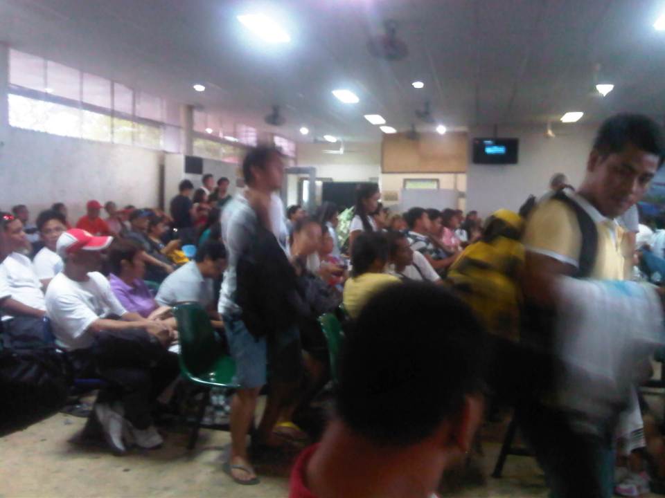 Another shot of the crowded pre-departure area
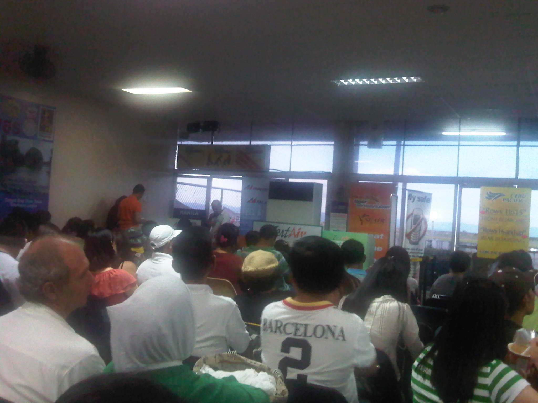 PAL passengers waiting for their plane to arrive
Tacloban Airport is due for expansion with a new terminal proposed for construction nearby. The land where the new terminal will be constructed has been acquired and cordoned off and I was told that the runway will be lengthened. I am just not sure if DOTC or CAAP has acquired the lands necessary for the runway component of the project but upgrading the runway for the airport to accommodate wide bodied aircraft will indeed require much land. Nevertheless, it is a project that is long overdue and needed to push for development of the region, which has one of the higher incidence of poverty at 37.2% for Region 8. Leyte has a 31.9% poverty incidence while Southern Leyte is at 36.4%. Neighboring Samar provinces have even worse statistics with Western Samar at 36%, Northern Samar at 43.7% and Eastern Samar at a staggering 59.4% poverty incidence. These stats are based on the figures recently released by the National Statistical Coordination Board (NSCB) based on the Family Income and Expenditure Survey (FIES) conducted in 2012.
–
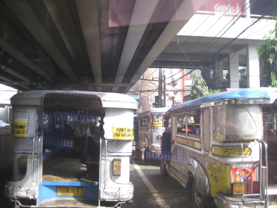
Rizal Avenue – Part 2: Tayuman to Pampanga Street
In the last post on Rizal Avenue, the featured photos show conditions under the LRT Line 1, which included visual evidence of certain issues like on-street parking, poor lighting and even sanitation (i.e., garbage) along the corridor. This post features more of the same and perhaps worse in some cases that are used as proof of the blight caused in part by the LRT superstructure. I say in part because LRT Line 1 is not wholly to blame for problems under and around it. Local governments and the private sector share responsibility for the decline of the areas within the direct influence of the rail line. Napabayaan. But of course, this does not absolve proponents of the LRT Line 1 for poor station design.
 Approach to Tayuman Station along the northbound side of Rizal Avenue.
 Tayuman Station – shown in the upper part of the photo is one end of the northbound platform.
 Underneath the station, jeepneys clog the lanes as they load/unload passengers. LRT Line 1 stations are poorly designed for intermodal transfers (e.g., LRT to jeepney, LRT to bus, etc.).
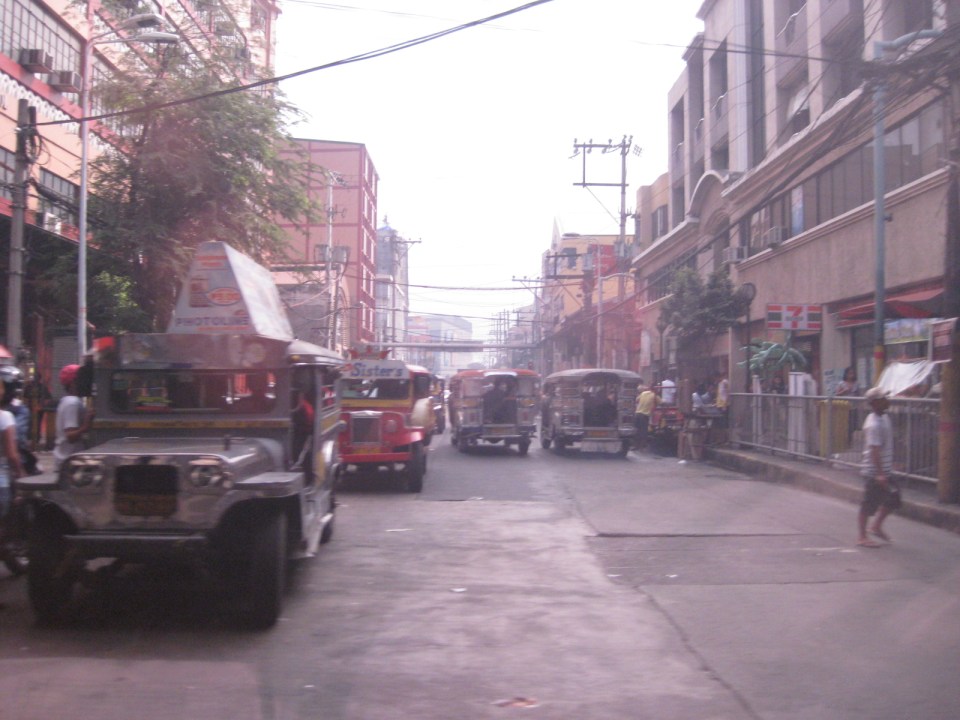 Tayuman Road is a busy street in Manila that’s served by jeepneys connecting to major streets like Lacson Avenue to the east and Abad Santos and Juan Luna to the west. The photo shows a view to the east of the LRT Tayuman Station.
 Approach to the junction with Herrera Street
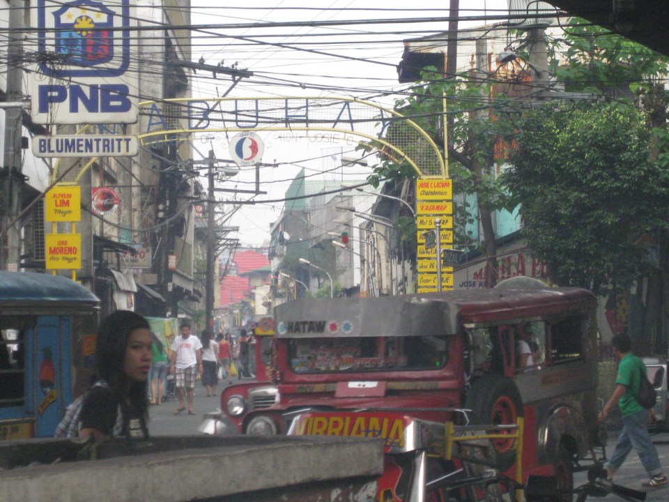
 Approach to Blumentritt Station – the station is named after Ferdinand Blumentritt, an Austrian who was a close friend of the national hero Jose Rizal. The street leads to a large public market close to the station (near the intersection) that is also named after the fellow and one of the more crowded markets in the metropolis. There are many jeepney lines with Blumentritt as part of their routes.
 Birds and other creatures being sold as pets around Blumentritt – many have been painted to attract children and other buyers curious at the colored birds.
 Vendors line the Rizal Avenue, Blumentritt and the other side streets in the area, which is usually crowded no matter what day of the week it is.
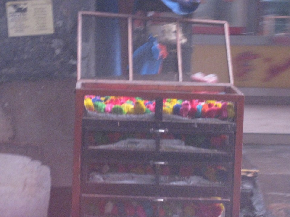 Angry birds? A closer look reveals the birds as chicken chicks colored by the vendors to attract interest. Sadly, many of these do not survive to become full grown chickens and children (and adults) will be disappointed to discover later that the color comes off pretty quick when the chicks come in contact with water.
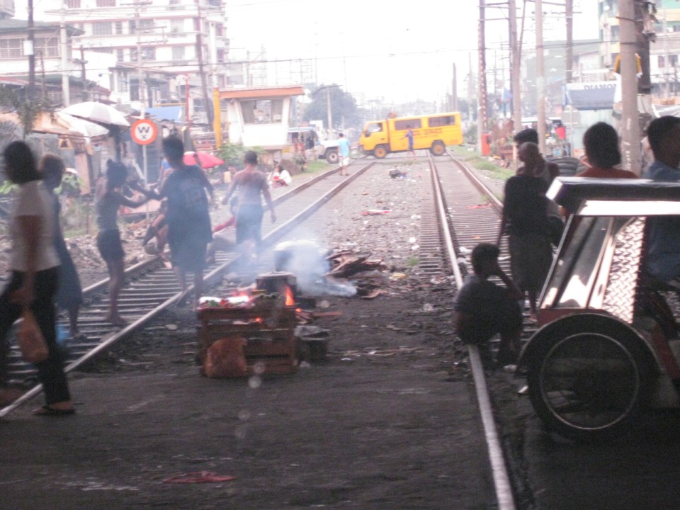
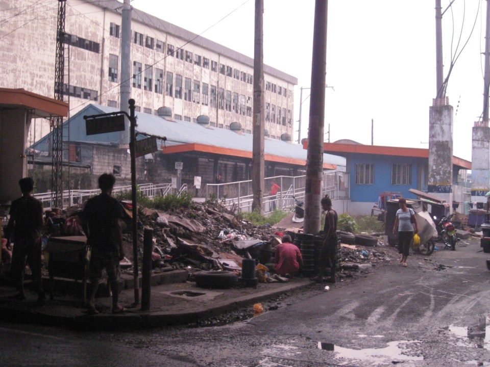 There is a PNR Blumentritt Station and unless there’s been some radical clean-up of the area, this is pretty much what you’d see around the station – garbage, dirt, informal settlers and other characters. The building behind the station is a public school.
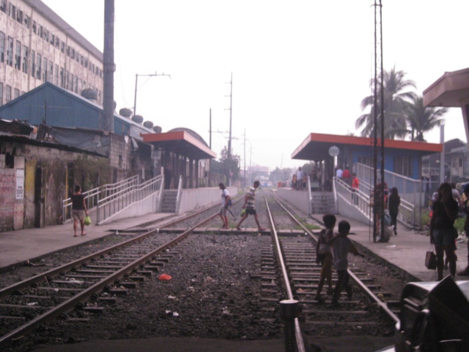 The PNR Blumentritt Station has two platforms on either side of the double track. Security is quite lax and people, including children, cross the tracks freely. Fortunately, train service frequencies are quite low (about 1 per hour) so the risk of getting hit by a train is also low. The photo shows the view to the east of Rizal Avenue.
 On the left side of Rizal Avenue is a scene where people are oblivious to the railways with some even doing their cooking between the tracks.
 Blumentritt Avenue is a very crowded street with a public school (building at right) just across the public market (at left). There are many vendors lined along the street and people as just about everywhere and without regard to vehicular traffic.
 Traffic congestion along Rizal Avenue is attributed mainly to the market and median barriers were constructed to reduce pedestrian crossings anywhere along the road. Commercial establishments line either side of Rizal Avenue, basically contributing to congestion in the area.
 Commercial establishments plus customers plus paratransit equal to traffic congestion
 16A busy side street in the Blumentritt area – there are no sidewalks so pedestrians and motor vehicles mix it up along the road.
 Bulacan Street serves as an informal terminal for jeepneys. The road appears to be newly paved but there are no sidewalks and tents are found along the road often bearing the names of politicians sponsoring the tents for various purposes such as wakes and parties.
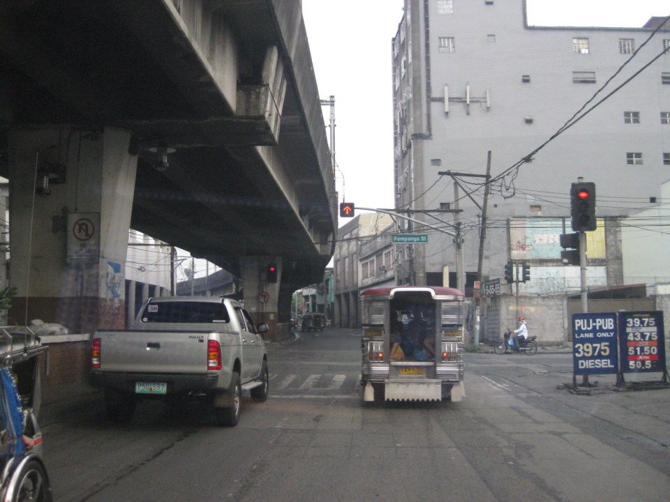 Intersection with Pampanga Street, just before Rizal Avenue and the LRT line turns towards Aurora Boulevard and proceed to Caloocan City and Monumento.
More on Rizal Avenue in future post…
–
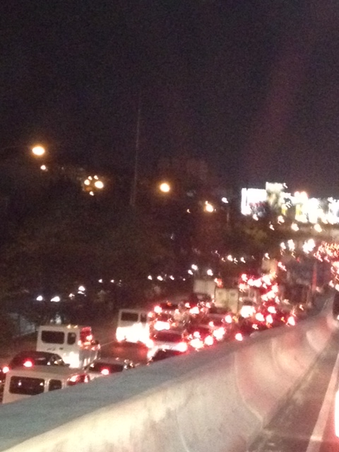
Night time congestion along C-5
Traffic congestion along Circumferential Road 5 is experienced practically throughout the day with the worst congestion along the southbound direction during the mornings between the Riverbanks Road in Quezon City and Kalayaan Avenue in Makati City, and the northbound direction between Bonifacio Global City and Eastwood from noon to nighttime. The following photos taken by my wife as I fetched her one night from her office shows the traffic jam along C-5 as we turned from the flyover past Market! Market! towards the highway.
 Congestion along the C-5 northbound is a regular thing during the weekdays from the afternoon to late at night. While apps like the MMDA’s Traffic Navigator and Waze allow us to have an idea of how congested C-5 is during such periods, the actual experience is much worse than what many of us can just imagine from the apps.
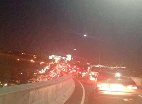 As far as the eye could see – congestion in the form of the taillights of vehicles along the northbound side of C-5 indicate just how many people are caught in traffic from Taguig all the way to Pasig and beyond. The giant billboards from Kalayaan Avenue to Pasig Boulevard including those seen along the bridge crossing the Pasig River. Most of these people are office workers coming from Makati and Global City and heading home to Quezon City, Pasig, and the towns of Rizal. After 7 PM, trucks add to the traffic
Many people are asking if there is a solution in sight for congestion along C-5. To be frank, there is none in the immediate future. There are proposals to introduce a public transport system along the corridor with one option being a Bus Rapid Transit (BRT) and another an elevated rail transit line. The BRT line is a recommendation of a Pre-FS for Metro Manila BRT conducted around 6 years ago though there was a proposal for a bus system (Philtrak) along the same corridor back in the late 80’s and pursued for some time during the 90’s. Not much have been done towards realizing any of these proposals. An efficient mass transit system along the corridor could encourage people to shift from private to public transport and help reduce vehicular traffic along C-5 considering that even as I write this post, vehicle ownership is increasing in Metro Manila and its environs and this could only mean more congestion along C-5 and other roads.
–
