
Home » Transport Planning (Page 32)
Category Archives: Transport Planning
“Make it easy!” – Encouraging cycling in the Philippines
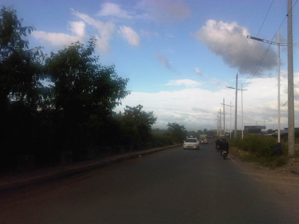
The stretch between Magallanes and Ayala Ave. along EDSA is not exactly the most ideal of sections for a bicycle sharing program. However, its success would be symbolic of a small and quick win for cycling in a metropolitan area that’s been perceived to be unfriendly to walking and cycling. The Metropolitan Manila Development Authority (MMDA) could have chosen other sections like a longer one along Commonwealth Avenue or perhaps a section of Circumferential Road 5 (C-5)/Katipunan Avenue like the stretch from Aurora Boulevard to C.P. Garcia Ave. that connects three major academic institutions: Ateneo De Manila University, Miriam College and the University of the Philippines Diliman. Marcos Highway, which stretches from Masinag Junction in Antipolo City to Santolan in Pasig/Marikina, was rehabilitated and now has exclusive bicycle lanes along either side of the highway. And, of course, there is the bicycle network in Marikina City, which is the first city in the country to have bikeways.
A friend posted an article about “The Best Bike-Sharing Program in the United States.” It is a good read with lots of lessons for cities formulating their own bicycle-sharing programs. Such programs are made in part to encourage a shift from motorized transport to non-motorized modes like cycling and walking. With motorcycles becoming more popular in the Philippines, there should be strong efforts to promote bicycle use especially for short trips.
 Cyclists pedaling along UP Diliman’s Academic Oval where one lane has been designated for NMT.
Another perspective on promoting/encouraging cycling comes from Europe. I read an article that caught my fancy sometime last year and searched for it on the internet. The article appeared on the online version of the New York Times stating as its title: “To encourage biking, cities lose the helmets.” This is an interesting article because, for one, the author relates experiences in Europe that seem to be in contrast with those in the US. Particular mention is given to cyclists being required to wear helmets in US cities while many European cities are lax about this practice that is strongly associated with road safety.
There I said it. Road safety. A primary concern for many if not most road users including those using bicycles is safety. In the cities where cyclists share road space with motor vehicles, crashes involving NMT and motorized vehicles may result in fatalities. Studies in the US have linked fatalities and serious injuries to cyclists not wearing helmets. However, in European cities where there are more cyclists and drivers of motor vehicles are probably more aware and respectful of cyclists, the perception is that laxity in helmet use helps promote cycling.
In the Philippines, where mandatory helmet use for motorcyclists is a continuing enforcement challenge, strictly requiring helmet use for cyclists can also be a challenge and can be a turn-off for many would-be cyclists. Strict helmet-wearing requirements might be equated to cycling being a dangerous activity and therefore discourage a lot of people from using bicycles. Definitely, safety should not be sacrificed and where there are high risks but these sections need to be identified and enforcement along these should be firm. These include routes where bicycles and motor vehicles share the same road space. In routes, however, where there are exclusive space or lanes for cycling, perhaps the rule on helmets may be relaxed. Speed is one consideration here where those using bicycles for trips between their homes and workplaces or schools are not necessarily speedsters compared to those who cycle for recreation or for sport. Utilitarian cycling should be treated differently from recreational or sport cycling, which can be more risky and requires not only helmets but other safety gear as well.
–
Technical Papers on Sustainable Urban Transport
This is just a quick post to end this first month of the year. Following is a link to the website of the GIZ-supported Sustainable Urban Transport Project featuring the page with the latest technical papers. These represent some of the latest work on sustainable transport featuring good practices from developing and developed cities that can be used as guides or benchmarks for those dealing with transport issues in their respective cities or towns.
HK Airport Express: check-in and transit
I wrote about Hong Kong International Airport (HKIA) and the Airport Express service between the terminal and Kowloon in a previous post. I had an opportunity to take a few more photos on the service on my way back from Hong Kong, when I checked-in at Kowloon Station prior to proceeding to HKIA. The system is so easy and so convenient for travelers, and is something that should definitely be replicated elsewhere where they still don’t have something similar in place. More information may be found with the HKIA website and the MTR website that features all the details on the Airport Express service, including complementary services such as shuttle buses to and from hotels via Kowloon or Hong Kong Stations.
 One does not have to purchase tickets over the counter as there are ticket vending machines at the station. The easy-to-use machine can be operated in Chinese or English and accepts coins and bills for payment.
 Check-in counters for most if not all airlines using Hong Kong International Airport may be found at Kowloon Station. This makes it possible for travelers to complete the procedure including checking-in their luggage for passengers to be able to travel light between the station and HKIA.
 Monitors on top of each counter displays which airlines are served by the counter staff.
 Flight schedules are displayed at Kowloon Station and there is a security check prior to the check-in counters.
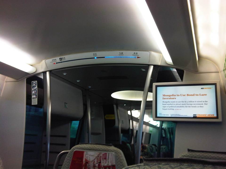 The LED display on top gives passengers information on the progress of the trip while the monitor provides business news.
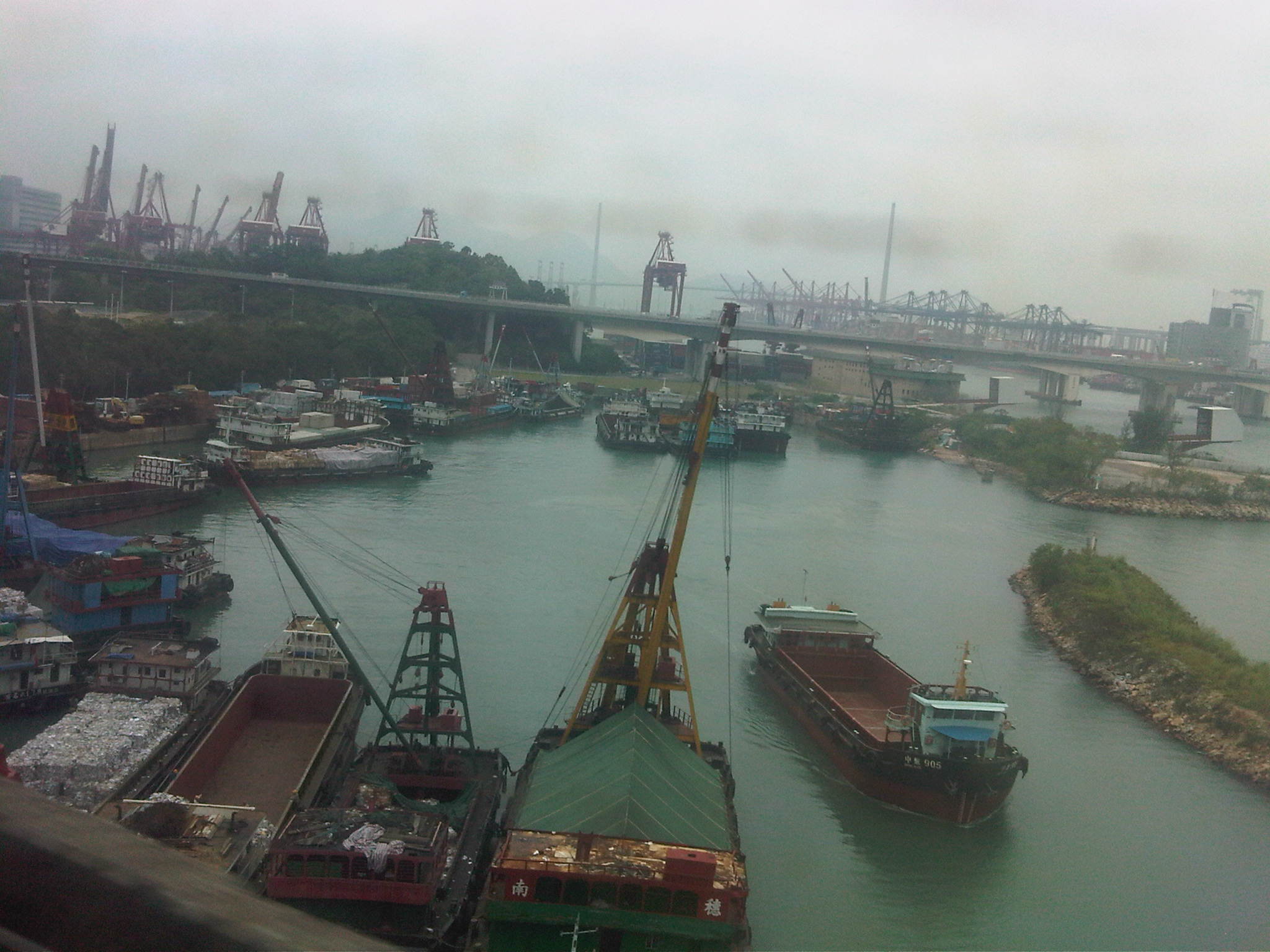 A view of the ports along the way to the airport.
The Hong Kong Airport Express provides one of the most efficient services I’ve seen for airports. It makes perfect sense in this day and age when advances in IT would allow for such services like checking-in for your flight and convenience and comfort should be the focus of service providers. I think such services are what makes airports like HKIA good examples for best practices on service delivery to passengers.
In the case of Manila, the recent opening of an airport lounge at a major mall in Quezon City serving Clark International Airport (north of Metro Manila) presents an opportunity to provide similar services for the convenience of passengers. Perhaps a local airline like Cebu Pacific should initiate check-ins at this satellite lounge so that passengers would be freed from their luggage as they make their way to Clark (a 1.5 hour trip between the Quezon City and the airport). Perhaps, too, there should be a similar system for people taking Ninoy Aquino International Airport even though the challenge is how to manage travel using the road in the absence of express rail services. These are sure to boost travel and tourism but should also have impacts on business considering the convenience and efficiency such a system can provide.
–
C6: Bicutan to Napindan
I wrote about Circumferential Road 6 (C-6) in a previous post where I featured some photos taken while we were en route to the DOST compound in Bicutan, Taguig City. It was originally constructed as a dike road, an access road along the barrier constructed along the coast of Laguna de Bay to provide additional protection to Taguig City against the lake waters breaching the banks during incidence of heavy rains. Once the link between Taytay, Pasig, Pateros and Taguig was completed, however, traffic significantly increased as C-6 provided a very convenient alternate route for people residing in the east who had to go to Makati, Taguig or southern Metro Manila mostly for work trips. Following are photos showing C-6 from Bicutan to Napindan, before crossing to Pasig City.
 Tree-lined – one can imagine how the highway will look like once the trees planted along either side are full-grown
 C-6 is a two-lane, undivided highway with a sidewalk along the Taguig side and a shoulder along the dike along the coast of Laguna de Bay
 Approach to the intersection with Seagull Ave., which connects M.L. Quezon Ave. and Taguig proper in the west and Bay Breeze Subdivision in what appears to be a small peninsula on the bay.
 Most sections of the existing C-6 have no pavement markings.
 The entire road is of asphalt concrete pavement.
 There are several pumping stations along C-6, which reminds people of the flood control aspect of the dike and the road. The photo shows the Taguig Pumping Station operated by the MMDA.
 While C-6 provides an alternative route for travelers from the eastern towns of Rizal wanting no part of the traffic congestion along Ortigas Avenue and C-5 en route to Makati or Taguig (or back from these areas), peak traffic is usually predictable and at other times of the day, volumes are quite low as shown in the photos.
 There aren’t any significant developments or establishments for most part of C-6.
 The undeveloped lands are mainly due to these areas being flood prone, and requiring extensive improvements to raise elevations and provide for adequate drainage.
 Labasan pumping station – is practically the only building for a long stretch of the highway.
 Past the Labasan Pumping Station, are more undeveloped areas along the highway. At right in the photos is the dike that serves as
  The bridge across the Napindan channel of the Pasig River is further ahead (downstream), which travelers can use to cross to Pasig City.
The stretch of C-6 from M.L. Quezon to Napindan is currently subject to studies for widening as traffic steadily increases due to the very strategic position of the road. However, there should be a more direct link between C-6 and C-5 so as to maximize the benefits of the road, particularly as an alternative route between Rizal province, and Bonifacio Global City and Makati CBD. I estimate that travels times can be reduced significantly for people traveling between their homes in Antipolo and Taytay to the offices in Makati and Taguig (Fort Bonifacio). On a normal day, this trip can take easily more than 60 minutes due to congestion along Ortigas and C-5, the usual route for most people. With the alternate route, it might just be possible to reduce it to say 45 minutes, give and take some congestion. Of course, once this alternate route is discovered by more people (and UV Express vehicles are already using this route), then it would attract more traffic and necessitate an increase in capacity for it to handle such traffic. But then the result may well be an easing in traffic along Ortigas and C-5 so that should be good until perhaps we finally have a good public transport system in place along Ortigas and C-5. BRT? That deserves another post…
–
Commuting on the LRT Line 2
Metro Manila’s LRT Line 2 stretches from Santolan in Pasig City to Recto in the City of Manila. It is the only suburban railway line serving Metro Manila outside the PNR, and uses trains that have the highest passenger capacities compared to the LRT Line 1 and EDSA MRT (Line 3), which uses cars that can be categorized as light rail vehicles. Line 2 employs vehicles that would elsewhere be used for metros or surface heavy rail transit. I occasionally use Line 2 for commuting between Katipunan and Cubao but I must admit I haven’t used it to commute all the way to Manila. Following are photos I took on one commute between Katipunan and Cubao.
 Going underground – descending to the station at Katipunan, there are no escalators so most people have to use the stairs.
 Accessibility – there are elevators for the physically-challenged including persons with disabilities (PWDs), senior citizens and pregnant women.
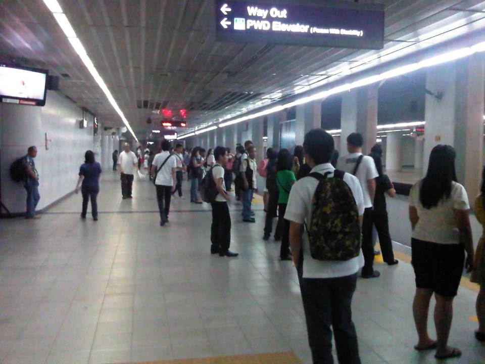 Katipunan Station platform – is underground and gives the feeling of being in a subway. There are directional signs to guide passengers but I think there should be more signs informing people about train arrivals and schedules. Note that most passengers do not form lines and are standing along and near the entire platform edge. This seems to indicate people are either undisciplined or there is little effort to establish order in boarding and alighting procedures.
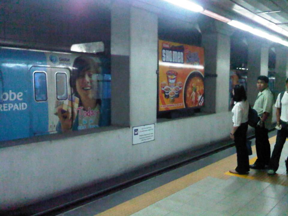 Passengers waiting along the platform form lines where the trains’ doors are supposed to be positioned once the vehicle is stopped. In other countries there are also signs along the median to guide passengers where to line up along the platform and to give way to people alighting from the trains before boarding the train. Such procedures are important for orderly operations. A train bound for Santolan Sta. is on the other side of the platform.
 Passengers boarding the train
 Stragglers hurrying to enter the train before the doors closed for departure. Like in other cities, some passengers attempt to board the train at the last second. Such situations can cause injury as people can get caught by the closing doors.
 Train leaving the Katipunan Station and bound for Recto in Manila
 Warning sign – signs inform passengers of the dangers along the tracks. In this case, the danger is in the form of high voltage wires as the trains are powered by electricity. There is a fine of PhP 50,000 (~USD 1,200) for anyone illegally going down to the tracks.
 The yellow line defines the area where passengers should be safely behind and clear of the trains. There are dimples on the line, which are generally for the benefit of blind people using their canes to “feel” such lines for guidance.
 Defective – Most ticket machines were out of service. Those that weren’t marked as defective (just a few) had problems accepting coins. This issue regarding ticketing makes it inconvenient for most passengers to use the trains as they end of queuing along one or a few manned booths selling tickets at the stations. One would think that with so many options now available for fare collection (tickets, passes, cards, etc.) and the LRT’s already in operation for so many years that authorities would have already had a more efficient system in place for fare collection.
 Turnstiles – there are enough turnstiles at the stations (in this case Cubao) but the queuing problem is not here but at the ticketing stage of the journey. Of course, there are also queues due to the security checks at the station but these are usually quicker compared to the time it takes for people to purchase tickets.
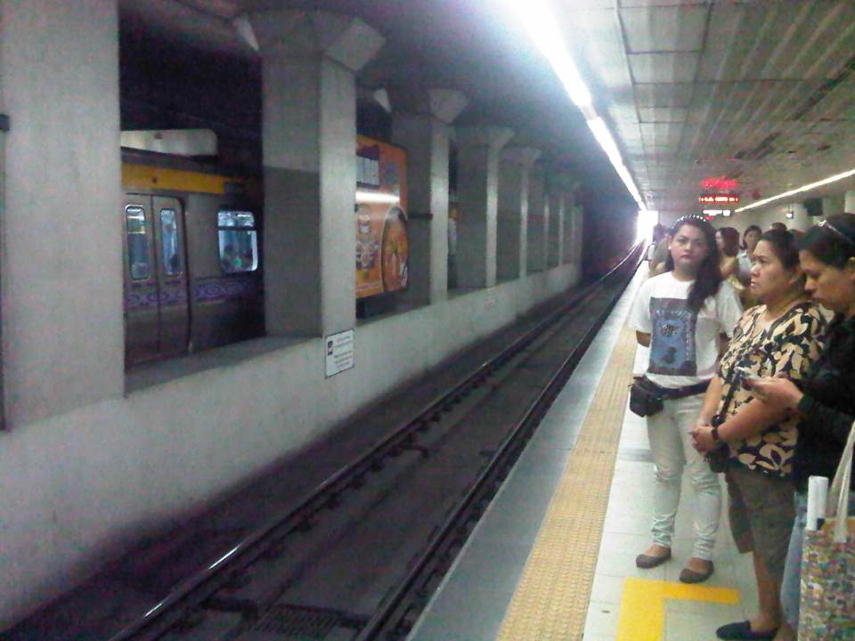
 Westbound arrival – a train bound for Recto arrives at the opposite platform at Cubao Station.
 Departures – a train bound for Manila leaves Cubao Station while passengers form queues along the platform for trains bound for Pasig.
I tried to get photos of the connection between the Cubao Station and Gateway Mall but the pictures didn’t come out right (Note: I usually only use my cell phone to take quick photos.). The same was the fate of photos I tried to take between Katipunan Station (Exit at St. Bridget’s) and the UP-Katipunan jeepney terminal. In the latter case, the rains and the crown prevented me from taking photos. I will try to get better ones to post next time and perhaps that post will focus on the conditions around stations including their connectivity to other modes of transport (e.g., convenience of transfers) and other aspects such as walkability.
–
Link: Measuring Transport Efficiency
I’m sharing a recent article from Todd Litman of the Victoria Transport Policy Institute. The article is entitled Measuring Transport System Efficiency that appears in the Planetizen online journal. It’s a very good read for all, even those without planning or engineering backgrounds, who want to have an understanding of how to evaluate or assess transport systems according to the various aspects of a system (e.g., there’s a difference between conventional road planning and accessibility-based transport planning). Todd is as usual very good in discussing these topics given his experience and expertise, and is able to present it in a manner that is easily understood by any reader (well, except maybe the trolls we find anywhere online these days).
Happy reading!
–
Rationalizing public transport in the Philippines
I got a copy of the recent study “Development of a Mega Manila Public Transportation Planning Support System” conducted by UP Diliman’s National Center for Transportation Studies (NCTS) for the Department of Transportation and Communications (DOTC). The main outcome of the study was a planning support system that includes an updated database of bus, jeepney and UV Express routes for Metro Manila and its surrounding areas (collectively called Mega Manila), and a calibrated travel demand model for the region that is supposed to be used by the DOTC and the LTFRB in transport planning including the rationalization of public transport in the region. Among the notable recommendations for addressing public transport issues is the following on the classification of routes according to passenger demand, which I quote from the study:
“…routes and modes may be classified and prioritized as follows:
- Routes with Very High Passenger Demand [>160,000 passengers per day] – shall be served by high capacity modes such as rail-based transit or Bus Rapid Transit(BRT) with passing lanes.
- Routes with High Passenger Demand [100,000 to 160,000 passengers per day] – shall be served by high capacity vehicles such as Bus Rapid Transit System (BRT) without passing lanes;
- Routes with Medium Passenger Demand [10,000 to 100,000 passengers per day] – shall be served by PUVs with 60 or less passengers/seats but not less than 22 passengers (excluding driver) such as buses, CLRVs with more than 22 passengers/seats (including driver), or with 90 passengers/seats in the case of double decker or articulated buses;
- Routes with Low Passenger Demand [not exceeding 10,000 passengers per day] – shall be served by PUVs with less than 22 passengers/seats (including driver) such as jeepneys and other paratransit modes.
Under this principle, high capacity modes would have priority in terms of CPC allocation and transit right of way in a particular route over lower capacity modes with the exception of taxis. The latter, after all, operate as private cars rather than PUVs with fixed routes.
Applications to operate bus and/or minibus service in jeepney routes can be considered, but not the other way around. Similarly, bus service applications can be considered in minibus routes but not otherwise.
Based on the analysis of routes, the establishment of public transportation routes and the corresponding modes of services may be based on the following criteria:
• Passenger demand patterns and characteristics
• Road network configuration
• Corresponding road functions (road hierarchy)
• Traffic capacities and
• Reasonable profits for operation of at most 13% ROI.”
[Source: DOTC (2012) Development of a Mega Manila Public Transportation Planning Support System, Final Report.]
An interesting figure in the report is an illustration of how services can be simplified using buses and rail transport as an example. The following figure shows two maps: one showing the plotted EDSA bus routes (left) and another showing a more consolidated (and rational) route network for buses complementing existing and proposed rail mass transit systems.
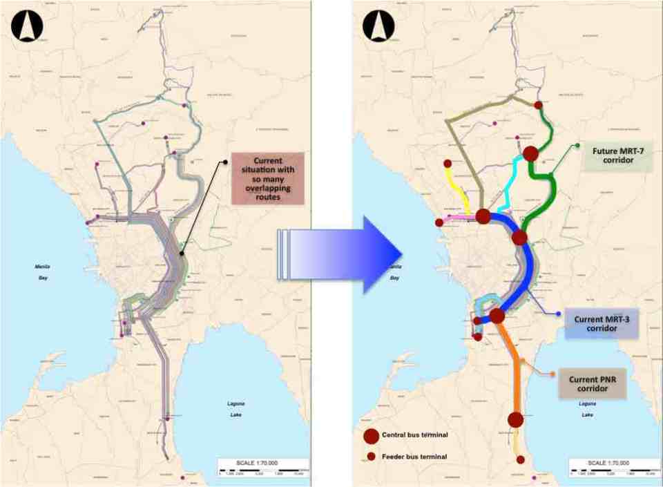 Simplifying bus transport services (source: DOTC, 2012)
What are not included in the figure above are the prospects for Bus Rapid Transit (BRT) systems for Metro Manila. Since the Final Report was submitted in mid 2012, there have been many discussions for BRT in the metropolis and current efforts are now focused on the assessment of a BRT line along Ortigas Avenue. The World Bank is supporting the evaluation of a route between Tikling Junction near the boundary of Antipolo and Taytay (Rizal Province) and Aurora Boulevard. There are also informal talks of a BRT line along Commonwealth Avenue but that would have implications on the proposed MRT-7 along the same corridor. Nevertheless, such mass transit systems have long been required for Metro Manila and their construction have been overdue. A more efficient public transport system will definitely have tremendous impacts on how we commute between our homes, workplaces, schools and other destinations. Long distances can easily be addressed by better transport options and could actually help solve issues pertaining to informal settlements, relocations and housing. That topic, of course, deserves an article devoted to this relationship between transport and housing. Abangan!
–
Transport gaps
I first learned about the concept back in the 1990’s when I was a graduate student at UP majoring in transportation engineering. The concept on transport gaps was first mentioned in a lecture by a visiting Japanese professor as he was discussing about transport modes, particularly on which was suitable or preferable over certain travel distances and which could carry more passengers. Another time later and while in Japan, I heard about the concept during a presentation of a friend of his technical paper on public transport.
The figure below is one of many possible illustrations of the concept of transport gaps. In the figure, a distinction is made for mass transport and individual transport. As the original figure is likely taken from a textbook or a paper (probably from Japan), shown with a white background are the more conventional modes of transport including subways, urban and suburban railways, walking and a mention of the shinkansen (more popularly known as the bullet train). With a gray background in the original figure is a category on new urban transit systems that include monorails, AGTs and LRTs. If we attempt to qualify local transport modes such as jeepneys, UV Express, tricycles and pedicabs into the graph, the outcome can be like what is illustrated with different color backgrounds in the figure below.

The concept of transport gaps allow us to visualize which modes are suitable for certain conditions where other established modes of transport may not be available or viable. In the original figure, the gap in Japan is filled by new urban transit systems. In our case, gaps are filled by so-called indigenous transport modes such as jeepneys, multicabs, tricycles, pedicabs and even habal-habal (motorcycle taxis).
There are gaps in the Philippine case probably and partly because of the slow development of public transport systems such as the mass transport modes shown in the preceding figure. There was a significant gap right after World War 2 when the tranvia and other railways were destroyed during the war. That gap was filled by the jeepney. There was also a gap in the early 1990’s that was eventually filled by FX taxis. Such gaps can obviously be filled by more efficient modes of transport but intervention by regulating agencies would be required and rationalizing transport services can only be addressed with the provision of mass transport options complemented by facilities for walking and cycling that will complement these modes.
–
UP-AGT test runs
Happy New Year!
I start the year with a short feature on the Automated Guideway Transit (AGT) prototype at the University of the Philippines Diliman (UPD) campus. The prototype has been featured in a number of articles in quad media in the recent weeks of November and December after its delivery and a few runs along the elevated test track at the campus. A project of the Department of Science and Technology (DOST) through its PCIEERD and MIRDC, and in cooperation with UPD, the vehicle has caught the attention of the general public and particularly those who have advocated for better public transport services in Metro Manila and other Philippine cities. Many are excited about the prospects of a “home-grown” system being constructed and operated in Metro Manila, and the buzz about the AGT replacing the IKOT jeepneys of UP Diliman is still very much alive despite clarifications by both the DOST and UP about this being a R&D project as well as questions regarding sustainability and practicality. Following are a few photos of the AGT prototype during one of its demonstration runs last December.
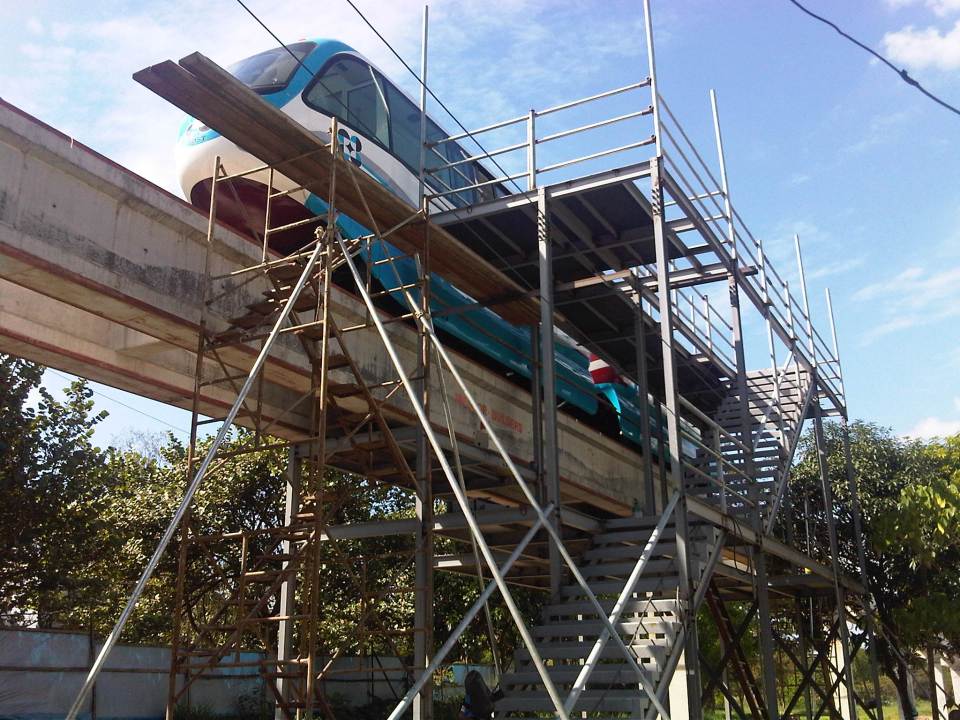 Unfinished platform at the Jacinto Street end of the test track allowing access to the vehicle’s underside and bogey and the loading platform
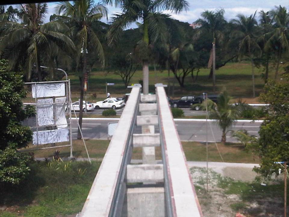
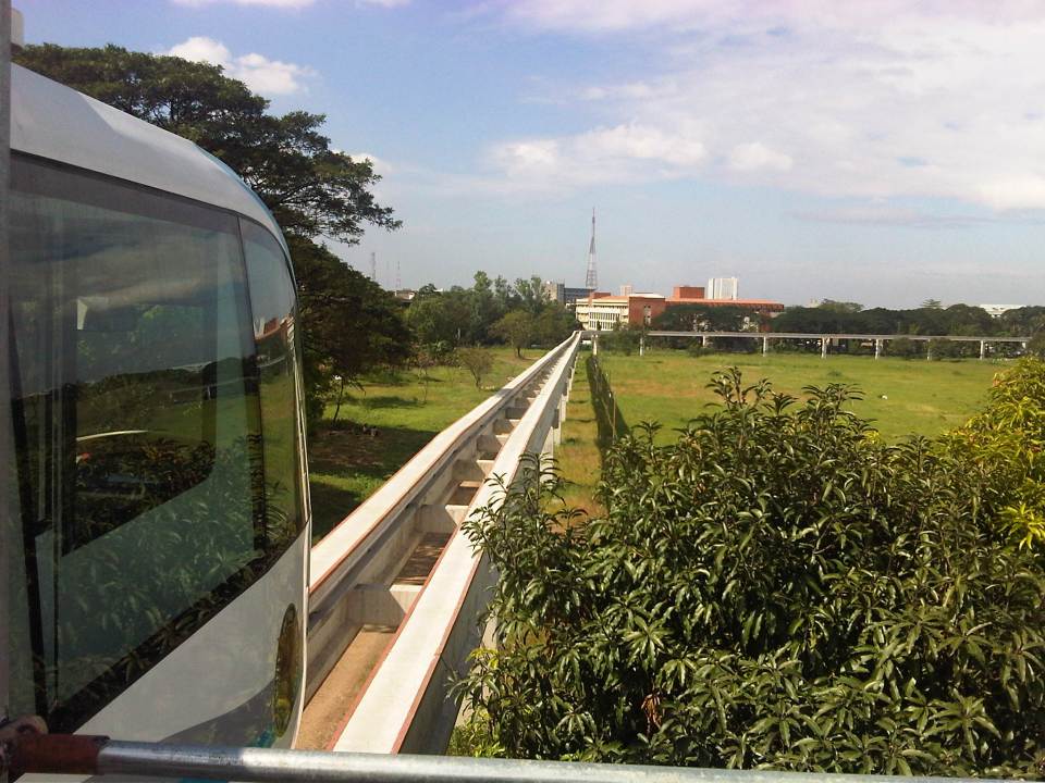 View of the test track from the platform – note again the absence of rail tracks as the AGT employs rubber tires. Wheels travel along the two concrete guideways shown in the photo. That’s the CHED building along C.P. Garcia Ave. downstream from the position of the AGT
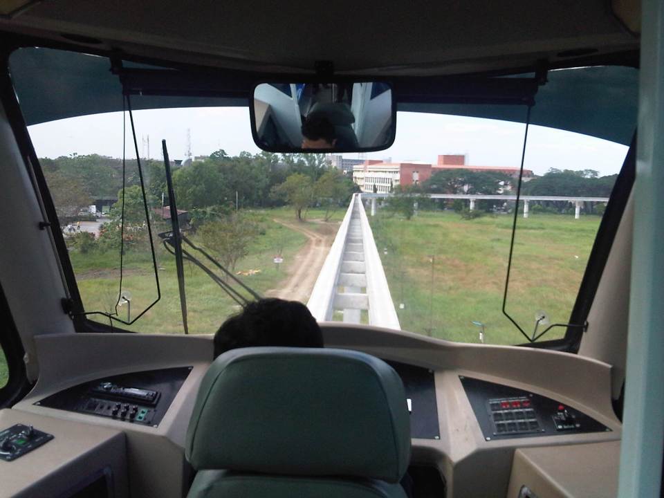 Driver’s perspective of the test track – the vehicle will eventually be driver-less (hence, automated) but for the test runs, there will initially be a driver to make sure the train operates correctly
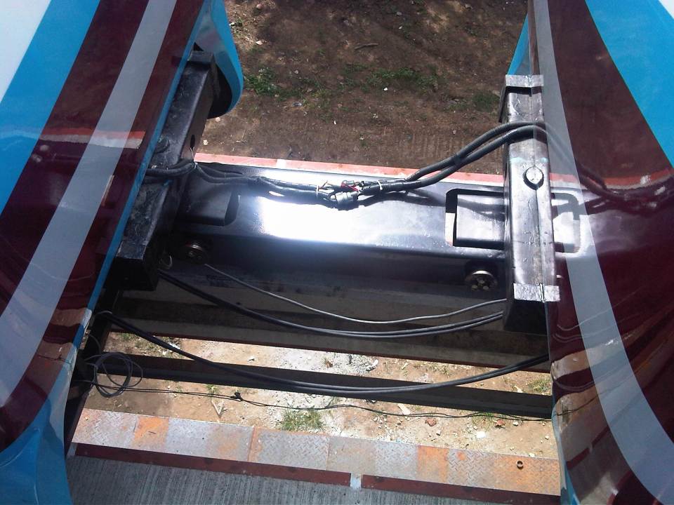 Connection – the two prototype vehicles are connected by this crude assembly that is definitely one of the things that would need to be reconsidered in subsequent vehicles. Perhaps an automatic coupler should be installed in the future?
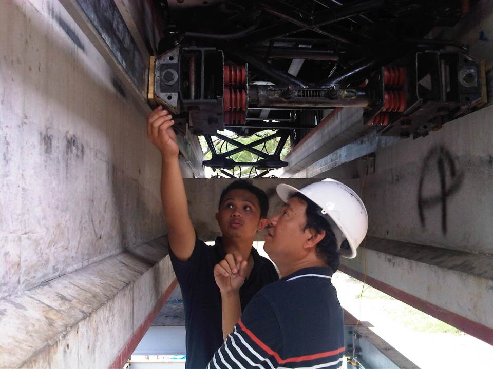 Dr. Ric Sigua of the Institute of Civil Engineering inspecting the pick-up system for the AGT prototype with DOST project staff.
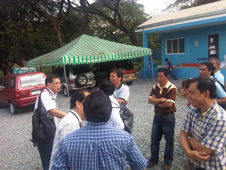 DOST-PCIEERD and UP Diliman faculty (from the Institute of Civil Engineering, Department of Mechanical Engineering, Electrical and Electronics Engineering Institute and School of Urban and Regional Planning) exchange ideas on the prototype.
 View of the end of the test track showing the two guideways employed by the vehicle and traffic along the University Avenue
The initial runs of the AGT have been exclusive demonstrations to government officials including those in national agencies, guests from the private sector, and partners with UP Diliman. The formal test runs will start in January 2013 but there are still no details on how these will be carried out in order to determine the functionality and safety of the prototype. Already, there are informal discussions on what needs to be improved in the prototype based on the initial observations and inspections conducted by faculty members from UP Diliman’s College of Engineering who will be involved in the technical evaluation of the prototype. Hopefully, such evaluations can be completed at the soonest and improvements are considered prior to a full system eventually being constructed and made available for public use. Where that system can be constructed and operated is still up in the air but should definitely be somewhere where the system is needed and where it can be a showcase for localized technology.
–
Hierarchy of transport modes
To better understand issues regarding our transportation system in the Philippines and elsewhere, I am showing two diagrams that both describe hierarchies of transport modes. The figures illustrate a concept much like our concept of the food pyramid where many if not most could easily understand in terms of what we need more of and less of in terms of proper nutrition. Transpose this concept to transport and we can understand that the most basic mode of transport is and should be on top of an inverted triangle, which represents which modes re to be prioritized over the others. The figure can also be used to symbolize mode shares. In terms of both priority and mode share, walking is the most dominant as we all walk. As such, it is only logical that facilities be provided for everyone to be able to walk safely and efficiently. These facilities include sidewalks, overpasses and underpasses that would encourage walking over other modes (especially the motorized ones). Walking is the most equitable and sustainable among transport modes and is definitely the healthiest.

For public transportation, another diagram may be constructed to show which modes can carry more people. Though the following figure is somewhat customized for Philippine public transport, it does not include multicabs, FX/AUVs, van-type services, and other paratransit modes (e.g., habal-habal, kuliglig, etc.) that are found throughout the country. There should be similar hierarchies in our ASEAN neighbor countries as they also have their indigenous modes like the tuktuks and samlors of Thailand.

Of course, each mode of transport is suitable for different trips with non-motorized public transport (particularly the 3-wheeler pedicabs, trisikad or padyak) being most appropriate for short distance trips though such trips can also be covered by walking. Jeepneys and multicabs are suitable for medium distance travel (~4 to 10 kilomemeters) where ridership is not yet viable for buses but which would have been serviced by too many tricycles. There is a reason from the perspectives of safety and efficiency why pedicabs and tricycles are not encouraged along national roads and jeepneys are not supposed to be plying routes along EDSA and C5.
Going up the hierarchy would have cost implications and rail transit is the most expensive mode in terms of capitalization, operations and maintenance. Of course, there are different type of rail transport services that include light rail to the long distance heavy rail commuter and regional services. As such, these systems require investment as well as foresight for the eventuality of a large, populous urban area ultimately requiring rail transport to carry so many passengers over longer distances. Rail alone would probably be insufficient so it needs to be complemented by bus and perhaps jeepneys as well. The emergence of Bus Rapid Transit (BRT) has provided city and transport planners with a flexible option bridging rail and bus transport in terms of cost and passenger capacities and are now being considered as immediate solutions for travel demand and public transport needs in major cities.
–
