
I wrote about Circumferential Road 6 (C-6) in a previous post where I featured some photos taken while we were en route to the DOST compound in Bicutan, Taguig City. It was originally constructed as a dike road, an access road along the barrier constructed along the coast of Laguna de Bay to provide additional protection to Taguig City against the lake waters breaching the banks during incidence of heavy rains. Once the link between Taytay, Pasig, Pateros and Taguig was completed, however, traffic significantly increased as C-6 provided a very convenient alternate route for people residing in the east who had to go to Makati, Taguig or southern Metro Manila mostly for work trips. Following are photos showing C-6 from Bicutan to Napindan, before crossing to Pasig City.
 Tree-lined – one can imagine how the highway will look like once the trees planted along either side are full-grown
 C-6 is a two-lane, undivided highway with a sidewalk along the Taguig side and a shoulder along the dike along the coast of Laguna de Bay
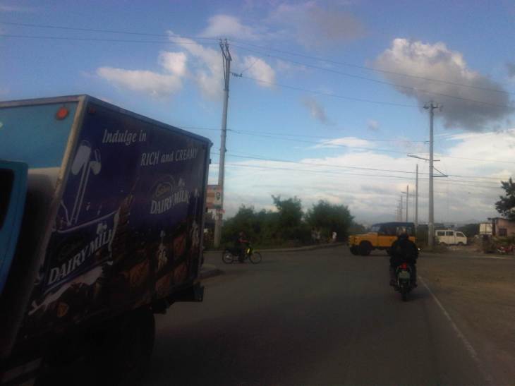 Approach to the intersection with Seagull Ave., which connects M.L. Quezon Ave. and Taguig proper in the west and Bay Breeze Subdivision in what appears to be a small peninsula on the bay.
 Most sections of the existing C-6 have no pavement markings.
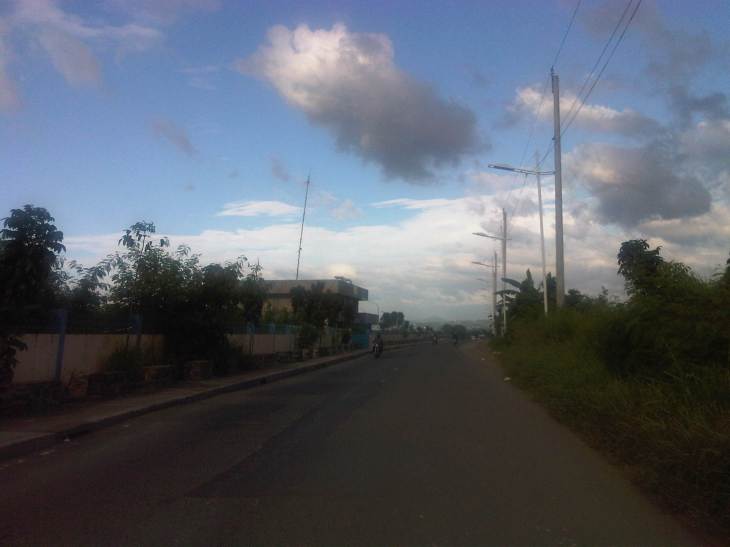 The entire road is of asphalt concrete pavement.
 There are several pumping stations along C-6, which reminds people of the flood control aspect of the dike and the road. The photo shows the Taguig Pumping Station operated by the MMDA.
 While C-6 provides an alternative route for travelers from the eastern towns of Rizal wanting no part of the traffic congestion along Ortigas Avenue and C-5 en route to Makati or Taguig (or back from these areas), peak traffic is usually predictable and at other times of the day, volumes are quite low as shown in the photos.
 There aren’t any significant developments or establishments for most part of C-6.
 The undeveloped lands are mainly due to these areas being flood prone, and requiring extensive improvements to raise elevations and provide for adequate drainage.
 Labasan pumping station – is practically the only building for a long stretch of the highway.
 Past the Labasan Pumping Station, are more undeveloped areas along the highway. At right in the photos is the dike that serves as
  The bridge across the Napindan channel of the Pasig River is further ahead (downstream), which travelers can use to cross to Pasig City.
The stretch of C-6 from M.L. Quezon to Napindan is currently subject to studies for widening as traffic steadily increases due to the very strategic position of the road. However, there should be a more direct link between C-6 and C-5 so as to maximize the benefits of the road, particularly as an alternative route between Rizal province, and Bonifacio Global City and Makati CBD. I estimate that travels times can be reduced significantly for people traveling between their homes in Antipolo and Taytay to the offices in Makati and Taguig (Fort Bonifacio). On a normal day, this trip can take easily more than 60 minutes due to congestion along Ortigas and C-5, the usual route for most people. With the alternate route, it might just be possible to reduce it to say 45 minutes, give and take some congestion. Of course, once this alternate route is discovered by more people (and UV Express vehicles are already using this route), then it would attract more traffic and necessitate an increase in capacity for it to handle such traffic. But then the result may well be an easing in traffic along Ortigas and C-5 so that should be good until perhaps we finally have a good public transport system in place along Ortigas and C-5. BRT? That deserves another post…
–

hi is there any public transport available from taguig to san pedro laguna passing c6?
The current C-6 is served only by tricycles and terminates at the junction with M.L. Quezon St. and Gen. Santos Ave (bound for Bicutan Interchange). Conceptually, M.L. Quezon St. would be C-6 but the plan for C-6 calls for an elevated tollway along the coast of Laguna de Bay and parallel to M.L. Quezon. M.L. Quezon is served by both jeepneys and tricycles but from what I know, there are no direct routes to San Pedro. You’d have to take several rides between Taguig and San Pedro.