
Home » Walking (Page 11)
Category Archives: Walking
U.P. Town Center
Passing along the University of the Philippines’ part of Katipunan, one will see a new development at the area where the UP Integrated School (UPIS) is currently located. The UP Town Center is being promoted as part of a university town center concept and is the second major Ayala development on UP land after the Technohub in the north side of the 493-hectare campus. The surrounding area to the newly built Town Center will most likely host business process outsourcing (BPO) including call centers that currently populate Technohub.
I learned that the development’s design was reviewed on the UP side by a team that included faculty members from UP Diliman’s College of Architecture and School of Urban and Regional Planning. I assume that they were able to cover most if not all the aspects of the design for this particular development and the rest that will follow once UPIS moves to the main campus and the entire lot is developed much like into what Technohub is at present. I would assume that they provided recommendations to Ayala and that these recommendations were used to improve on potential issues with the development. However, my worry is that the transport or traffic component of the design (i.e., transport impact assessment) was not sufficient for the traffic that will be generated by the development. While Technohub had no serious problems regarding traffic as it was along the wide Commonwealth Avenue, the Town Center was located in the narrower C-5 that is the route for much private traffic as well as trucks.
Let us look at the potential problems for the UP Town Center in relation to transport and traffic. For one, the development is close to a major intersection, the junction of Katipunan-CP Garcia. The current traffic signal cycle for the intersection allows for continuous through traffic for the northbound side of Katipunan. Thus, traffic in front of the development, which is along this same northbound side of C-5 will be continuous. Vehicles slowing down to enter the parking lots at either end of the building will likely slow down traffic along C-5. Meanwhile, there are no driveways or bays for transport to load/unload passengers in front of the building. Instead, the driveway is right after Katipunan-C.P. Garcia intersection and does not appear to be designed for jeepneys, taxis and cars will, instead, likely stop on the road and such will mean one lane of C-5 will be occupied, contributing to a decrease in the capacity of the roadway.
Another thing is the parking. Currently, there are limited spaces as understandably the area is still being developed and the lots are temporary facilities. I presume that there will be more spaces available soon considering the parking generation characteristics of such types of developments that tend to attract car-owning people though perhaps the target is a broader range of customers.
And then there are the issues regarding walking and cycling. One friend was asking if there were bicycle racks at the Town Center. I saw none (yet?) but perhaps there will be facilities for cyclists. As for walking, this section of Katipunan is more walkable compared to the segments in front of Ateneo and Miriam where cars seemed to be parked or standing everywhere and pedestrians are forced to walk on the road. Along the side of the U.P. Diliman campus, there are sidewalks where pedestrians can safely walk. On the Town Center’s side, there are also sidewalks and we hope these can still be improved once construction is at full swing. Perhaps what requires attention for both pedestrians and cyclists are crossings. With the increased traffic along C-5 due to the opening of the Luzon Avenue overpass crossing Commonwealth, it has become more dangerous to cross C-5. As such, there is a need to address such issues as surely there will be significant pedestrian traffic crossing to and from the Town Center.
 No driveways or bays for public transport? Construction work continues for the soon to open UP Town Center even as the fences are taken down to reveal a modern building that will host restaurants and shops.
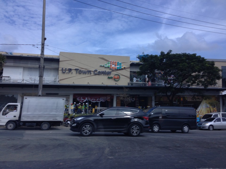 The UP Town Center is already attracting traffic as some restaurants and shops have already made “soft” openings.
A colleague once made the comment that the Town Center was not really for UP but, like the Alabang Town Center, was for the posh residential subdivisions in the area. These include nearby La Vista, Loyola Grand Villas and Ayala Heights subdivisions. Also, it will likely attract more car users than public transport users as locator restaurants and shops are mainly upper-middle to upper class. There are no Jollibees, Chowkings or McDos here. For now, the developer and UP Diliman deserves to be given the benefit of the doubt in as far as the development’s design is concerned. Perhaps the issues I mentioned above will be addressed once the entire area leased to Ayala would have been fully developed. And until then, there would be opportunities to check and ascertain if the development is indeed people friendly and something that can be called a university town center and not just another commercial development that attracts traffic.
–
All weather transport
The flooding brought about by heavy rains around the country rendered many roads impassable to motor vehicles. This meant traffic congestion in many areas and so many commuters being stranded due to the lack of public transport vehicles available to them. In these times, the only modes for traveling are reduced and limited to walking and non-motorized tranport (NMT). While cycling is an option for some people, a more popular mode in many areas and local roads are pedicabs. Known by various names in the vernacular such as padyak, trisikad, sikad, etc., these three wheelers are found providing transport services particularly in residential areas. These tend to use national roads and busy streets in cities, and such often causes conflicts with motor vehicles as the NMTs slow down traffic. During times of heavy rains due to typhoons or the monsoon, pedicabs become the mode of choice for many who need to get to their workplaces, schools or home despite flooded streets.
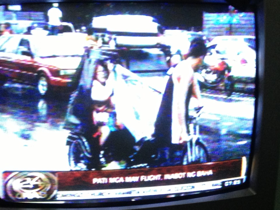 Photo of TV news report (GMA News’ 24 Oras) on air passengers taking pedicabs in order to get to the airport and catch their flights. Traffic was terrible due to floods along airport roads and only the non-motorized transport could navigate the flood waters. Interviews of passengers including tourists and foreigners showed their appreciation of the alternative mode of transport they had to take to catch their flights.
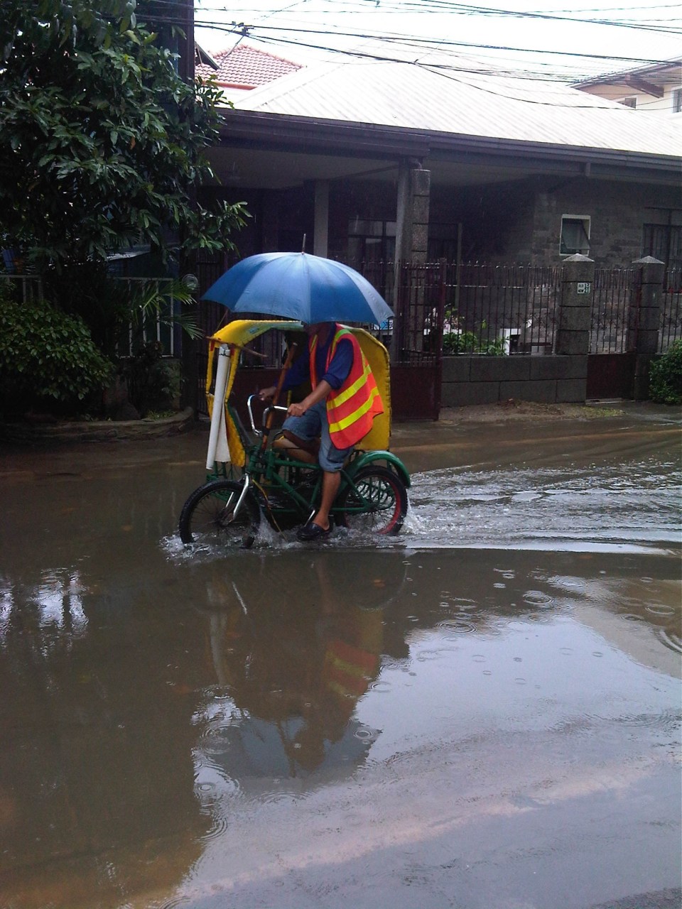 Pedicab service along a flooded residential road – special rates are often charged by pedicab drivers during the rainy season and when go into flooded streets. Regulated fares are charged in areas like residential subdivisions where homeowners associations have a say in fare rates. In other places, fares can be arbitrary or according to the willingness to pay of prospective passengers.
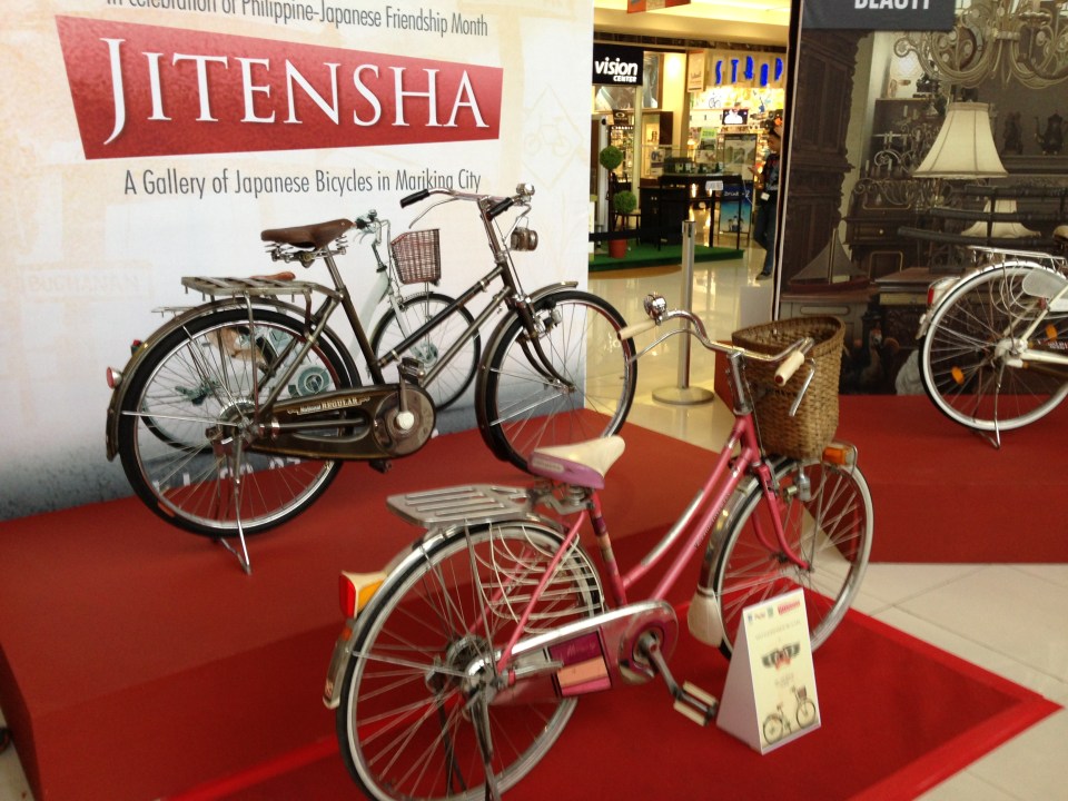 Bicycles are becoming popular for commuting not especially due to floods but more because of increasing fuel prices and fares. There is also an influx of second-hand or used bicycles from Japan (Note: Jitensha is bicycle in Japanese). These have become collectibles but are in actual use by their owners like the bikes shown in the photo that were exhibited at a mall recently.
–
Some thoughts on the issues on bus bans and terminals in Metro Manila
I had originally wanted to use “Clarifying issues on bus bans and terminals in Metro Manila” as the title for this post. However, I felt it was too strong a title, and one that would be more appropriate for a government agency like the MMDA or DOTC, or an LGU like Manila. More than fault-finding and criticizing government agencies and local governments, I believe we should take a closer and more objective look at the issues (or non issues?) pertaining to the Manila bus ban and the opening of the southwest provincial bus terminal for Cavite-bound buses. Following are my comments on issues raised the past weeks about the two initiatives.
Issue 1: There were no or few announcements about the implementation of the bus ban in Manila and the southwest terminal in Cavite.
Comments: While the bus ban in Manila came as a surprise to many, the move was actually a consequence of a Manila City Council resolution. Normally, such resolutions would take time to implement and would entail announcements for stakeholders. Though we will probably never know the truth or who is saying the truth about the resolution and its implementation, it is likely that bus operators already knew about the implications but decided to call Manila’s bluff and play the media and public appeal cards rather than comply with Manila’s requirements for franchised buses and terminals as they have done before in other issues like fuel prices and fare hikes.
I find it difficult to believe that the MMDA did not do its part in announcing the opening of the southwest terminal. Perhaps people thought the announcement was over a very short period? Or maybe people didn’t mind the announcement and are also at fault for paying no or little attention to the announcement? If so, then the public is also partly to blame for disregarding the announcement from the MMDA, assuming the agency won’t push through with its initiatives to implement central terminals for buses. Next up will be another southern terminal at Alabang and a northern one near Trinoma.
Issue 2: Poor transfer facilities and services including a lack of pedestrian facilities between the bus terminal and transfer point, and lack of public transport like jeepneys to ferry passengers to their destinations.
Comments: I think it’s quite clear that the MMDA and LGUs are at fault here. Despite the construction and scheduled opening of the southwest terminal, there have been limited effort in improving pedestrian facilities. Such facilities needed to be in place prior to or upon the opening of the southwest terminal and requiring all provincial buses to terminate at the facility instead of continuing to Metro Manila. People-friendly facilities could have helped people in adjusting to the new policy though walking from 100 to 200 meters is certainly not for all, especially during this rainy season. Senior citizens and persons with disabilities (PWDs) would have specific needs that could have been addressed from day one of operation of the terminal. One approach to “bridge the gap” between the terminal and where people could take city bus and jeepney rides could have been to modify some city bus and jeepney routes to make these closer to the terminal. Ideally, the terminal could have been an intermodal facility providing efficient, seamless transfers between modes of transport.
In the case of Manila, the jeepneys were already there with routes overlapping with buses but their numbers and capacity could not cope with the demand from the buses. Since the main objective of Manila was to weed out colorum buses, it could have coordinated with the LTFRB to check the registration and franchises of buses rather than generalizing among all buses. Perhaps Manila just wanted to make a big statement? But then this was at the expense of the riding public, which obviously got the attention of many including the media. Coordination among agencies and LGUs, however, has not been a strong suit for these agencies, and this thought leads us to the next issue.
Issue 3: Lack of coordination among LGUs and agencies in implementing transport schemes.
Comments: This issue is an enduring one and has been the topic of discussions, arguments and various fora for as long as we can remember. On one hand, the DOTC and the LTFRB should provide guidelines and guidance to local governments on transport planning and services. The agencies should be proactive in their engagement of LGUs in order to optimize transport services under the jurisdiction of national agencies and local governments. On the other hand, LGUs must accept the fact that most if not all of them are ill equipped or do not have the capacity nor capability to do transport planning much less addressing issues regarding public transport. Citing the Local Government Code and its devolution of local transport to LGUs everytime there’s a transport issue certainly won’t help LGUs solve their problems.
Issue 4: Terminals required for city buses in Manila.
Comments: There should be a terminal for city buses in Manila but not a terminal for each company. There should only be one or maybe two terminals where buses can make stops prior to making the turnaround for the return trip. There is actually a terminal in Manila, which the city can start with for city buses. This is the one just beside the Metropolitan Theater and near City Hall, which can be utilized by city buses. It is also close to the LRT Line 1 Central Station so the facility can be developed as a good intermodal terminal for land transport.
Issue 5: Colorum or illegal public transport vehicles in Manila
Comments: This is actually a problem not just for Manila but for the rest of Metropolitan Manila and the rest of the country. The colorum problem is there for both conventional and paratransit services as there are illegal buses, jeepneys, UV express, multicabs, taxis, tricycles and pedicabs everywhere. Many of these are allegedly being tolerated by national agencies and local governments with many allegedly being fielded or owned by public transport operators themselves.
–
In most cases, the best time to evaluate a traffic policy or scheme is NOT during its first days or weeks of implementation but after a significant time, say at least a month, after it was implemented. This is because the stakeholders, the people involved would take some time to adjust to any scheme or policy being implemented. This adjustment period will vary according to the magnitude or scope of the scheme/policy and can be quite “painful” to many who have gotten used to the old ways. Usually, a lot of comments and criticisms are quite emotional but it is clear that the collective sentiment is the result years or decades of poor transport services and fumbling by government agencies. Transport in Metro Manila is already quite complicated with routes overlapping and services competing with each other for the same passengers. Perhaps it is time to simplify transport while also in the process of optimizing and rationalizing services. I have written about this in this previous post.
More transport issues in Manila will come about should the city train its attention on other modes of transport including jeepneys, UV express vehicles, tricycles, pedicabs and kuligligs. If the city is really intent on reforming transport services within its jurisdiction, it should consider the needs of all stakeholders and especially and particularly the riding public. Transport should be inclusive, people-friendly as well as environment-friendly and there are many good practices in other cities that Manila could refer to and study for adaption and adoption for the city. If it is successful in improving transport, then perhaps Manila could be the country’s model for transformation from being the “Gates of Hell” to being a “Portal to Heaven” to residents and visitors alike.
–
Walking around Ginza
The Ginza District in Tokyo is one of the most prominent areas for both shopping and offices. It is reputed to be upscale as many of the world’s top brands such as LV, Chanel and Hermes have big shops here aside from the more recognizable Japanese shops like Matsuzakaya and Mikimoto. From a transport perspective, it is a very accessible area with metro lines having several stations here and the district being a few minutes walk from the JR Lines. Sidewalks are wide and therefore a boon to pedestrians and cyclists. There are no jeepneys, tricycles or pedicabs here that are used in the Philippines as modes for almost door-to-door transport and for short travel distances. Instead, you have to walk between buildings and metro or JR stations or bus stops.
 Cyclists making a turn at an intersection in Ginza.
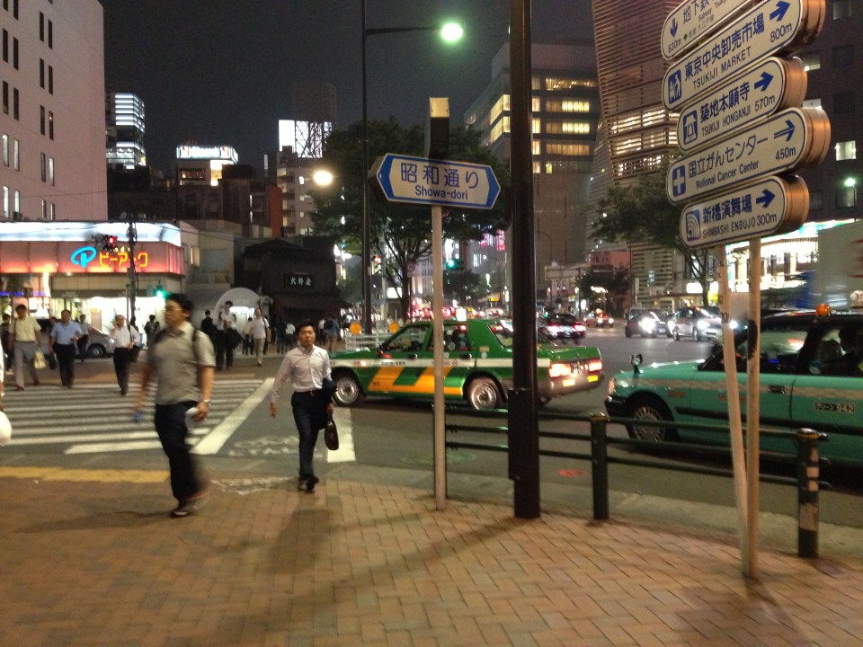 Taxis patiently wait for pedestrians to cross before making a left turn (Japan’s using the right hand drive system) – you will hear no horns from motorists as they give way to pedestrians and cyclists cross the streets unlike Metro Manila and elsewhere in the Philippines where motorists will run over people despite the latter having the right of way.
 Vehicles crossing a busy intersection in Ginza. Turning vehicles position themselves for the turn phase of a signal in anticipation of the green light and would give way to crossing pedestrians including stragglers who made the cross at the last instance.
 Navigating in Ginza – newcomers can get lost in any city and especially something as large and seemingly complicated as Tokyo. Fortunately, we now have map apps in our smart phones and we can more easily determine the way to our desired destinations. This is a friend and his daughter consulting the map on our way to our dinner venue.
 This fuzzy photo was taken as we crossed the street to get to the Higashi Ginza subway station where we parted with some of our company. The bright building at the center of the photo is the Kabuki Theater.
 Access to the Hibiya Line’s Higashi Ginza Station – note again the wide sidewalks.
 A quick shot of a street in Ginza with buildings and signs all lighted up.
 The lights and signboards reminded me of Shibuya (remember the movie Lost in Translation?) and Shinjuku, in other parts of Tokyo. I was not able to go there on my recent trip but will surely go next time I’m in Tokyo.
 Another look at a street as we crossed it to reveal a long line of buildings with the shop and store signs lit up.
 A large electronics store, Bic Camera, near the JR Yurakucho Station. Japan is well known for electronics and Tokyo is dotted with a lot of electronics stores selling the latest gadgets and appliances. Of course, there is the Akihabara “electric town” where there are stores and shops everywhere selling the same plus games and collectibles for hobbyists. But that, as they say, is another story to be told in a future post.
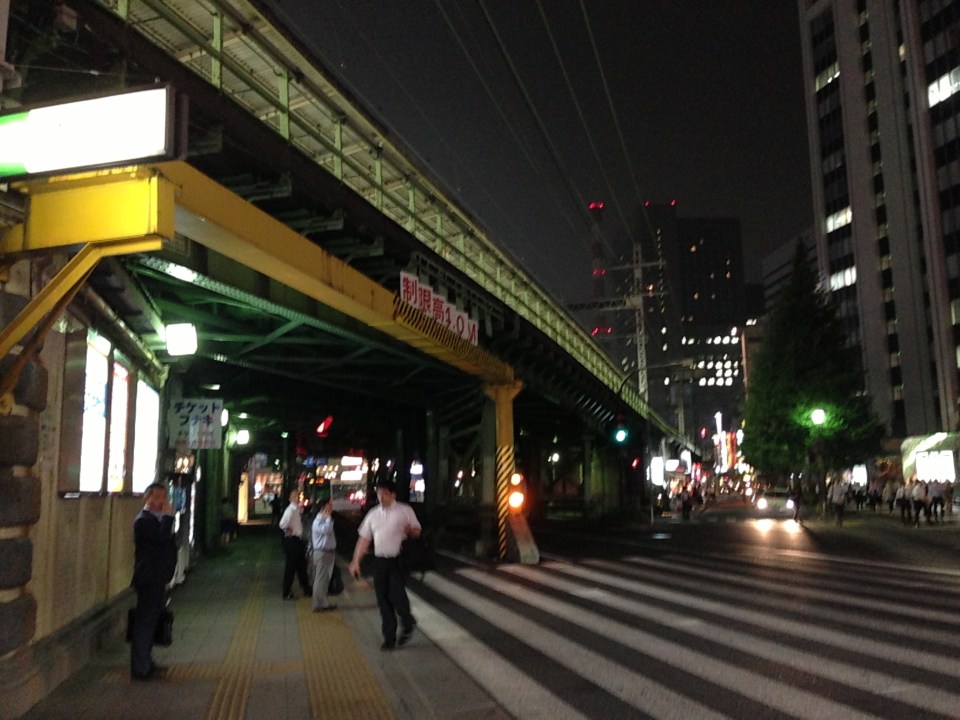 Wide pedestrian crossing at the JR Yurakucho Station. The area is host to many offices and generally has high pedestrian volumes.
–
More pedestrian facilities please!
I took a couple of photos one late afternoon on a weekday on my way home. I wanted to have a picture of typical jeepney overloading during the afternoon peak. Typically, jeepneys would allow “sabit” or passengers hanging from behind the jeepney. This practice is actually prohibited and carries a fine if jeepney drivers are apprehended. And that is usually a big “if” considering enforcers turn a blind eye to the practice especially during peak periods when it is difficult to get a ride.
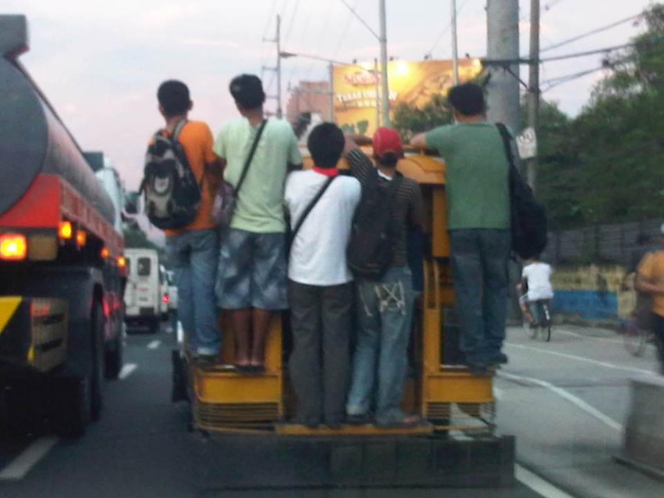 Jeepney full of sabit or hangers-on in heavy traffic along the eastbound side of a major highway
I also happened upon an opportunity to take a photo of the overloaded jeepney together with pedestrians walking along the walkway at the roadside. Though the photo was not so clear, it captured the image I wanted with people opting to walk while others took a risky ride on a jeepney. The cyclists in the photos were just bonuses and added to the visual of alternatives for mobility.
 Pedestrians and a cyclist along the widened walkway/bikeway along Marcos Highway
Walking remains as the mode of transport with the highest share when all modes, motorized or non-motorized, are compared. While there is a strong clamor from cyclists for bikeways and for cycling to be taken up by more people as an option for commuting, the reality is that cycling is not really for everyone. It is a viable and healthy mode but should also fit in a hierarchy of modes. Most people walk and walking should be encouraged over distances where it is most suitable. Facilities for walking need to be provided and properly designed so that people can walk safely and most efficiently like the example in the following photo taken during another weekday late afternoon.
 People walking along Marcos Highway
Local governments help promote walking by making sure sidewalks are provided and clear of obstructions. Perhaps walkability can be used as an indicator or parameter for a city to be qualified as livable and true to the advocacy of sustainable transport. Walking should be encouraged to promote healthy living as it incorporates exercise in our daily routines. More people walking should also increase awareness for the advocacy for clean air and help initiatives to improve air quality, particularly efforts to reduce harmful emissions by motorized vehicles. Thus, it is not difficult to understand how investing in pedestrian facilities and promoting walking is not a smart move and a beneficial one for any politician’s constituency.
–
Swapang! or the perils of walking
Walking to the jeepney terminal for a ride to the university, I was irritated by the constant honking behind me as motorcycles rode up the sidewalk to avoid the weaving into congested traffic along Aurora Boulevard. And so I tried to stand my ground allowing only half the space of the sidewalk for these motorcycles to pass through. As far as I’m concerned, I was already too generous giving part of the space that is for pedestrians and not for motorized traffic. Still, there were a few motorcyclists who seem to think they had the right of way as they attempted to convince me give up more space so they could practically take over the sidewalk. I didn’t give way and assumed they were cursing me inside their helmets. Manigas sila! I thought that in the end, sila ang asar at talo in this situation, not me.
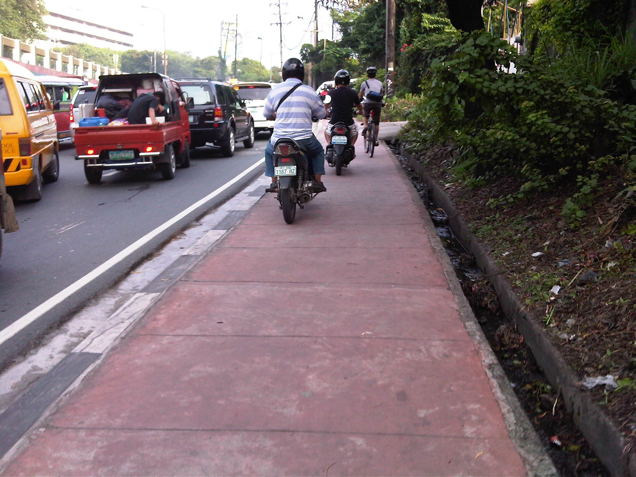 Motorcycles dominating space for pedestrians
At one point, I held my ground and didn’t give way to the motorcycles behind me [Advisory: This is not for everyone especially those who are “pikon” or who are looking for a fight.]. I knew my rights and I was walking on the pedestrian sidewalk. Unfortunately, a bicycle came along and I gave way only because I also appreciated cycling and understood that pedestrians and cyclists are sort of “kindred spirits” in a world dominated by motorized transport. The bicycle was immediately followed by two motorcycles including one that almost sideswiped the cyclist. I took the photo above to better show the situation.
The other day, I chanced upon a similar situation as I was driving in heavy traffic along Amang Rodriguez in Pasig City. What little space was available for pedestrians along a narrow sidewalk along this road connecting Marikina and Pasig cities.
 Motorcycles using a narrow pedestrian sidewalk to avoid traffic congestion along Amang Rodriguez
These cases are clear examples of swapang attitude or behavior that is prevalent among many road users. Unfortunately, these are not apprehended or accosted by traffic enforcers. The latter seem to be more engrossed with number coding and swerving violations, anyway, that they seem to have forgotten all the other traffic violations that included this brazen behavior of motorcyclists. Perhaps enforcers should go back to the basics and take more notice of all those other violations (e.g., speeding, counter flowing, beating the red light, beating the green light, etc.) to improve and promote discipline on our roads.
–
Here’s to walking!
I was lucky to be able to take a couple of photos as our vehicle passed along Marcos Highway to be able to capture images of people walking along the sidewalks between Ligaya and De la Paz. The driver maintained his position along the right side of the road so I had a good view of the pedestrians and cyclists making their way from Ligaya in the general direction of De la Paz and the two shopping malls downstream (the signs of one mall are visible in the photo).
Ligaya is a transfer point for people traveling to and from Pasig, Pateros and Marikina who use the jeepneys connecting these towns. They typically get off at the junction of Marcos Highway and Amang Rodriguez. From here, one can take a jeepney to the towns of Rizal or perhaps to Quezon City (Cubao). These days, however, it is not so easy to get a ride at Ligaya and one cause of congestion emanating from the junction are people taking two lanes of the road as they position themselves to board stopping jeepneys. Instead of waiting for the jeepneys and whatever limited seats are available, many people have decided to walk towards the junction with Imelda Avenue. There located are commercial establishments including two shopping malls and the terminals of public transport whose routes terminate at the area. There, it is relatively easier to get a ride home though during the early evenings it can also be difficult to get a ride to the Masinag and Cogeo districts of Antipolo (And that’s part of the reasons why the LRT Line 2 extension is necessary!).
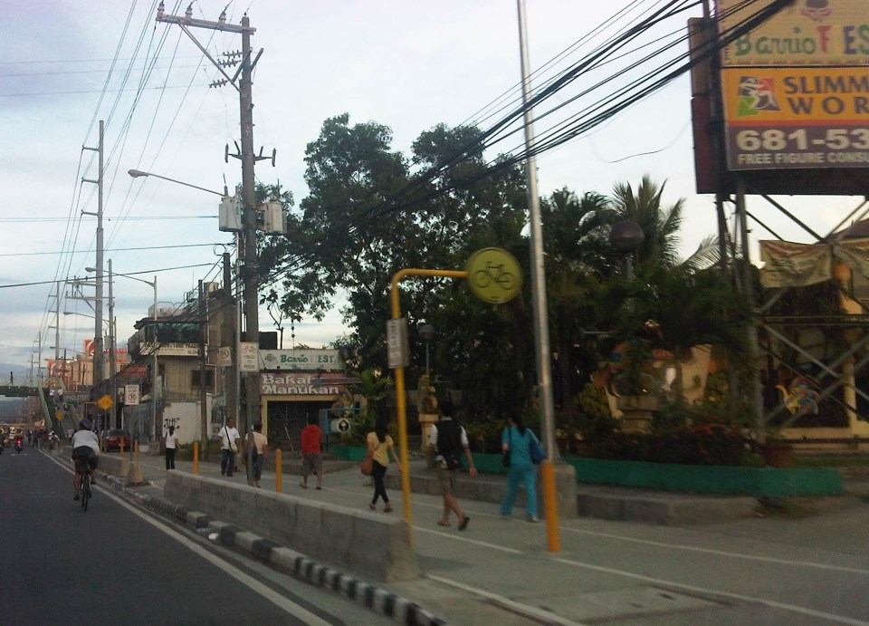 Pedestrians walking towards De la Paz or the shopping malls a little further on. There is actually a bicycle lane beside the pedestrian walk similar to how the Marikina Bikeways were designed but most cyclists opt to use the curbside lane of Marcos Highway.
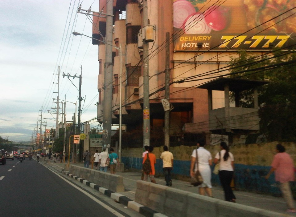 Pedestrians walking from Ligaya include workers and students.
The walkways are generally clean and well-lit during the night time, though I think portions are still quite dark. I also think the more people opting to walk means it can be safer to walk (strength in numbers?). The observation that many people walk encourages other people to do so, and is a deterrent for unlawful elements of society. Perhaps to further reinforce the safety and security aspect of walking, Pasig Police or the MMDA could have some of their personnel walk along this path. Police visibility here, especially at night, would help deter muggers and hold-uppers who might see the pedestrians as potential victims.
–
Rizal Avenue – Part 2: Tayuman to Pampanga Street
In the last post on Rizal Avenue, the featured photos show conditions under the LRT Line 1, which included visual evidence of certain issues like on-street parking, poor lighting and even sanitation (i.e., garbage) along the corridor. This post features more of the same and perhaps worse in some cases that are used as proof of the blight caused in part by the LRT superstructure. I say in part because LRT Line 1 is not wholly to blame for problems under and around it. Local governments and the private sector share responsibility for the decline of the areas within the direct influence of the rail line. Napabayaan. But of course, this does not absolve proponents of the LRT Line 1 for poor station design.
 Approach to Tayuman Station along the northbound side of Rizal Avenue.
 Tayuman Station – shown in the upper part of the photo is one end of the northbound platform.
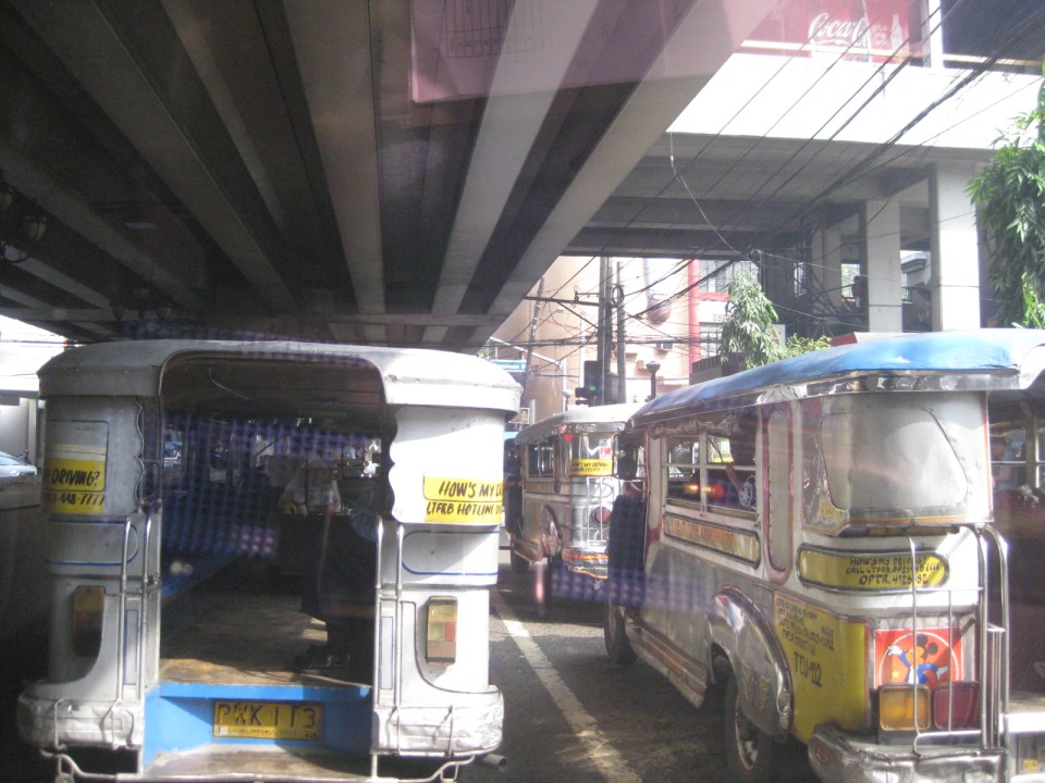 Underneath the station, jeepneys clog the lanes as they load/unload passengers. LRT Line 1 stations are poorly designed for intermodal transfers (e.g., LRT to jeepney, LRT to bus, etc.).
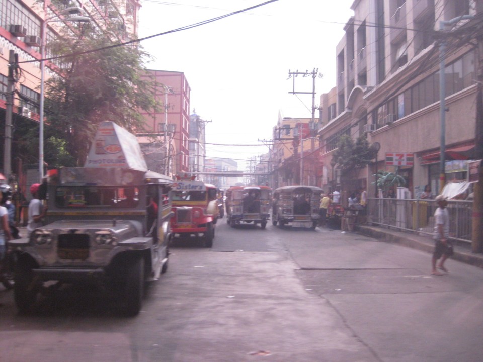 Tayuman Road is a busy street in Manila that’s served by jeepneys connecting to major streets like Lacson Avenue to the east and Abad Santos and Juan Luna to the west. The photo shows a view to the east of the LRT Tayuman Station.
 Approach to the junction with Herrera Street
 Approach to Blumentritt Station – the station is named after Ferdinand Blumentritt, an Austrian who was a close friend of the national hero Jose Rizal. The street leads to a large public market close to the station (near the intersection) that is also named after the fellow and one of the more crowded markets in the metropolis. There are many jeepney lines with Blumentritt as part of their routes.
 Birds and other creatures being sold as pets around Blumentritt – many have been painted to attract children and other buyers curious at the colored birds.
 Vendors line the Rizal Avenue, Blumentritt and the other side streets in the area, which is usually crowded no matter what day of the week it is.
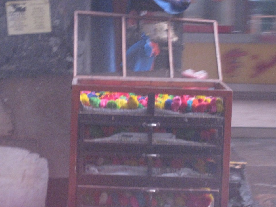 Angry birds? A closer look reveals the birds as chicken chicks colored by the vendors to attract interest. Sadly, many of these do not survive to become full grown chickens and children (and adults) will be disappointed to discover later that the color comes off pretty quick when the chicks come in contact with water.
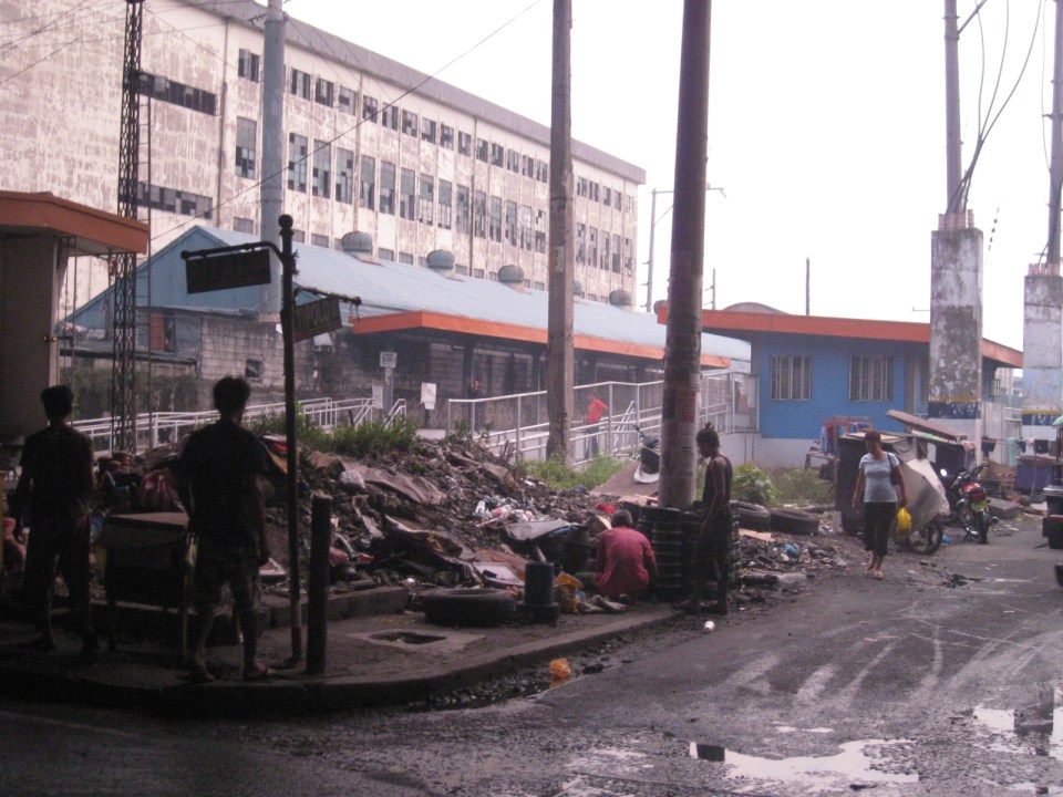 There is a PNR Blumentritt Station and unless there’s been some radical clean-up of the area, this is pretty much what you’d see around the station – garbage, dirt, informal settlers and other characters. The building behind the station is a public school.
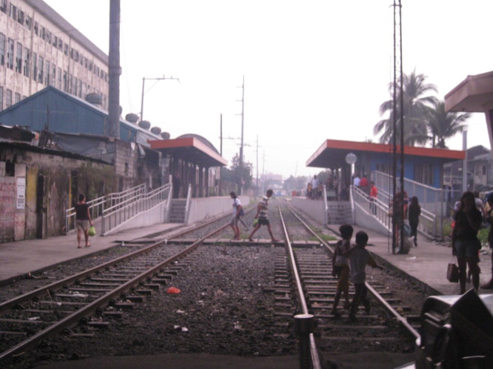 The PNR Blumentritt Station has two platforms on either side of the double track. Security is quite lax and people, including children, cross the tracks freely. Fortunately, train service frequencies are quite low (about 1 per hour) so the risk of getting hit by a train is also low. The photo shows the view to the east of Rizal Avenue.
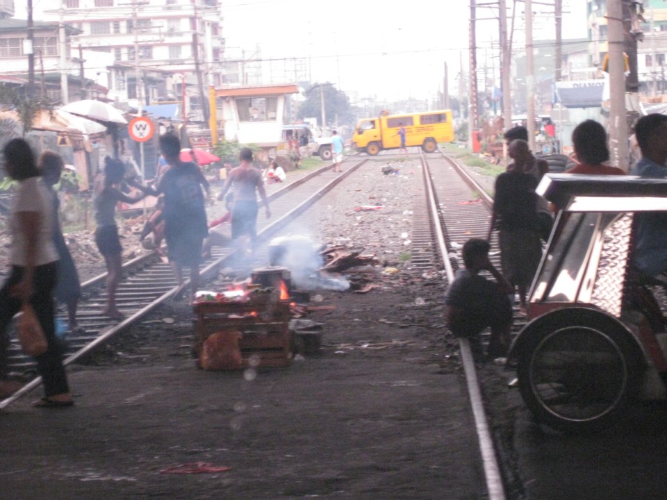 On the left side of Rizal Avenue is a scene where people are oblivious to the railways with some even doing their cooking between the tracks.
 Blumentritt Avenue is a very crowded street with a public school (building at right) just across the public market (at left). There are many vendors lined along the street and people as just about everywhere and without regard to vehicular traffic.
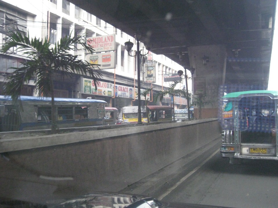 Traffic congestion along Rizal Avenue is attributed mainly to the market and median barriers were constructed to reduce pedestrian crossings anywhere along the road. Commercial establishments line either side of Rizal Avenue, basically contributing to congestion in the area.
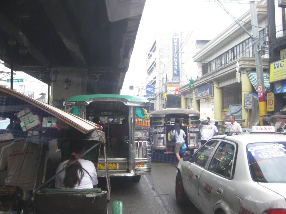 Commercial establishments plus customers plus paratransit equal to traffic congestion
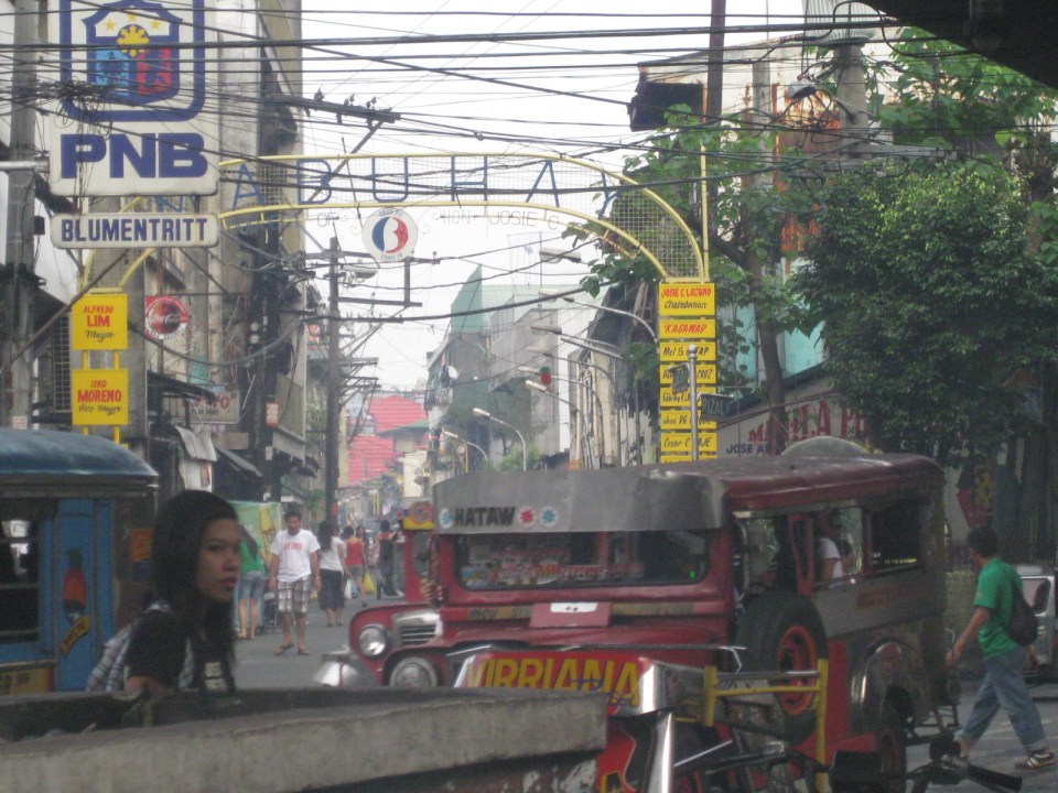 16A busy side street in the Blumentritt area – there are no sidewalks so pedestrians and motor vehicles mix it up along the road.
 Bulacan Street serves as an informal terminal for jeepneys. The road appears to be newly paved but there are no sidewalks and tents are found along the road often bearing the names of politicians sponsoring the tents for various purposes such as wakes and parties.
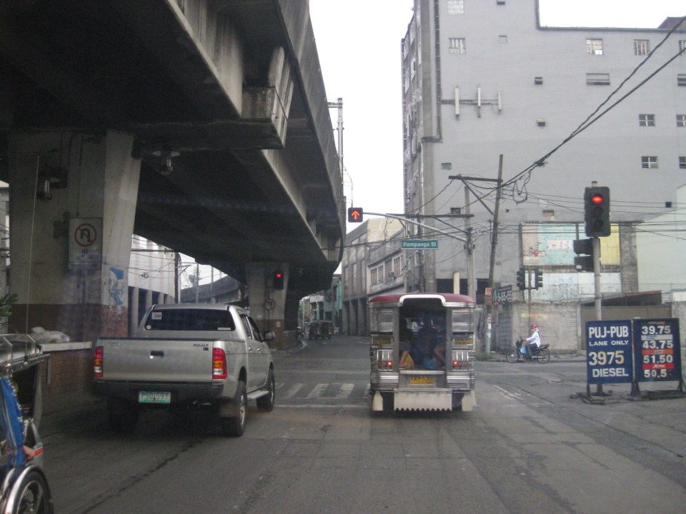 Intersection with Pampanga Street, just before Rizal Avenue and the LRT line turns towards Aurora Boulevard and proceed to Caloocan City and Monumento.
More on Rizal Avenue in future post…
–
Rizal Avenue – Part 1: Carriedo – Bambang
Rizal Avenue stretches from Manila northward to Caloocan city from Carriedo to Monumento. What used to be one of the more cosmopolitan streets in Manila was transformed (some say blighted) by the construction of the elevated LRT Line in the early 1980’s. Carriedo, for example, used to be a popular shopping street along with Escolta. Those were times when there were none of the huge shopping malls now scattered in Metro Manila and people came to Manila to shop.
The following photos were taken while we traversed Rizal Avenue as part of a recon we were conducting for a project with the Department of Transportation and Communications (DOTC) back in 2011. I’m not sure if there have been any significant changes along Rizal Avenue and I am not aware of any recent programs to improve conditions under the LRT Line 1.
 Approaching the LRT Line 1 Carriedo Station from the McArthur Bridge
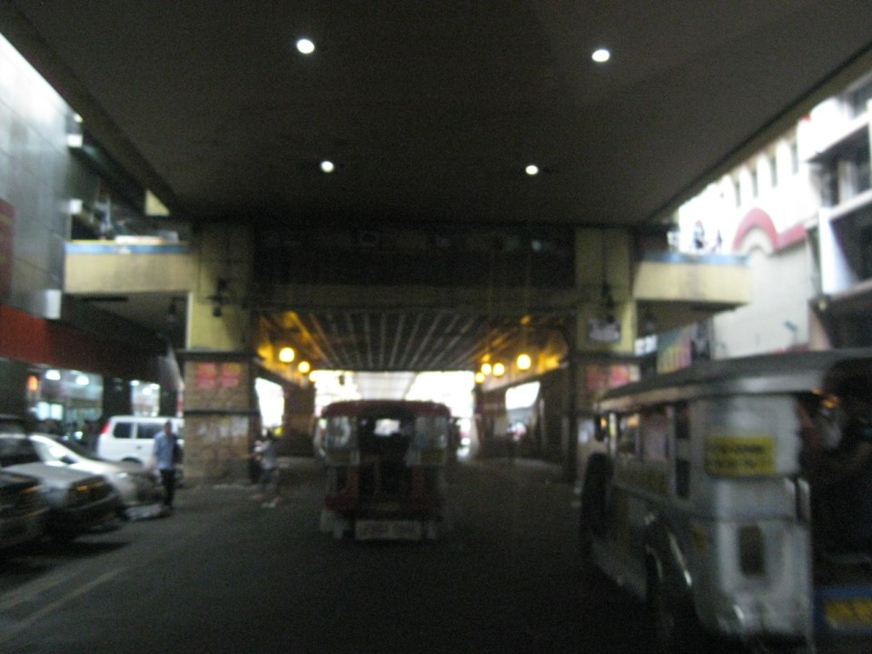 Under Carriedo Station, one experiences first-hand what people have been saying about the area being blighted by the LRT 1 structure
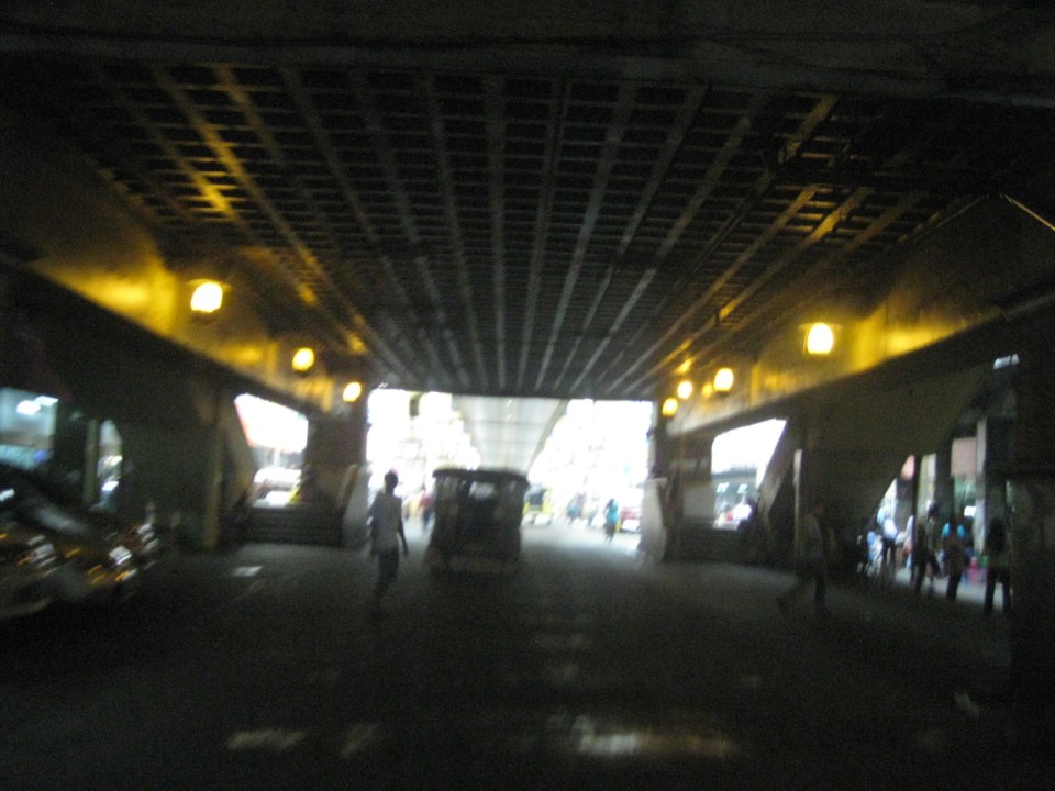 Poorly lighted? It was broad daylight outdoors when we conducted the recon but underneath an LRT 1 Station it can get quite dark. Of course, aside from the need to improve illumination, perhaps authorities can also improve the environment including the cleanliness of the area under the station. A common complaint is garbage and there are those saying the area smells of piss (i.e., mapanghi).
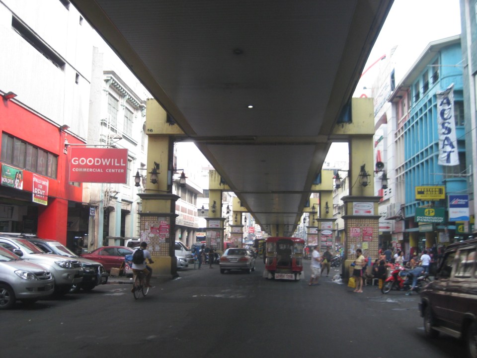 Past Carriedo Station, it was brighter and perhaps the area can be developed so that stretches can be pedestrian friendly. Maybe there should also be restrictions on vehicle parking, which tends to make the area look congested. It would be good to have a strategically located multilevel facility in the area where most vehicles can park instead of along the streets as shown in the photo.
 5More roadside parking plus the presence of tricycles contribute to traffic congestion in the area. People are everywhere walking and crossing anywhere. The arcades where they are supposed to walk along are mainly occupied by vendors or merchandise of stores/shops occupying the ground floors of the buildings along the street.
 Each side of Rizal Avenue is surprisingly wide with 3 lanes per direction. One lane is effectively used for on-street parking while the other two are for general traffic. There are no lane markings at the time we passed by the area so there can be confusion as to lane assignments.
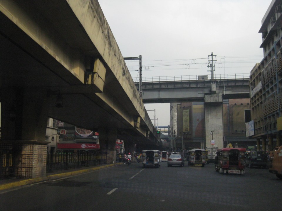 Approach to the junction with Recto Ave. and the LRT Line 2, which is also elevated and at the 3rd level as shown in the photo.
 Rizal Ave.-Recto Ave. intersection – visible downstream in the photo is Doroteo Jose Station
 Provincial bus terminal between Doroteo Jose and Bambang Stations
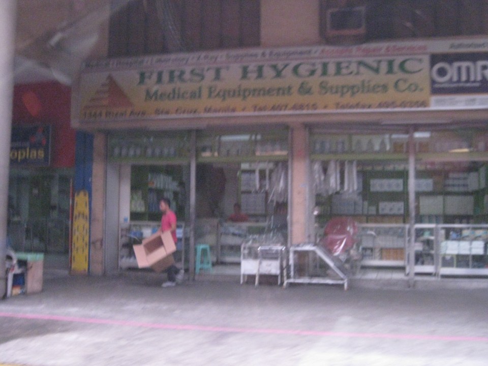 The Sta. Cruz district and particularly the Bambang area is well-known for shops selling medical equipment and supplies. Medical, nursing and other students of allied medical professions as well as professionals come to Bambang to purchase equipment and supplies from these shops, which offer items at lower prices.
 LRT 1 Bambang Station
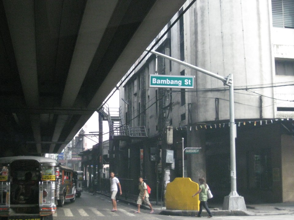 Rizal Ave.-Bambang St. intersection beneath the station
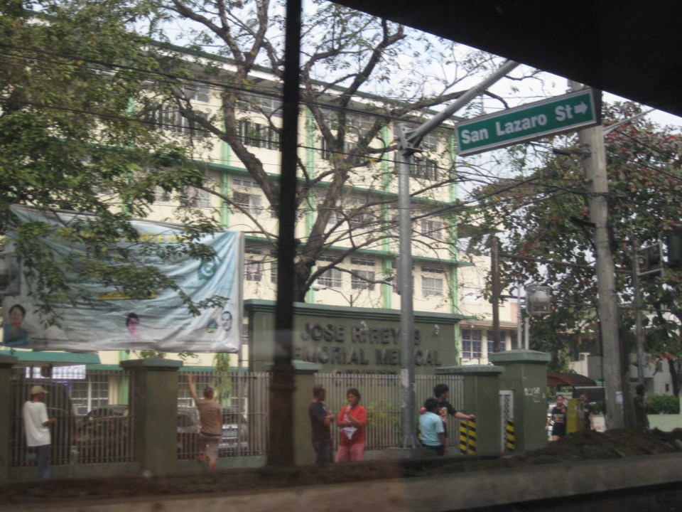 Two large government hospitals are located in the area between Bambang Station and Tayuman Station – San Lazaro Hospital and Jose Reyes Memorial Medical Center. Both are run by the Department of Health (DOH), which is located beside Jose Reyes.
–
The streets and sidewalks of Melaka
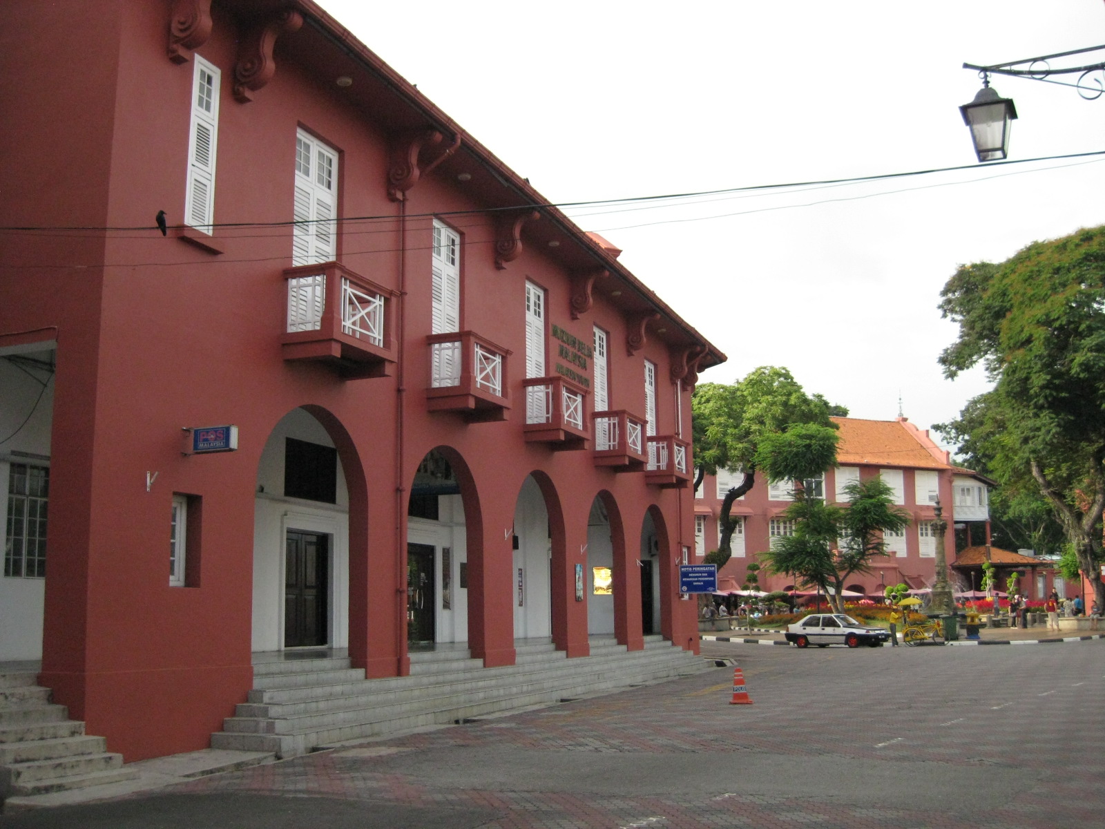 |
| View towards the plaza – the red building is part of the Christ Church complex but is now home of the Melaka Post Office |
 |
| The walkways reminded me of similar forms in Manila, Cebu and Iloilo, all old cities established during the Spanish Period when Melaka was under the rival Portuguese. |
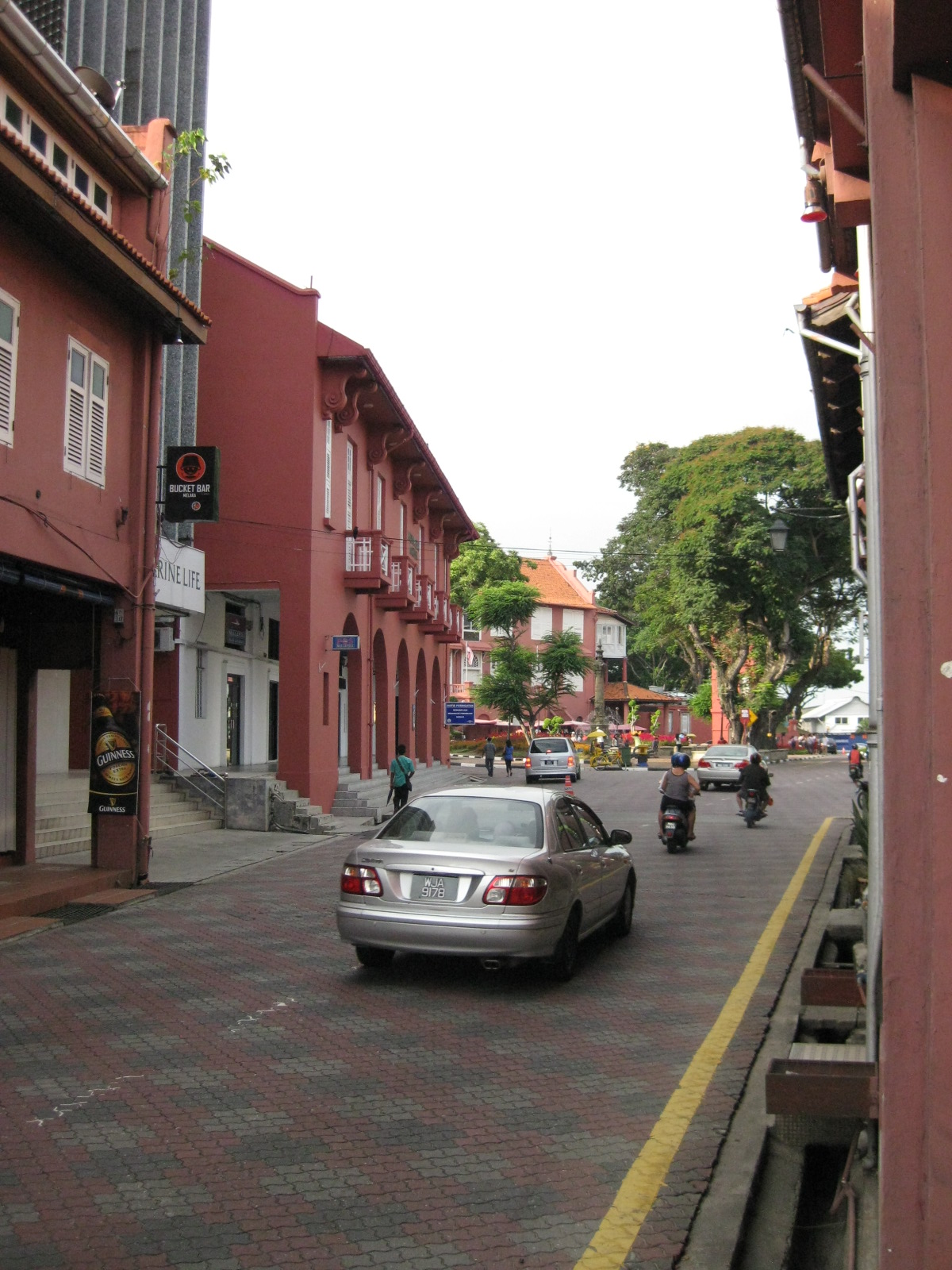 |
| The pavement was tiled but well-maintained |
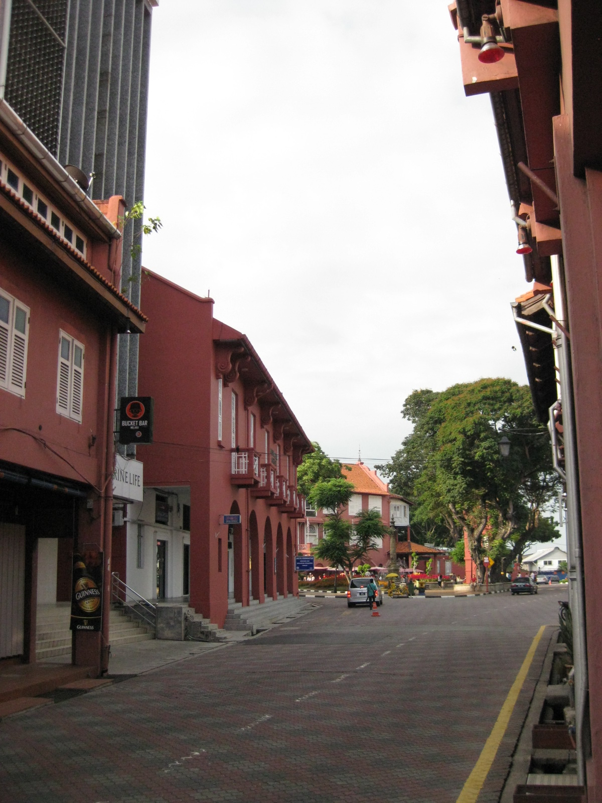 |
| Traffic was light so one could get a good shot of the street leading up to the plaza. |
 |
| The street leading to St. Francis Xavier made me imagine how old cities in the Philippines would have looked like if those cities made an effort to preserve heritage and controlled motor vehicle access to their street. |
 |
| Some buildings have been converted to restaurants and bars but they retained their nostalgic features and feel. |
 |
| Melaka made sure their signposts and lamps were designed consistent with the ambiance of the heritage city |
 |
| Another shot of the seemingly endless walkway beneath the buildings. |

