
Home » Walking (Page 12)
Category Archives: Walking
The Streets of Bacolod: Around the Public Plaza
The streets surrounding the Bacolod Public Plaza are one-way streets following a counter-clockwise circulation around the plaza. Typical of plazas of old, the latter has around it the church (in this case San Sebastian Cathedral), the old city hall, commercial establishments, the police headquarters, and a major school (La Consolacion College). The following photos were actually taken a year ago in February 2012. I doubt if much has changed since then but the circulation and traffic situation should practically be the same give and take the normal traffic growth due to progress for the capital city of Negros Occidental.
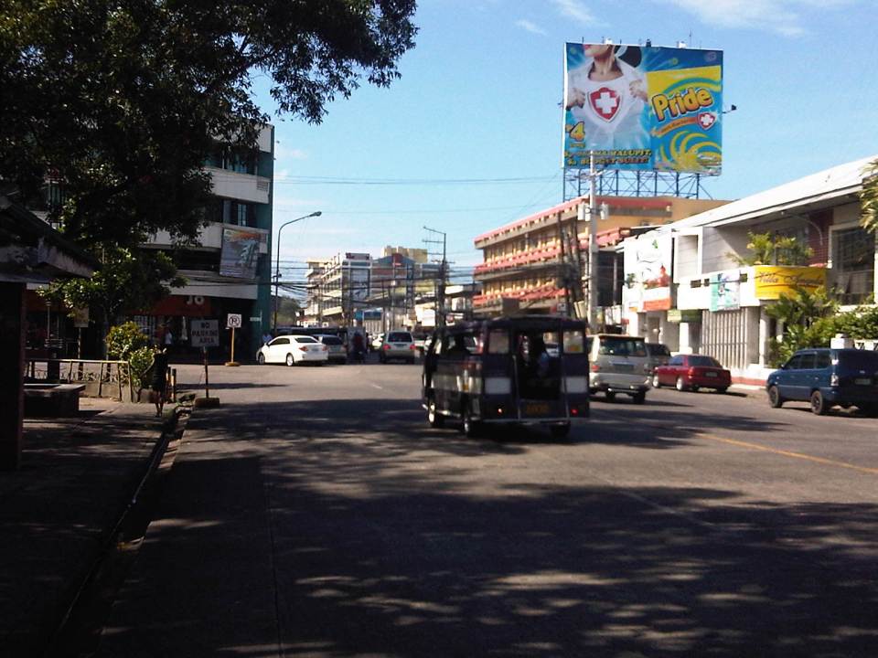 Intersection of San Juan St. and Gonzaga St. (view along San Juan St. towards southwest)
 Intersection of San Juan St. and Luzuriaga St. (view from east corner of intersection towards Westown Hotel)
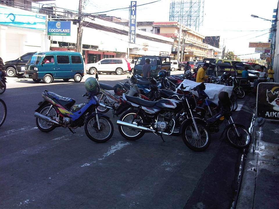 Roadside parking along San Juan St. Noticeable above are the motorcycle parked along the road, with some occupying pedestrian crossing space.
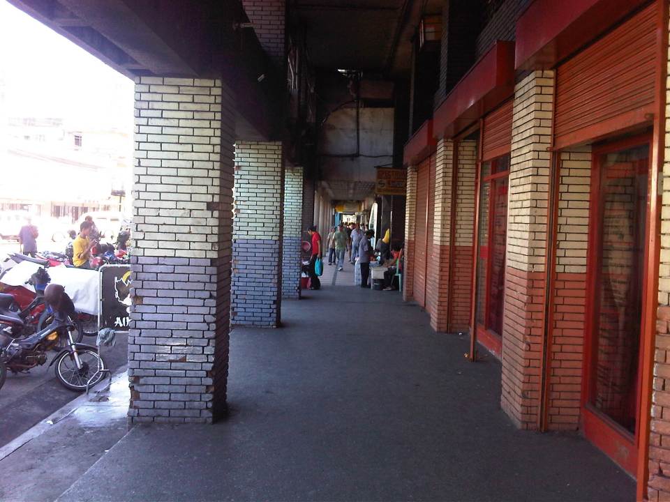 Old cities like Bacolod have buildings featuring arcades like this where pedestrians have the ROW and are sheltered from the elements. I was glad to see that the city basically cleared these facilities from obstacles. It is not entirely without impediments though as shown in the photo.
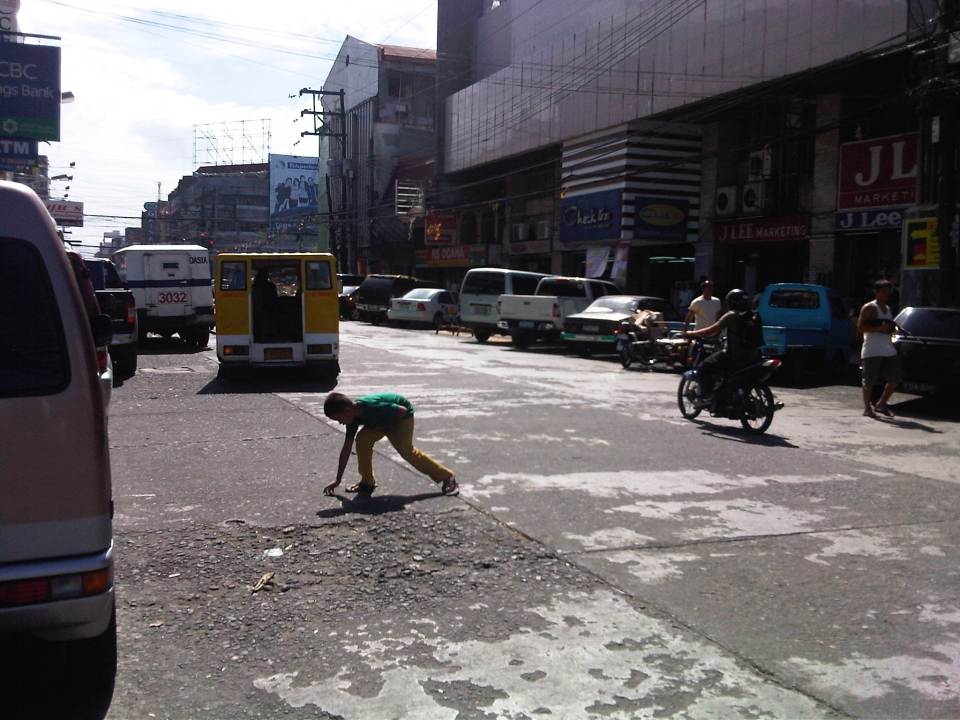 Luzuriaga Street (view towards southeast)
 Arcade of Plaza Mart building along Gonzaga Street and across from the Bacolod Public Plaza (view towards Araneta Ave. and Gatuslao Street)
 Another view of the arcade of Plaza Mart, this time along San Juan Street (towards Luzuriaga St.)
 San Juan Street (view from the corner at Gonzaga Street) – at right is the Plaza
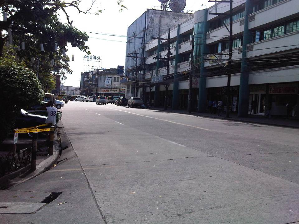 Gonzaga Street (view at corner of the Plaza along San Juan Street) – vehicles downstream are at the intersection of Gonzaga St. and Araneta Ave. Further downstream is Gatuslao Street
 Rizal Street taken from the plaza side and featuring San Sebastian Cathedral
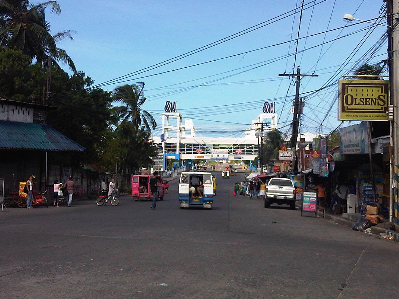 Rizal Street leads to SM City Bacolod, which is found in the reclamation area. (View from the intersection of Rizal St. with San Juan Street)
 Steel barriers along Rizal Street prevent vehicles crossing the street from the northeast side of San Juan St. All traffic must turn right towards SM. (view from the corner of San Juan and Rizal along San Juan towards the southwest direction) The PNP headquarters is the building on the opposite corner with the blue roof.
 Intersection of San Juan Street and Luzuriaga Street (view along San Juan St. towards southwest)
 San Juan-Luzuriaga intersection (view from Westown Hotel corner)
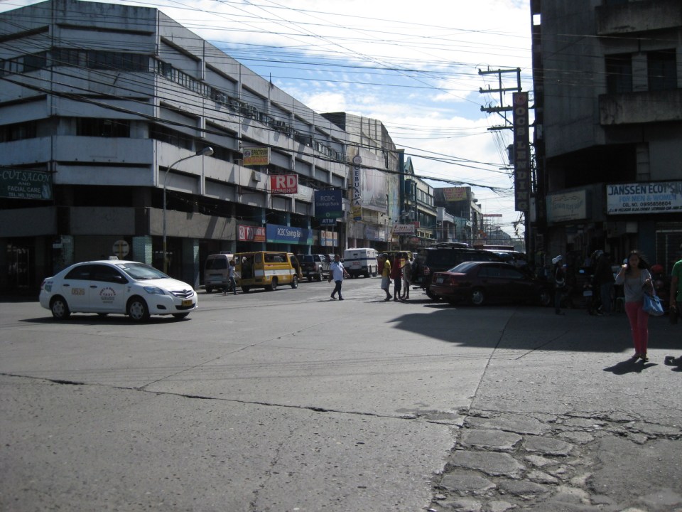 San Juan-Luzuriaga intersection (view along Luzuriaga St. towards southeast)
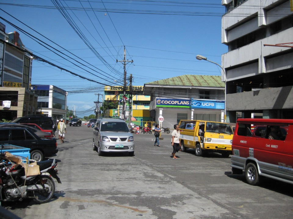 Luzuriaga Street is also a one-way street and with significant roadside parking as shown in the left side of the photo. View of traffic coming from the intersection with San Juan St. Westown Hotel is the building at left.
The circulation scheme at the plaza seems to be working out well at the time. This is despite the proliferation of roadside parking along the streets and around the plaza. The streets are relatively wide and so a one-way scheme works well in terms of taking advantage of the capacities of the streets while allowing for curbside parking that typically occupies one lane of road space as shown in the photos above. We didn’t see anyone charging parking fees for the vehicles and so we assume that these are practically free though we did see some informal “watch-your-car” boys who rely on tips from those parking along the road. Ultimately, though, the city should look into the provision off-street parking facilities as I can imagine traffic congestion, for example, in the vicinity of San Sebastian Cathedral on Sundays. Traffic in the area should be expected to increase as the city continues to experience economic growth and more developments ultimately locate at the reclamation area.
–
Antipolo Simbahan
“All roads lead to Antipolo” is a saying that is especially true for devotees to Our Lady of Peace and Good Voyage for whom the shrine in Antipolo is dedicated. Indeed, major transport routes lead to Antipolo City and signboards on jeepneys (and buses of old) state “Antipolo Simbahan” as their destination. In much older days, the Manila Railroad Company used to have trains directly serving this route. The remnants of its right-of-way is still there but in the form of roads. These are the Daang Bakal, which stretches from Valley Golf in Cainta, Rizal until its junction with Taktak Road and Ninoy Aquino Blvd., where it becomes the Lorenzo Sumulong Memorial Circle, Antipolo’s circumferential road. A trace of this old railway line may be found in this previous post.
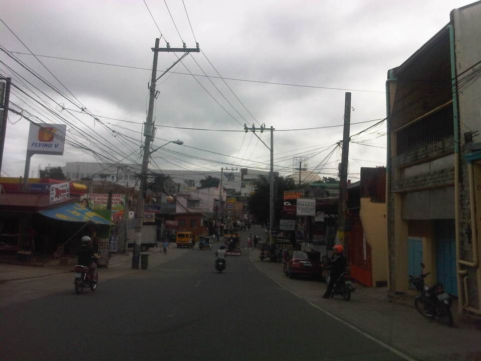 From J.P. Rizal Street, which extends from Sumulong Highway, one turns left to head straight towards the Antipolo church along P. Oliveros Street. The street is a two-lane, one-way road that has been widened at some sections. The shoulders, however, are mostly used for parking as shown in the photo.
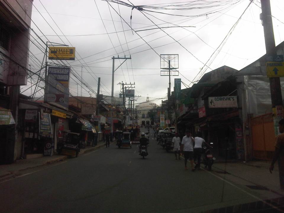 The dome of the church becomes visible to the traveler as one comes closer. P. Oliveros St. is closed to traffic during the feast day in May. It is usually open during Lent even during the Holy Week when there are lots of people coming to Antipolo for the Visita Iglesia. Traffic during those times can be quite slow because there are also lots of people walking along the streets, many of whom are devotees who are namamanata, or have promises of sacrifice and prayers to the patron of the shrine.
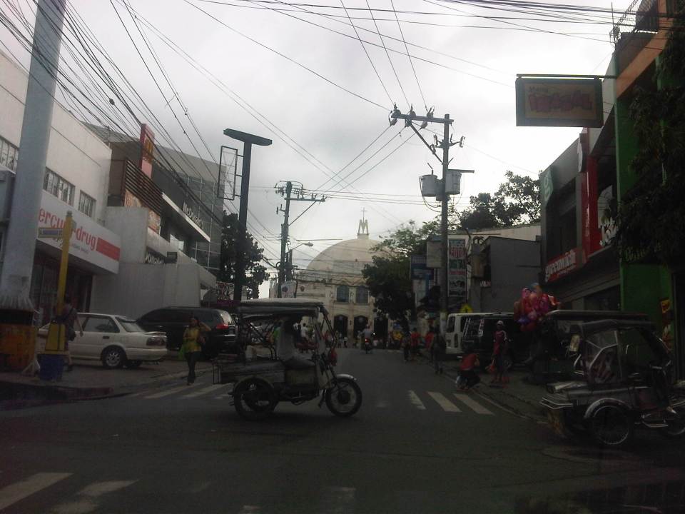 Similar to other poblacions around the country, commerce surrounds the church. Antipolo receives thousands of visitors daily and its being a natural traffic generator provides opportunities for businesses to thrive around it. Establishments around the church are proof of this and one will find most major fast food chains within a stone’s throw away from the shrine. In the photo are major chains Jollibee, Mang Inasal, Greenwich along the right and Mercury Drug(not fast food but the largest drug store chain in the Philippines) and McDonald’s on the left. There are more including banks and food stalls along M.L. Quezon Street, which is the main street of the poblacion.
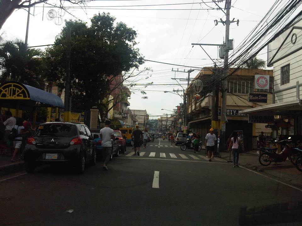 M.L. Quezon Street in front of the shrine and the main street of the poblacion, is also a two-lane, one-way street (southbound flow). There are many one-way streets here as it is no longer possible to widen streets. One side of M.L. Quezon is used for parking and a short walk from the church is Antipolo City Hall, which is the red building barely visible (obscured by the tree on the left) downstream in the photo.
 The Antipolo City Hall building is seen here at the left in this photo.
There is a proliferation of tricycles operating in the poblacion. I don’t know how many there are but they seem to be from different tricycle operators and drivers associations (TODA) that all converge at the shrine. This overlap of service areas (tricycles do not have fixed routes) suggest everyone is taking advantage of the shrine and city hall being major traffic generators. The problem is that the city has not been able to control their numbers and regulation is probably limited to registration, which brings some revenues to the city. This is certainly not sustainable from the perspective of transport
It would be nice to see the poblacion re-planned, designed and managed so that walking may be given primacy over other modes, particularly motorized ones. Antipolo should be walkable and it was in the past considering there were no tricycles and automobiles during the Spanish and early American periods. One took an animal-drawn vehicle, road a horse, or walked even when there was a train service in the early part of the last century. If parking is an issue, then perhaps the city, with the cooperation of the private sector, could find ways of building multi-storey parking facilities in the periphery and within comfortable walking distance from the shrine and city hall. There’s much potential here that is steadily being wasted due to traffic and with no design theme even for buildings surrounding the shrine. The shrine represents heritage and to preserve and enhance it, Antipolo City should find ways to introduce sustainable transport as well as applying architectural principles for the poblacion.
–
Technical Papers on Sustainable Urban Transport
This is just a quick post to end this first month of the year. Following is a link to the website of the GIZ-supported Sustainable Urban Transport Project featuring the page with the latest technical papers. These represent some of the latest work on sustainable transport featuring good practices from developing and developed cities that can be used as guides or benchmarks for those dealing with transport issues in their respective cities or towns.
Transport gaps
I first learned about the concept back in the 1990’s when I was a graduate student at UP majoring in transportation engineering. The concept on transport gaps was first mentioned in a lecture by a visiting Japanese professor as he was discussing about transport modes, particularly on which was suitable or preferable over certain travel distances and which could carry more passengers. Another time later and while in Japan, I heard about the concept during a presentation of a friend of his technical paper on public transport.
The figure below is one of many possible illustrations of the concept of transport gaps. In the figure, a distinction is made for mass transport and individual transport. As the original figure is likely taken from a textbook or a paper (probably from Japan), shown with a white background are the more conventional modes of transport including subways, urban and suburban railways, walking and a mention of the shinkansen (more popularly known as the bullet train). With a gray background in the original figure is a category on new urban transit systems that include monorails, AGTs and LRTs. If we attempt to qualify local transport modes such as jeepneys, UV Express, tricycles and pedicabs into the graph, the outcome can be like what is illustrated with different color backgrounds in the figure below.

The concept of transport gaps allow us to visualize which modes are suitable for certain conditions where other established modes of transport may not be available or viable. In the original figure, the gap in Japan is filled by new urban transit systems. In our case, gaps are filled by so-called indigenous transport modes such as jeepneys, multicabs, tricycles, pedicabs and even habal-habal (motorcycle taxis).
There are gaps in the Philippine case probably and partly because of the slow development of public transport systems such as the mass transport modes shown in the preceding figure. There was a significant gap right after World War 2 when the tranvia and other railways were destroyed during the war. That gap was filled by the jeepney. There was also a gap in the early 1990’s that was eventually filled by FX taxis. Such gaps can obviously be filled by more efficient modes of transport but intervention by regulating agencies would be required and rationalizing transport services can only be addressed with the provision of mass transport options complemented by facilities for walking and cycling that will complement these modes.
–
On pedestrian overpasses again
Pedestrian overpasses in Metro Manila are of various designs. The older ones are mostly concrete structures that were not designed to consider the needs of senior citizens or persons with disabilities (PWDs). Often the stairs are relatively steep and each step can be quite high. More recent ones, particularly those constructed by the MMDA in the last administration were steel structures. The first generation where constructed similarly as their concrete versions, with little consideration to the elderly and the physically-challenged. Many of these overpasses even got flak from women’s groups as the steps featured slits through which women can be taken advantage of by peeping toms. And so some of the “offending” overpasses had their stairs retrofitted to provide some cover for people using these facilities.
A good feature of more recent overpasses constructed has been ramps that allow easier access by persons with disabilities and cyclists. Most new overpasses in Metro Manila also have less steeper stairs and others even have landings to allow people to have some pause while climbing up or down the overpass. Following are a few photos of overpasses along Marcos Highway including one connecting a major shopping mall to the LRT Line 2 Santolan Station.
 Overpass along Marcos Highway in Pasig City featuring a ramp that can also be used by cyclists and persons with disabilities.
 “Conventional” overpass along Marcos Highway – there are no ramps but the stairs are not as steep as the older ones.
 Overpass connecting a major shopping mall to the LRT Line 2 Santolan Station
While such overpasses are necessary along wide roads with heavy motor vehicle traffic, similar facilities are not usually recommended for narrower streets where motorized traffic is manageable. There are discussions now that call for pedestrians to have the right of way along streets. Such discussions have basis given pedestrians attempting to cross at designated areas (definitely not the jaywalkers) have difficulty crossing as motor vehicles disregard them, with some seemingly attempting to sideswipe people (nananadya?). The rule should be that once a pedestrian steps on the pavement at a zebra crossing or crosswalk, vehicles should give way to them. Many drivers and riders are oblivious to this rule and it is not enforced by the MMDA or police. They should, in order to effect behavior change in motorists and to ensure the safety of pedestrians.
–
Using the Bangkok subway
I have gone around Bangkok in the past using the BTS Skytrain, buses, taxis and once using the tuktuk. I have only used the subway once as it has only one line and in the past trips to Bangkok I really didn’t need to use it considering most of my destinations were within walking distance of a Skytrain station or required the services of a taxi. And so I took the opportunity to take some photos at the Bangkok Metro during one commute to meet up with a friend.
 Directional sign guides people coming from the Skytrain platform to the MRT, Bangkok’s lone subway line
 Descending from the Skytrain station to the entrance to the subway station
 Directional signs guide commuters to the subway station
 Another descent, this time to the subway station plaza to purchase a token (instead of a ticket) to ride the train
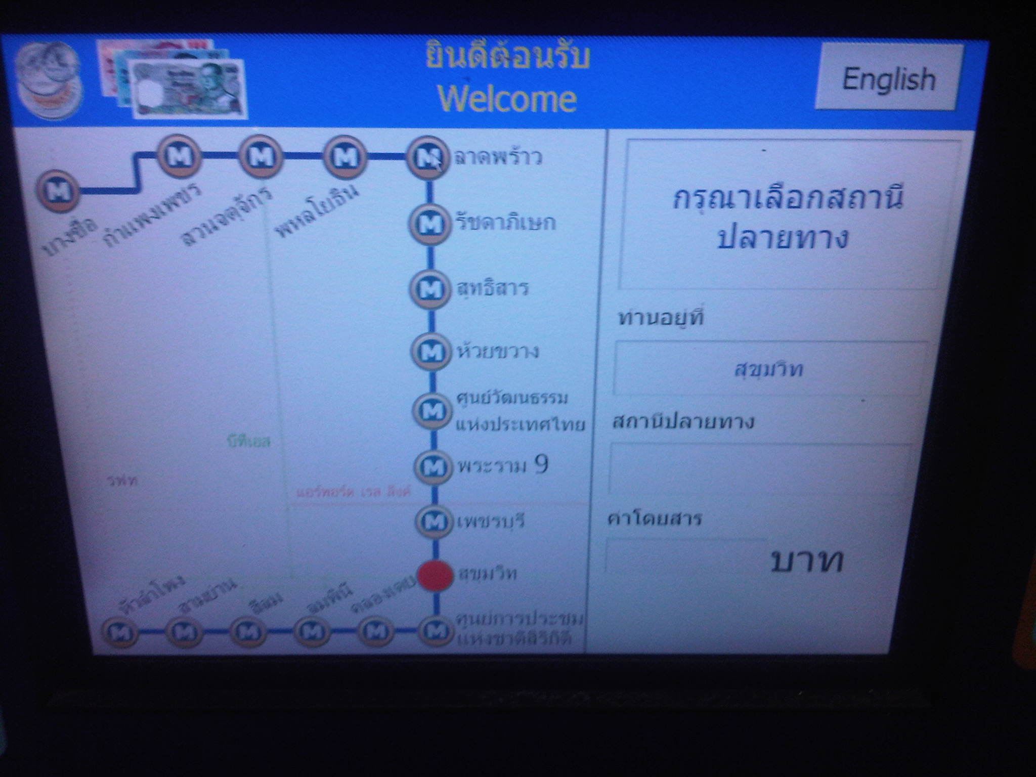 User interface for the Bangkok subway – commuters who can’t read Thai may opt to go for the English option. Unfortunately, the MRT’s system is not integrated or compatible with the Skytrain’s and so I could not use my Rabbit card for my fares. I think the MRT should work on this as it would be to their advantage.
 The station is spacious and there seems to be still few passengers using the subway – Fares have been criticized before for being expensive compared to bus and Skytrain. As such, the system is not as crowded as Singapore’s MRT or the Philippines’ elevated rail systems.
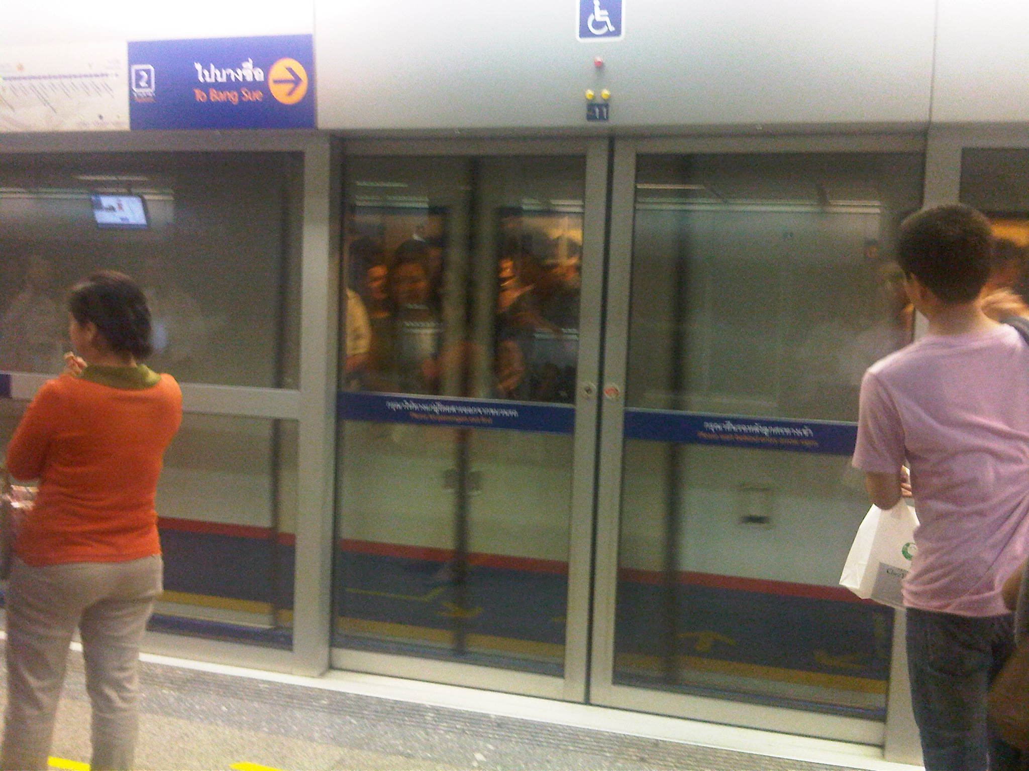 Platform doors are synchronized with the train doors, ensuring safety for commuters.
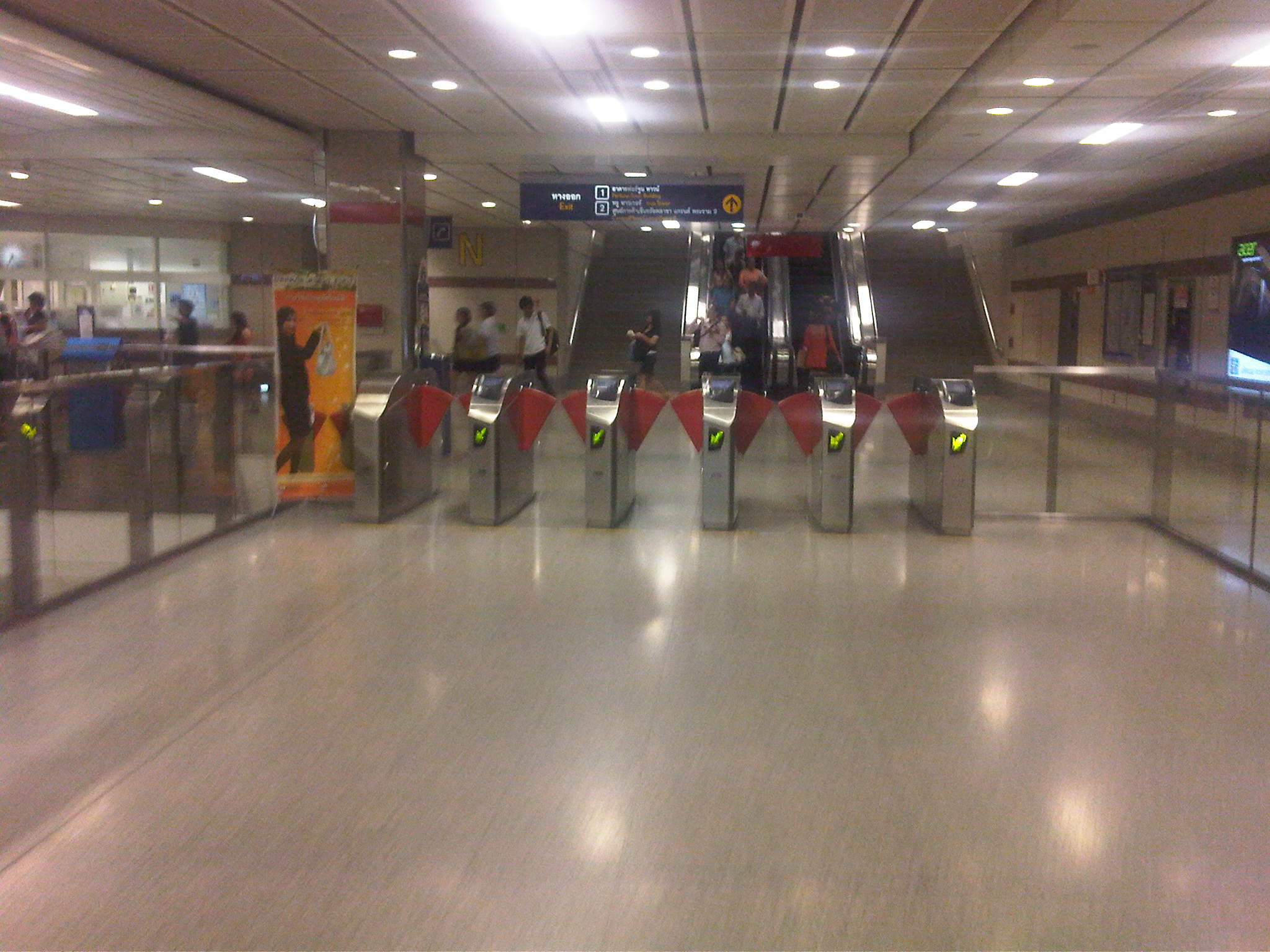 Turnstiles are similar to those in Singapore and Japan
I think the Bangkok subway is still a good option along the corridor it serves though it would be better if it is extended to increase its reach and consequently its ridership. Issues on inter-connectivity with other modes especially the Skytrain have been addressed to some extent but remain. Its most difficult challenge pertains to fares and is something that would probably be difficult to tackle given the financial implications but is necessary to encourage more people to use it regularly.
–
Walking and parking in Quezon City: Tomas Morato
Continuing on the series featuring pedestrian and parking facilities in Quezon City, featured in this post is the case of Tomas Morato Ave. Like Visayas and West Avenues, the pedestrian sidewalks and off-street parking spaces along the avenue were constructed to address the lack of off-street parking facilities and sufficient pedestrian walkways along streets that had significant commercial development. It should be noted, however, that the lack of parking spaces is due likely to many establishments not complying with the minimum standards set under the National Building Code and City Hall’s approval of plans and construction despite this non-compliance (note: LGUs issue the building permit upon approval of plans including what is supposed to be a review of compliance to various standards.).
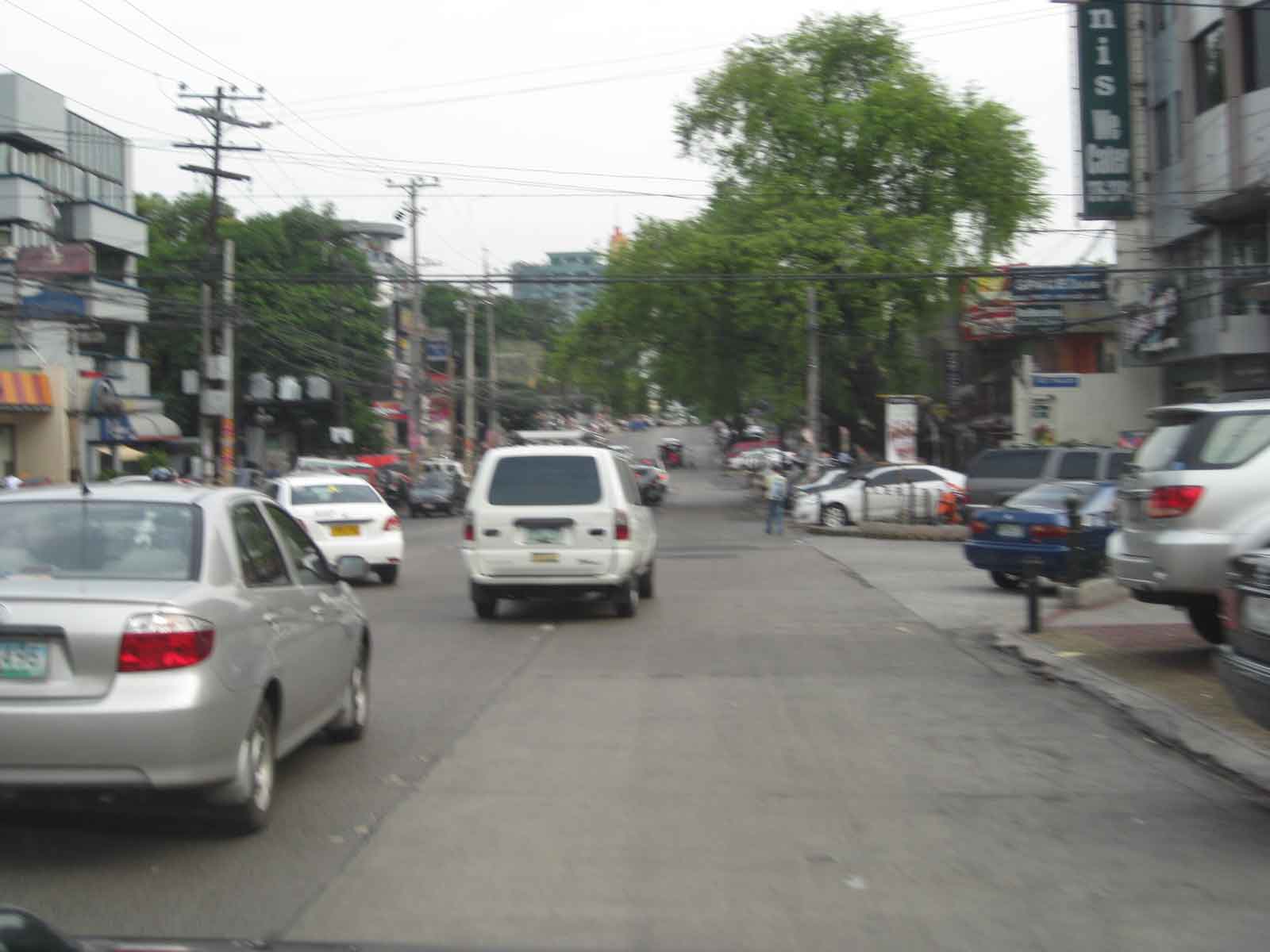 A view of a stretch of Tomas Morato Ave. – note the absence of or weathered pavement markings and the vehicles parked at spaces constructed by the Quezon City government. Space was relatively more limited along Morato and so much of the spaces available were allocated for parking. Pedestrians, thus end up walking along whatever remained or along the edge of the carriageway.
 Establishments such as the many restaurants along the street. From a purely transport planning perspective, one wonders how these establishments were able to get approval from City Hall without having enough parking slots for their customers. These are not your neighborhood turo-turo or karinderya types and so they will generate a lot of vehicle traffic and require more parking spaces in addition to the token slots they provide.
 Some of the larger and older establishments along Morato already have sufficient parking spaces and these were upgraded by the LGU to have uniformity along the road.
 The off-street parking spaces definitely benefited traffic as road capacity is not reduced by on-street parking. There are still problems though especially during noon and night time when the restaurants generate traffic resulting to some vehicles parked or standing along the street.
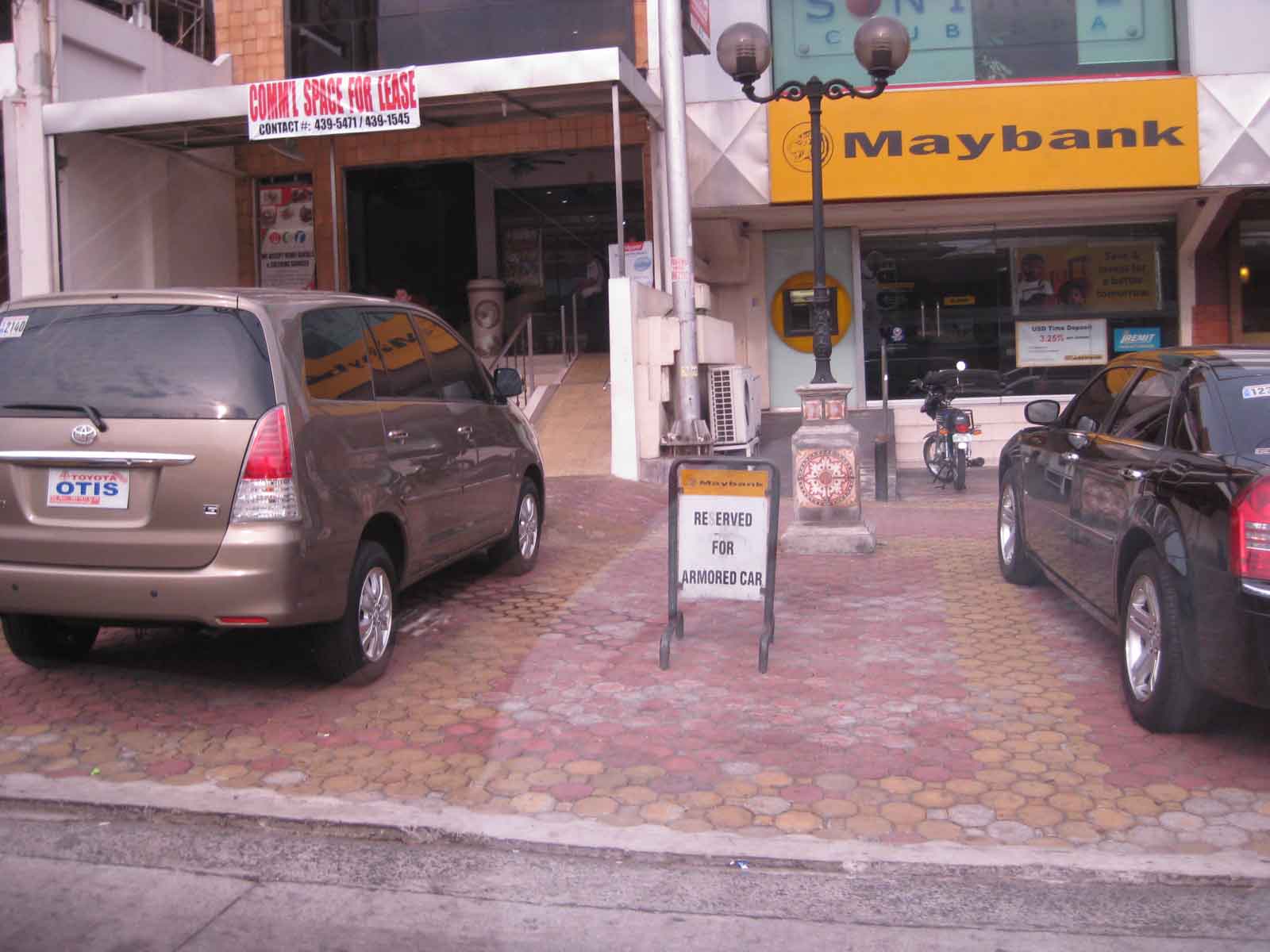 One issue along the street are public parking constructed using public funds being reserved by establishments such as this bank along Morato.
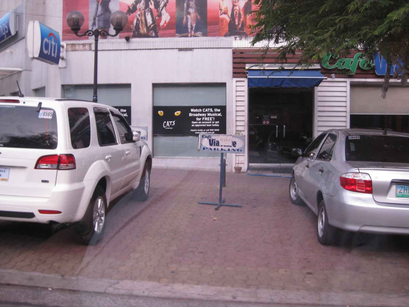 Another case concerns slots reserved by restaurants like this one.
There are still issues concerning the construction of parking spaces for establishments who have not complied with building standards (minimum parking spaces). These issues are rooted on the use of public funds that otherwise could have been used for other, perhaps more important purposes such as healthcare or classrooms. However, one should not lose sight of the fact that there are benefits derived from these parking spaces from the perspective of traffic flow. Moreover, the inclusion of pedestrian facilities definitely enhance safety. These are benefits which are often quite difficult to quantify in monetary terms but contribute to better quality of life for the general public. Such projects also show that the city is doing something to improve public facilities unlike the cases of other LGUs that have sufficient revenues but seem to be lacking in the provision of similar infrastructure.
–
Eastbound walk along Marcos Highway
I took a couple of photos of the walkway and bikeway along the eastbound side of Marcos Highway while traveling to Antipolo one weekend. This used to be a wide, open canal along the eastbound side of the highway, which forced pedestrians and cyclists to use the outermost lane of the carriageway. Such exposed people to a high risk of being sideswiped by motor vehicles that often speed along the sections shown in the following photos.
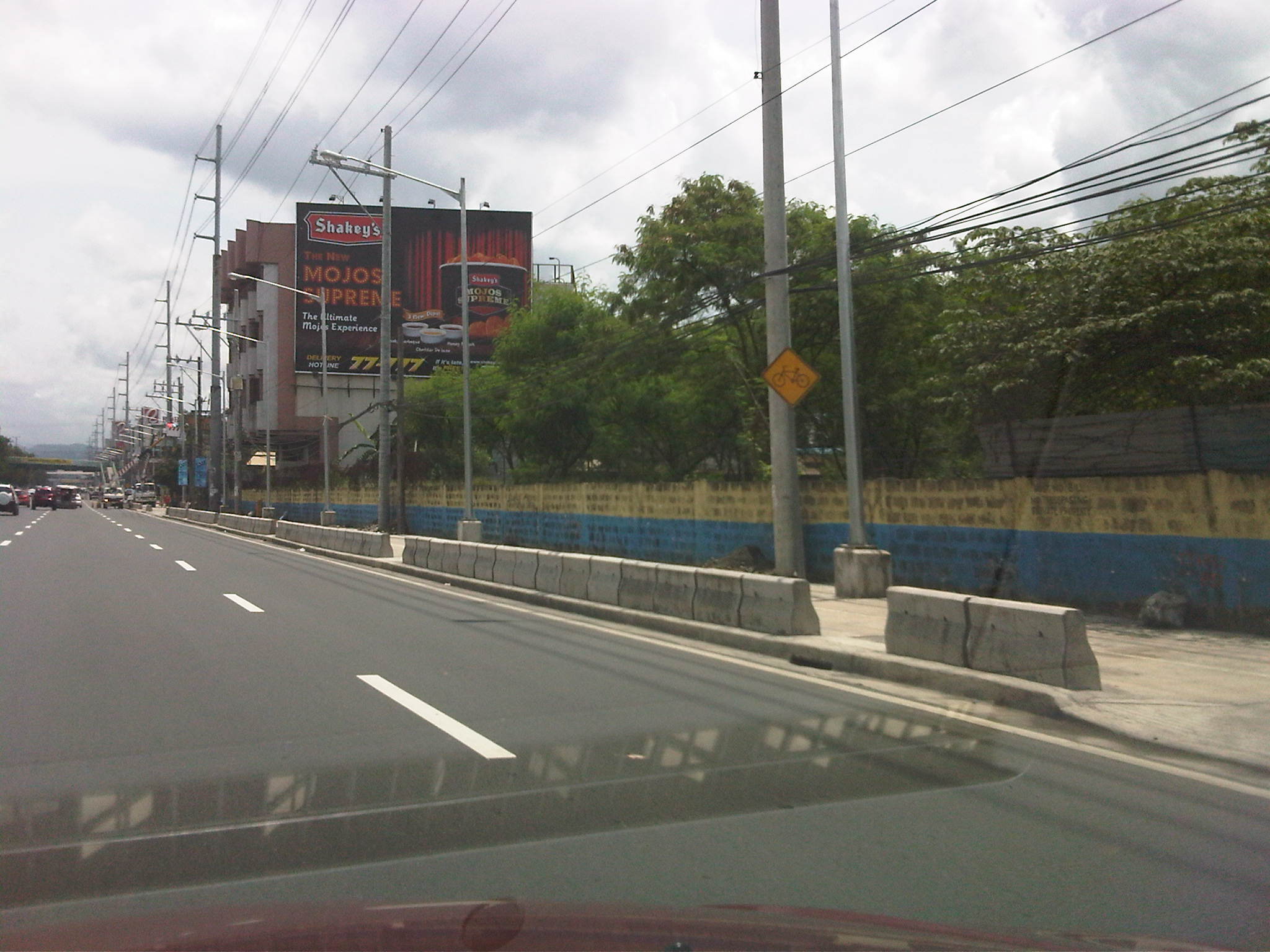 Sign indicating bicycle path along the eastbound side of Marcos Highway. The space is supposed to be shared with pedestrians. Concrete barriers are supposed to provide protection from wayward vehicles.
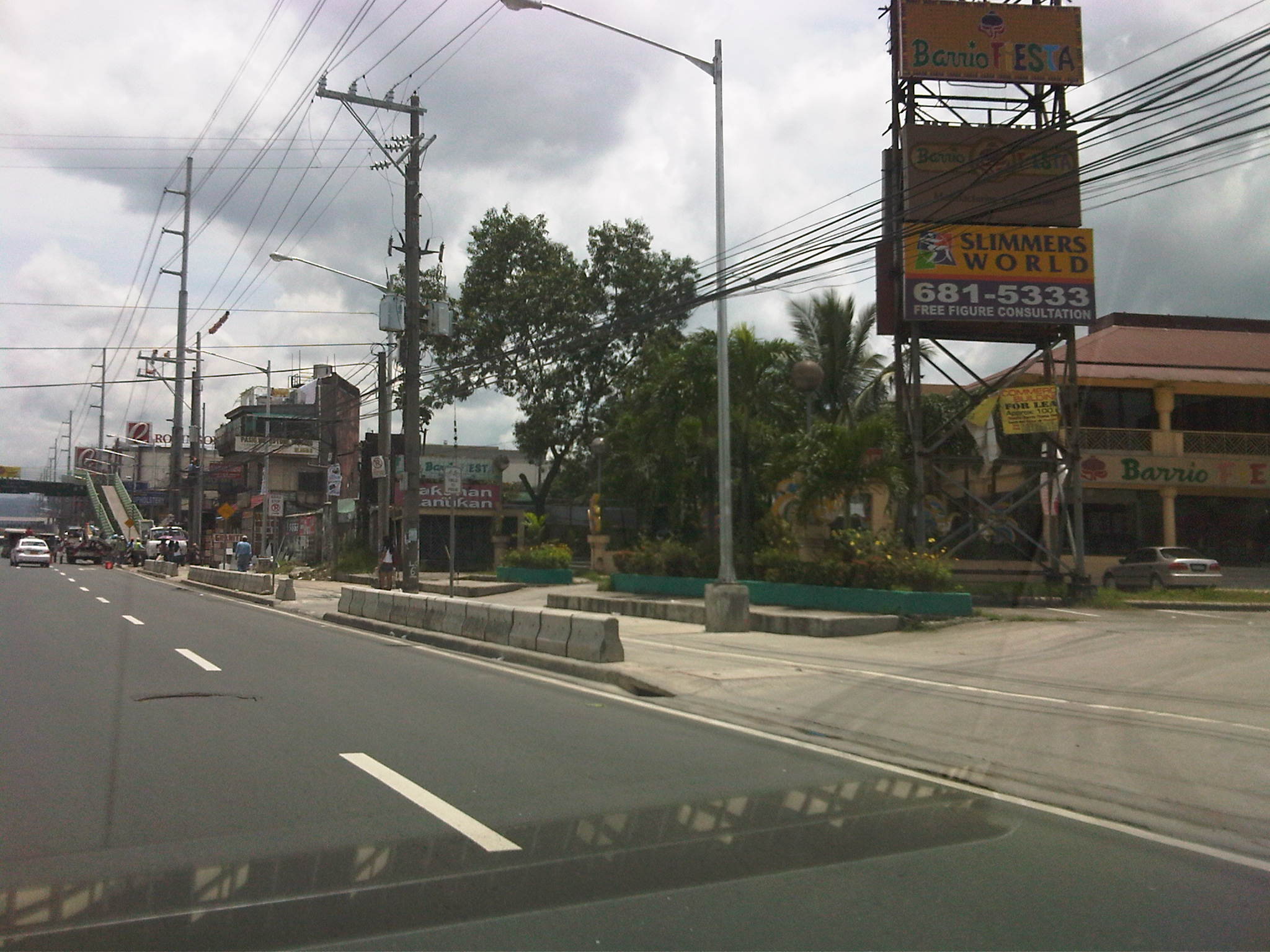 Treatment at driveways of establishments along Marcos Highway. Notice the white line delineating space for pedestrians and cyclists. The overpass at Dela Paz can be seen downstream in the photo. The overpass has a ramp for cyclists and persons with disabilities.
The pedestrian and cycle paths along both sides of Marcos Highway greatly enhance the safety features of the highway. These will especially be important come summer, particularly during the month of May, when many people take the Marcos Highway route to Antipolo Church in what is one of the most popular (if not the top) pilgrimages in the Philippines.
–
Walking and parking in Quezon City: West Avenue
Parking spaces and walkways were also constructed along West Avenue. Bollards separate the parking spaces from the pedestrian right of way. As mentioned in a previous post, many commercial establishments benefitted from this “freebie” from the Quezon City government considering many establishments didn’t even have the minimum number of parking spaces as stipulated in the National Building Code. The local government balked at charging parking fees but one opinion is that they should charge fees for on-street parking facilities that generally benefit car-owners more than they benefit non-owners. I personally believe that there should be parking fees in order to recover some funds that could be used for other programs that could have otherwise received funding that also could have benefited more people. Following are photos taken along West Ave.
 Parking along West Ave. in front of an office building
 One advantage of the project was the reduction of on-street parking though there are still those who prefer to wait along the roadside (i.e., those with drivers).
 Parking spaces in front of a fine dining restaurant.
 Parking spaces near the Delta area, which is the intersection of 3 major roads – Quezon Ave., West Ave., and Timog Ave.
–
Walking and parking in Quezon City: Visayas Avenue
I’m initiating a series of posts on Quezon City – focusing on the pedestrian and parking facilities that were constructed not so long ago. As part of a city-wide project using local funds generated from QC’s internal revenue allotment (IRA) and other incomes, the city constructed pedestrian sidewalks and off-street parking spaces along its major roads. These included roads like Quezon Avenue, Visayas Avenue, West Avenue and Tomas Morato Avenue. I believe that these facilities provide example of good practices for other cities seeking to enhance walkability while addressing on-street parking issues.
Following is a photo journal of pedestrian and parking along Visayas Avenue.
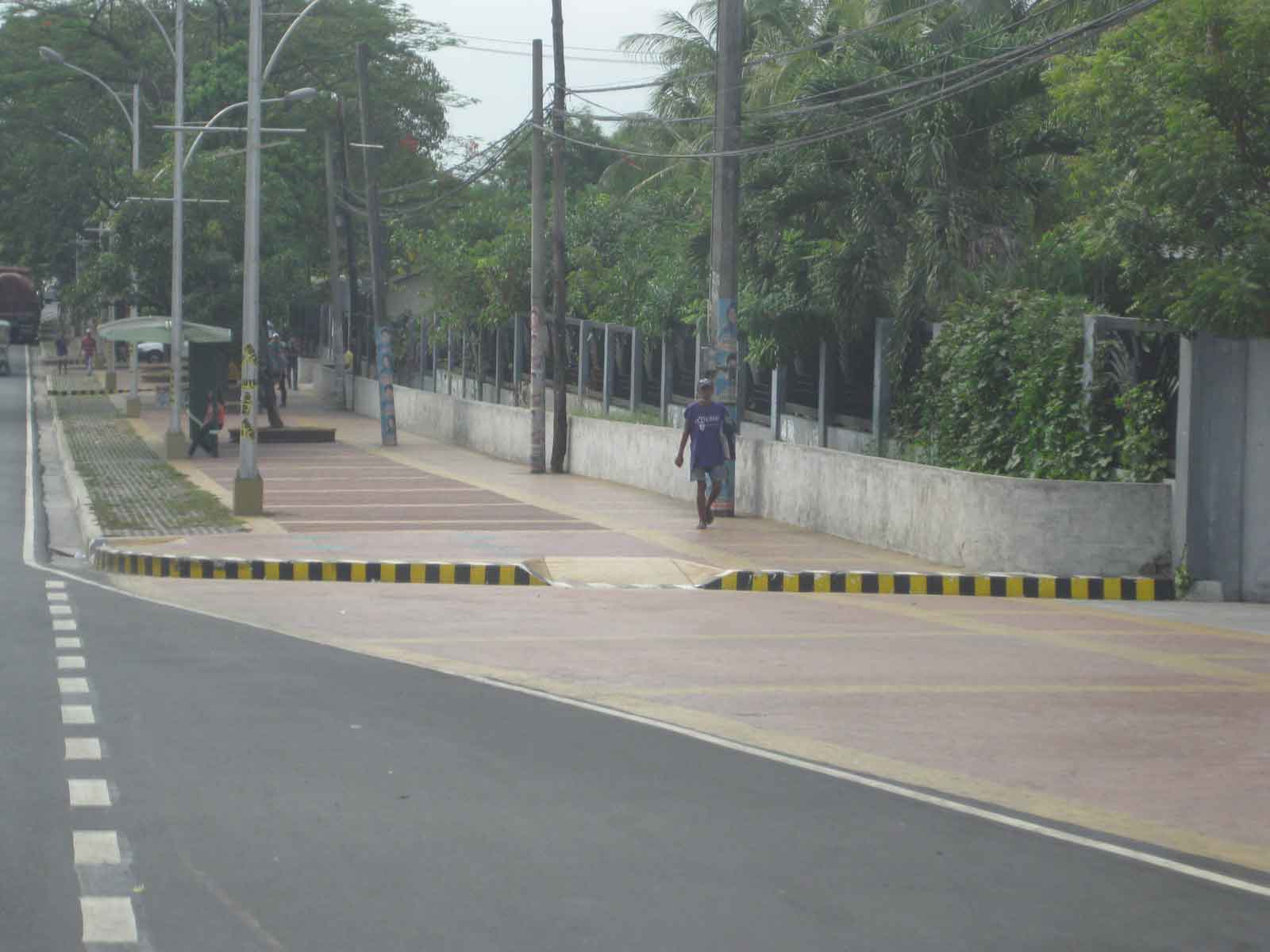
Spacious pedestrian walkways along Visayas Ave. visible upon turning right from the Elliptical Road.
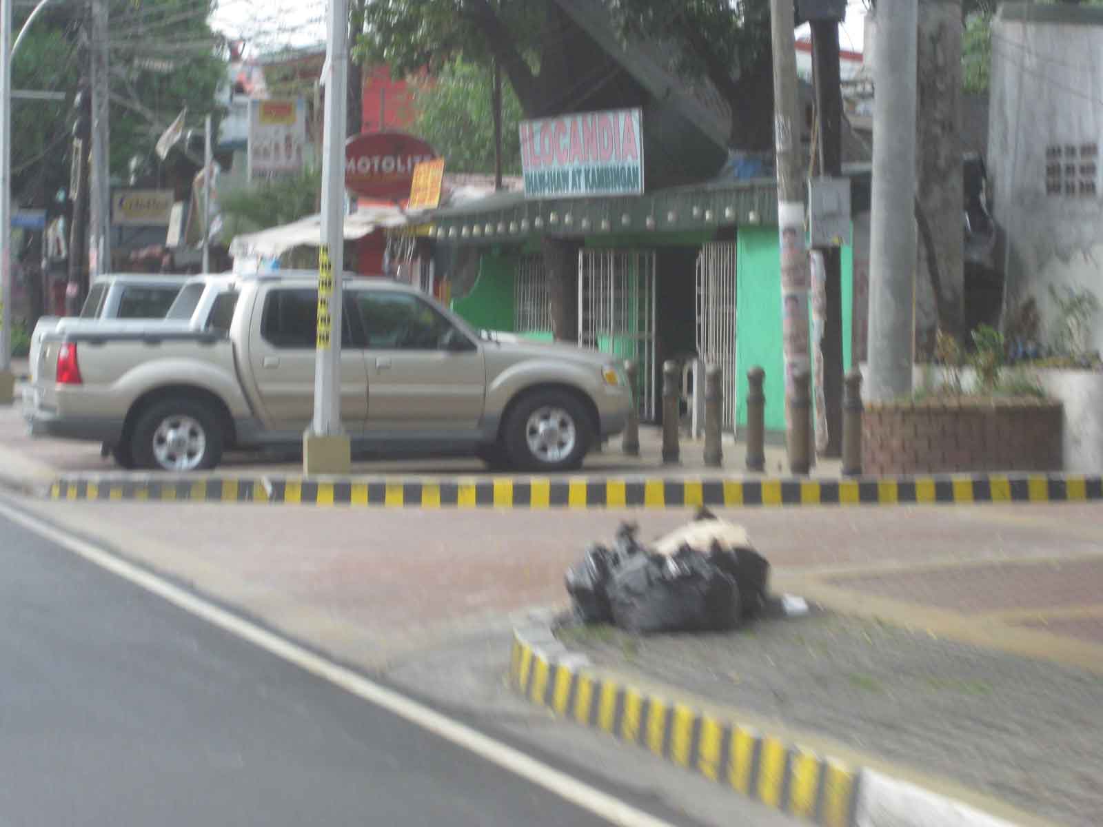 Combination of parking and pedestrian walkway along Visayas Ave. along a line of commercial establishments, mostly restaurants and shops along the road. There are bollards to separate parking spaces from the walkways.
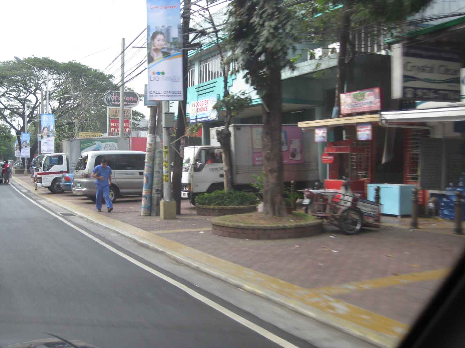 Despite the opportunities during the project, many lamp or electric posts have not been moved/transferred. These create obstructions in addition to the common practice of delivery trucks backing up and blocking pedestrian paths.
 Commercial and residential buildings along Visayas Ave. have benefited from the project as there were no off-street parking along most sections of the road and pedestrian facilities were often the token sidewalks that are also often obstructed with debris or vendors.
 There are few other cities in the Philippines with off-street parking such as this that does not intrude into the rights of way for pedestrians. Then again, there are also limited opportunities where space is generally not available for such projects.
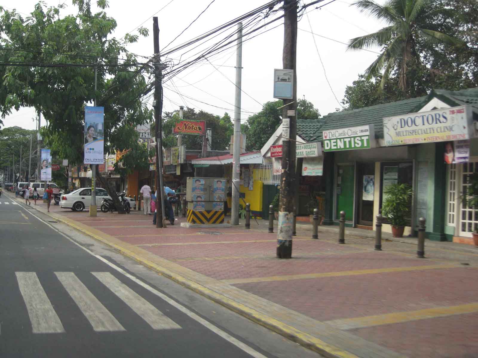 Most establishments along this side of Visayas Ave. had adequate frontage space or buffers (likely part of the road’s ROW) that made it possible to have pedestrian and parking spaces.
In the last local elections, parking fees for these spaces became an issue. Since government money was used to construct the parking facilities where there were none despite minimum parking requirements for establishments as stipulated under the National Building Code, some councilors proposed parking fees to recover the cost of construction. Some sectors including the businesses rejected the proposal stating that these benefit the general public. In an unusual move, the Catholic Church in QC even stated in a pastoral letter (!) that parking fees were anti-poor, something that was difficult to understand given that car-owners were the first to benefit from off-street parking. I doubt if what we regard as poor people would own cars. Parking fees were never implemented along this road and others like it.
–


