
Home » Walking (Page 10)
Category Archives: Walking
Inappropriate designs for pedestrian overpasses
There was a photo that circulated in social media the last two weeks showing electric and telephone cables coming out of the stairs of a steel pedestrian overpass. It was obvious that the people responsible for both the overpass (MMDA) and the cables (power and phone utilities) did not coordinate their work and so people had to risk electrocution to be able to cross the street at what is assumed to be a busy intersection. Such is an example of unsuitable designs and bad implementation of infrastructure projects; in this case, that of a pedestrian facility. There are many other examples of these flawed execution of projects including electric posts in the middle of lanes after road widening projects, short span pedestrian overpasses that are not utilised by people (preferring to cross at ground level) because the road was narrow in the first place. Many are a waste of resources considering they may not have been required in the first place if careful assessment were made about the situation.
The pedestrian overpass under construction at the Masinag junction (photo below) is a good example of what looks like flawed design. The elevated walkway is narrow and is located right at the corners of the intersection. The width is important here because there are many people usually crossing at Masinag and the overpass can become congested for users. The stairs have not yet been constructed but if past designs of overpasses like this is to be considered, the stairs will likely be steep and therefore difficult to use for senior citizens, PWDs and children. Note, too, in the photo that the bridge already obscures part of the traffic signals previously installed at the intersection. This means the lights would have to be reinstalled or transferred so motorists can clearly see the signals.
 Pedestrian overpass under construction at the Masinag junction in Antipolo City
My friends at the DOTC tell me that it is only a matter of time before the Line 2 Extension project is bidded out an construction finally goes underway. Depending on the the final design of the line and end station, there might be a need to revisit the pedestrian overpasses along Marcos Highway. Hopefully, they don’t become like the overpasses along EDSA that had to be raised more due to the elevation of the Line 3 facilities including the catenary for the trains. I’m sure there is a suitable design for pedestrian facilities for crossing the wide Marcos Highway. It only requires careful thinking and creative minds to come together to come up with the appropriate facilities.
–
Practicable road sharing in Antipolo
As there are increased calls for more bikeways, we try to look at some good examples of what I’d call “practicable” road sharing. I term it “practicable” because it is something doable or is already being done or practiced. I tried to find a few good examples of practicable road sharing to show that it can be done and usually if all road users respect each others’ right to use the road. This respect can be developed over time and requires some familiarity for each users behaviors. Of course, there will always be abusive or disrespectful people on the road including drivers of different types of vehicles. Reckless or unsafe driving is not limited to public transport or truck drivers. There are also many unruly private vehicle drivers who endanger the lives of others whenever they are on the road. Then there are the motorcyclists, cyclists and pedestrians – all road users and also with bad apples or “pasaway” among them.
Road sharing happens everyday in Antipolo City in the Province of Rizal. Along Ortigas Avenue and Sumulong Highway – the two main routes to and from Antipolo, you will see motor vehicles, bicycles and pedestrians sharing what are mostly 4 lane, undivided sections of the two major roads. Antipolo is a very popular destination for cyclists so even during weekdays you will find a lot of people cycling up and down the mountain roads even during the night time and very early mornings. While many are recreational riders, many, too, are doing this for health. I would bet that a good percentage might be biking to work or school but there are no hard statistics to show this (topic for research?).
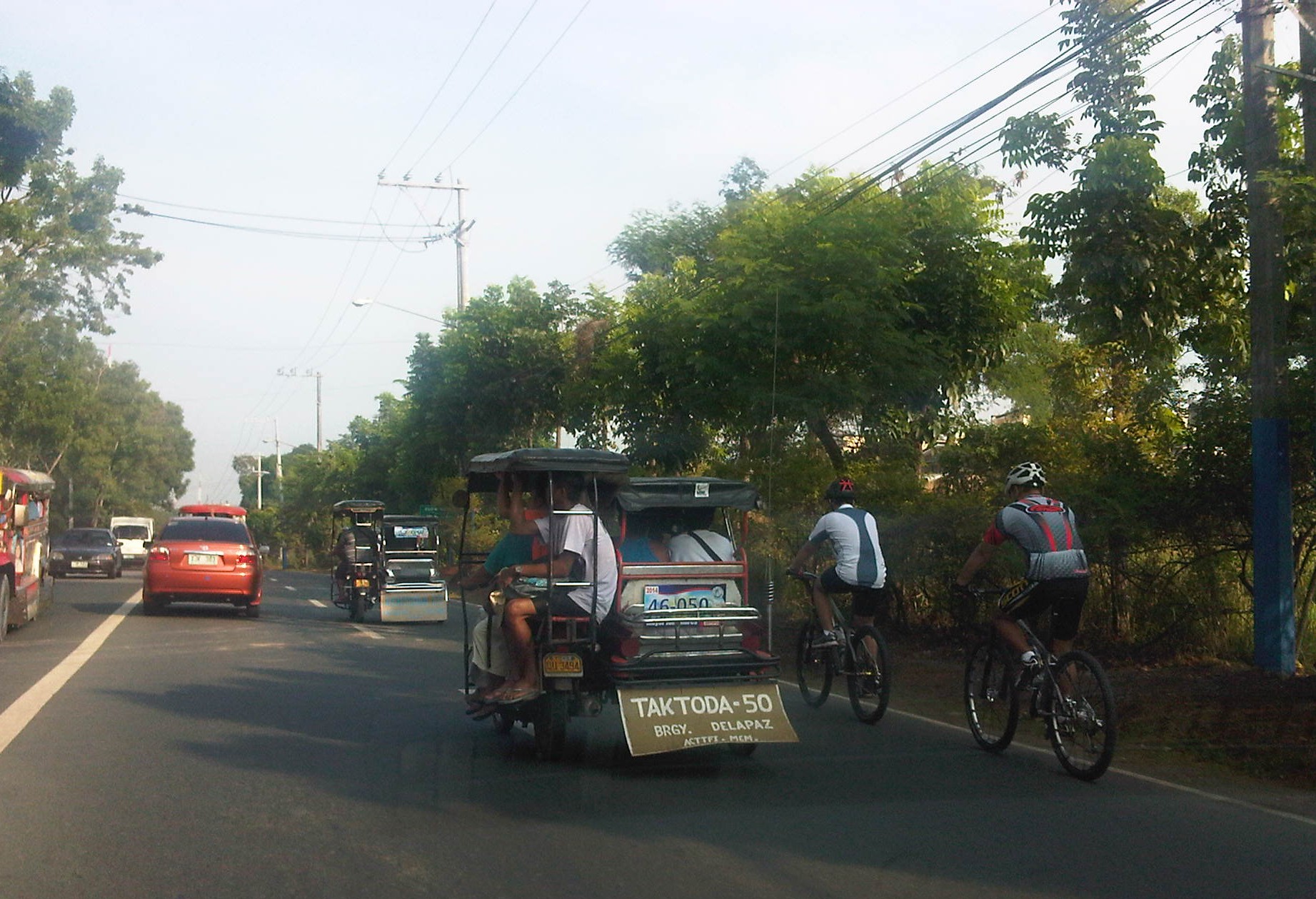 Motorists and cyclists “sharing the road” along Sumulong Highway
Sharing the road shouldn’t be too difficult. However, road users need to have respect for each other’s right to use the road. I have observed many instances where one or more road user types are guilty of “disrespect” and tend to hog the road as if making a statement that “i am king of the road” rather than “i have the right to use the road.” Here are among my pet peeves:
1. Slow moving trucks or jeepneys hogging two lanes and not giving way to other vehicles to pass them.
2. Jeepneys and private vehicles racing up or down the mountain roads and overtaking even in perilous sections (i.e., those already identified as prone to crashes).
3. Tricycles taking up the middle lanes and maneuvering anywhere.
4. Cyclists taking up the middle lanes or sometimes the entire two lanes of any direction preventing other road users to pass them.
5. People crossing anywhere along the road especially at blind sections (curves) where sight distance is limited.
There are practically no pedestrian sidewalks along most of Ortigas Extension and Sumulong Highway so pedestrians would have use the carriageway. As there are a significant number of people walking (e.g., students, workers, and even joggers or walkers), motorists and cyclists need to be careful not to hit these people. The same people, however, need to be aware of these vehicles and should exercise caution, always being alert as they use the road properly. Ultimately though, I would like to see walkways built along Ortigas and Sumulong especially since there is already an increasing demand for walking especially during the summer months when Antipolo holds its fiesta and a lot of people go on pilgrimages on foot to the Shrine of Our Lady of Peace and Good Voyage.
There is practicable road sharing in Antipolo because most road users are already familiar with each others’ behavior and accept each others’ presence and rights on the road. These road users are likely residents of Antipolo or nearby towns or regular visitors to the city. They are “nagbibigayan sa daan.” The “pasaway” people are likely the newer ones who seem to think that the way they drive or ride (i.e., unsafe) elsewhere is the norm. Of course, that goes without saying that familiarity with the roads and its users also breed risk takers who think they already know the road and have the skill and experience to drive like crazy. Here is where effective enforcement (e.g., timely apprehensions and reminders) and engineering (e.g., traffic signs and pavement markings) comes in to address the gaps in safety in order to reduce if not totally eliminate crash incidence along these roads.
–
Discouraging walking?
We were looking for suitable sites for a traffic survey along Espana the other day and had chosen the pedestrian overpass across Ramon Magsaysay High School as a possible site for a camera to record traffic flow along the avenue. Data from the video will be used to calibrate measurements from other cameras that are part of an intelligent system under development and supported by the DOST-PCIEERD. Those cameras are currently installed at a post at the junctions with Lacson Ave. and Vicente Cruz St. The system will also utilise data from the ASTI’s flood sensors near Lacson and San Diego. What we saw on the footbridge was not exactly a shocker to us as we anticipated the conditions on the overpass. However, we all agreed that the conditions of such pedestrian facilities need to be improved significantly and in such cases as this footbridge, immediately!
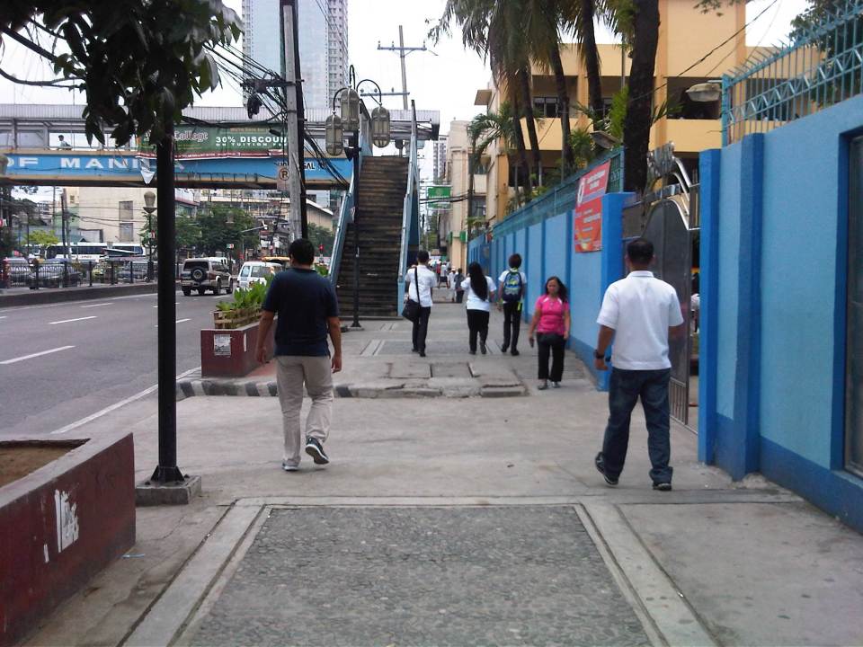 Walking to the overpass in front of Ramon Magsaysay with the school on the right.
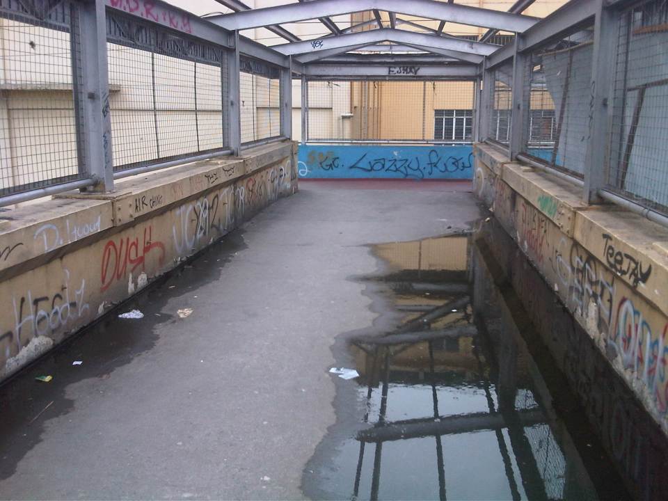 The overpass was partly flooded from the rains the past few days. The roofing only had the frame so anyone using the overpass on a rainy day would have to use their umbrellas for cover. The MMDA had removed the roofs of many overpasses to discourage vendors and beggars to set up on the overpasses. Spared from the campaign were overpasses that were secured by establishments like those along Katipunan with Ateneo and along Espana with UST. While there are no vendors or beggars on this overpass, it’s quite obvious from the photo that vandals have been busy defacing the facility.
 Many open overpasses like this are stinky because they are (ab)used as urinals. Who knows about the composition of these puddles aside from the rainwater during this wet season.
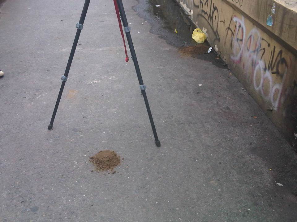 The overpass smelled of poop and that’s simply because there were poop scattered along the overpass. Neglected facilities like this, despite being used by many people (its right in front of a big public school) to cross busy streets like Espana, are often used by vagrants as toilets. Quick thinking and action by one of our staff reduced the stink when he got some soil from the (also neglected) plant boxes in the area to cover the feces that littered the overpass.
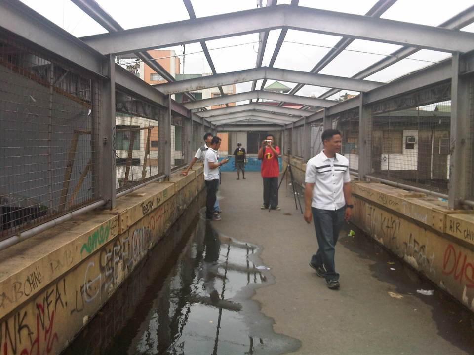 NCTS staff setting up a camera while also taking up the conditions at the footbridge.
 The stairways to/from the footbridge are quite steep. Such features need to be designed with senior citizens, children and PWDs in mind.
This overpass is located in Manila and is probably used by hundreds of students from the public school beside it aside from the other pedestrians that need to cross Espana Avenue. I think there is an opportunity here for the City of Manila and the specific barangay to improve the conditions of the facility and ultimately contribute to improving quality of life through the improvement of the quality of walking – the most basic of all modes of transport and certainly a strong indicator for a city’s health and vibrance.
–
The inconvenience of pedestrians
Walking is our most basic mode of transport and yet it seems that we have failed to design facilities that would make us walk more conveniently and comfortably. Many Philippine cities have been developing their transport systems that favor road transport and motorized vehicles while generally neglecting the needs of pedestrians. Metro Manila cities have been quite inconsistent in the way they deal with the needs of pedestrians (i.e., walking) and often pass on the blame to the DPWH. While that agency also is definitely responsible with a lot of issues pertaining to suitable designs of transport infrastructure, I think LGUs should also be responsible and take up the challenges with respect to design of people friendly facilities. There are a lot more local roads than the national roads under the DPWH. And so LGUs, especially the more developed cities have a bigger role in developing their transport infrastructure to be more people oriented.
 Pedestrians can no longer cross at-grade at the intersection of Quezon Avenue and Araneta Avenue. Note the vendor in the photo (with umbrella) crossing counter-flow with his pedicab full of plastic merchandise. The cyclists in the photo are risking their lives and limbs in crossing the intersection. Fortunately for them, there seems to be no traffic enforcers around to apprehend them. The “yellow box” has been replaced by a “red box” in many intersections including this one.
 The pedestrian overpass at Quezon Ave.-Araneta Ave. as seen from the sidewalk along the Q.C.-bound side of Quezon Ave. The sidewalks are often obstructed by vendors but fortunately the overpass itself is not clogged by vendors unlike other overpasses.
 This overpass along EDSA is the outcome of pedestrian crossings being only an afterthought (some would say aftermath) of the EDSA MRT design. It is an example of the “pwede na yan” (this will do) attitude of many engineers and architects when it comes to transport systems.
All of the above examples are found in Quezon City. That city is among the most wealthy cities in the country and there have been a lot of transport-related developments in the past few years that are more people oriented. These include the construction of sidewalks, overpasses and underpasses outside those typically under the MMDA. However, there are still a lot to build and may I say correct in order to promote walking and other non-motorized transport in the city. Quezon City and other cities can be walkable cities and walkability should not be limited to CBDs that are often (and again) passed on to the private sector for development. LGUs should not be too dependent on what the private sector can offer in terms of infrastructure for walking and cycling. There are not many responsible private companies out there who would commit resources towards walkable and cycling-friendly developments. Often they are tempted to maximize space for buildings, even sacrificing space for parking and motor vehicles, and ultimately at the expense of the general public. This is where LGUs, and not even national government, comes in to put things into order. However, the caveat here is that LGUs should have a plan to guide them in development and again, there are few LGUs that have this capability and capacity to plan and implement such plans. And here is where national agencies like the DOTC and the DPWH can provide help to LGUs given their resources and expertise.
–
Innovations for cycling and walking
I usually browse the net for the wealth of information now readily available on transport facility designs that are pedestrian and/or cycling friendly. In the Philippines, there has been an increased awareness lately for people-oriented systems encouraging cycling and walking. These have extended to calls for more bikeways and walkways to enhance mobility, with several projects being implemented to further the advocacies for non-motorised transport (NMT). Of course, there are already existing examples of both good and bad practices around the country including ideal and undesirable cases in Marikina City, which is the first (and only?) city in the Philippines to have a comprehensive network of bikeways.
Recently, I found this article entitled “Urban Innovations That Could Turn Your City Into a Bicycling Paradise” on one of my favourite websites io9.com. It contains some of the more prominent examples of bicycle and pedestrian-friendly designs that have been implemented elsewhere that we could probably take note of as good practice references when we do plan and design similar facilities in our cities. I’m sure there are many people out there, and not just architects or engineers, who would have good ideas for people-friendly infrastructure design. We need to encourage them to come out and propose these ideas that can be adapted into sound design according to architectural and engineering principles (i.e., the designs would still have to follow standards or guidelines, e.g., seismic, wind, etc. in order for these to be safe for use and last long.
Government agencies especially the DPWH and local government units should be open to new ideas or innovative designs to help transform our transport system to become more people-oriented than vehicle-oriented. There should be initiatives from within these agencies to come up with innovative designs while keeping the details up to standards or following established guidelines. So far, there have been no notable push for updating road designs, for example, despite road safety assessment findings and recommendations that should resonate more within agencies and LGUs if they are not comfortable dealing with NGOs or civil society groups advocating for people-friendly infrastructure.
I believe government engineers are competent and have the talent to come up with innovative designs and guidelines but there is a lack of incentive for them to do so and to think out of the box. The bottom-line is still to create an enabling environment for such design ideas to come out and be implemented. Perhaps the academe could lend a hand here with their strong linkages with government planners, architects and engineers. The schools could provide the environment for encouraging new thinking in as far as transport infra is concerned and the leading universities would have the resources that can be harnessed towards innovative designs.
–
Walking vs. cycling?
I remember an episode in an old series, The West Wing, where White House staff had to meet with various proponents of renewable energy. The very same proponents advocated for the RE they thought should get the most attention, and therefore funding support from the government. They ended up criticising each other’s advocacies, even pointing to the flaws of each and basically putting each other’s proposals down. The POTUS (ably played by Martin Sheen) had to intervene and scolded these people for working against each other rather than working together to push a common RE agenda.
This is pretty much where we are now with many proponents of sustainable transport initiatives. People and certain groups would advocate for walking, cycling, BRT, rail transit, etc. as if these are exclusive from one another. The results have often been haphazard facilities such as entire pedestrian facilities being painted and designated as bikeways and regular bus services being mislabeled as BRT. I have some friends who insist that cycling is the way to go simply because they cycle between their homes and workplaces, not fully understanding that this mode is not for everyone especially with the various issues in urban sprawl affecting our choices of residence. Clearly, what is good for one person is not necessarily applicable to everyone else, and that is why we should have options for travel or commuting. These options would have to be integrated, complementary, affordable and people and environment-friendly.
 The MMDA fenced off entire stretches of sidewalks and painted the pavement red to designate them as bikeways. This basically alienates pedestrians and while the wire mesh fence has its benefits from the perspective of safety, it also effectively constricts the space that cyclists and pedestrians have to share. Note also the trees and poles that pedestrians and cyclists would have to evade or risk injury.
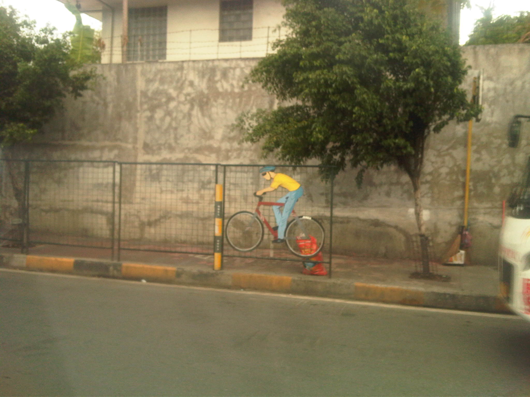 Along EDSA, the same treatment of fences and coloured pavements was applied ahead of Temple Drive/Corinthian Gardens. The space is just too constrained for sharing given the trees and poles and then you have the smoke belching buses adding to the misery of people using these facilities.
While there have been some quick wins for pedestrians and cyclists, it seems to me that many if not all do not seem to be as sustainable as we want them to be. Many cases are classic for their being “pwede na yan.” There is no innovation in design or no design involved at all much like what we typically see as best or good practices abroad. Marikina still has the best examples so far for integrated bikeway and walkway design though there are many examples of good pedestrian facilities around including those in Makati and Bonifacio Global City (I tend to resist saying Taguig because that city practically has no say in how BGC is developed.). Quezon City (along Commonwealth) had a little promise and the UP Diliman campus but perhaps that can be realised with the rise of a new CBD in the North Triangle area. Of course, we look forward to developments in Iloilo City what with the bikeways being constructed along the long Diversion Road. Still, I believe that there should be a conscious effort not just from the private sector but from government agencies, especially the DPWH, to come up with new designs and guidelines that LGUs could refer to. That agency so far has not measured up to the expectations of many for it to take a lead in revitalising our roads so that facilities can be truly inclusive and environment-friendly.
–
The Philippines’ National EST Strategy – Final Report
Friends and some acquaintances have been asking about whether there is a master plan for sustainable transport in Philippines. There is none, but there is a national strategy that should serve as the basis for the development and implementation of a master plan, whether at the national or local level. This strategy was formulated with assistance of the United Nations Council for Regional Development (UNCRD) through the Philippines’ Department of Transportation and Communication (DOTC) and Department of Environment and Natural Resources (DENR), which served as the focal agencies for this endeavour. The formulation was conducted by the National Center for Transportation Studies (NCTS) of the University of the Philippines Diliman. For reference, you can go to the NCTS website for an electronic copy of the National Environmentally Sustainable Transport Strategy Final Report.
 Cover page for the National EST Strategy Final Report
–
Food for thought – a few articles on transport and traffic
This will just be a quick post for now and I just wanted to share a few recent articles on transport and traffic from a favourite magazine – Wired:
What’s Up With That: Building Bigger Roads Actually Makes Traffic Worse
Why We’re Sad the Best Airport in the World Is Getting Even Better
The Hidden Genius and Influence of the Traffic Light
These are very well written, easy to understand articles on things we encounter everyday (traffic congestion, traffic signals at intersections) and when we travel long distance (airports). They show different perspectives of things we take for granted or assume we understand. An example of the latter includes notions that road widening or road construction will solve traffic congestion problems. Much of what goes around regarding road widening or road construction as solutions do not account for induced demand, which is basically additional traffic generated or encouraged by wider or new roads. The second article talks about Changi Airport, arguably the best in the world, and the high tech approaches they have employed or will employ in order to ensure efficient operations there. Such tools, I think, should be used in our airports especially NAIA where the long standing excuse is the limitations of the runway(s) and the airport terminals. Certainly, there are other issues that need to be addressed and going high tech and employing sophisticated methods for airport operations should alleviate problems until we ultimately build a new airport elsewhere. The third article takes a look into behaviour and mentions a “social contract” we have agreed to in order to reduce mayhem in our roads. This “social contract” as well as others related to it should be revisited and understood as they are very much a part of how we behave when we travel and have a significant effect on others around us.
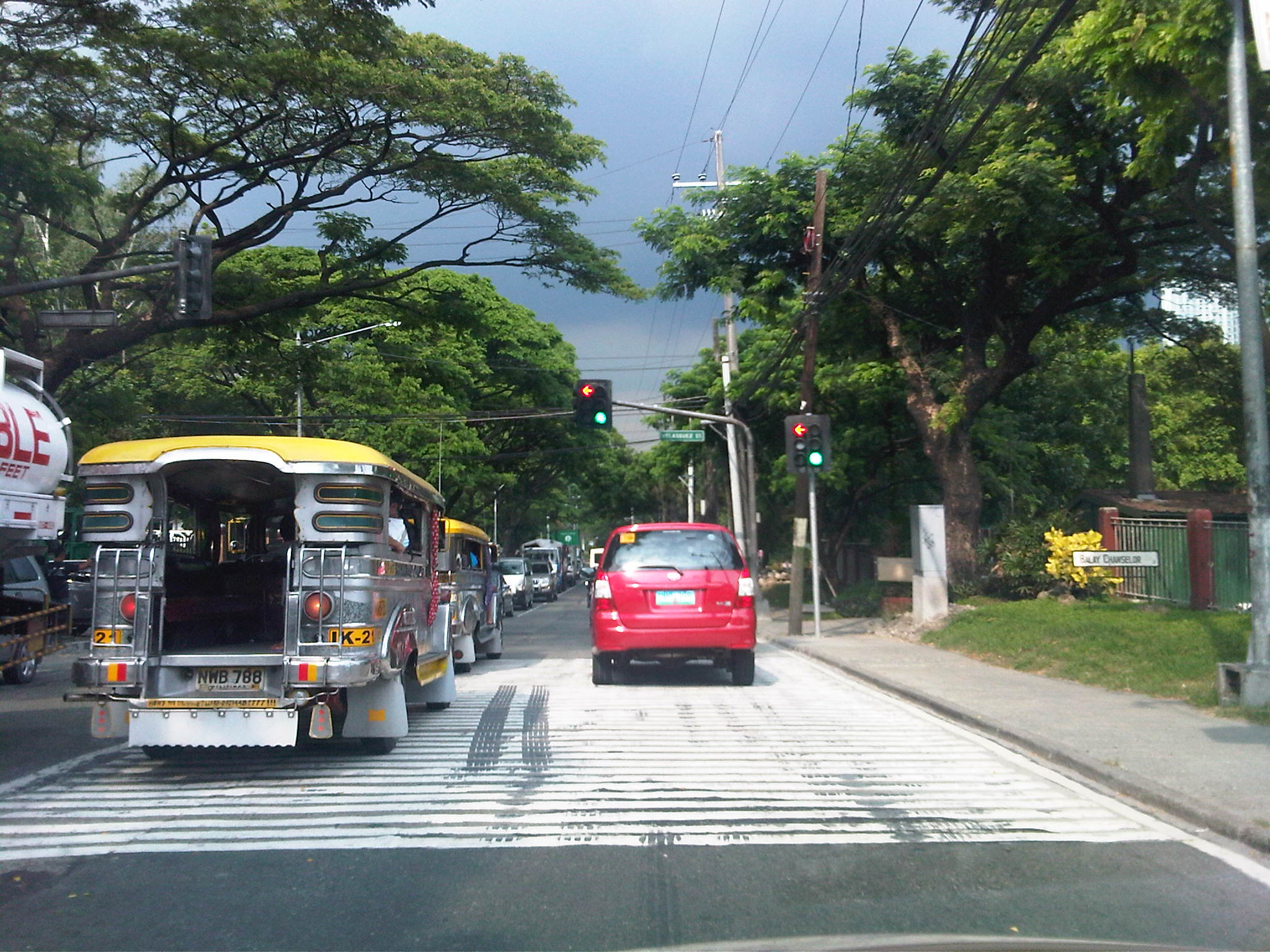 Traffic congestion and traffic signals along the 4-lane C.P. Garcia Avenue in UP Diliman
–
Designing for walking and cycling
There are current discussions regarding the highway and street designs mostly from the perspective of safety. These discussions include those hosted by the academe and those posed as challenges by practitioners, mainly architects with experience designing similar facilities abroad and who are advocating for more people-friendly designs. Such discussions are slowly but steadily gaining traction in the Philippines but has met with some resistance in the form of key persons and agencies not giving due attention to the design challenges being posed that would have implications on planning and design guidelines. That is, the implications of promoting people-friendly designs in our roads will require changes in the National Building Code as well as the Highway Planning Manual of the Department of Public Works and Highways (DPWH). These changes will include standards and specifications for the geometric design of walkways and bikeways integrated into our roads and a departure from the current approach that basically treats pedestrian and cycle facilities as an afterthought to motorways.
I’m posting a few photos I took from a recent visit to Yokohama, Japan, which was my home for 3 years back in the 1990s. Much has changed in Yokohama since I last visited in 2008 but notable are the people friendly transport infrastructure including pedestrian and cycling facilities. Following are photos taken in the Minato Mirai district of the city.
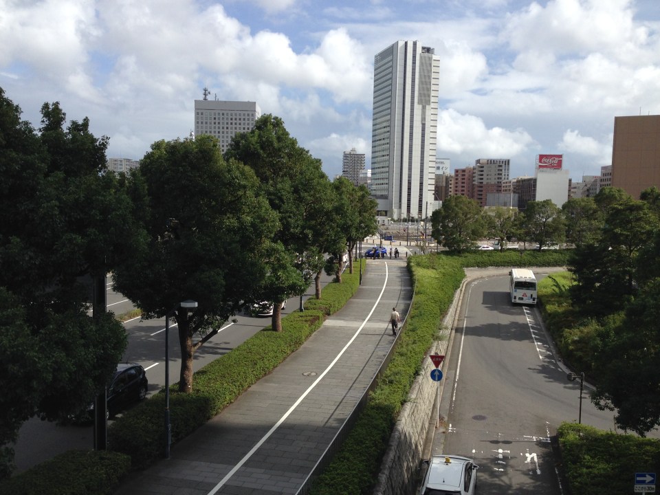 Pedestrian and cycling lanes along the main road of Yokohama’s Minato Mirai district. The tree-lined street provides a conducive environment for walking and cycling.
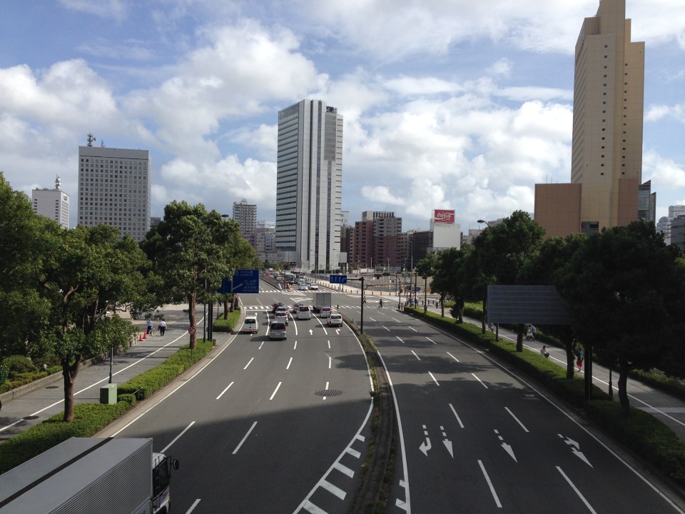 Depending on how one sees it, Minato Mirai Odori is a 10-lane road with 4 lanes allocated for walking and cycling (i.e., 1 lane each on either side of the lanes for motor vehicles).
 Pedestrian bridge connecting Minato Mirai Odori with the World Porters commercial development
 A 10-lane bridge with 2 of 5 lanes per direction devoted for walking and cycling. That’s a full lane of at least 3.2 meters allocated for pedestrians and another full lane for cyclists. While it is not shown in the photo, the pedestrian and cycling lanes are efficiently utilized during the peak periods.
–
Motomachi
It’s December again and during this month I like to reminisce about favorite places I went to or still go to here and abroad. One of my favorite haunts during the time I called Yokohama my home city was the Yamate area. I went to Mass every Sunday at Yamate Catholic Church. After church, friends and I descend towards the Motomachi shopping street to take strolls, window shop or have lunch in one of the many restaurants along the street. I think it is a good example of a shopping street that’s also found in many other places particularly in Europe and the US. It provides a better environment compared to the large malls we often find in many cities including Metro Manila.
 On-street parking spaces are provided along one side of several sections of along the street. There are parking meters at these spaces.
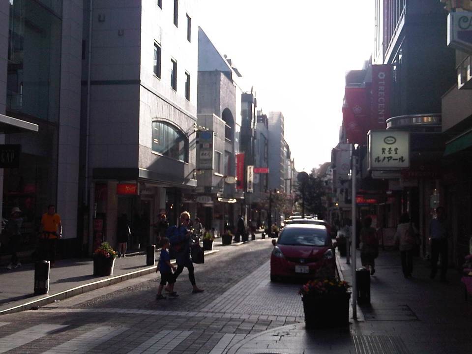 It is a nice place to take a walk whether doing actual shopping, window shopping or just a simple stroll to while away the time.
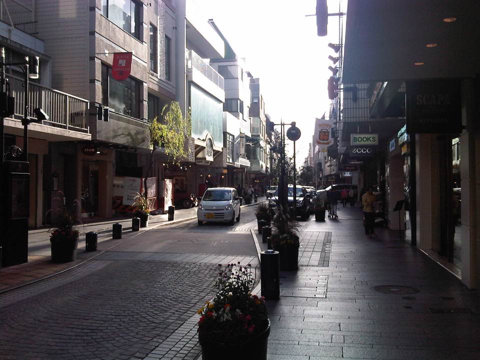 I like the brick road of Motomachi and the restaurants and shops lining the street.
 Benches where people can sit down, take a short rest or wait for their companions who are shopping at a nearby store.
 Motomachi Union where I used to do some groceries whenever I’m in the area (usually Sundays after Mass at Yamate Church).
 A look back to Motomachi as I approached the JR Ishikawacho Station.
There used to be a Indian restaurant at one of the side streets of Motomachi. The chef of the restaurant was a Sri Lankan Catholic who was a church mate at Yamate. We often went to eat there after Mass or on occasion. He would usually adjust the ingredients of our favorite curry and tandoori dishes so they weren’t too hot or spicy for our palates. I wonder where he is now with his family and hope they are doing very well.
There also used to be some clubs or pubs at the end of Motomachi. These included one that was operated by Filipinos that had the Philippine flag displayed. Those establishments are long gone, replaced by newer restaurants and shops as well as a building leading to the underground station of the Tokyu Minato Mirai Line. I know there are also a lot of new, still undiscovered shops and restaurants in the side streets to Motomachi. I look forward to going around the area again soon to check out these places.
–

