
Home » Walking (Page 13)
Category Archives: Walking
Another look at the Marcos Highway bikeways and pedestrian walkways
The improvement of Marcos Highway included provisions for pedestrian walkways and bikeways along both sides of the highway. The inclusion of such provisions was a welcome development as both sides of the highway, particularly along the stretch from Dela Paz to Santolan, lacked pedestrian facilities. This situation has forced a lot of people to walk on the carriageway, putting them at risk of being sideswiped by motor vehicles like jeepneys and cars that are often speeding along Marcos Highway. I experienced this walking from SM Marikina to Robinsons Metro East one time I couldn’t get a ride from the Santolan Station. One had to watch out for puddles and canals in addition to watching one’s back for speeding vehicles that often come close to the roadside.
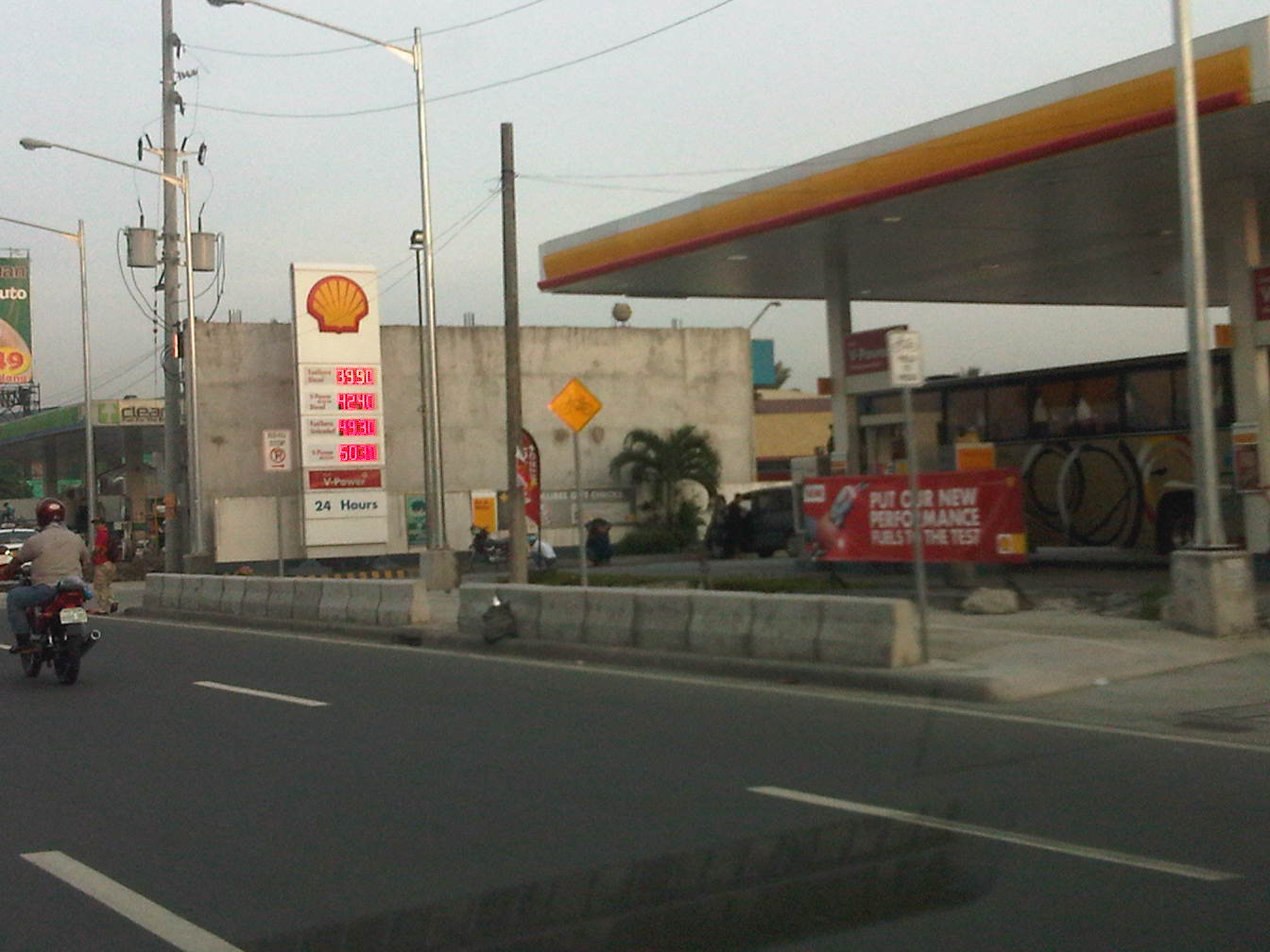 Concrete barriers along the curbside of the highway – the intention seems to be to protect pedestrians or cyclists from wayward motor vehicles in addition to the preventing the same vehicles from mounting the sidewalks
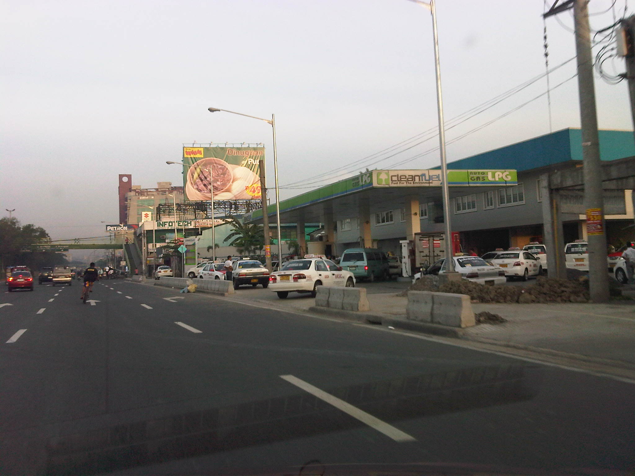 Pasaway? – taxis at an LPG station parked or standing along the bikeways and pedestrian sidewalks.
 Taxis maneuvering as if all the space is for them including the space designated for pedestrian and bicycle use.
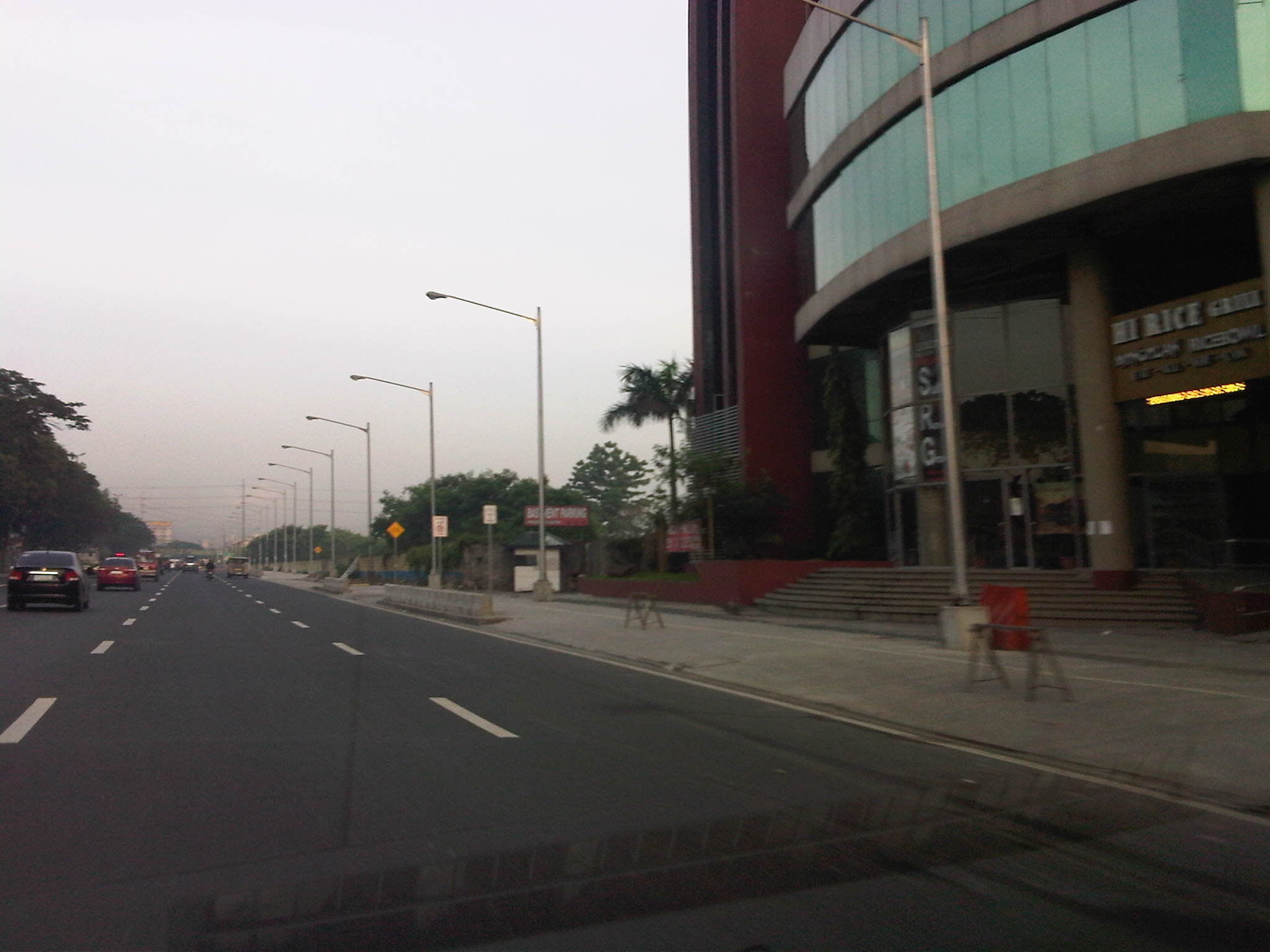 Spacious walkways and bikeways along westbound side of Marcos Highway. Lamp posts are installed to provide sufficient illumination not just for motor vehicles but for pedestrians and cyclists as well.
 Obstructions? – some lamp posts seem to be in the middle of the walkways and bikeways , posing hazards to cyclists. This issue can be addressed at the very least by painting the posts so that they will be visible especially at night time.
I will be writing more about walking and pedestrian facilities in the coming weeks in order to highlight good practices in the Philippines. I am currently looking forward to a trip to Thailand where I hope to collect photos of transport and traffic in Bangkok. It’s been a while since I last traveled to Bangkok so I am quite eager to see how Bangkok looks like particularly considering the destructive floods of last year when the waters of the Chao Praya River breached its banks.
–
Some thoughts on transport and traffic while commuting between Cainta and Antipolo
Commuting from the Ortigas (Cainta) end of Imelda Ave. to its other end at Marcos Highway (near where Pasig, Marikina, Cainta and Antipolo meet), one should be able to observe and make a quick assessment of the positives and negatives of our local transport system. While there are more negatives at Cainta Junction and along Imelda Avenue, Marcos Highway definitely has improved particularly in terms of walkability. It is a commute that I have taken so many times since my childhood days and I can only now remember times when one could walk safely from one end to the other when there were far less vehicles than the volume that flows along Imelda Ave. these days.
Junction is still quite the mess despite some road widening at the intersection owing to various factors including the fact that the intersection simply cannot handle the volume of vehicles using it even after the elimination of some turning movements from Ortigas Ave. in favor of U-turns particularly for traffic coming from the eastbound side of Ortigas. It seems the traffic signal settings can no longer handle peak period traffic and manual traffic management probably aggravates the situation especially when enforcers employ the buhos technique of trying to dissipate as much of the queued vehicles per approach or movement. The latter technique does not take into consideration that the longer a movement or group of movements are allowed to move, there are corresponding build-ups in traffic along all other approaches. It is a vicious cycle (pun intended) that is supposed to be addressed by an optimally times signal system. Saturated conditions, though, are inevitable due to the sheer volume of vehicles using the intersection given that Junction is a catchment for vehicles from Rizal Province that ultimately uses Ortigas Ave. to head into Metro Manila in the mornings. The reverse is true in the afternoon to evening periods.
Imelda Avenue, which was also known for a time as Francisco Felix Ave., is plagued congestion due to notoriously bad pavement conditions, so many median openings, and high vehicle trip generation rates from the many residential subdivisions or village along the road. The pavement conditions are due mainly to damage brought about by trucks and, during the wet season, frequent flooding along many sections of the avenue. Bad pavement conditions and flooded streets significantly slow down traffic as Imelda Ave only has two lanes along each direction and is divided by a narrow median island that’s just enough for a few plant boxes and lamp posts.
There are mostly middle class subdivisions including the large Vista Verde, Village East, Karangalan, and Pasig and Cainta Green Parks along the road. There is also a DMCI medium rise development has its main access road also connecting to Imelda Ave. These villages generate much vehicle traffic and each have their own median openings that practically function as intersections along the entire stretch of the avenue. These openings create a lot of conflict between through traffic and vehicles entering and exiting the villages, especially those taking left turns to or from their gates.
While there are commercial establishments along the avenue, most were small and traffic generation characteristics were not so significant as to cause severe congestion. The first major generator in the middle of the avenue was a branch of the membership-concept Makro supermarket cum depot. Makro generated significant traffic but did not cause much congestion along the stretch in front of the Village East gate. It was eventually acquired by commercial giant SM and the branch is now an SM Supercenter that seems to be generating much more traffic than Makro did at its peak. While traffic studies are usually the norm before such developments are constructed given the trips attracted by SM, the congestion experienced along Imelda Ave has been reported to be generally un-managed despite the need for more disciplined loading and unloading by public transport, pedestrian movements and vehicle entries and exits.
Jeepneys are the main public transport mode along Imelda Ave. although there are tricycles serving the various subdivisions that often not only cross the road but also travel along Imelda Ave. for short distances. I remember in the 1970’s and early 80’s that the tricycles used to be the primary mode of transport from Junction and the Cainta Public Market as Imelda was not yet connected to the still to be completed and unpaved Marcos Highway. There was even a Metro Manila Transit Corp. bus service (probably missionary route and with low frequency of service) along Imelda Ave. that turned around near Kasibulan Village, one of the first subdivisions in the area. Many jeepneys are noticeably the patok or popular type known for their loud stereos and reckless driving. Still, there are the smaller, older jeepneys whose route connects either ends of Imelda Avenue. Most patok jeepneys are from the many longer routes between Rizal towns and Cubao overlapping along Imelda Ave (e.g., Angono-Cubao, Antipolo-Cubao, Binangonan-Cubao, Taytay-Cubao, etc.).
–
School traffic impacts – issues along Ortigas Ave., Part 2
I had written recently about traffic congestion along Ortigas Avenue that is due mainly to traffic generated by a private school in the area. In the previous post, the photos only show vehicles parked on the sidewalks on either side of the road. They did not show the actual traffic congestion experience. The parked vehicles seem more incidental and indirect than concrete evidence of congestion brought about by school traffic generation though they are a definite manifestations of parking generation, which is directly related to traffic generation.
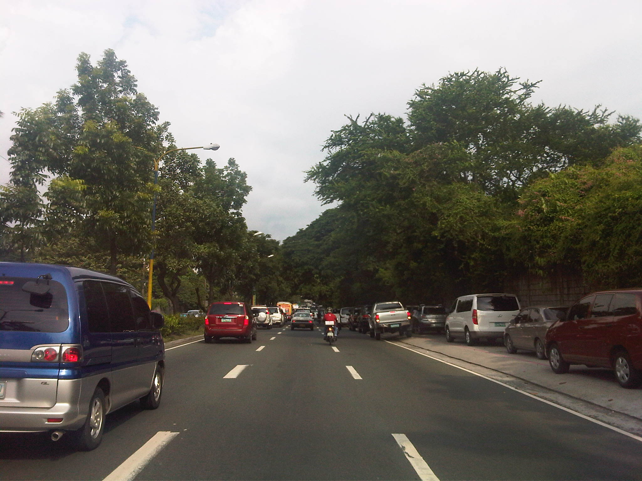 Parked vehicles on the sidewalk are seen as we approached the tail of a very slow moving platoon owing to the congestion generated by an exclusive school.
 Traffic jam with road capacity reduced by the parked and standing vehicles along the EDSA-bound side of Ortigas Ave. The trees are witnesses to the chronic traffic jams and help alleviate their impacts by absorbing emissions from the vehicle.
 Severe congestion as we approached the school – the overpass downstream in the photo is a reference for where the school is located
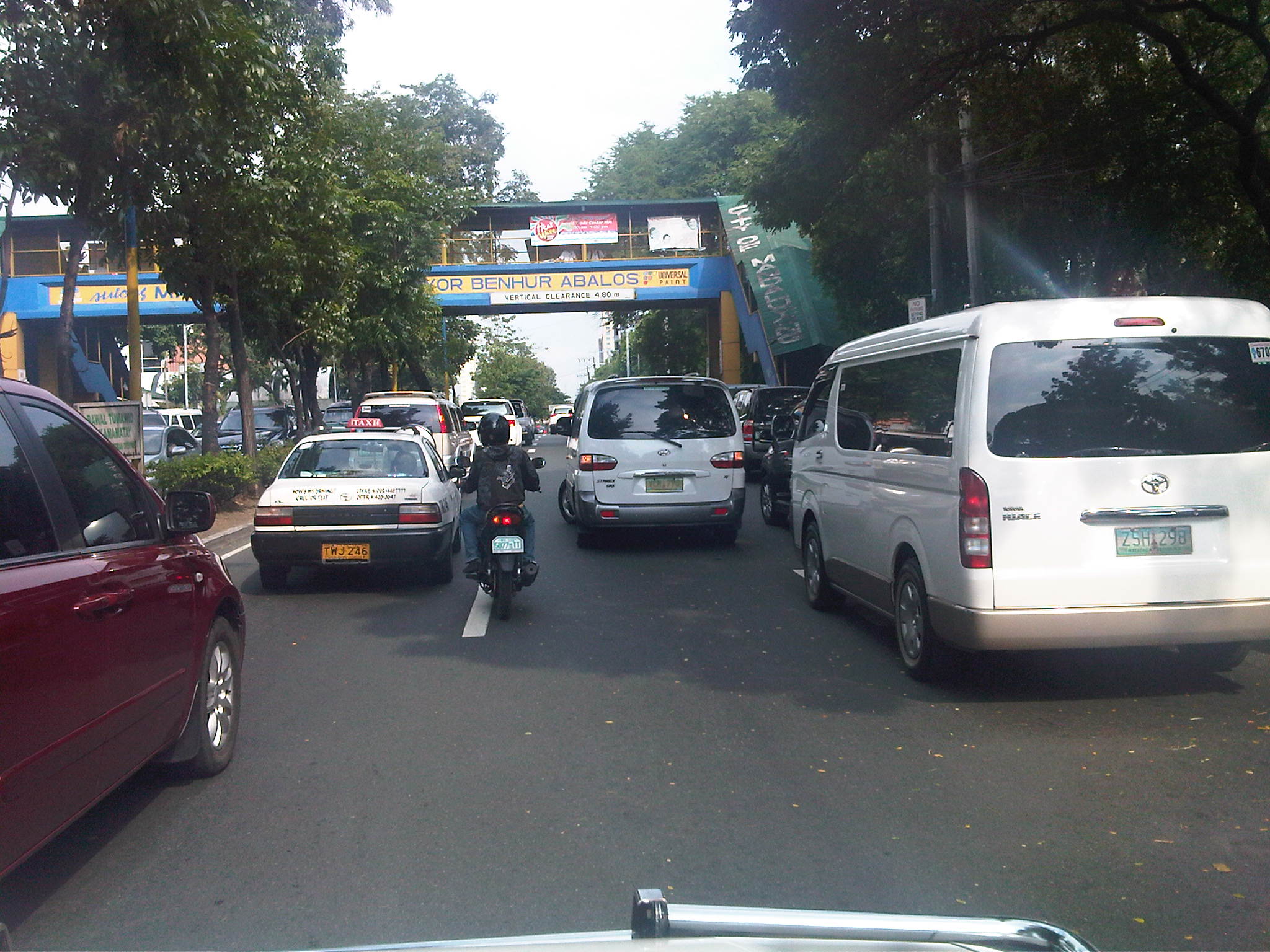 The overpass bears the name of the mayor of Mandaluyong City, where this school is located and which has jurisdiction, together with the MMDA, for traffic management in the area. At the time we passed the area though, there were no enforcers in the area despite the severe congestion. Is this because they gave the responsibility (or burden) of managing traffic to the school? Perhaps there was no need to post enforcers here as congestion is a regular thing and people seem to have been conditioned with the almost daily experience.
 The area at the foot of the pedestrian overpass actually functions as a pick-up and drop-off area for students of the school. As such, vehicles occupy not just the the sidewalk but also more than a lane of Ortigas Avenue. This effectively constricts traffic along this major road.
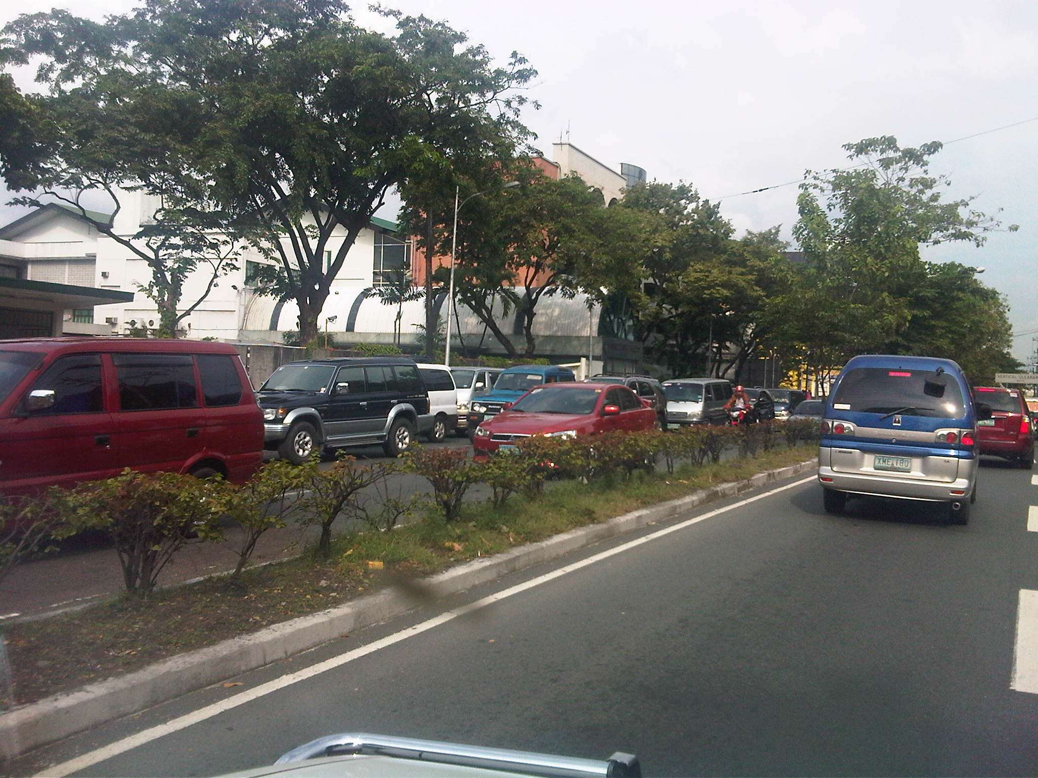 Traffic is slow along the San Juan-bound direction of Ortigas as vehicles waiting for their passengers (students of the school) are lined up and occupying the outermost and even the middle lane of the road.
 This queue is not entirely attributed to traffic generation by the school but is likely due to traffic management at the EDSA-Ortigas intersection, which is signalized. If the signal setting is not optimized or if the intersection is not cleared of straggler vehicles, traffic is backed up along all the approaches to the intersection. The tall building in the background hosts DOTC’s headquarters. I wonder if our officials are taking in the congestion that occurs almost daily (weekdays) and if they are even crosses their minds how to solve this problem and others like it around the country.
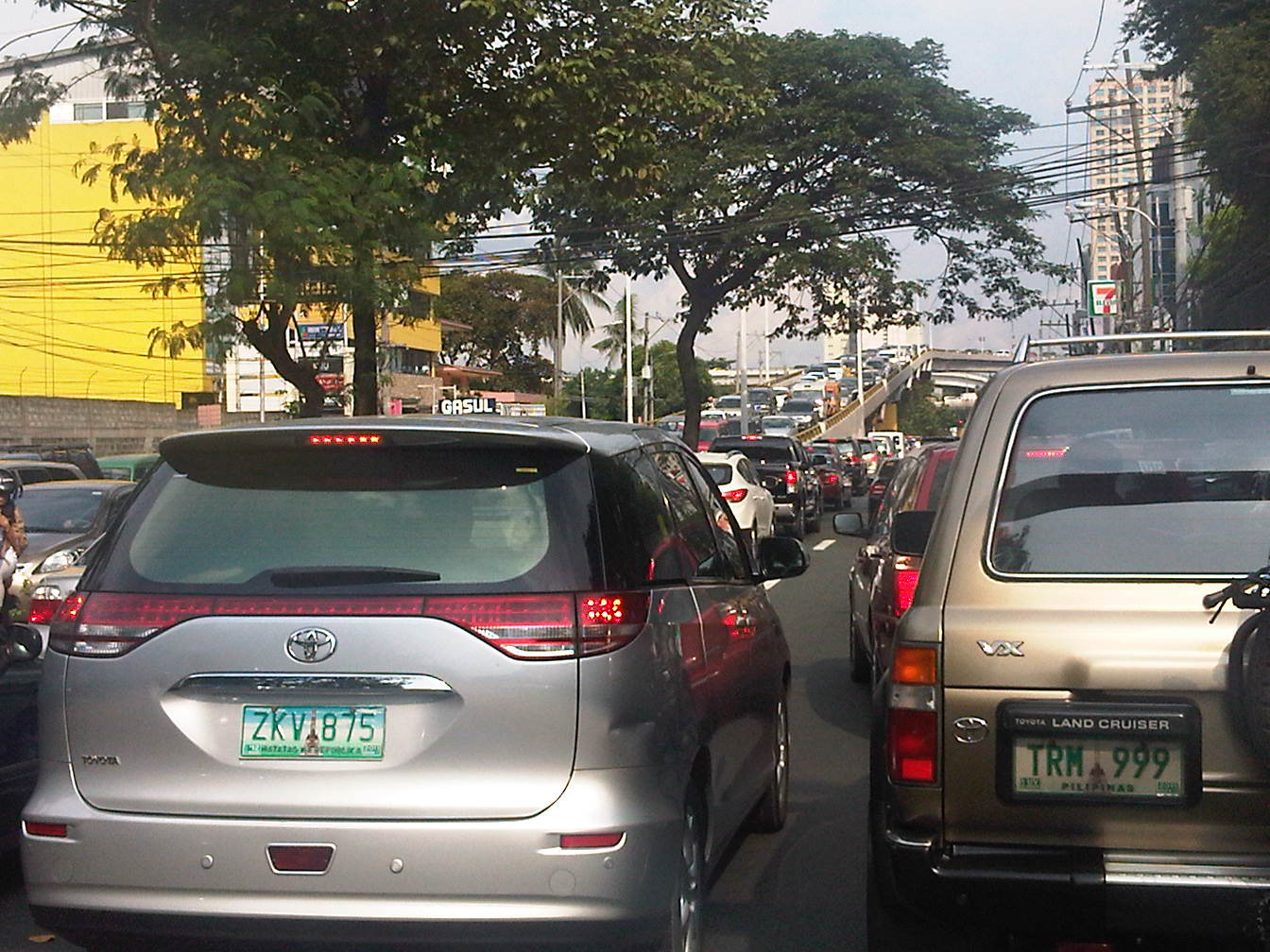 Proof that congestion is along both directions of Ortigas Ave. is seen in the middle of the photo where vehicles are also backed up along the overpass ramp coming from EDSA’s northbound side. For what it’s worth, the DOTC headquarters is right along this road at the building where the 7-Eleven (sign visible in the photo) is located.
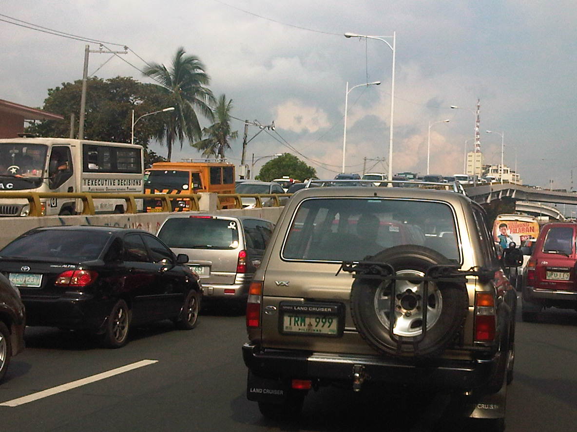 Another and even closer look of what is literally bumper-to-bumper traffic along both sides of Ortigas Avenue during the afternoon peak triggered by the exclusive school along its San Juan-bound side. Visible in the photo is the congestion along the overpass from EDSA.
–
Marcos Highway Bikeways and Walkways
I have written about the need for pedestrian facilities in previous posts. These include walking as a mode of transport, walkability in the Philippines, and even some personal experiences. There is no doubt about how important pedestrian and bicycle facilities are in order to promote walking and cycling as environment-friendly, healthy, and therefore sustainable modes of transport. Cities and towns where people walk and cycle are among the most healthy and perhaps vibrant places in the world. Walking outdoors, in fact, should be promoted if not encouraged (i.e., its difficult to encourage if there are no facilities, and health and safety are concerns) in cities where tourism is also being promoted as it can be used as an indicator for how easy it is to go around the city or town and perhaps how clean the air is in the area.
Following are a few photos I managed to take along Marcos Highway that show the newly designated bikeways apportioned from the sidewalk that was constructed along with the rehabilitated carriageway. There are bikeways on both sides of the highway as what used to be the open channel drainage was replaced by culverts and the sidewalks where built on top. In order to enhance the safety of pedestrians and cyclists, concrete barriers were placed along the road margins just above the curbs. The barriers actually work in another way, preventing or discouraging pedestrians or cyclists from wandering into the traffic lanes of this busy thoroughfare.
 The white line delineates the bikeway, which is the lane along the curb, from the pedestrian walkway that is on the inner side of the path. This can be a bit confusing and creates conflicts between pedestrians and cyclists as the parts of the roadside are also designated as bus/jeepney stops.
 Obstructions? – the bikelane runs smack into the staircase of the pedestrian overpass while the pedestrian path leads to electric posts. Such are issues that are also present along the more established bikeways of Marikina City.
 Too many signs? – from this view, there seems to be a lot of signs along the bikeway, appropriate perhaps in order to inform motorists, pedestrians and cyclists about the facilities. The signs are also useful for enforcement as Marikina City, for example, is strictly enforcing its policies against parking and other obstructions along the bikeway. Unfortunately, Pasig, Cainta and Antipolo are lax in their responsibilities to clear the bike and pedestrian paths from obstructions.
 Which direction? – the bike path markings state the direction for flow. Such is at best a suggestion as it is quite difficult to enforce one way flow for cycling. It must be made clear that the bikeway is mainly for commuting or utilitarian rather than for recreational or sporting purposes. Speeds should be slow enough for cyclists and pedestrians to co-exist and perhaps share space for two-way flow.
 All clear – the bike path is good enough even despite it going along so many driveways due to the nature of the developments along Marcos Highway. The bike path in front of the Metro East mall can be filled with commuters waiting to catch a ride and won’t be passable to cyclists especially during the afternoon to evening.
 Unfortunately, crossing the highway is another challenge for cyclists as the steps for most overpasses along Marcos Highway are quite steep. There are at least 3 that were designed to have ramps (the Imelda Ave/A. Tuazon, Dela Paz and Ligaya overpasses have ramps) for bicycles and wheelchair access).
 Establishments along highway can pitch in by ensuring the bike and pedestrian paths are clear of obstructions including parked vehicles. Incidentally, there is one gas station along Marcos Highway that is also a depot for taxis where the latter seem to always occupy the sidewalks. I have seen Marikina staff flagging them for disrespecting the right of way of pedestrians and cyclists but they seem to have some difficulty in clearing the area of parked vehicles. (Note: The Dela Paz pedestrian overpass is visible downstream.)
The pedestrian and bicycle facilities along Marcos Highway will certainly go a long way in promoting walking and cycling. At both ends of the highway though, at the Masinag junction at the eastern end and Santolan in the west, there are issues pertaining to continuity as both bikeways and walkaways disappear and pedestrians and cyclist would suddenly have to contend with mixing it up with motor vehicles along the carriageway should they want to continue in their travel. This issue of continuity should be addressed both by policy and the provision of suitable facilities for cycling and walking.
Perhaps something to think about is the realization of a link between the Marikina Bikeways, the Marcos Highway bike paths and UP Diliman’s bicycle lane along its academic oval via Aurora Boulevard and Katipunan. This can eventually be linked to the wide sidewalks along Commonwealth Avenue that can also be apportioned for pedestrians and cyclists. Perhaps such an integrated network covering parts of Quezon City, Marikina City, Pasig City, Cainta and Antipolo City can be realized quickly with enough effort from the respective local governments and maybe with a little help from the private sector including schools and commercial establishments along the network.
–
School traffic impacts – issues along Ortigas Ave., Part 1
I have written about school traffic generation in this blog and have mentioned about the traffic congestion experiences along major thoroughfares due to the vehicles attracted by private schools. La Salle Greenhills (LSGH) is an exclusive school found along Ortigas Avenue and during the summer months of April and May, people passing through the stretch of the road from EDSA to the Greenhills Shopping Center are relieved that they won’t have to go through traffic jams due to the school-generated traffic. From June to early December and January to March, however, the area is almost always congested in the morning and afternoon. Such congestion is predictable since it occurs during a period when students come to school and when they are dismissed mid-day or in the afternoon.
Heading to a meeting at the DOTC from the University one morning, we decided to take an alternate route. Instead of EDSA or C5, we took East Ave., Tomas Morato Ave., Gilmore Street and then emerged at the westernmost end of Ortigas in San Juan. It was already 9:00 AM when we arrived at the section most affected by the traffic generated by LSGH and so we didn’t to get caught in a jam as we proceeded towards our destination. We were proven right as traffic was almost free-flowing, and I took advantage of the traffic conditions and to take a few photos of the indicators for the potential traffic congestion in the area. The following photos also show a serious parking problem and (sadly) the usurpation of space from pedestrians. For shame!
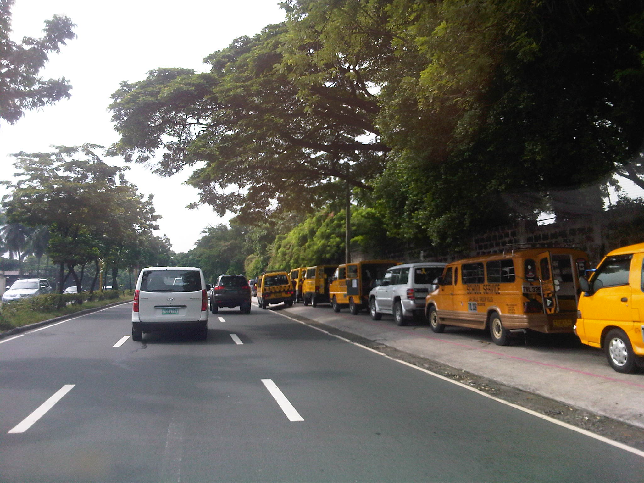 School service vehicles parked along the sidewalk along Ortigas Avenue – beyond the wall on the right is Wack-wack, a high-end residential subdivision named for the sound of golf clubs swinging at its famous course.
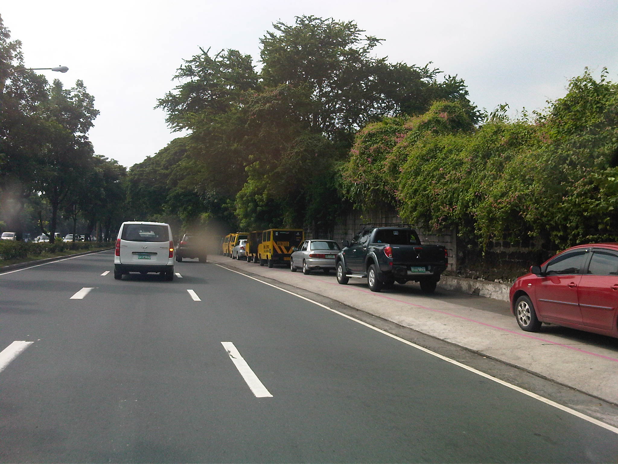 Private vehicles parked along the same sidewalk – noticeable in the photo is the pink line drawn by the MMDA to supposedly demarcate space that should not be obstructed and instead allocated for pedestrian use. It is clear in the photos that pedestrians would have to walk along the edge of the sidewalk or the outer lane of the carriageway itself, increasing the risks for them to get sideswiped by motor vehicles.
 More parked vehicles along Ortigas Avenue, mostly private vehicles that are highly likely owned by those studying at LSGH.
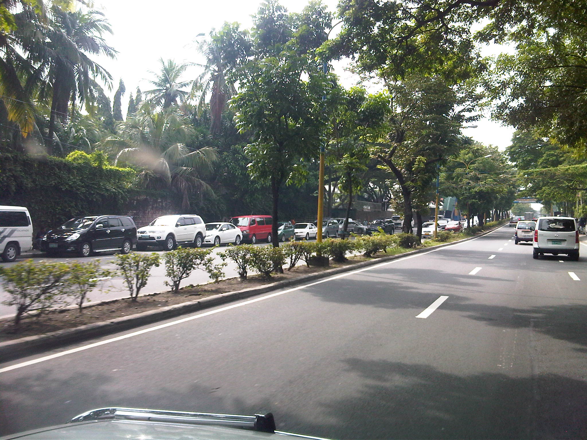 It’s actually worse on the other side of Ortigas Ave. as vehicles occupy a lane of the carriageway, effectively reducing capacity along this stretch of the road.
 It seems the main purpose of the pedestrian overpass is to allow students to safely cross the street to get from and to their vehicles. I can only imagine the congestion caused by drop-offs and pick-ups along Ortigas Ave., which for certain times of the day functions as a driveway for the school.
–
Esplanade Drive
I enjoy walking in Singapore and perhaps to compare with walking in Japan, the only difference at times would be that at certain times of the year, it’s much cooler (or colder) in Tokyo or Yokohama. Outdoors in Singapore it can be uncomfortable due to the humidity but its actually the same in the temperate countries during summer. Among the more enjoyable walks even during workdays would perhaps be along the Esplanade connecting the Marina Square and Suntec areas with the offices across the river as well as the newly famous Marina Sands development.
 View of the drive from the Marina district towards Fullerton and the financial district across the bridge.
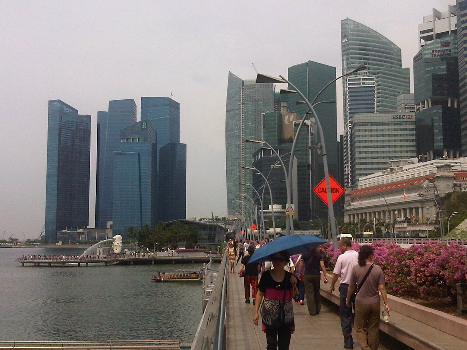 View of the walkway, which is alongside the carriageway but separated by a plant box. That’s the Merlion on the background with all the people crowding probably to take souvenir photos with the city state’s symbol.
 The Esplanade bridge with the skyscrapers of Singapore’s financial district in the background and the famous Fullerton Hotel at the center.
The key really is to enhance the walking experience such that people would not at all notice the distance they were traversing. Walking should be for everyone and not just something for those regarded as transport poor. In cities in progressive countries, for example, you see professionals in their suits mixed with people in casuals and students wearing their uniforms walking their chosen paces along streets provided with facilities suitable for walking and the volume of walkers (Yes, there is such a thing also as a level of service for pedestrian facilities and flow).
I would have taken photos of the connections between stations and places of interest in Singapore but I usually only had my trusty cell phone rather than a professional camera. With all the cameras installed around the city, my taking of photos might be misinterpreted rather than dismissed as just another camera nut taking souvenir or “artistic” shots of places.
–
But seriously…recognizing walking as a mode of transport
There is a general observation that urban planning in the Philippines, including planning and design for transport, revolves around motor vehicles. In fact, much of what we think are sound policies and guidelines, even rules of thumb, are car-oriented rather than people-oriented. Our love for the car is often traced to our being a colony of the United States and our orientation to cars have been reinforced over the years by policies, plans and projects that seem to be biased for car users while detrimental to commuters in general. In fact, we have been used to having roads built and widened that these types of projects seem automatic, no brainer solutions to the traffic problems we encounter everyday. Not that this is a bad thing, considering that we do have many missing links to complete and infrastructure to build where they are needed. Yet, for many of our highly urbanized cities, public transport infrastructure has been too slow to address the demand for movement.
Metro Manila is already choking in as far as traffic is concerned and our proposed solutions still are road widening and the call for elevated expressways. Meanwhile, we have poor road public transport services and a limited rail or mass transit network. It seems that most of the plans for trains and BRTs have never left the proverbial pipeline and as such, we continue to languish in I would like to think that a lot of people would want to take public transport if only the quality of service is similar to systems in Singapore, Hongkong, Kuala Lumpur or even Bangkok or Jakarta. We have to deliver on this end, which will also see our streets begin to become decongested as vehicles will naturally decrease with people choosing PT over their cars, especially in this period of increasing fuel prices.
Of course, these public transport infrastructure carry hefty price tags. And so to complete the picture and solve the puzzle of transport in cities like Metro Manila, Cebu and Davao, we would need to address what is perhaps the most basic for of transport that is often forgotten when talks center on highways and mass transit – walking. It is a fact that walking is the mode with the highest share for transport; dwarfing all other modes since we all walk at some point of our trips (e.g., Car users still have to walk to and from the parking spaces.) Unfortunately, we seem to have become lazy, preferring to ride than to walk and making so many excuses even when the facilities for walking are already provided and conditions favor walking over motorized transport. Of course, the main challenges for ensuring the safety and comfort of those who choose to walk remain and investments are required for more infrastructure to encourage walking. There are good practice examples like the walkways connecting buildings at the Makati CDB and the sidewalks of Quezon City. These are, however, more the exception than the rule and so there is still a need to actually “formalize” walking as a mode of transport and one that could probably save us a lot of fuel, reduce emissions and, most importantly, improve our health and well-being.
Following are excellent articles for reading, and for consideration when we re-think what we are doing to improve transport and mobility in our cities. A re-orientation is in order for us to address
(Note: the sources and links to the online articles are shown below and in the files. These are made downloadable here only to facilitate access to the articles. There is no intent for any copyright infringements.)
Why don’t Americans walk more? The crisis of pedestrianism:
What scientists know about how pedestrians really behave:
Walking_in_America__What_scientists_know_about_how_pedestrians_really_behave_
How walk score puts a number on walkability:
Walking_in_America__How_Walk_Score_puts_a_number_on_walkability_
With America and the rest of the world taking a second and perhaps critical look into how they are planning their transport systems and focusing on encouraging people to walk, we should perhaps take this as our cue to also re-think how we are planning and designing our systems. We should, and not be too dependent on the recommendations of studies past and present that seemingly try to simplify our plights as something that can be solved by roads and cars alone.
–
Pedestrianizing Session Road
When visiting Baguio City, one should never fail to go to Session Road whether to have a meal or just to take walk along the street. It is perhaps the city’s most famous street and a landmark itself where it used to be that a lot about Baguio is going about along Session Road. Here you will find shops, restaurants, bars and other establishments. Since my first time to go to Baguio in 1995, I have seen the city become more crowded and Session Road become more congested. There have been proposals for the street to be pedestrianized but I am unaware of any detailed study concerning pedestrianization and its implications on traffic and commerce in the area. This, I think, should now be among the things Baguio City should look into with more urgency and perhaps a study can be initiated among the universities there, together with the local chapters of planning, architecture and civil engineering societies.
The following article is from the Business Mirror entitled Road Revolution, which appeared in the newspaper’s February 4, 2012 issue:
BAGUIO CITY—Architect Joseph Alabanza keeps a long-held dream: to see Session Road pedestrianized.
As early as 1972, when Alabanza, former head of National Economic and Development Authoriy-Cordillera Administrative Region (Neda-CAR) was head of the city planning office, policies then had pointed out strongly that something had to be done about Session Road as it was predicted to soon become polluted and congested, and lose it aesthetic heritage, being at the heart of the city’s central business district.
A scene that is exactly what Session Road has become.
Then there were not too many cars and the population was much lower than the almost 400,000 mark today, and there was a lack of urgency to control the traffic situation in the city.
In more recent years, as lecturer and consultant of the architecture department of the St. Louis University, his class drafted, as their theses, a layout plan for the streets of the city. The central blueprint was that of Session Road pedestrianized.
Some consultations were made, but this was strongly opposed by business establishments around.
The yearly “Session Road in Bloom,” a market event for Panagbenga (meaning a season of blooming in the Igorot Kankanaey dialect) on Session Road, which stayed closed for a week, was used as a vehicle to test the plan. But it proved to be too hectic and the pedestrian is too heavy to be desirable for a longer period of time.
Even if it seemed that Alabanza’s dream was far from becoming a reality, the glimmer of hope remains as he continuously lamented the continuing deterioration of Session Road—the heavy pollution, the unkempt façades, the heavy traffic, crimes, the insane cat-and-dog chase of the police with sidewalk vendors. Life in the heart of the city was in shambles, but business thrived as usual.
Road Revo
THEN a group of environmental advocates heard of this dream. Something that was a success in Cebu. They came to tell the people of Baguio about their winning game plan in a forum on January 27.
It is called Road Revo—a revolution to change the way people think about the way they transport themselves.
Road Revo is a concept developed by lawyer and environmental activist, Antonio Oposa, a 2009 Ramon Magsaysay awardee in environment.
“We cannot have a Hollywood kind of transportation system, one of individual and expensive mobility. They have eight-lane highways and their roads are like moving parking lots,” he said.
Our insistence at individual mobility has resulted in serious collective mobility, he said.
“Kanya-kanyang galaw kaya lahat di makagalaw [Everybody wants his own way to move that’s why all could not move],” he said, referring to the traffic congestion that has also resulted in serious air and noise pollution.
The road is supposed to be for everyone, that is why Road Revo is for making road use fair. This would mean a turn-around in priorities.
“There’s a need to change mindsets. Road use and policies must have a bias for people, not for cars,” he said.
A World Bank study shows that only 300 out of a thousand own a car in the country. Oposa pointed out that only 3 percent own cars, and they occupy 97 percent of the road, while showing an image of a street jammed with cars in chaos, while people walked on narrow sidewalks.
He said Executive Order 774 specifically cites the new paradigm that the movement of men and cars must follow the principle that “those who have less in wheels must have more in roads,” and that the system must favor nonmotorized transportation and collective transportation.
EO 774 also ordered the Department of Transportation and Communications and the Department of Public Works and Highways to follow the same principle in transforming the road system.
Oposa said that ideally a good public transport system provides 30 percent for all-weather walkways, 30 percent for bicycle lanes, and 30 percent for a greenbelt and what remains would be for cars.
EO 774 also directs all public open spaces along sidewalks and roads no longer needed to be devoted to urban agriculture, something that has been done in Cebu.
“If we could do it in Cebu, so can you,” Oposa said.
Alabanza said that the city has lost its sense of space, referring to walking and open spaces.
“People used to have a sense of belonging here. Now we feel like strangers in our own place,” he said.
Session Road closed: Music, dining on road, sidewalks
AS an experiment, one side of Session Road was closed from 3 p.m. to midnight the day Oposa and his group of environmental activists were in the city on January 27.
And it did happen. Families dined on tables set on the road and sidewalks. Young people were seen just hanging out with one another. Lovers strolled leisurely. Musicians and poets drew a crowd as they beat on their percussions and read poems. Passersby even stopped to do a few dance steps.
For those few hours, the spirit of community was palpable, one of the aims for pedestrianizing Session Road.
Alabanza said that minimizing pollution was one of the first objectives of the proposed road closure as Session Road has become but a passageway for cars and people between the market and the SM Mall on opposite ends. The safety of pedestrians is also compromised as the sidewalks have become too narrow for the crowd who had to walk on parts of the road.
Oposa showed some examples of the ingenious Filipinos’ inventions of environment-friendly modes of transportation. There is the blueprint for a rail bus. There is already a carousel where people pedal to make it run. There is the idea of giving discounts to volunteers who pedal trolleys on train rails. A prototype for a wind-powered bamboo train is on the works, which can run both with an electric motor or the option for pedaling.
“We are a unique place and we cannot but just copy the transportation systems and models of other places,” Alabanza said. The transportation crisis can give rise to opportunities, something that will serve the city well, he said.
Change attitudes
OPOSA pointed out that the world is now experiencing so much disasters because of climate change and it becomes everybody’s responsibility to change attitudes about transportation systems, as this is the sector that emits one of the highest volume of carbon dioxide to the atmosphere.
He reminded that people need to think out of the box and to get out from the inertia of collective insanity, of doing the same thing because everybody else is doing it, no matter how senseless it has become. To illustrate, he said that the bicycle runs on fat and saves you money, while the car runs on money and makes you fat. But all the cars suffering the cost of insurance, stress and productivity lost to traffic jams, loss of a healthier lifestyle indicate that habits are hard to break.
Road Revo will help decrease man’s dependence on oil, restore sense of community, reduce criminality as this allows visibility of one another and, most of all, give people a sense of belonging and owning the space which is a secret tip to keeping it clean.
Oposa is on a nationwide campaign to promote Road Revo. Pasig City opened a road for a day on July 8 last year and Ongpin Street in Binondo became a festival road for the Chinese New Year celebration. After Baguio, Oposa will do the rounds in Subic, Dumaguete, Marikina, Davao and Puerto Princesa.
Alabanza’s dream may not even happen in his lifetime, but the wisdom of keeping the air clean, of enlivening the spirit of community and giving importance to people rather than cars has been sown in the few hours of not closing Session Road but opening it for people.
Perhaps pedestrianization will be more beneficial to the stakeholders of Session Road. It would not be an easy task to convince people that a car-free session road will be the way to go. There probably would also be other options, even a middle ground between status quo and pedestrianization. But doing nothing and letting Session deteriorate further is surely unacceptable to most people.
–
Pedestrian facilities around Saitama Shintoshin Station
I have found many examples of excellent pedestrian facilities during my visits to Japan. Among the best are those integrated with the Saitama Shintoshin Station along the JR Keihin Tohoku Line. I had the good fortune of staying at a hotel near the station, from where I could easily catch a train to go to Saitama University via Kita Urawa Station where I transfer for a short bus ride to the university. Following are photos taken in September 2008 showing the walkways connecting my hotel with the JR station. Along the way the walkway connects other buildings such as those hosting government offices and the Saitama Super Arena, a major venue for indoor sports events like the Asian basketball tournaments that determine the continent’s representatives to the Olympics and World Championships.
 Tiled walkways with provisions for the blind (the yellow tiles) and protection from the elements
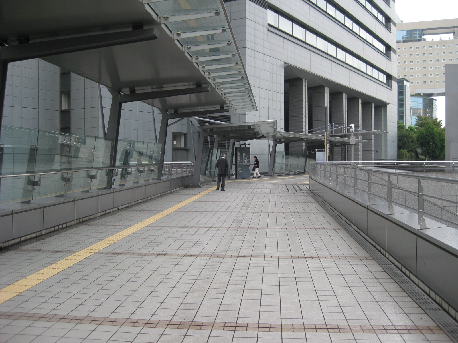 The walkways are wide and should be able to accommodate a high volume of pedestrian traffic. This section leads to the Saitama prefectural government offices located in the building on the background.
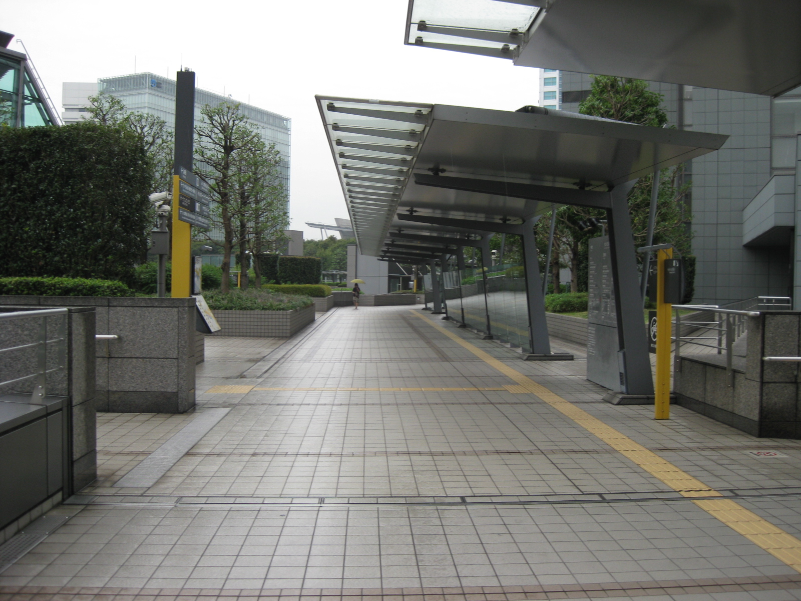 The yellow tiles forming the paths for blind pedestrians are designed to be under the shed and extends to the stairs from which the pedestrian could access the sidewalks and establishments at the ground level of the complex/area.
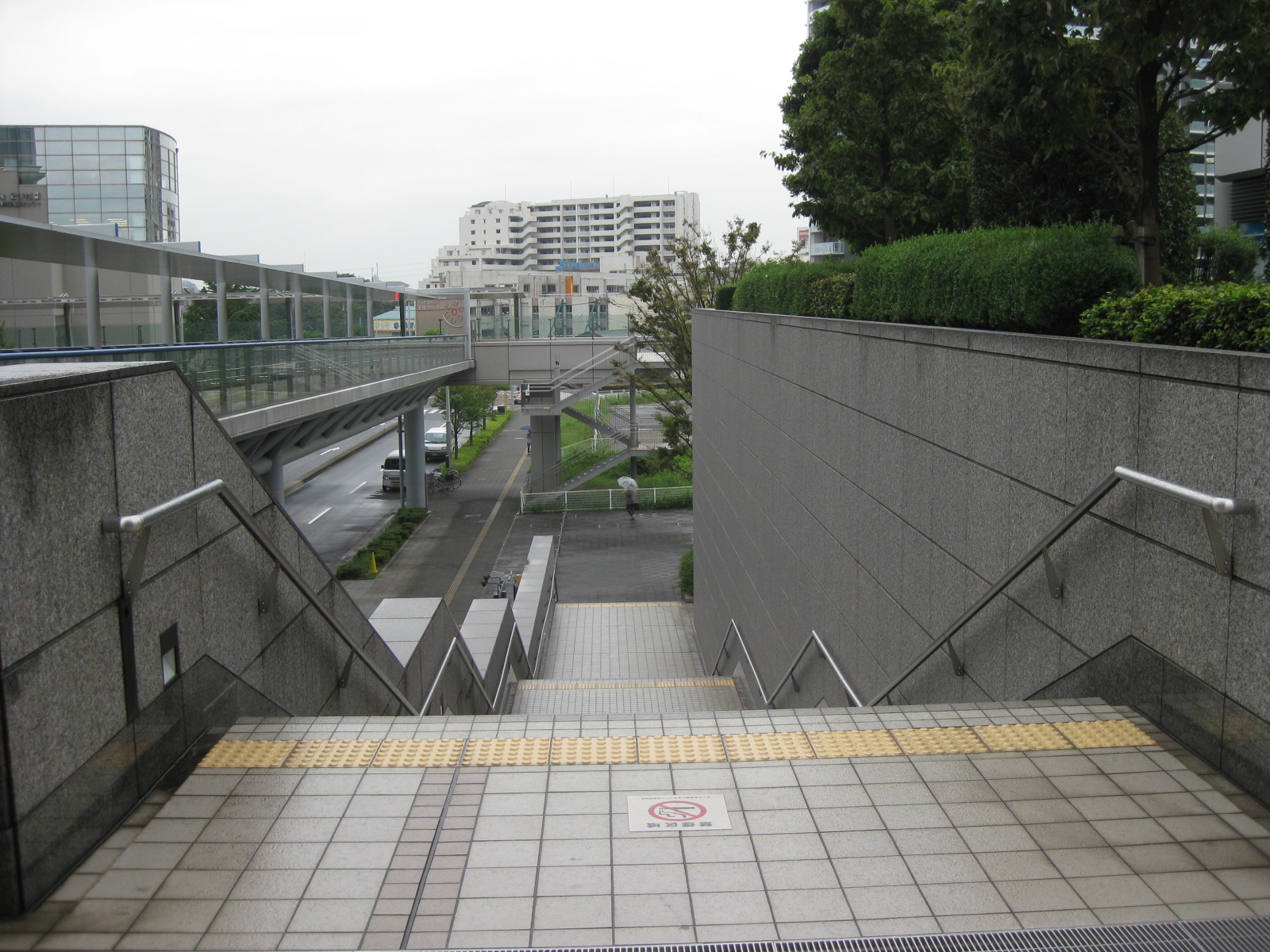 Stairs are designed with hand rails to support physically challenged people including the elderly. Note the yellow strips prior to the first step down the stairs.
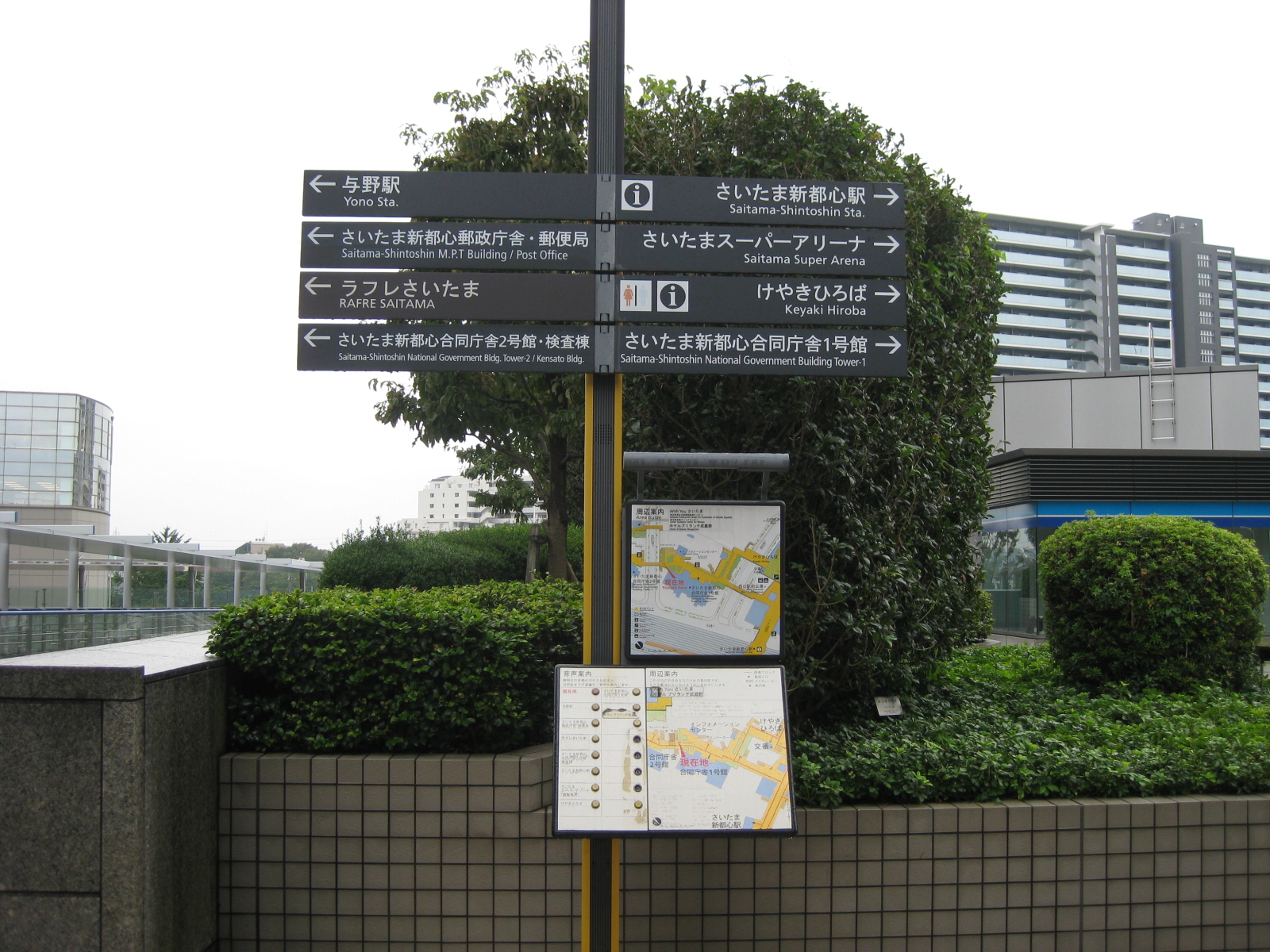 Pedestrian need to have access to information and maps and directional signs provide guidance for people especially those unfamiliar with the area (e.g., visitors or tourists). Most signs in the urban areas of Japan have English translations like what is shown beneath the Japanese in the signs above.
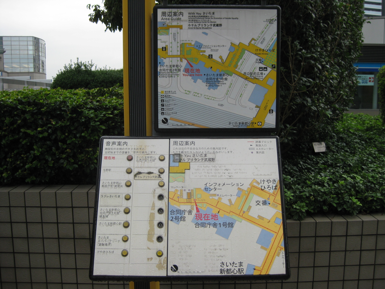 Some maps have interactive features. In this case, there are buttons that provide audio description of places of interest on the map. Today, there are already touchscreen maps in malls and there should be outdoor versions of such facilities.
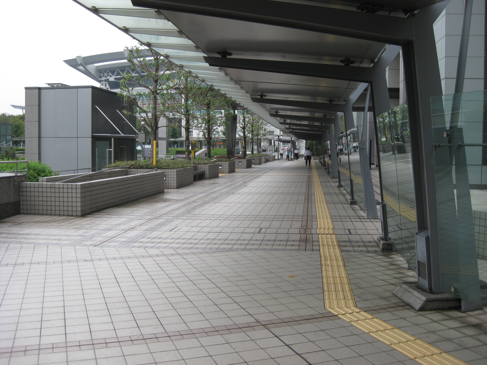 Another photo of the spacious walkways in the Saitama Shintoshin area. One could see the roof of the Saitama Super Arena on the upper left part of the photo and the building housing the elevators for those using wheelchairs or carrying heavy items.
 Closer to the station and the arena.
 There are plant boxes containing brushes and trees along the walkways, providing a more relaxing environment for pedestrians.
 The walkways eventually lead to the complex where located is the Super Arena on one side to the train station in the middle and the commercial complex on the other side.
 Walking from the station to the commercial establishments and office after the Super Arena (at right in the photo), there is a wide space for visitors (e.g., fans, spectators, etc.). There are many coffee shops and restaurants in the area where people could meet up for coffee or tea aside from grab a quick or leisurely meal.
 This the view of a pedestrian approaching the Saitama Shintoshin JR station. Shops are located along the right side of the promenade while the arches form the roof structure of the station, reflecting the modern architecture of the transit station.
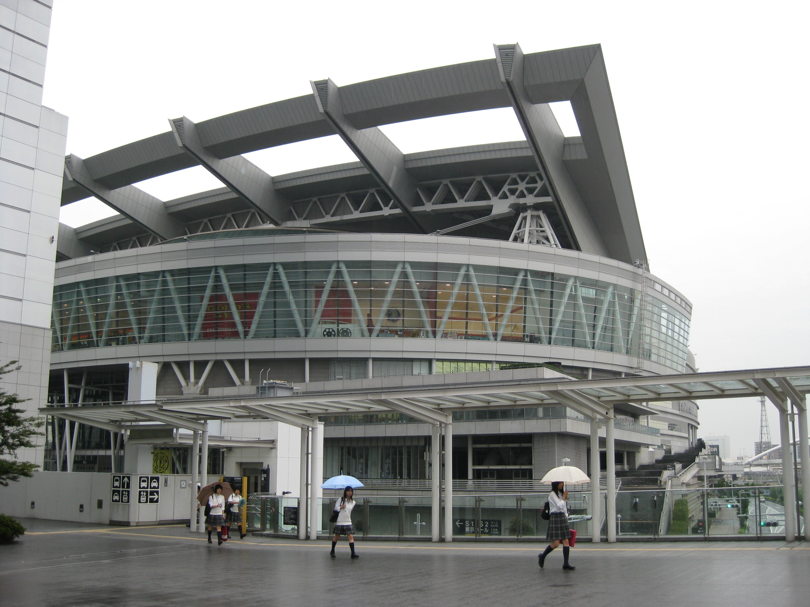 The Saitama Super Arena is also host to a museum dedicated to the late Beatle John Lennon.
 Inside the JR station plaza with kiosks on the left side and ticket machine to the right. Further on are more commercial establishments located in an upscale mall.
–
SM Marikina-Santolan Station pedestrian walkway
A good example of providing for pedestrian access for development is the walkway connecting LRT Line 2’s Santolan Station with SM City Marikina. Of course there’s an even better example in Makati City where the walkways at the Ayala CBD connect office buildings and the commercial center comprising Greenbelt and Glorietta. That system of walkways is probably the first of its kind in the country and has not been replicated elsewhere, at least as far as I know. The significance of the walkway that practically connects to points in two cities (SM is in Marikina while the LRT station is in Pasig) is that it is a good example of a facility that provides access to a transit station. Not too long ago and before Typhoon Ketsana laid waste to the area beneath the bridge and overpass, there was even a proposal for a public transport terminal to be developed here. If this was realized, then the area would have been a very busy hub similar to Crossing or Market!Market! but maybe not at the level of Cubao.
 The elevated walkway across the bridge along Marcos Highway is wide and obviously designed to be able to handle the potential number of people generated by the mall.
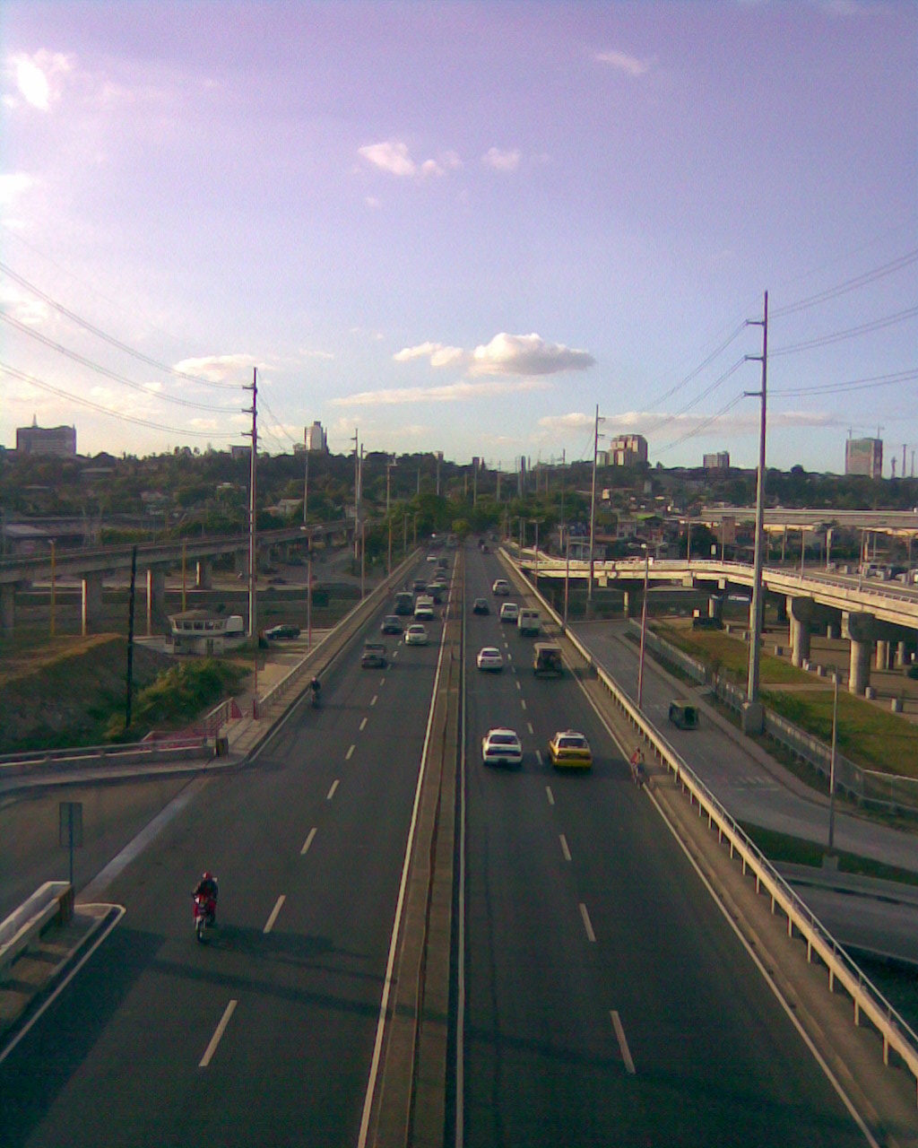 The walkway provides a perfect position for observing traffic along the bridge. This is probably an ideal location for a station for conducting screenline traffic counts for Metro Manila. The driveway on the left side of the photo is for public transport loading and unloading bays commonly used by jeepneys bound for the towns of Rizal Province.
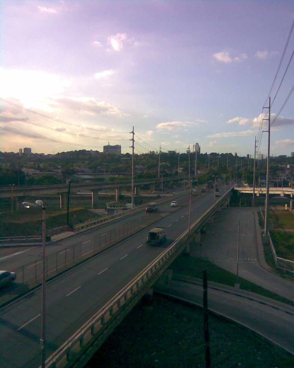 Another view from the walkway with a good perspective of the underpass connecting to a bridge to C5. Visible from this position is the area under the bridge that was proposed to be an eastern bus terminal during a previous dispensation at the MMDA.
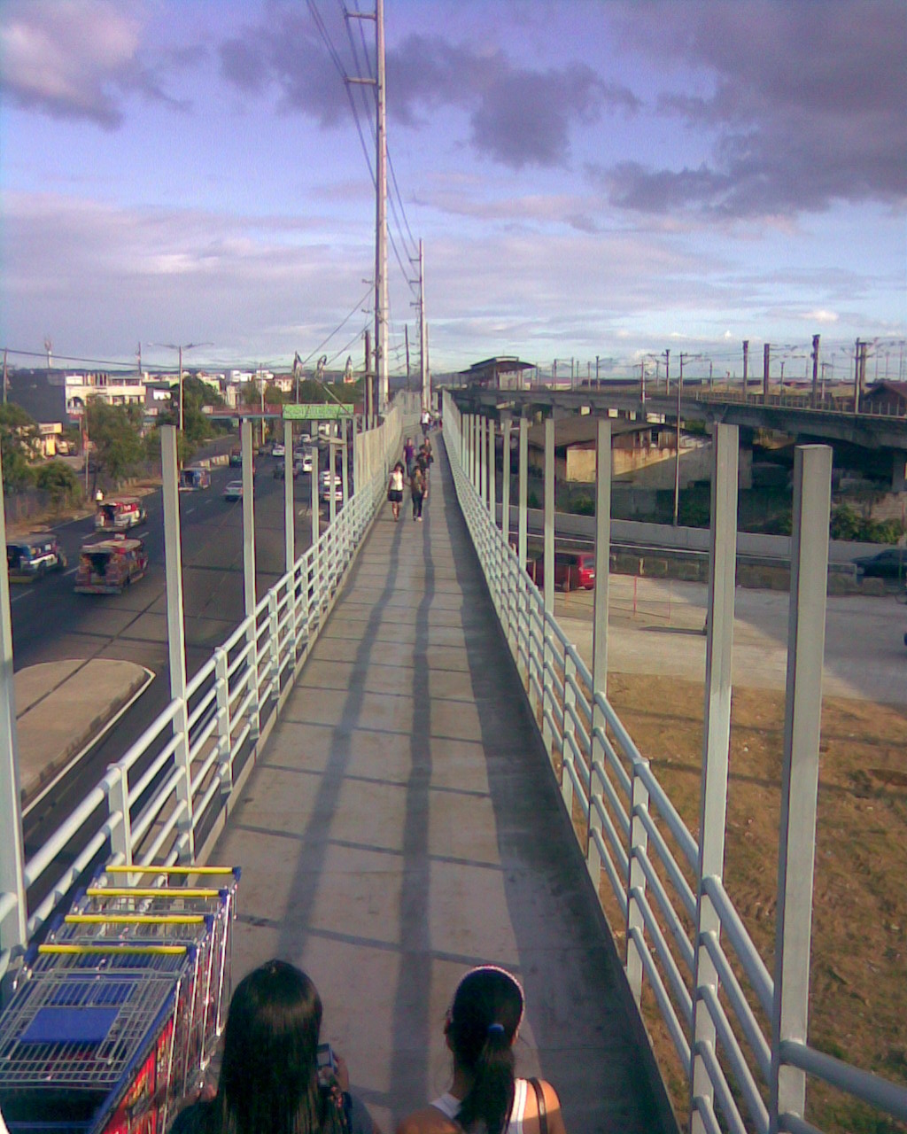 The long walk to the MRT station – from this perspective, it seems the walkway connects directly and almost level with the station platform. It is not at all connected directly with the station. Instead, one has to walk towards the end of this path and then down the stairs that end at the sidewalk near the PUV loading/unloading area. To get to the station, one has to walk some more. The posts appear to be provisions for the installation of a roof over the walkway to shield people from the elements.
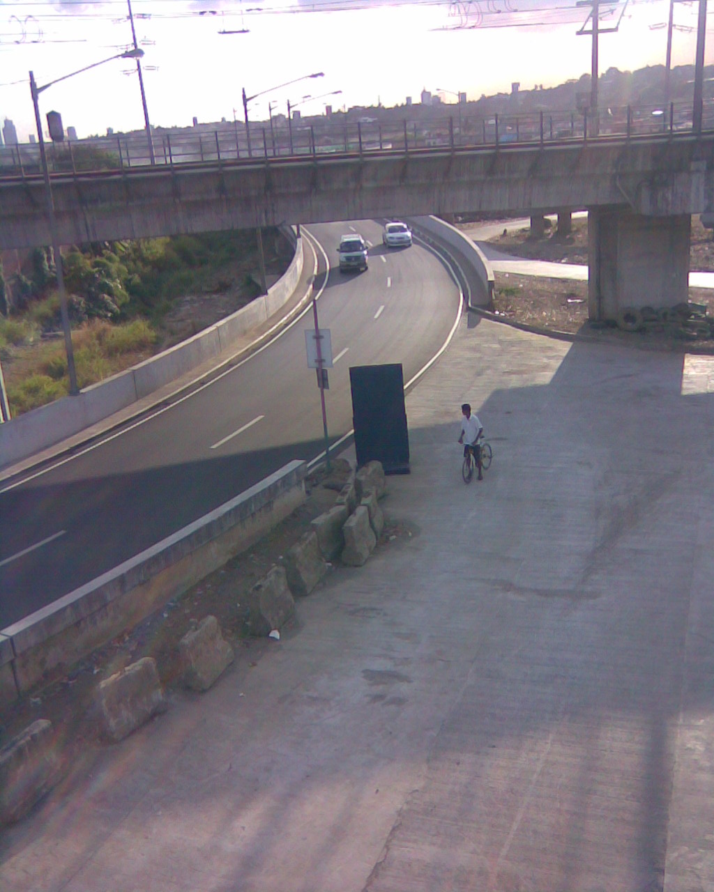 That’s the branch of the bridge emanating from C5 via the Riverbanks Road that was constructed on land expropriated from Camp Atienza, headquarters of the 51st Engineering Brigade of the Philippine Army. The curved section carries traffic from C5 that feeds into eastbound lanes of Marcos Highway.
–

