
Home » Posts tagged 'bikeways'
Tag Archives: bikeways
On the pushback vs. bike lanes
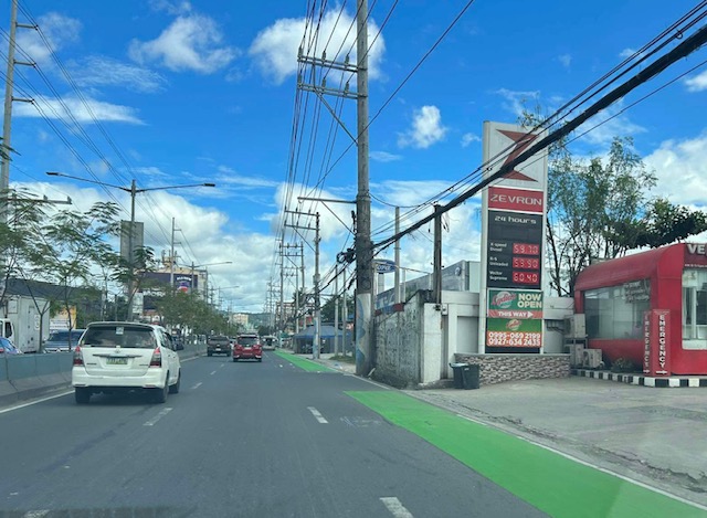
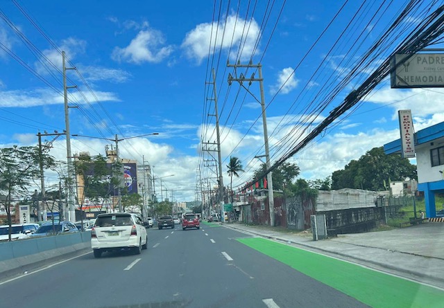
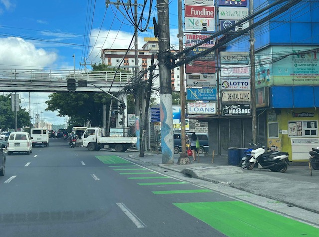
I saw this short article at Planetizen that linked to another article that was the original one about cities dismantling or removing bike lanes. This is a very concerning trend in the US but something that’s also happening here. The Department of Public Works and Highways (DPWH) has always been lukewarm to bike lanes (parang napipilitan lang), the Metro Manila Development Authority (MMDA) seemed never to understand it (even during BF’s time as Chair), and many local government units that jumped on the bike lane bandwagon during the COVID-19 pandemic have reneged on their declared commitments. Currently, it seems that only cities like Quezon City and Iloilo City have sustained bike lanes development. Others have removed protected bike lanes or have not enforced vs. motor vehicles encroaching on the bike lanes.
Johnson, R. (February 18, 2025) “Cities Start to Backpedal on Bike Lanes: A Growing Crisis for Cyclists,” Momentum Mag, https://momentummag.com/cities-start-to-backpedal-on-bike-lanes-a-growing-crisis-for-cyclists/ [Last accessed: 3/2/2025]
To quote from the article:
“Bike lanes have become a culture war where those in favor are seen as “woke” or some other terrible conservative slur. But, most who use bike lanes are just regular people who want to save some money, and get the mental and health benefits to cycling to work.
Urban cyclists, bike commuters, and advocates for safer streets, have all noticed a troubling trend. What was once a symbol of progress toward sustainable transportation and safer roads for all is being reversed in multiple cities across North America.”
Will bike lanes and cyclists suffer similar setbacks here? Will the Department of Transportation (DOTr) continue to champion bike lanes? Will the agency be more aggressive and assertive of bike lanes development? Your guess is as good as mine!
–
On bike lanes contributing to safer roads
Do bike lanes make roads safer? There are obviously mixed reaction to this question especially if you look as social media. If we are level headed about this topic and look at the evidence out there, the answer is yes. But there can be caveats as we try to contextualize in the local setting. The formal studies so far are in countries where the drivers arguably more disciplined than ours here in the Philippines. Driver behavior, after all, is a major factor for road traffic safety. Here is a good article for reference in the discussions and arguments for bike lanes:
Tu, Maylin (November 5, 2024) “How Bike Lanes Slow Drivers and Save Lives,” Next City, https://nextcity.org/urbanist-news/how-bike-lanes-slow-drivers-and-save-lives [Last accessed: 11/10/2024]
To quote from the article:
“Bike lanes with physical delineators (cones or bollards) were more effective than paint-only lanes at calming traffic, echoing a popular mantra for bike activists: “Paint is not protection.” (The lanes were not protected, however, because drivers could drive over the delineators.) For vehicles turning right, top speeds were reduced by 28% and average speeds by 21%. Paint-only bike lanes slowed driver speeds by up to 14% and drivers going straight slowed down by up to 8%…
The study adds that pop-up bike lanes are a cost-effective solution for studying the effects of more permanent solutions — after all, you could just borrow the traffic cones. A city could quickly implement pop-up or temporary infrastructure. Then, armed with data and community feedback, they could invest in making the changes permanent.”
The article also points to a technical paper or scientific article on the traffic calming effect of bike lanes. Here is the link to the article published in the Journal of Urban Mobility: https://doi.org/10.1016/j.urbmob.2024.100071
–
More than just painted lines – good practice examples of bike lanes
I’m sharing this article on the best bike lanes in the United States:
Holbrook, A. (February 12, 2024) “The 5 Principles That Make America’s Best Bike Lanes: A Lot More Than Painted Lines,” Velo, https://velo.outsideonline.com/urban/urban-gear/five-principles-the-best-bike-lanes/ [Last accessed: 2/15/2024]
This is a follow-up on an article on the best new bike lanes or bikeways that I shared earlier. This article features an interview of the author of the previous article about what features distinguish these bike lanes over others that have been implemented. Definitely, bike lanes should be designed beyond the usually painted lines that offer little protection to cyclists.
Here are examples of bike lanes in the Philippines:
 Painted bike lanes along Ortigas Avenue Extension, Cainta, Rizal
 Protected bike lane along Katipunan Avenue (C-5), Quezon City
–
Eastbound bike lane along Ortigas Avenue Extension, Cainta, Rizal
I recently posted about the newly painted bike lanes along Ortigas Avenue Extension between Cainta Junction and Valley Golf in Cainta, Rizal. Here are more photos of the bike lanes along the eastbound direction of the avenue.
 Just past Cainta Junction and across from a gas station. The bike lane marking here though should have been for a driveway due to the service station.
 Bike lane approaching the Ford dealership
 Bike lane in front of the Ford dealership along Ortigas Ave. Ext.
 An unusual discontinuity in front of a vacant lot
 Another discontinuity
 The broken lane markings are supposed to be for driveways and approaches to intersections like this section at a gas station. This was the appropriate marking for the station in the first photo.
 Car parking are a concern for cyclists as they often encroach on the bike lane.
 Approach to an intersection (J.G. Garcia Street) across from Brookside Subdivision gate
 Approach to intersection with Huners ROTC Street and just before STI.
I will share photos on the westbound bike lane along the same section in the next post.
–
Who can design bikeways?
I have read many comments about how bike lanes and other bike facilities are sub-standard or unacceptable because they were designed by non-cyclists. From an academic perspective and perhaps also from a point of view of someone who values empathy, the planning and design of bicycle facilities should not be so limited. The objective of education, and particularly for schools whose graduates become professionals like engineers, architects and planners, should be to have the latter be able to plan and design the most suitable infrastructure and facilities for all users. Suitability here should include equity considering the many elements involved for people of different gender, physical ability or disability, age, health conditions, etc. That said, it is the responsibility of agencies such as the Department of Public Works and Highways (DPWH) to revise and update their design manuals and guidelines to ensure that these are according to International standards and mindful of the best practices in various cities and countries that are now very well documented.
 Bike lane in BGC,Taguig City
 Bike lane and jogging/walking lane in UP Diliman
–
Bike lanes at the UP Diliman campus – Part 2
The bike lanes in UP Diliman are not limited to the Academic Oval. There are now also bike lanes along other major roads including Magsaysay Avenue, which is road immediately after the portal at the Asian Center and allowing direct entrance and exit via Katipunan Avenue (C-5). The bike lanes are along either side of Magsaysay Avenue and are of Class II – Type B (separated bike lanes) but there are no LED markers that are ideally placed along the delineation for the bike lanes.
 Painted bike lanes along Magsaysay Avenue, which is the road behind Malcolm and Melchor Halls. To the left is the Department of Mechanical Engineering Building and the Computer Center. To the right is the Resilience Institute.
 To the right is what used to be the Chemical Engineering Lab behind Melchor Hall. To the right is the Ipil and Yakal Dormitories.
–
Bike lanes at the UP Diliman campus – Part 1
I had first read about the enhanced bike lanes at the UP Diliman Academic Oval last month from a social media post of a friend. She was present as the delineations of the jogging and cycling lanes were being painted along with the baybayin marks distinguishing UP’s bike lanes from others like it. UP’s bike lanes predate the current ones around Metro Manila that mostly popped-up during the pandemic.
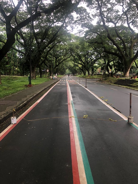
 The Academic Oval road original had two-way traffic along its wide carriageway, that could easily fit 4 lanes. Since it became a one-way, counterclockwise road, the lanes had been divided into 3 wide lanes with one lane initially committed to bicycles.
 Here are the two lanes designated for joggers/walkers (curbside) and cyclists (median). The pedestrian sidewalk was originally planned to be widened in time for UP’s Centennial celebration back in 2008. That did not materialize. The Academic Oval could have had wider sidewalks for those who are not walking for exercise.
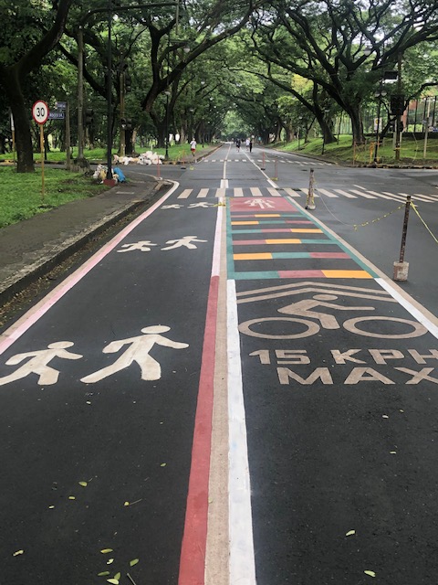
 The section in front of Melchor Hall features the words bicycles or bike lane and pedestrian in baybayin. Its certainly a novelty for now and something probably apt for the campus roads but not necessarily for others.
 A closer look at the baybayin script along the jogging/walking and bike lanes.
 Here’s the bigger picture on the pavement markings.
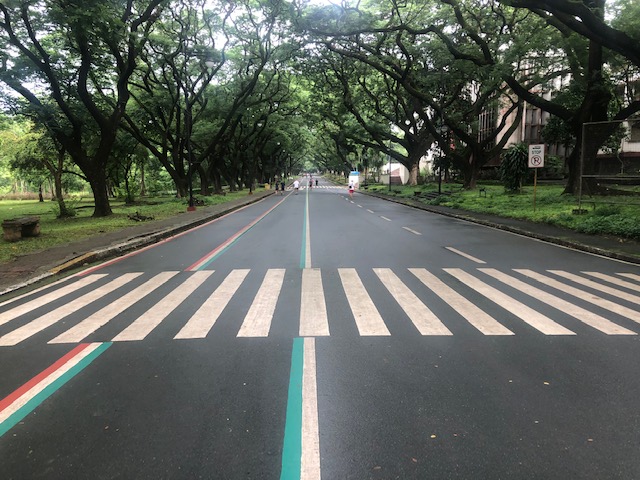
 Approach to an intersection
The UP colors inform riders about the intersection ahead. These are more visual as they are flat and not rumble strips. The older pavement markings advising riders of the speed limit should be seen in the context of utilitarian cycling (e.g., bike to work, bike to school) rather than cycling for fitness or recreation, which obviously may involve higher speeds and is frowned upon along the oval.
 The intersection approach from another angle.
The Academic Oval bike lane is one of the original recommendations of a transport study conducted for the campus about 17 years ago. The study was the basis for the campus being declared as a road safety zone, which among others included a provision for its roads to have a 30-kph speed limit. The one-way counter-clockwise traffic circulation and the jogging and bike lanes, however, are officially a part of what has become a long-term experiment on campus. There are many who oppose the one-way scheme and are vehement against the ultimate plan to have the Academic Oval car-free or car-less (it is mostly car-less during Sundays – part of the “experiment”).
The other new bike lanes on campus in Part 2 of this series.
–
A Bike Master Plan for Metro Manila, Metro Cebu and Metro Davao
Before Active Transport Week concludes this weekend, I would just like to share this collage from one of our staff at the National Center for Transportation Studies of the University of the Philippines Diliman. It is about the Master Plan developed for the three metropolitan areas in the country – Metro Manila, Metro Cebu and Metro Davao. I will share more details about this soon including a link or links to where you can download a copy of the plan.

The project concluded recently with the submission of the Final Report but most important is the Master Plan document that can serve as a reference for further development of bike lanes in the metropolises. I’ve seen the Master Plan and many of its provisions and recommendations can easily be adopted or is replicable in other cities and municipalities in the country. Perhaps, there should be a National Master Plan?
–
Roadside bike repair stations
Walking along 38th Street at the Uptown side of Bonifacio Global City (BGC) in Taguig, I came along this mini bike repair station conveniently located along the bike lane and just across from the schools along the street. It had some tools and a pump. Typical of what a cyclist or biker may need in case some quick repairs, adjustments or tire inflation are required. The first time I saw something like this was along Commonwealth Avenue; provided by a bicycle group that helped promote bike-to-work along that corridor and Quezon City.

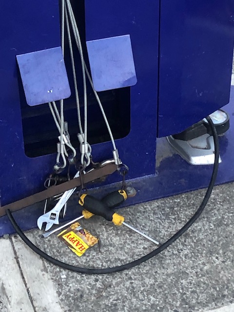

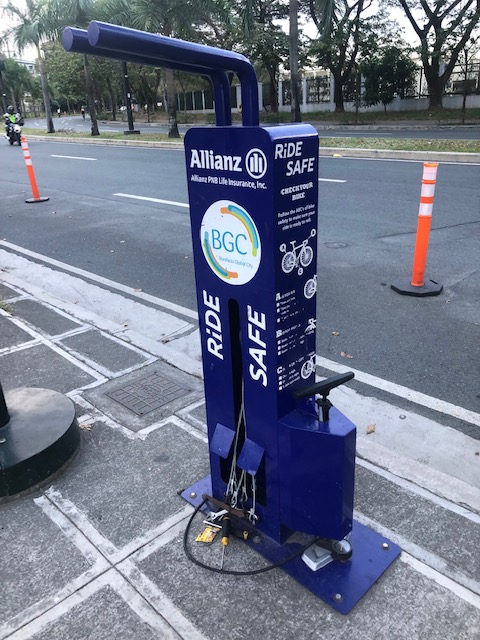
We need more of these especially along the major roads used by cyclists; especially those who bike to work. Granted that there are many bike shops and perhaps the vulcanizing shops as well as cyclists bringing their own tools and pumps but you never know when you will need some tools or perhaps a pump to inflate tires. Of course, these will need to be secured as there are people who have the propensity to steal, damage or vandalize tools.
–
An opinion on sharrows
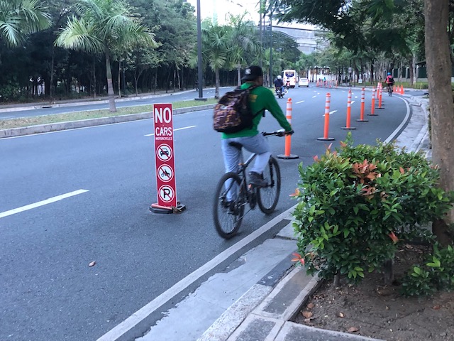
We conclude November 2021 with an article about shared lanes or shared right-of-way (thus, the term ‘sharrow’). These are lanes designated for use of both motorized vehicles and bicycles. I share many of the sentiments of the writer and there are many ways to go about to have legitimate, separate and maybe protected bike lanes for multi-lane roads (yes, the kind DPWH has been so keen in having along many national roads) should be the rule. For local roads/streets, however, there might be a need to compromise.
Flax, P. (November 7, 2021) “Why Sharrows are Bullshit,” Medium, https://medium.com/@peterflax/why-sharrows-are-bullshit-b01fea1fea6f [Last accessed: 11/30/2021]
I think the issue at the local level in the Philippines is that many roads are already quite narrow and cannot really accommodate bike lanes unless you ban motorized vehicles from using them (e.g., pedestrianization of certain roads/streets). While you cannot really close off so many roads, careful study by local governments should identify which streets can be pedestrianized over a certain period (i.e., phases) while others have shared lanes to accommodate the needs of residents and commercial establishments.
The above is just an example and should be subject to scientific or evidence-based assessments if such is indeed feasible. This can also provide an opportunity for education as people (i.e., road users) generally don’t understand the need for active transport facilities including what we assume to be common knowledge about the need for sidewalks, for example. Of course, other interventions may be implemented in order to “calm” traffic. Streets that are predominantly residential should have 20 kph tops as the speed limit. If such speed limits can be achieved and enforced then perhaps we can have safer streets, too, not just for cyclists but pedestrians as well.
–
