
Home » Posts tagged 'LRT 2' (Page 2)
Tag Archives: LRT 2
Another look at Marcos Highway pedestrian overpasses – Part 2
I purposely didn’t include the overpasses at and near the Masinag Junction because I felt they deserved their own article. For one, the area will be the location of the future end station of the current LRT Line 2 Extension project. Here are a couple of photos of the overpasses in the area.
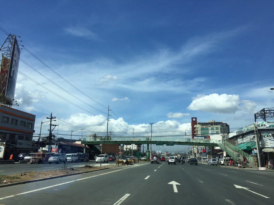
 Overpass at SM City Masinag – note the tall columns for the elevated tracks of Line 2. Will the Masinag Station be located that high or will it be at a lower level, perhaps closer to the SM City overpass?
The overpass at SM City Masinag is something that has been replicated in many other locations where an SM mall has been constructed. Note the similarity of the situation with the likes of SM City Iloilo, SM City Novaliches where SM built pedestrian facilities to allow for safe crossings between the mall and the area across from it along the highway. In many cases, it is the mall which provided the overpass in coordination with the local government unit and, I assume, the DPWH.
 Overpasses at Masinag Junction – there are actually 4 bridges here, each spanning one leg of the junction.
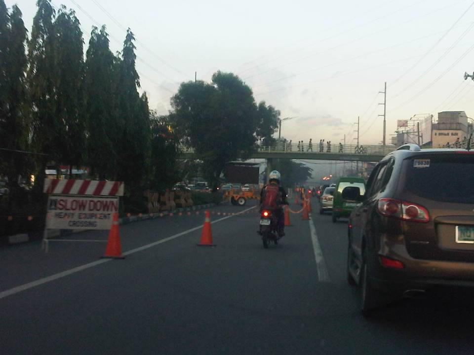
One of the intents for these is to eliminate at-grade pedestrian crossings at the junction. While crossing have been reduced significantly, there are still many “pasaway” who cross even when there is a green light for vehicular traffic along the leg they are crossing. Traffic enforcers here are quite lax about this and don’t seem to put in an effort to inform people about the overpass. There is no excuse for those who might claim they are too old or weak to climb the steps since the overpass has 4 working elevators for those unable to make the stairs. I noticed though that most of those using the elevators are able bodied people who probably are just too lay to take the stairs.
–
LRT Line 2 issues: elevated tracks vs pedestrian overpasses
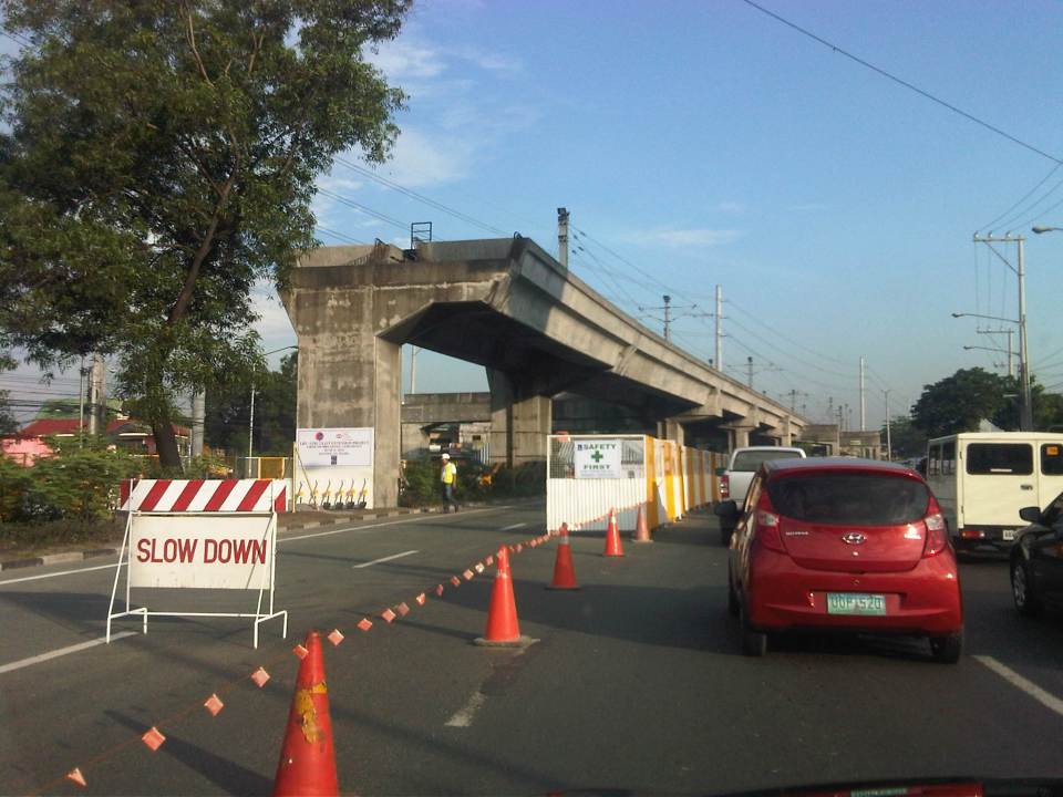
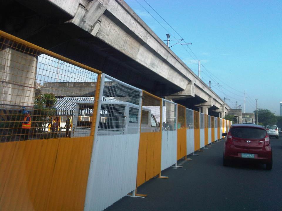
The ongoing construction of the LRT Line 2 Extension has reached a point where it is clear that several pedestrian overpasses will be affected by the project. Following are photos of overpasses between Angel Tuazon Ave./Felix Ave. and Masinag. Most are clearly along the elevated superstructure of the Line Extension and will have to be redesigned if not removed. Some are relatively new and so brings some questions whether those behind the overpasses coordinated with the proponents of the Line 2 Extension project.
 The practically new pedestrian overpass near the Vermont Royale subdivision gate will have to be redesigned to give way to Line 2’s elevated tracks. This is the view along the westbound side of Marcos Highway. Hopefully, the design will not be similar to the somewhat awkward and, some say, ‘people-unfriendly’ designs of overpasses along EDSA due to the MRT 3 tracks.
 Here’s a view of the same overpass from the eastbound side of Marcos Highway.
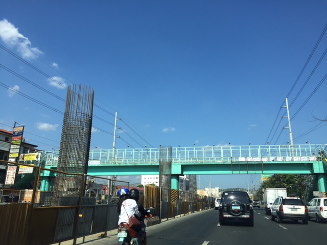 Another overpass that will have to be dismantled from the looks of the columns currently under construction is the one near the Filinvest East gate.
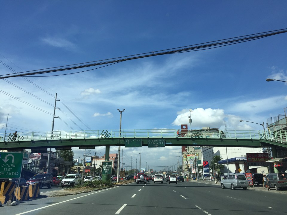
 The overpass across from SM Masinag may also have to go but since there will be a stations to be constructed in this area, there is an opportunity to integrate the pedestrian walkway with the elevated station.
I will try to take photos of other overpasses between Santolan and Sta. Lucia that may be affected by the construction of the Line 2 extension. The ones across Robinsons Metro East and De La Paz though might be integrated with the station that is to be constructed in the area. This would be similar to the SM Masinag overpass, which will presumably be integrated with the Masinag Station of the Line 2 extension.
–
Line 2 Extension construction at full swing
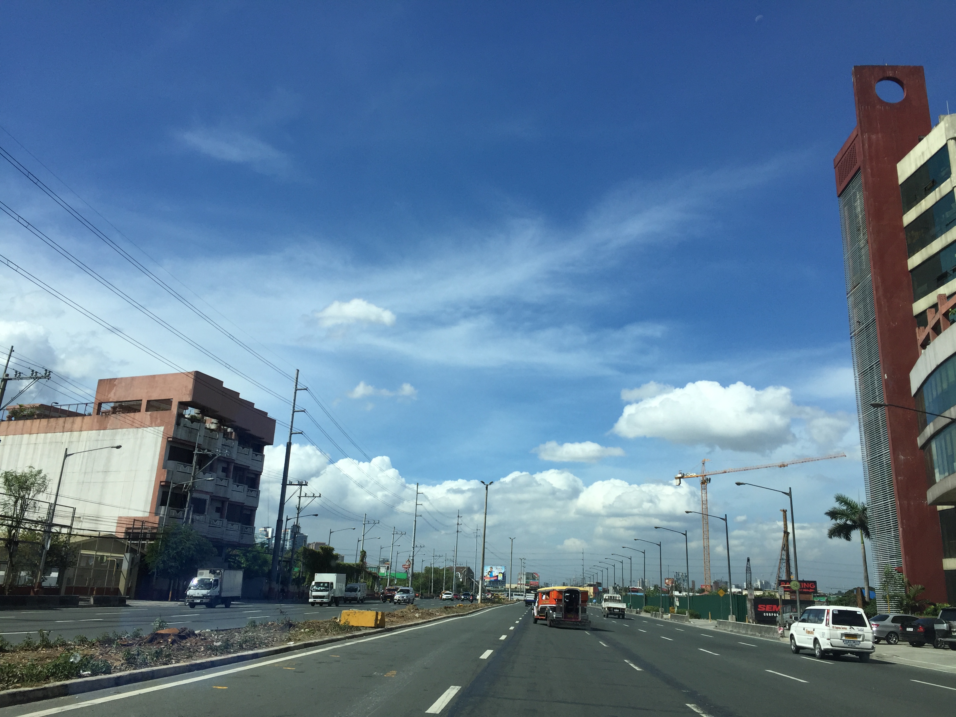
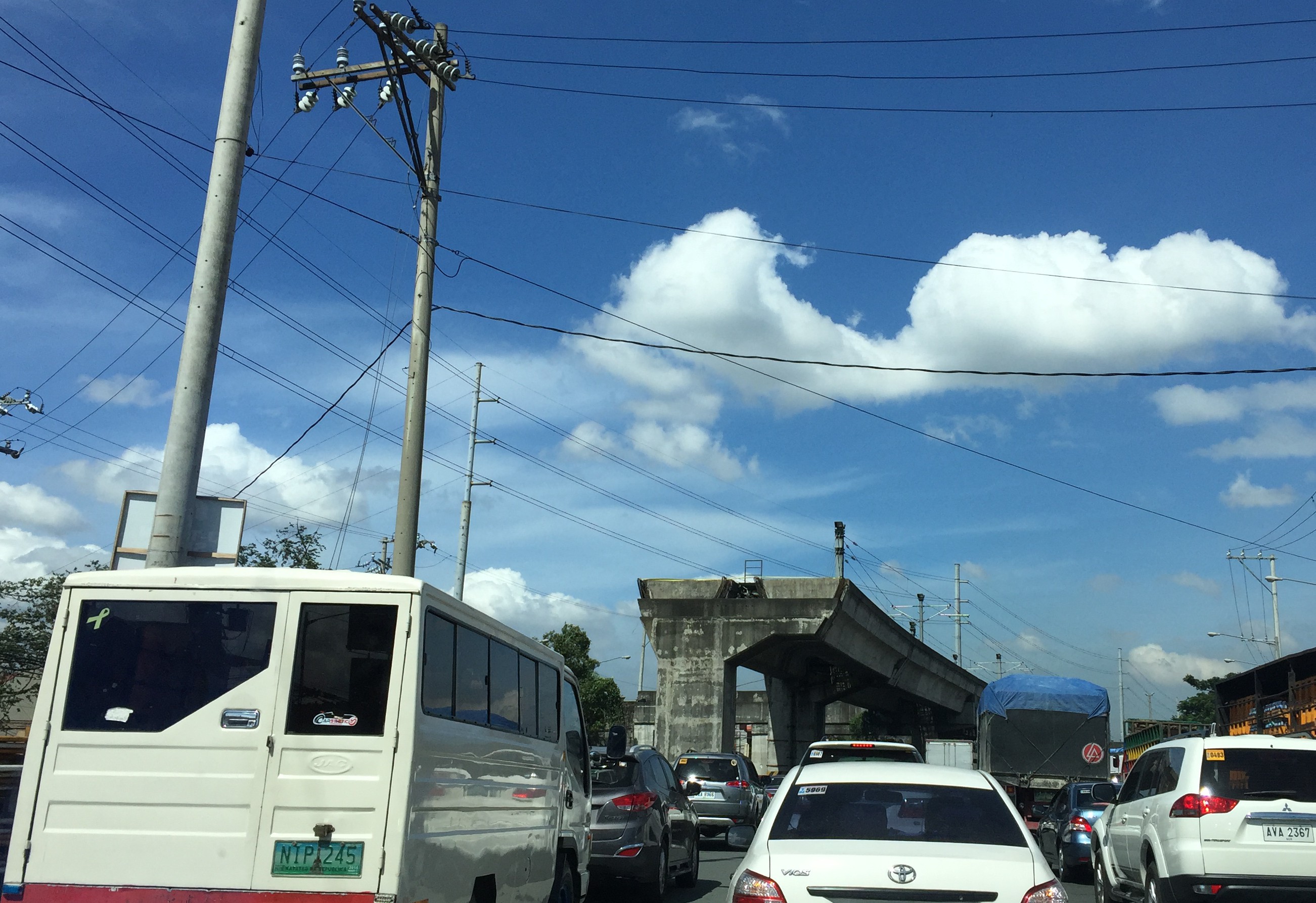
The construction of the LRT Line 2 Extension from Santolan, Pasig City to Masinag, Antipolo City is now in full swing. The contractor, DM Consunji, Inc., has occupied several lanes of Marcos Highway and the reduced capacity of the highway has led to moderate to severe congestion along sections from Ligaya to Masinag. At certain times, construction work required more space than the 2 lanes usually occupied by construction equipment and materials. Following are a few photos of the project showing various stages in the construction of the Line 2 extension.
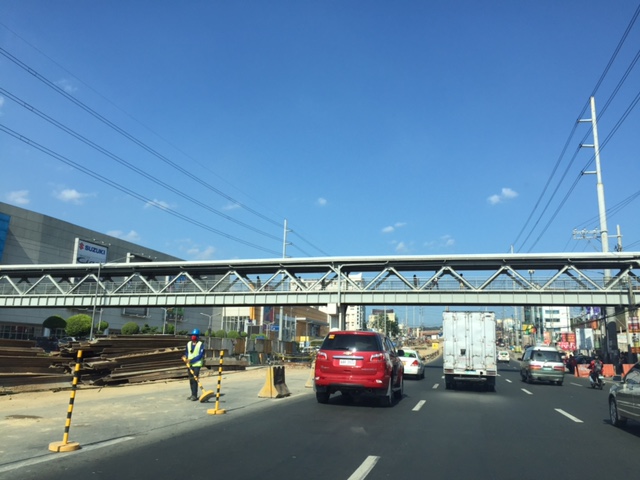
 Section in front of SM Masinag also showing the pedestrian overpass across Marcos Highway
 Section in front of Vermont Royal Executive Village also showing a newly constructed pedestrian overpass that looks like it will be cleared by the elevated tracks.
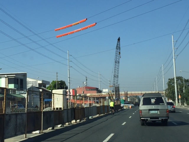
 Columns under construction along Marcos Highway across from Golden Meadows Subdivision.
 Columns completed and under construction across Town & Country Executive Village – the photo also shows another pedestrian overpass but from the completed column its clear that modifications aren’t needed for the overpass.
 Construction at the current end of the elevated tracks at Santolan, Pasig City
Construction works are expected to go on for at least a year before the trains can start test runs along the new tracks. This is definitely going to be a game changer in terms of commuting along this corridor once the extension becomes operational and hopefully DOTC is already planning an extension further towards Cogeo or perhaps branch out to Marikina via Sumulong Highway.
–
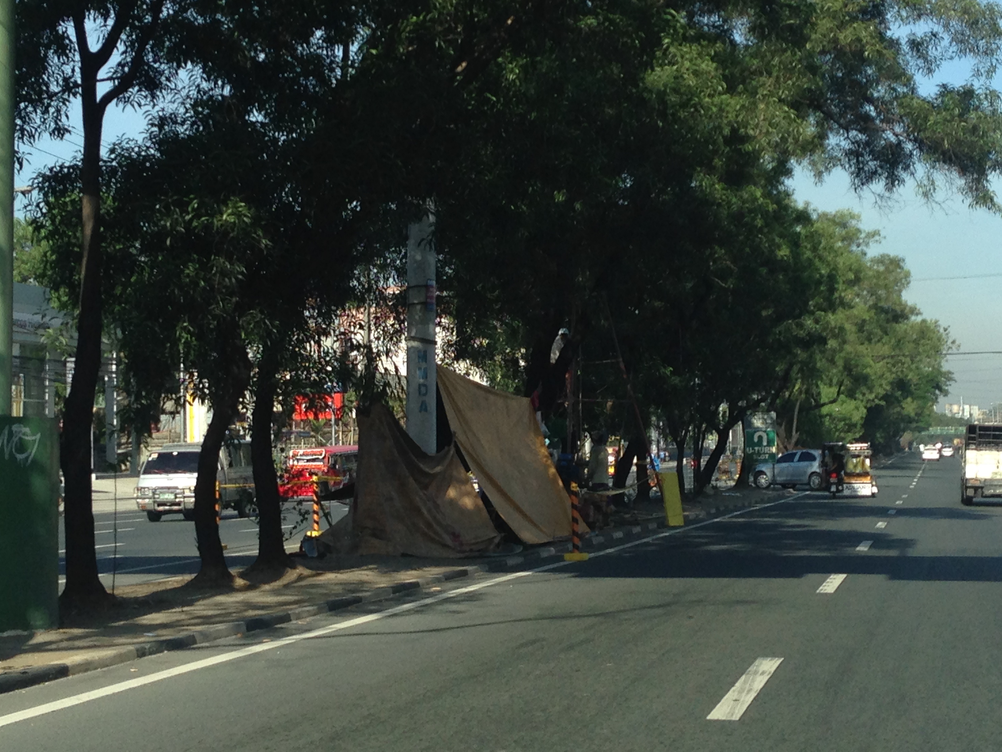
Updates on the LRT 2 Extension – no more trees!
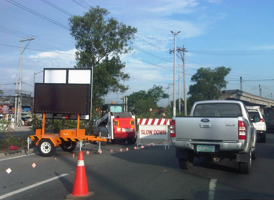
It’s been a while since I last passed by along Marcos Highway. This morning, I was a bit surprised by what I saw (or perhaps, more appropriately, what I didn’t see). The median along the section between Imelda Avenue all the way to Santolan has been cleared of trees. This was already expected as the contractor was already clearing the median for the past weeks. The work entailed fencing off the inner lanes of Marcos Highway and has caused congestion with the highway’s capacity significantly reduced and many motorists slowing down to observe what was going on (usyoso). Following are a few photos of Marcos Highway taken this morning.
 DMCI removed the barriers securing the inner 2 lanes to reveal a median clear of trees. The median will be where the columns for the elevated LRT Line 2 extension to Masinag will be constructed.
 I wonder what will become of the pedestrian overpasses along Marcos Highway. These structures would have to be redesigned with respect to the elevated structure of the LRT Line 2.
 Here’s the conspicuously clear median along Marcos Highway approaching Ligaya. The Ayala development can be seen on the right side along the Quezon City bound side of the highway.
 Waiting – Line 2 currently terminates just after Santolan Station where trains make the switch for the return journey.
–
The LRT Line 2 Extension gets underway
A lot of people have been waiting to see the construction of the LRT Line 2 extension from Santolan in Pasig City to Masinag in Antipolo City. Right after the groundbreaking ceremony last June, there seemed to be no activity along the alingment that was the center of Marcos Highway. Actually, there were already activities as the contractor already deployed personnel to do some surveys including marking the locations of the columns that will support the elevated tracks.
The past week saw the contractor setting up a work zone in the middle of Marcos Highway and stretching from across Robinsons Metro East and McDonalds. The work area included what was the opening for the Felix Avenue-Marcos Highway intersection. This is probably one of the busiest if not the busiest stretches of Marcos Highway so the reduction by one lane for either direction of the highway immediately had a negative impact on traffic. Added to the highway capacity reduction in terms of the remaining available lanes is the further reduction due to the ‘usyoso’ behavor of motorists ‘inspecting’ the work zone as they pass by.
 Work zone across from Robinsons Metro East – direction of traffic to Masinag (eastbound)
 Work zone at the junction of Imelda Ave. (formerly Felix Avenue formerly Imelda Ave.), Gil Fernando Ave. (formerly A. Tuazon Ave.) and Marcos Highway
 Work zone near McDonald’s (on the other side -westbound – of Marcos Highway) and also near a major U-turn slot used by vehicles coming from Imelda Ave that are westbound
Traffic will definitely be heavy along this section and the rest of Marcos Highway once construction is at full swing. I am tempted to say that it might be worse than the NAIA expressway construction site of which the contractor is the same. I just hope the appropriate traffic management measures are implemented and that road users will be cooperative. This will likely be a couple of years’ sacrifice for anyone living along this corridor and the major roads connecting to it. Will there be a light at the end of the proverbial tunnel? There should be as LRT Line 2 will finally be able to serve an area wanting of efficient and reliable public transport.
–
Finally, the LRT Line 2 Extension begins construction
The groundbreaking ceremony for the extension of the LRT Line 2 from Santolan, Pasig City to Masinag Junction in Antipolo City was held last June 9, 2015. This marks the beginning of the construction of the much anticipated and much delayed extension of the line to what was supposed to be part of the first phase of Line 2. I say supposed because most experts believe the current line should have terminated at Masinag from the start instead of at Santolan where the depot is located. Masinag had much more sense many years ago as it was a good staging point for possible extensions to Cogeo, Antipolo City proper or Marikina City. The areas along the Marcos Highway corridor beyond Masinag alone have experienced tremendous growth especially after the floods of Ondoy (Typhoon Ketsana), which submerged much of the Marikina Valley including Pasig, Cainta and lower Antipolo.
 Traffic cones and signs guide motorists away from the inner lanes of Marcos Highway.
 Two lanes from each side of Marcos Highway at the current end of the Line 2 were appropriated in addition to the median for the groundbreaking ceremony.
 The stage is set – the stage for the ceremony is set under the viaduct with these barriers practically shielding the participants from curious passers-by (usyoso). Regardless, the event cause congestion along the highway.
Of course, that was the groundbreaking ceremony. As of today, there’s no sign yet of the contractor, DMCI, fully mobilizing and already reserving the inner lanes of Marcos Highway for the construction of the viaduct and stations. If the current works for the NAIA Expressway in the airport area is to be a reference, then severe traffic congestion is to be expected along the highway and this will extend beyond the actual construction site from Santolan to Masinag. As such, the public will experience inconvenience for the next so many months or perhaps couple of years (or more if there were delays). However, I believe that once the line is operating all the way to Masinag, it will help to ultimately decongest Marcos Highway and Aurora Boulevard and a lot of people will benefit from the improved travel times.
Incidentally, the term LRT is actually a misnomer here because among the 3 operational rail mass transit lines (I am excepting the PNR Commuter Line here.) in Metro Manila, Line 2 is actually a heavy rail system. Perhaps the government should already correct this by simply referring to Line 2 as ‘LRTA Line 2’ or renaming LRTA to reflect its nature as a transit authority that should not be limited to light rail only.
–
Compromising on the common station(s) for the Metro Manila rail lines
It seems that the issue regarding the common station for Line 1, Line 3 and the future Line 7 in the North EDSA area has not yet been resolved. The interested private sector parties, Ayala and SM, will not back down on their arguments support each’s proposal for the common station to be located at either of the giant malls that each corporation owns. Ayala’s claim is that the contract for the Line Extension to Cavite stipulates that the common station with Line 3 should be at Trinoma. Meanwhile, SM is claiming the validity of an agreement it made with DOTC on a grand central station to be located across their SM City North EDSA mall. The last one is consistent with an even earlier agreement with the proponents of the future Line 7 for an end station in front of SM.
A compromise solution to the impasse should be in the works and is the responsibility of the DOTC. What if instead of one common station, two stations are made into common ones? There will be no grand central station in the sense that all three lines will terminate as presented in SM’s version nor will there be a common station for Lines 1 and 3 at Trinoma that incorporates a very long walkway to a Line 7 station near Mindanao Avenue. Instead there can be two common stations – one at SM North for Line 1 and Line 7, and another at Trinoma for Line 1 and Line 3. Line 1 will still terminate at Trinoma but can have another stop at SM North where there can be a smooth transfer between Line 1 and Line 7, which terminates at this station. Perhaps there should still be a walkway connecting the two common stations in the interest of pedestrians although seamless fare collection systems and platform design can easily allow Line 7 or Line 3 passengers to ride Line 1 trains between stations to transfer to Line 3 or Line 7.
The common station or stations (depending on what will finally come out of this) should be designed thinking of the best interests of the public who will be using the transit systems and stations. Lost in the discussions are the plight of commuters. Parties claim that their designs are in the best interest of commuters (actually SM has the better set-up of all three lines terminating at one central station) and yet the bottomline for their arguments are very much revenue oriented – not for the transit lines but for their own commercial developments. Its basically one mall vs. another, leaving out the public as incidentals in the discussions. This is why government must intervene and this is where DOTC should show it has a spine after all and is promoting the public good and not favoring one private company over another. And so we’ll wait and see what will eventually come out of this although a lot of people continue to suffer with their inefficient commutes and are definitely becoming more impatient about mass transit systems that should have been constructed a long time ago.
–
Anxious about the LRT Line 2 Extension
Among the overdue projects that have generated much attention and, quite recently, some excitement is the extension of the LRT Line 2 from the current end station at Santolan, Pasig to Masinag Junction in Antipolo. This is a 4 kilometer stretch that has been viable for quite a long time now but somehow has not been constructed for various reasons. It was among the low hanging fruits that the current administration should have picked that could have been completed and operating now if it were started sometime 2011 (i.e., factoring in the transition in government after the 2010 Presidential elections). For some reason, government officials had to get proof that there was passenger demand for the extension by considering having another study undertaken just for this purpose. As I’ve mentioned before, one only needs to observe the situation at Santolan Station and perhaps the Sta. Lucia/Robinsons Metro East area to understand just how many people will benefit from the extension to Masinag. I would even dare say that you can even justify extending the line further to Cogeo. Following are a few photos I recently took along Marcos Highway along with some comments pertaining to the Line 2 extension construction.
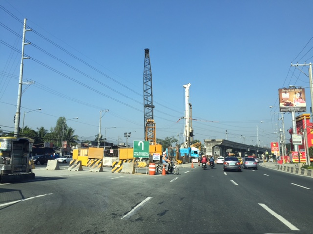
 Soil testing site along Marcos Highway in Pasig City – these activities preclude the designs for the superstructure, which include the elevated tracks and the stations (there will be 2) along the Line 2 extension.
 Another soil test site – each location roughly correspond to the location of the columns that will be constructed to support the elevated tracks and stations.
 Scenes of overloaded jeepneys should no longer be the norm once the Line 2 extension is completed. However, such would probably be common for jeepneys coming to or from the last station at Masinag. There are no other choices for people taking public transport beyond Masinag except jeepneys bound for destinations like Antipolo Simbahan, Cogeo, Tanay and Marikina.
 Pedestrian overpasses such as this relatively new one near the Filinvest East main gate would have to give way to the elevated Line 2. Another option is for this and other overpasses to be reconfigured with respect to the future line. I just hope this will be done with utmost care so we won’t have overpasses similar to those along EDSA that go above or below the elevated tracks of the MRT 3.
 This overpass will like be removed to give way to the future end station of the Line 2 extension. The overpass in front of SM Masinag will have to be integrated with the station to be located in this area.
–
Cubao Aurora
Cubao is one of the busiest areas in Metro Manila where a lot of public transport routes converge. It is a major transfer point for road and rail transport particularly near the junction of three major roads – EDSA, Aurora Boulevard, and E. Rodriguez Avenue, which is only a few meters from EDSA. I took a few photos when I was in the area one time and here they are:
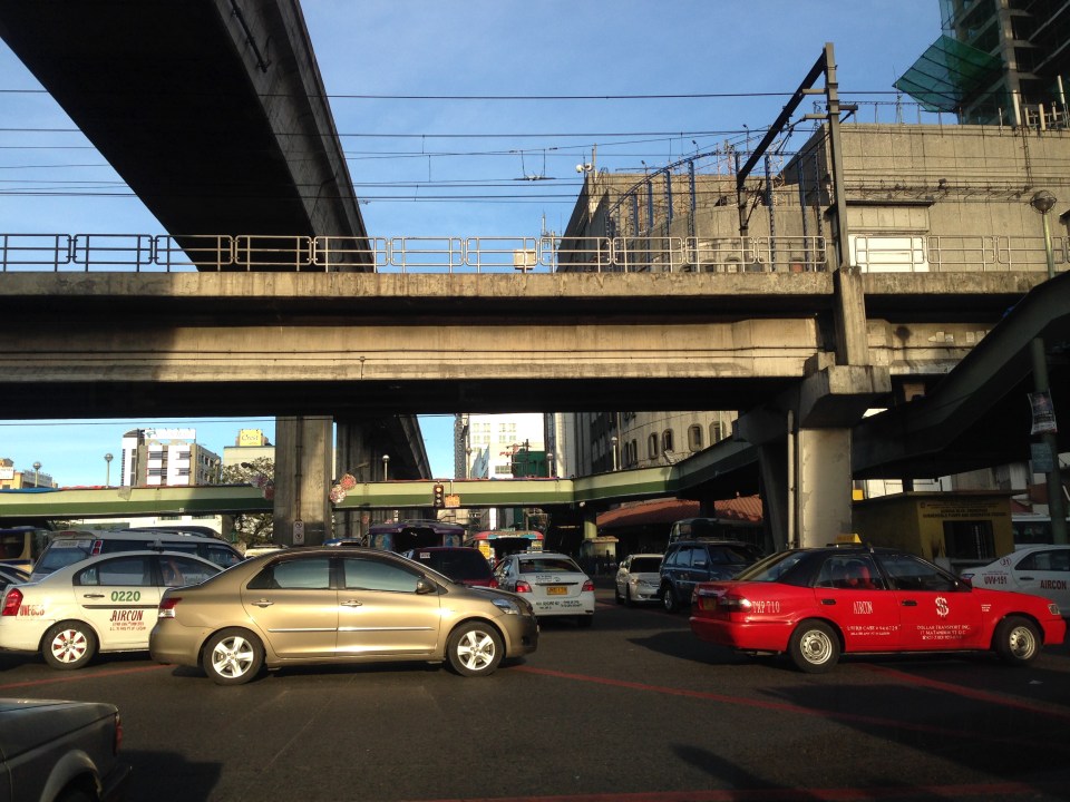 EDSA and Aurora Boulevard intersect at ground level. There is, however, an underpass along EDSA bypassing the at-grade intersection. Shown in the photo are the two rail transit lines passing through the area – EDSA MRT 3 at the 2nd level and LRT Line 2 at the 3rd level.
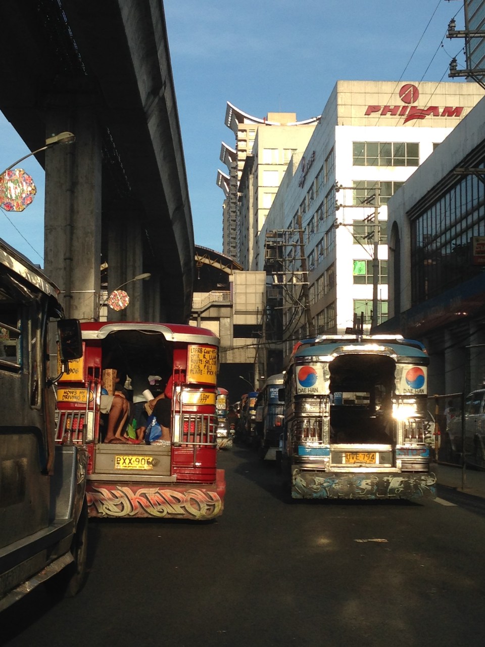 After crossing EDSA, eastbound jeepneys approach the LRT 2 Cubao Station, which is beside the Gateway Mall of the Araneta Center. Traffic along this section of Aurora Blvd. is typically slow as jeepneys bound for different destinations in the east congregate here. Meanwhile, on the other side of EDSA, the same situation is experienced as jeepneys line up along informal terminals on the street. This usually leads to congestion and low throughput along Aurora at the intersection.
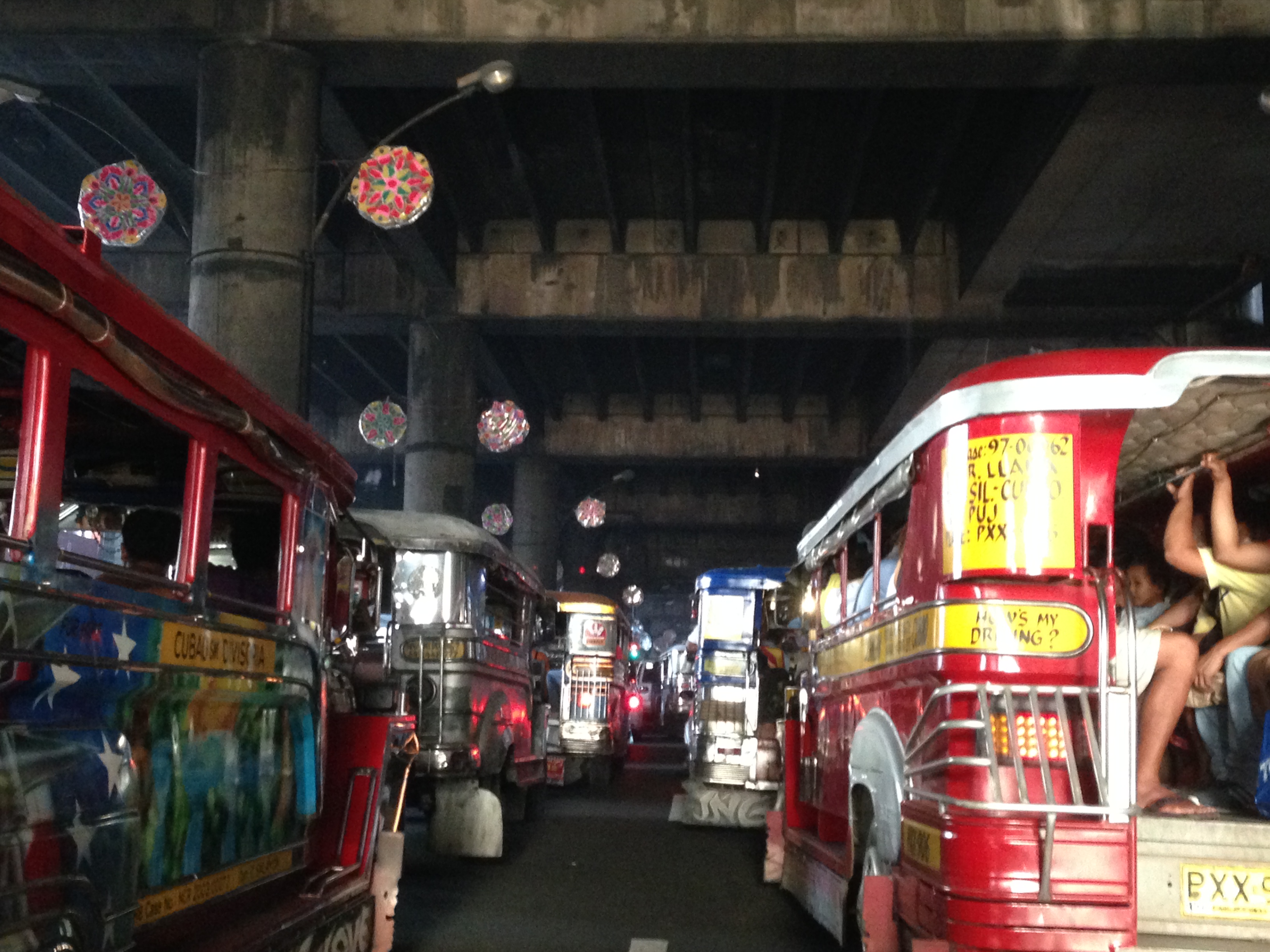 Jeepneys tend to linger under the LRT 2 station and occupy practically all the lanes with most jeepneys deliberately moving at snail’s pace as they try to get passengers. This is the case along both directions of Aurora Boulevard, which makes one wonder why many people don’t take the LRT instead. Of course, for eastbound passengers, the answer is simply that the LRT ends at Santolan Station in Pasig (along Marcos Highway and just after the Marikina River). Most passengers would rather take a single, direct jeepney ride from Cubao to their destinations rather than make the difficult transfer at Katipunan (for Marikina-bound passengers) or Santolan (for Rizal and Pasig-bound commuters).
I wanted to take some photos during the night time one time we were passing under LRT 2 along Aurora Boulevard near the Gateway Mall. The area wasn’t well lighted though so all the photos didn’t come out right. This blight is similar to the situation along the LRT Line 1 corridor stretching from Caloocan to Pasay, and affecting areas along Taft Avenue and Rizal Avenue. The areas including the rail superstructure are so dirty mainly because of the emissions from road vehicles, particularly jeepneys, buses and trucks with surplus and generally poorly maintained engines. Hopefully, the local governments and MMDA can address problems of bright with a campaign to install pocket and hanging gardens like the ones already along EDSA. The plants, if cared for properly, will surely help improve both air quality and aesthetics in these areas darkened by design and soot.
–
Identifying opportunities with the MRT 7 and the LRT 1 extension
As we welcome 2014, we also look forward to major projects that will help alleviate transport and traffic problems in our cities and elsewhere in the Philippines. With the approval of the MRT 7 and LRT 1 south extension projects late last year, there should be less impedance to these much-delayed projects starting construction within the current term. These lines should have been built way back, – “ideally” in the 1980s, “practically” in the 1990s, and “urgently” in the last decade. At this time, I think the need for these lines are beyond urgent. I think perhaps we have reached the state of “desperation” is so far as mass transportation is concerned for Metro Manila and its surrounding cities and municipalities.
 MRT 7 map from a public presentation made by the line’s proponents about 5 years ago.
Opportunities that can be related to the MRT 7 and LRT 1 lines include land development that fall under the category of transit oriented development (TOD). I think the government should not be too dependent on the private sector for developments around and near the future stations of the rail lines. The prevailing assumption that the private sector will do what’s best is only applicable to themselves and not the public good. Note the difference between perspectives here where it is only to be expected that private companies will be concerned with their own bottom-lines, i.e., revenues generated towards the maximization of profits. Economic benefits are and should be treated or regarded differently from such a perspective. The latter is the responsibility of the government as it concerns the public good and interest, and with a more macroscopic and strategic scale, with a long-term vision for development.
One such opportunity concerns informal settlers and their resettlements to areas outside the CBDs. Why do these people keep on returning to the cities when they are already supposed to have been provided housing elsewhere (e.g., Bulacan, Laguna, Cavite, Rizal)? The answer seems almost automatic: they don’t have the means for livelihood where they have been relocated and access to basic services and jobs/workplaces is limited (i.e., very difficult). The government must be involved and very deliberate in developing lands for housing around or near rail stations such as those for the future MRT 7 development. It cannot rely on the private sector to push for public housing when, frankly, those companies are driven by their desires to maximize their profits rather than push for the public good. That’s a bit of reality that we must accept and we must factor in decision making. The government already lost a huge opportunity when the National Housing Authority (NHA) effectively gave away prime lands in Quezon City for an upscale development. I leave it up to the reader to check the mandate of the NHA. It could have pushed instead for a development much like the HDBs in Singapore, which are not located in the boondocks but in prime locations in the city state. It need not be purely residential but a healthy mix of commercial development should be pursued along the lines of equitable transit oriented development (TOD).
Note that it should be clear here that when I say public housing this does not necessary mean the mass housing or low cost housing we tend to associate with failed projects in the peripheral provinces to Metro Manila. These are more like multi-level, medium to high rise developments you now find in major cities in Japan, China, Thailand and Singapore, which can be the model development for replication in other cities around the country. These can be reasonably priced units that can be affordable in terms of payments over a reasonable period of time. The concept is not new as there have already been BLISS projects before and Quezon City continues to collaborate with private sector for projects like Smile, Sunny Villas and the current Bistekville. These should be extended not just to your middle class and upper class (yes, they do make investments and have their units rented out to derive income) but formulated for the lower income classes (e.g., informal settlers), which now occupy much lands with their shanties. “Formalizing” these settlements should be a priority and the best locations for such developments, I think, should be around stations. Of course, there should be clear rules regarding the neighborhood and these rules should be strictly enforced for the buildings and area to keep their integrity (e.g., no extensions to the balconies or windows).
The concept and application of land-banking is not new and has been used by the private sector especially major developers like Ayala Land, Filinvest, Sta. Lucia, SM and Robinsons. Properties are acquired based on criteria regarding their potential for development. These lands are usually of low value and in many cases the land use need to be changed in order for these to be developed (e.g., agricultural lands being converted into residential, commercial or industrial uses). The national government and local government units should also do land-banking perhaps to address issues, for example, on informal settlers. And land banking should be along transit lines that are being planned (e.g., in Bulacan for MRT 7, in Cavite for the LRT 1 Extension, in Rizal for the LRT 2 Extension, and in Laguna for the PNR Commuter Line) so that issues pertaining to access to jobs, education and other services can be addressed by such transport infrastructure.
We look forward to the government realizing such opportunities that have for so long been available yet it has not taken into serious consideration. These require both strategic and practical thinking to be able to undertake master planning for such developments and their implementation over the immediate to long terms. No easy task but if our leaders are focused and determined to see these through, there’s no reason why these cannot be implemented and operational soon. Hopeful we are for these things this 2014.
Happy New Year!
–
