
Home » Posts tagged 'pedestrian' (Page 2)
Tag Archives: pedestrian
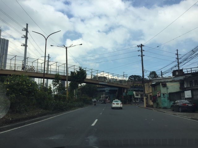
Vermont Royale pedestrian overpass
There was a comment on a previous article asking if the pedestrian overpass across Vermont Royale along Marcos Highway is already usable. The photo in that article showed a still-to-be modified overpass. Following are photos taken last Sunday of the overpass. It shows the lowered mid-section passing under the Line 2 extension structure.
 The modified pedestrian overpass across Vermont Royale along Marcos Highway
 That’s a pedestrian and a cyclist using the overpass
–
Footpaths at the College of Engineering Complex, UP Diliman
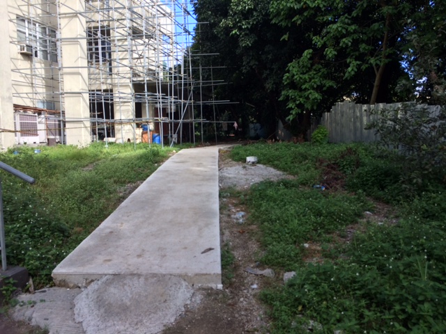
There are newly constructed concrete footpaths connecting the buildings of the College of Engineering complex at the University of the Philippines Diliman. These are intended for pedestrians to be able to walk between buildings without worrying about weather-related concerns such as muddy paths during the wet season.
My colleague took the following photos while walking towards the Institute of Civil Engineering building from Velasquez Street where the university has a portal leading to its housing for faculty and staff.
 The concrete pathway is a significant improvement from the old dirt path that seemed to have been carved out of people’s trekking along this path over the last year or so.
 The path connects buildings at the area designated for the College of Engineering Complex. Many buildings such as the one above are under construction or to be constructed in this area.
 Much of the pathway goes through trees and other plants, preserving the greens already there that help provide a more enjoyable environment for walking.
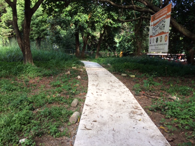 The pathway was dubbed the “Engineering Unity Path” as it connects buildings that are homes to individual institutes and departments that constitute the College of Engineering.
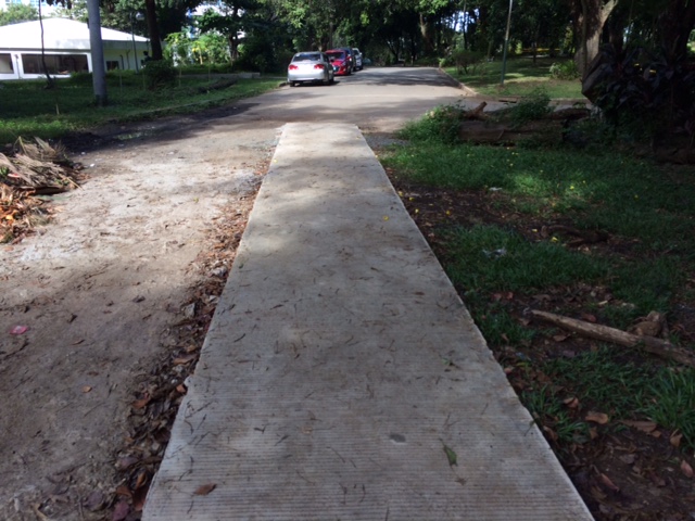 End of the road – one end of the foot path leads to Maramag Street and the driveway to the Executive House, the official residence of the UP President.
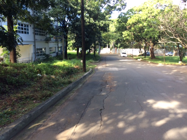 Maramag St. towards the Institute of Civil Engineering (ICE) complex with the ICE main building at left
While the pathway seems to be a permanent structure it is something I think is basically evolving just like the College of Engineering Complex. The complex already has a master plan but implementation towards a cohesive complex seem far from completion. For one, much of the complex covers a residential area in the university that has many (too many) informal settlers. And then there is the Executive House at the heart of the complex that probably needs to be moved elsewhere.
–
Another look at Marcos Highway overpasses – Part 3
The overpass at SM City Marikina is a bit more complex than what it looks like across the bridge. Here are some photos of the footbridge connecting the mall with the Santolan Station of Line 2:
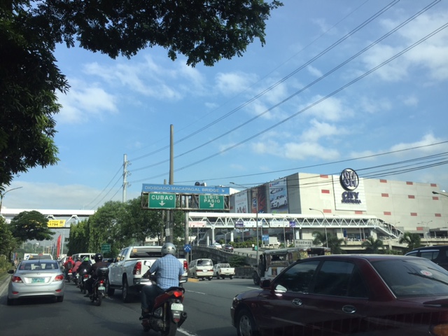 The overpass is a very long one and provides users with a partially covered walkway connecting to the LRT Line 2 Santolan Station. I say ‘partially’ because the roof over the overpass extends only across Marcos Highway.
 Note the covered bridge is only until the other side of Marcos Highway. From there it is an open overpass as shown at the left in the photo above.
 A closer look at the SM Marikina overpass shows just where the cover ends. There are stairs here leading to the loading/unloading bays across from the mall. There is also a path that leads to stairs to the public transport terminal under the bridge. There is a sign with a blue background in the photo stating the terminal is named after a former MMDA Chair who was also a mayor of Marikina and currently one of its congressmen.
–
Another look at Marcos Highway pedestrian overpasses – Part 2
I purposely didn’t include the overpasses at and near the Masinag Junction because I felt they deserved their own article. For one, the area will be the location of the future end station of the current LRT Line 2 Extension project. Here are a couple of photos of the overpasses in the area.
 Overpass at SM City Masinag – note the tall columns for the elevated tracks of Line 2. Will the Masinag Station be located that high or will it be at a lower level, perhaps closer to the SM City overpass?
The overpass at SM City Masinag is something that has been replicated in many other locations where an SM mall has been constructed. Note the similarity of the situation with the likes of SM City Iloilo, SM City Novaliches where SM built pedestrian facilities to allow for safe crossings between the mall and the area across from it along the highway. In many cases, it is the mall which provided the overpass in coordination with the local government unit and, I assume, the DPWH.
 Overpasses at Masinag Junction – there are actually 4 bridges here, each spanning one leg of the junction.
One of the intents for these is to eliminate at-grade pedestrian crossings at the junction. While crossing have been reduced significantly, there are still many “pasaway” who cross even when there is a green light for vehicular traffic along the leg they are crossing. Traffic enforcers here are quite lax about this and don’t seem to put in an effort to inform people about the overpass. There is no excuse for those who might claim they are too old or weak to climb the steps since the overpass has 4 working elevators for those unable to make the stairs. I noticed though that most of those using the elevators are able bodied people who probably are just too lay to take the stairs.
–
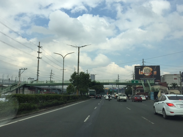
Another look at Marcos Highway pedestrian overpasses – Part 1
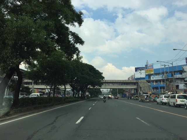
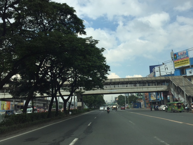
My daily commute allows me to have a look at the progress of the LRT Line 2 Extension construction. I also became curious about the situation of the pedestrian facilities along Marcos Highway particularly the crossings since many at first seemed to be affected by the elevated rail structure that was to be built. Now, we already have a good idea of the fates of these pedestrian overpasses. This article shows the conditions/situation of pedestrian overpasses (also called footbridges) along Marcos Highway. Most overpasses are not covered; exposing pedestrians to the elements. Most are also made of steel, which can be traced to the MMDA’s (and later the DPWH’s) preference for these structures.
 Overpass near Filinvest East-Vermont Park gates – the overpass actually is between a technical college and the commercial building across from it.
 The overpass across from Vermont Royale in front of a new Shell service station was actually among the newest facilities along Marcos Highway. Apparently though, it was built without considering the impending construction and design of the Line 2 extension. As such, the overpass needs to be modified or would have to be reconstructed elsewhere near the area.
 Overpass at Town & Country Executive Village that is also near the San Benildo School
 Overpass at Marcos Highway-Felix Avenue-Gil Fernando Avenue intersection – is probably the busiest among the pedestrian overpasses as it is at a busy junction where there are major commercial establishments (i.e., malls) and where many public transport routes converge.
 Robinsons Metro East overpass – this one also survived the clearance requirements with respect to the elevated superstructure for the Line 2 extension. However, since one of the two stations to be built will be nearby if not right across (part of the station at least) from the mall, then the station itself may function as an overpass.
 Overpass at De la Paz – note the ramp for bicycles and wheelchairs. This is one of the more bike- and PWD-friendly facilities along Marcos Highway. The slope is gentle enough for pedestrians, too, especially senior citizens who might have difficulty with steps.
 Overpass at Ligaya – this one also has ramps that make it easier for people to use to cross the busy highway. This will eventually be the closest overpass to the huge Ayala mall (Feliz) currently under construction at the Marikina side of Ligaya. I suspect that there might be a need for another overpass to be built with respect to the mall for one to directly serve the mall’s customers.
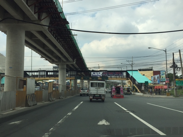
 Line 2 Santolan Station overpass connects the Marcos Highway westbound public transport stop with the rail station along the eastbound side of the highway.
 A closer look at the Santolan Station overpass, which is used by a lot of Line 2 passengers who cross the highway to continue on their journeys/commutes via train from their origins in Rizal, Marikina and Pasig. During the mornings, the observer will see a lot of jeepneys and UV Express vehicles emptying of passengers who cross the bridge to get to the station.
 Santolan footbridge – this is actually more complicated than what is seems in the photo because the steel footbridge also connects to the SM City Marikina overpass (which is not included in this compilation but is visible in the photo). The footbridge branches to provide and almost direct connection between the mall and the Line 2 Santolan Station. That structure is shown at
 Monte Vista footbridge allows people to cross Marcos Highway (at its Marikina/Quezon City end) to and from A. Bonifacio Avenue, which is in Marikina City (Barangka)
More on pedestrian overpasses in the next post!
–
Walking is good for you!
I found the following graphic on social media (Facebook). It shows the benefits of walking, particularly 30 minutes of walking per day. There are many studies that have established the benefits of what is now termed as ‘active transport’ that includes walking and cycling to promote healthy communities and cities. If only our communities and cities are more walkable then perhaps more people can be encouraged to walk more and there will be a reduction of motor vehicle traffic. The latter will be those vehicles used for short distance trips that are typically associated with distances suitable for walking rather than riding or using a motor vehicle.

–
NAIA Terminal 3 – Newport connector
Currently under construction is a bridge connecting the Ninoy Aquino International Airport (NAIA) Terminal 3 and the Newport City complex across it. Once completed, it will be a convenient physical connection between the airport and the complex of hotels, residential condominiums and commercial establishments. The connection will be at a third level above the NAIA Expressway that is currently under construction. Here are a few snapshots of the bridge:
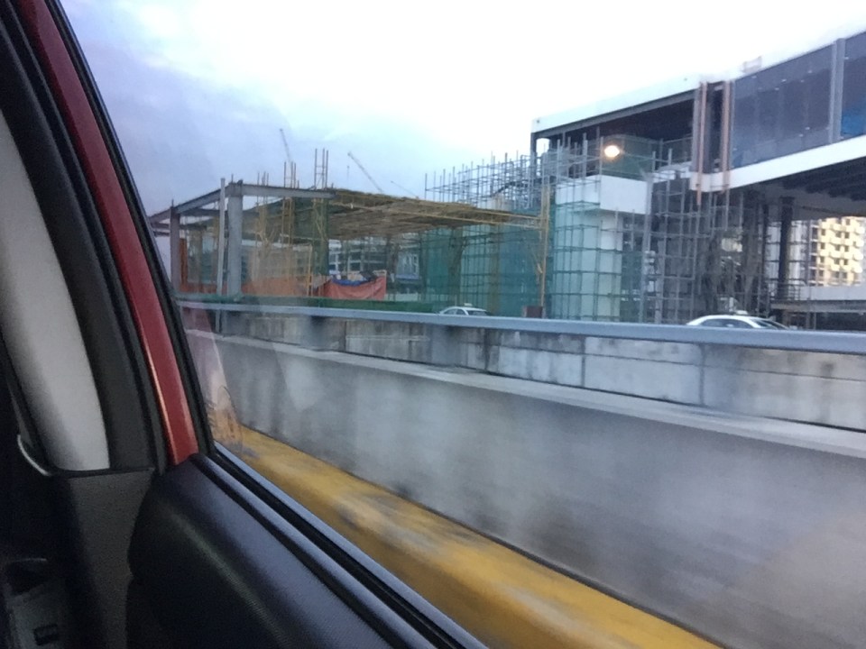 Under construction: a bridge connecting NAIA Terminal 3 and the complex that includes, among other, the Marriott Hotel and Resorts World Manila
 Another snapshot of the bridge under construction. The dome in the background is of the Shrine of St. Therese of the Child Jesus across from Terminal 3.
–
Buses giving way to pedestrians
We saw a sign on a bus at Bonifacio Global City (BGC). Hopefully, the drivers of all buses plying routes in BGC practice this and stop for pedestrians crossing at the designated lanes. Perhaps they should also be proactive in stopping also for jaywalkers as this is the safe practice even if these pedestrians also endanger others by crossing juts anywhere including the most unsuitable places (e.g., blind spots).
 Signs at the back of a Fort Bus including one regarding giving way to pedestrians crossing at designated lanes. Another sign cautions drivers of following vehicles about the bus making wide turns. These are good for promoting road safety.
–
The benefits of walking
I came across an old article on walking that appeared in The New Yorker in 2014. This was after reading another article my wife shared that also was about walking. One is about both the physical and intellectual benefits of walking while the other was about walking without a purpose. Both were about walking and thinking, and definitely about the benefits of even a short stroll to our physical and mental being.
Here’s the article from The New Yorker: Why walking helps us think
And the article from BBC: The slow death of purposeless walking
I highly recommend both articles as we ponder about making our cities safe for pedestrians/walking.
–
Encouraging and providing incentives for walking
A friend based in Singapore posted a photo showing a poster promoting a ‘National Steps Challenge’. The objective apparently and obviously is for Singaporeans and foreign nationals living there to get into walking. The target, according to the poster, is 10,000 steps per day. There are even illustrations in the poster showing estimates of how many steps you can do at the home, the office or during your regular commute.
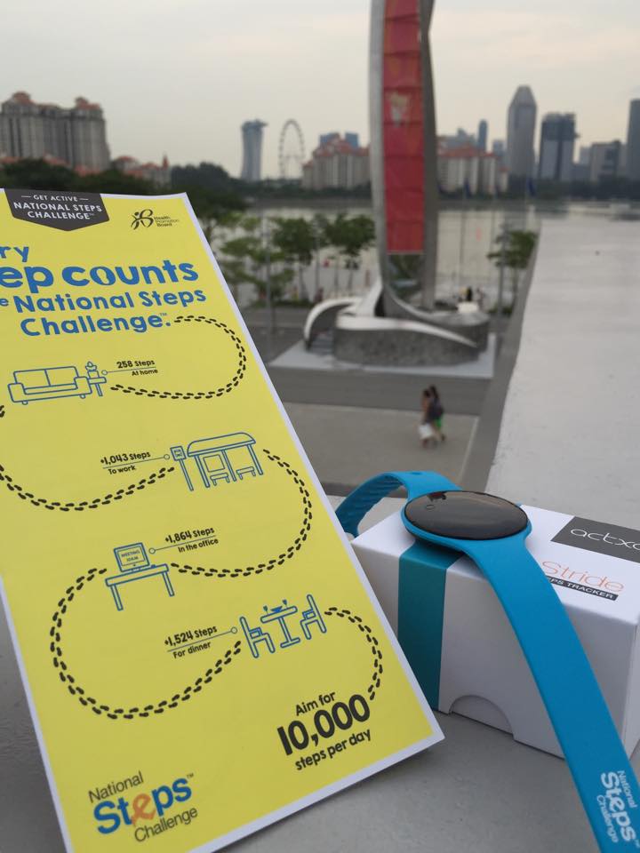 [Photo courtesy of Engr. Joy Garcia]
Such programs are exemplary and are aimed at boosting citizen’s health and welfare. Of course, Singapore can do this and many will respond even without rewards because Singapore has excellent transport infrastructure including an extensive public transport system and suitably designed pedestrian facilities.
Can cities in the Philippines come up with a similar challenge? Are there cities with good enough pedestrian facilities that can lead the way and become good practice examples in promoting walking; not just for the reason of commuting but also as a means to achieve better health among its citizens? Authorities can even include infographics on promotions showing the number of calories you can burn for typical walking trips as well as the health benefits one can derive from walking regularly. I think there are many cities that have decent infrastructure and attractive routes to promote walking. Among them are Vigan City, Marikina City, Legazpi City, Iloilo City and Davao City. Hopefully, these cities can take the cue from Singapore in promoting walking and perhaps, too, a national agency like the Department of Health can pitch in to promote this worthwhile cause for healthier lifestyles.
–
