
Home » Posts tagged 'Taytay'
Tag Archives: Taytay
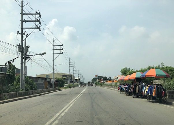
Ortigas Avenue Extension counterflow
One traffic scheme that has been constant along Ortigas Avenue Extension is the counterflow scheme. The scheme is applied in the mornings for westbound (outbound from Rizal) traffic. It has been implemented for as long as I can remember; perhaps since the early 1980s. One variant before was a form of “Buhos” where eastbound traffic is stopped for several minutes at certain intervals (6:30am, 7:00am, 7:30am and so on), and westbound traffic is allowed to take all the available lanes during the periods.
Considering this scheme has been implemented for more than 4 decades now, there must be some measure of effectiveness there. It is an example where the directional distribution during the peak hours allow for such scheme to be implemented. Note that the scheme pre dates number coding and similar counterflow schemes elsewhere in other major roads in Metro Manila (correct me if I’m wrong).
The scheme though only shows that there should have been a better transport system put in place along the corridor, which has had a steady growth in travel demand. There should have already been a transit line along this corridor a long time ago. What happened? Was it not in the government’s radar? There was a line proposed and shown in various master plans before.
–
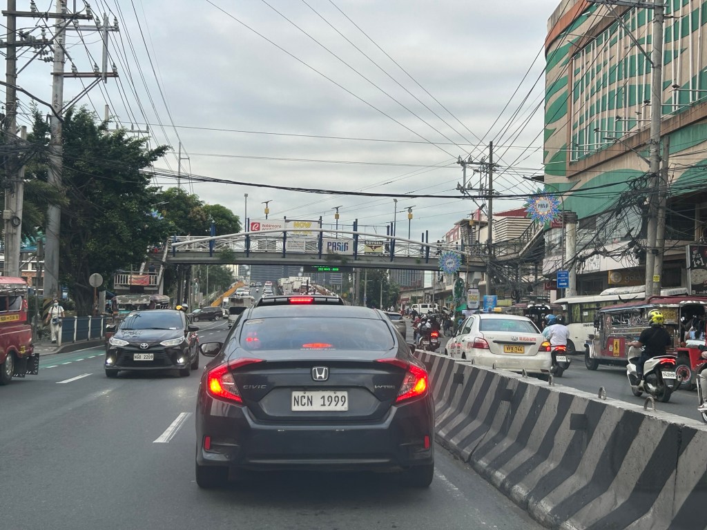
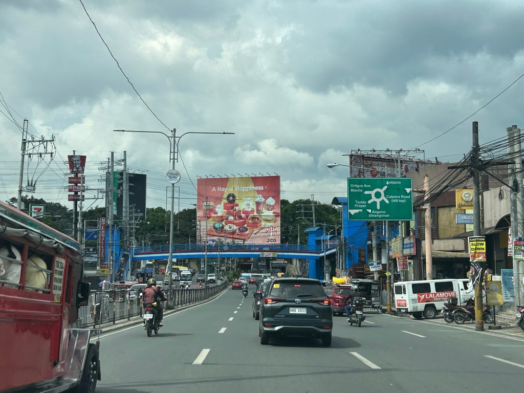
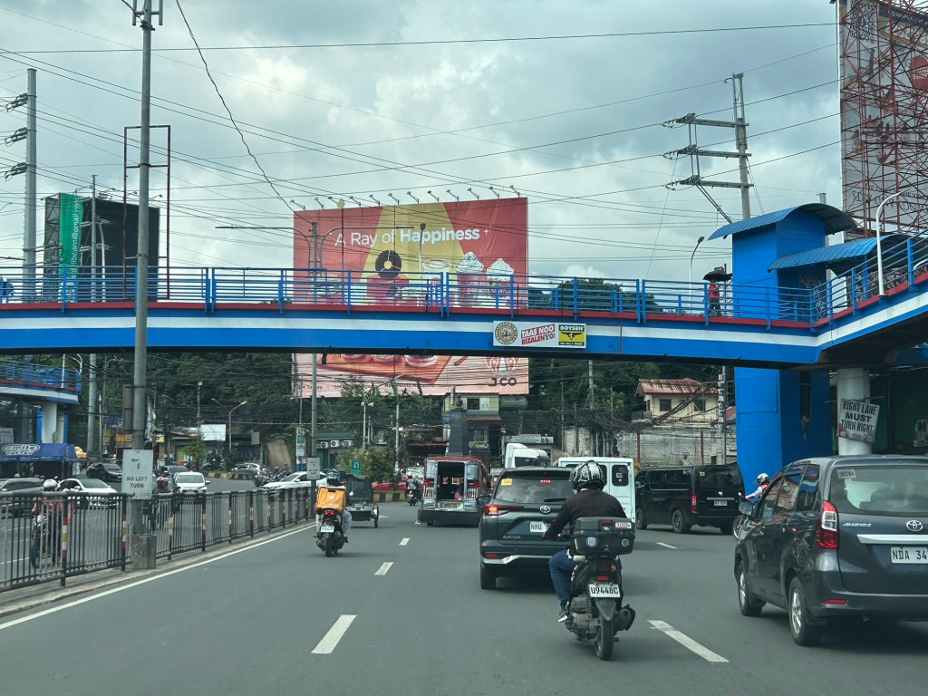
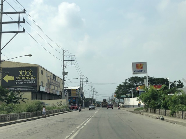
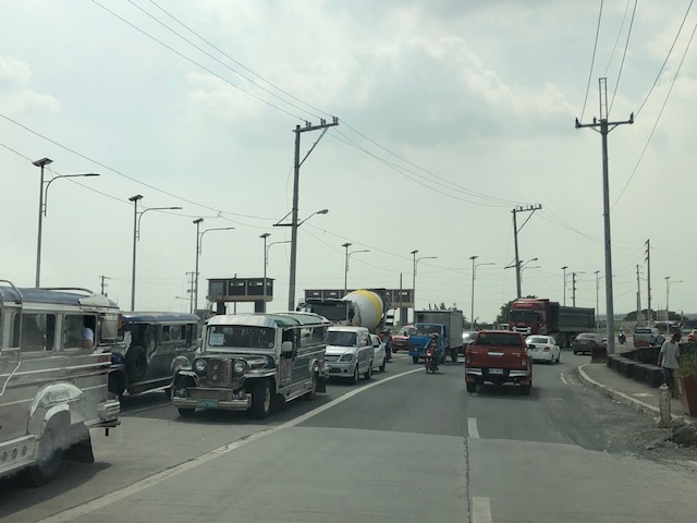
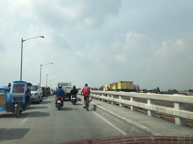
On the chronic congestion along Ortigas Avenue Extension
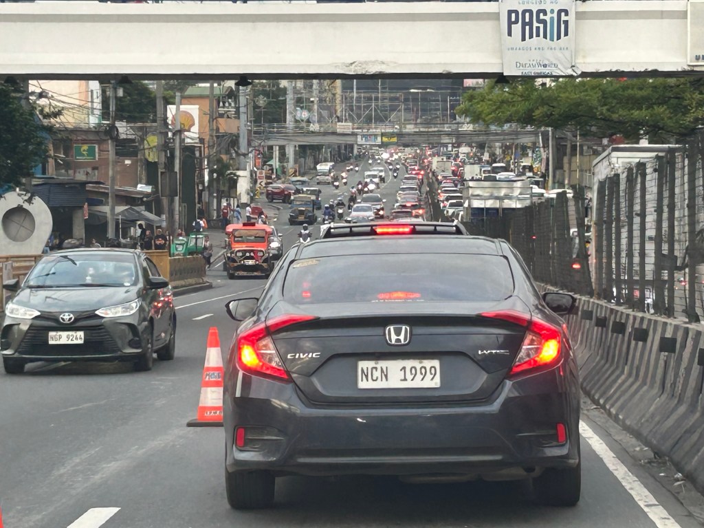
I previously wrote about the counterflow scheme along Ortigas Avenue Extension. While this is usually implemented during the mornings. A similar scheme is not applied in the afternoons or evenings. Apparently, the directional distribution in the afternoons and evenings is not suitable for a counterflow scheme. The photos below show the typical eastbound traffic as seen from the Manggahan Floodway bridge.
 Typical weekday evening traffic along Ortigas Avenue Extension
 The photos show that the traffic along the opposing direction (westbound) is as heavy as the eastbound traffic. This means a counterflow scheme similar to that in the mornings cannot be implemented during this period.
I have mentioned in the previous article that the corridor already required a mass transit system since the 1980s. Despite the operations of several bus companies over the past decades, these have not been enough (together with jeepneys and vans) to serve the demand along the corridor. It is not uncommon to find so many people stranded along the corridor and waiting to get a ride even during the early mornings. While Lines 2, 3 and 7 were being constructed, people in Rizal who have long endured the traffic along Ortigas Avenue Extension could only wonder why a transit system has not been provided for them. Will the proposed Line 4 be finally constructed? When will it be completed? What could be the traffic impacts of construction considering the limited space available for the construction? Should commuters prepare for more miserable travel once construction is underway?
–
Complicated intersections in Rizal – Tikling Junction
There are several major intersections in Rizal Province. Among them are 3 junctions in Cainta, Taytay and Antipolo – Cainta Junction (Ortigas Ave Ext.-Felix Ave), Masinag Junction (Marcos Highway-Sumulong Highway), and Tikling or Kaytikling Junction. The first two are signalized intersections. The last one is supposed to be a roundabout. All three are problematic in various ways and have been associated with congestion along the major roads intersecting at these junctions.
Tikling is quite interesting as traffic seems to have worsened after it was set up as a roundabout. Taytay enforcers have been deployed here but they seem to contribute more to worsening congestion rather than easing it. Motorists familiar with the area will tell you that traffic is better when there are no enforcers. Unfortunately, not all motorists here are from the area or are familiar with the rules for navigating or positioning at a roundabout. And so the intersection is often constricted with vehicles whose drivers and riders don’t practice courtesy.
Perhaps a combination of geometric improvements and more clever enforcement/management can improve intersection performance?
–
Vehicle refuge during floods
Passing Felix Avenue one early morning this week, I saw familiar scene. There were lots of vehicles parked along Felix Avenue (formerly Imelda Avenue) including the service roads along either side of this major road connecting Marcos Highway and Ortigas Avenue Extension.
These vehicles are owned by residents of subdivisions along the avenue whose areas are prone to flooding. These include Vista Verde, Metroville, Kasibulan, Karangalan and the two Green Parks. I didn’t see this along the stretch so the other flood prone villages like Village East and Country Homes. Perhaps they have been able to adapt better?
Car-centric discussions aside, when you go the ‘east’ you will notice a lot of people using SUVs. One reason probably is because many Rizal towns including Antipolo City, and Pasig and Marikina Cities are prone to flooding. Can you imagine over 50 years of flooding in these areas? And then with the current investigations concerning flood control projects, have you wondered if the ‘east’ really got their taxpayers’ money’s worth in terms of interventions?
–
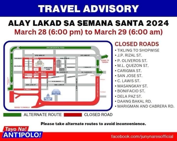
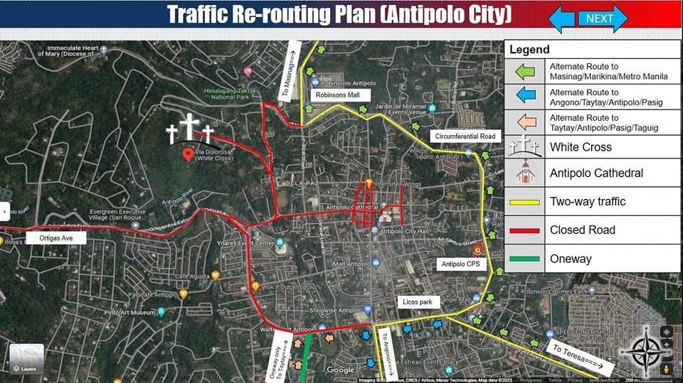
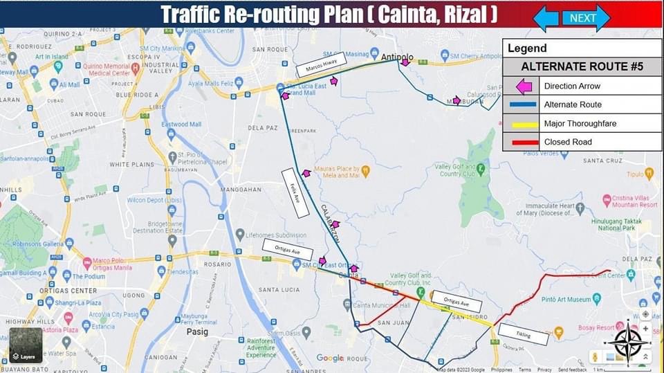
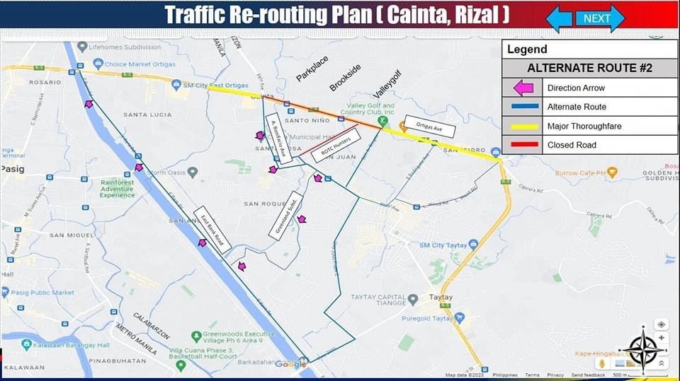
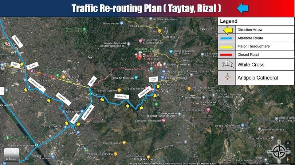
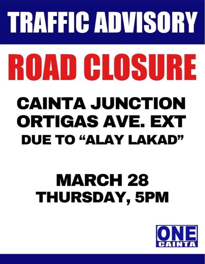
Alay Lakad 2024
I’m sharing here the announcements and maps shared by Antipolo, Cainta and Taytay regarding road closures and alternative routes during the Alay Lakad this Holy Week. The roads leading to the Antipolo Shrine will be closed from 5pm of March 28 (Maundy Thursday) to 6am of March 29 (Good Friday). Expected are hundreds of thousands of people making the trek to the Shrine of Our Lady of Peace and Good Voyage, which is among the most popular pilgrimage sites in the country.
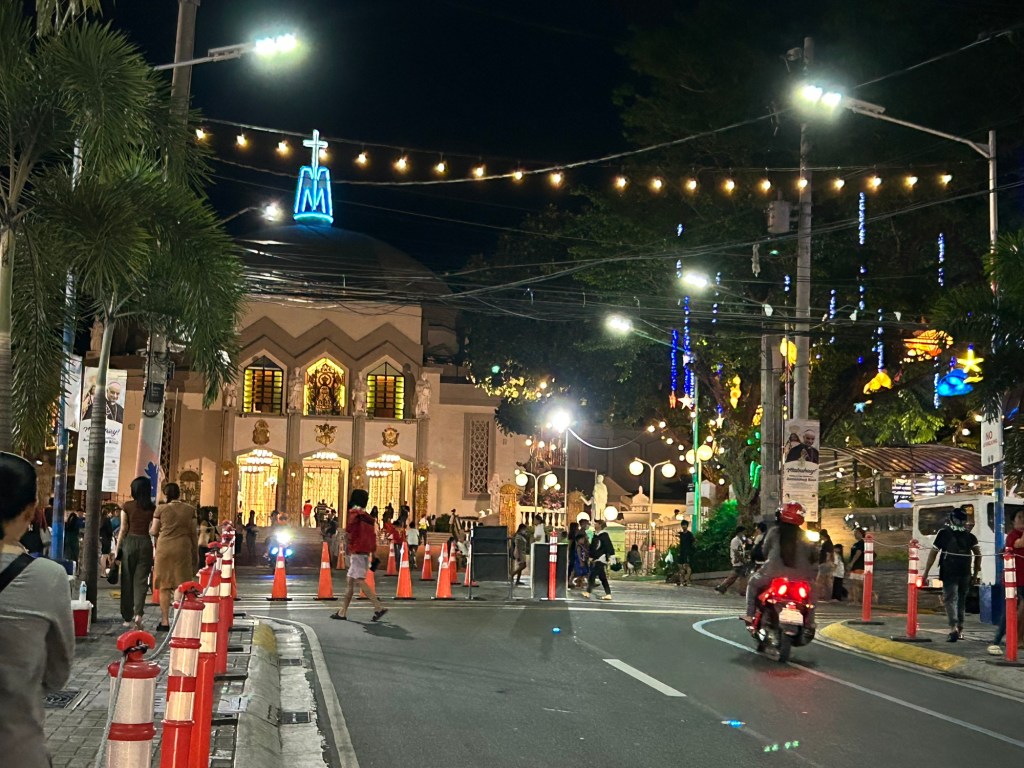
Many are probably walking as part of their panata or commitment in exchange for a favor they have prayed for. This may be healing for an illness or finding work or passing a licensure exam. Of course there are those who also pray for wants rather than needs like a new car, a big house or winning the lottery. And then there are those who are in it for the adventure, treating this as an excursion or a gig with the barkada.
Here are the maps and announcements posted in the official pages of the LGUs:
–
Tikling junction traffic
Easily a pet peeve along my commute is Tikling or Kaytikling Junction in Taytay, Rizal. I think traffic here is worse than two other major junctions in Rizal Province – Cainta Junction and Masinag Junction in Antipolo City. And that is because of the combination of traffic management (or mismanagement) by elements of the Taytay Municipal Government and motorists lack of understanding of how vehicles should position (or travel) at roundabouts. Of course, the volume of motor vehicle traffic converging at this junction would probably merit traffic signals over a roundabout but for most times when there are no enforcers here, traffic is somewhat more efficiently flowing as drivers and riders are forced to give way in order to not constrict traffic.
 Enforcers often employ the “buhos” system of prioritizing traffic for one leg at a time. However, instead of a quick transition from one leg to another, they tend to give more time to vehicles coming out of the Manila East Road and turning left and (west)bound for Ortigas Avenue Extension. The long time allocated to the latter means long queues for traffic coming down from Antipolo and those from Cainta.
 Enforcers are partial to outbound traffic from Taytay rather than make an effort to have more equitable ‘go’ time for all legs at the junction.
One wonders who is in charge of traffic for Taytay considering they mismanage traffic everyday. [Though I also wonder why the rest of Rizal including Antipolo and Cainta can’t seem to be bothered by the congestion emanating from Tikling.] As if to prove the point of incompetence, another problematic intersection is the Highway 2000 – Barkadahan Bridge – East bank road intersection, which is signalized and yet somehow always congested (or saturated). But that’s another story.
–
Highway 2000, Taytay, Rizal
Prior to taking the photos I posted on Barkadahan Bridge, I was able to take a few photos of Highway 2000.
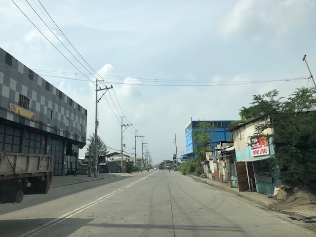 Section right after the Taytay Public Market – it is basically a 4-lane road but there are no lane markings for either direction. There is only the double line indicating which sides are for opposing flows of traffic.
 Informal shops along the highway
 There are many garments and textile factories and depots/warehouses along Highway 2000 and from their names appear to be Chinese-Filipino or Chinese-owned businesses.
 There are also several gas stations along the highway including this Shell station that used to have cheaper fuel prices than others like it in Taytay and Antipolo.
 Bikers along the highway – new pavement markings should include those for bike lanes on either side of the highway. Ideally, bike lanes or bikeways should be protected and consistent with the design along C-6.
 There seems to still be a lot of informal settlers along this road as evidenced by shanties on either side of the highway.
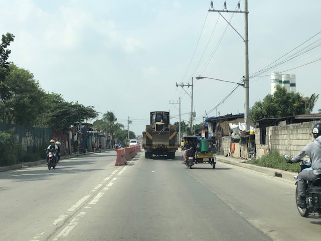
 There are many trucks using Highway 2000. Among them are those carrying tractors or heavy equipment like the one shown here hauling a bulldozer.
 Orange barriers delineate opposing traffic at the Highway 2000 approach to Barkadahan Bridge. The intersection before the bridge is with the East Bank Road of the Manggahan Floodway.
I posted the following photo earlier. This show the RROW acquired along the eastbound side of Highway 2000.
Highway 2000 already figures as a major link between Rizal and Metro Manila. It is part of an alternate route between Rizal and major CBDs like BGC and Makati via Circumferential Road 6. It is also a route to the south via Bicutan and eventually SLEX. Thus, it is imperative that this corridor and the Barkadahan Bridge be improved in order to carry the potential traffic (both non-motorized and motorized) that it is supposed to. Highway 2000 in particular should already feature protected bike lanes consistent with the design along C-6 in order for it to be transformed into part of a “bicycle highway” that can be the backbone for cycling as a mode for commuting.
–
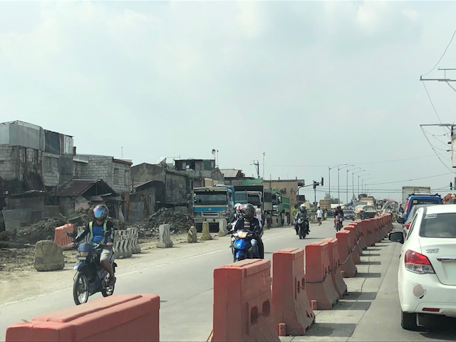
Traffic congestion due to Barkadahan Bridge rehab
Here are more photos of the situation in the vicinity of Barkadahan Bridge. Photos were taken on a late Sunday morning (around 11 AM). Photos show the traffic congestion particularly along the eastbound side of Ejercito Avenue and Barkadahan Bridge.
 Even before completely crossing the bridge, one can see how long the queue from C-6 is. This is a photo of the queue just past the West Bank Road. The road here is names Ejercito Avenue after former Pres. Joseph Estrada whose real family name is Ejercito.
 Truck occupying an entire lane and encroaching on one of the lanes to C-6. This is due to the bottleneck caused by the wall of a residential subdivision across from the Greenwoods gate. The wall actually only contains the subdivision name and yet DPWH has been unable to expropriate the land that includes part of that subdivision’s driveway.
 Long queue extending towards Tapayan Bridge along Ejercito Avenue
 Queue along Tapayan Bridge or bridges considering there are two – one for each direction of traffic.
 Queue crossing the bridge and the bend towards C-6 and Lupang Arenda, which is a major relocation site for Metro Manila squatters during the time of then Pres. Joseph Estrada. Vehicles turn left towards C-6 while those going straight continue along Ejercito Avenue towards Pinagbuhatan, Pasig City.
 The queue reaches C-6 on a Sunday morning. It is likely worse on weekdays.
–
Status of Barkadahan Bridge, Taytay, Rizal
I recently wrote about the Barkadahan Bridge and its current state and compared it to the Marcos Highway Bridge that is now completed and fully opened to travelers. Unfortunately, I didn’t have photos to share but only shared my observations based on what friends have told me and what I’ve read on social media (i.e., Rizal Provincial’s and Taytay’s official Facebook pages) about the situation there. I finally had the opportunity last Sunday when I went to fetch my family at the airport. Here are photos of the Barkadahan Bride and its environs. Note that Barkadahan is actually two bridges and not one. The new one is currently being used for two way traffic (one lane each) while the second one is under rehabilitation and retrofitting. The latter had and will have 2 lanes, too.
 Approach to the Barkadahan Bridge via Highway 2000 – notice the widening on the south side of the highway? That’s the ROW expropriated to align the bridge(s) with the highway. Ultimately, this should be of the same width as C-6.
 Closer to the bridge, you see more of the ROW acquired to improve the geometry for the area and the intersection with the East Bank Road. Highway 2000 is now aligned with the second (newer) bridge constructed that will eventually carry only the eastbound traffic. The older bridge currently being rehabilitated and retrofitted will carry the westbound traffic.
 Vehicles crowd on the two-lane bridge that is the new Barkadahan Bridge. The old one is currently being rehabbed. Notice the significant volume of trucks using the bridge? This is expected to increase due to the industrial developments in Rizal Province and along C-6, and the direct route this corridor provides towards the SLEX via Bicutan.
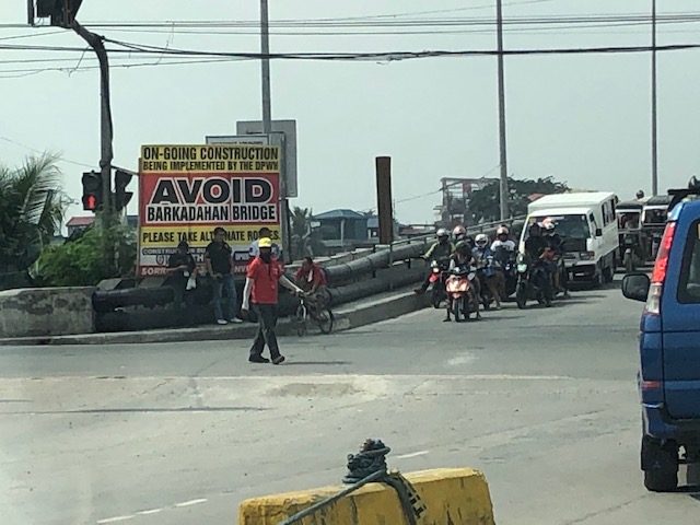 Big sign at the bridge – there are many of these scattered around Pasig and Rizal advising travelers against using the route and Barkadahan Bridge because for the construction work on the bridge. This ‘avoidance’ basically transferred (some say returned) much of the traffic to Ortigas Avenue Extension. Many if not most users of the bridge use this alternate route to travel from Rizal to BGC and Makati CBD.
 A peek at the construction work on the old bridge – note that the contractor seems to have completed installing the steel reinforcement for the slabs for this section of the bridge. The next phase would be the concrete pouring.
 Still another peek showing the extent of the work on the old bridge – my casual observation of the work areas was that there seems to be not so many workers. But then maybe it was a Sunday? Perhaps there should be more people working considering this is a very urgent project?
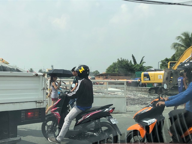
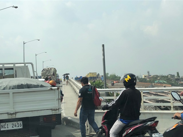
 Tricycles, motorcycles and bicycles – there’s a lot of local traffic using the bridge and these are represented by mostly tricycles serving the residential and commercial areas along the East and West Bank Roads and the cyclists you most often see crossing the bridge. Most motorcycles are through traffic. On weekends one can observe more recreational cyclists as this route is a popular one to Rizal and particularly its mountainous areas that are popular to mountain and road cyclists.
 Counterflow – many motorcyclists tend to counterflow and this adds to the friction and slows down traffic. Once the other bridge is completed and re-opened, these will likely be reduced to lane splitting or filtering as the opposite flows of traffic will be assigned to separate bridges. Counterflow traffic will then be very obvious and should be apprehended.
 Here’s the resulting queue on the other side of the bridge. This is severe congestion that reaches C-6. Note that the photo was taken on a Sunday. Perhaps these travelers have no other option but to use this route so they are stuck in hellish traffic on a Sunday? I can only imagine how worse it is on weekdays.
As a parting shot, I think there are still a couple of things that need to be addressed once the bridges are both open to traffic:
- Optimizing traffic management at the intersections with the East Bank Road and West Bank Road of Manggahan Floodway – the (mis)management of traffic here also contributes to congestion in the area. Traffic enforcers on both ends of the bridge have basic knowledge of how traffic must be managed and end up with the “buhos” approach. They don’t seem to be coordinating with each other, too. Their approach also heavily favors the East and West Bank roads when traffic is heavier along the main corridor that is C-6/Highway 2000. There needs to be a more efficient way to manage traffic here and that may be in the form of a sophisticated traffic signal system at least for the two intersections. Settings need to be studied and signals have to be adaptive to the variation of traffic throughout the day.
- Resolve bottlenecks in the area including structures that tend to reduce capacities of the approaches to the bridge.
More on this topic soon!
–
On Tikling Junction traffic (mis)management
There was an uproar among commuters when Taytay installed traffic signals at the rotunda at Tikling Junction. The junction is the intersection of Ortigas Avenue Extension, which continues towards Antipolo, the Manila East Road, which connects many of Rizal Province’s towns, and Leonard Wood Road, which leads mainly to residential areas in Taytay. There is another road that is close to the junction, Cabrera Road, that qualifies the intersection to be an offset type. However, vehicle coming in and out of Cabrera Road mainly are with respect to the Manila East Road.
 Traffic signals as seen from the Manila East Road approach to the rotunda
 Traffic signals as seen from the Ortigas Ave. Ext. leg approach from Antipolo
The horrendous congestion last Thursday was due to the settings of the signals that forced most vehicles to stop even though there were movements that were not in direct conflict with others (e.g., through traffic along Ortigas Ave. Ext. from Antipolo towards the direction of Valley Golf/Cainta and right turning traffic from Ortigas Ave. Ext. to Manila East Road). The results were vehicles backed up all the way to Cainta Junction along Ortigas Avenue Extension and SM Taytay along the Manila East Road. We were able to experience the slight congestion the following day (Nov. 1) when we descended to Tikling from Antipolo. Congestion was slight probably because of the significantly reduced traffic due to the holidays.
I thought, based on experiences at this junction, that the traffic signal settings somewhat mimicked the style applied by Taytay traffic enforcers when they manually manage traffic at the intersection. Too often, they apply the “buhos” system where they try to let through all vehicles they see queued per approach. The outcome of this, of course, is longer stopped times to all other vehicles from the other legs resulting in longer and longer queues that become unmanageable especially during the peak hours (i.e., when vehicle arrivals are highest at the intersection). Basically, what happened last October 31 was that the “buhos” traffic enforcers were replaced by the machines (i.e., traffic signals) that employed the same system only this time there was no opportunity for some flexibility for movements that had none or the least conflicts at the intersection.
–
