
I recently wrote about the Barkadahan Bridge and its current state and compared it to the Marcos Highway Bridge that is now completed and fully opened to travelers. Unfortunately, I didn’t have photos to share but only shared my observations based on what friends have told me and what I’ve read on social media (i.e., Rizal Provincial’s and Taytay’s official Facebook pages) about the situation there. I finally had the opportunity last Sunday when I went to fetch my family at the airport. Here are photos of the Barkadahan Bride and its environs. Note that Barkadahan is actually two bridges and not one. The new one is currently being used for two way traffic (one lane each) while the second one is under rehabilitation and retrofitting. The latter had and will have 2 lanes, too.
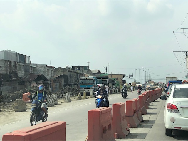 Approach to the Barkadahan Bridge via Highway 2000 – notice the widening on the south side of the highway? That’s the ROW expropriated to align the bridge(s) with the highway. Ultimately, this should be of the same width as C-6.
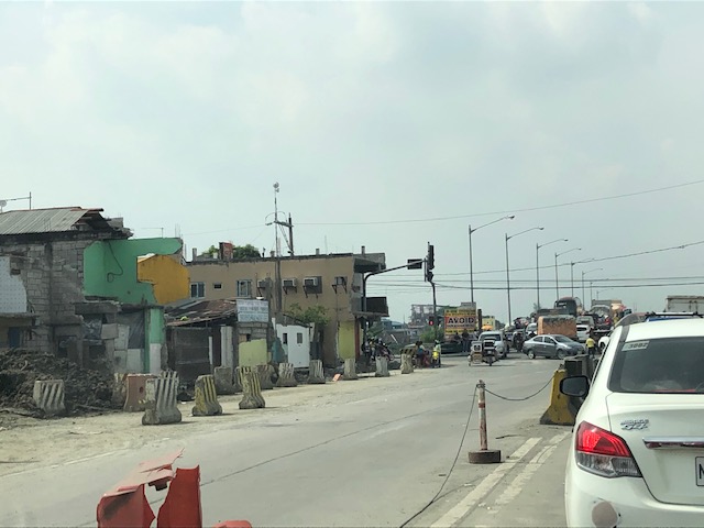 Closer to the bridge, you see more of the ROW acquired to improve the geometry for the area and the intersection with the East Bank Road. Highway 2000 is now aligned with the second (newer) bridge constructed that will eventually carry only the eastbound traffic. The older bridge currently being rehabilitated and retrofitted will carry the westbound traffic.
 Vehicles crowd on the two-lane bridge that is the new Barkadahan Bridge. The old one is currently being rehabbed. Notice the significant volume of trucks using the bridge? This is expected to increase due to the industrial developments in Rizal Province and along C-6, and the direct route this corridor provides towards the SLEX via Bicutan.
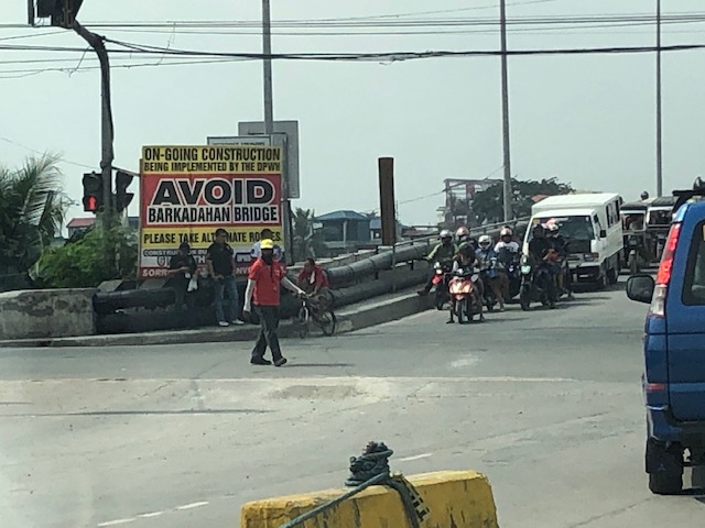 Big sign at the bridge – there are many of these scattered around Pasig and Rizal advising travelers against using the route and Barkadahan Bridge because for the construction work on the bridge. This ‘avoidance’ basically transferred (some say returned) much of the traffic to Ortigas Avenue Extension. Many if not most users of the bridge use this alternate route to travel from Rizal to BGC and Makati CBD.
 A peek at the construction work on the old bridge – note that the contractor seems to have completed installing the steel reinforcement for the slabs for this section of the bridge. The next phase would be the concrete pouring.
 Still another peek showing the extent of the work on the old bridge – my casual observation of the work areas was that there seems to be not so many workers. But then maybe it was a Sunday? Perhaps there should be more people working considering this is a very urgent project?
 Tricycles, motorcycles and bicycles – there’s a lot of local traffic using the bridge and these are represented by mostly tricycles serving the residential and commercial areas along the East and West Bank Roads and the cyclists you most often see crossing the bridge. Most motorcycles are through traffic. On weekends one can observe more recreational cyclists as this route is a popular one to Rizal and particularly its mountainous areas that are popular to mountain and road cyclists.
 Counterflow – many motorcyclists tend to counterflow and this adds to the friction and slows down traffic. Once the other bridge is completed and re-opened, these will likely be reduced to lane splitting or filtering as the opposite flows of traffic will be assigned to separate bridges. Counterflow traffic will then be very obvious and should be apprehended.
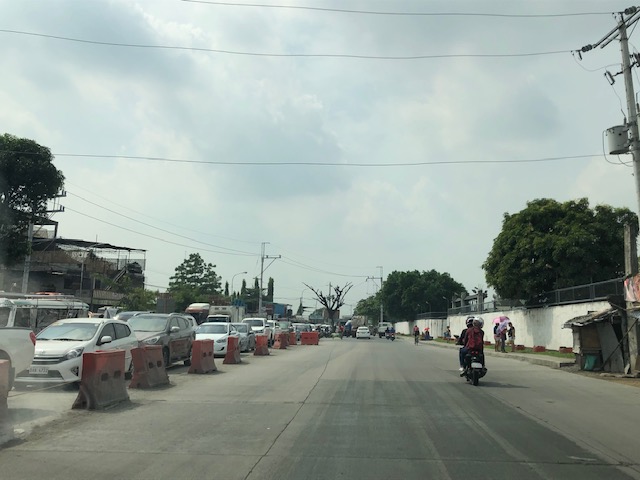 Here’s the resulting queue on the other side of the bridge. This is severe congestion that reaches C-6. Note that the photo was taken on a Sunday. Perhaps these travelers have no other option but to use this route so they are stuck in hellish traffic on a Sunday? I can only imagine how worse it is on weekdays.
As a parting shot, I think there are still a couple of things that need to be addressed once the bridges are both open to traffic:
- Optimizing traffic management at the intersections with the East Bank Road and West Bank Road of Manggahan Floodway – the (mis)management of traffic here also contributes to congestion in the area. Traffic enforcers on both ends of the bridge have basic knowledge of how traffic must be managed and end up with the “buhos” approach. They don’t seem to be coordinating with each other, too. Their approach also heavily favors the East and West Bank roads when traffic is heavier along the main corridor that is C-6/Highway 2000. There needs to be a more efficient way to manage traffic here and that may be in the form of a sophisticated traffic signal system at least for the two intersections. Settings need to be studied and signals have to be adaptive to the variation of traffic throughout the day.
- Resolve bottlenecks in the area including structures that tend to reduce capacities of the approaches to the bridge.
More on this topic soon!
–

I am crying while seeing these images of Taytay, Rizal in 2000 Highway 😦