
Home » Posts tagged 'terminals' (Page 2)
Tag Archives: terminals
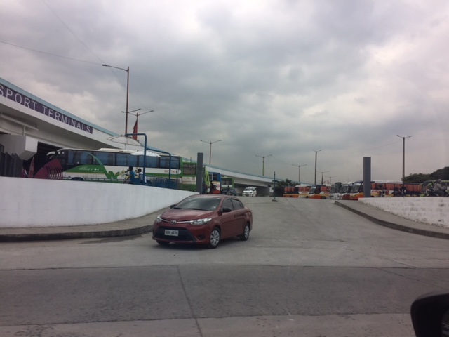
Public transport terminal at the Sta. Lucia East Grand Mall
Sta. Lucia’s East Grand Mall reconfigured its transport terminal and made it somewhat more formal than it was before. Previously more like a informal terminal with jeepneys parked along their driveways, the mall relocated its terminal to be closer to the Line 2 Station currently under construction just across from the Robinsons Metro East Mall and Sta. Lucia’s main access road from Marcos Highway.
 Jeepney station for eastbound PUJs including those bound for Cainta, Taytay, Angono and Binangonan via Felix Avenue (formerly Imelda Avenue) and Cainta Junction
 There is space for 4 to 5 jeepneys depending on how they are parked. There are also seats for waiting passengers and the area is fully occupied during the peak hours in the afternoon and evening when there is higher demand and jeepneys are not able to come back as fast to pick-up passengers.
This is a welcome development as passengers have a better place to get a ride. The terminal is more secure and protected from the environment (i.e., it is practically covered as shown in the photos). Then, of course, there is the proximity from the Line 2 Station making transfers between rail and road transport more efficient. The walk between the station and the terminal is not a difficult one as there should be adequate space along the Sta. Lucia mall driveway that has an improved pedestrian sidewalk, too.
I will post more photos of this terminal soon!
–
Mactan Cebu airport arrival – Part 2
This is a continuation of the feature on arriving at the Mactan Cebu International Airport (MCIA). In the previous post, I shared photos of our arrival at the new Terminal 2 and our walk from T2 to the domestic Terminal 1.
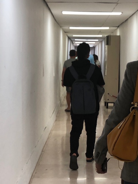
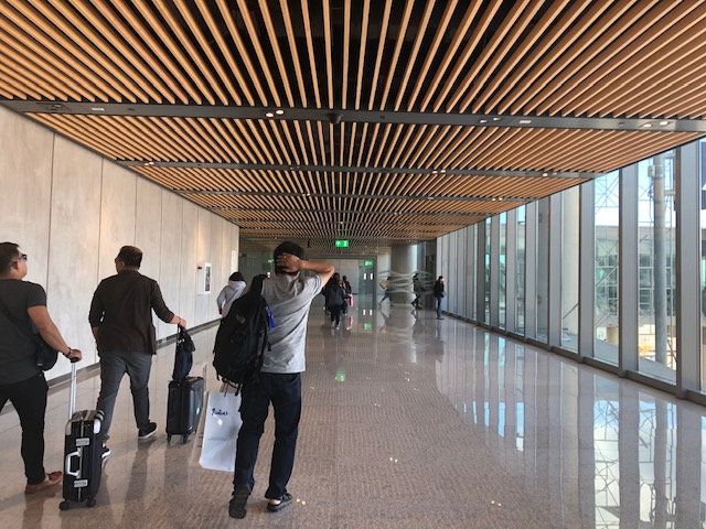
 Passengers continue to the corridor on the Terminal 1 side
 Take-off run for a commercial flight
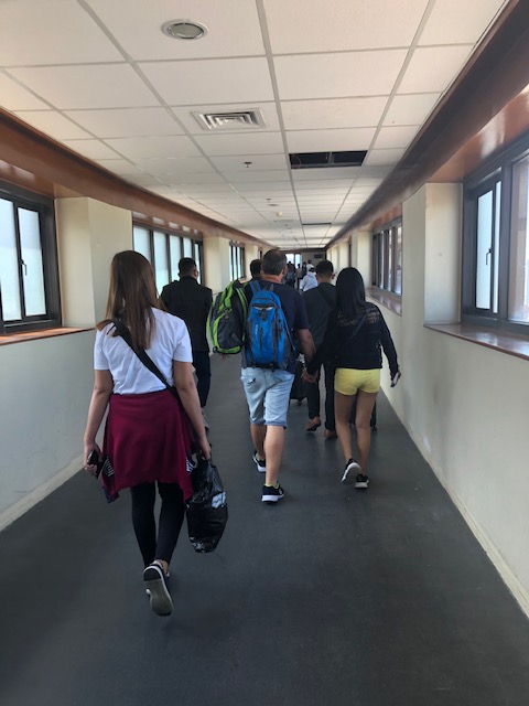
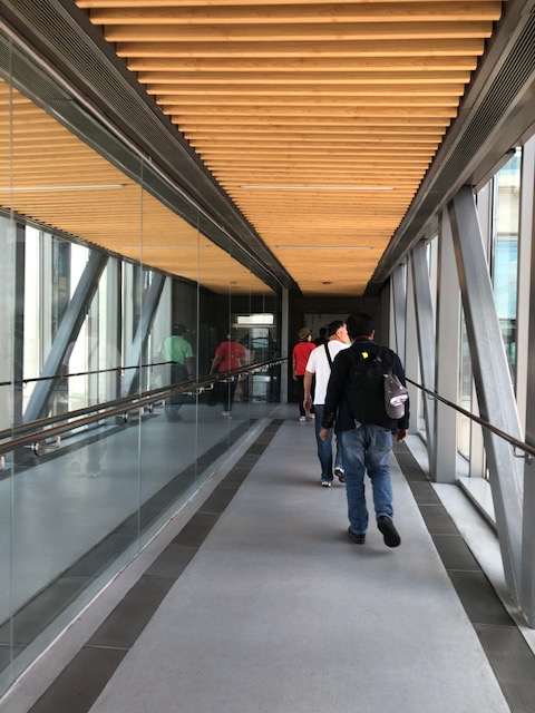
 Cramped corridor for arriving passengers heading to the baggage claim area
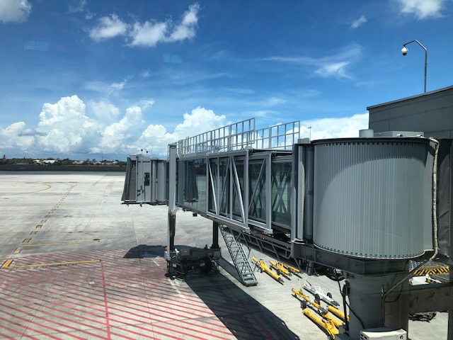
 Bridgeway or tube at T1
 We emerged from the corridor to the T1 building and a sign showing us the way to the baggage claim area
 Descending the stairs or escalator to the arrival level and the baggage claim area
 Visitors are greeted with posters showing Cebu’s attractions as well as ads for residential and resort developments. Also shown in the photo are information boards on arriving flights.
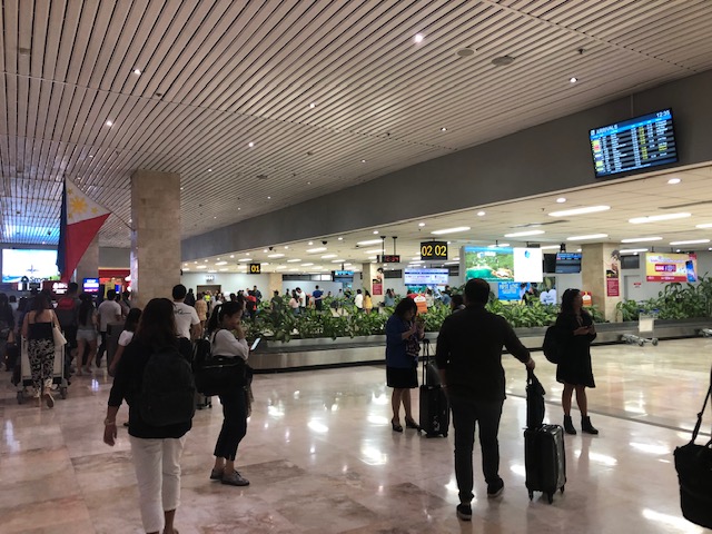
 Baggage claim area for domestic flights – notice the passengers with their carts or trolleys crowding along the conveyor system.
 Another look at the baggage claim area and a less crowded conveyor
More photo of the arrival including the taxi stand soon…
–
Mactan Cebu airport arrival – Part 1
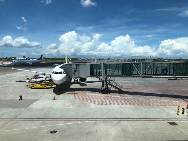
We were treated to a somewhat pleasant surprise upon arriving in Cebu’s Mactan International Airport a couple of weeks ago. The surprise was that our plane taxied to and berthed at the new Terminal 2, which was for international flights.
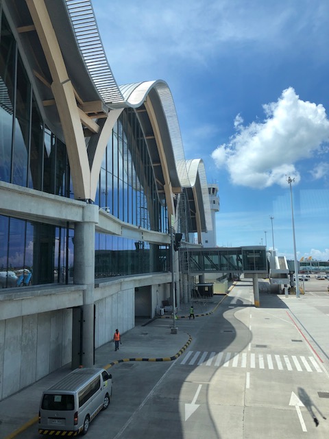
 A view of the MCIA Terminal 2 from our taxiing aircraft
 A closer look at MCIA T2 as our plane turned towards the apron
 Passengers deplaning via the T2 tube
 A view of MCIA T2 from the airbridge
 View of the tarmac and one of the airbridges as we walked along the corridor lined along the terminal’s departure level that connected to another corridor for the old Terminal 1.
 Corridor along Terminal 2 connecting to Terminal 1
 A snapshot of the tarmac
 The interior design elements of MCIA Terminal 2 evoke a local, Asian flavour
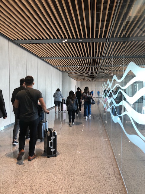
 Spacious corridor towards Terminal 1
 A look at an aircraft berthed at MICA T2
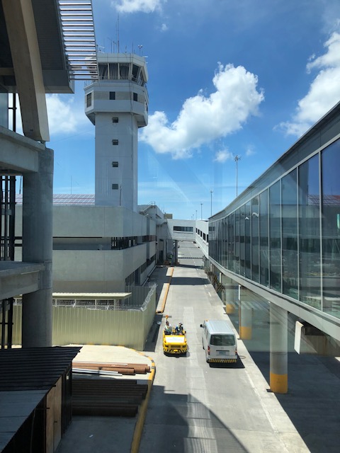 Bridge connecting Terminals 1 and 2 with a view of the air traffic control tower
 Passengers walking to T1
 Interphase of T2 with T1 at this point of the bridgeway
More on MCIA soon!
–
On good transit stop designs
We interrupt our regular programming to share this good reference for designing bus stops:
Transit Center (2018) From Sorry to Superb Everything You Need to Know about Great Bus Stops, transitcenter.org, http://transitcenter.org/publications/sorry-to-superb/#introduction [October 2018]

This is a new publication and though the focus is on bus stops, the principles and guides presented are very much adaptable and applicable to other public transport modes as well, particularly the road-based modes we have in the Philippines. The article contains a link for those who want to download the entire report.
–
The ill-located terminal at Ligaya along Marcos Highway
There is a newly constructed public transport terminal in what is popularly known as the Ligaya area along Marcos Highway in Pasig City. The terminal is right across from the new Ayala Feliz Mall. The terminal is mostly unused or under-utilised. The jeepneys and UV Express vehicles that were supposed to use the terminal seldom go there as the natural stop for most coming from Pasig to Marikina would be closer to the junction of Marcos Highway with Amang Rodriguez Avenue. There is also the U-turn slot nearby where many passengers dare to cross to in order to catch a ride. Sinasalubong ng mga tao ang jeepney na lumiliko dito and the traffic enforcers in the area generally turn a blind eye to this.
 The practically empty terminal during evenings
Late at night, the terminal is dark with the lights turned off. Most times I pass by the area in the mornings and afternoons, there are few, if any, PUVs at the terminal and you don’t see a congregation of a lot of passengers there as with other terminals. Did Ayala make a mistake with this terminal? For one, it is known already that while this area is a transfer point for many passengers, the location of the terminal with respect to the established U-turn slots make it unsuitable and undesirable for most PUVs. Then there is the impending operations of the Line 2 Extension whose nearest station will be hundreds of meters away across Robinsons Metro East and Sta. Lucia Mall. I think Ayala needs to construct a physical connection to the terminal if only to increase the number of people going there and therefore attract PUVs. Finally, the area is not a terminus (or last stop) for PUVs so it doesn’t make sense for them to spend time there except perhaps during off-peak periods (i.e., for rest). However, it is not attractive even for the latter since there seems to be no amenities including stores or maintenance shops to support PUVs.
–
Another look at Suvarnabhumi Airport – departure, Part 3
Here are the rest of the photos for this series on Bangkok’s Suvarnabhumi Airport.
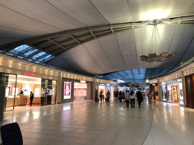 Here’s another look at some of the shops inside the terminal
 Here is a view of the grand display at the departure concourse after you clear immigration.
 For those who did their shopping in Thailand, VAT refund is available at the airport. Just make sure you kept your receipts.
 King Power duty free shops
 Information boards
 I like to say that a highlight of my recent travel to Bangkok was enjoying mango with sticky rice at the airport. Bangkok is famous for its street food and this is comfort food for me.
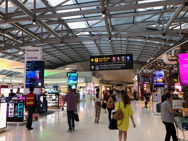
 More shops greet you on the way to the boarding gates. These are actually the last ones prior to the boarding gates and present the last chance for some shopping.
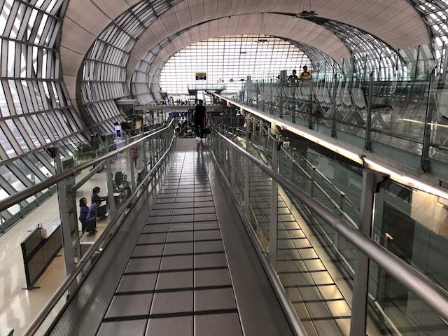
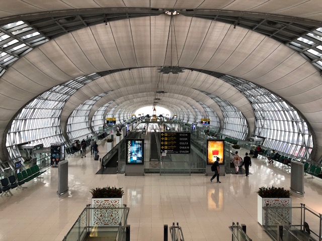 A view of one of the piers (there are 6) of the airport terminal.
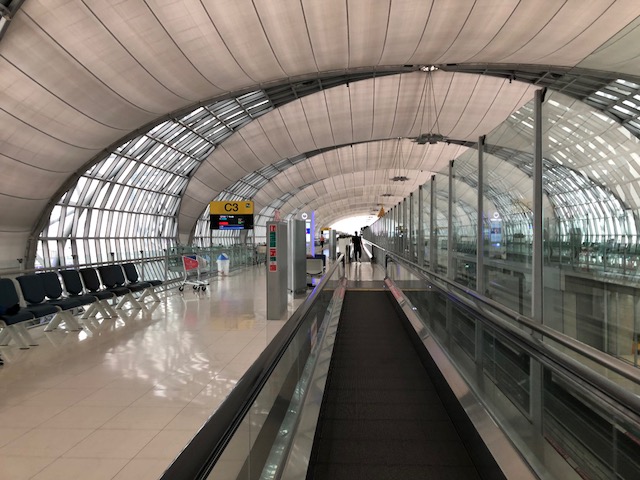 Moving walkways help passengers get to the boarding gates along the long piers emanating from the main terminal building. But if you want to have some exercise and increase your step count then you might opt to do some brisk or relaxed walking.
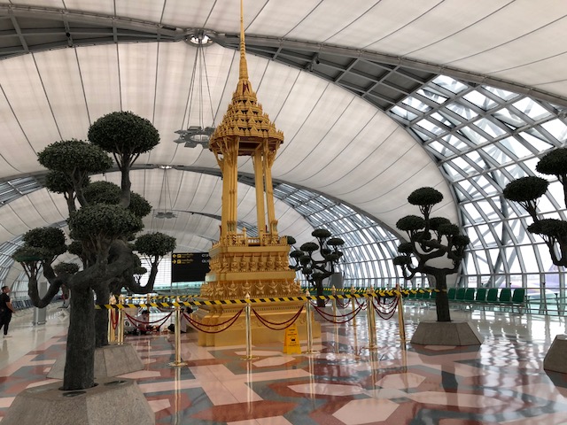 There is always these cultural-religious elements inside this modern terminal that remind you that you are in Thailand.
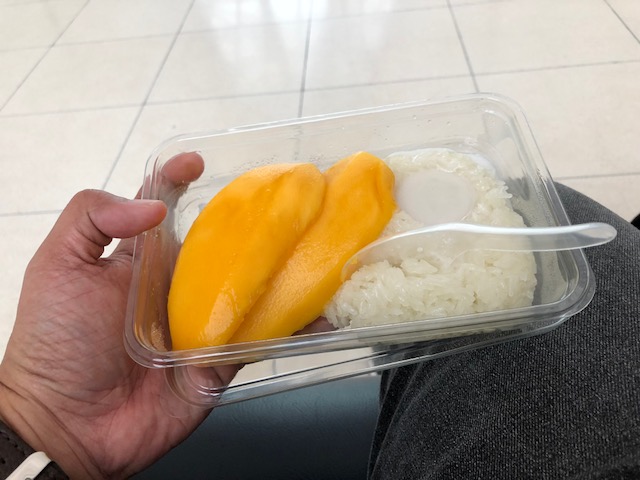 I enjoyed my mango with sticky rice while waiting for my boarding call.
 Ramp to the pre-boarding lounge before the gate
I’m looking forward to traveling to Cebu soon. Although the new terminal is for international flights, I hope to get some photos from the tarmac. And who knows if there is a chance to take a few opportunistic shots of the interior?
–
Another look at Suvarnabhumi Airport – departure, Part 1
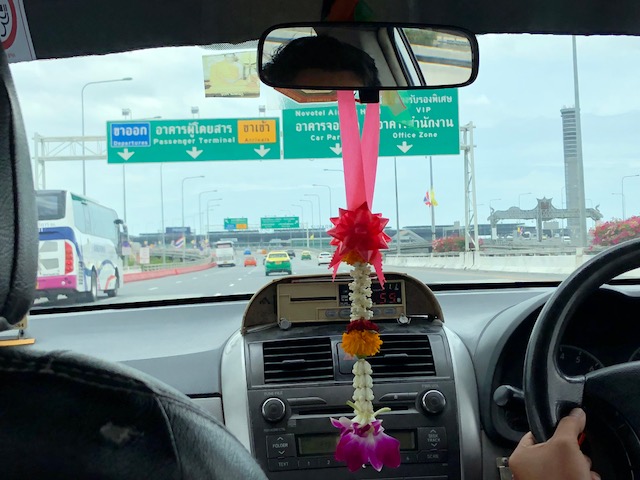
My recent trip to Bangkok allowed me to take more photos of Suvarnabhumi Airport. I already posted on my arrival at the airport and this time, I am posting on my departure. The following photos were taken as we approached the airport and upon my entry to the terminal.
 On the elevated expressway link to the international airport. The signs are obviously in Thai.
 A view of the control tower
 The taxi driver proceeds towards the departure level driveway to the left of the expressway link. The exit ramp to the right is for vehicles heading towards the arrival level driveway.
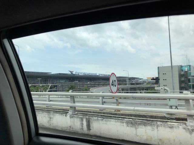 Speed limit for this section is 40 kph.
 The airport terminal is at left and at the foreground is the multi-level parking facility
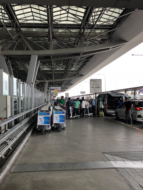
 After alighting from the taxi, I took this photo of the luggage carts neatly filed and ready to be taken to the terminal.
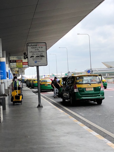 Taxis unloading passengers and their luggage along the driveway designated for public transport.
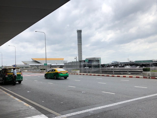 Airport departure level driveway with a view of the control tower and the multi-level parking building
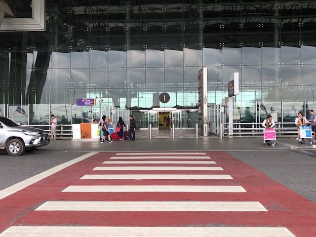 A properly and conspicuously marked pedestrian crossing at the airport
 The driveway designated for private vehicles is more crowded
 Sign for the national flag carrier whose hub airport is Suvarnabhumi.
More photos next time!
–
On the Tacloban airport terminal expansion
Tacloban’s Daniel Romualdez Airport terminal’s expansion has been completed and it now has ample space to accommodate passengers. I took the following photos a couple of weeks ago.
 There is more space for the two inspection machines but only one was functioning when we were there. Nevertheless, the terminal now has a more spacious check-in lobby.
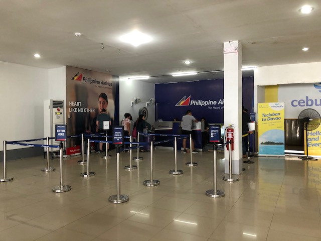 The check-in frontage remains the same with the same number of counters for each of the carriers. However, there is more space now for queueing so it is not as crowded as before. Shown are the counters for Philippine Airlines (PAL).
 Here is the counter for Cebu Pacific (CebPac); again showing the same counter frontage but with more space for queueing.
 There is a perceivable wide area now available in the terminal. That’s the TIEZA booth as well as others for quarantine.
 Air Asia Philippines’ check-in counters
 The pre-departure lounge is basically “divided” among PAL, CebPac and Air Asia. This is the scene of what you would have seen prior to the completion of the expansion.
 Now, there is more space so its not as crowded.
 There is a play area for kids as well as a room for nursing mothers (i.e., for breastfeeding or changing diapers). A welcome sight are the refurbished toilets.
 The old food stands are gone with the exception of Dunkin’ Donuts. There’s a Goldilocks stand but not one with local goods or delicacies like ‘moron’ for souvenirs/pasalubong.
 Another look at the passenger lounge area near the gates.
 Here is the expansion area with additional seats and spaces for people with (a lot of) carry-on baggage.
–
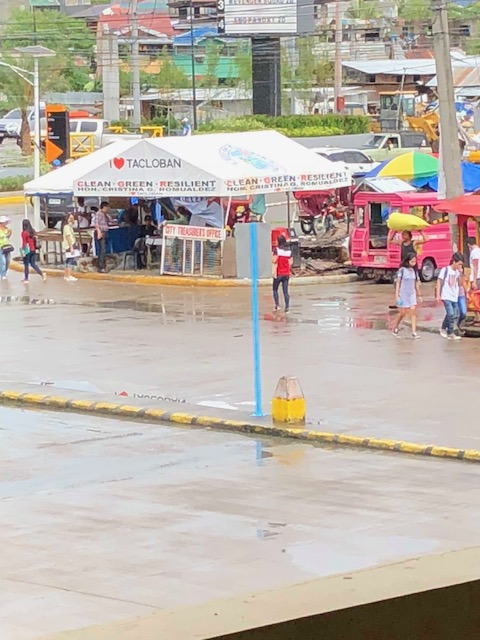
Tacloban City’s New Transport Terminal
Tacloban City has what is called a new transport terminal located to the northwest of downtown and across from the new Robinsons mall in the area. Here are a few photos of the terminal taken earlier this year.
 Vendors selling mostly food items including local delicacies
 The City Treasurer’s Office has a makeshift post at the terminal to collect fees from transport operators including buses and vans using the terminal.
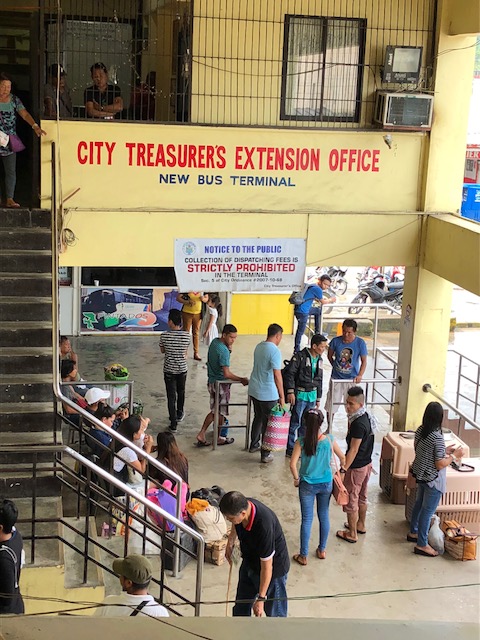 The terminal hosts an Extension Office of the City Treasurer and also has a K-9 unit to help keep the terminal safe and secure. The dogs work regularly to sniff out illegal substances that may be carried by people using the terminal.
 Passengers wait for their buses or vans at the terminal.
 The waiting area is not air-conditioned but is relatively cool and is clean.
 Another view of the passengers’ waiting lounge
 Passengers may purchase bus tickets at the terminal prior to boarding a bus.
 The same goes with vans including those called mega taxis
 View of the front of the terminal
 A view of the terminal from the transport parking lot
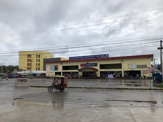 A view of the terminal from mall across from it. Note the sign at the left side of the photo? The office of the city’s traffic management and enforcement unit (TOMECO) is located at the second floor of the terminal.
Tacloban hopes to continue development of the terminal area that will eventually be expanded to have an even larger lounge for passengers, a hotel and more commercial spaces aside from berths for public transportation.
–
A quick look at the BFCT in Marikina
I went to SM Marikina recently and had my companion take some quick photos of the transport terminal project of former Marikina Mayor and MMDA Chair, now Congressman Bayani Fernando (BF). Following are some of the clearer shots as we were moving when these were taken.
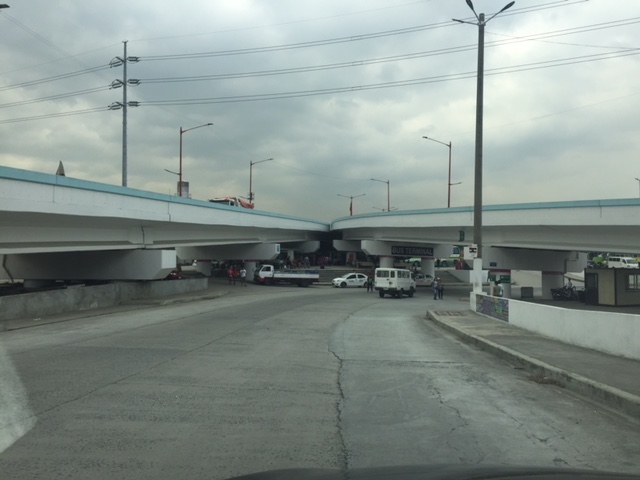 A look at the terminal located just beneath the two overpasses connecting Marcos Highway to C-5.
 The driveway to and from the terminal lot.
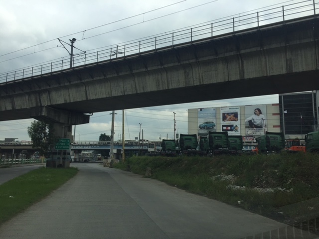 Moving towards SM Marikina under the LRT Line 2 structure, you see rows upon rows of trucks. I assume these are for sale and are there for display to prospective buyers.
 Leaving SM Marikina, this is the view of the trucks parked at the lot beneath the Marcos Highway and Line 2 bridges.
 Approach to the driveway of the terminal showing the buses currently at the BFCT.
 A closer look at the buses parked at the terminal. The green buses are RORO buses that the serve the West Philippine Nautical Highway route.
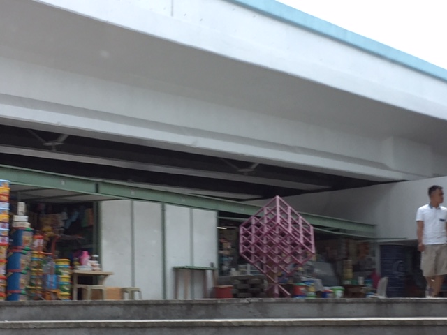 A quick look at some of the stores at the terminal. These are mostly the sari-sari/carinderia types you see in most provincial terminals. Among the merchandise are biscuits and cookies in containers of different sizes. These are popular pasalubong for travellers to relatives and friends in their destinations.
 The sign on the right is intended for vehicles coming from C-5 that are allowed to make a U-turn near the junction with Marcos Highway to get to the terminal. This, however, takes them into direct crossing conflict with vehicles coming up from the riverbanks heading to Marcos Highway.
It would be nice to see some statistics about the number of passengers using the terminal as well as their characteristics such as origins and destinations, including transfers (e.g., how do they get to or from the terminal and what modes do they use). I suspect that there are not so many people using this terminal and the numbers will not significantly improve once the Line 2 extension is completed and the new end terminal and its environs are developed in Masinag, Antipolo City.
–
