
Another look at Imelda Avenue traffic
A reader brought to my attention some traffic problems encountered along a section of Imelda Avenue in the vicinity of a major retail chain’s branch. There are experiences of traffic congestion along the section fronting the SM Hypermarket from across the Village East subdivision. However, the commercial development and the traffic generated is not really new since the hypermarket replaced another similar establishment (Makro). Arguably though, the trip generation rates of SM developments can be higher than their competitors considering their branding and customer preferences based on traffic experience around SM malls. Following are some specific observations and comments for the case of Imelda Ave. in the vicinity of the SM Hypermarket along the highway.
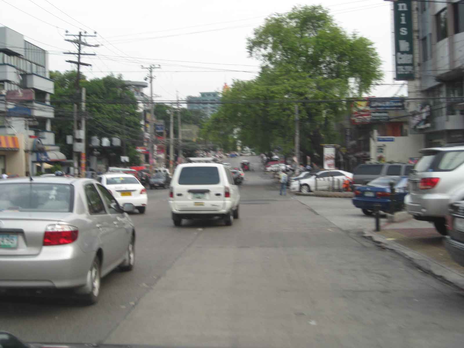
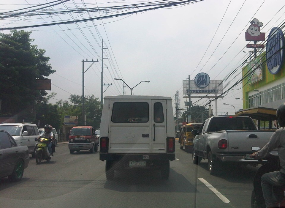 Slow-moving traffic in front of the SM Hypermarket along Imelda Avenue in Cainta, Rizal
 Congestion in the previous photo turned out to be caused by jeepneys loading and unloading passengers in front of the commercial development. Jeepneys tend to occupy the outer lane of the highway, significantly reducing road capacity thereby causing a bottleneck leading to congestion propagating upstream. There is actually a loading/unloading bay on the Hypermarket side of the road but jeepneys do not use this and almost always stop in the middle of the road.
 There are also tricycles using Imelda Ave. despite the regulations prohibiting them from national roads. The tricycles serve the residential subdivisions along the highway but used to be the main mode of transport along an unfinished Imelda Ave. from the 1970’s and competed directly with the jeepneys from the 1980’s one the connection between Ortigas Ave. and Marcos Highway had been made, leading to the opening of new jeepney routes through Imelda Avenue.
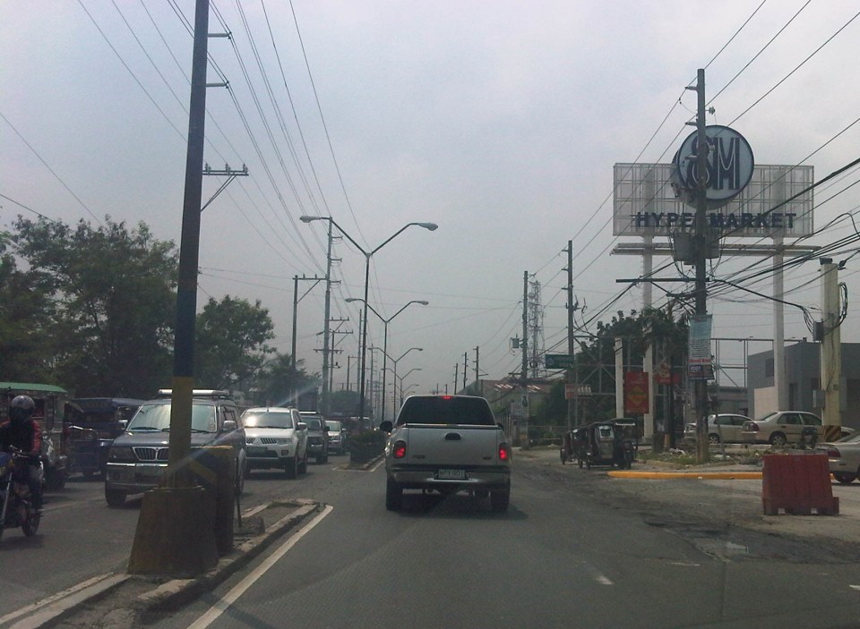
 The bottleneck for this section is along both directions as jeepneys stop not only for the Hypermarket but also for the residential subdivision (Village East) that is located just across from SM. The gate of the village opens toward SM with traffic generated significant enough to create a 3-leg intersection at the subdivision access/egress. This is an unsignalized intersection that has no enforcer to manage traffic, leaving it up to the motorists to determine acceptable gaps for conflicting movements. Compounding the situation are pedestrians crossing just about anywhere along the road like the people shown in the photo above.
The issues mentioned above are not all unique to the location but are often the case for many other places where there are major traffic generators such as malls, supermarkets and even residential developments. In fact, middle class villages are major traffic generators due to the car ownership but they are usually predictable in terms of peak periods. That is, the morning and afternoon/evening peak are well-defined according to office or school hours associated with residents (i.e., “to school,” “to work,” and “to home” trips). The solution, of course, is quite basic though not so simple – traffic management in the form of personnel who will enforce traffic and manage intersection flow. It is basic because it is a solution that’s definitely “in the box” and traditional or conventional. It is not simple because often, there is a lack of qualified personnel who can manage traffic full-time, and competent to firmly enforce traffic rules and regulations in order to effect behavioral change (for the better) among motorists and pedestrians. Granted, the commercial development should take the initiative to manage traffic and these may be recommendations already made when a traffic/transport impact assessment was conducted prior to the construction of the Hypermarket. Such assessments should have included traffic forecasting (estimating future traffic) in order to determine potential traffic congestion in the area and the formulation of site specific and appropriate mitigation measures. Perhaps there is a document somewhere (EMB?) that Cainta may use as a guide for how to address transport and traffic problems in the area due to the presence of the supermarket. If none, then the burden will be on the local government to study the traffic and come up with a strategy on how to lessen the detrimental traffic impacts of development in the area.
–
Araneta bus terminal
Cubao in Quezon City has always been a point of convergence for a lot of people and, like Pasay City, is a gateway for people coming from all over the country. Cubao is one of the larger commercial districts in Metro Manila and its Araneta Center is host to a large bus terminal catering mainly to southbound bus companies. The terminal is larger than any of the individual, private terminals around Cubao and nearby along EDSA or Aurora Boulevard. Most of these private terminals are for northbound buses. Southbound refers to buses connecting Metro Manila with Southern Tagalog and the Bicol Region in Luzon Island and those taking the western nautical highway and the Roll-On, Roll-Off (RORO) system to the Visayas and Mindanao provinces via the Port of Batangas and Mindoro. In fact, it is possible to take the bus to Caticlan, the jump off point for the immensely popular Boracay Island.
The Araneta Bus Terminal is located a block away from the Araneta Coliseum, housed in a building that was formerly the Rustan’s Department Store (to those who remember the old store) just across from the Ali Mall. It used to be located at an open lot across to the east of Ali Mall but had to be moved to its present (and perhaps better location) after the lot was committed to a new condominium development. Bus companies have their ticketing services inside the building and one can reserve tickets for future trips or, if seats are still available, can purchase tickets outright for buses scheduled to leave around that time.
 Passengers waiting or purchasing tickets at the Araneta bus terminal. There are clean rest rooms inside the terminal.
 Another look at the ticket booths and waiting area at the terminal. There are also stores selling food, snacks, drinks and even souvenir items. Popular pasalubong are assorted biscuits and other food stuffs. Located at the second level are terminal offices and a BPO, which shares tenancy with the terminal.
The terminal is usually very crowded during Christmas, Holy Week, and All Saints’ Day when people flock to the provinces (i.e., their hometowns). Many bus companies sell seats ahead of these holidays and people are encouraged to purchase tickets ahead of their trips to make sure they do get seats.
–
Sunduan at NAIA Terminal 1
Manila’s Ninoy Aquino International Terminal 1 has been named as the worst airport in Asia by a website that seems more focused on “sleeping in airports.” The same site ranks Changi, Incheon and Hong Kong as the top airports in the region and mentions a couple more in Southeast Asia in the top ten. Surprising for me is the low ranking for Changi’s Budget Terminal. One can practically sleep on the floor there as it is sparkling clean! But of course, I won’t encourage it as what’s not visible to thehuman eye might probably make one sick especially in places like airports where you have people from all over using the facilities. In fairness to the same site, it differentiates NAIA’s old Terminal 1 from the newer Terminals 2 and 3, which received fair assessments but again especially for sleeping. I think the value of such independent assessments is that they are very objective and given the power of social media, it informs people about the quality of facilities and challenge those in-charge to do better.
So to continue with my features on NAIA Terminal 1, I am featuring a few more photos from the perspective of someone waiting for or fetching a loved one, relative, friend or anyone arriving at the terminal from the building just across from the passengers’ arrival area.
 Before the mayhem – prior to the arrival of aircraft and exiting passengers, the area appears like a picture of calm with few people including airport staff.
 Here they come – passengers start accumulating at the area along with vehicles whose drivers have probably been notified of the arrivals
 Information screen – there are several screens at the waiting area for people to check the aircraft arrivals
 Refreshments – there are 3 concessionaires inside the building, all on the second floor, including one generic food stall and this one featured in the photo that’s quite popular for its coffee buns and kaya toast.
 Fast food – the other concessionaire is a branch of the most popular and largest fast food chain in the Philippines
 Kiosks and stalls – at the back of the building are kiosks and stores spread out in the open parking lot for people who’d rather wait in these areas. One will find here whole families and other groups loitering about or even picnicking as they wait for arriving passengers.
 Comfortable – the second level of the building is air-conditioned unlike the first level and so many people choose to lounge around the area. Most seats, however, are immediately taken and so a lot of people end up standing while watching out for people they’re fetching.
 Waiting game – arrivals waiting for their sundo (people fetching them).
 Another level – there is actually another driveway atop the one seen in the photo. The lights at the top of the photo are lined up along the driveway for the main terminal building, which is reserved for VIPs and others extended the privilege of using the driveway. All other passengers have to cross from the main terminal to descend towards the area shown and the lower driveway that’s level with the open parking lot.
 Congestion and mayhem – the arrival of several aircraft particularly from major origins like Hong Kong, Dubai and the US (via Narita and Nagoya) meant that the area would be very crowded with passengers, well-wishers and vehicles. People and drivers tend to disregard personnel trying to manage the people crossing between the terminal and the waiting area, and traffic along the driveway.
 Crowded house – the ground floor area of the building where passengers an well-wishers generally meet up is a very crowded area and airport personnel often struggle in controlling people from crossing over to the arrival area to personally fetch passengers, often with cause due to the amount of luggage (e.g., balikbayan boxes) passengers tend to bring with them when traveling to Manila.
NAIA Terminal 1 serves most international flights coming in and out of Manila that are not Philippine Airlines, Cebu Pacific or ANA (the only other foreign carrier using the larger and more modern Terminal 3). It definitely has seen better days and its current capacity and facilities are not suitable for the number of flights that it serves given that it wasn’t adequate from the time it started operation in the early 1980’s. There is the welcome news that T1 would be renovated and that a large reputable firm has been hired to do the unenviable task of improving this gateway. We can only hope that the project proceeds with little delay so that travelers would be able to avail of better services and perhaps allow this terminal to shed its tag of being the worst airport in Asia.
–
Suitability of public NMT in the city?
Paratransit systems are a common thing all around the Philippines. Some have been part of the mainstream that to call them paratransit seems inappropriate. Among the most dominant modes of transport in the country are the jeepneys and motor tricycles that serve short to very long routes in many areas in the country including the National Capital Region. There is also the so-called kuliglig in the City of Manila that is a 3-wheeler comprised of a bicycle and a side car. The bicycle is motorized, using a small motor much like the one used by pumpboats or bancas. These are very much the same as the “tricyboats” of Davao City and other parts of Mindanao and the Visayas. The “original” kuliglig may be found in rural areas and these are basically farm tractors pulling carts that may be used to transport people or goods (e.g., farm products, raw materials, etc.).
When the term “non-motorized transport” or NMT is mentioned, the first things that come to mind are probably bicycles and walking. There are other NMT modes around including animal drawn vehicles and pedicabs. Perhaps the most well-known animal drawn vehicles in the Philippines are the calesas and caretelas, which are pulled by horses. Pedicabs are 3-wheeled vehicles consisting of a bicycle and a side car. These are quite popular in residential areas particularly in residential subdivisions or villages where tricycles have been prohibited or restricted due to their noise and emissions.
Pedicabs, however, have become an attractive means of livelihood for people who have less options for employment (i.e., many drivers have no qualifications to apply for more formal jobs). As such, one will find them proliferating where there is a perceived demand for them; including urban streets where they serve as feeder services quite similar to those offered by their motorized counterparts. While tolerated along minor streets, many have tested the waters and the limits of regulations by taking major roads. The following photos show such examples where pedicabs are seen operating along major roads.
 NMT along national roads – pedicab at the intersection of Quezon Avenue and Agham Road
 Informal terminal for informal transport – pedicab queue along the Quezon Ave. service road
 Cause of congestion? – pedicab (and tricycle) operating along the bus lanes of EDSA in Pasay City. Such situations expose drivers and their passengers to risks of being hit by larger motorized vehicles such as buses and trucks.
 Over-reaching? – pedicabs defy regulations against them using national roads and particularly major ones like EDSA.
There is the persistent challenge of how to rationalize public transportation in many Philippines cities. In fact, there are cities that have embraced paratransit modes as part of their character and thus seem unlikely to upgrade or phase out such transport modes from roads or routes that require higher capacity vehicles to deliver higher levels of service. For one, there are socio-economic and political factors that have to be considered in any initiative focusing on these modes of transport. Many are already organized or members of organizations such as tricycle operators and drivers associations (TODA) and jeepney operators and drivers associations (JODA). These have become quite influential over the years and have even participated in elections as party list groups while also exerting pressure on government agencies when issues like fuel price increases and fare setting are in the spotlight.
Many public NMTs are not as organized or empowered as their motorized counterparts. However, many are connected with groups such as those of the urban poor and NGOs taking their side when issues are raised regarding their operations. Perhaps these NGOs should take a closer look at public transport as not just a source of livelihood considering the responsibilities that come with providing such services. And perhaps they should also busy themselves with helping people learning skills that will not commit them and their descendants to being jeepney, tricycle or pedicab drivers.
–
Undergraduate research topics on transportation
Our undergraduate students are presenting today and are divided into two groups: those presenting research proposals under the CE 190 course and those presenting the outcomes of their research implementation unse CE 199. Following are topics related to transportation as administered by their respective groups under UP Diliman’s Institute of Civil Engineering and associated with the University’s National Center for Transportation Studies (NCTS) and the Building Research Service (BRS).
Research proposals (CE 190)
Transportation Engineering Group (TEG)
- Study on Parking Supply and Demand in UP Diliman (Jonard Apilado and Kathleen Perez)
- An Assessment of Heavy Vehicle Factors and Other Current Practices Relating Traffic and Pavement Design (Maricar Biscocho)
- Trip Generation and Trip Distribution Modelling of Lipa City (Dominic Aloc and Jan Aaron Amar)
- Compliance of Jeepneys with Selected National Vehicle Regulations and Standards (Raphael Dela Cruz and Abhigael Marabut)
- Development of Bus Passenger Origin-Destination Table of EDSA-Commonwealth Avenue Routes (Angelica Neri and Abigail Sunga)
- Development of Bus-Passenger Origin Destination Table for EDSA Bus Routes with Turnaround Points Covering Southern to Northwestern Metro Manila (Jake Aaron Chua Yap)
- Improving the Passenger Queue Conditions of North and Taft Avenue Stations of Metro Rail Transit 3 (Michael Macaraig and Marc Cyril Tuazon)
- Identification of Traffic Bottlenecks inside UP Diliman Campus (Diana B. Andino)
- Locational Analysis: Centralized Provincial Bus Terminals in Metro Manila (Carl Buzon and Franz Flores)
- Philippine Maritime Transport Safety: Analysis of Incidents over the Last 10 Years (John Michael Escarro)
- Blackspot Mapping of UP Diliman Campus Using Google Earth (John Michael Parco)
- Designing A Simple Procedure to Manually Count Traffic Volumes in Large Roundabouts (Patrick Nepomuceno)
- Designing Bike-friendly Intersections (Zara Alaira)
- Motorcycle lane safety evaluation (Fatima Cipriano and Karl Vicenta)
Research Implementation (CE 199)
TEG:
- Perception of Traffic Noise Inside U.P. Campus (John Carlo D. Villar and Michelle Monelle S. Quilatan)
- Level of Service of Pedestrian Facilities in University of the Philippines Diliman (Angel U. Gacutan and Maria Jenna M. Tan)
- The Assessment of the Effects of Billboard to Safe Driving (Dave Andrei Rivera)
- Analysis of the Presence of Urban Air Pollutants from Road Vehicles Within UP Diliman (Joshua Carlo S. Padilla and Tsuyoshi A. Sakurai)
- Assessment of Public Transport Supply and Demand Characteristics for the UP-Philcoa Route (Ms. Jessica Mae Anaque and Ms. Kylie Dianne Erika Landingin)
- Determination of Walkability Index of UP Diliman (Niki Jon Y. Tolentino)
Geotechnical Engineering Group:
- Simulation of the Bottom-Up Cracking Performance of Portland Cement Concrete Pavement (PCCP) with Cement-treated Sub-base using the Mechanistic-Empirical Road Design Framework (Ma. Karenina J. Lardizabal and April Anne Acosta)
Construction Engineering & Management Group:
- Comparison of Strength Parameters of Concrete for Road Application Using Different Types of Cement (Shioichiro S. Sato)
- Performance of Cement as a Stabilizing Agent for Selected Soil Classifications in Cement Treated Bases (Gerard Christopher Filart Lahoz)
–
Using the Bangkok subway
I have gone around Bangkok in the past using the BTS Skytrain, buses, taxis and once using the tuktuk. I have only used the subway once as it has only one line and in the past trips to Bangkok I really didn’t need to use it considering most of my destinations were within walking distance of a Skytrain station or required the services of a taxi. And so I took the opportunity to take some photos at the Bangkok Metro during one commute to meet up with a friend.
 Directional sign guides people coming from the Skytrain platform to the MRT, Bangkok’s lone subway line
 Descending from the Skytrain station to the entrance to the subway station
 Directional signs guide commuters to the subway station
 Another descent, this time to the subway station plaza to purchase a token (instead of a ticket) to ride the train
 User interface for the Bangkok subway – commuters who can’t read Thai may opt to go for the English option. Unfortunately, the MRT’s system is not integrated or compatible with the Skytrain’s and so I could not use my Rabbit card for my fares. I think the MRT should work on this as it would be to their advantage.
 The station is spacious and there seems to be still few passengers using the subway – Fares have been criticized before for being expensive compared to bus and Skytrain. As such, the system is not as crowded as Singapore’s MRT or the Philippines’ elevated rail systems.
 Platform doors are synchronized with the train doors, ensuring safety for commuters.
 Turnstiles are similar to those in Singapore and Japan
I think the Bangkok subway is still a good option along the corridor it serves though it would be better if it is extended to increase its reach and consequently its ridership. Issues on inter-connectivity with other modes especially the Skytrain have been addressed to some extent but remain. Its most difficult challenge pertains to fares and is something that would probably be difficult to tackle given the financial implications but is necessary to encourage more people to use it regularly.
–
Suvarnabhumi Airport revisited
The first time I traveled to Bangkok in 2002, the international airport was still at Don Muang, which is to the north of the central business district. A few years and few more subsequent visits later the international gateway was moved to the new Suvarnabhumi International Airport located to the east of Bangkok. It is the 4th largest single terminal in the world and has the tallest control tower of any airport. At the time of the transition from the old airport, there were already other infrastructure in place or being constructed for an efficient connection to the metropolis. These included an elevated expressway and an airport rail link. Both cut down travel time between the airport and Bangkok’s CBD significantly. I was able to use the expressway several times in my previous visits to Bangkok but was only able to use the rail link recently. It is a good option particularly when arriving during the peak hours when traffic can still terrible along Bangkok roads and when your destination happens to be accessible via the BTS Skytrain to which the rail link connects at Phaya Thai station.
Following are a few photos taken upon my arrival at Suvarnabhumi after something like 5 years since my last visit to Thailand.
 Ready, get set, go? – Filipino overseas foreign workers (OFW) in transit to Dubai and other destinations via Bangkok seem to be rushing to their transfer flight using the moving walkway or “walkalator.”
 Long walks – the airport terminal is basically linear and moving inside the terminal would probably require one to use the many moving walkways especially if one is in a hurry to board or for a transfer.
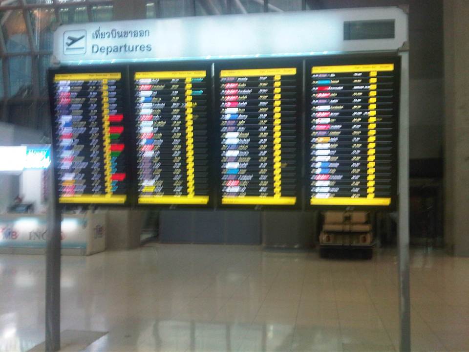 Departures – flight information board for departing aircraft
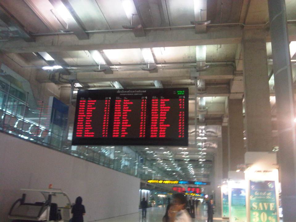 Can’t get enough of info – overhead electronic information boards for passengers can be quite useful for transfers or boarding information
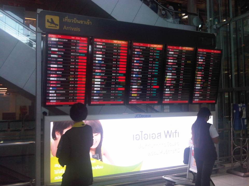 Arrivals – information board for arriving aircraft are useful to people picking up friends or clients.
 Airport concourse – the spacious airport terminal provides enough room for moving around. There are information booths for visitors/tourists as well as those catering to currency exchange, transport services, souvenirs, and snacks.
 Up and down – escalators and elevators are available for the convenience of airport users particularly when traveling to or from the rail link.
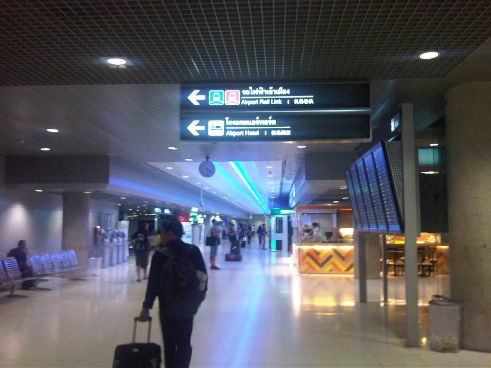 In transit within – heading to the airport rail link, travelers will be guided by the signs along the way.
 Airport rail link – ticket vending machine for the rail express link between the airport and the city center
I will post more photos later of the interior of the passenger terminal. There is not much difference between the terminal as I remember from the last time I was in Bangkok 5 years ago and this recent trip. This will be obvious in the next post on the airport.
–
Walking and parking in Quezon City: Tomas Morato
Continuing on the series featuring pedestrian and parking facilities in Quezon City, featured in this post is the case of Tomas Morato Ave. Like Visayas and West Avenues, the pedestrian sidewalks and off-street parking spaces along the avenue were constructed to address the lack of off-street parking facilities and sufficient pedestrian walkways along streets that had significant commercial development. It should be noted, however, that the lack of parking spaces is due likely to many establishments not complying with the minimum standards set under the National Building Code and City Hall’s approval of plans and construction despite this non-compliance (note: LGUs issue the building permit upon approval of plans including what is supposed to be a review of compliance to various standards.).
 A view of a stretch of Tomas Morato Ave. – note the absence of or weathered pavement markings and the vehicles parked at spaces constructed by the Quezon City government. Space was relatively more limited along Morato and so much of the spaces available were allocated for parking. Pedestrians, thus end up walking along whatever remained or along the edge of the carriageway.
 Establishments such as the many restaurants along the street. From a purely transport planning perspective, one wonders how these establishments were able to get approval from City Hall without having enough parking slots for their customers. These are not your neighborhood turo-turo or karinderya types and so they will generate a lot of vehicle traffic and require more parking spaces in addition to the token slots they provide.
 Some of the larger and older establishments along Morato already have sufficient parking spaces and these were upgraded by the LGU to have uniformity along the road.
 The off-street parking spaces definitely benefited traffic as road capacity is not reduced by on-street parking. There are still problems though especially during noon and night time when the restaurants generate traffic resulting to some vehicles parked or standing along the street.
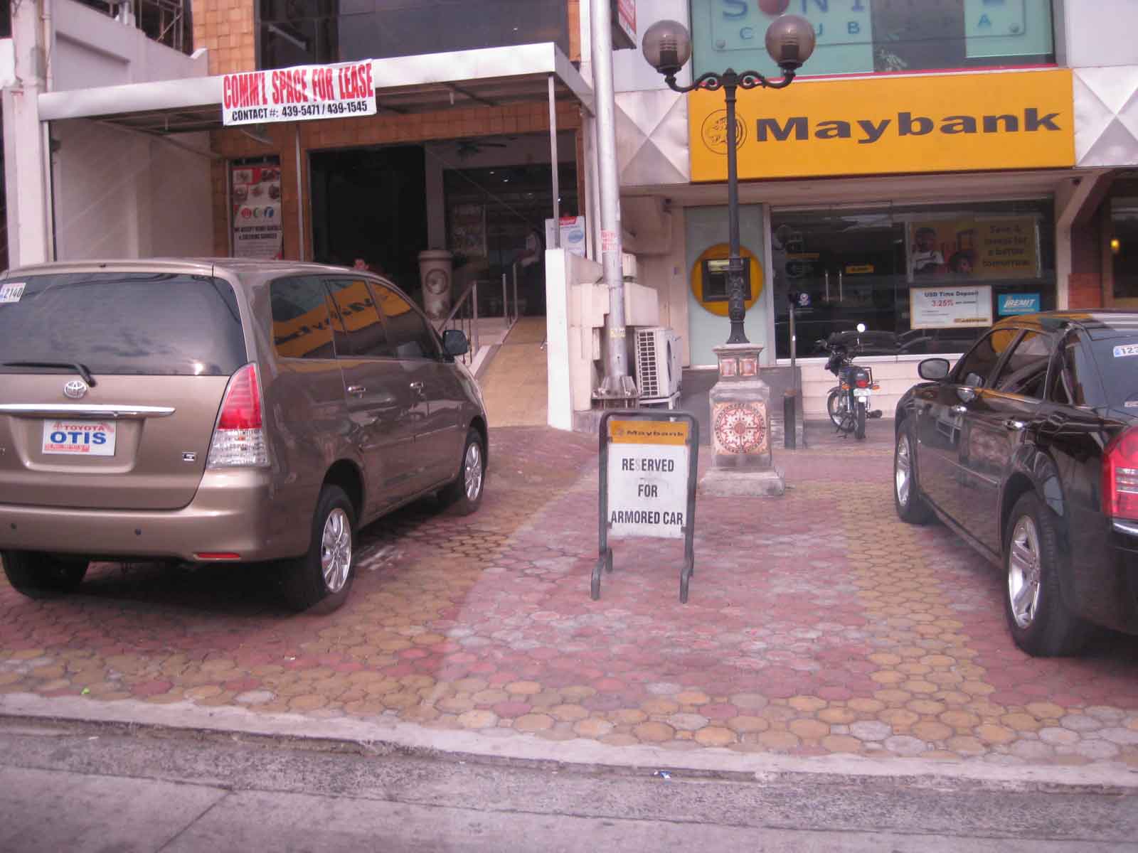 One issue along the street are public parking constructed using public funds being reserved by establishments such as this bank along Morato.
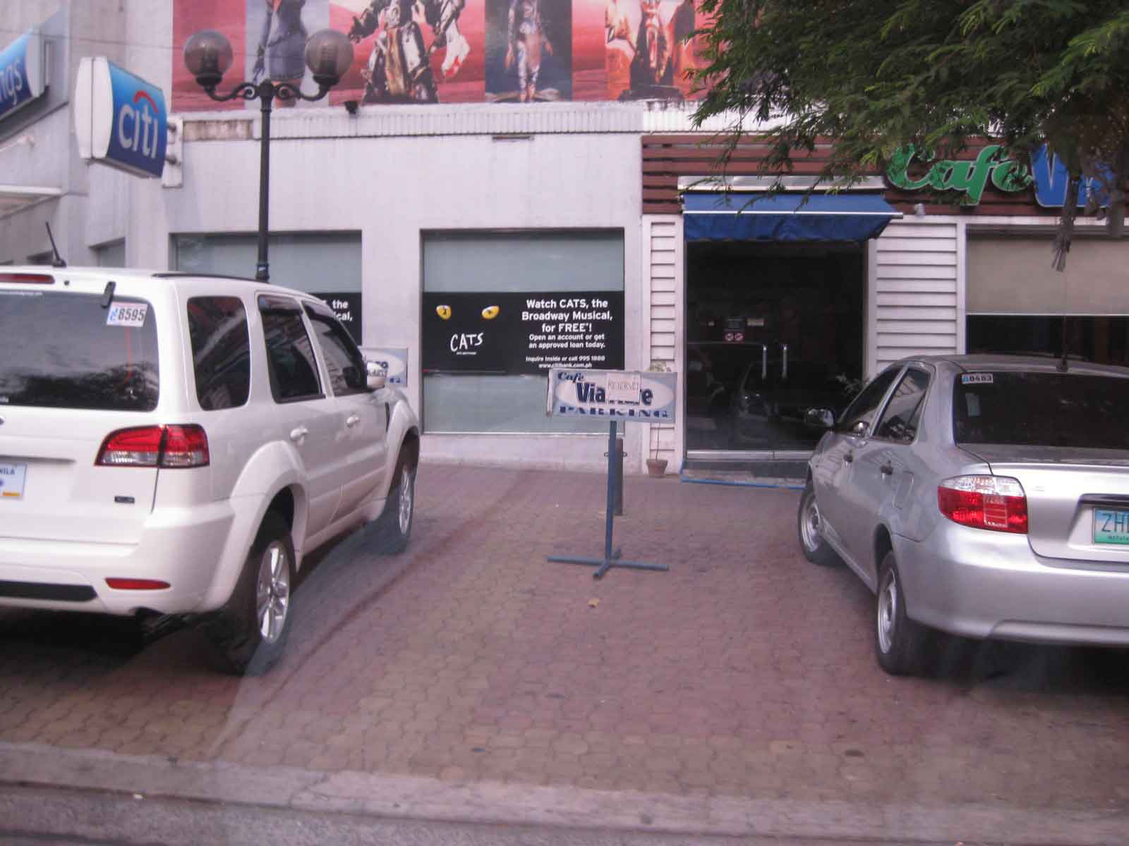 Another case concerns slots reserved by restaurants like this one.
There are still issues concerning the construction of parking spaces for establishments who have not complied with building standards (minimum parking spaces). These issues are rooted on the use of public funds that otherwise could have been used for other, perhaps more important purposes such as healthcare or classrooms. However, one should not lose sight of the fact that there are benefits derived from these parking spaces from the perspective of traffic flow. Moreover, the inclusion of pedestrian facilities definitely enhance safety. These are benefits which are often quite difficult to quantify in monetary terms but contribute to better quality of life for the general public. Such projects also show that the city is doing something to improve public facilities unlike the cases of other LGUs that have sufficient revenues but seem to be lacking in the provision of similar infrastructure.
–
Completed Quezon Avenue-Araneta Avenue underpass
The underpass along Quezon Avenue at its intersection with Araneta Avenue was finally completed and opened to traffic last September 28, 2012. It is perhaps one of the most anticipated inaugurations of infrastructure for Metro Manila and not an anti-climactic one like what was hyped as the completion of the loop formed by MRT3 and LRT1 a few years ago. That didn’t turn out well as we now know there is no loop at all with real connection of the two rail lines. But that, as they say, is another story worth another post or two.
Based on reports from different people including our office’s drivers and some colleagues, traffic has significantly improved in the area. The only joke going around is if the underpass will not be a catchment for floodwaters should there be strong rains considering that it was flooded during construction due to its proximity to the San Juan River and the perennially flooded areas of Talayan and Espana. There are, of course, pumps that have already been installed for the underpass to reduce if not eliminate the possibility of flooding. Following are a few photos taken one Saturday mid-morning when I passed along the area.
 A view of the approach to the underpass from Banawe. The pedestrian overpass is across Sto. Domingo Church.
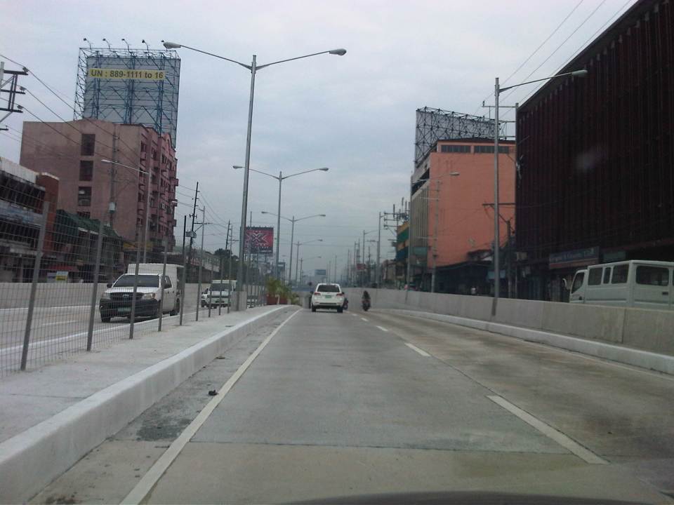 The section has 4 lanes with opposing traffic physically separated by a median island. The fence is likely to prevent jaywalking as well as maybe dissipate glare from headlights during night time.
 Potted plants have been placed along the median and though perhaps more are needed, I am glad there are no concrete balls that look like goat poop used to “decorate” the underpass. Columns and girders support the underpass walls at near the junction with Araneta Ave.
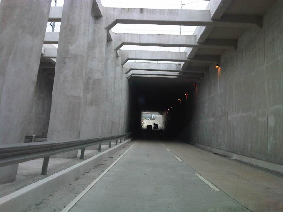 Approaching the section directly under Araneta Avenue, the first impression is that it is quite dark though motorists can see the end of the underpass. Pumps have been installed to drain water from this lowest parts of the underpass and prevent it (or reduced) from being flooded during times of strong rains.
 The end of the tunnel is practically a mirror image of the other. There are few potted plants as shown and perhaps more are needed to soften the look of the underpass as well as to reduce headlight glares.
 Back at-grade – emerging from the underpass, motorists will eventually merge with the traffic along the wide sections of Quezon Avenue. On the opposite direction, I noticed some congestion for vehicle emerging from the underpass as there is a U-turn slot a few meters from the ramp at the Banawe area.
There are traffic signals to manage flows at the at-grade junction of Quezon Ave. and Araneta Ave. It is expected that by reducing the volume of through traffic along Quezon Ave., the signals would be able to handle the remaining traffic and that the intersection will not be as congested as the case prior to the construction of the underpass. Of course, I would also like to see for myself how traffic is in the area during the regular weekdays, particularly on the typically busy days of Monday and Friday.
–
Nomination for the next NCTS Director
The nomination process for the next Director of the National Center for Transportation Studies of the University of the Philippines is currently underway. The Nomination Committee is comprised of three members – Dr. Aura Matias (Dean, UP College of Engineering & Committee Chair), Dr. Mario Delos Reyes (Dean, UP School of Urban and Regional Planning), and Dr. Rene Rollon (Director, Institute of Environmental Science and Meteorology of the UP College of Science). The nomination was open to all qualified persons from the University and particularly from the units currently having an active part with the NCTS through the Research and Extension Fellows from these units (i.e., Engineering, SURP, National College of Public Administration and Governance or NCPAG).
As of the deadline last September 28, 2012 only one person has been nominated. The lone nominee is Dr. Hilario Sean O. Palmiano, an Assistant Professor from the Institute of Civil Engineering and currently the ICE’s Deputy Director for Students and Alumni. Dr. Palmiano previously held posts as technical staff of the NCTS, first as Transport Development Officer in the early 1990’s when the Center was still known as the Transport Training Center (TTC). Later, he was a University Extension Specialist and headed the Traffic Engineering & Management Group of the NCTS before eventually joining the faculty of the College of Engineering of UP Diliman. Dr. Palmiano graduated with a degree in BS Civil Engineering from UP Diliman and obtained his M.Eng. and Dr. Eng. degrees from the Tokyo Institute of Technology.
Formal presentations were made today including one on the accomplishments of the NCTS under its outgoing Director, Dr. Jose Regin F. Regidor, also from the ICE followed by Dr. Palmiano’s on his proposed plans and programs for the Center. The presentations were followed by an open forum and afterwards, interviews of stakeholders and the nominee by the Committee.
 Dr. Palmiano starting his presentation on his proposed plans and programs for the next 3 years.
 Dr. Palmiano reading from his notes during his presentation.
 The presentation was attended by staff and fellows of the NCTS.
The Nomination Committee is to complete their evaluation this week and submit their recommendation to the UP Diliman Chancellor next week. The new NCTS Director will assume his post from November 2012.
–
