
Technical Papers on Sustainable Urban Transport
This is just a quick post to end this first month of the year. Following is a link to the website of the GIZ-supported Sustainable Urban Transport Project featuring the page with the latest technical papers. These represent some of the latest work on sustainable transport featuring good practices from developing and developed cities that can be used as guides or benchmarks for those dealing with transport issues in their respective cities or towns.
Airport terminals and transfers at NAIA in Manila
Ninoy Aquino International Airport (NAIA) has four (4) terminals:
- Terminal 1 – is the international terminal for ALL foreign airlines except All Nippon Airways (ANA), which uses Terminal 3. It is located along the Ninoy Aquino Avenue from the NAIA Road.
- Terminal 2 – also called the Centennial Terminal because it opened in the year the Philippines celebrated 100 years of proclamation of independence from Spain (1998). It is used exclusively by Philippine Airlines (PAL) for both international and domestic flights. International flights use the north wing while domestic ones use the south wing. Recently, PAL transferred several domestic flights to Terminal 3, retaining only major domestic destinations at Terminal 2 (e.g., Cebu, Davao, Iloilo, Bacolod, etc.). For a complete list on which domestic flights are on T2 or T3, one can consult the PAL website. Terminal 2 is located at the end of NAIA Road.
- Terminal 3 – the newest of the three main terminals, it is located beside Villamor Air Base (actually part of it was carved out of the base) and across from the Resorts World Manila complex. It is used mainly by Cebu Pacific (Ceb Pac), currently the country’s largest airline, for both international and domestic flights. Other airlines using Terminal 3 are ANA and Airphil Express, which is a budget subsidiary of PAL. The terminal is located along Andrews Avenue at the end of Sales Road (from Fort Bonifacio).
- Domestic Terminal – now also called Terminal 4, it is the old terminal along the Domestic Road that used to be called the Manila Domestic Terminal where PAL, Cebu Pacific and other airlines used to operate domestic flights. At present, it is used by Zest Air and Seair.
More detailed information on these terminals may be found at the website of the Manila International Airport Authority (MIAA).
It is quite easy to transfer between domestic and international flights if you happen to fly Ceb Pac since all flights operate out of Terminal 3 and the airline provides assistance through its transfer desk. The same used to be the case for PAL when all flights were out of Terminal 2. But then after PAL transferred flights to Terminal 3, many passengers would now have to travel between Terminals 2 and 3. The most inconvenient cases are for travelers transferring to or from international flights at Terminal 1. Terminal 2 is quite near and can easily be reached via shuttle bus. The more challenging transfer is between Terminals 1 or 2 and Terminal 3. Shuttle buses would have to go through the NAIA Road, the Domestic Road the Airport Road
There are no internal connections between the 4 terminals operating within the NAIA complex such as AGTs, monorails. There are shuttle buses that travel between these terminals but they use the public roads rather than an internal road exclusive for the airport. As such, these shuttles are subject to traffic congestion and possible delays. The MIAA website states that using the shuttle buses are free but I saw a sign at Terminal 3 showing that there is a flat rate of PhP 20. While the fare would probably cover fuel, maintenance and other costs, it can also be argued that this service should be free at least for passengers and covered by airport authorities as part of the services they provide to travelers. Perhaps passengers can present their tickets before boarding the bus. Others may be required to pay the PhP 20 fare.
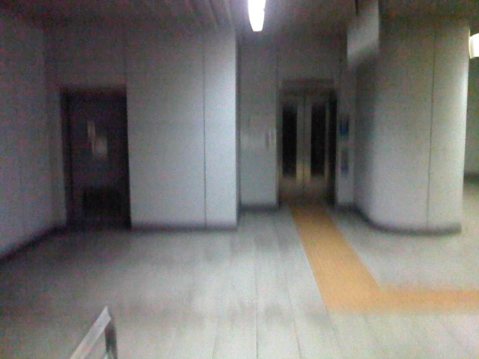
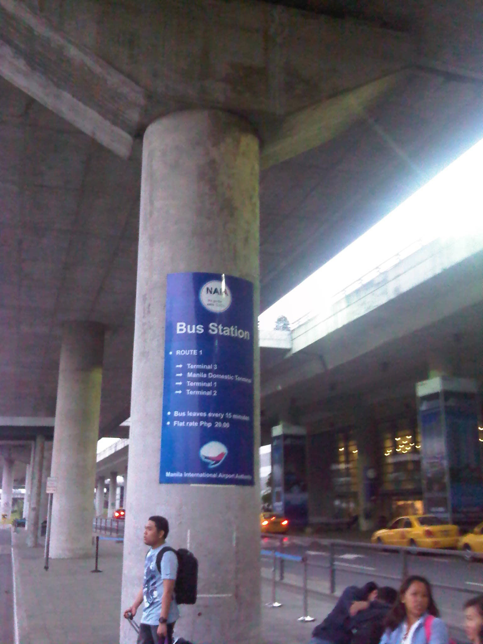 Bus station/stop at the NAIA Terminal 3 – the station is located at ground level (arrivals) beneath one of the overpasses (departure level) and across from the airport taxi stand (shown in the photo). Shuttle buses are scheduled to depart every 15 minutes according to the sign.
–
HK Airport Express: check-in and transit
I wrote about Hong Kong International Airport (HKIA) and the Airport Express service between the terminal and Kowloon in a previous post. I had an opportunity to take a few more photos on the service on my way back from Hong Kong, when I checked-in at Kowloon Station prior to proceeding to HKIA. The system is so easy and so convenient for travelers, and is something that should definitely be replicated elsewhere where they still don’t have something similar in place. More information may be found with the HKIA website and the MTR website that features all the details on the Airport Express service, including complementary services such as shuttle buses to and from hotels via Kowloon or Hong Kong Stations.
 One does not have to purchase tickets over the counter as there are ticket vending machines at the station. The easy-to-use machine can be operated in Chinese or English and accepts coins and bills for payment.
 Check-in counters for most if not all airlines using Hong Kong International Airport may be found at Kowloon Station. This makes it possible for travelers to complete the procedure including checking-in their luggage for passengers to be able to travel light between the station and HKIA.
 Monitors on top of each counter displays which airlines are served by the counter staff.
 Flight schedules are displayed at Kowloon Station and there is a security check prior to the check-in counters.
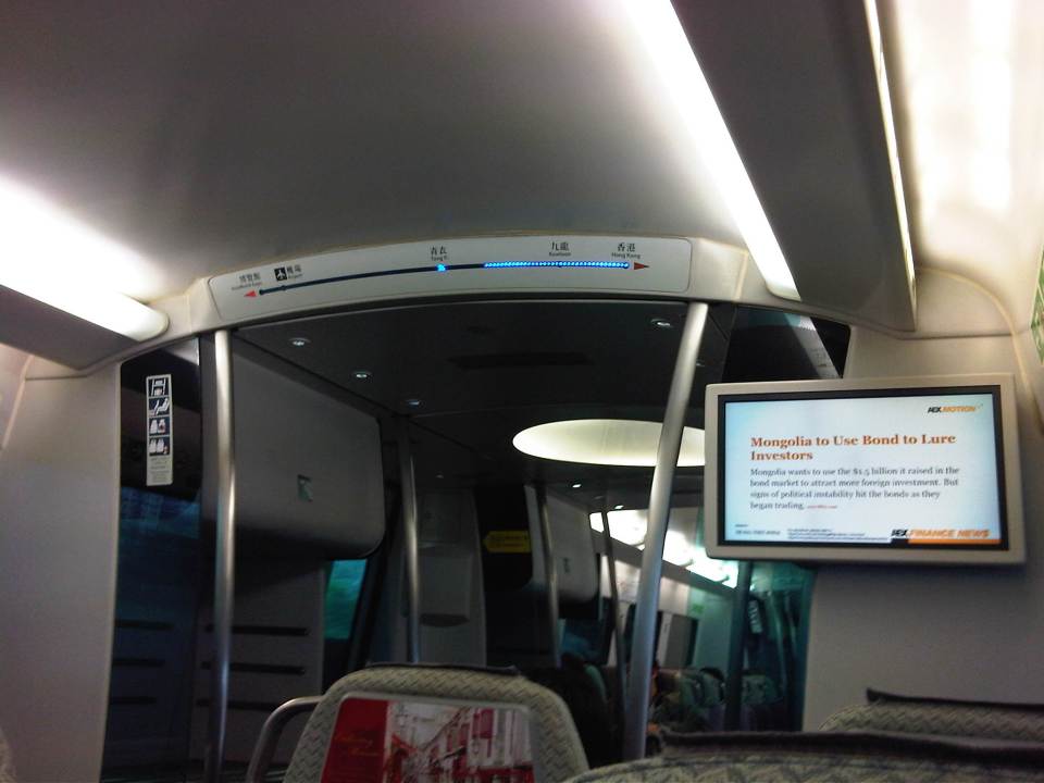 The LED display on top gives passengers information on the progress of the trip while the monitor provides business news.
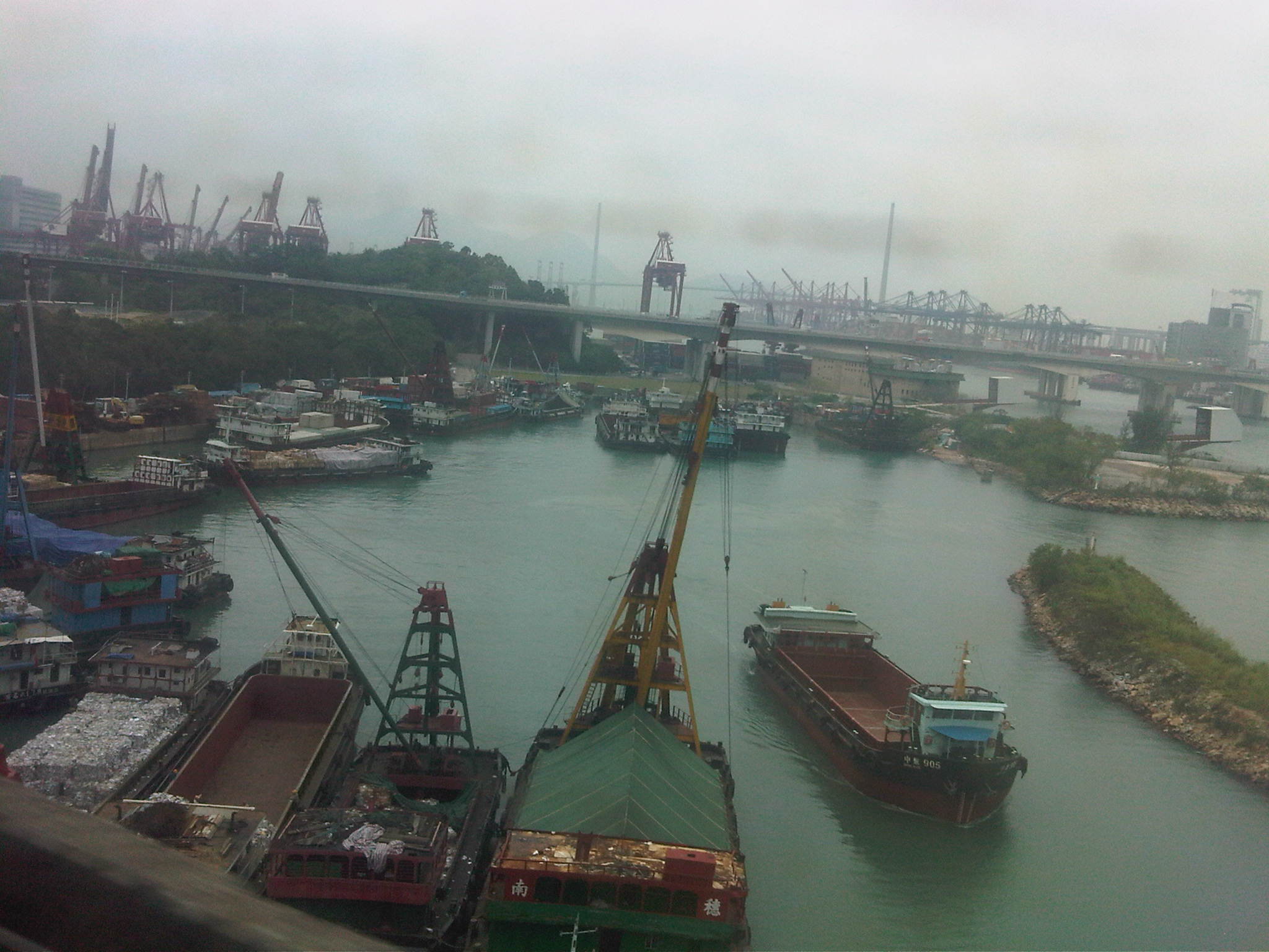 A view of the ports along the way to the airport.
The Hong Kong Airport Express provides one of the most efficient services I’ve seen for airports. It makes perfect sense in this day and age when advances in IT would allow for such services like checking-in for your flight and convenience and comfort should be the focus of service providers. I think such services are what makes airports like HKIA good examples for best practices on service delivery to passengers.
In the case of Manila, the recent opening of an airport lounge at a major mall in Quezon City serving Clark International Airport (north of Metro Manila) presents an opportunity to provide similar services for the convenience of passengers. Perhaps a local airline like Cebu Pacific should initiate check-ins at this satellite lounge so that passengers would be freed from their luggage as they make their way to Clark (a 1.5 hour trip between the Quezon City and the airport). Perhaps, too, there should be a similar system for people taking Ninoy Aquino International Airport even though the challenge is how to manage travel using the road in the absence of express rail services. These are sure to boost travel and tourism but should also have impacts on business considering the convenience and efficiency such a system can provide.
–
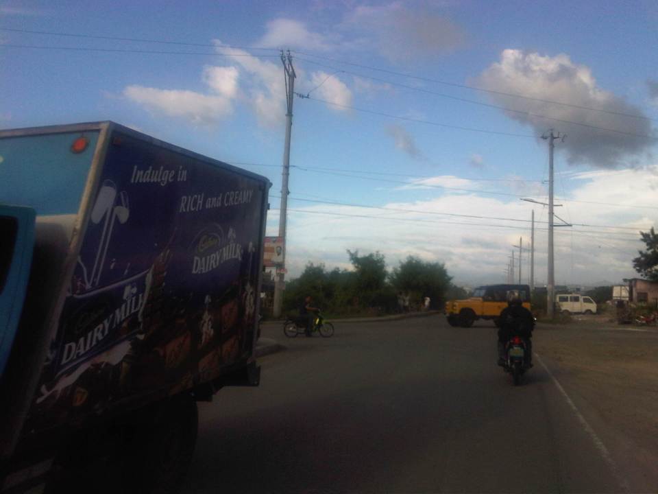
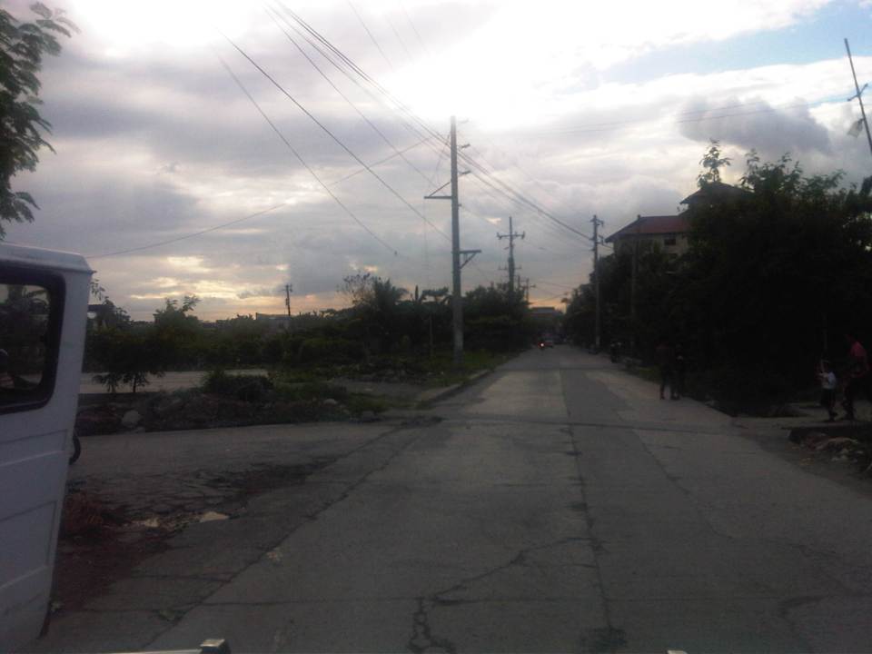
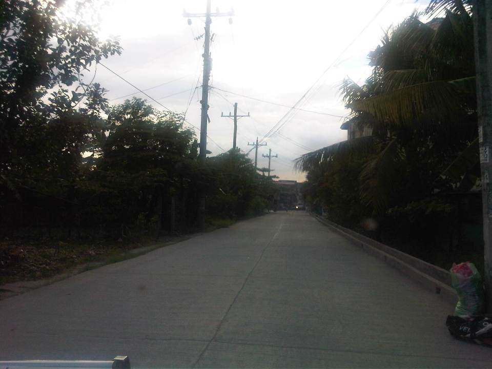
C6: Bicutan to Napindan
I wrote about Circumferential Road 6 (C-6) in a previous post where I featured some photos taken while we were en route to the DOST compound in Bicutan, Taguig City. It was originally constructed as a dike road, an access road along the barrier constructed along the coast of Laguna de Bay to provide additional protection to Taguig City against the lake waters breaching the banks during incidence of heavy rains. Once the link between Taytay, Pasig, Pateros and Taguig was completed, however, traffic significantly increased as C-6 provided a very convenient alternate route for people residing in the east who had to go to Makati, Taguig or southern Metro Manila mostly for work trips. Following are photos showing C-6 from Bicutan to Napindan, before crossing to Pasig City.
 Tree-lined – one can imagine how the highway will look like once the trees planted along either side are full-grown
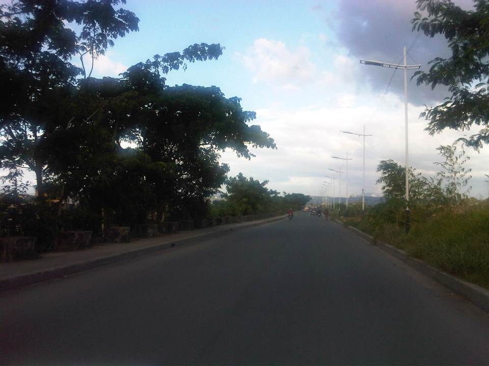
 C-6 is a two-lane, undivided highway with a sidewalk along the Taguig side and a shoulder along the dike along the coast of Laguna de Bay
 Approach to the intersection with Seagull Ave., which connects M.L. Quezon Ave. and Taguig proper in the west and Bay Breeze Subdivision in what appears to be a small peninsula on the bay.
 Most sections of the existing C-6 have no pavement markings.
 The entire road is of asphalt concrete pavement.
 There are several pumping stations along C-6, which reminds people of the flood control aspect of the dike and the road. The photo shows the Taguig Pumping Station operated by the MMDA.
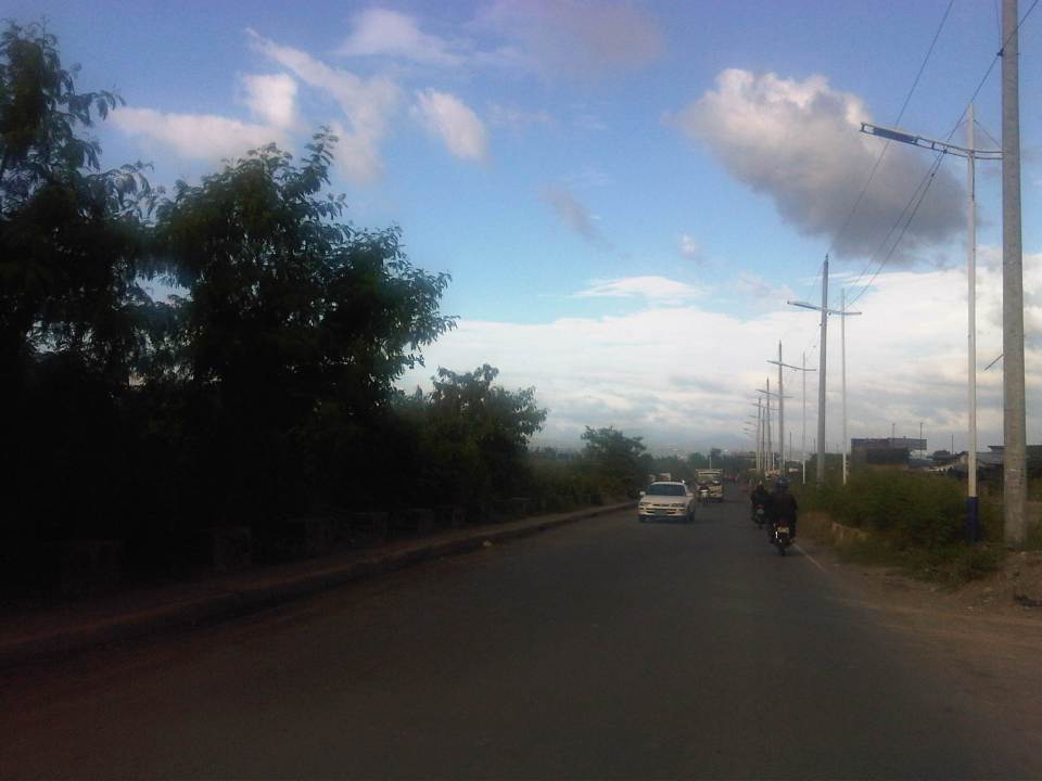
 While C-6 provides an alternative route for travelers from the eastern towns of Rizal wanting no part of the traffic congestion along Ortigas Avenue and C-5 en route to Makati or Taguig (or back from these areas), peak traffic is usually predictable and at other times of the day, volumes are quite low as shown in the photos.
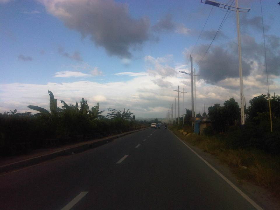
 There aren’t any significant developments or establishments for most part of C-6.
 The undeveloped lands are mainly due to these areas being flood prone, and requiring extensive improvements to raise elevations and provide for adequate drainage.
 Labasan pumping station – is practically the only building for a long stretch of the highway.
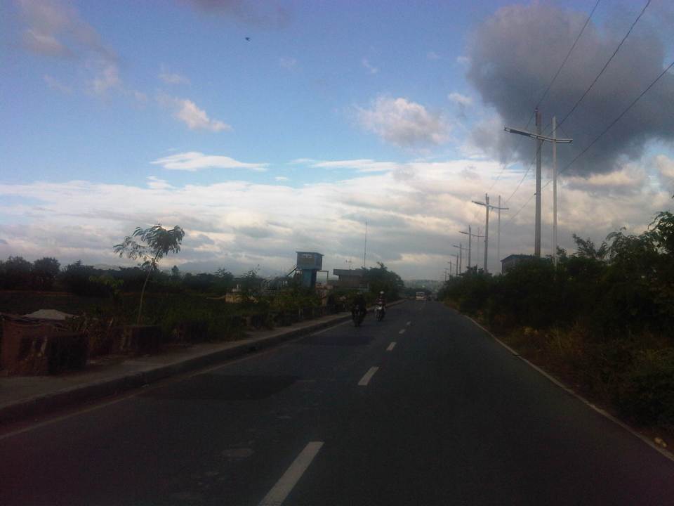
 Past the Labasan Pumping Station, are more undeveloped areas along the highway. At right in the photos is the dike that serves as
  The bridge across the Napindan channel of the Pasig River is further ahead (downstream), which travelers can use to cross to Pasig City.
The stretch of C-6 from M.L. Quezon to Napindan is currently subject to studies for widening as traffic steadily increases due to the very strategic position of the road. However, there should be a more direct link between C-6 and C-5 so as to maximize the benefits of the road, particularly as an alternative route between Rizal province, and Bonifacio Global City and Makati CBD. I estimate that travels times can be reduced significantly for people traveling between their homes in Antipolo and Taytay to the offices in Makati and Taguig (Fort Bonifacio). On a normal day, this trip can take easily more than 60 minutes due to congestion along Ortigas and C-5, the usual route for most people. With the alternate route, it might just be possible to reduce it to say 45 minutes, give and take some congestion. Of course, once this alternate route is discovered by more people (and UV Express vehicles are already using this route), then it would attract more traffic and necessitate an increase in capacity for it to handle such traffic. But then the result may well be an easing in traffic along Ortigas and C-5 so that should be good until perhaps we finally have a good public transport system in place along Ortigas and C-5. BRT? That deserves another post…
–
Roads in Pasig: Ejercito Avenue
Upon reaching the end of the existing C-6, travelers encounter an intersection at the mouth of the Manggahan Floodway that leads to Taytay, Rizal via the Barkadahan Bridge. Turning right leads to Taytay while turning left leads the traveler to Pasig City via Sandoval Avenue. C-6 and Sandoval Avenue are linked by a short road named Ejercito Avenue.
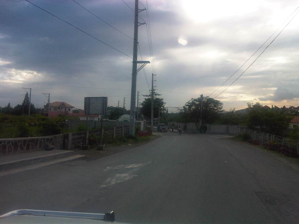 Turning left from C-6, travelers are greeted by the walls of exclusive residential subdivisions.
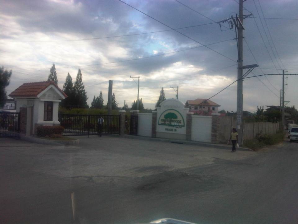 Among these subdivisions is Greenwoods, whose Phase 10 is located near C-6 and the Manggahan Floodway to Taytay, Rizal.
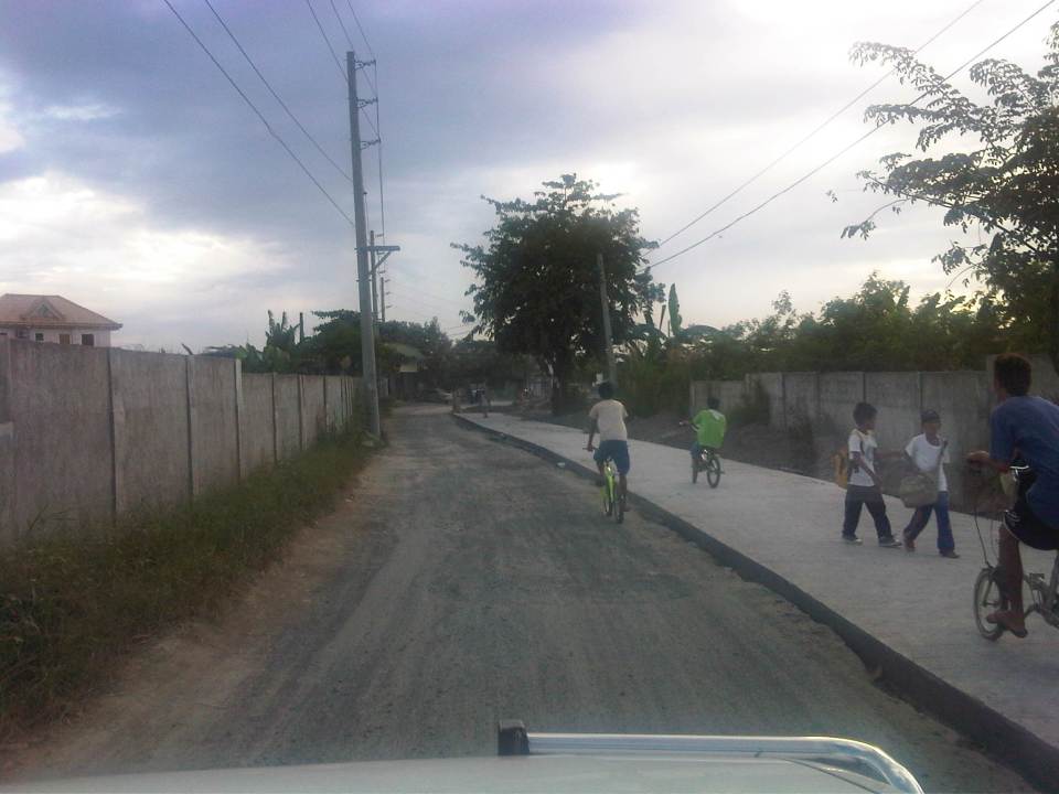 The easternmost section of Ejercito avenue was under rehabilitation when we passed the road. Only one lane, the one where the sub-base was exposed, was available to motorized traffic. The other lane is presumably still in the curing stage but is used by pedestrians and cyclists.
 Past the section under repair is a section that’s showing a lot of pavement distresses that appear to be partly due to patch-up work by a water concessionaire (note the features of the concrete slab in the middle of the road where an excavation for waterworks used to be).
 Rehabilitated section of Ejercito Avenue features what appears to be properly cured pavement but with curb only along one side.
 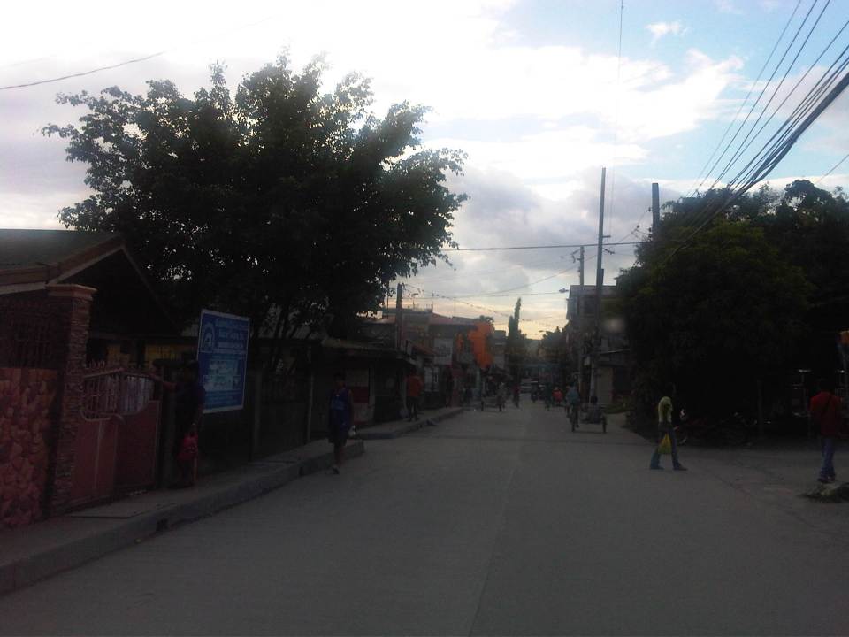 Open residential area in Pinagbuhatan, Pasig where one can see that the pavement is higher in elevation compared to the ground floors of most houses. This us usually an indication that the area is prone to flooding.
 Some parts of the road pass through what appears to be unplanned developments typical of informal settlements or resettlement areas for people from Pasig and other cities of Metro Manila. Notice the bunch of meters installed by the Meralco on the post in the middle of photo? That’s another indicator associated with crowded, unplanned areas. I always wonder how Meralco staff are able to read the meters and collect payments due. I assume there are still significant losses here due to jumpers that are eventually subsidized by those who do pay their bills.
 Noticeable in this photo, the previous one and the next one are indications of previous waterworks in the area. The pipes are laid out under the middle of the road and so requires excavations in cases when maintenance works need to be undertaken.
 Ejercito Street ends where P. Sandoval Avenue begins. From what we observed this transition from one road to another is not a clear one except perhaps to those who are familiar with the area such as residents of Pinagbuhatan, Pasig City.
–
AGT demonstration runs at UP Diliman
The Automated Guideway Transit (AGT) project of the Department of Science and Technology (DOST) is well under way with the initial test runs already being conducted by the agency. Several demonstration runs were also undertaken to show the vehicle and provide an initial experience for various stakeholders including government official, UP faculty, the media and invited guests from the private sector. I am posting a short video taken during one demonstration run where faculty members from UP’s College of Engineering rode on the prototype and also made some initial inspections of the vehicle.
.
The first phase of tests is expected to be completed during this first quarter of 2013. The next phase, which is expected to be a joint undertaking of DOST and UP, will follow immediately and should involve a multidisciplinary team that will evaluate the prototype. Such assessments are necessary to determine and address issues and/or weaknesses. It is imperative that the AGT would be proven to be safe and sound in its specs before a scale-up in the project.
Already, there are discussions on the future applications of this vehicle, and CBDs and airports are already being mentioned where the AGT would be most applicable. Also being mentioned is the further development of the test track to connect the UP-Ayala Technohub along Commonwealth Avenue and the future University town center along Katipunan with a line along C.P. Garcia Ave. Perhaps, too, such a line would have more ridership if it is extended all the way to Ateneo along Katipunan (C-5). While there is also talk on the AGT along the lines of the existing LRT and MRT lines, the reality is that AGT’s and monorails have significantly less capacities compared to regular commuter lines that are much needed in Metro Manila and other rapidly developing, highly urbanized cities in the country.
–
Suvarnabhumi departure
This is actually a continuation of a previous post on Thailand’s main international airport. In the previous post, I featured checking-in at Suvarnabhumi International Airport. In an even earlier post, airport railway access was featured. Following are photos I’ve taken while exploring the airport again eight years after my last visit to Bangkok.
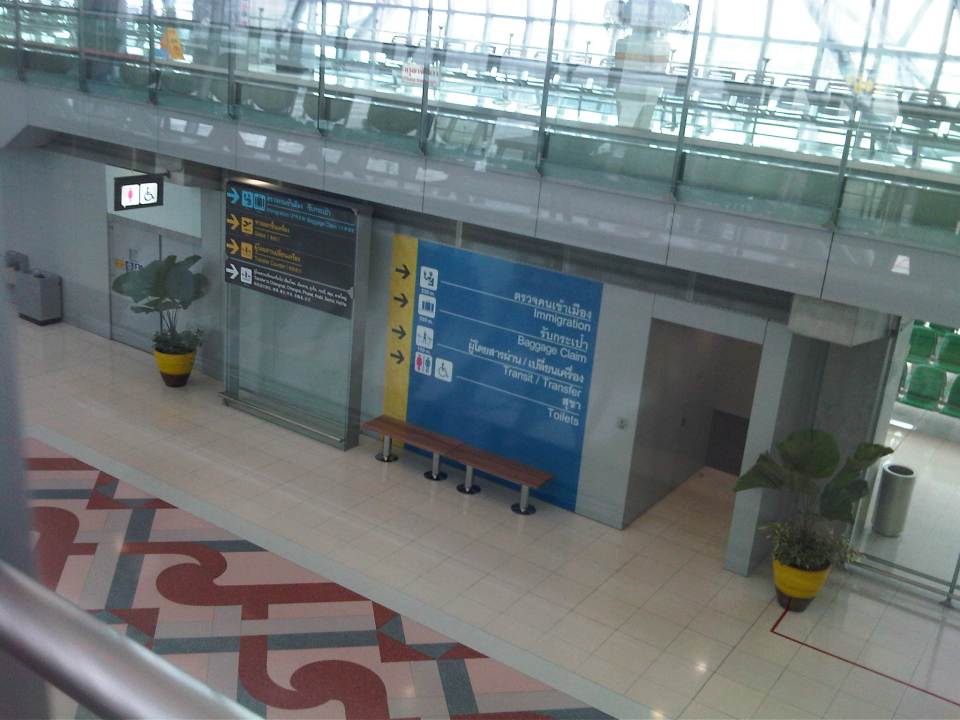
 After clearing immigration, the traveler is greeted by this attraction, presenting additional photo opportunities to tourists.
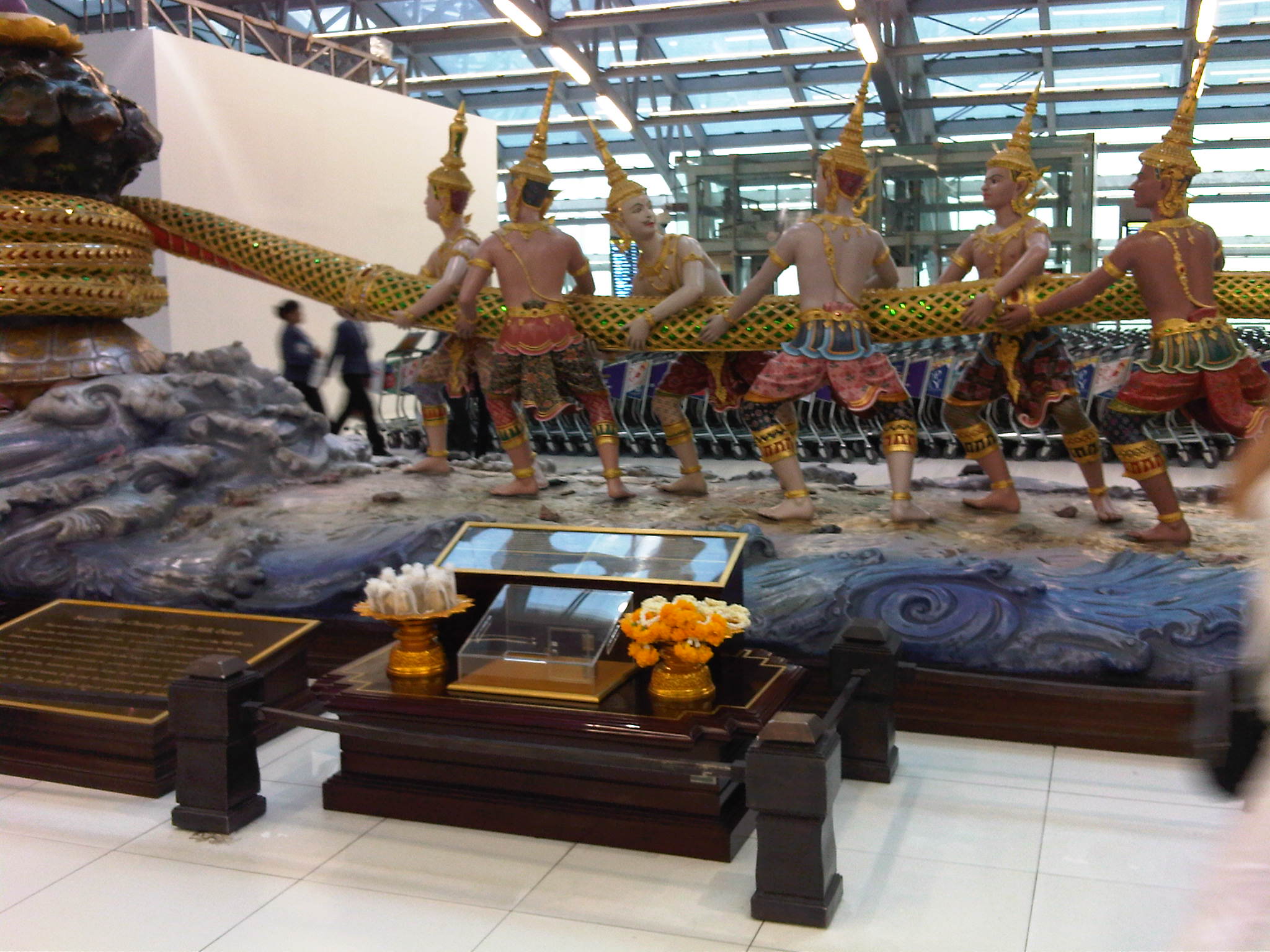 The scene is is religious in nature and there is an explanation on a plaque in front and at the center of the life-size display. Unfortunately, I wasn’t able to take a photo of the plaque.
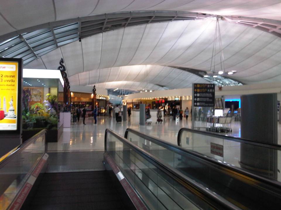 Duty free shops line both sides of the corridor to the boarding gates.
 Tourists will be happy to find more photo opportunities as they explore the airport or walk towards their boarding gates. This gazebo-like feature in the airport is a curiosity given its contrast against backdrop of the modern interiors of the airport.
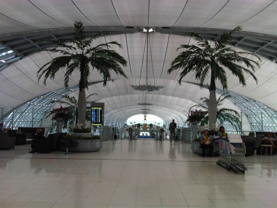 Natural features in the airport include these palm trees serving as sentinels to the escalators to the boarding gates.
 Cavernous terminal is emphasized in this photo taken during my descent via escalator.
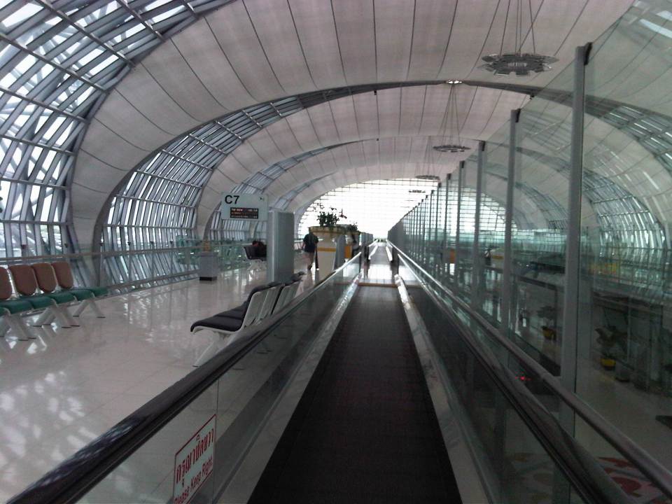
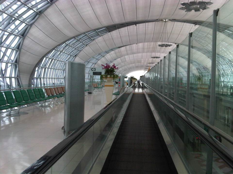 The moving walkway helps people get to their boarding gates, which may be located at the farther parts of this linear airport terminal layout.
 The departure level is on the upper level concourse so as to separate arriving and departing passengers. The photo gives a view of the lower level corridor for arriving passengers.
 The terminal building is linear and requires several moving walkways.
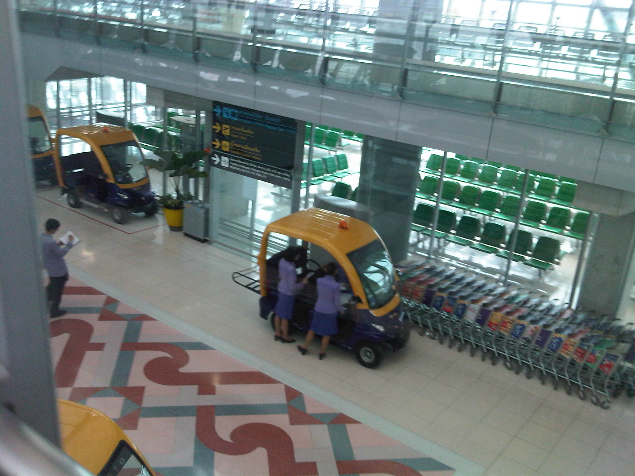 There are electric service vehicles at the airport but these are mainly for the use of airport staff.
 Another photo opp feature at the airport for last minute pictures reminds me of the royal palace.
 Another view of the attraction. The trees are real.
 End of the line? – my boarding gate appeared to be the second to the last gate along this wing of the airport. I found this unusual and a bit inconvenient considering I flew on Thai International Airways. International airports would usually provide the more convenient gates for their national airlines.
 Waiting area for departing passengers as seen by someone descending the stairs.
 Access to the waiting area is via staircase shown in the photo.
–
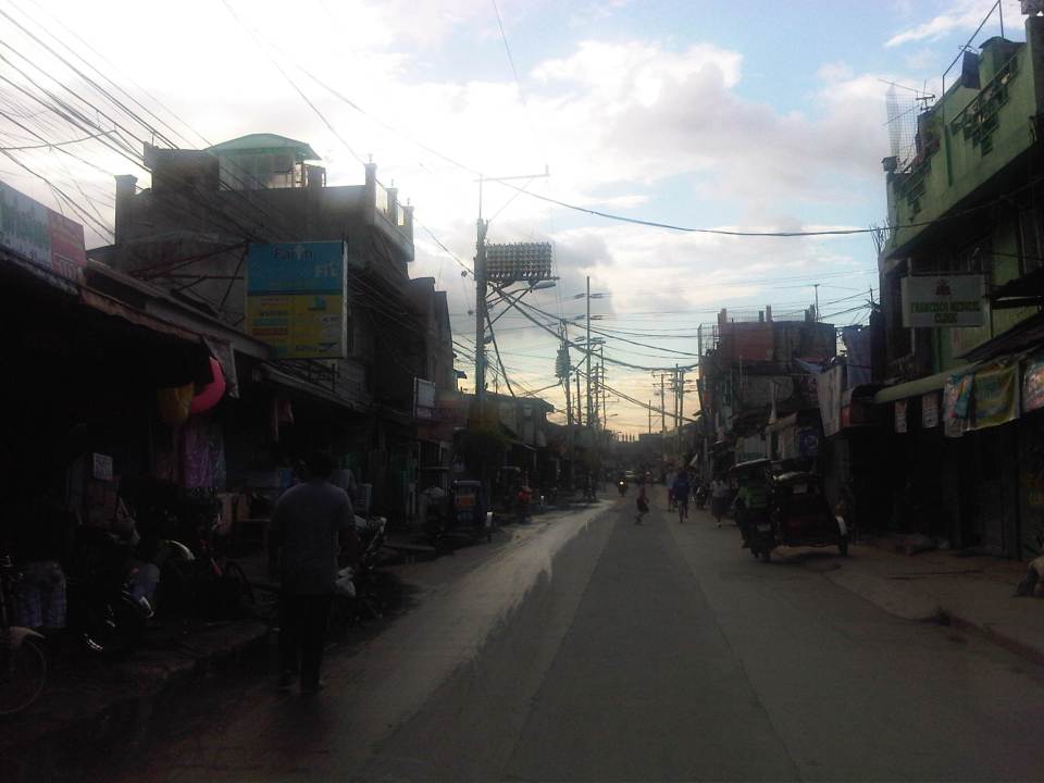
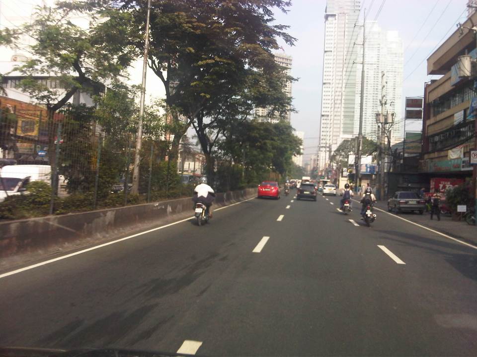
Shaw Boulevard: Kapitolyo to St. Francis
I have not been to Shaw Boulevard for quite some time so I decided to take photos en route to a speaking engagement at my alma mater, a school located along the major thoroughfare. Though I have commuted between my parents’ home in Cainta to school using this route and some landmarks remain, a lot has definitely changed in the area including the skyline along the boulevard. I have memories of vast grasslands where the buildings of Ortigas Center now stand. One could see EDSA traffic from the balcony of St. Francis Church in the 1970’s and the 1980’s as there were still no SM Megamall, Shangri-la or ADB along EDSA. The old provincial capitol site (Pasig used to be part and the capital of Rizal Province) is now being redeveloped into a commercial center after it was bidded out and the capital moved to Antipolo City. It was the Rizal provincial capitol which gave Barrio Kapitolyo in Pasig its name.
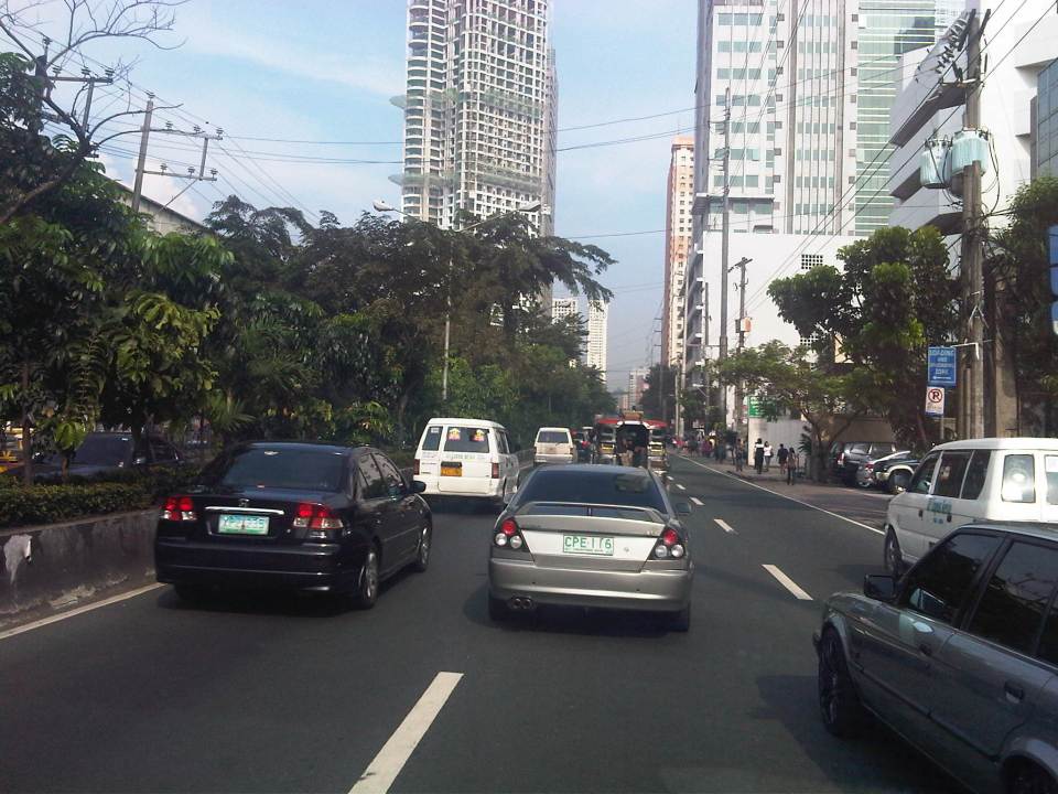
 Turning from Meralco Ave, one is greeted by the view of tall buildings along Shaw Boulevard.
 Shaw Blvd is a six-lane, two-way highway with a median island separating opposing traffic flows
 The signalized intersection leads to Kapitolyo and an area that was generally called United (as seen in the jeepney sign boards). United stands for United Laboratories or Unilab, which had its main offices and plant in the area (They still have property there even after moving to their plant in Laguna.).
 It seems more crowded now along the street because of the high rise buildings that have been constructed.
 It doesn’t help that there are also more electric wires, telephone cables and posts/poles along the boulevard.
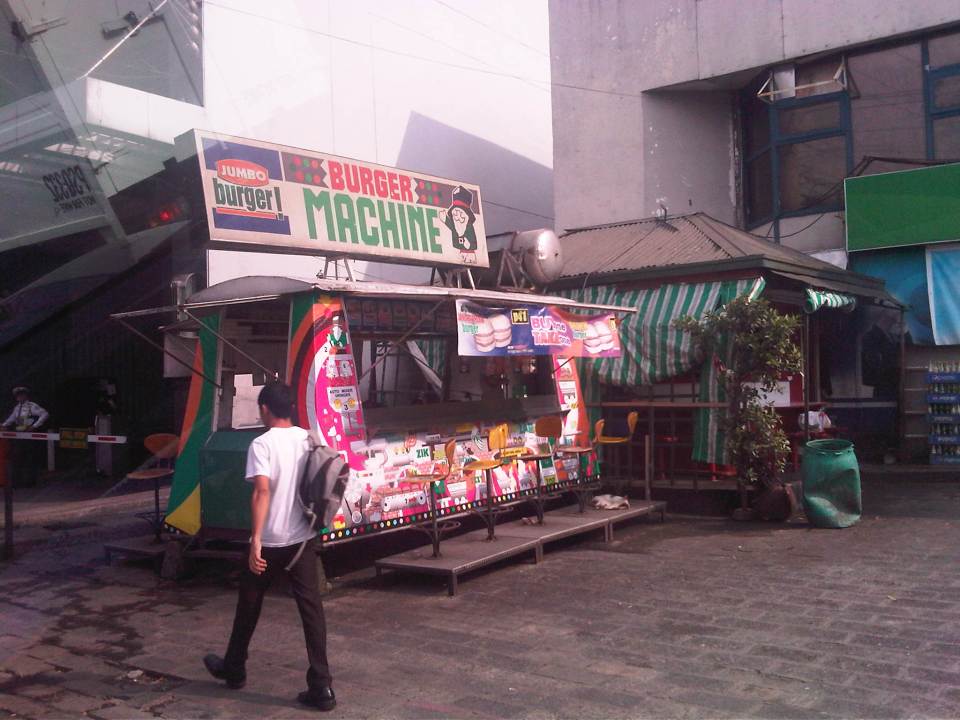 There used to be a lot of these burger stands around Metro Manila. Usually installed at gasoline stations, they provided inexpensive fast food while the big boys (Jollibee, McDo, etc.) were not yet into their aggressive expansions. The one at the former gas station where One San Miguel now stands was a Minute Burger stand. I think only Burger Machine survived from that era though there are others like that ubiquitous Big Mak that flourished in the provinces.
 Intersection with San Miguel Ave. – right after the intersection is Lourdes School of Mandaluyong and St. Francis of Assisi Church. There was a time when the school and the church were the only major structures in the area. Most of the surrounding lands were unoccupied including what is now Shangri-la, SM Megamall, ADB and all the lands in Ortigas Center where there are now tall buildings housing offices and residential units.
 Despite the sign stating that boarding and alighting is prohibited along the area, many commuters continue to defy authorities. Jeepney drivers usually oblige if they see that there are no traffic enforcers around to apprehend them. There used to be substantial sidewalk space in front of Lourdes Mandaluyong but perhaps the space was sacrificed when Shaw was widened to allow for more space in relation to the ramp of the overpass/flyover along Shaw that crossed EDSA. It doesn’t help that what little space remained is blocked by posts such as the one shown at the right in the photo. Pedestrians are forced to walk on the carriageway where they are exposed to the risks of being hit by motor vehicles.
 Pedestrians walk along the carriageway due to the narrow space of the sidewalk. Notice that the ramp of the Shaw flyover is practically in the middle of the intersection with St. Francis Avenue (which is in front of St. Francis of Assisi Church). The configuration of the ramp prevents vehicles coming from St. Francis from getting on the flyover and all traffic must turn right towards the at-grade, signalized intersection with EDSA. The area is usually a bottleneck as jeepneys congregate along Shangri-la mall to load/unload passengers at what becomes an informal terminal at the Crossing area.
–
Roads in Pasig: Eagle Avenue
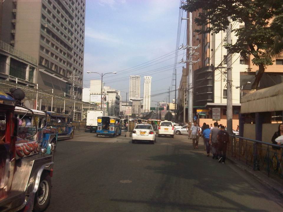
There are a few options for travelers heading to/from the eastern part of Pasig from/to other parts of Metro Manila. The usual routes are via Ortigas Avenue, Marcos Highway and Pasig Boulevard, all crossing the Pasig River or the Marikina River via Rosario Bridge, Marcos Bridge and Vargas Bridge, respectively. I am featuring in this post an alternative route that also crosses the Marikina/Pasig River – Eagle Avenue. Following are a few photos for this road, which connects E. Rodriguez, Jr. Ave. (C-5) and Sixto Antonio Avenue.
 Sandoval Bridge along Eagle Avenue – the road and the bridge is a two-lane, undivided street connecting C-5 in the west and Sixto Antonio Ave. in the east. The latter connects to a network of roads leading to the what is generally regarded as the center of Pasig City, including City Hall.
 The Grove – a major high density residential development along the Marikina River with access via C-5 (E. Rodriguez Avenue) is visible from the bridge.
 Towards C-5 – the perspective shown in the photo is for westbound travelers. There is only a short distance between Sixto Antonio and Sandoval Bridge. Most of Eagle Ave. is from the west end of the bridge until C-5, which used to have mostly industrial land use on either side of the road.
 Re-development – the lands on the left are currently used by industries while the lands on the right used to be industrial, too (PIMECO). These lands east of C-5 are now being re-developed into residential areas like the development mentioned in a previous photo. Others are currently being advertised by developers.
I can imagine that this road can become congested during the peak periods as many residents of Pasig City would opt to use this route instead of Vargas Bridge or Rosario Bridge to get to or from Pasig town proper. During the morning, most traffic would be westbound and this direction can be congested due to vehicles merging with C-5 traffic. During the late afternoon to evening period, the eastbound direction is congested and traffic can spill into C-5 due to the limited capacity of the intersection at Sixto Antonio. There are limited options to improve this intersection as both sides of Sixto Antonio are generally built-up and land acquisition for widening the road will have prohibitive costs. There’s just too many cars?
–
Commuting on the LRT Line 2
Metro Manila’s LRT Line 2 stretches from Santolan in Pasig City to Recto in the City of Manila. It is the only suburban railway line serving Metro Manila outside the PNR, and uses trains that have the highest passenger capacities compared to the LRT Line 1 and EDSA MRT (Line 3), which uses cars that can be categorized as light rail vehicles. Line 2 employs vehicles that would elsewhere be used for metros or surface heavy rail transit. I occasionally use Line 2 for commuting between Katipunan and Cubao but I must admit I haven’t used it to commute all the way to Manila. Following are photos I took on one commute between Katipunan and Cubao.
 Going underground – descending to the station at Katipunan, there are no escalators so most people have to use the stairs.
 Accessibility – there are elevators for the physically-challenged including persons with disabilities (PWDs), senior citizens and pregnant women.
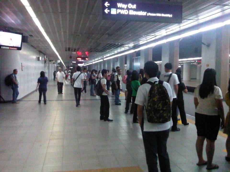 Katipunan Station platform – is underground and gives the feeling of being in a subway. There are directional signs to guide passengers but I think there should be more signs informing people about train arrivals and schedules. Note that most passengers do not form lines and are standing along and near the entire platform edge. This seems to indicate people are either undisciplined or there is little effort to establish order in boarding and alighting procedures.
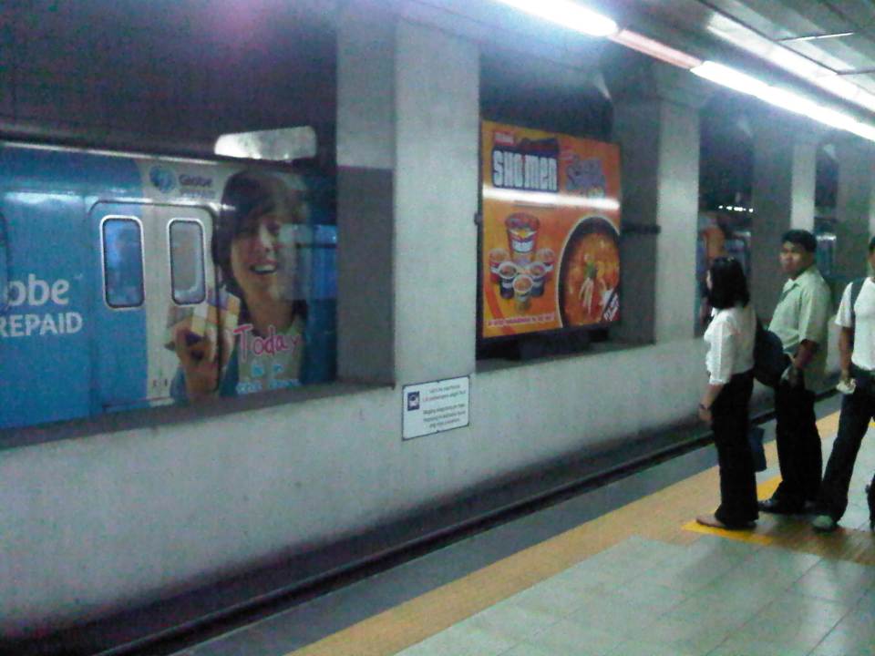 Passengers waiting along the platform form lines where the trains’ doors are supposed to be positioned once the vehicle is stopped. In other countries there are also signs along the median to guide passengers where to line up along the platform and to give way to people alighting from the trains before boarding the train. Such procedures are important for orderly operations. A train bound for Santolan Sta. is on the other side of the platform.
 Passengers boarding the train
 Stragglers hurrying to enter the train before the doors closed for departure. Like in other cities, some passengers attempt to board the train at the last second. Such situations can cause injury as people can get caught by the closing doors.
 Train leaving the Katipunan Station and bound for Recto in Manila
 Warning sign – signs inform passengers of the dangers along the tracks. In this case, the danger is in the form of high voltage wires as the trains are powered by electricity. There is a fine of PhP 50,000 (~USD 1,200) for anyone illegally going down to the tracks.
 The yellow line defines the area where passengers should be safely behind and clear of the trains. There are dimples on the line, which are generally for the benefit of blind people using their canes to “feel” such lines for guidance.
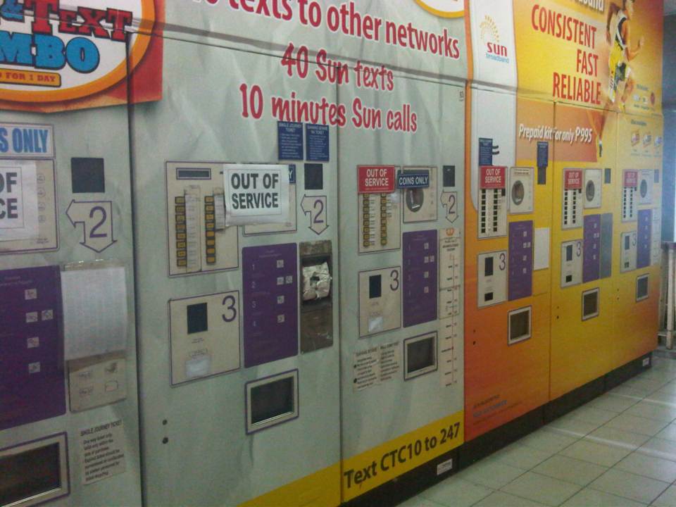 Defective – Most ticket machines were out of service. Those that weren’t marked as defective (just a few) had problems accepting coins. This issue regarding ticketing makes it inconvenient for most passengers to use the trains as they end of queuing along one or a few manned booths selling tickets at the stations. One would think that with so many options now available for fare collection (tickets, passes, cards, etc.) and the LRT’s already in operation for so many years that authorities would have already had a more efficient system in place for fare collection.
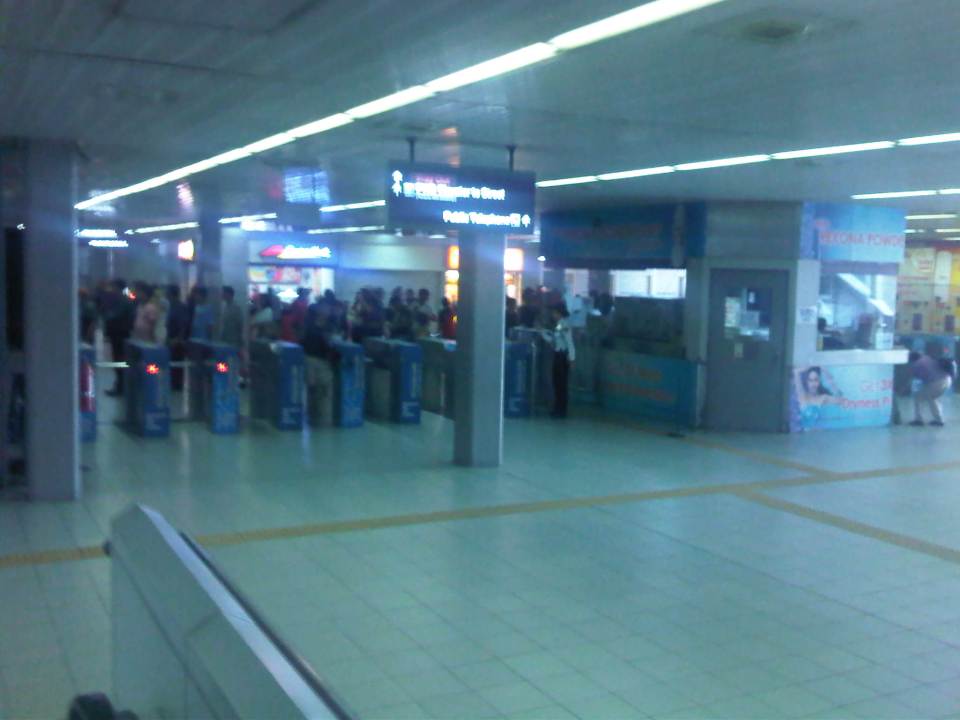 Turnstiles – there are enough turnstiles at the stations (in this case Cubao) but the queuing problem is not here but at the ticketing stage of the journey. Of course, there are also queues due to the security checks at the station but these are usually quicker compared to the time it takes for people to purchase tickets.
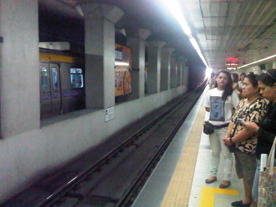
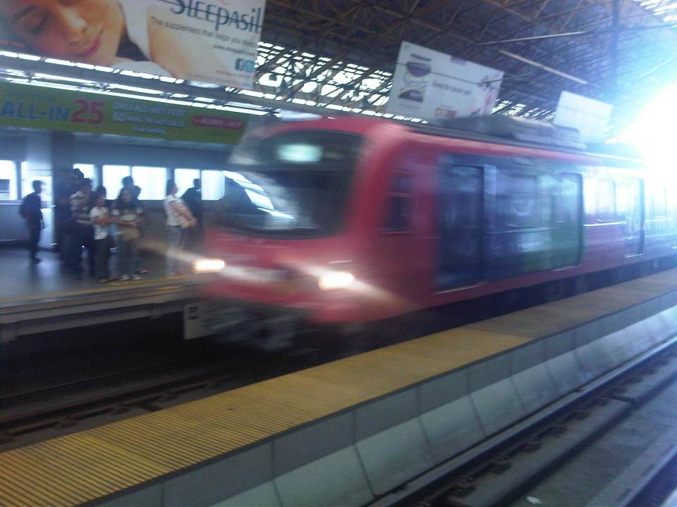 Westbound arrival – a train bound for Recto arrives at the opposite platform at Cubao Station.
 Departures – a train bound for Manila leaves Cubao Station while passengers form queues along the platform for trains bound for Pasig.
I tried to get photos of the connection between the Cubao Station and Gateway Mall but the pictures didn’t come out right (Note: I usually only use my cell phone to take quick photos.). The same was the fate of photos I tried to take between Katipunan Station (Exit at St. Bridget’s) and the UP-Katipunan jeepney terminal. In the latter case, the rains and the crown prevented me from taking photos. I will try to get better ones to post next time and perhaps that post will focus on the conditions around stations including their connectivity to other modes of transport (e.g., convenience of transfers) and other aspects such as walkability.
–
