
Antipolo Station of the old railway line
For readers who are interested in the old railway line to Antipolo, please look at the comments section of this old post from November 2012:
What if Manila retained its old railway lines?
Someone (Thank You!) posted about the Antipolo Station, which is the last one along the line and the station closest to Antipolo Church. While the remnants of the old station at Hinulugang Taktak is well preserved and safe (for now) from any future developments, what remains of the old Antipolo Station is now in danger of being demolished. Antipolo and the DPWH are widening the circumferential road located in the area and based on the dimensions of the sections already completed at Siete Media beside the Robinsons mall, the remains of the old station structure may be lost as well.
In my opinion, the city should preserve this part of its history that is also a part of our railway heritage. While such road widening projects may be important, retaining this piece of history is equally relevant as it provides us with a perspective of the past (i.e., how people travelled, what were their destinations of interest, etc.) and learn some lessons about this (e.g., why we should not have wholly abandoned rail for road transport).
–
Skylab – motorcycle taxi
We are currently doing research on motorcycles and a major part of the research is on motorcycle taxis. Motorcycle taxis are popular in many areas in the Philippines despite national and local government agencies have not sanctioned or legalized their operations. There are two popular versions of the motorcycle taxis – the habal-habal and the Skylab. Both are basically motorcycles with some add-ons to increase passenger capacity or to be able to carry more goods or cargo.
The habal-habal is carries all passengers or cargo on the motorcycle with some variants having a plank for extension to the back or a customized seat over the gas tank that is usually for children. The Skylab owes its name from the US satellite that fell to the earth in the 1970s. The shape of the satellite inspired innovative extensions along each side of the motorcycle. This enabled riders to take in triple the number of passengers they could with the habal-habal set-up. Both have variants with roofs.
The following video shows a Skylab in Surigao Del Sur care of a very good friend, Dr. Alex Ladaga of Surigao Del Sur State University, whom we are collaborating with in this research:
More on these motorcycle taxis soon!
–
More congestion along Ortigas Avenue Extension?
There are two malls currently under construction along Ortigas Avenue Extension – SM East Ortigas and Waltermart Taytay. Nearing completion is the SM East Ortigas, which looks like a very big mall. It is the former Ever mall beside Riverside Subdivision and close to one of DMCI Homes’ first developments. It will open on December 2 and there are already a lot of promotional tarps announcing this along major roads including C-5, Felix Avenue and, of course, Ortigas Avenue.
Waltermart is further up towards Tikling Junction. These two are actually from the same mother company SM, which has somewhat diversified its retail business so it now includes the SM malls, Savemore, Waltermart and the newly minted S-Mall. These two are sure to generate a lot of traffic and cause more congestion with the SM East Ortigas already in an area where Ortigas Ave. Extension is regularly congested. I am not aware of any studies conducted with respect to this mall but I assume there is a transport impact study somewhere. Personally, I would ask SM to look into the case of SM Novaliches for something sort of a solution to the traffic problem right in front of the mall. Quirino Highway is widest along the section where SM Novaliches is, with the mall providing a very generous setback to accommodate multiple lanes for traffic to flow smoothly at least in front of the mall. That seems possible with SM East Ortigas especially since there is practically only 2 lanes for the westbound direction of Ortigas Ave. Ext. at this area.
Waltermart is a different thing because it is in an area where there is generally no congestion along Ortigas Ave. Ext. I also assume there is a traffic study somewhere providing traffic management schemes or alleviation measures in case congestion occurs due to the mall and its high density residential development component (it is part of a complex called “The Hive”).
I am speculative about the expansive lot vacated by Mitsubishi Motors beside the Panasonic complex. I wonder if any of the big developers are acquiring it and perhaps developing it into a major mixed use project. There is also the lot where Consolidated Tobacco used to be just across Countryside Subdivision and close to SM East Ortigas. Such future developments require careful study for its transportation impacts and the Municipality of Cainta should take a proactive stance for major developments that will generate a lot of traffic. Ortigas Ave. Ext., even after some widening, remains as a road with high potential and regularity for congestion. Only a mass transit system can probably decongest it but that will take some time to realize.
–
On expressway rest stops
Perhaps the first really nice rest stop long an expressway in the Philippines was the Petron station along the southbound side of the South Luzon Expressway (SLEX) that became operational more than 15 years ago (correct me if I’m wrong). Since then, there have been many additional rest stops/stations built along SLEX, NLEX and STAR Tollways. Rest stops have only been recently constructed along SCTEX and TPLEX. We stopped at the PTT station along the northbound side of SCTEX partly to check out their toilets. One colleague had mentioned that one should know which rest stops provided the best facilities in case of a toilet emergency. That, of course, can be a relative thing given the seasonality of traffic as well as the maintenance requirements for such facilities or amenities.
The PTT station did not disappoint as it basically had two options for the traveller – free toilets and a pay alternative. The payment is supposedly considered a donation to a charity supported by PTT. I opted to use the pay toilet (or lounge as some will call it) just so I know if it was worth the 20 pesos they charge. Following are a few photos for the discriminating travelers.
 Wash basins and urinals are currently immaculate. This is understandable for a new facility but I hope they can keep it that way even when there are more traffic along SCTEX.
 The toilet seems something like what you’ll find in a top quality resort or hotel with generous space, bidet, and a nice relaxing view of a pocket garden.
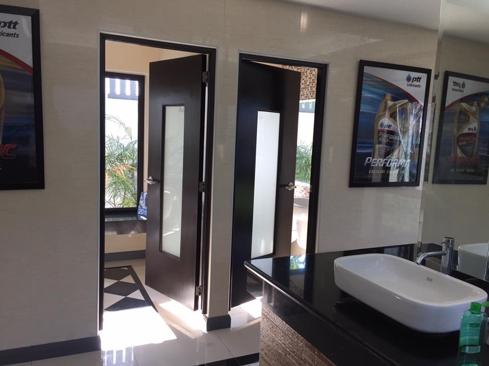 There are only 2 toilets in the men’s room. That is understandable since we most likely and often use the urinal instead of the toilet bowls. The ladies’ room should have more of these.
I think it is a big challenge for these stations/rest stops to maintain their facilities especially toilets. The volume of people and the frequencies of use (e.g., flushing, washing, etc.) will ultimately cause deterioration of faucets, water closets, etc. and these are usually free (service) with the station benefitting from the revenues generated by restaurants, shops and gas pumps rather than direct income from the use of toilets.
I would still suggest that rest stops also provide pay toilets and these should be expected to be clean and orderly compared to free toilets. I’m sure people will be willing to pay for this but then that shouldn’t be an excuse to neglect the free ones. Service is still the name of the game and quality service need to be provided by rest stops. Travelers will know about which stops have good facilities and word goes around quickly about comfort room quality among these stations. Of course, that goes without saying that such facilities should be child-friendly, PWD-friendly and senior citizen-friendly.
–
Another look at Marcos Highway overpasses – Part 3
The overpass at SM City Marikina is a bit more complex than what it looks like across the bridge. Here are some photos of the footbridge connecting the mall with the Santolan Station of Line 2:
 The overpass is a very long one and provides users with a partially covered walkway connecting to the LRT Line 2 Santolan Station. I say ‘partially’ because the roof over the overpass extends only across Marcos Highway.
 Note the covered bridge is only until the other side of Marcos Highway. From there it is an open overpass as shown at the left in the photo above.
 A closer look at the SM Marikina overpass shows just where the cover ends. There are stairs here leading to the loading/unloading bays across from the mall. There is also a path that leads to stairs to the public transport terminal under the bridge. There is a sign with a blue background in the photo stating the terminal is named after a former MMDA Chair who was also a mayor of Marikina and currently one of its congressmen.
–
Calamba-Binangonan boat ride
A niece posted on social media about a boat ride she took from Calamba, Laguna to Binangonan, Rizal. I immediately became curious about this as this presented an alternative mode of transport across the Laguna de Bay that could significantly cut travel time between major towns in Laguna and Rizal. Perhaps a boat ride could also cut substantial minutes between these provinces and Manila if only there was a direct connection or service with the Pasig River Ferry. I learned that it cost 50 pesos for a 45-minute trip from Calamba and Binangonan. Both the cost and the travel time are significantly less than what it would take via land and the roads connecting the two towns. I would estimate that the travel time using the South Luzon Expressway, Circumferential Road 6, Eastbank Road and Manila East Road would probably take more than 2 hours and the tolls alone will cost much more than 50 pesos. And this was via private transport. It would be longer and more expensive using public transport considering also that a person would have to make several transfers to travel between Calamba and Binangonan.
 Outrigger ferrying people and goods across the Laguna de Bay (photo courtesy of Zarah Bombio)
The boats are practically the same ones that ferry people to and from Talim Island and my niece mentioned that there is a regular service of at least one boat every hour. Certainly this option should be considered by transport planners as they think of alternative modes for more efficient travel.
–
Some relief due to the number coding adjustments?
A friend asked me about my commute after the Metropolitan Manila Development Authority (MMDA) had implemented a tweak in the number coding scheme. To those not familiar with the recent adjustments to the Unified Vehicular Volume Reduction Program (UVVRP) or more popularly known as the number coding scheme, the MMDA has recently eliminated the window that was applied to many roads. The 10:00 AM to 3:00 PM window is no more and the MMDA also extended the coding period to 8:00 PM from the old 7:00 PM lifting.
My observation from my personal experience commuting in the mornings between Antipolo and Quezon City is that my travel times have somewhat improved. After Undas, I have enjoyed travel times of 45 minutes to 1 hour during the same morning periods when I choose to travel. This has improved significantly from the 1.5 hours I had spent prior to the adjustment. My usual route was mainly through Marcos Highway so perhaps its not just the coding aspect but also the fact that much of the construction work for the LRT Line 2 Extension have been completed and there have been less obstructions due to this project between Masinag and Santolan. My homebound trips seem to have improved too for the same reasons although not as significant as my morning commute. Another friend has similar observations and is very happy about the big improvements he says he now enjoys considering he has even longer commutes between Antipolo and Manila (Intramuros) or Makati (Gil Puyat).
But generally speaking, is it possible that there are significant positive impacts of the tweak in the number coding scheme? My assessment is that it is very possible and very likely especially if we see it from the perspective of vehicle trip reduction due to the adjustments made in the restraint policy. The number coding scheme is a travel demand management (TDM) measure designed to reduce vehicle traffic through vehicle use restraint. By introducing the coding window many years ago, the restrictions to vehicle travel were in effect relaxed and that encourage more people to use their cars.
The elimination of the coding window means people could not move their times of commute to later than 7:00 AM or earlier than 3:00 PM. It meant people whose vehicles were “coding” had to leave (forced?) early and go home late. Extending the coding period to 8:00 PM probably was probably a back-breaker to many people. And then the difference now compared to the 1990s and decade after that is the availability of the more reliable Uber and Grab vehicles that many car-owners had no option to use before. I’m not a psychologist but perhaps such factors have led to an improvement in traffic conditions. How long this would last shouldn’t be so difficult to tell given the experiences in the past and the fact that population and vehicle ownership continues to rise. Perhaps a year or two if no significant improvements in transport (e.g., mass transit projects) happen.
–
Starting November 14, the MMDA is also supposed to be clamping down (read: stricter implementation) on the motorcycle lane policy along EDSA, C5, Commonwealth and Macapagal Blvd. I’m not so sure how they will be doing this as enforcement along the stretches will require a lot of manpower.
–
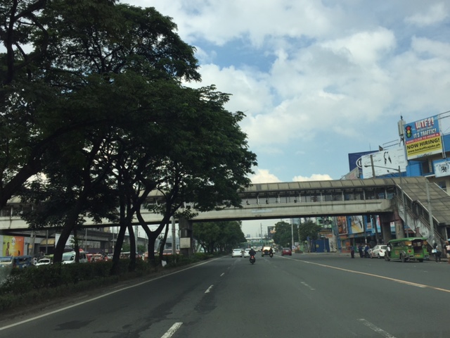
Another look at Marcos Highway pedestrian overpasses – Part 2
I purposely didn’t include the overpasses at and near the Masinag Junction because I felt they deserved their own article. For one, the area will be the location of the future end station of the current LRT Line 2 Extension project. Here are a couple of photos of the overpasses in the area.
 Overpass at SM City Masinag – note the tall columns for the elevated tracks of Line 2. Will the Masinag Station be located that high or will it be at a lower level, perhaps closer to the SM City overpass?
The overpass at SM City Masinag is something that has been replicated in many other locations where an SM mall has been constructed. Note the similarity of the situation with the likes of SM City Iloilo, SM City Novaliches where SM built pedestrian facilities to allow for safe crossings between the mall and the area across from it along the highway. In many cases, it is the mall which provided the overpass in coordination with the local government unit and, I assume, the DPWH.
 Overpasses at Masinag Junction – there are actually 4 bridges here, each spanning one leg of the junction.
One of the intents for these is to eliminate at-grade pedestrian crossings at the junction. While crossing have been reduced significantly, there are still many “pasaway” who cross even when there is a green light for vehicular traffic along the leg they are crossing. Traffic enforcers here are quite lax about this and don’t seem to put in an effort to inform people about the overpass. There is no excuse for those who might claim they are too old or weak to climb the steps since the overpass has 4 working elevators for those unable to make the stairs. I noticed though that most of those using the elevators are able bodied people who probably are just too lay to take the stairs.
–
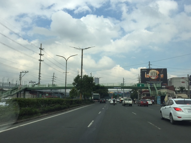
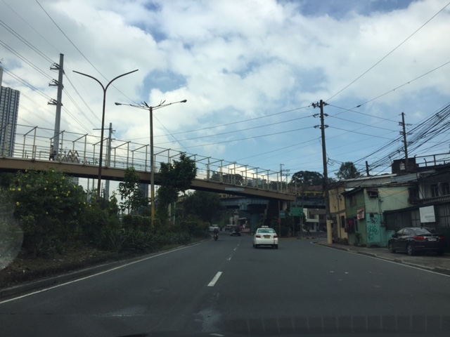
Another look at Marcos Highway pedestrian overpasses – Part 1
My daily commute allows me to have a look at the progress of the LRT Line 2 Extension construction. I also became curious about the situation of the pedestrian facilities along Marcos Highway particularly the crossings since many at first seemed to be affected by the elevated rail structure that was to be built. Now, we already have a good idea of the fates of these pedestrian overpasses. This article shows the conditions/situation of pedestrian overpasses (also called footbridges) along Marcos Highway. Most overpasses are not covered; exposing pedestrians to the elements. Most are also made of steel, which can be traced to the MMDA’s (and later the DPWH’s) preference for these structures.
 Overpass near Filinvest East-Vermont Park gates – the overpass actually is between a technical college and the commercial building across from it.
 The overpass across from Vermont Royale in front of a new Shell service station was actually among the newest facilities along Marcos Highway. Apparently though, it was built without considering the impending construction and design of the Line 2 extension. As such, the overpass needs to be modified or would have to be reconstructed elsewhere near the area.
 Overpass at Town & Country Executive Village that is also near the San Benildo School
 Overpass at Marcos Highway-Felix Avenue-Gil Fernando Avenue intersection – is probably the busiest among the pedestrian overpasses as it is at a busy junction where there are major commercial establishments (i.e., malls) and where many public transport routes converge.
 Robinsons Metro East overpass – this one also survived the clearance requirements with respect to the elevated superstructure for the Line 2 extension. However, since one of the two stations to be built will be nearby if not right across (part of the station at least) from the mall, then the station itself may function as an overpass.
 Overpass at De la Paz – note the ramp for bicycles and wheelchairs. This is one of the more bike- and PWD-friendly facilities along Marcos Highway. The slope is gentle enough for pedestrians, too, especially senior citizens who might have difficulty with steps.
 Overpass at Ligaya – this one also has ramps that make it easier for people to use to cross the busy highway. This will eventually be the closest overpass to the huge Ayala mall (Feliz) currently under construction at the Marikina side of Ligaya. I suspect that there might be a need for another overpass to be built with respect to the mall for one to directly serve the mall’s customers.
 Line 2 Santolan Station overpass connects the Marcos Highway westbound public transport stop with the rail station along the eastbound side of the highway.
 A closer look at the Santolan Station overpass, which is used by a lot of Line 2 passengers who cross the highway to continue on their journeys/commutes via train from their origins in Rizal, Marikina and Pasig. During the mornings, the observer will see a lot of jeepneys and UV Express vehicles emptying of passengers who cross the bridge to get to the station.
 Santolan footbridge – this is actually more complicated than what is seems in the photo because the steel footbridge also connects to the SM City Marikina overpass (which is not included in this compilation but is visible in the photo). The footbridge branches to provide and almost direct connection between the mall and the Line 2 Santolan Station. That structure is shown at
 Monte Vista footbridge allows people to cross Marcos Highway (at its Marikina/Quezon City end) to and from A. Bonifacio Avenue, which is in Marikina City (Barangka)
More on pedestrian overpasses in the next post!
–
Mobilizing sustainable transport for development
The United Nations (UN) has recently published a new report on “Mobilizing sustainable transport for development” authored by a High Level Advisory Group on Sustainable Transport formed by the UN. The report and other resources may be found at the following website:
Secretary General’s High Level Advisory Group on Sustainable Transport
This is under the UN’s Sustainable Development Knowledge Platform. You can check out the other materials at the website. The UN has many initiatives on sustainable transport and has been very active in promoting or advocating for sustainable transport for a long time now. It is through the UN Centre for Regional Development (UNCRD), for example, that the Philippines and other ASEAN countries were able to formulate their national EST strategies. The new report continues on the UN’s commitment to promote sustainable transport to improve people’s lives around the world.
–
