
Home » Highways and Streets (Page 16)
Category Archives: Highways and Streets
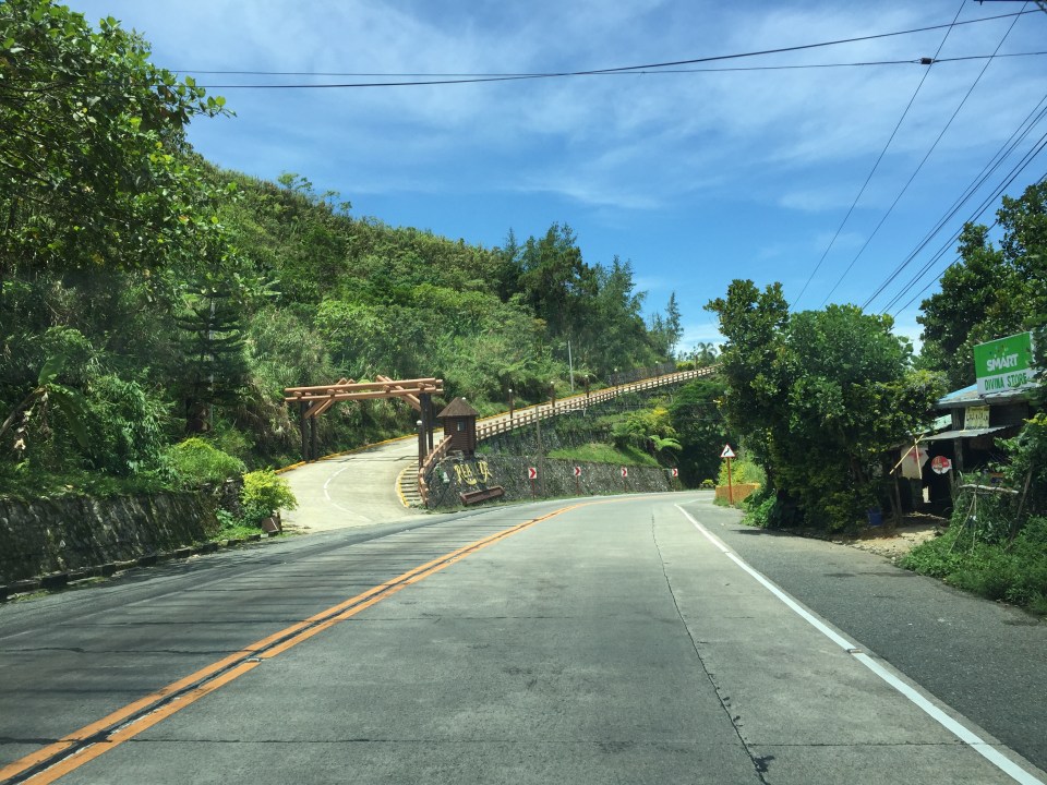
Sparing the trees
The Department of Public Works and Highways (DPWH) embarked on a major road widening project in the last administration. This continues today. One of the issues raised then was the cutting down of many trees along the roadside to give way to one additional lane along each direction of national roads. While conservationists and environmentalists were not successful in provinces like Tarlac where old camachile trees were cut down, the case in Pangasinan seems a bit more positive. Traffic along rural highways such as the Urdaneta-Calasiao-Dagupan Road can become heavy but not so much so that it requires two additional lanes to the original two. As such, while the shoulders can be paved as part of the lane widening program of the DPWH, the trees can actually be spared. I think the DPWH and the LGUs would just need to mark the trees to make them very visible at night time or when visibility is low along the highway.
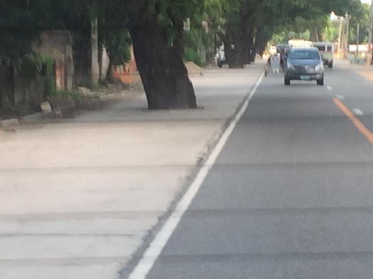 Big old trees, mostly mango trees line up the Urdaneta-Calasiao-Dagupan Highway along the newly paved lane that used to be a shoulder of this highway. These huge trees are fruit bearing and so one can imagine that part of the loss if these were to be cut down were the tons of mangoes that many people could benefit from.
 Sections of the additional lanes are generally not usable for general traffic and revert to their previous use as parking spaces. These paved sections now also are useful as ‘solar driers’. Shown in the photo above is an example where grains of rice (palay) are laid out direct on the concrete pavement for natural drying under the sun. People (staff of the owners) guard these against animals, wayward motorists and possibly thieves. These staff will gather the grains when there is impending rains or when the day’s almost over to dry another day.
I wanted to take more photos of the highway but was seated at the back of our van so I had to settle for a few select shots. The second photo above is care of a colleague who sat in front and took a few shots himself.
–
Data on local roads – digital maps
Here’s another quick reference to an article describing a current undertaking to map the 45,000+ kilometers Philippine road network:
PH undertaking $5M digital mapping of 45,000-km road network
What’s significant with this development is that soon the country will have excellent maps, including 3D and 360-degree views of most if not all local roads. While there are similar maps via Open Street Maps and Google Maps, the latter are not as comprehensive. These maps will be very useful for a lot of applications including transport planning, urban and regional planning, and disaster mitigation. A lot of people are surely looking forward to the completion of this project as well as when the maps can be accessed and used.
–
Roads to Baguio: Marcos Highway – Part 3
Still on Marcos Highway, the following photos complete this feature from my most recent trip to a city dubbed as the summer capital of the Philippines. This is the third part of the series on this major road to/from Baguio City, and sections pretty much show very similar characteristics as the previous ones in the preceding posts. Its been a while since the Part 2 of this series and since then, an additional section of the Tarlac-Pangasinan-La Union Expressway (TPLEX) has been opened further cutting down travel time between Manila and Baguio to 4 hours.
 We start with a series of curves. Here is a section complete with signs and markings to guide and protect road users.
 The approach to this curve reveals the uneven terrain on which the road was built.
 These row houses and their driveways seem too close to the road
 That’s a poorly placed driveway right in the middle of the curve
 Many motorists tend to overtake slower moving vehicles via the opposing traffic lane. Here is a bus undertaking a passing maneuver at a curve!
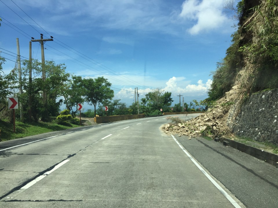 Rockslide – these are frequent along mountain roads such as Marcos Highway. They are even more frequent along Kennon Road and Naguilian Highway.
 Yet another section this time showing a reverse curve.
 Here are a few more of the big bikes we encountered on our trip down from Baguio. These are of the same group of bikers in Parts 1 and 2.
 Many sections of Marcos Highway have excellent sight distance and have usable, paved shoulders.
 There is significant truck traffic along Marcos Highway. These, especially the loaded ones, often slow down traffic. In certain cases, trucks form platoons making it difficult to pass them.
 I was not surprised to see a school along the highway since there are many communities along the road. This is a good example of standard signs and markings including a pedestrian crossing.
 The curve is not a good location for a home.
 The pavement at this section is intriguing as the road seems to have had a different orientation in the past. I suspect this was formerly a paved bay (for emergency stops or for loading/unloading passengers) in what used to be an unpaved shoulder.
 The position of this driveway is quite risky and motorists from both the highway and the driveway will be blind to each other.
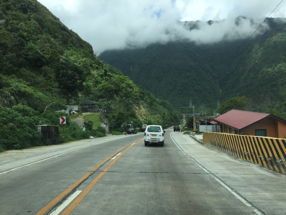
 The section shows also what looks like a bay along the inner (left in the photo) side of the highway. Note that the shoulder is rather narrow along the ridge-side (right).
 Curve sections like this offer picturesque views but are actually are treacherous. The barriers are supposed to prevent vehicles from ‘flying’ out of the highway. Their designs should arrest large, heavy vehicles that may lose control and collide with the barriers.
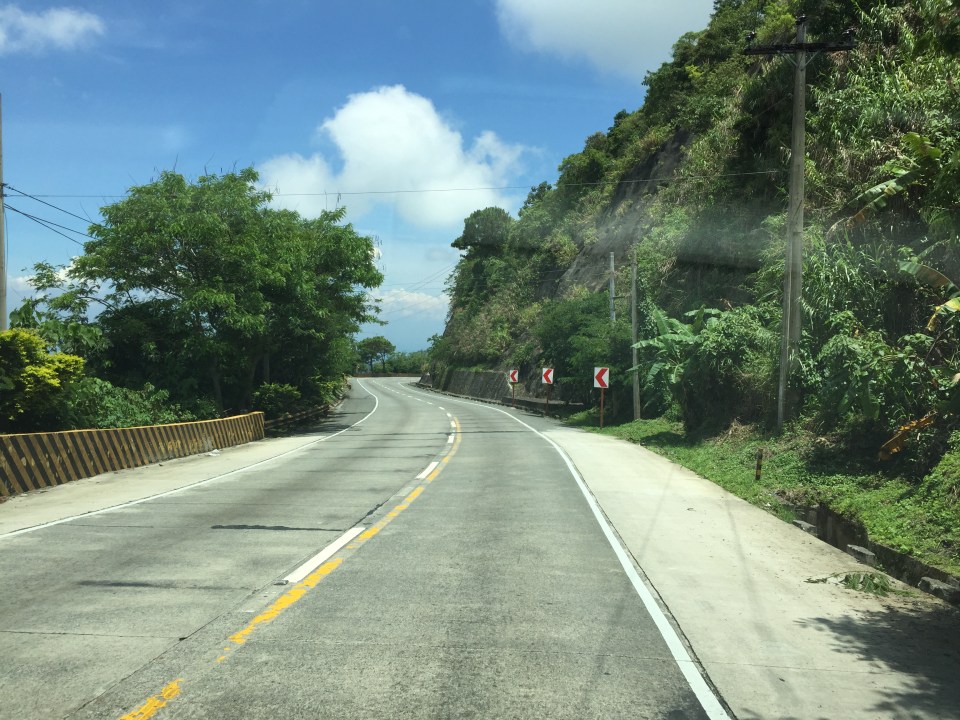
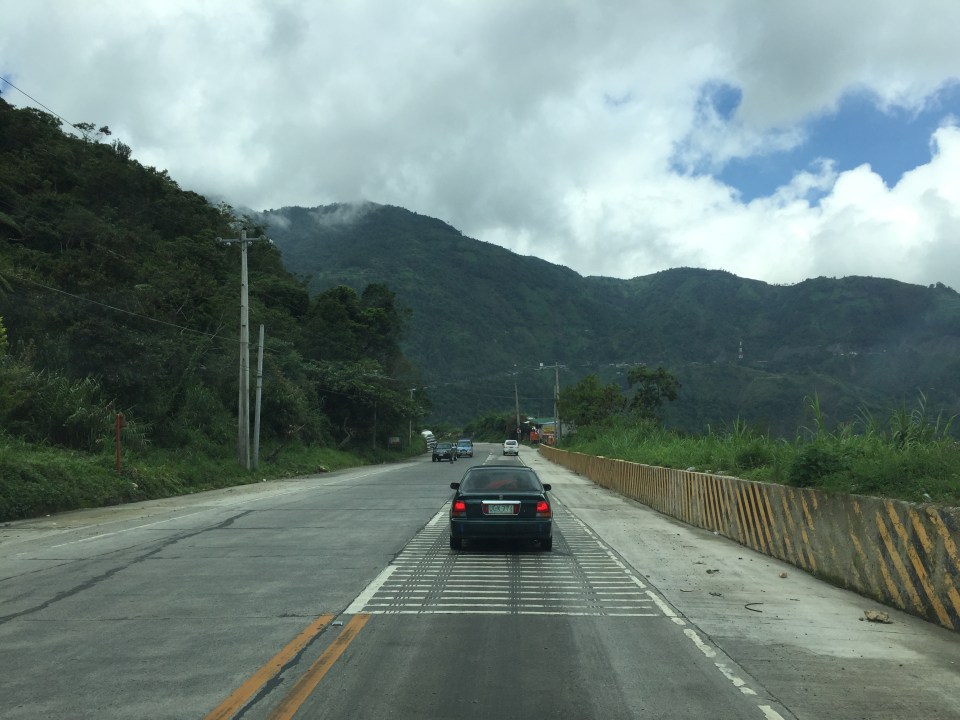
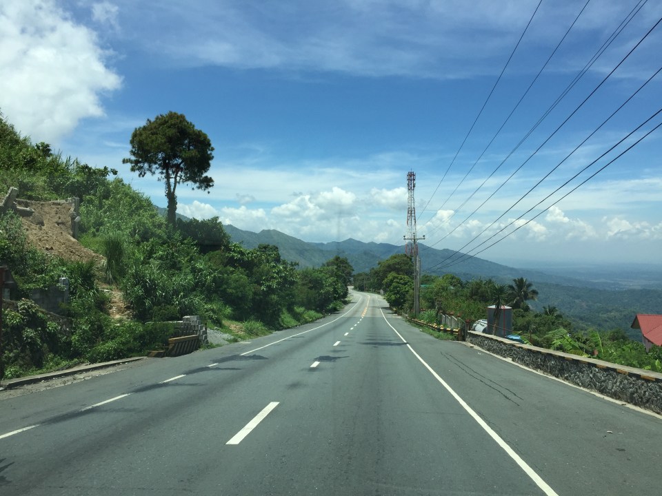 Marcos Highway offers many breathtaking views and excellent sight distance along many portions.
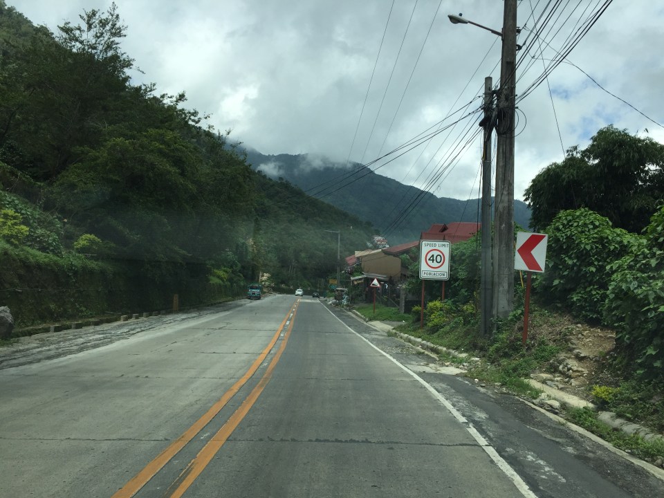
 This is the final stretch of Marcos Highway that terminates at the intersection with the Manila North Road, which is part of AH-26.
–
Road and drainage works along Soliven Avenue, Antipolo City
Traffic has been quite terrible for people living along the Marcos Highway corridor and it doesn’t help that one option via Marikina is also currently congested. I am talking about the stretch of Sumulong Highway between Masinag and Soliven Avenue, which is currently being rehabilitated with drainage and pavement works. The work seems to be progressing but not as fast as most commuters would want it to be. Complicating things are more serious road and drainage works along the Antipolo section of Soliven Avenue. This has rendered the street to become one-way and from what I have seen, work here is proceeding much more slowly (perhaps excruciatingly for those residing or working along this stretch). Following are photos I took of Soliven Avenue from the intersection with Sumulong Highway to the border with Marikina City where Soliven Ave. becomes Lilac Street. I won’t put any labels anymore and let the photos speak for themselves.
 1
1  2
2  3
3  4
4  5
5  6
6  7
7  8
8  9
9
Hopefully, these road and drainage works can be completed very soon and would allow for the alleviation of traffic along these roads and the alternate route between Antipolo and Quezon City via Marikina. Such will also help ease congestion along Marcos Highway.
–
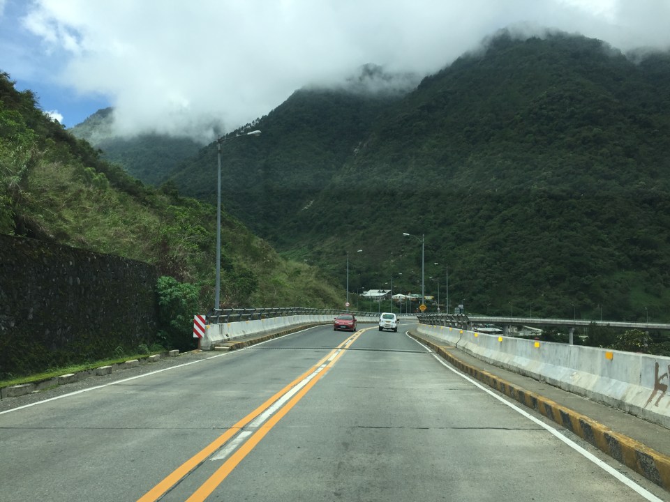
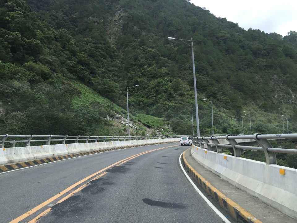
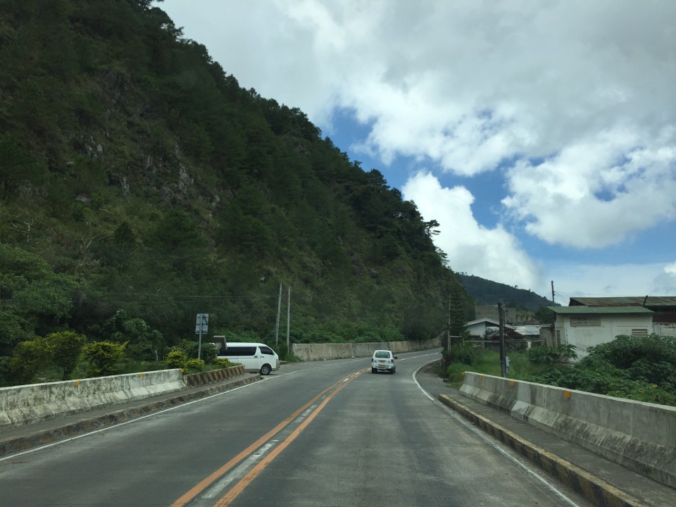
Roads to Baguio: Marcos Highway – Part 2
To open September, I continue on the feature on Marcos Highway. Following are more photos I took on our way back to Manila from a short vacation in Baguio.
 Many sections of Marcos Highway have some form of protection against landslides or rock slides. Note the concrete faces fences along the left in the photo.
 There are many structures along the highway including houses and stores
 The mountain limits sight distance along curves like this.
 We encountered this group of motorcyclists heading up to Baguio on what appeared to be what is termed as “big bikes”, that typically are the more expensive ones, too. Other photos in this series will show these motorcycles. I lost count of them while we were traveling the opposite direction.
 This seems to be a popular stop for hungry travelers. The location though and its driveway are not at all desirable from the highway engineering perspective.
 Combination of signs to guide motorists along this sharp curve.
 Curved sections like this one offer breathtaking views of the mountains.
 Shoulders may function as space for emergency stops including for breakdowns or changing tires. Full shoulders allow for stopped vehicles to be completely clear of the traveled way. That is, they don’t pose as obstacles that traffic would need to evade.
 More examples of poorly located establishments along a curve
 The road seems to disappear in the mountains
 Another home along the highway and right at one of the curves. This one seems to be wisely located behind the barriers though its pretty obvious where their driveway is located.
 Conspicuous location for a religious site along the highway
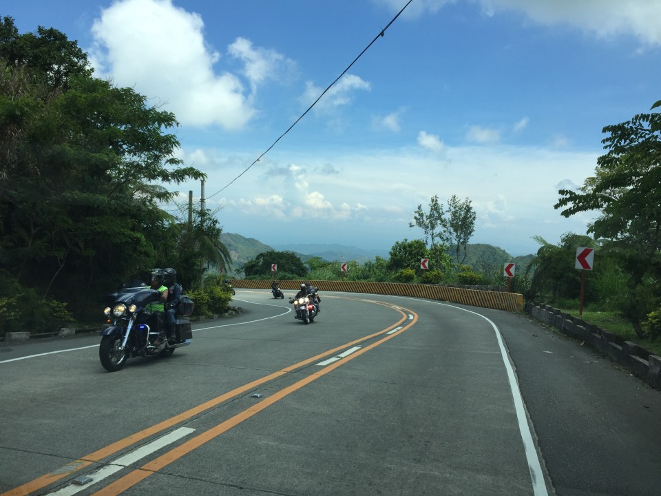
 More motorcyclists and their big bikes
 Barriers along both side of the highway seem sturdy enough to keep vehicles from flying off the road in case their drivers/riders lose control. This section offers enough to satisfy sight distance requirements and noticeably does not feature double yellows like the other photos in this post.
 A residential community along the highway including this big house just clear of the shoulder.
 Another community including a home atop the mountain. The barriers appear to be newly constructed along with the PCC paved shoulders. These would have to be painted for them to be visible to motorists especially at night-time or when visibility is poor.
More photos of Marcos Highway soon!
–
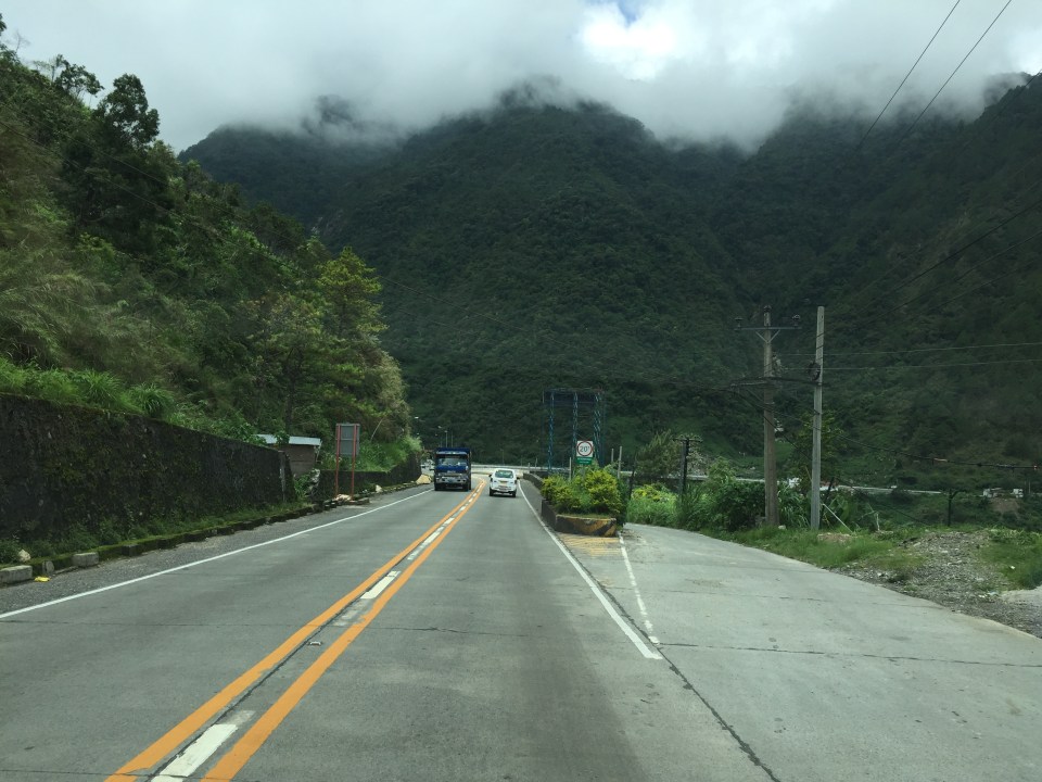
Roads to Baguio: Marcos Highway – Part 1
In my recent trip to Baguio, I made sure to take new photos of roads particularly the major ones that made that city in the mountains accessible. Of course, one objective was also to have an updated selection for my highway engineering lectures. Following are the first batch of photos I took of Marcos Highway last June 2016. I won’t be writing a caption for many of these photos as well as those in the succeeding batches. I’ll just put these here for others to refer to whether for practical uses or for research.
 I found it unusual to see double yellow along a relatively straight and level section of Marcos Highway. It is perhaps a section where there have been a significant number of road crashes?
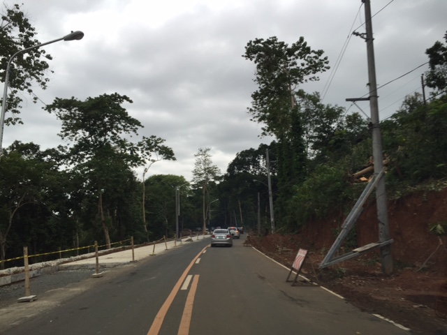
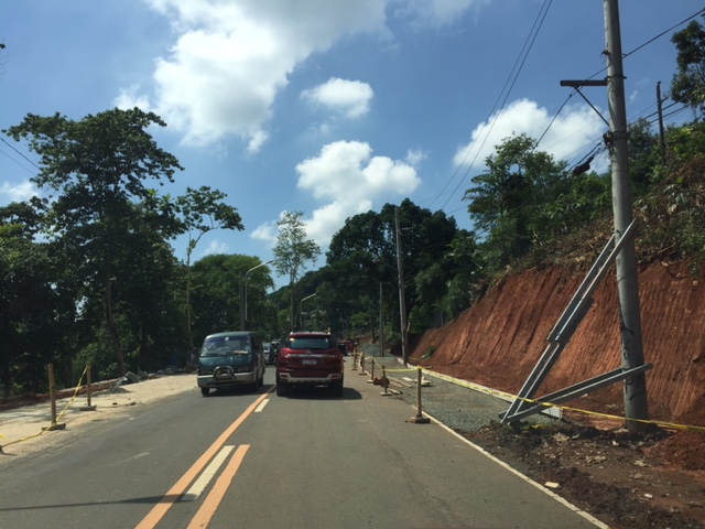
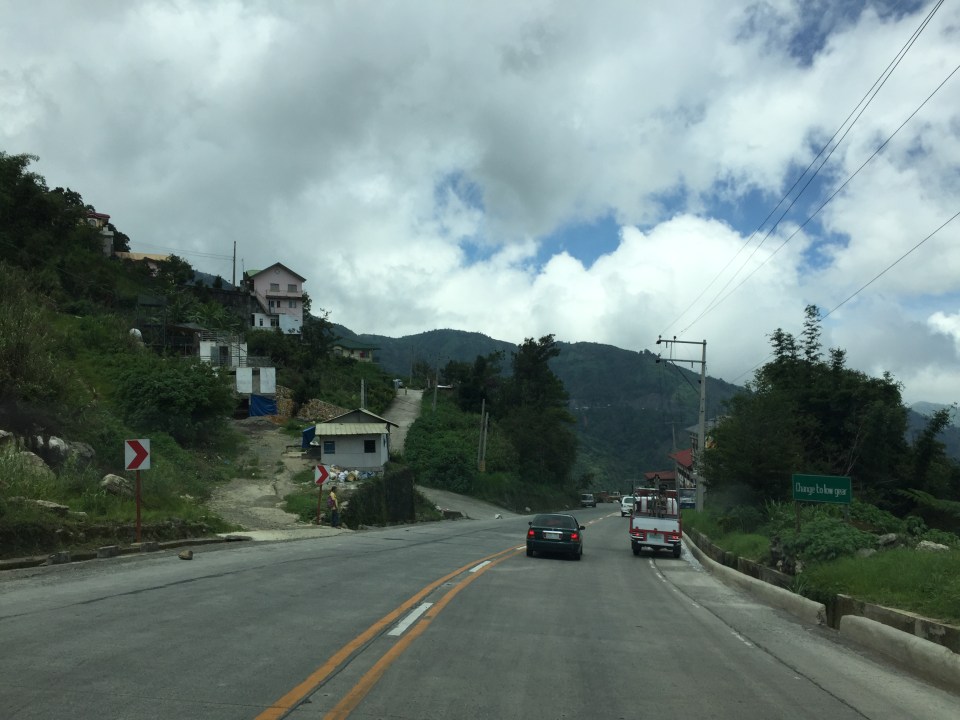 There are many roads built to provide access to areas previously uninhabited but now have houses giving some spectacular mountain views.
 There are rumble strips along many sections of the highway; seemingly there to wake up travelers that where getting sleepy.
 It can get quite foggy along the highway

 Old barriers look sturdy enough to prevent heavy vehicles from falling off the highway.
 One end of the viaduct alongside the mountains
 There are communities in many places in the mountains along the highway. Access would be via local roads, some of which are private roads.
 I thought perhaps bridges and viaducts in the Philippines should have shoulders and more generous space for pedestrians.
 The van in the photo enters the highway from one of the many driveways and local roads connecting to the national highway.
 What appears to be a tunnel for many people is actually a roof structure to protect travellers and the road from landslides.
 During the day, it is bright inside the structure given the openings along one side of the highway.
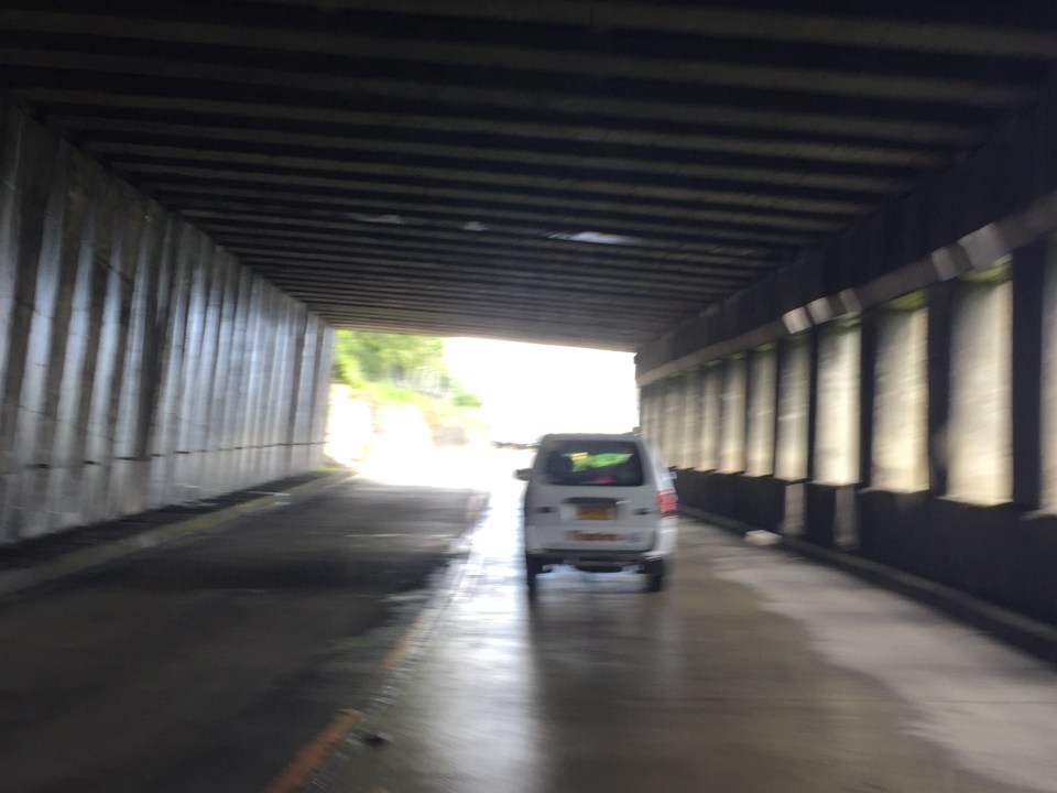 The light at the end of the tunnel?

More photos in Part 2 coming up soon.
–
Evidence from Montreal: Building bike lanes to reduce car use
I just wanted to share this article showing evidence of car use reduction (and therefore, car traffic along roads) with the provision of bicycle lanes.
Building Bike Lanes Really Does Get More People Out of Their Cars
The article though cautions readers against generalising or assuming great improvements. Some figures mentioned in the article including the following (I took the liberty of copying and pasting):
- “A 10% increase in bike accessibility resulted in only a 3.7% increase in ridership.”
- “…cycling infrastructure also reduced greenhouse gas emissions from cars by 1.7%, a reduction equivalent to converting transit buses to hybrids and electrifying commuter trains.”
These numbers are for the case of Montreal, Canada. Not mentioned are the number of cyclists, vehicle traffic volumes and other pertinent data that are useful in analysis. The article correctly points out the importance of using science (e.g., sound analysis based on good data) in order to convince governments to put up bicycle infrastructure. I would even add that this approach should also be applicable to pedestrian facilities.
–
Dang Bakal road widening in Antipolo
We go to church at the Parish of the Immaculate Heart of Mary along Daang Bakal in Antipolo City. Quite obvious is the current road widening project being implemented along Daang Bakal. While the improvement of the road was welcome, my opinion is that widening the 2-lane road to 4 lanes was not necessary given the traffic in the area served by the subject section (basically traffic generated by the parish and the exclusive subdivisions along the road). For one the section being widened from the intersection with the Antipolo Circumferential Road leads to a dead-end (i.e,, the gate of an exclusive subdivision). And so, traffic is generally very light along this road section
Are there plans to revive the original right of way of the old railway line but in the form of a road connecting Hinulugang Taktak to Ortigas Avenue via Valley Golf? If not, then the road widening of Daang Bakal is unnecessary. Even if the justification were for cyclists, I would argue that perhaps you only needed to have paved shoulders that need not have the same width as the carriageway lane. Following are photos of Daang Bakal featuring the road widening project.


From the photos, it is clear that a lot of trees have been cut in order to make space for the additional lanes for the road. While most of these trees are too close to the original carriageway, there were many that I felt didn’t need to be cut if a narrow shoulder was deemed sufficient for the road. Traffic in the photos are typical peak period traffic on a Sunday when the road carries the most traffic in a day due mainly to churchgoers.
–
Roadworks along Sumulong Highway, Antipolo City
The roadworks along Sumulong Highway continues with drainage work along the sections across Palos Verdes and Cavalier’s Village. They have cleared a lot of trees along the road’s edge on the Masinag-bound side and only one lane is usable for these sections. This has recently caused several road crashes involving all types of vehicles. While there are obvious shortcomings about the worksite on the contractor’s side, many hardheaded drivers and riders continue to operate their vehicles (read: drive or ride recklessly) as if there are no hazards along the road.
 Concrete culverts line the Masinag-bound side of Sumulong Highway
 Worksite occupies one lane of the 4-lane/2-way highway. Temporary barriers often encroach upon the single lane available to Masina-bound traffic. This leads to many vehicles encroaching on the opposing traffic lane, violating the double line that states “no overtaking.” Perhaps the contractor needs a refresher or a lesson in proper traffic management and signage for worksites?
 Completed sections are not immediately cleared, apparently and likely to have proper curing for the concrete. Notice in the photo that the project includes sidewalk construction. Sidewalks will enhance safety for pedestrians and even joggers or hikers going up and down Antipolo.
 Notices are nailed to many trees that will be cut down to give way to highway drainage and sidewalks along the Antipolo-bound side of Sumulong Highway.
–
Throwback to 1995 – Baguio flyover
Baguio retains a special place in me as it is where I did my first out of town project back in 1995. This was just after I finished my master’s at UP Diliman. The project was Baguio’s first flyover or overpass and it was being proposed along Bokawkan Road, which is then as now a very busy thoroughfare connecting the city to La Trinidad, the capital town of Benguet province. Our task was to determine the best configuration for the flyover including the required capacity for it and the remain at-grade roads once it was built.
I remember it was very rainy when we were there and our accommodations (which was volunteered by our client – their family’s vacation house in the city) turned out to be quite inhospitable. We had to buy blankets and make our own beds as we had practically no budget to stay at a hotel. I recall the house was a bit creepy especially for the last few days I stayed there by myself (my mentor had to go back to Manila) to supervise the traffic surveys at the proposed site of the flyover. That was quite the adventure for me then as I also tried to explore the city on foot. I walked the entire stretch of Session Road when it was still the Session Road (old) people reminisce about. I also walked around neighborhoods in the Gen. Luna area where the house I was staying at was located.
Here are some photos of the flyover now and the area where I supervised traffic surveys together with the bridge engineer who was from Baguio.
 The flyover as seen from one of the side streets in the Trancoville district.
 A closer look at this almost 20-year structure.
 Traveling along the service road along the flyover and towards the direction of La Trinidad. Shown also in the photo is one of the pedestrian overpasses in the city. I actually like the architecture of these overpasses that seems more apt compared to Metro Manila’s steel structures.
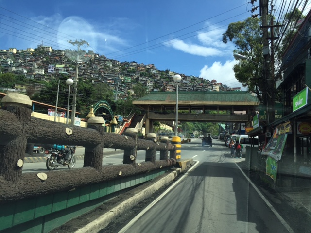
 I included this photo past the overpass to show how crowded Baguio is already with houses having replaced trees in many mountains and hills. These used to be all green with trees back in the 1990s with only a few shanties that had started to sprout back then. I have other photos of such scenes of houses growing out of the mountains around the city and will share those in another post soon. Such have become the representation of unsustainable development for a city that has become overcrowded and yet continue to attract many people who eventually become residents.
–
