
Home » Public Transport (Page 60)
Category Archives: Public Transport
Melaka central bus terminal
Trips between Singapore and Malaysia are quite frequent given the proximity between the two countries (Singapore used to be part of Malaysia.) with a lot of people employed just across the borders and Malaysia being a popular destination for shopping and recreation. In fact, the first Premium Outlet in Asia is located in Johor, Malaysia, which is just across the border from Singapore. On a weekend trip to Melaka (Malacca), we took an express bus that made only 3 stopovers including one each for immigration control/processing in Singapore (exit) and Malaysia (entry). On the way back, we only had an extra stopover due to a fellow passenger requesting for a toilet break.
Arriving at Melaka, I was impressed with the central bus terminal, a sprawling complex that connected with commercial establishments around it. Inside the terminal, there are many shops and restaurants so one doesn’t need to leave the terminal to eat or to make some last minute shopping. Good buys are rubber sandals much like those being sold under Brazilian brands. Malaysia is a major producer of rubber and the sandals made in Malaysia are of high quality but less expensive than the Brazilian and perhaps Chinese counterparts.
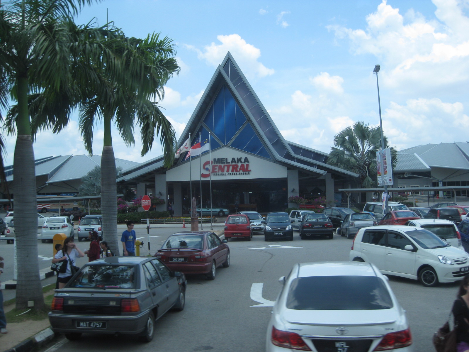 Terminal building and parking
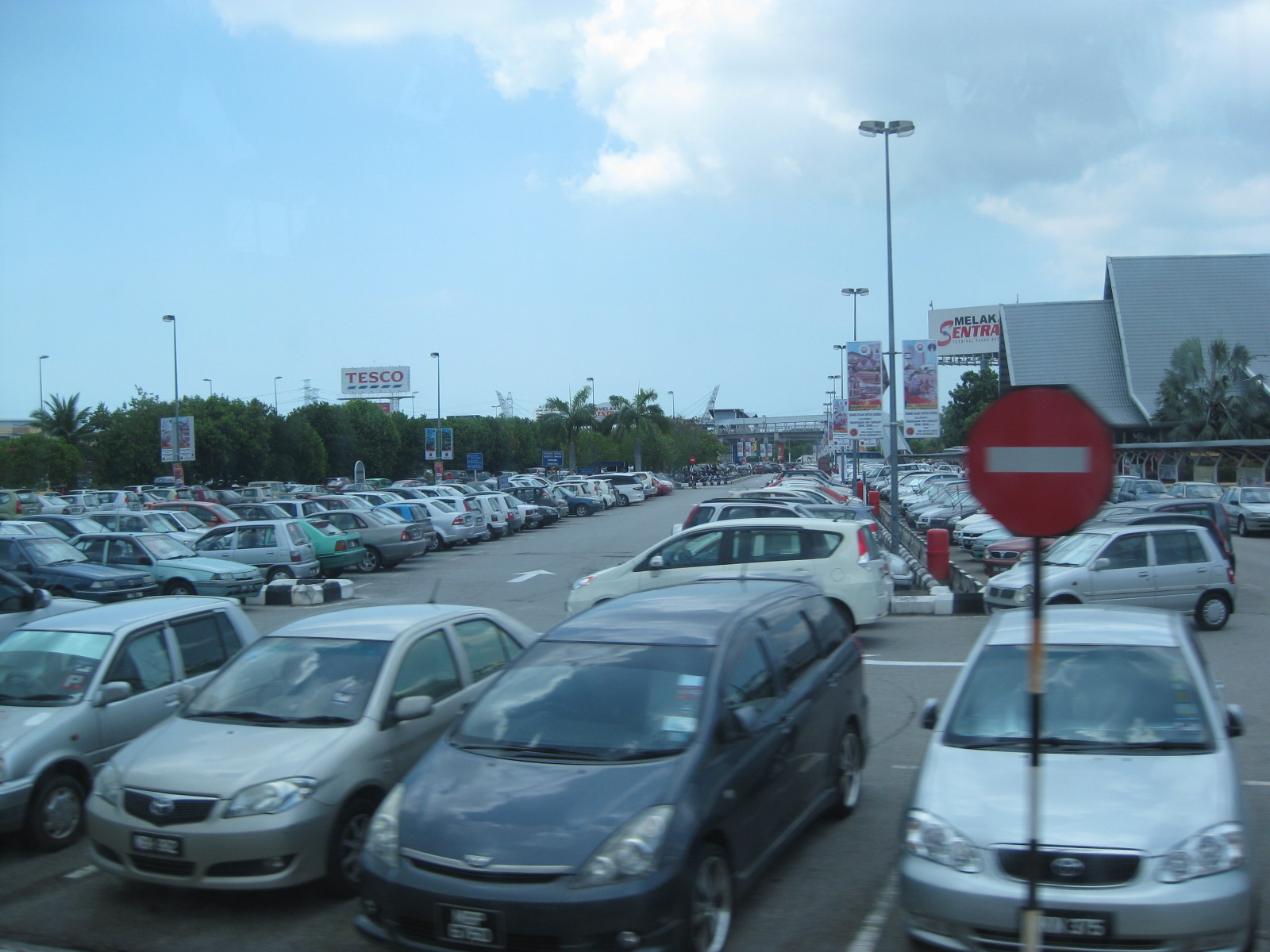 A look at the spacious parking area around the terminal.
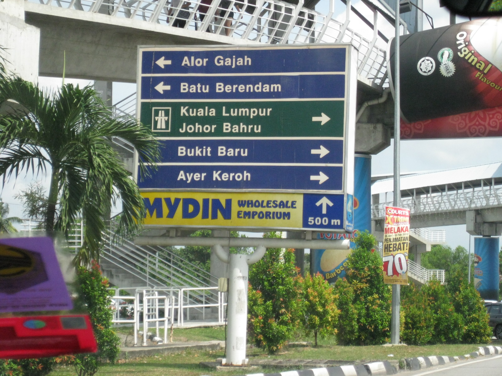 Directional sign to guide visitors (probably sponsored by the emporium indicated at the bottom).
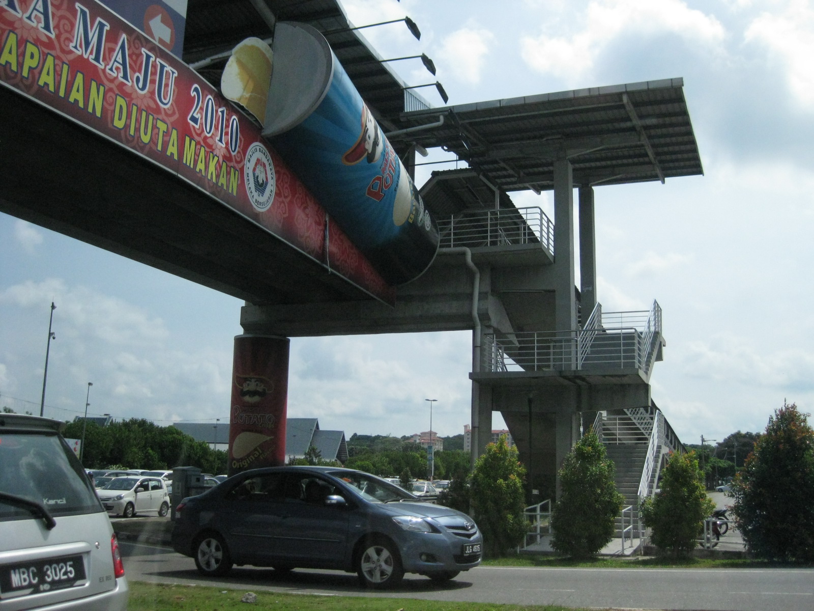 Pedestrian overpass for people crossing the busy highway in front of the terminal.
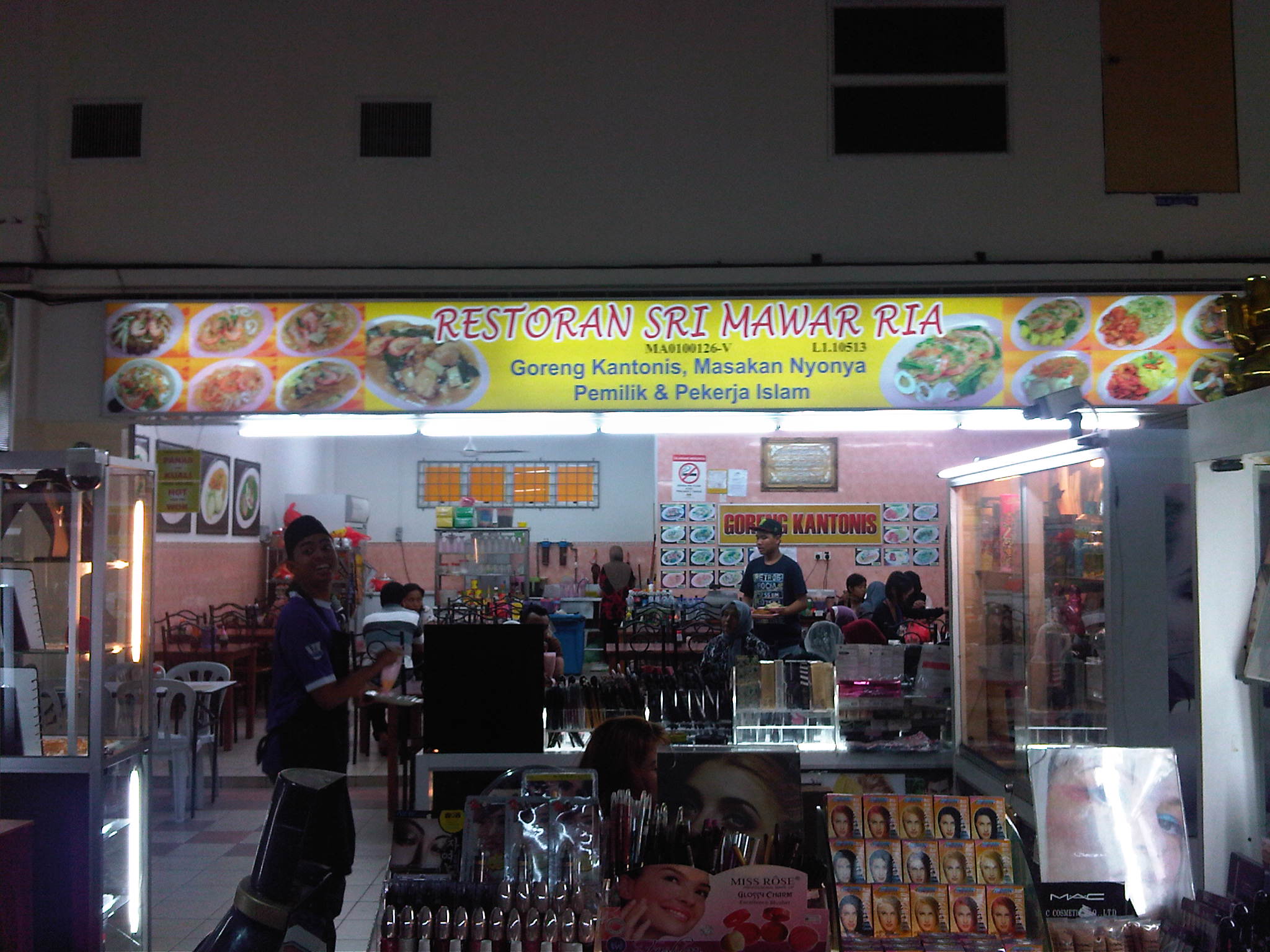 There are many restaurants and shops inside the terminal, which is by itself a commercial establishment.
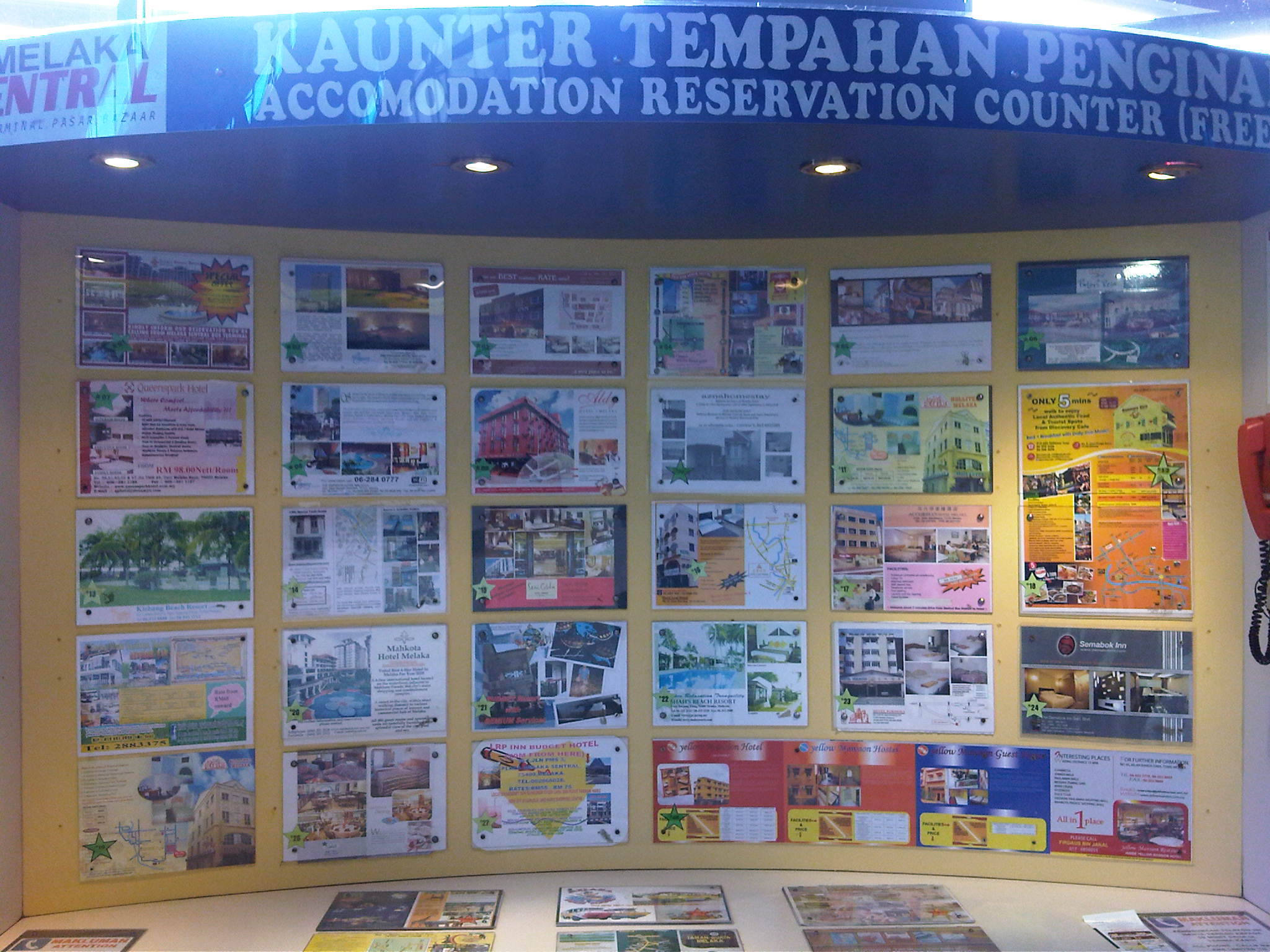 Hotel/accommodations information for travelers are posted at the terminal.
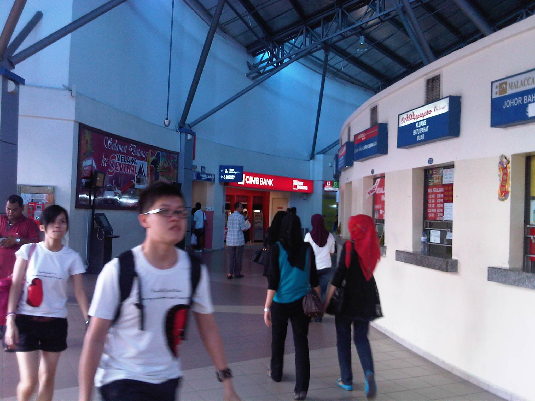 The different bus companies operating out of the terminal have their booths were travelers may buy/reserve tickets.
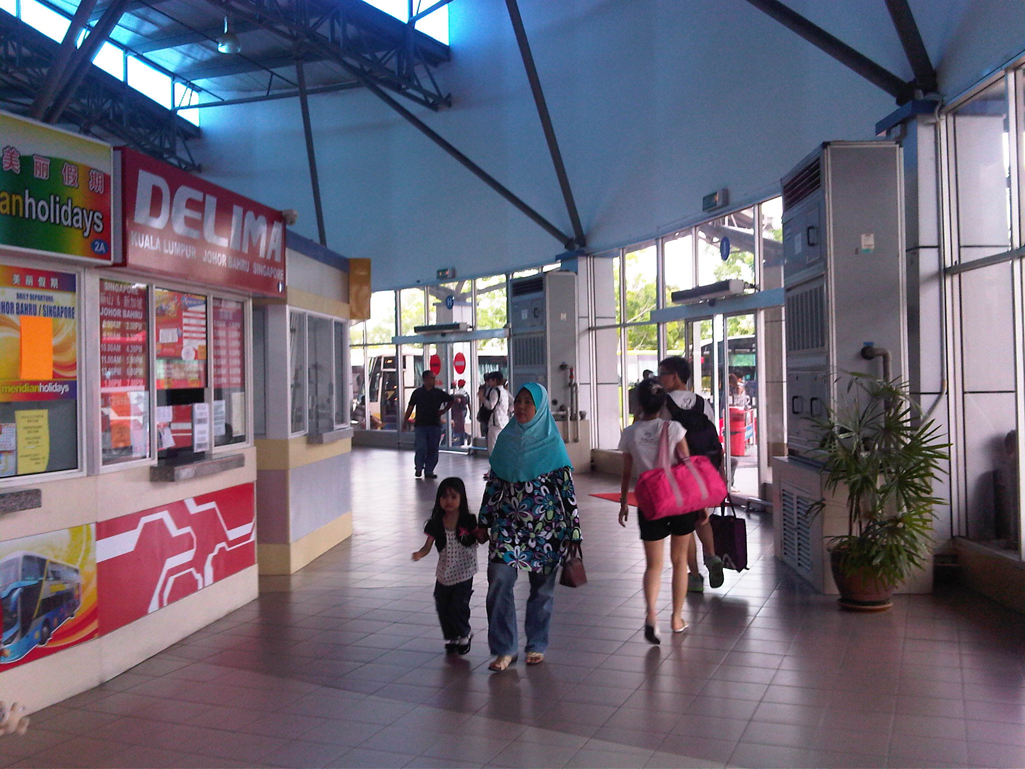 The ticketing area is spacious and there were no long lines, in part due to the availability of online (internet) ticket purchases. Seating is not free for all so travelers need to reserve or purchase tickets ahead of travel in order to get good schedules and seats.
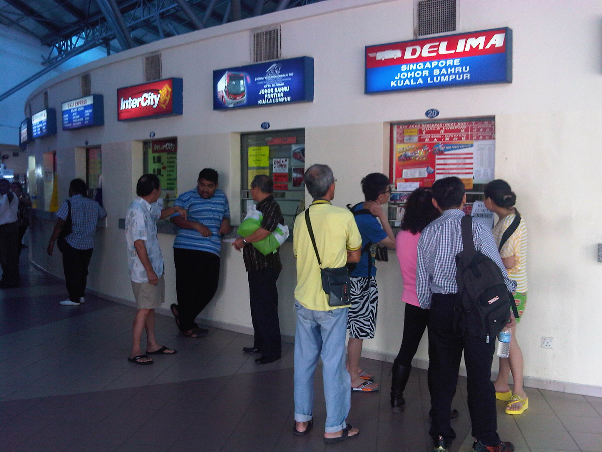 One can purchase tickets to any point in Malaysia (local long distance trips) and Singapore (another country) is among the most popular destinations. Schedules and fares are posted for information of travelers.
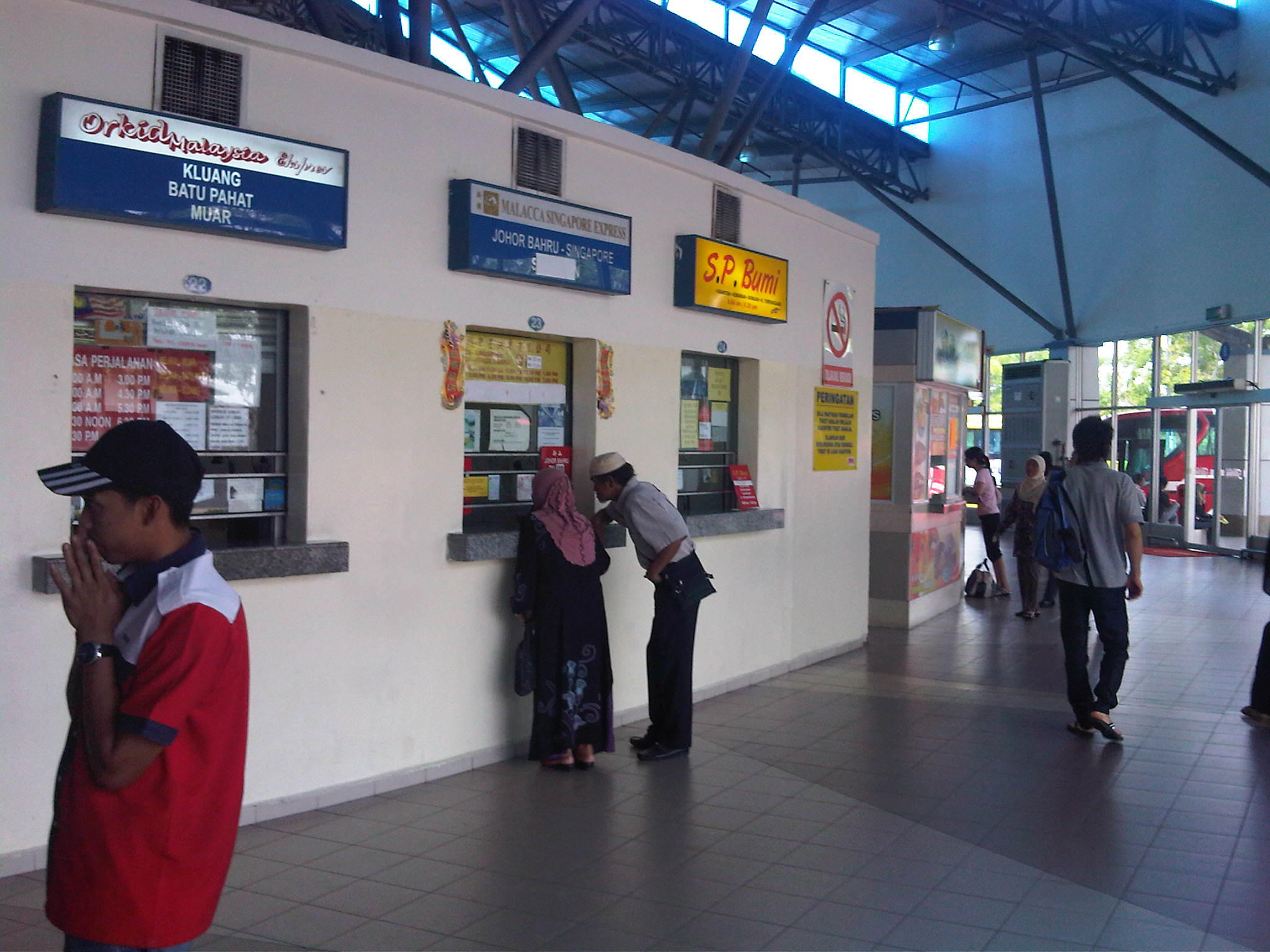 There are many choices among the bus companies but I would strongly recommend Starmart Express buses when traveling between Singapore and Malaysia. They provide excellent service and have well-maintained buses. One can purchase tickets online and claim these at their booths/stations.
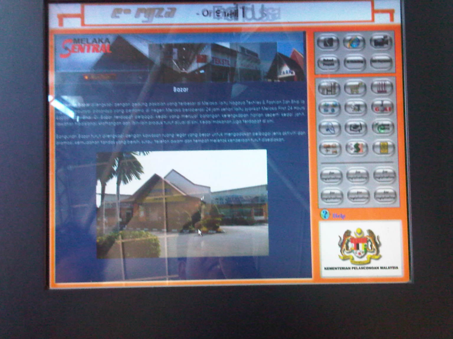
Interactive information screen at the terminal
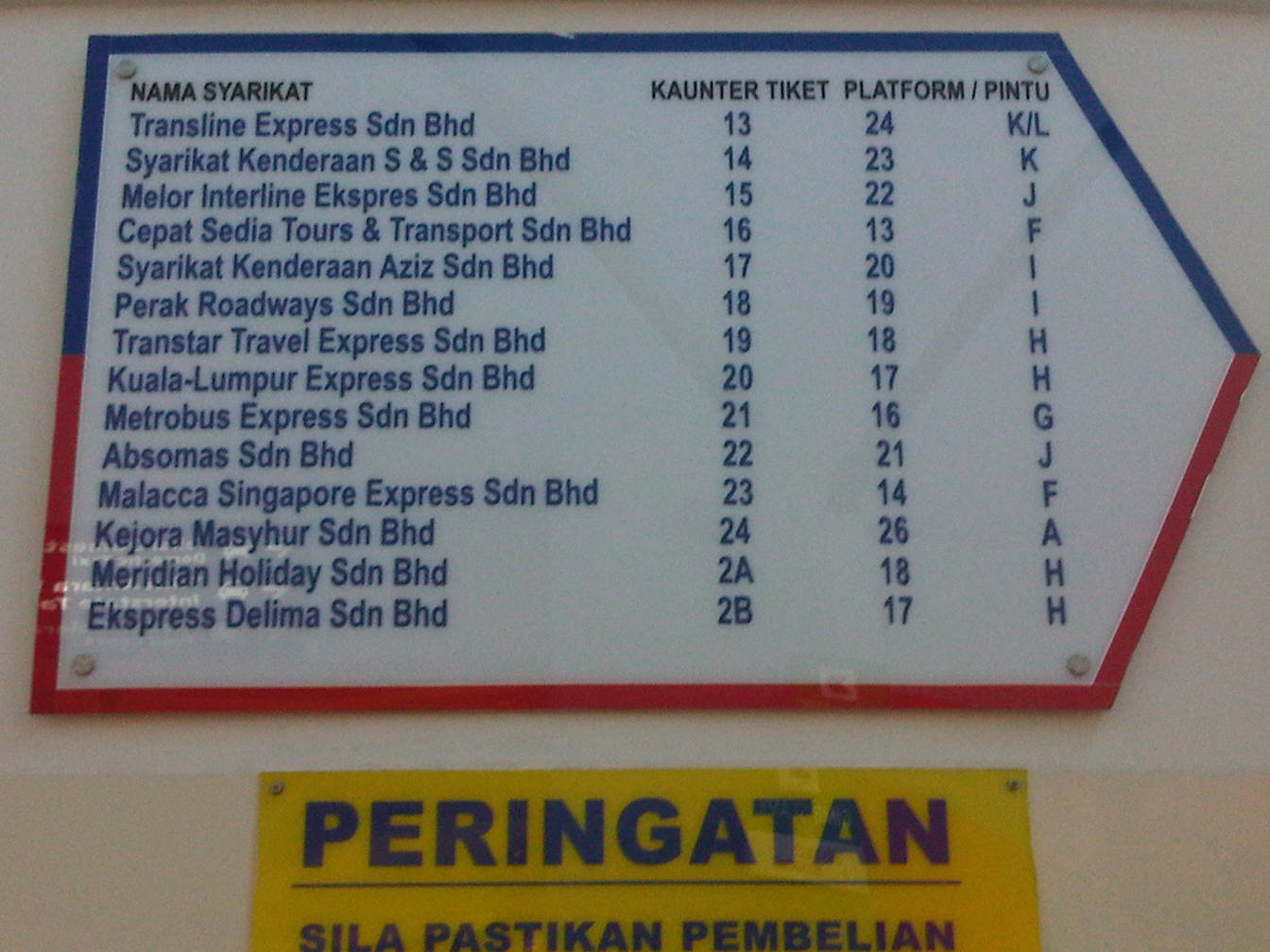 Static information board for the locations of bus company booths at the terminal
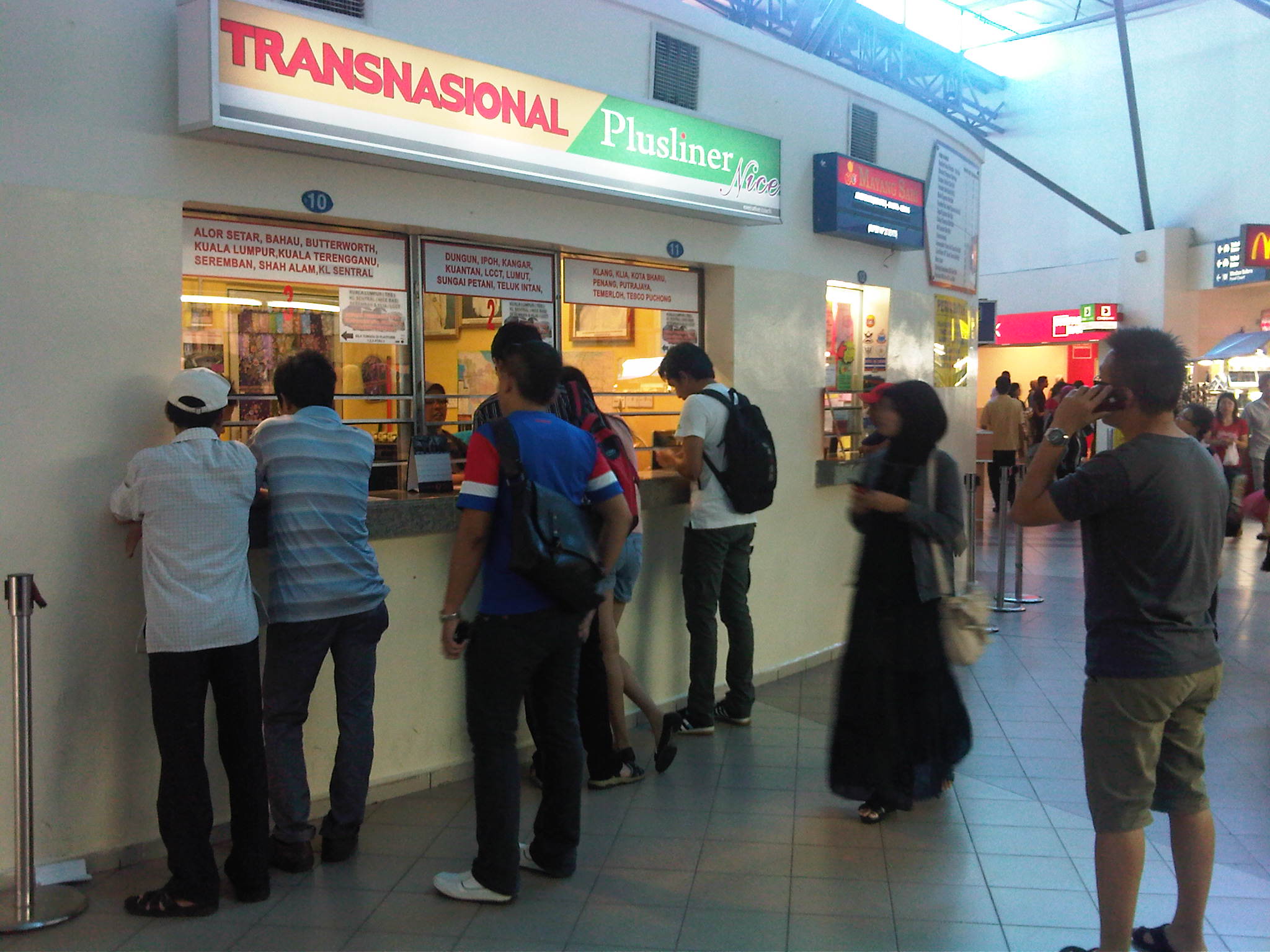 Travelers lining up before a booth to purchase tickets
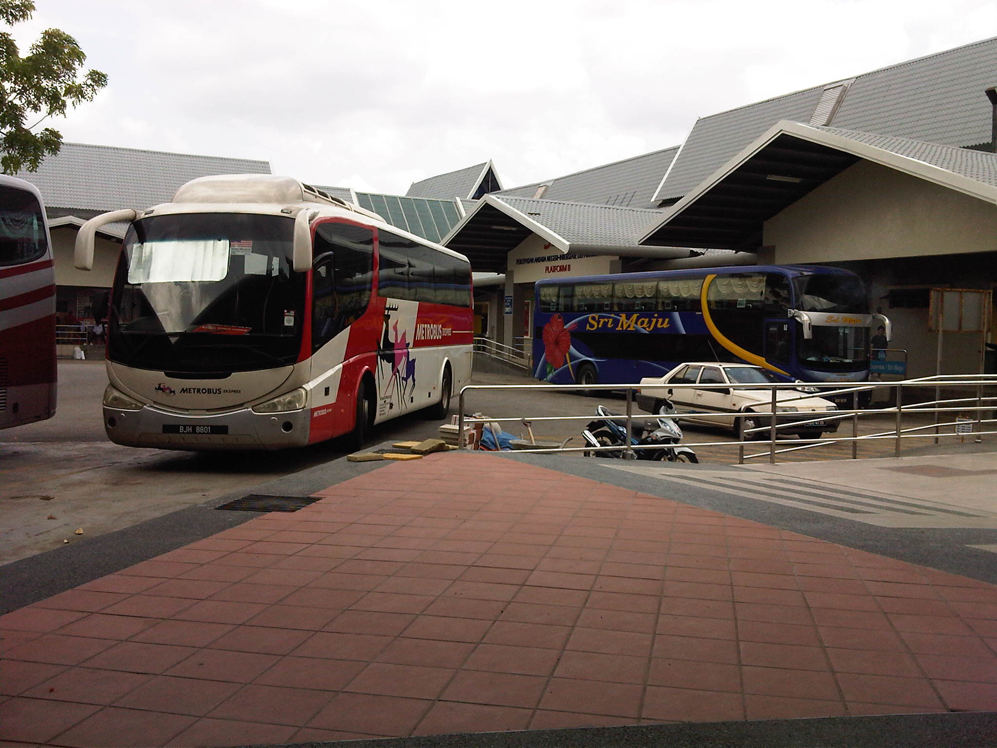 Buses berthed at the terminal departure area
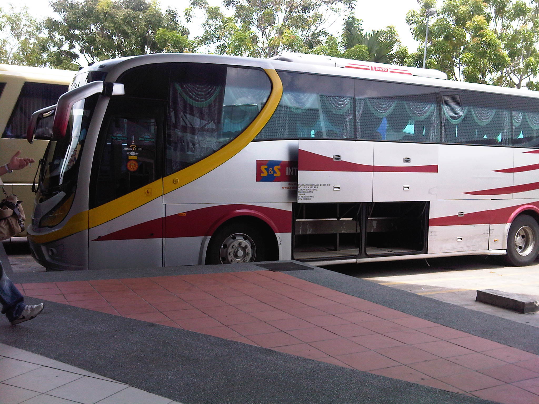 Typical long distance limousine bus plying routes between Malaysia and Singapore
The central bus terminal at Melaka is a good example of terminal design for long distance buses. Such concepts are also found in the Philippines but with some significant variations in the design. Among the notables are the terminals in Mabalacat (Pampanga), Lucena (Quezon) and Legazpi City (Albay) in Luzon. Other terminals in the Philippines are not good examples in the sense that many are not developed or well-planned, many without the amenities or features of a modern terminal. Perhaps local and international examples of terminals should serve as templates for central terminal development in the Philippines including those being conceptualized for Metro Manila.
–
Resurrecting the Bicol Express
Part of our recent field visit at the PNR included a tour of the depot where the maintenance and refurbishing works are undertaken. Among the cars we saw were those intended for train sets to serve the recently revived Bicol Express. The service to Bicol was recently re-started with a once-a-day trip to Naga City in Camarines Sur, which was eventually extended all the way to Ligao, Albay. The revival hopefully could be the start of something big – a renaissance – for the once famed Bicol Express. For older people, this could be a nostalgic service while for younger people it could be an adventure of sorts. Perhaps it would be a welcome alternative to air and road travel to the region given that the PNR ROW offers a better view along the way into Bicol including breathtaking Vistas of Mayon Volcano, the Pacific Ocean, Lamon Bay, Ragay Gulf and the Bicol countryside. Unfortunately, for now Bicol Express trains travel mainly at night from Manila and so the views will come up only after Naga City, which the train reaches at around 6:00 AM in the morning, and from there proceeds to Legazpi City for the next few hours.
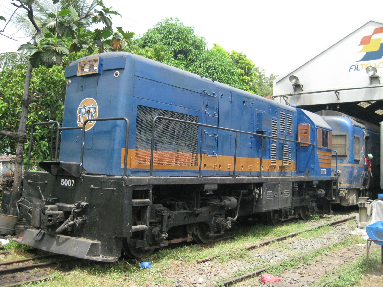 Diesel-electric locomotive that pulls PNR trains – unlike those I rode in Japan, Philippine trains are no electrified and have to be pulled by locomotives.
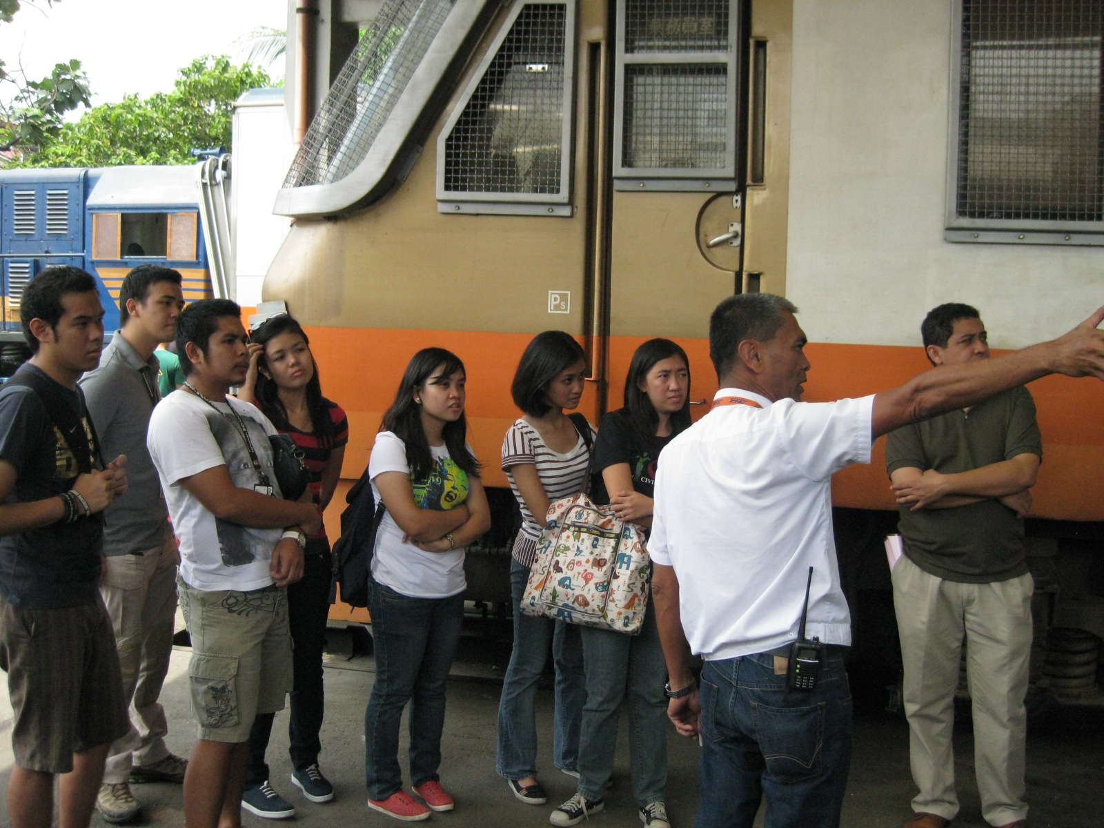 Technical tours – our hosts were very gracious and generous to provide us with a grand tour of the depot and the rolling stock. Such tours help our students to understand railway engineering “from the source.” Perhaps some students may be inspired to join a rail company.
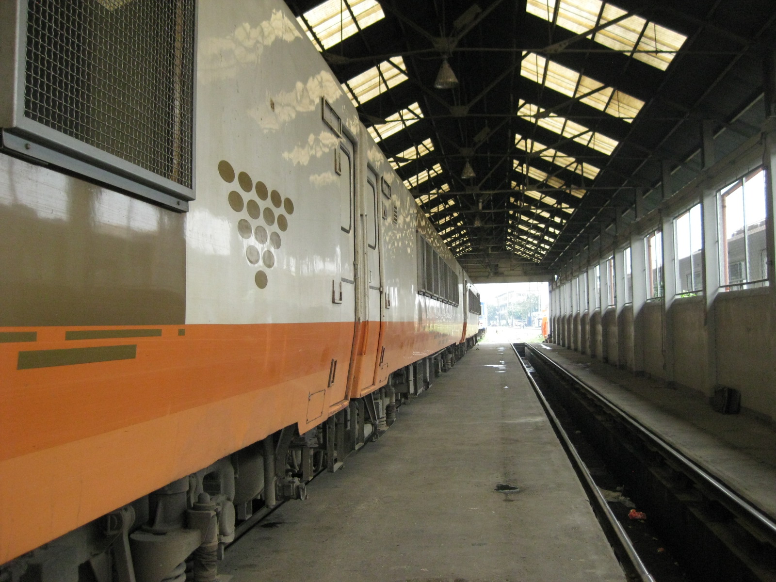 Sleepers – not referring to the rail ties but to the sleeper cars of this train, which has the family cabins consisting of 4 beds (0n 2 double-deckers) each cabin.
 Side view – the same diesel electric locomotive, which is actually a mobile power plant. Diesel is used as the fuel for the engine that produces electricity to power the locomotive.
 Upper deck – the cabins have 2 double deck beds with the upper deck bed having straps to prevent passengers from falling. While much of the PNR’s tracks have been rehabilitated, they are said to be still far from providing the smooth ride of their Japanese counterparts.
 Hallway – our students pose for photo along the corridor to illustrate the space in a sleeper car. There is a small seat that can be unfolded from the side wall across from each cabin door. Perhaps this is not really for use by the conductor but an extra seat for groups having a huddle or individuals wanting a seat to get a good view from the other side of the train. There’s are thick curtains that serve to provide privacy for each cabin. Each car is connected to each other so it is certain that passengers from other cars may be walking along these corridors.
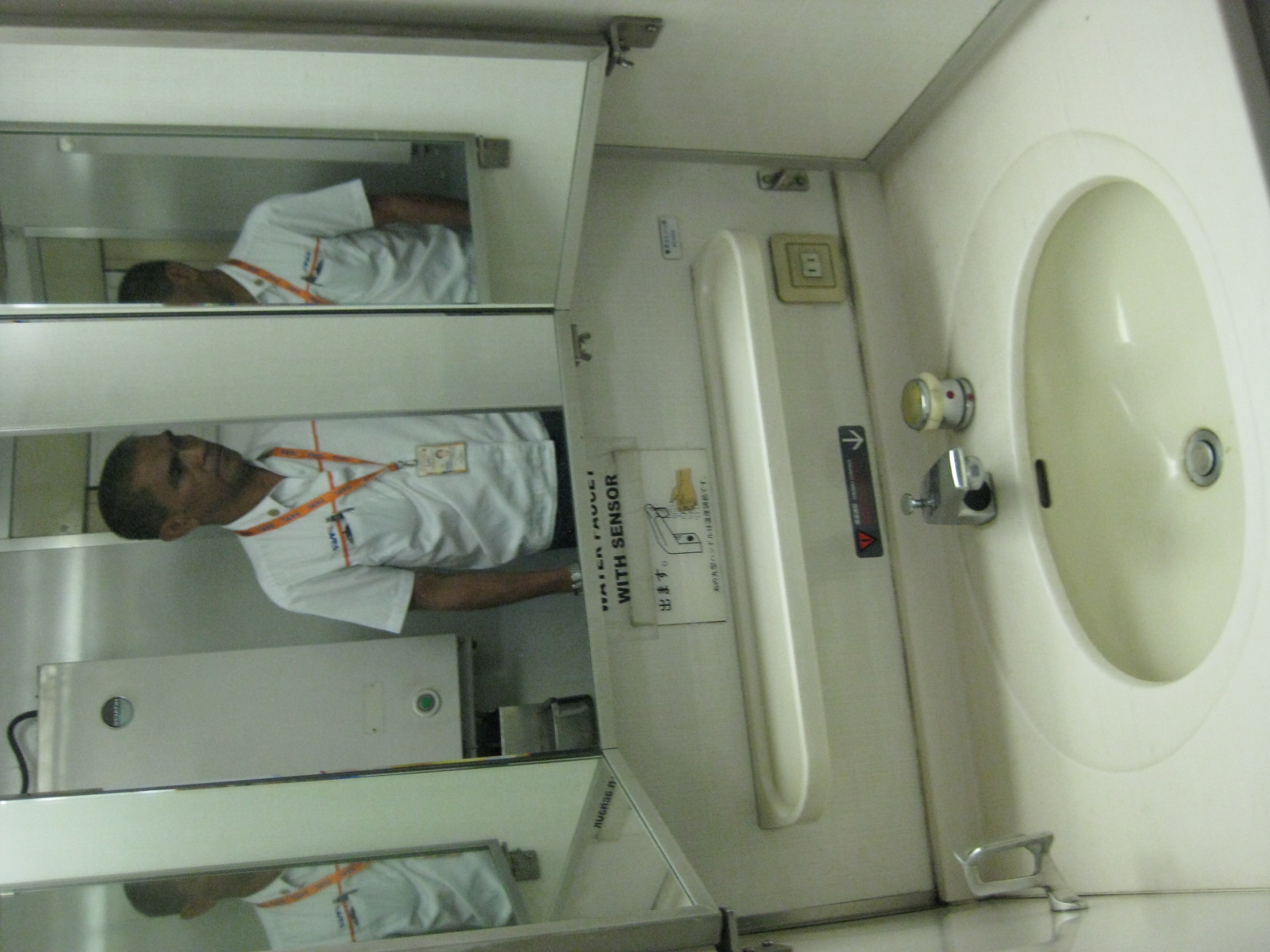 Wash room – the sleeper cars are equipped with washrooms and toilets for the long ride, amenities not usually found in most long distance buses serving the same corridor.
 Dirty toilets? – not really because this train has not yet been put into operation. The amenities like toilets and sinks are part of the refurbishing activities, we were told. Of course, this would have to be validated by actual passengers who would, by now, have taken the Bicol Express trains to/from Bicol during these Holy Week holidays.
 Conductor’s cabin – each car has a cabin assigned for the conductor or whoever is assigned to assist passengers during their journeys.
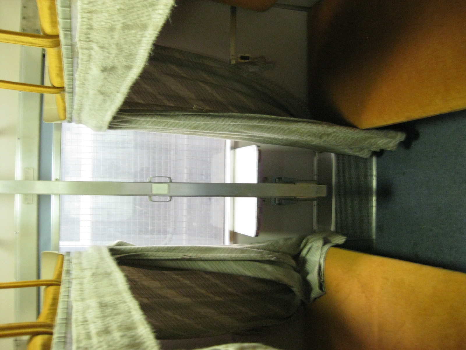 Double-deckers – the photo affords a better view of the double deck beds in a family cabin. The handles on the vertical bar on the center when pulled apart will reveal steps for persons to climb to the upper deck beds. There are also curtains for persons to have privacy particularly while sleeping or when sharing the cabin with other people.
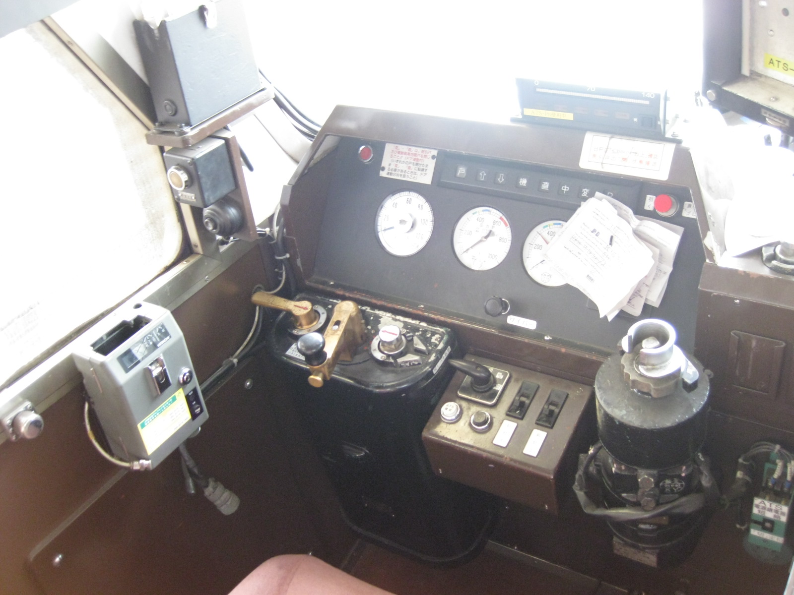 Driver’s console – the controls for the train give a hint on how old this unit is, noting that it has been retired in Japan. I remember looking at similar dials and levers during my first visit to Japan in 1996 when we usually stood behind the cockpit to see how the train is operated.
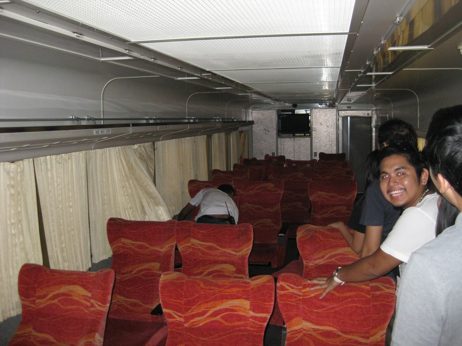 Recliners – inside the cars are reclining seats that seem to be as comfortable as business class seats on airliners. I tried one of the seats and the cushions are still quite firm for something that’s more than a decade old. I couldn’t smell any traces of tobacco so I guess these were already sanitized. Smoking cars are quite common in Japan and seats and entire cars can smell of smoke that tends to stick to the furniture and your clothes if you happen to be in one during a trip.
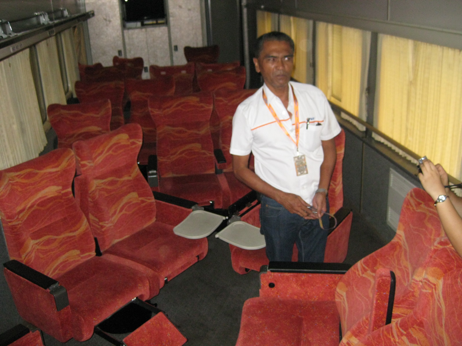 Rotation – the seat can be configured so that groups may face each other. Many seat two people kind of like love seats perfect for snuggling on long distance trips. There are also pull-out trays for eating, writing or working on your computer to update FB status or tweet about the experience.
 Entertainment – Yes, that’s a television set at the far end of the cabin. I can imagine that like in buses, the PNR will be showing some movies during trips to help passengers wile away the time. We were informed that big groups could actually take a car for themselves so it is also possible to have activities like workshops in the train. Perhaps groups could even have karaoke if they had the entire car to themselves.
 Reserved – the seat numbers remind ticket holders which seat they are to take and the characters remind us where the trains came from. That’s a hook (for hanging your coat or other belonging) in the lower center of the photo.
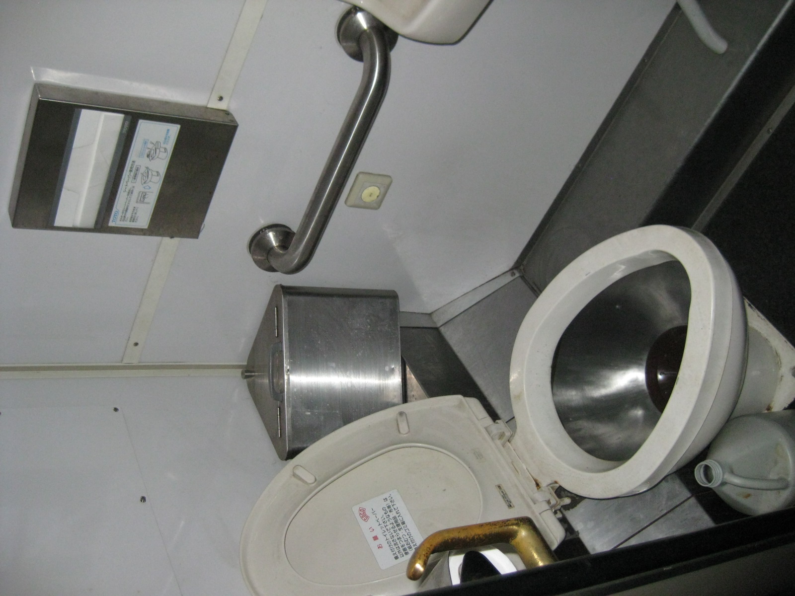 Toilets – the toilets are western-style with support bars for those requiring stability and a paper towel dispenser for the convenience of passengers.
 Toilets for PWDs and others – this has larger space for people requiring space including persons with disabilities, senior citizens, pregnant women and those with babies or small children.
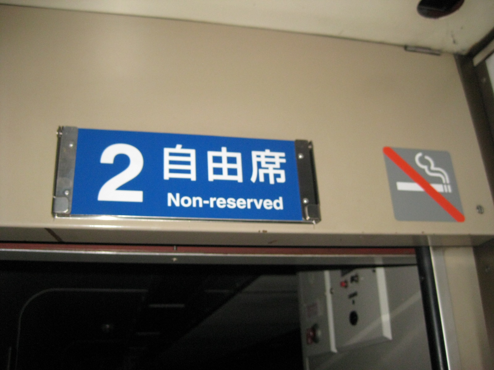 No reservations – in Japan “Non-reserved” means that seats on the car are first come, first served. One could purchase either such seats or the more expensive reserved seats from the train station.
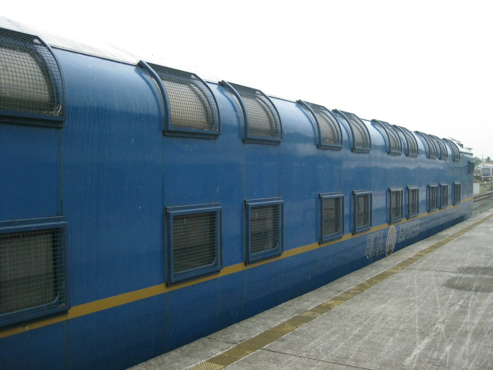 Executive class – the double deck cars containing Executive Sleepers or individual cabins for the Bicol Express
 Airconditioned – the Executive Sleepers have air-conditioning, which is a requirement for all services of the PNR that is part of the attraction for passengers. Some cars were fitted with generator sets to supplement the power provided by the locomotives. Note again that the PNR lines are not electrified so power required for lights, aircon and other equipment have to be provided by these generators.
 Dining car – the Bicol Express trains include dining cars like this one also being refurbished by the PNR.
 The Bar – the car included a bar where people could have drinks. This feature of the train elicited a lot of questions and some excitement among our students.
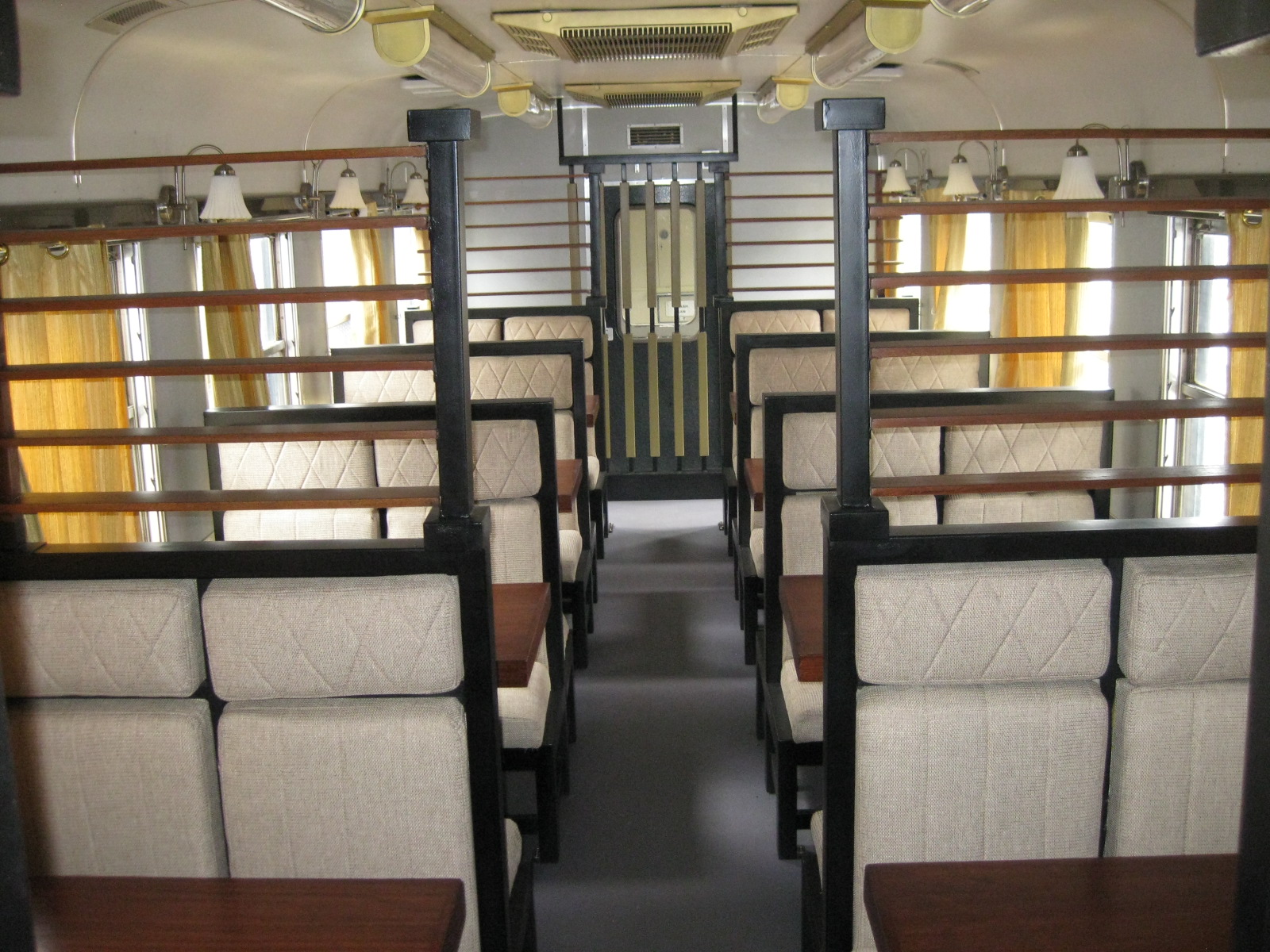 Dining tables – there’s ample space for diners though we were not able to ask who may actually be allowed to use the dining cars. There are 4-seater and 2-seater tables in the car.
 4-seaters – a closer look at the dining tables show comfortable seats and a good view from the window. Unfortunately, the Bicol Express trains travel at night so there’s really not much to see while in transit.
 Singles – passengers may also opt to eat at the bar, especially for the case of individuals who might end up hogging a table and depriving groups of space.
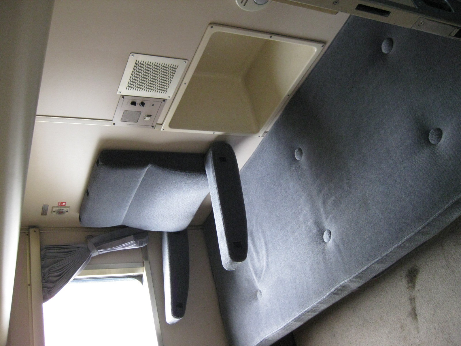 Executive sleeper – the cabin has a bed that doubles as a seat. Note the foldable arm rests and back cushion by the window. Also, there is space for a small bag located at a more secure part of the cabin.
 Lights and aircon – each cabin is equipped with a desk, adjustable lights and individual air-conditioning control for the convenience of the occupant.
 Window seat – each cabin has a window and generous space for the individual. The same features are found on the cabins on the upper deck but I guess the view is better upstairs so these would be the choice cabins for the Executive Sleepers.
I look forward to finally riding the Bicol Express, perhaps with family or friends, as I visit relatives in Bicol (my mother hails from Sorsogon). Though I can ride the train to Legazpi City, Albay, it is just a short trip by bus from that city to my mother’s hometown. Of course, there are other cities of interest for me including Naga City, my father-in-law’s hometown and Legazpi where there are many attractions around. My father has told me a lot about the Bicol Express, which he took with his sisters en route to Sorsogon to wed my mother. And so, part of the attraction to the train is sentimental in nature.
–
PhP 21.5 B for electric tricycles
Another article came out today, this time from GMA News about the NEDA’s approval of a PhP 21.5 Billion project for electric tricycles. The approval of the project is said to be based on the evaluation of a feasibility study submitted by its proponent, the Department of Energy (DOE). I have not yet seen this FS and I am not aware of any formal studies in this regard that has been made public so I cannot make a fair comment with regards to what the NEDA had as reference materials in their assessment. I am aware of one private initiative where UP was involved but to my knowledge this has not been disseminated or shared by the Client to government agencies. Though caution is still very much necessary and desired when moving forward with this e-trike project (What would happen to spent batteries? Is there adequate technical support? Charging stations? Policies regarding phasing out conventional tricycles?), it is hoped that this will be one of those “tipping point” moments that will ultimately benefit the country.
The article on the e-trike is reproduced below:
MELAY GUANZON LAPEÑA, GMA News March 26, 2012 5:29pmThe National Economic and Development Authority (NEDA) approved a P21.5-billion project to promote sustainable transportation and achieve energy efficiency.
The Market Transformation through Introduction of Energy Efficient Electric Tricycle (E-trike) Project will reduce fuel consumption of tricycles by 2.8 percent, equivalent to 560,926 oil barrels, NEDA said in a statement Monday.
“The project will distribute 100,000 E-trikes to tricycle operators on a lease-to-own arrangement, replacing their old gas-fed and two-stroke gasoline engine units. This way, we are also able to protect our environment,” according to NEDA, citing Socioeconomic Planning Secretary and NEDA board vice chair Cayetano W. Paderanga Jr.
“The electric tricycle is a specially designed, highly efficient tricycle that runs on a motor powered by a battery charged by electricity. E-trikes produce no noise, no tailpipe emissions, and represent an opportunity to make public transportation in the Philippines more environmentally conscious while improving the livelihood of tricycle drivers across the country,” reads the project description on the website of Asian Development Bank, which is financing part of the project through a P12.9-billion loan.
The project was proposed by the Department of Energy (DOE).
Additional financing will come from the Clean Technology Fund (P4.3 billion loan and P43 million grant), Clean Development Mechanism facility (P860 million), Philippine government counterpart funding (P3.397 billion).
Early this month, the DOE selected 10 winners in a nationwide contest for the best E-trike design on a theme of “Bright Now! Do Right, Be Bright.”
According to the DOE, the design is optimized to ensure structural integrity.
ADB explained that the project gives tricycle drivers the opportunity to lease or lease-to-own the E-trikes by paying less than 200 pesos a day, which translates to a higher take-home income.
“For example, a conventional tricycle needs between 5 and 7 liters of gasoline to travel approximately 100 kms, costing P250 to P350. To travel the same 100 kms, an E-trike will use between 3 kWh and 5 kWh of electricity, costing only P30 to P50. The 200 peso difference in fuel savings will help the driver pay for the cost of the E-trike,” ADB added.
The pilot project was launched in April 2011, with 20 E-trikes deployed in Mandaluyong City. The E-trikes use two different types of lithium ion battery technology—the 3 kWh and 6 kWh battery packs.
Models with the 3 kWh battery pack can run as far as 50 km on a single charge, and can be recharged to 80 percent in under 30 minutes at fast charging stations. Models using the 6 kWh battery pack can go up to 100km on a single overnight charge.
Sen. Edgardo Angara, who heads the Congressional Commission on Science, and Technology, and Engineering, lauded the E-trike project, saying the use of e-vehicles could lower air pollution levels and lessen the dependence on oil.
“Once thousands of E-trikes begin to be manufactured, many new jobs could be created. Working together, we can give Manila cleaner air, bluer skies, and a more livable environment,” Kunio Senga, director-general of ADB’s Southeast Asia Department, said in an earlier report.
The Quezon City government is preparing pilot test the E-trikes. According to a news release, the city has conducted an Eco-Driving Training for Quezon City Tricycle Operators and Drivers Associations (QC-TODA).
Discussed was the impact of good driving behavior, proper engine maintenance for lesser emissions and reduced maintenance cost as well as increased fuel saving for the current conventional tricycles operating in the city.
QC will be given 22,000 E-trikes over five years—the largest allocation among LGUs in Metro Manila—2,000 this year and 5,000 every other 4 years.
“The project is expected to complement the city government’s continuing effort to mitigate the ill effects of pollution on public health and safety. This would also pave the way for the gradual phase-out of conventional tricycles now plying city roads,” according to a statement by the Quezon City government.
Under Phase I of the project, 20,000 E-trikes will be distributed to operators in Metro Manila, Boracay, Puerto Princesa City, Cabanatuan City, and Davao City from 2012 to 2013.
Eighty thousand units will be distributed to operators in municipalities and cities that are still to be determined under Phase II (2013 to 2016).
NEDA said the project aims to promote, establish and develop electric-vehicle support industries such as battery leasing, recycling and disposal, and motor supply chain and charging stations.
But the Electric Vehicle Alliance and the Partnership for Clean Air are questioning the project, saying its funds were reallocated from the renewable energy industry—originally stipulated in the Clean Technology Fund.
Greenpeace is also not happy with the project.
“Why are we rushing this project?” asked Greenpeace Southeast Asia campaigner Francis Dela Cruz.
While E-trikes are not bad in terms of technology, Dela Cruz said
they are not necessarily good for the environment. “Hindi siya magiging source ng mobile pollution, but because you use power outlets to charge, you are just shifting to a stationary source of pollution—the fossil fuel-fired power plants,” he said.In addition, the project-mechanism that involves LGUs as lenders make the project seem dubious to Greenpeace.
“Kaya bang magpautang at maningil? Baka magpapautang tapos hindi maniningil, ang magbabayad ang taong bayan,” Dela Cruz said, noting this will be unfair to taxpayers who don’t benefit from the project but may end up having to indirectly pay for it. — VS, GMA News
–
PNR Field Trip 2012
We took our students to a field visit to the Philippine National Railways (PNR) station and depot in Tutuban in Manila. It was a good experience for all of us who joined the trip as the PNR is currently in the process of upgrading their services with the acquisition of refurbished rolling stock and the resumption of services to Bicol. We were quite curious as to the current state of the PNR after what has been a long period of neglect from a government that is supposed to promote safe, efficient and affordable mass transit not just for the urban setting but for long distance travel as well.
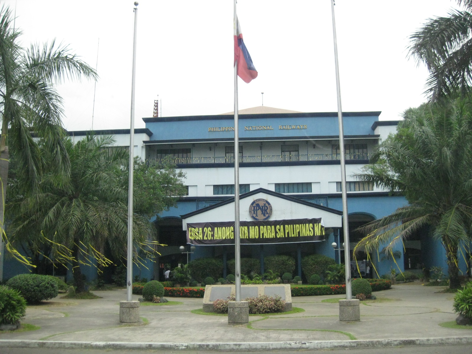 The PNR station and office building at Tutuban – the old station is actually where the Tutuban is now located. Access to the Tutuban Station is through a gate and the surrounding area is not suitable for a main or central station. There is no station plaza and as we will see in another photo, the space including the platform will not be suitable should operations expand in the next few years. In fact, passengers entering the station are processed as if they are entering an office building. This is partly true as the building serves as head office for the PNR.
 Train schedule for the PNR commuter line – service frequency is still low with headways of 30 minutes (a train every half hour). With the number of passengers steadily increasing, the current capacity of trains has already been exceeded. The PNR should resolve issues pertaining to conflicts along its tracks and deploy more trains and/or more cars.
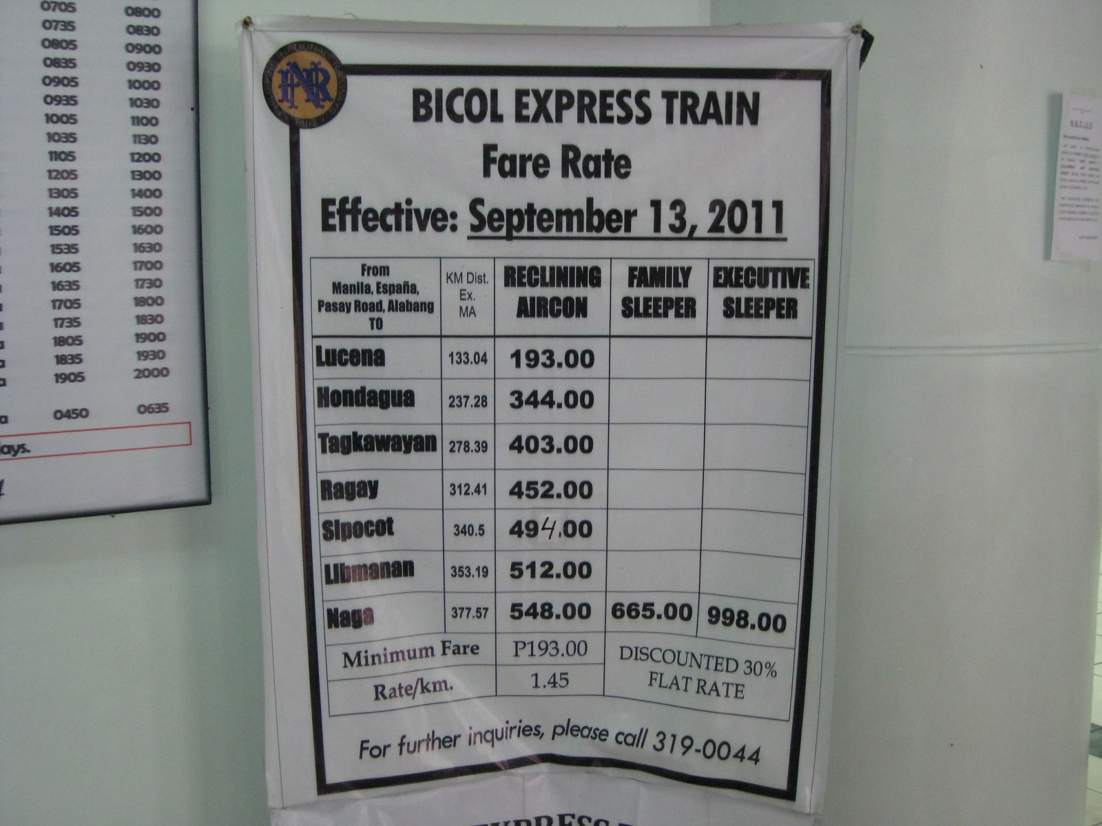 Fare table for the resurrected Bicol Express – family and executive sleepers were supposed to start operation last March 16. We were told that the PNR hosted representatives of travel/tourist agencies to an exclusive initial run of the sleeper and recliner cars to Bicol and back. This was part of the promotion of rail services to travelers especially as the summer months are approaching.
 Replica of old PNR train car – there were many photos and other memorabilia on display at the Tutuban station. Unfortunately, the security people seem quite iffy about people taking photos. They had to be told by our host PNR officials that we were visitors from the State University. I found this to be very odd and a definite turn off for people interested in the trains. Rail needs to be promoted and PNR security is not helping in this aspect.
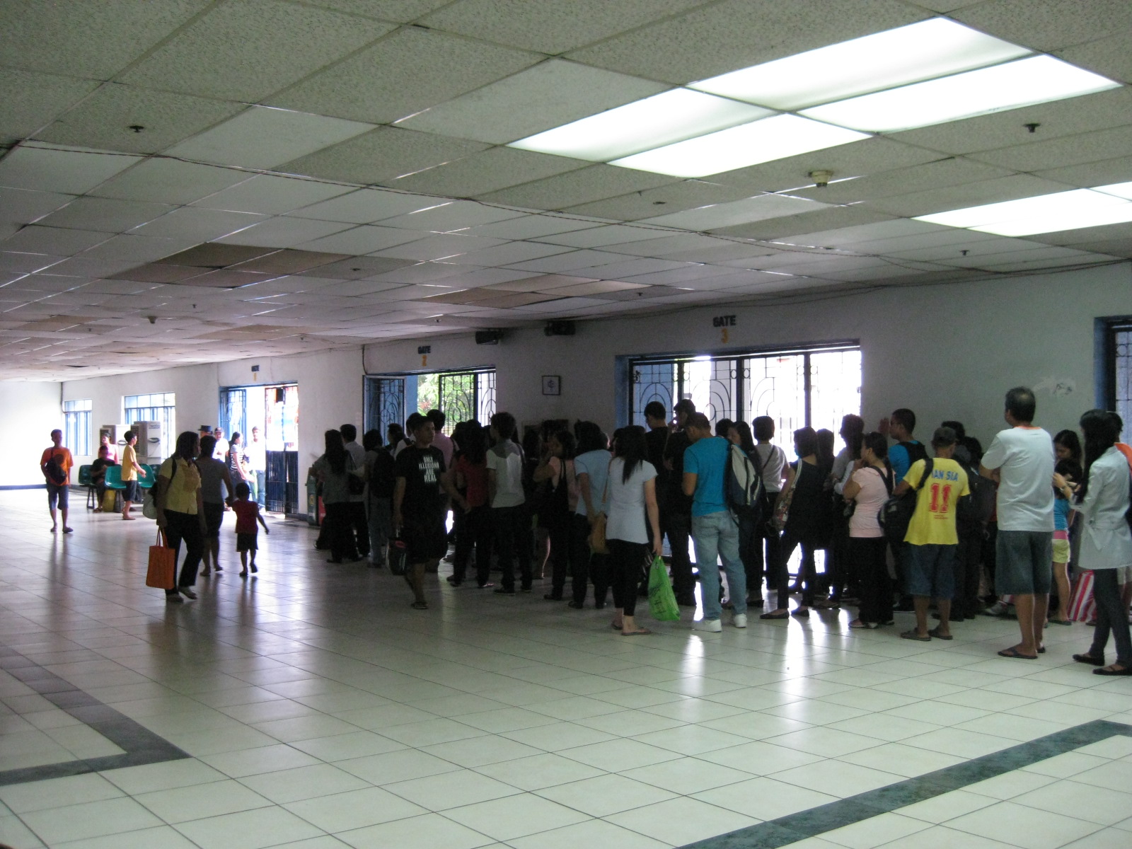 Passengers queued at the Tutuban Station – there were very few seats in the waiting area and passengers who want to board the next train emanating from Tutuban had to stand in line from the gate where PNR staff and security process passengers. A better system should be established here including the introduction of ticketing machines and turnstiles to better serve passengers. It won’t hurt also to have an electronic information system for train schedules and announcements.
 Maintenance cars – when our hosts led us to the platforms, the first things that caught my eyes were the maintenance cars. These have allowed the PNR to provide better maintenance work on their tracks, no longer relying solely on manual labor for inspection and other works. Behind the equipment are cars familiar to me and my colleagues – Japan Railways (JR) retired these cars from the Saikyo Line that served areas along a route connecting Tokyo and Saitama Prefecture.
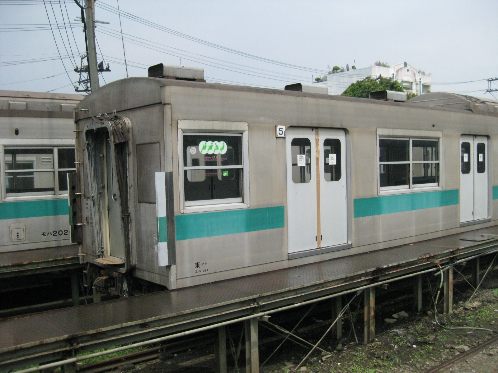 Nostalgic – these cars were the very same cars we used to ride along JR East’s Saikyo Line, which now runs between Omiya in Saitama Prefecture and Osaki in Tokyo via Ikebukuro and Shinjuku. It was usually my choice for going to Tokyo from Saitama University if I was heading to Shinjuku or Shibuya. From the university, I ook a bus to Minami Yono Station where I can also see Shinkansen trains passing through the station. The latter were also headed to Omiya where the Shinkansen lines branch out to Nagano, Tohoku and Akita. The cars shown in the photos are donations from Japan and the PNR only paid for its transport.
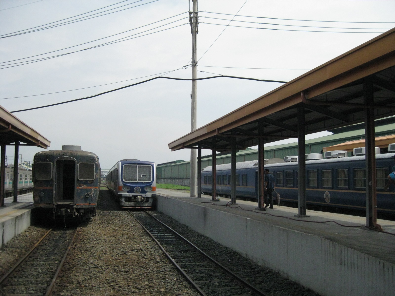 Old and new – old cars of the PNR may also be found at the Tutuban depot like this old passenger coach at one of the platforms. We were not able to ask if the PNR had plans to preserve these old cars. In other countries, there are railway museums like the one near Omiya Station in Japan. I’m sure the PNR would not lack for museum pieces including the old locomotives on display at its gates.
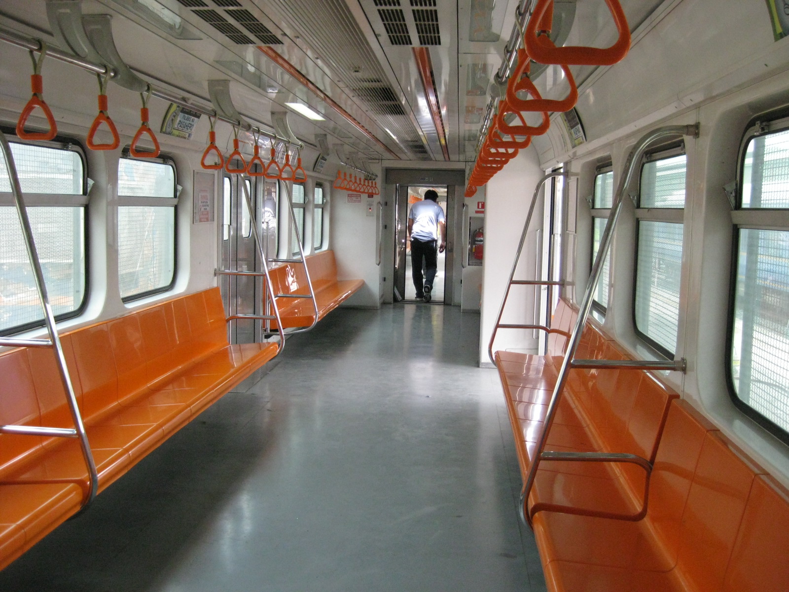 Sparkling – The interiors of the commuter trains reflect the service upgrade for the PNR. The trains are clean and spacious (appropriate for the capacities required for commuter service).
 Try-outs – our students and my colleagues try out the seats as we were ferried from the Tutuban platform to the depot where our hosts gave us a technical tour of the rolling stock and other facilities.
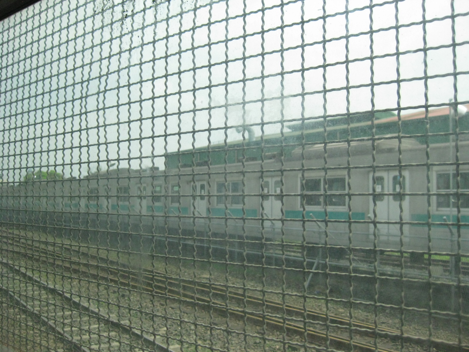 Grilled reminder – PNR coaches have their windows fitted with grills like this on the PNR commuter trains. Despite efforts to clear its right-of-way of informal settlers, there are still many along its route and these have often vandalized trains. In many instances, garbage and other items are thrown at the trains. These incidents have been significantly reduces but the PNR continues to experience such, necessitating the installation of grills. The coaches from Japan will not be operated until they are fitted with the same grills. Hopefully, the PNR ROW will be clear of informal settlers as well as other sources of impedance.
 Control panel – the lead car of the train features this more modern panel for the train controls. Note also the grills on the windshield of the train to mitigate the impacts of stones or other items thrown at the train as it rolls along its tracks near communities that include informal settlers.
 Exit route – when our train reached the depot, we had to climb down from the train as there were no platforms in the area. For this, one had to climb down backwards and feel for the steps just below the doors.
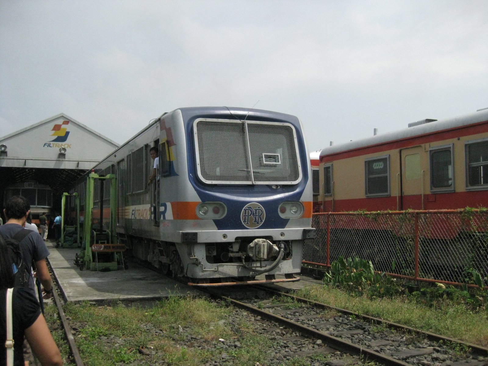 Maintenance yard – one of the newer commuter trains from Korea undergoing maintenance work at the depot. The coaches on the right are also Japanese donations for refurbishing, and are fitted for long distance travel though not as comfortable as the recliners or sleeping cars. These are more for longer distance commutes like from Laguna to Manila, which are similar to commutes along the JR Tokaido Line.
 Busy bees – with the resumption of Bicol Express services and the revitalized commuter line, the PNR’s maintenance staff have become more busy. There seems to be higher morale, too, as the long-neglected railway company gets a much needed proverbial “shot in the arm.”
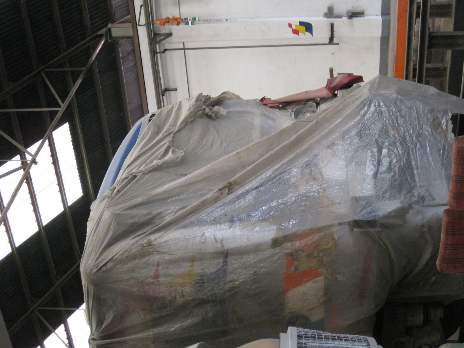 Crash victim – one of the commuter trains was involved in a crash when a truck proceeded despite the warnings and the barriers indicating an approaching train. That effectively knocked out one train and will cost the PNR a lot to repair the train. There are still many issues pertaining to safety along rail crossings, and many motorists and pedestrians remain hardheaded (pasaway?). As the PNR increases its frequencies for both its commuter and provincial services the subject of safety will become more serious and one that needs much attention.
 Briefing – colleagues ask our hosts about operations and other matters concerning the PNR today. Our students also had the opportunity to ask about employment possibilities at the PNR including what qualifications are needed for railwaymen.
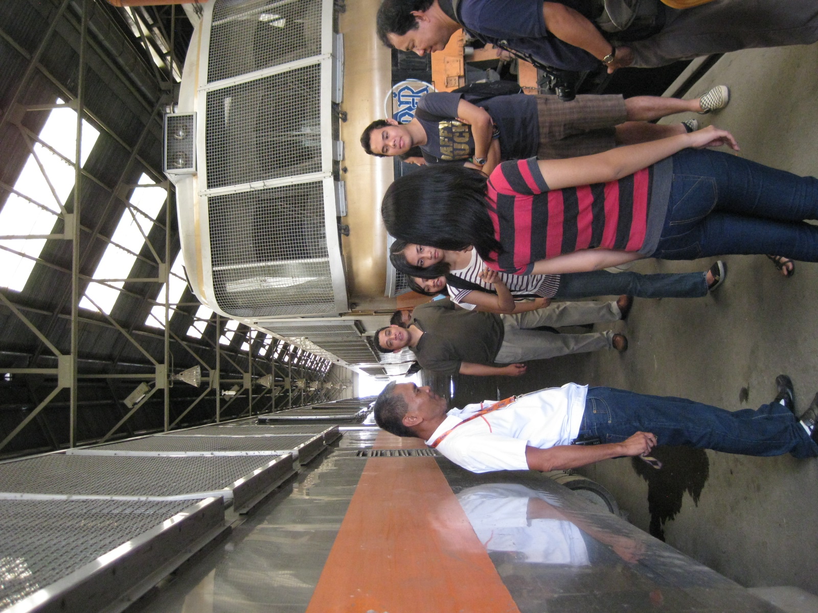 From JR to PNR – those are more Japanese trains in the background. We were not really surprised about the conditions of the trains considering that JR does a great job maintaining their trains given their usage.
 Recruitment pitch – our students had plenty of questions for our host including those about the trains and the history of the PNR. They were informed that the Polytechnic University of the Philippines (PUP) has a baccalaureate program in Railway Engineering and that our host taught courses there. When asked where the graduates go for employment, our host mentioned its difficult for them to get employment locally as railway engineers and that the program will soon terminated.
 Noontime rush – back at Tutuban Station, we witnessed passengers alighting at the station and walking towards the exit. The number of passengers was significant considering the limited capacity of the trains and the fact that it was already noontime. There are probably more passengers during the morning and afternoon peak periods.
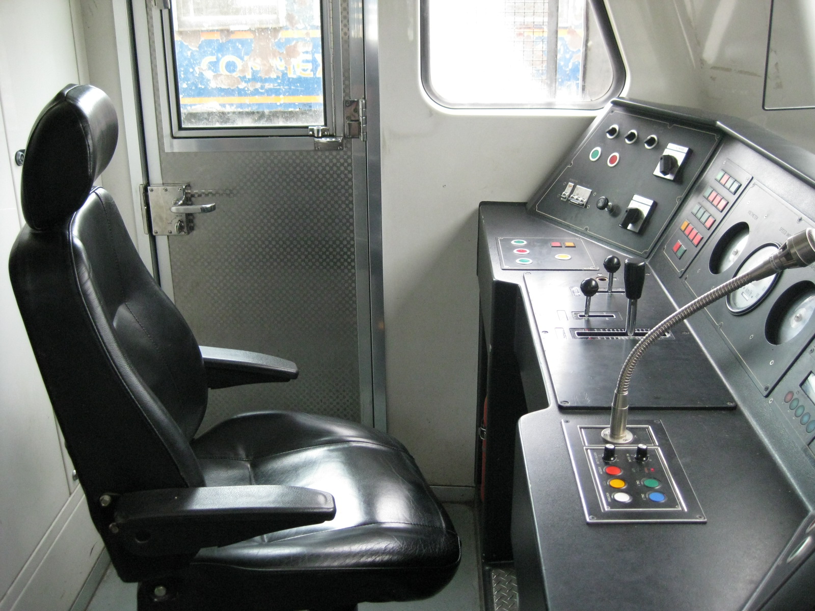 Driver’s seat – I took this photo when we boarded our train from Tutuban to Espana. Our hosts were very kind and generous to allow us to ride in the cockpit where all the action takes place. We also got a firsthand experience of what the driver had to go through (his hand was practically on the horn the whole time he was running the train) to earn a living.
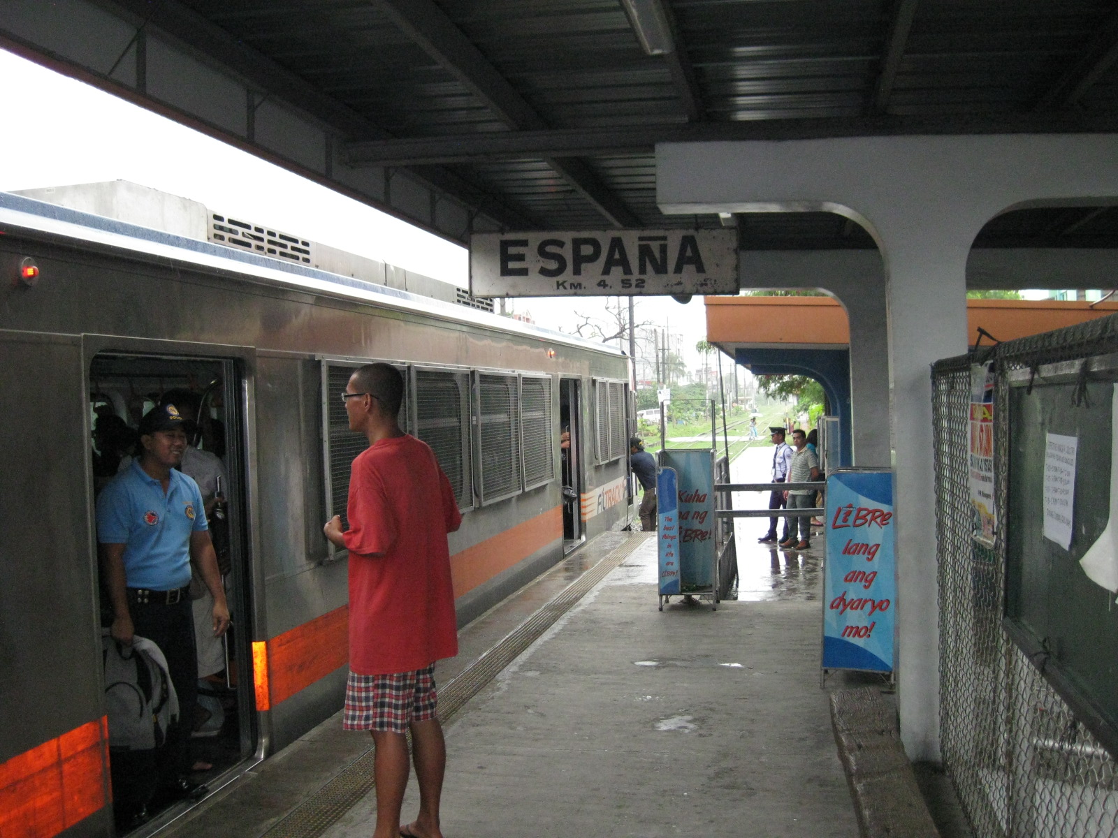 All aboard! – the Espana Station platform after all passengers have boarded the train. One passenger seems to be talking to the security personnel at one of the doors. The DOTC and the PNR posts security staff on the trains to ensure safety and security on-board. Their presence is a deterrence against criminality including snatchers and con-men who prey on students and the inattentive.
 Capacity – the train is filled with passengers, underlining the demand for more efficient public transport services in Metro Manila. This, despite the fact that trains have 30-minute headways. The PNR commuter line provides an inexpensive alternative to commuters.
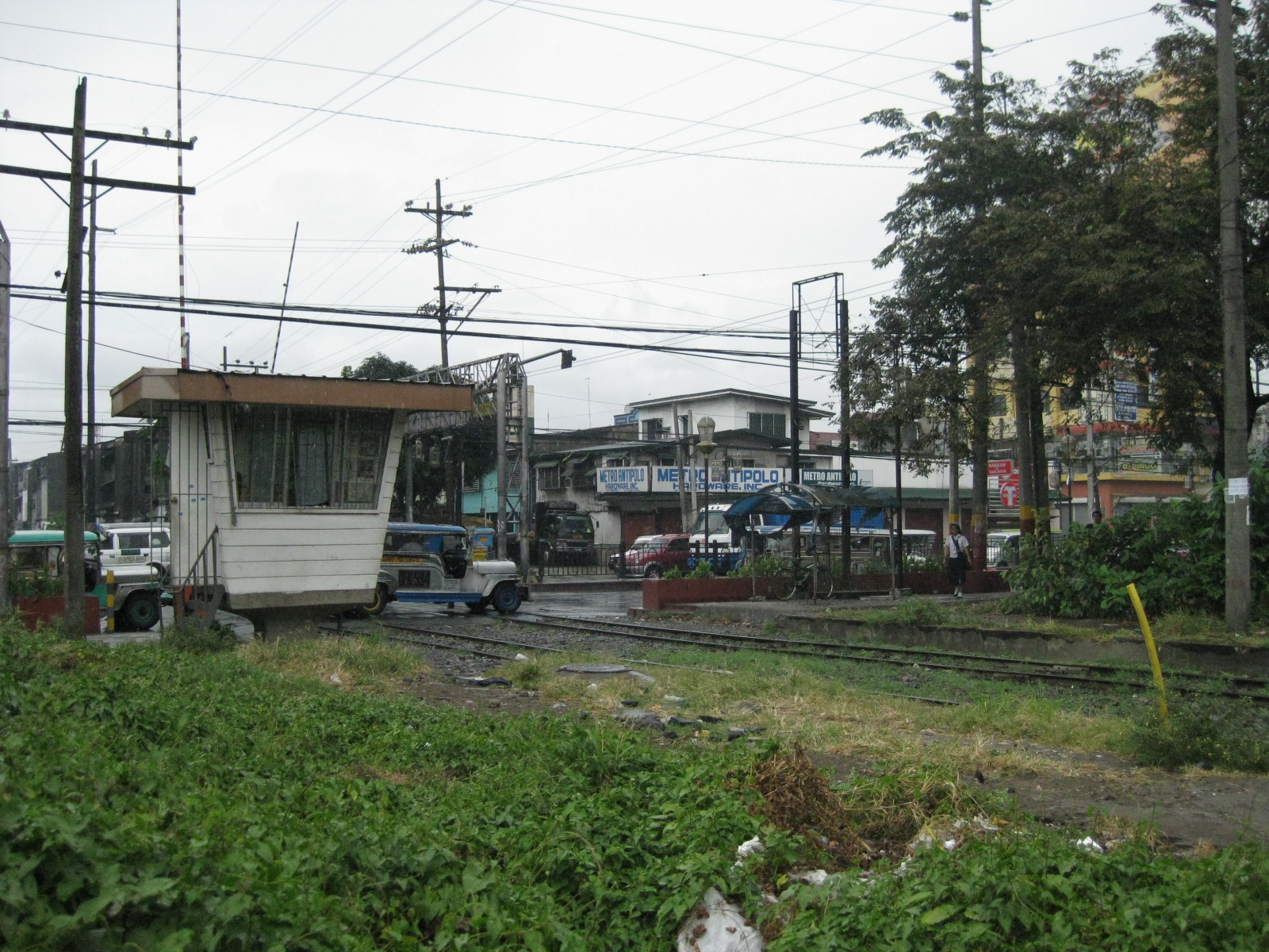 Crossings – the junction at Espana Avenue in Manila is among the busiest given the road traffic along this major arterial. If the PNR will increase service frequencies (and therefore capacity), this will result in higher likelihoods for crashes involving trains. During our short ride from Tutuban to Espana, we already saw a lot of crossings along the railways that require much attention and safety devices.
 Line diagram – like most trains, the PNR displays information on the stations along its commuter line. We visited their main station at Tutuban and rode a train from there to Espana. I can imagine that the stations listed in red would be express stations in the future but then conspicuously “blue” are Paco and Buendia Stations, which I believe should be major stops for the PNR.
–
A tale of transport costs for a commuter
When I was in high school, the minimum fare was 1 peso and my daily afternoon commute from school cost me an average of 3 pesos per day. If we didn’t have to go to school for extra-curricular activities on a Saturday, that meant I usually spend 15 pesos per week or about 60 pesos per month. I remember that my parents paid 200 pesos for the school service, which only covered the morning trips from home to school. This brought my monthly transport cost total to 260 pesos and this was back in the 1980’s. At the time my weekly allowance was 100 pesos (~400/month); more than enough for my lunch and snacks, and which allowed me to save some money that I usually deposited in my savings account. Of course, my actual total allowance was 600 pesos per month factoring in the amount my parents paid for the school service. These figures meant transport accounted for 43.33% of what was my income back then (15% if the school service component was not included).
At university in the early 1990’s, my allowance was up to 300 pesos per week. Transport fares, however, increased with a minimum fare of 2 pesos (for the first 4 kilometers) and my two rides one way to the university cost me a total of 5 pesos per trip. This could easily be multiplied by two if I was able to get an easy ride home from Katipunan but traffic was already worsening at the time and I, together with a few friends who had similar commutes, often found myself going to Cubao where the terminal was so I could get a sure ride home. This meant I had to shell out an additional 6 pesos on certain days. I estimate that my weekly total could average around 80 pesos, bringing my monthly average up to 320 pesos. That translates to 26.67% of what can be considered as my monthly income at the time.
By the time I was in graduate school in the mid 1990s, commuting in Metro Manila was a whole different animal with congestion along my route really becoming terrible. It was so terrible that the conditions then resulted in the birth of what was called FX services. The then newly introduced Asian Utility Vehicles (AUV), particularly the Toyota Tamaraw FX’s, that originally were registered as regular taxis started contracting passengers (illegally) in order to maximize their fares. It was actually the other way around as passengers who were exasperated at the very long queues in Cubao decided to contract FX taxis as groups and offering the drivers fares they just couldn’t refuse given that their being taxis allowed for flexible travel routes bypassing congested roads. By the time, the going rate was 10 pesos per passenger for an FX taxi starting from Cubao and ending at Cainta Junction. I was among the people willing to pay for this luxury, considering it saved me a lot of time and the ride then was comfortable due to the airconditioning on these vehicles. Perhaps it was also my way of applying what I understood from my transport economics lessons from my Japanese professor back then.
My daily commute during my grad school days cost me around 30 pesos for a total of about 200 pesos per week counting Saturdays and other side trips during the week. This to me was quite acceptable considering I had a scholarship grant at the time that gave me 3,000 pesos per month excluding other allowances that covered research expenses. The significant increase in my income was actually just enough to retain the percentage I spend for transport. Due to the corresponding increase in my transport costs, the percentage I spent for transport remained at 26.67%!
Taking post grad studies in Japan a few years later, I estimate that my average monthly transport costs amounted to around 20,000 yen (I traveled practically everyday using trains and buses.) This didn’t include the very occasional taxi on late nights when trains and buses were no longer available from the city center to the dormitory. My monthly allowance though was a very generous 185,000 yen so transport only accounted for 10.81% of my monthly income. This meant I had money available for a comfortable life abroad after accounting for my needs (e.g., food and shelter) and factoring in savings towards my estimated disposable income at the time.
The above examples are illustrations of how much transport costs become significant considerations in our typical expenses. Transport costs like the fares I paid when I was a student ate up a significant part of what was considered my income at different times. My case can probably be considered as fortunate since my parents were able to provide for me during my high school and university days, and I was able to get generous scholarships during my grad and post grad schooling. It is not the same for may others who would have to shell out more to be able to travel between home and school and do not have the choice, given limited resources (i.e., allowances), to select transport with a higher level or quality of service. There are those who have to walk (and even swim) to and from school simply because they have no other means.
I relate my personal experiences as I try to understand the plight of many commuters who have to bear the provisional fare hikes that the LTFRB approved today. This is in part a reaction to the clamor of public transport groups for transport fare increase in relation to the alarming increase in fuel costs. Unfortunately, there is little difference between transport during my time as a student and transport today. In fact, we still are very dependent on tricycles and jeepneys where buses and perhaps rail transport is the more appropriate modes for travel.
Perhaps our continued dependence on transport that is too dependent on fossil fuels whose prices are susceptible to many factors makes us quite vulnerable not just to price changes but also to the whims of a public transport system that has been proven to be inefficient and ineffective. It goes without saying that we need to have the necessary public transport infrastructure built in order for commuters to once and for all be relieved of the constant threats of oil price hikes and fare increases. Too long have been the delays for rail lines and BRTs, and it is costing us billions of pesos that could have instead already paid for these systems that we are hesitant to put up. Only then will we be liberated from those who claim to be concerned about the welfare of commuters but fail to deliver safe and efficient transport services as they put revenue first contrary to their commitments when they got their franchises.
–
Decoupling transport and fossil fuels in the Philippines
An article appearing in the Business World today caught my attention as it provided, to me, a very good argument to support initiatives to wean transport away from its dependence on fossil fuels. Being a supporter of the initiatives for alternative energy to power public transport, especially the electric jeepneys, I can appreciate the discussions pertaining to urban transport. The DOTC, LGUs and the current dispensation should take heed of the main points in the article and focus attention and resources to building the transport infrastructure that our cities so badly need and that have been delayed for so long that we are often forced into short term (and short sighted) remedies (the FX or UV Express services come to mind).
The author is a former Dean of the School of Economics of the University of the Philippines Diliman and is well respected for his articulate views on practically everything connected to his field of expertise. His piece on urban transport in the Philippines includes mention of what many of our leaders already know but are afraid to touch due probably to its socio-political, and therefore painful, implications. I reproduce below the entire article as it appeared on the March 19, 2012 issue of Business World’s online edition. My sincere apologies for any copyright infringements that I might have committed.
The right thing is doing nothing
The clamor from public transport groups, mass organizations, a few politicians, media columnists, and — surprisingly — even some academics to reduce the VAT on oil products has now become so insistent that the government may just be tempted to cave in.
Doing so would be a big mistake.
It is hard to justify on first principles just why or how a solution to high oil prices should involve a reduction of the VAT on fuel. The VAT, after all, is based on the idea that all consumption must be uniformly taxed — that is, taxed at the same rate. Without good reason, the tax system should not itself be responsible for making some goods more or less expensive than others. Hence, if without taxes the price of a can of corned beef was, say,twice that of a bar of bath soap, then it should still be worth twice as much after a 12% tax is imposed on each. (Note that the ratio of X to Y is the same as the ratio of X(1.12)to Y(1.12).) That relationship is unchanged whether the uniform VAT is set at 5, 10, or 12%, as long as the rate is the same across all goods. (My colleague Ben Diokno has even seriously proposed that the VAT rate be raised to 15 percent in lieu of high income taxes — although he has curiously been reported as supporting a cut in the VAT on fuel.)
To argue that the VAT rate should be reduced for some products but not for others is to privilege the consumption of those products. But why should gasoline and diesel in themselves be more vital to consume than other goods? Why is a peso spent on fuel socially more important than, say, the peso a family spends on electricity or water? Or the toll paid by a bus using the NLEx? Or what a student pays for a cheap sandwich? Or a professional’s hard-won savings to purchase a laptop? Or more meritorious than a farmer’s purchase of fertiliser, pesticides, and farm tools? What entitles petroleum products to this special treatment?
If the answer given is that petroleum products are “consumed by the poor,” that’s not exactly true either. It is vehicle owners, both private and commercial, who consume petroleum-based fuel — and few of them are poor. Indeed, if the government were to cut the VAT on fuel, it would help not only jeepney — and bus — operators but also owners of BMWs, Benzes, Pajeros, and Fortuners. The effect would be to privilege heavier users of auto fuel — poor or not.
Tax-tinkering is fraught with danger, and its deleterious effects should by now be evident in our experience with an already existing fuel subsidy (which everyone seems to have forgotten), namely, the decades-old privilege given to diesel fuel. For starters, note that there is no inherent physical reason that diesel should be cheaper than gasoline. Indeed, from a pure cost perspective, diesel is more costly to refine, so that before any taxes, it is likely to be more expensive than gasoline. In the US and the UK, for example, where the two fuels are taxed uniformly, diesel is more expensive than gasoline; in Germany and Canada they cost virtually the same. So if only the 12% VAT were applied to both — say, at landed cost — gasoline would probably still be cheaper than diesel.
It is not the VAT but the lower specific tax on diesel — at only one-third of that applied to gasoline — that makes the latter more expensive by more than 20%. This low tax, which has been in place since time out of mind, was always meant as a concession to public transport, the predominant user of auto diesel.
And where has this discriminatory policy taken us? First, it has only deepened the country’s reliance on diesel fuel. It has discouraged any search for or shift to alternative fuels on the part of public transport. On the contrary, it has enticed an increasing number of private vehicle owners to shift to diesel fuel themselves. The latter, of course, is a completely unforeseen consequence and embarrassingly gives the same “pro-poor” diesel tax privilege to a jeepney driver and a Mercedes Benz owner. It’s basic Slutsky: cheapen something in relative terms and you divert consumption towards that thing. Similarly, lowering the VAT on fuel will do nothing but deepen the country’s dependence on all petroleum fuels.
The second effect is more pernicious. Cheap diesel — combined with the lax franchising of everything from buses to jeeps to pedicabs — has created an overcrowded and über-fragmented urban transport sector. A 2007 World Bank volume reports that Manila had 13,375 public transport vehicles per million people, compared to only 1,890 for Bangkok and 1,807 for Hong Kong. (Guess where the public is better served.) Philippine public transport today is dominated by numerous and fragmented small operators kept alive only by artificially cheap fuel.
Transport groups routinely blame high fuel prices for their woes. Under-appreciated is the fact that their own uncontrolled proliferation — which leads to cutthroat competition, congestion, and dangerous road rage and warfare — is the main reason for their low incomes. This proliferation of bit-players has itself been unwittingly brought about by the policy of subsidized fuel (diesel). Ultimately, however, this kind-hearted approach has only hurt the poor by depriving them of cheap, clean, and efficient transport. For just as large developers will be discouraged by squatters occupying a property, the transport sector’s preemption by an inefficient and fragmented small sector precludes the entry of firms with larger capacities and more efficient technologies, all of which could have led to better service.
Lowering the VAT on fuel addresses none of these problems. On the contrary, it would only perpetuate them. The country is better served by confronting the real problems of urban transport. Government time, imagination, and effort are better directed at encouraging higher capitalization in the transport sector, larger capacities, more fuel-efficient technologies, and less reliance on imported fuels whose prices are volatile. The initiative to field large numbers of natural gas-powered and electric buses is a promising start. Unlike the transport sector, the power industry weaned itself from imported oil many decades ago, and electric power now is largely sourced domestically and therefore largely immune to the price-gyrations of world oil markets. Using more electricity for transport is the more effective way to insulate the country from the speculative activity that characterizes world oil markets. The same goes for natural gas, which is something the country itself produces.
The sooner the petroleum dependency of public transport can be reduced, the better it will be for the country-including its poor. For that, the most urgent and bold actions are clearly warranted. But as for the demand to reduce the VAT rate on petroleum products-effectively undermining and distorting hard-won legislation for the sake of a temporary exigency-the best response is clearly inaction. And if there are those who choose to call this indolence, indifference, or “Noynoying” (the latest meme), if some critics cannot see the difference between a placebo and real medicine, between palliatives and real reforms-then the president would do well to pay them no heed.
He should simply-igNoy them.
Emmanuel S. de Dios is the treasurer of the Institute for Development and Econometric Analysis and a Professor at the UP School of Economics. For comments and inquiries, please email us at idea.introspective@gmail.com.
–
Indeed, Filipinos deserve better transport services. In most cases, the proliferation of informal modes where they are no longer suitable (e.g., tricycles dominating urban transport in many cities, jeepneys plying long distance routes, etc.) is actually a disservice with many operators no longer committed to providing safe and efficient service. For most, the livelihood aspect of transport has become so deeply rooted in the sector that our leaders have tended to turn a blind eye to the excesses and abuses such operators impose upon the riding public. The result? Filipinos will continue to aspire for their own vehicles (these days this vehicle would be the affordable motorcycle) because of the low quality of service of our public transport modes, eventually contributing to the worsening congestion we experience in our daily commutes. Meanwhile, we continue to envy the transport systems in the major cities of our neighbors like those in Bangkok, Kuala Lumpur and Jakarta. We are eons behind Singapore but soon, even Vietnam will probably overtake us in terms of public transport systems once they start building what they are currently planning for Hanoi and Ho Chi Minh. How long must we all suffer before our leaders are moved to finally address this problem head-on and not be satisfied with remedies.
–
First franchise for the electric jeepney
The first franchise for electric public transport was issued by the Land Transport Franchising and Regulatory Board (LTFRB) in favor of the electric jeepneys that currently service routes in the City of Makati, the financial center of Metro Manila. An article featuring the LTFRB’s issuance of the first electric vehicle franchise may be found here. Initially, these e-jeepneys were operating with support from the Makati City Government, which had the foresight for environment friendly public transport. But despite the formality of their routes in that city’s CBD, the e-jeepneys could only rely on donations, being unable to charge fares in part due their having no franchise to authorize them to do so.
The journey towards this first franchise was a long and somewhat arduous one. It took quite some time for the e-jeepneys to be recognized and registered under the Land Transportation Office (LTO) as the agency didn’t have guidelines that were flexible enough to admit a new generation of vehicles birthed by the desire to come up with low emission, low carbon transport to address environment concerns. For one, as the popular anecdote goes, the LTO was insisting on the vehicle having a tailpipe! Another story involved inspectors being dumbfounded by the vehicle not having a conventional engine (the e-jeepney had an electric motor). There are other stories (some probably tales) about other obstacles that the proponents of the e-jeepney had encountered from government as well as their own ranks (e.g., businessmen who just wanted to make a quick buck and weren’t really looking at the medium and long term of e-vehicle applications and deployment). And these add up to the significance of their accomplishments up to this point.
It is very fortunate and definitely admirable that proponents of the e-jeepney led by the Institute for Climate and Sustainable Cities (iCSC) and active players such as the Clean Air Initiative for Asian Cities (CAI-Asia) and those in the private sector have passionately and persistently pushed for the mainstreaming of electric vehicles. The group, now under the umbrella of the Electric Vehicle Association of the Philippines (EVAP) has been able to get the attention and support of bigger players such as Meralco and its mother corporation Metro Pacific. In fact, EVAP has been very strong in their lobbying for incentive to electric, hybrid and other vehicles using alternative energy sources. Perhaps with the continued, unflagging efforts of the group we will eventually see the transformation of Philippine road transport to one that is environmentally sustainable.
Theirs is a group that is very well grounded, knowing that the stakes are high and that the public and the transport sector need to be convinced of the viability of e-vehicles. The social and economic aspects of e-vehicles replacing conventional local transport modes such as the jeepney and the tricycle are quite complex when seen from the perspective of livelihood; a topic that seems to have been taboo to transport planners and policymakers. Yet, it is a topic that would ultimately have to be dealt with or addressed if real transformation is to be achieved for road public transport even outside the realm of the e-vehicle initiatives.
Transport, after all, is not entirely an energy issue or something simplified into such. This is why the various agencies need to work closely together and with organizations like the EVAP, the academe and international agencies like the ADB and the WB. It is a challenge to all concerned, and most especially to the DOTC, the DENR and the DOE to collaborate and encourage discussions in order to effect meaningful changes to our transport system. This should be pursued instead of the current set-up where national agencies like the DOTC and DOE appear to be working independently of each other while dealing with the same concerns. This can be problematic as well as wasteful in terms of time and other resources (e.g., funds), and may lead to confusion to the people and organizations involved.
–
EVA and PCA stand on the ADB’s eTrike initiative
The Electric Vehicle Alliance (EVA) and the Partnership for Clean Air (PCA) wrote to the ADB regarding the proposed “reallocation of USD 110 million away from the original stipulation in the approved Country Investment Plan of the Philippines with respect to the Clean Technology Fund (CTF).” The amount will pay for the purchase of about 100,000 electric tricycles, with the intention of having these replace conventional ones currently operating in many Philippine cities and towns. Following is the letter from the EVA and PCA:
Warm greetings!We wish to inform you that the Electric Vehicle Alliance (EVA) represents a broad assembly of private sector organizations involved in vehicle manufacturing and assembly, fleet operations, battery solutions, electricity provision and after-sales servicing, academic institutions, government officials and civil society groups. EVA is spearheading the transition of the country towards a low emission transport regime, particularly through the sustained deployment of electric vehicles.We wish to inform you that, in principle, EVA supports the aims enunciated by the eTrikes proposal that your office is currently evaluating. We urge your office, however, to postpone decisions over the requested reallocation of USD110 million away from the original stipulaton in the approved Country Investment Plan of the Philippines with respect to the Clean Technology Fund.
We believe further deliberation is warranted in order to correct what may be flaws in the proposal as designed and which can help ensure the genuinely transformational utilization of the CTF.
Among many other reasons, the following deserves serious scrutiny:
1) Country ownership: As documents from the Philippine government will demonstrate, country ownership of the initiative is far from certain. We attach, as an example, a document from the Department of Energy expressly stipulating that this is largely an ADB-driven initiative, a fact that is the subject of public debate at present.
In addition, as the the lead agency that determines climate change policy and operational coherence with regard to Philippine mitigatory and adaptation measures, there has been no formal involvement of the Climate Change Commission in the crafting, much less finalization, of the said proposal. The eTrikes initiative remains under intensive discussion at the National Economic and Development Authority (the Philippine planning authority) as to whether or not it will be included in the Investments Coordination Committee of the country.
2) Lack of government consultations with the private sector, civil society and academe. The Department of Energy itself has stated that it has not undertaken formal consultations with stakeholders to the enterprise, particularly the transport sector and the banking sector. (Using subsidized credit from the CTF the eTrikes project may potentially crowd out commercial banks intent on opening lending windows for e-vehicle financing) and, particularly, the renewable energy industry from whose sector the USD110 million is going to be diverted. No member of the renewable energy industry, in fact, has been consulted over the reallocation of the funds.
3) Design flaws. Unless corrected – which is also the purpose behind the need for quality undertaking of consultations – huge gaps in the project design are likely to have an adverse impact on the long-term success of the transition to low carbon transport in the Philippines. For instance:
* No feasibility study has been presented to sectors that stand to gain from, or be adversely impacted by, the eTrikes proposal. We believe such a brief should actually be the basis for consultations that the Philippine government is obliged to undertake.
* The project unbundles the undertaking into four operational clusters that will be bidded out: motor and controller; battery supply; charging station and chassis/body. It is uncertain if there is a fifth cluster on after-sales service, specifically because is no bidding process for the assembly stage of the operations. This last point particularly invites sticky warranty and legal issues – if there is no aggregator of the different clusters of the project, the question is who will assume liabilities? We hope it is not the Philippine government.
Furthermore, haphazard unbundling may also involve questionable transactions down the road given the size of the undertaking. (A single firm that does not undergo bidding may end up assembling 100,000 E-Trikes that, as the project proponent states, will be given away to “beneficiaries”).
We can identify further concerns but suffice it to say, from the examples cited above, a postponement of decisions by the CTF board is warranted.
We would be pleased to share with you further details about issues that will arise if decisions are made with undue haste.
Thank you for your attention.
Signed,Mr. Rene Pineda Jr.President, Partnership for Clean Air, Inc. (PCA)Convenor, Electric Vehicle Alliance (EVA)EVA Members:
Danilo Villas – AMMEO; David Garcia – Atin ‘To; Michael Alunan – Atin ‘To; Atty. Glynda Bathan – CAI-Asia; Bert Fabian – CAI-Asia; Alvin Mejia – CAI-Asia; Dir. Gregorio Tangonan – COMSTE; John Sognco- COMSTE; Engr. Jean Rosete – EMB-DENR; Asec. Cora Davis – DENR; Manny Sabater – DENR; Dir. Zenaida Mendoza – DOE; Arnel Garcia – DOE; Lourdes Capricho – DOE; Dr. Manuel Biona- DLSU; Rey Esguerra – DOST; Cynthia Lazo – DOT; Engr. Terry Galvante Jr. – DOTC; Art Valdez – former DOTC Undersecretary; Yuri Sarmiento – e-jeepney; Sec. Bebet Gozun – Office of the Phil. President; Yvonne Castro – EVAP; Red Constantino – iCSC; Efren Cruz – FPAD; Engr. June Yasol – JAYAREC; Ma. Theresa Calo – Mandaluyong City Office; Rannie De leon – Mandaluyong City Office; Anthony Agoncillo – Meralco; Mack Dizon – Meralco; Melinda Derpo – Meralco; Frank Collantes – Meralco; Jufaleh Constable – Meralco; Annie Reodica – Meralco; Victor Baylosis – Meralco; Carlo Nombres – Meralco; Tessa Oliva – Miriam P.E.A.C.E.; Raquel Naciongayo – MMASBA; Arnold Sarmiento – Motolite; Rhene Borja – Motolite; Abelardo Mendoza – Motolite; Rommel Juan – MVPMAP; Bong Cruz – MVPMAP; Ferdie Raquelsantos – MD Juan Enterprises; John Marasigan – PhUV; John Lee – PhUV; Rene Pineda – PCA; Vicky Segovia – PCA; Aileen Tepace – PCA; Alberto Suansing – SOPI; Jose Regin Regidor – UP-NCTS; Atty. Gia Ibay – WWF; Denise Galvez – WWF; Vince Perez – WWF; Lory Tan – WWF; Elsie de Veyra – ZWRMP
The statement is a clear expression of the stand taken by stakeholders in the e-trike saga. It is also clear that many if not most stakeholders have not been consulted in the rush towards the deployment of 100,000 electric tricycles. While the ADB and the DOE may have meant well in pushing for electric tricycles to replace the conventional ones, railroading e-trikes will cost the fledgling local industries a lot considering the possibility that the electric vehicles will all be imported from China. It should be noted, however, that there has really been little or no success at this stage since the e-trikes that have been donated have only added to the current fleets comprising of legitimate and colorum tricycles. Perhaps in the haste or excitement associated with the potential positive impacts of e-trikes (e.g., low emission transport) on the environment, the bigger picture concerning issues on public transport in Philippine cities and towns has been disregarded. But then this might be understandable since the approach appears to be still mostly from the energy perspective rather than transport’s. It should be emphasized again that the DOTC, as the lead transport agency with a mandate to draw up policy concerning transport in the country, should be active in the discussions and present a clear road map for what transport should be in terms of hierarchy and taking into consideration the relationship between demand and supply. Then perhaps the direction we are taking in relation to low emission transport such as electric vehicles will be a clearer and, not to mention, a straighter one.
–
Weekday EDSA
I chanced upon an uncongested EDSA one day during noontime along the northbound direction. I was traveling from the airport and saw that my usual route along C5 was very congested. I decided to take EDSA instead considering it was noontime and there would probably be less vehicles along the highway during that time of day. I was right and the following photos speak for themselves in as far as describing traffic between 12:00 NN and 1:00 PM.
 Section past Orense Street and the MMDA headquarters
 Section approaching Guadalupe
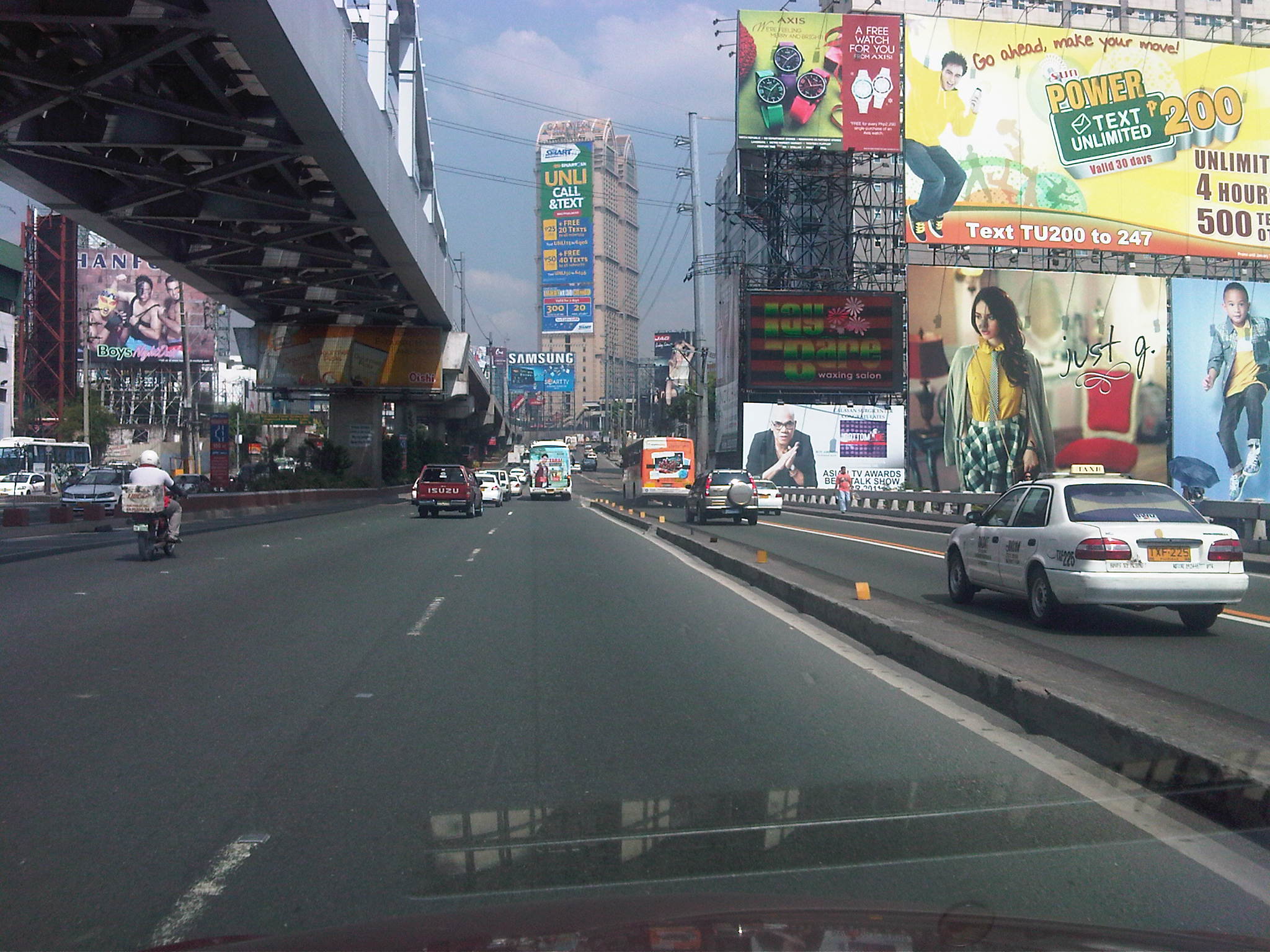 Guadalupe Bridge, crossing the Pasig River, the MRT 3 runs along the steel bridge above
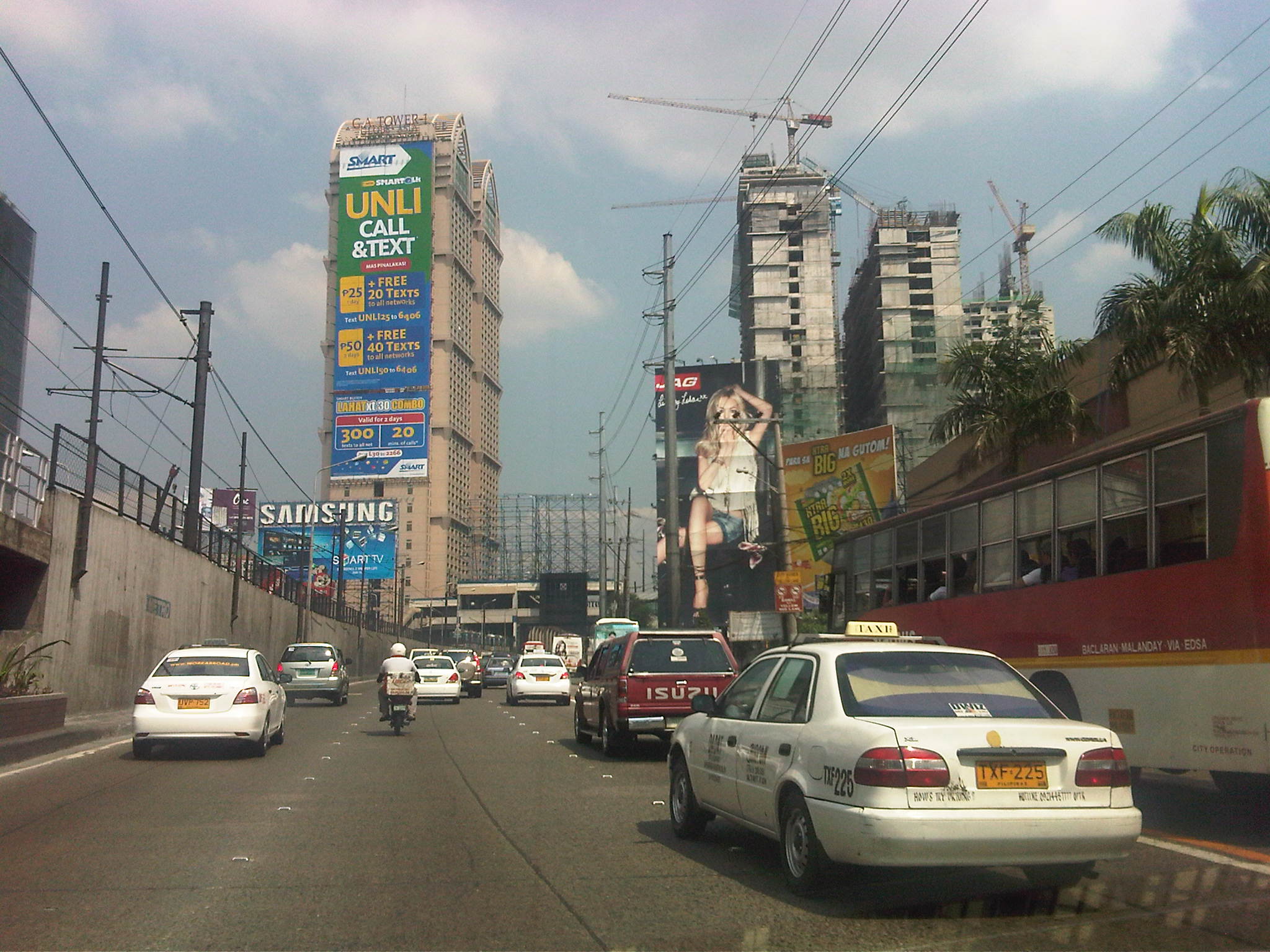 Approaching A. Bonifacio/Renaissance, in the background is the G.A. Tower, the Boni MRT Station and condos under construction including SMDC’s Jazz
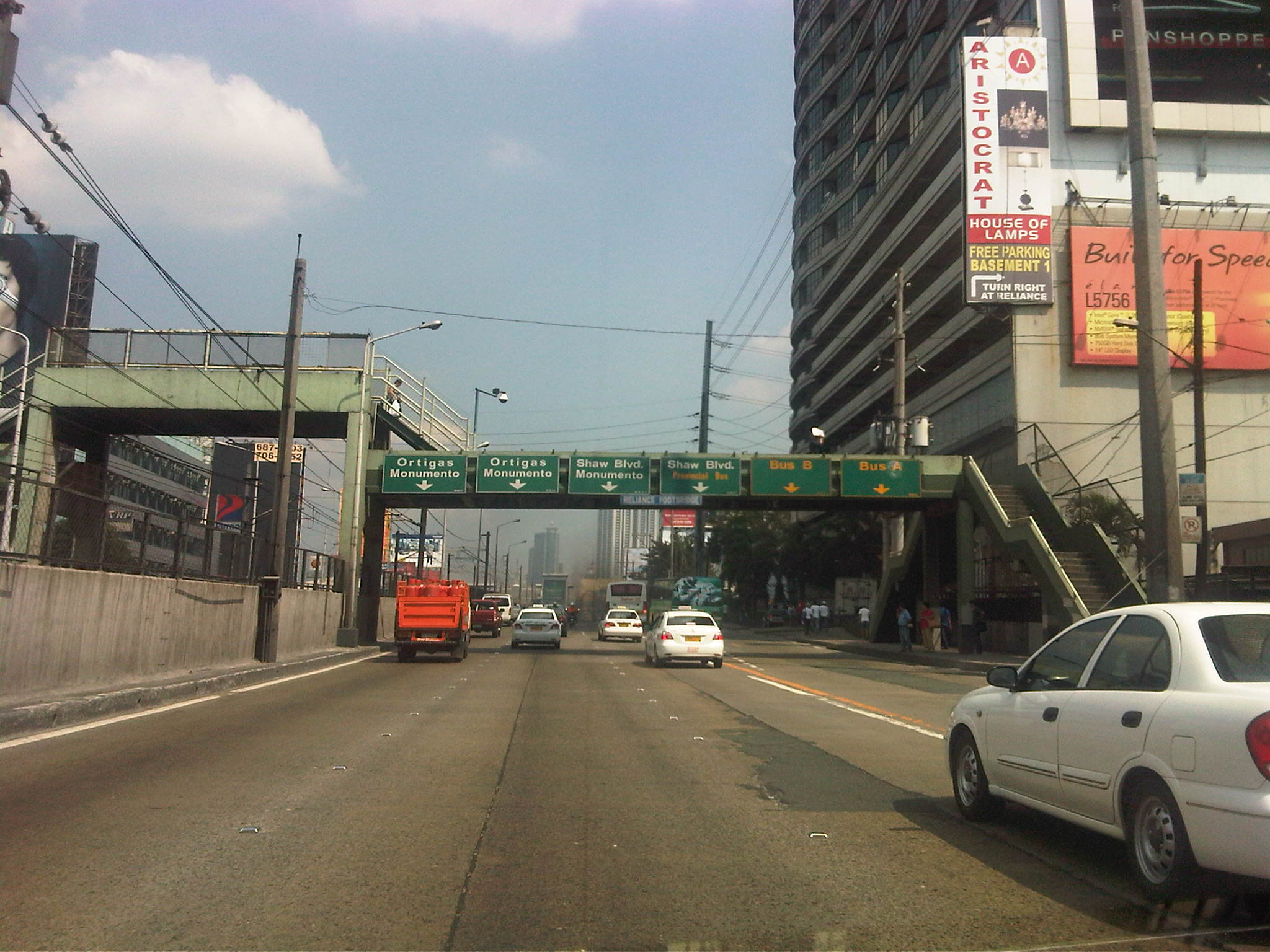 Section across the Renaissance Tower where many FM radio stations are based
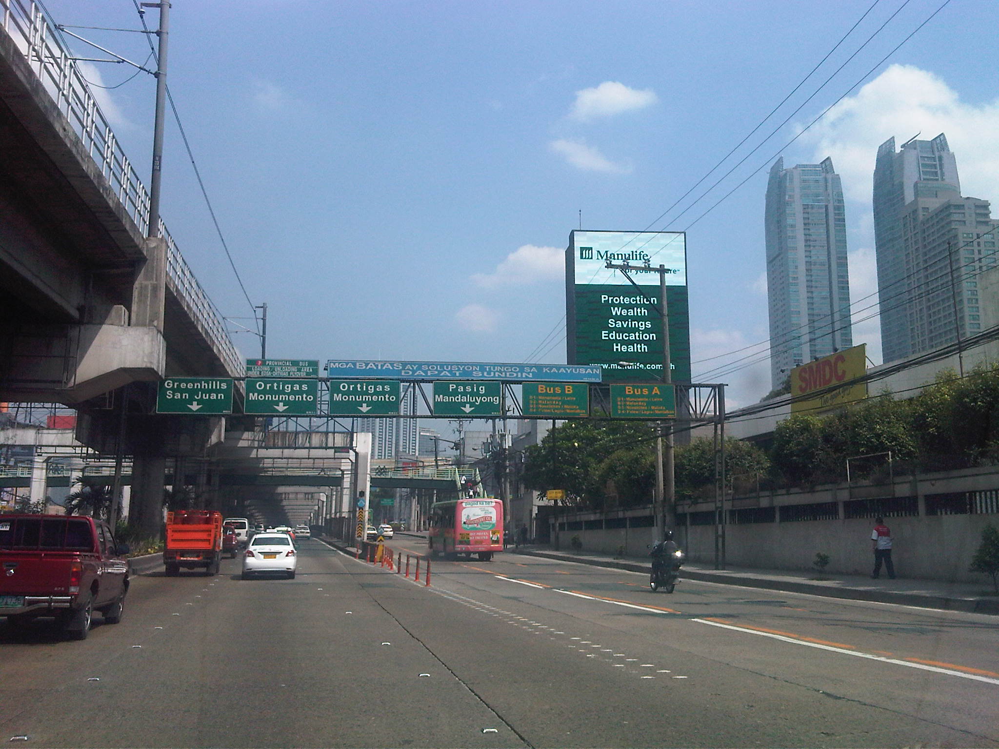 Section past Robinsons Cybergate Mall
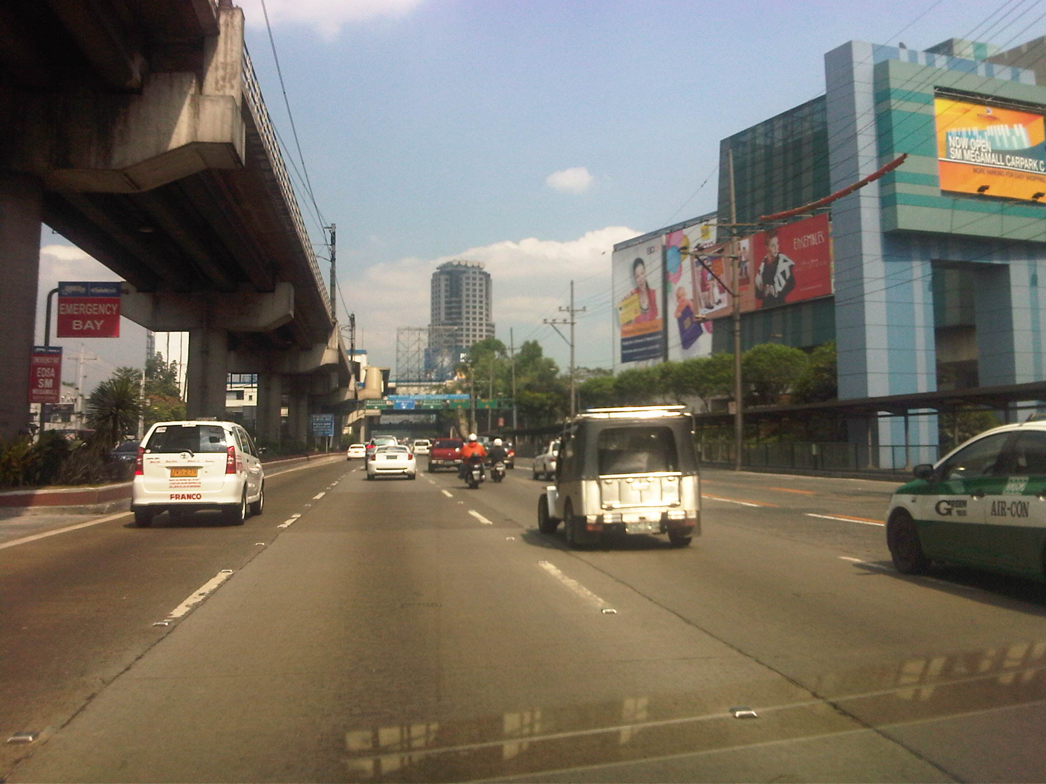 Section across the SM Megamall and approaching the ADB
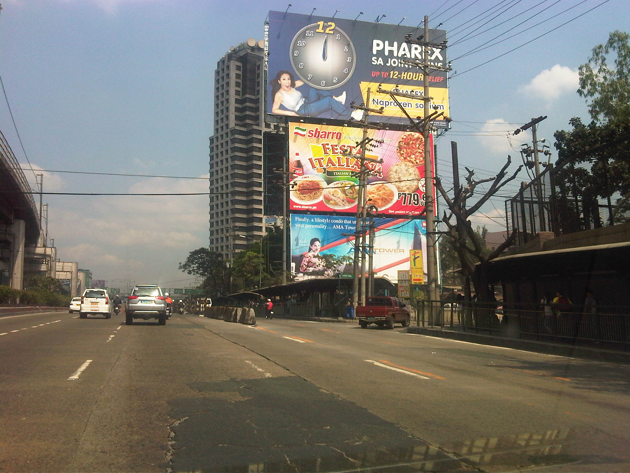 Section across the ADB and approaching Ortigas Ave. One of Galleria’s buildings is seen behind the giant billboards. The MRT
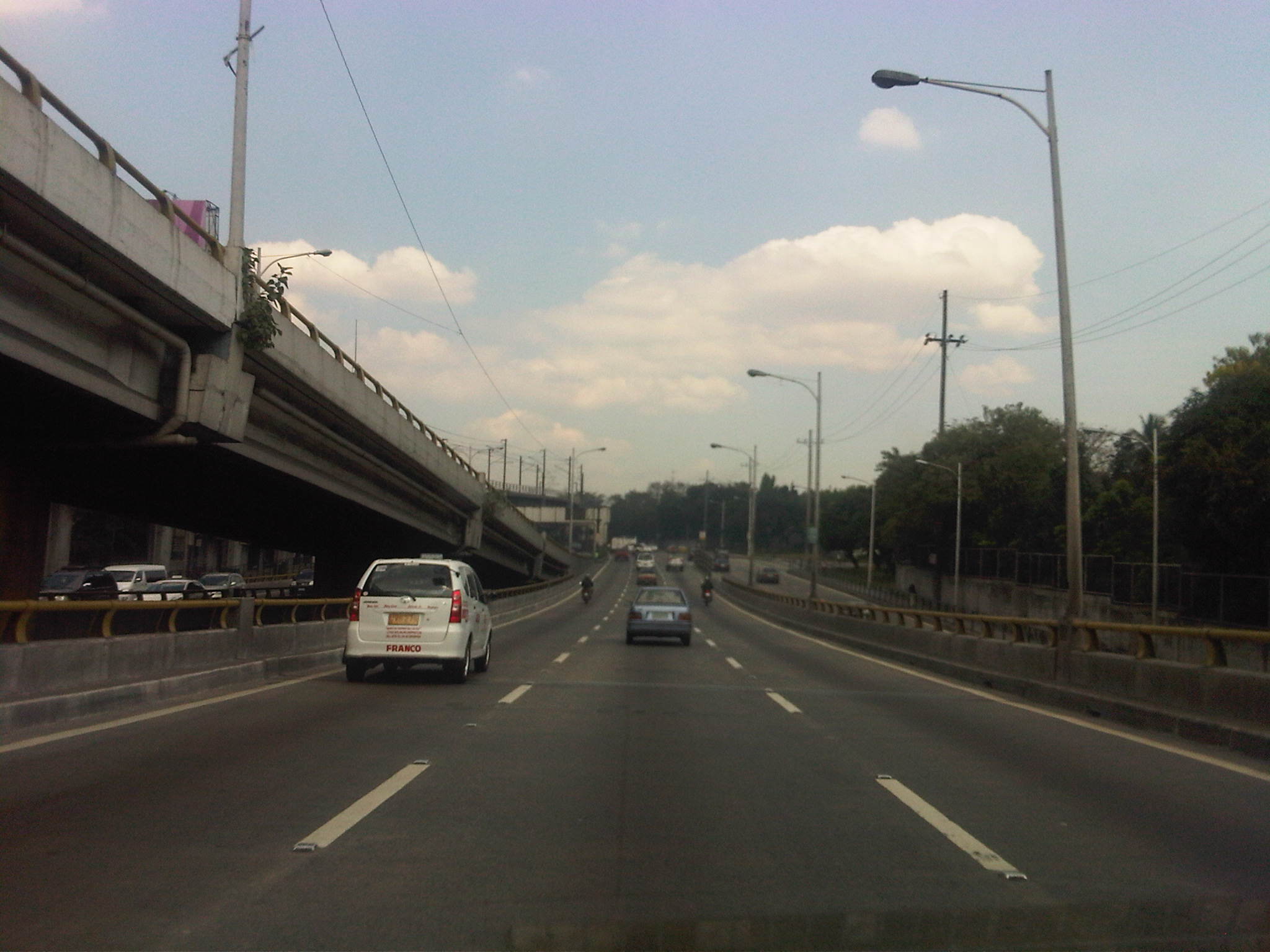 Section descending the Ortigas Flyover and across from Corinthian Gardens
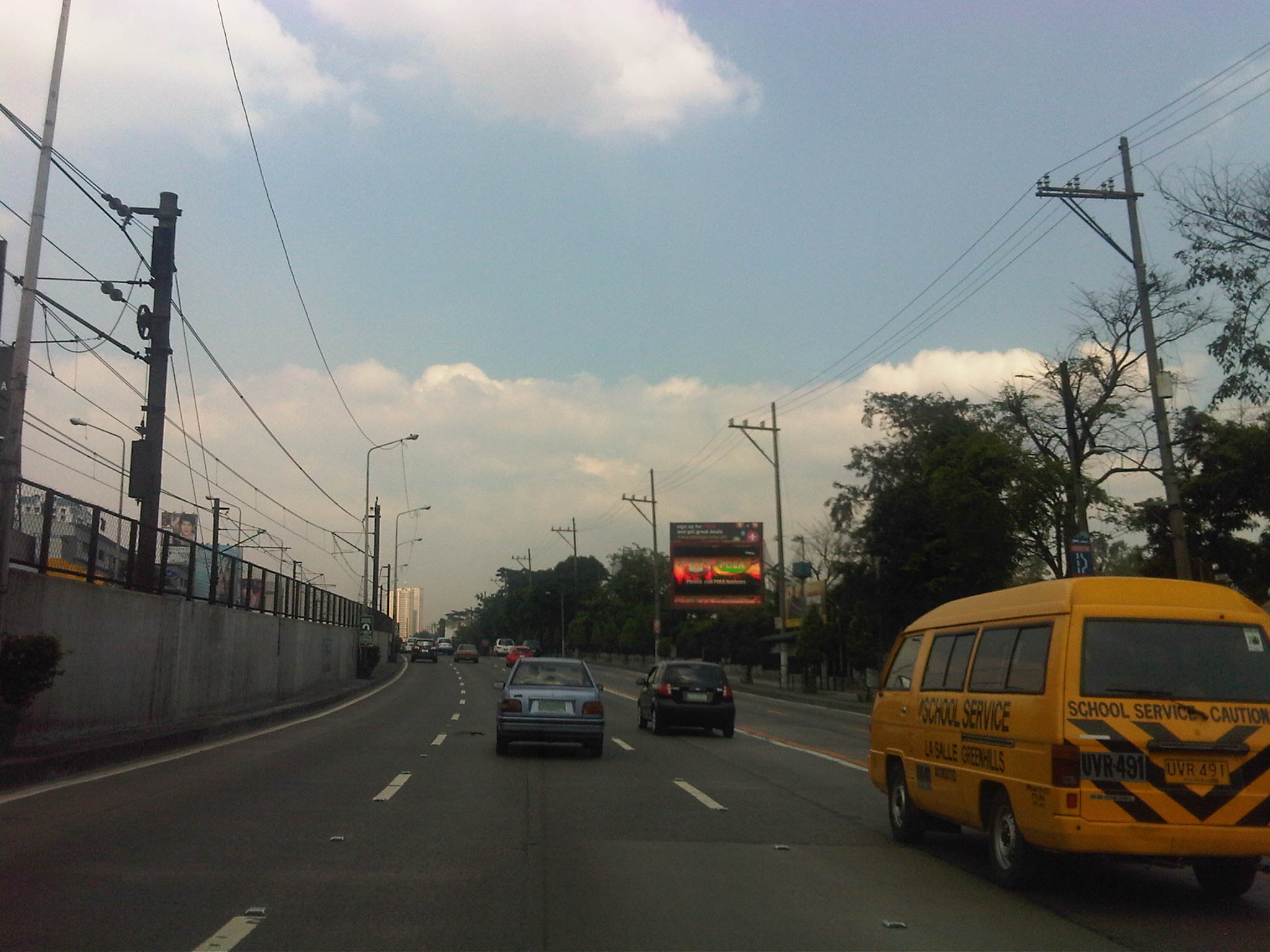 Section across Camp Aguinaldo (between the Aguinaldo and Crame) and approaching the Camp’s EDSA gate
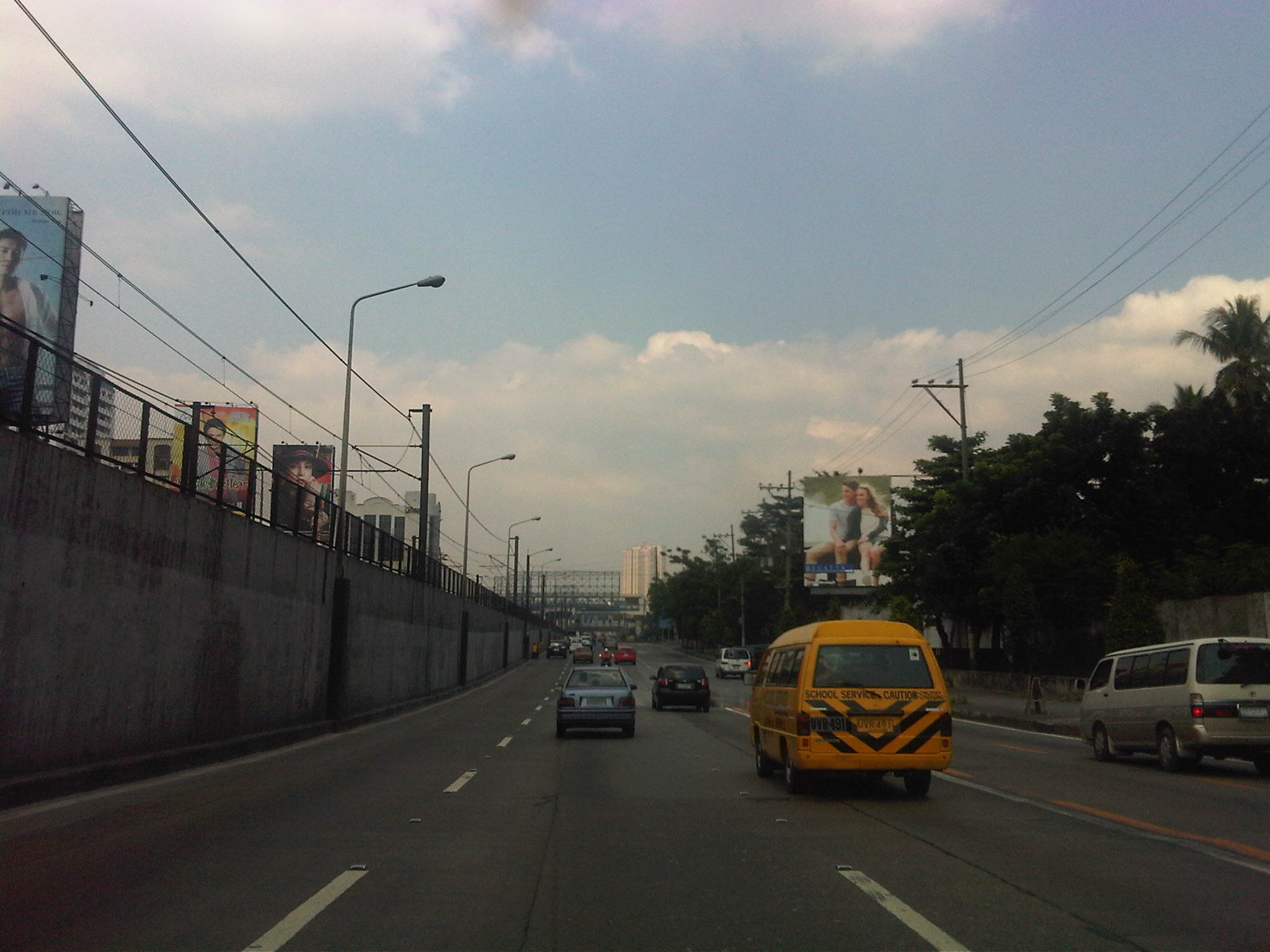 Section approaching Boni Serrano Avenue
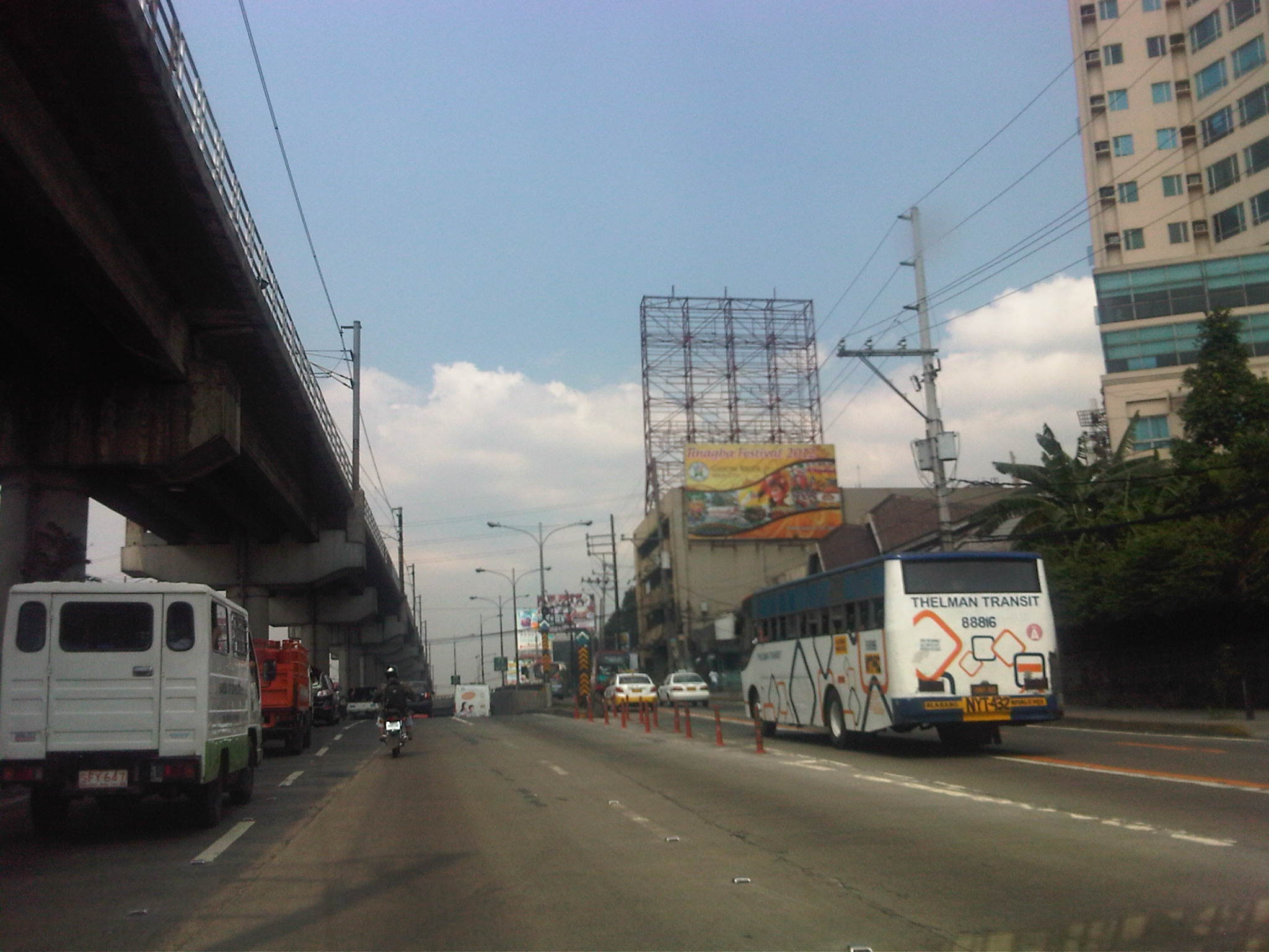 Section approaching the EDSA underpass crossing P. Tuazon and approaching the Cubao commercial center
 Section past the Cubao commercial center and across from several provincial bus terminals lined up along EDSA northbound
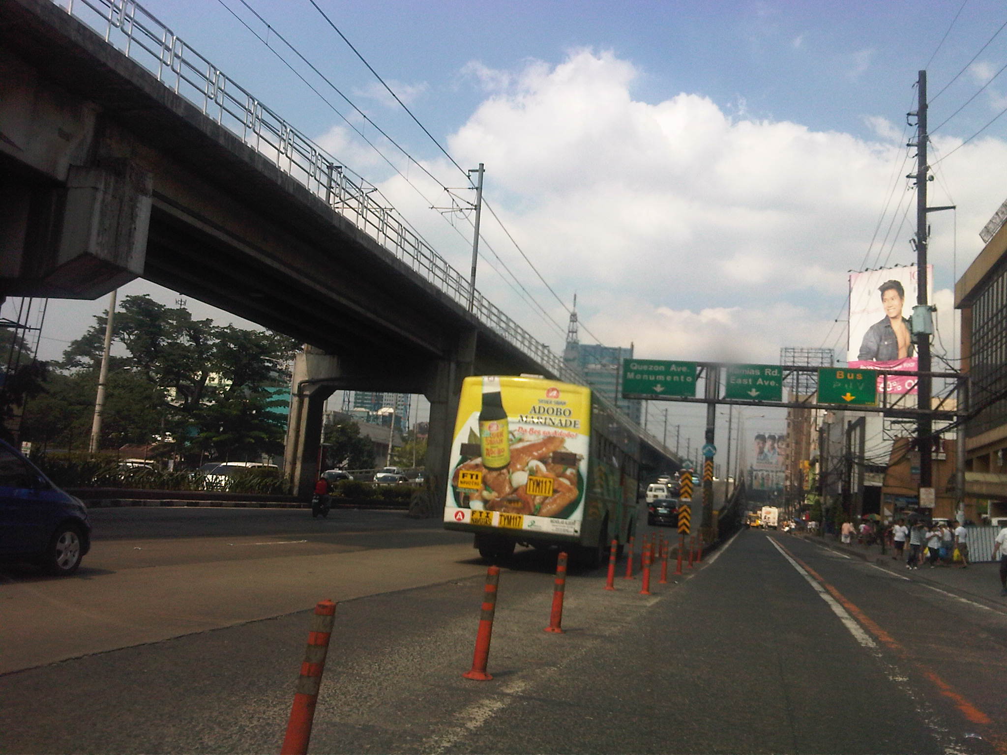 Section approaching Kamias – taking the flyover means I won’t be able to turn towards East Avenue so we shifted towards the outer lanes
Now, if only EDSA and the other main arteries of Metro Manila could be like this more frequently…
–
Municipal transport in San Francisco – Part 2: Trolley buses
San Francisco’s trolley buses are probably among the last of a fading breed of bus transport still employing electricity to service various routes in that city. With a cousin driving our vehicles along McAllister Street, I was able to take photos of the overhead cables from which the trolley buses are able to pick-up electricity to power their motors.
 Overhead cables seem to be everywhere including the streets around the San Francisco City Hall located at the Civic Center. This is a photo of the intersection of McAllister and Polk Street.
 Another view of City Hall with cables running above McAllister. Notice the cables connected to transverse wires that are in turn connected to the light poles.
 Where buses turn, cables may also be found above. This is the junction of McAllister and Van Ness Avenue. That’s the Herbst Theater building on the left, which houses the Museum of Performance and Design, and the California Public Utilities Commission on the right. Those are two buses, one trolley and the other natural gas-powered in the middle of the photo.
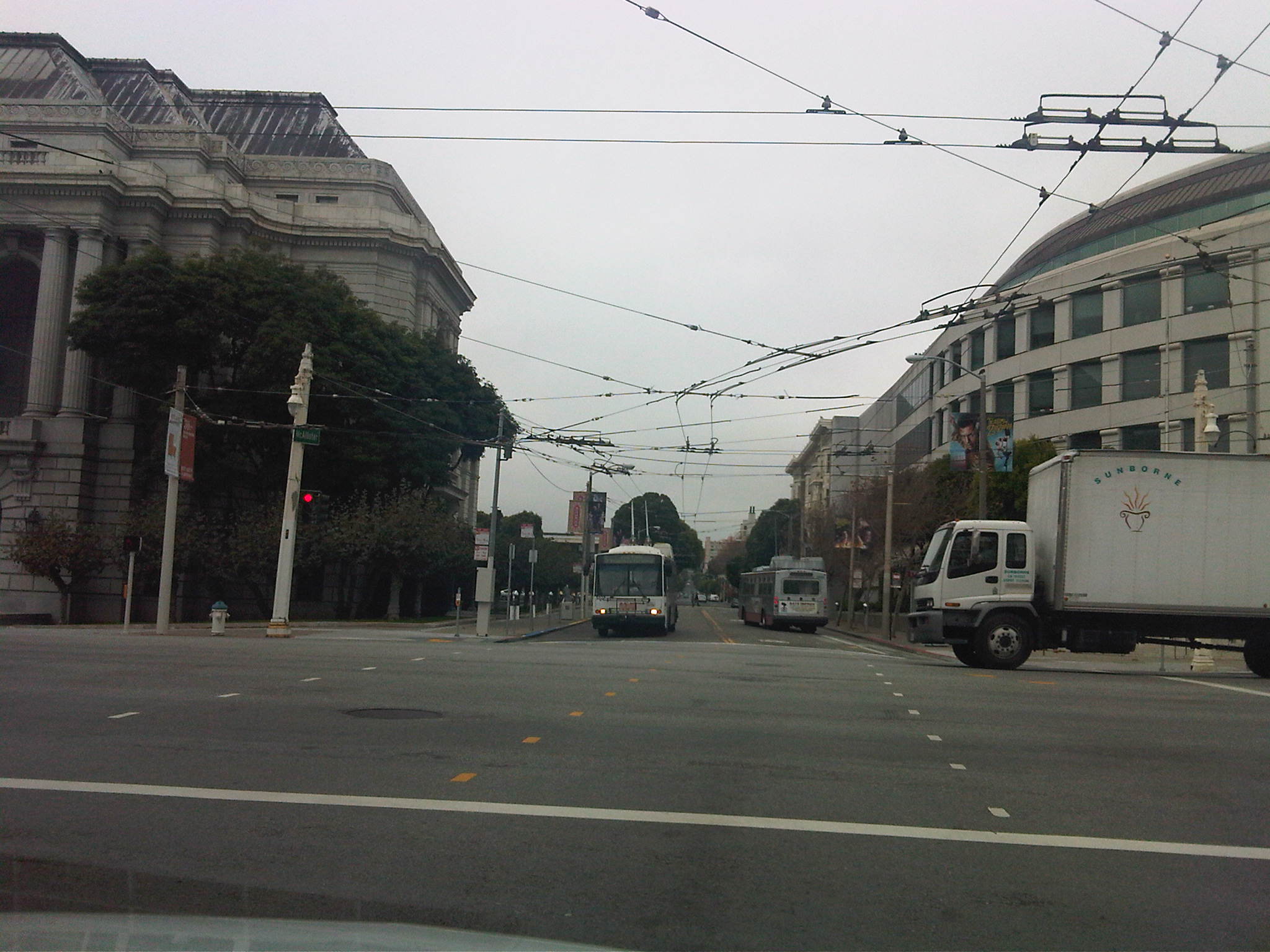 A close-up from the preceding photo shows the trolley bus with its long pantograph. The bus on the right runs on natural gas and is a low emission vehicle.
 A closer view of the overhead cables show how they are connected to the poles along the roadside.
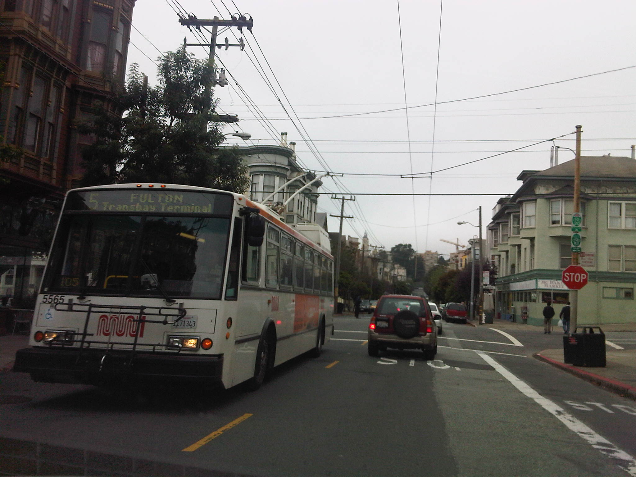 That’s a bus headed for the Transbay terminal. At front is a bicycle rack and the worm logo of Muni.
In the streets of San Francisco, one thing’s for sure – if you see those overhead cables along a road, you know that the trolley buses run along that street. Most major streets in San Francisco are served by public transport, providing excellent mobility for its citizens. They say you can usually take or get off a bus within a block of your destination. If you have to walk, the walk is usually at a leisurely pace and generally in a safe environment. You’ll probably only encounter difficulties walking when you’re in the hilly areas like Nob Hill and Russian Hill where the streets can get quite steep. Still, the walk’s usually well worth it not just because of the exercise but also because of the view and the small neighborhood shops and restaurants along your way.
 Caught (up) in traffic