
Home » Posts tagged 'Quezon City'
Tag Archives: Quezon City
Updates on the Katipunan jeepney terminal
Here are some photos I took while waiting for the green light
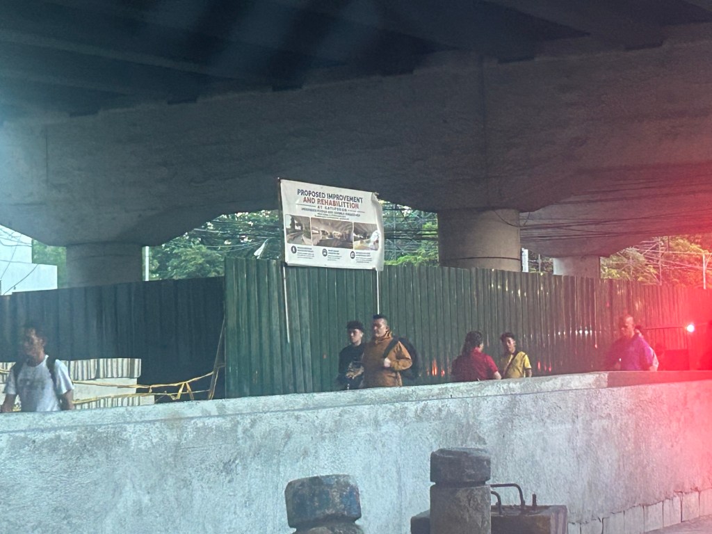
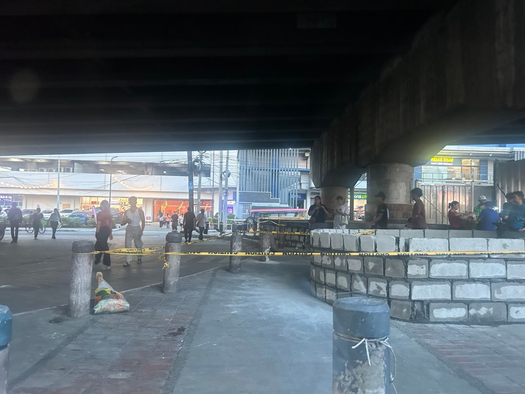
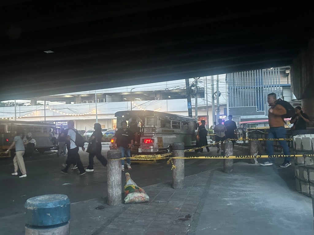
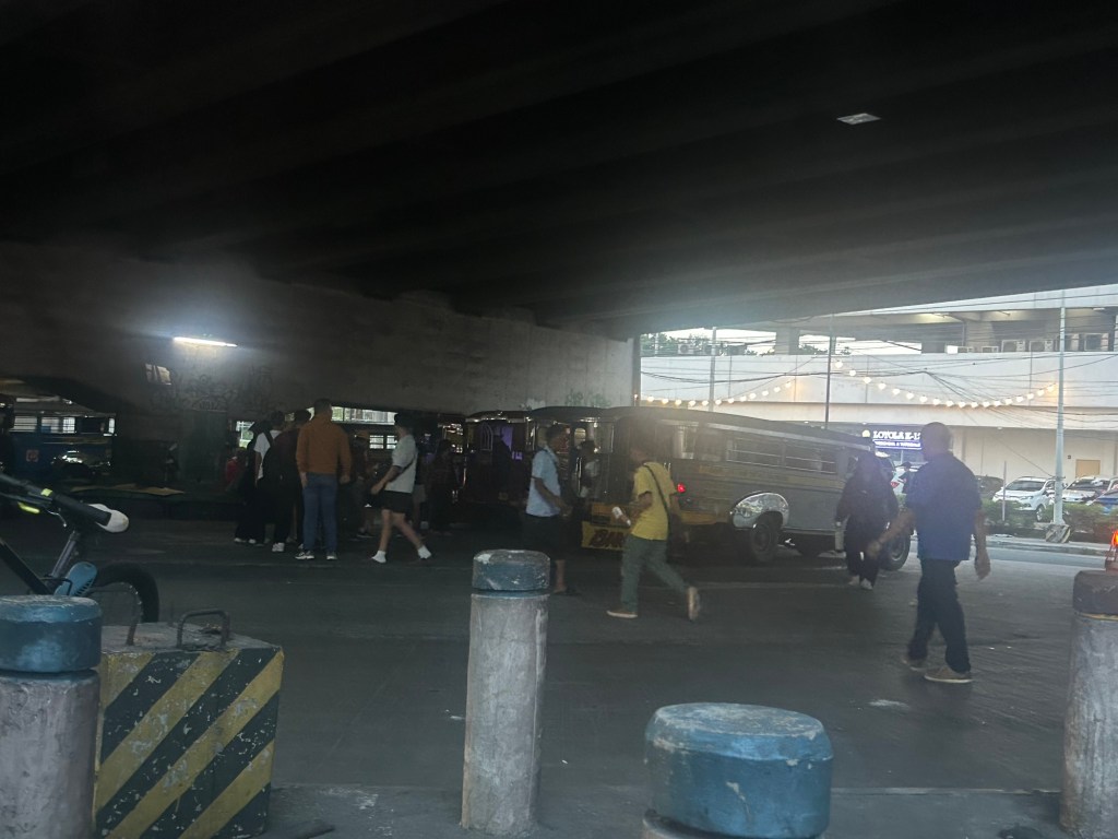
The bottom line is that the terminal will not be completely displaced. Jeepney parking spaces though have been reduced. I wonder where the other jeepneys spend their idle time considering not all Katipunan jeepneys are allowed entry to the UP Diliman campus.
–
How about a pop-up BRT along Commonwealth Avenue?
I posted this map on social media showing a possible route for a pop-up BRT (Bus Rapid Transit) along Commonwealth Avenue. This was inspired by the reports this week of the horrendous experience of commuters along this corridor due to the current fuel crisis. It seems that a lot of people have reduced their use of private vehicles in favor of what they thought was adequate public transportation only to find out how lacking the supply was.
While this route can be extended (all the way to Fairview via Regalado, for example), I think the one in the map below would be able to capture a majority of the commuters along the corridor with the end at Dona Carmen being a drop-off/pick-up area for those residing to the north. Quezon City Hall and the Elliptical Road is a no-brainer since the Quezon City Bus service terminates here and people can transfer to one of the other lines that will allow them to travel elsewhere covered by the bus network. Quezon City or DOTr can lease buses and come up with a service contracting scheme to sustain operations. The idea is to first run this pop-up BRT while the crisis in Iran is ongoing. Data collection and assessments should coincide with this to refine the service and perhaps, make recommendations for sustaining this service at least until MRT 7 gets online.
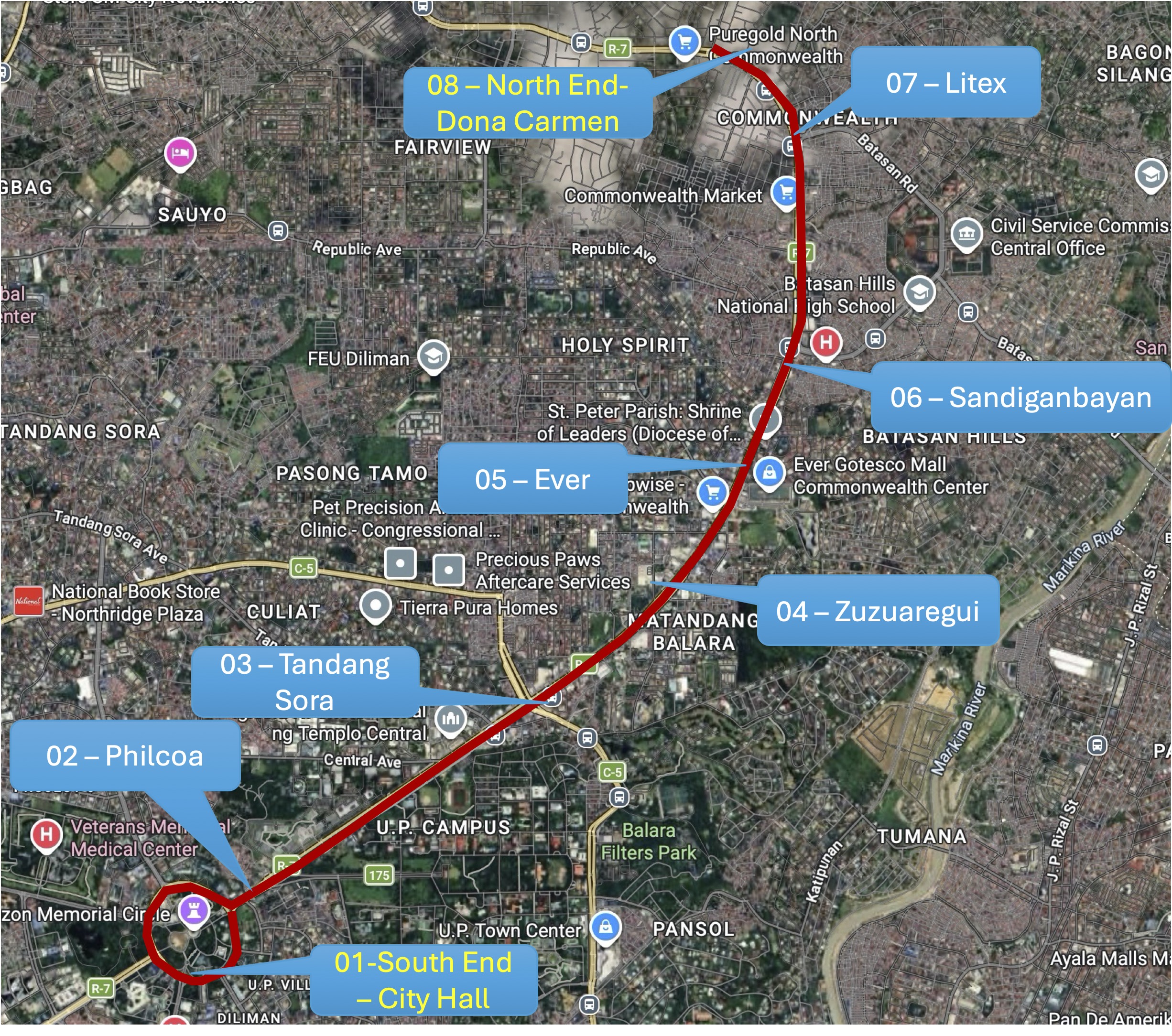
The idea of a pop-up BRT is not really new as there were “proof of concept” runs along Commonwealth and at BGC many years ago. Unfortunately, the BRTs never came to be in both cases; both now missed opportunities as we have come to realize. It’s still a long way before the MRT 7 is up and running. The recent announcement from the proponent that they will probably start operations next year is perceived by many as too late. Government, both national and local, need to be decisive if they want people to be able to go to their workplaces and schools. Maybe this is another opportunity for the more than 70% public transport users to be provided with the services they need while taking advantage of road space being freed up from car dominance?
–
Quezon City’s electric buses
While Quezon City rolled out its new electric buses, I have not seen them along my typical commutes that takes me to C5, particularly and mainly along Katipunan Avenue. Most of these buses are probably deployed along the other routes served by the Q City buses. So I took this snapshot of one that I saw not in QC but along Ortigas Avenue Extension in Pasig City. Maybe it was en route to the end station/terminal at Bridgetown, which is at its border with Pasig?
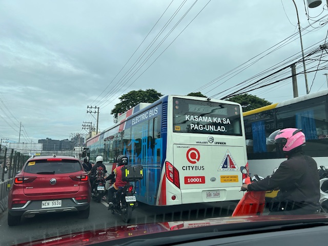 One of Quezon City’s electric buses
–
Flash floods in Quezon City
The rains poured again this afternoon and it was quite intense for more than an hour in Quezon City. We had floods at the UP campus and along Katipunan Avenue. Reports from various sources stated that there were also floods along EDSA and other major roads in the city. The floods come at a time when QC flagged flood control projects undertaken by the DPWH without the city’s blessings.
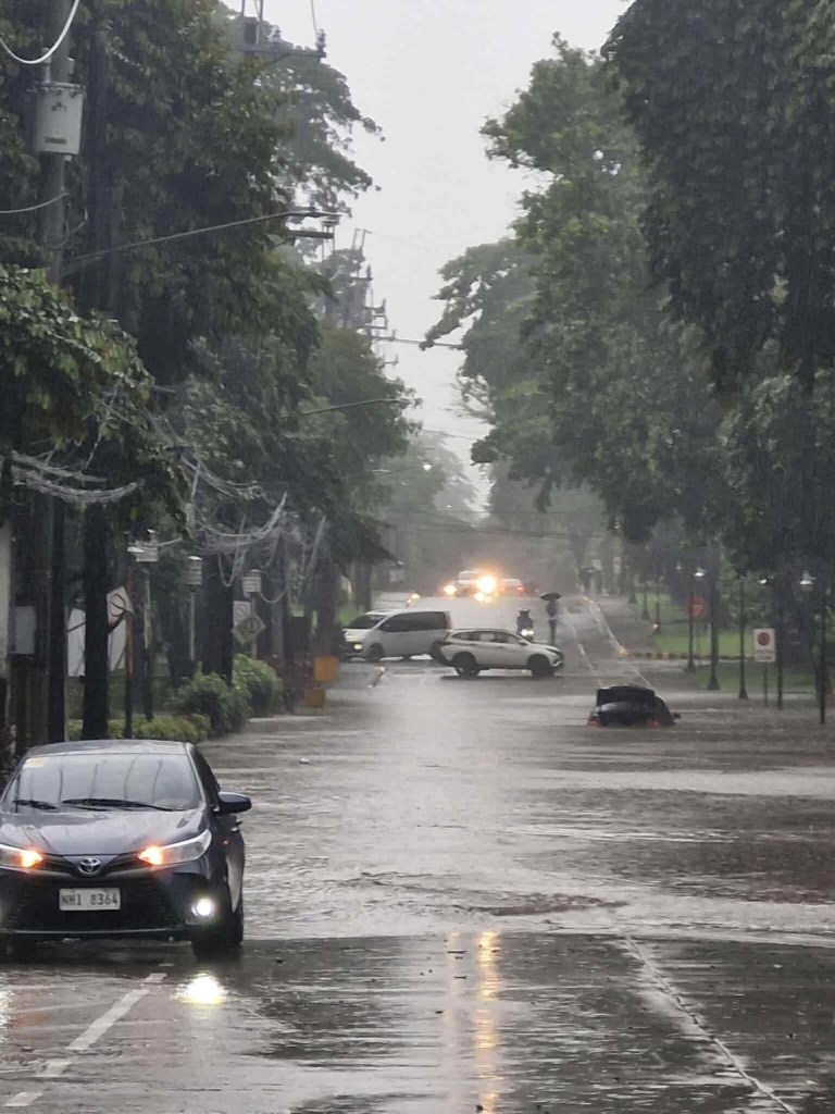
The flash floods were probably proof of the shoddy work associated with DPWH and its contractors. While QC residents and the LGU should share the blame for these, the scale and frequency of the floods indicate drainage issues.
The floods have led to intense traffic congestion and commuters being stranded due to public transport vehicles not being able to turn around. The latter is one of the cases where public transport appears to be lacking. Their numbers may not be lacking at all but the traffic conditions prevent their turnaround to address the demand for transport.
–
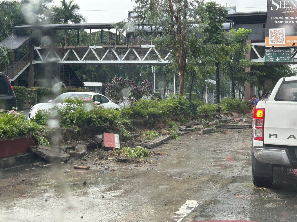
Quezon City’s bike lane barriers
Here’s a first look at Quezon City’s new bike lane barriers along Katipunan Avenue (C-5). I took these photos while crawling towards Ateneo Gate 3 on my way to the office.


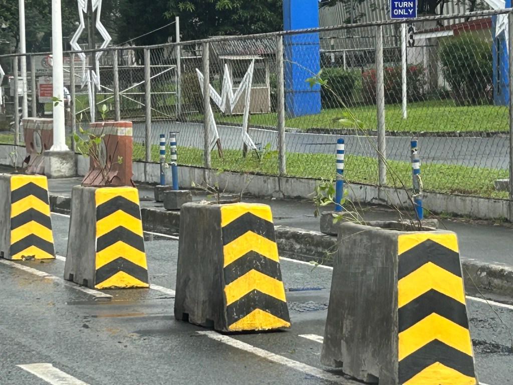

The same or similar barriers/planters have been installed along other major roads including Commonwealth Avenue. This is part of Quezon City’s commitment to building a bikeway/bike lane network and a worthy investment to encourage more people to take up cycling especially for work and school trips. The barriers serve to protect cyclists from motor vehicles thereby enhancing safety along these roads. Hopefully, other LGUs will follow suit and invest in active transport facilities.
–
A zipper lane along Katipunan?
Yesterday, the Metro Manila Development Authority (MMDA) started another experiment along Katipunan Avenue in Quezon City. They introduced a zipper lane along the stretch fronting Ateneo’s Gate 2 and Miriam College’s main gate (about 740m – less than a kilometer). This single lane was supposed to ease traffic congestion along the northbound direction of Katipunan (aka Circumferential Road 5 or C5 or Pres. C.P. Garcia Avenue), which is saturated with vehicles especially during the morning peak.
While we wait for the official pronouncements regarding this experiment, the impacts are likely to be marginal as the original northbound lanes are jammed with vehicles. Thus, there is a tendency for the entry to the zipper lane to be blocked. MMDA staff will also have to stop vehicles at the exit if they will allow the movement of left-turning and U-turning vehicles at the junction with B. Gonzales and Miriam’s main gate. While it may seem an exercise in futility, we have to appreciate the continuing effort of MMDA for such schemes. The bottomline though is the MMDA has limited options to address the hellish traffic along Katipunan. The schools and other establishments would need to put their heads together to formulate a more sustainable solution for this corridor.

Traffic and the changing Katipunan cityscape
The traffic situation along Katipunan Avenue has worsened over the years. While there was some respite from the usual congestion experienced along the stretch of interest that has 3 major schools and a mall during the pandemic, ‘traffic’ is back with a vengeance and the new normal seems worse than the old. That Katipunan has changed a lot over the decades is an understatement. The photo below shows high rise buildings completed and under construction. All of these are residential condominiums along Katipunan and Xavierville. Many students now reside there and walk, cycle or take public transport to school. Enrollment though at Ateneo, Miriam and UP has also increased over the years. That means more trips generated by the schools. And with many still dependent on cars for their commutes, it is no wonder that the traffic situation is usually hellish especially during the peak hours.
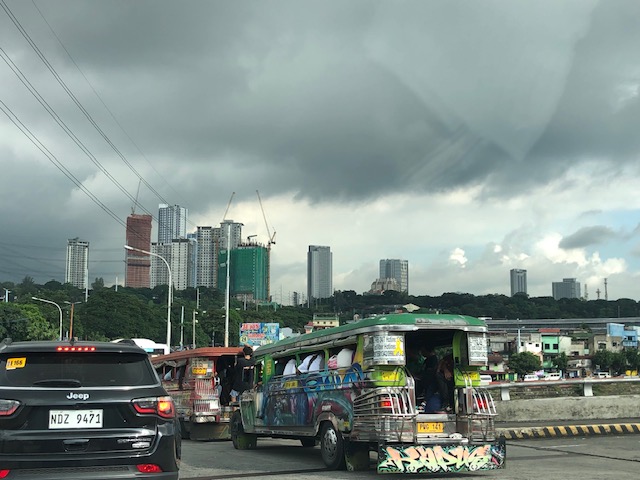 I took this photo while stopped in traffic at the SM Marikina service road one morning. I have been commuting along this route since the late 1980s and at that time, there were no tall buildings along Katipunan. However, traffic was already bad especially along the stretch from Aurora Boulevard to C.P. Garcia. Its worse now from what I have observed and experienced these 35 years.
There will likely be more condos to be built in that area. The question is if these will lead to more people walking, cycling or using public transport, and becoming less car-dependent. What are the travel characteristics of people there? How much is through traffic?
–
Quezon City’s bike ramps
This is a very late post on bicycle facilities. I took a few photos of the bike ramps Quezon City installed on the stairs of pedestrian footbridges in the city. I am sharing a couple of these photos here for reference.
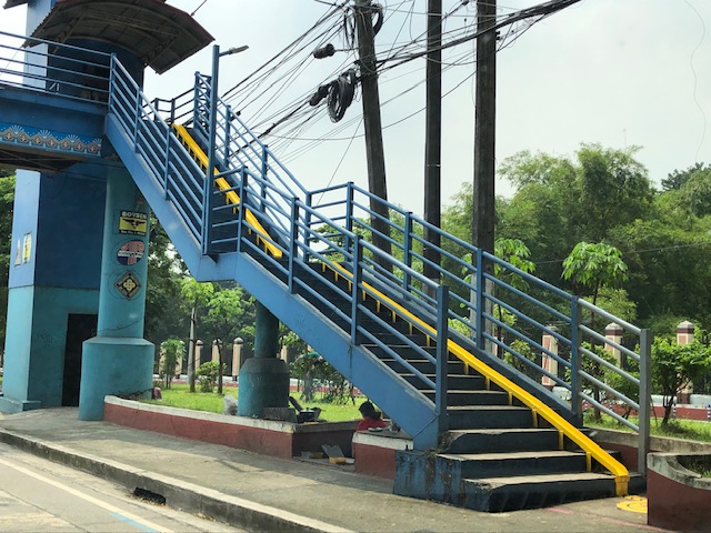 The bike ramp allows one to roll his/her bicycle with relative ease up and down the footbridge. Otherwise or without the ramps, cyclists would have to carry their bikes up and down the stairs.
 The landing for the the bike ramp at the foot of the stairs.
It’s quite obvious in the photos that the space along the stairs is quite constrained. Ideally, perhaps there should be two ramps – one for going up and another for going down. One ramp means one cyclist will have to wait for another or others to go up or down before proceeding to use the ramp. Perhaps this highlights the need to re-imagine the designs of footbridges. The current designs are not inclusive or equitable for all users. But whether footbridges are required in the first place is another matter.
–
The return of carmaggedon and the illusion of low vehicle ownership
Traffic seems to be back to pre-pandemic levels in the Metro Manila and its adjacent provinces. You can experience this along major roads like Commonwealth Avenue, C-5 and yes, EDSA. The number of vehicles on the roads including motorcycles defy what is supposed to be low motor vehicle ownership in Metro Manila (as claimed by DOTr and JICA in the MUCEP report and echoed by groups who cite the report as if it is flawless).
 Intense traffic congestion along C5/Katipunan Avenue. The photo shows traffic on the C5/Katipunan flyover’s northbound side and towards the direction of Ateneo, Miriam and UP Diliman.
The reality appears to be that more households actually own motor vehicles and the inefficiencies and unattractiveness of public transport continues to convince people to take private transportation, including motorcycles, over public transport options. The inconvenient truth according to one senior transport expert is that while cycling has gained ground, the numbers are minuscule compared with those taking either private or public motorized transport. Yes, carmaggedon is back and looks here to stay for a while longer until the so-called game changers like the MM subway and Line 7 are operational. Will they change the commuting behavior or are these too late in as far as solutions are concerned?
–
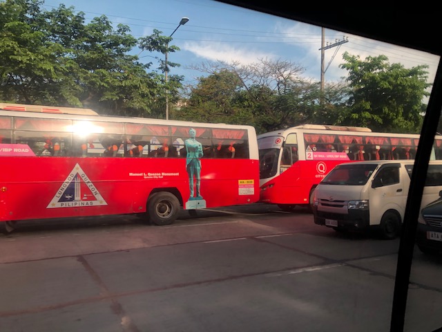
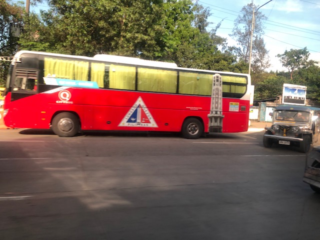
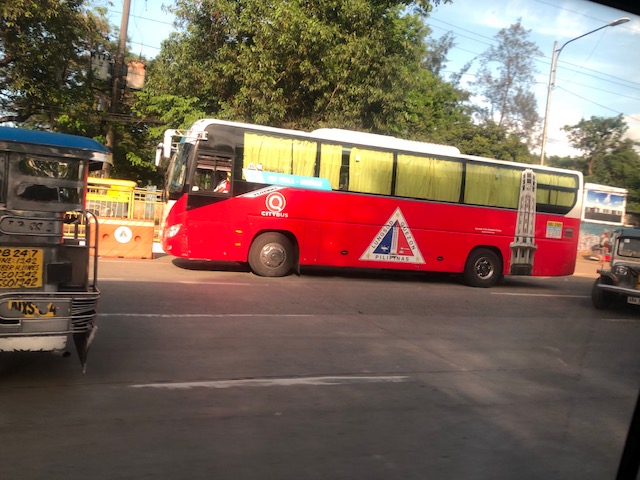
Quezon City’s bus services
One of the projects of the Quezon City (QC) government during the pandemic and which they continued to the present was transport-related. QC deployed buses to provide free transport for its residents.
Here are the routes (source: QC FB page):
Route 1 – Quezon City Hall to Cubao (and vice versa)
Route 2 – Litex / IBP Road to Quezon City Hall (and vice versa)
Route 3 – Welcome Rotonda to Aurora Blvd. / Katipunan Avenue (and vice versa)
Route 4 – General Luis to Quezon City Hall (and vice versa)
Route 5 – Mindanao Ave. cor. Quirino Highway to Quezon City Hall (and vice versa)
Route 6 – Quezon City Hall to Robinsons Magnolia (and vice versa)
Route 7 – Quezon City Hall to Ortigas Avenue Extension (and vice versa)
Route 8 – Quezon City Hall to Muñoz (and vice versa)
See their UPDATED Bus Route & Schedule:
https://m.facebook.com/story.php?story_fbid=273192358328744&id=100069139452704
https://www.facebook.com/photo/?fbid=273192031662110&set=pcb.273192358328744
Here are some photos of the buses along the Elliptical Road. These are air-conditioned and have WiFi for the comfort and benefit of the commuters.
With the fresh mandate (second term) of the QC Mayor Joy Belmonte, it is expected that they will continue with this public service. I am not sure if it should be strictly for QC residents. Perhaps those who work or study in QC should also benefit from the service. These people may show proof in the form of valid IDs like school or employee IDs.
–
