
On airport runway names
There’s an interesting article on runway renaming that appeared on Wired. Ever wondered what those numbers on airport runways are about? Well, they represent the runway’s orientation, which is influenced by many factors among them the magnitude and dominant directions of winds. Historical wind data are collected and translated into a wind rose, which looks very much like a compass, and is used to determine a suitable orientation for a runway.
Davies, A. (2018) Thank the planet’s shifty magnetic poles for runway renaming, http://www.wired.com, https://www.wired.com/story/airports-rename-runways-magnetic-shift/?CNDID=37243643&mbid=nl_011918_daily_list3_p2 [Last accessed 1/21/2018].
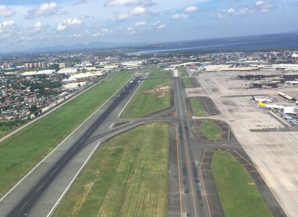 NAIA’s main runway is 06-24 or 24-06 depending on the take-off or landing direction. Does it need renaming, too?
–
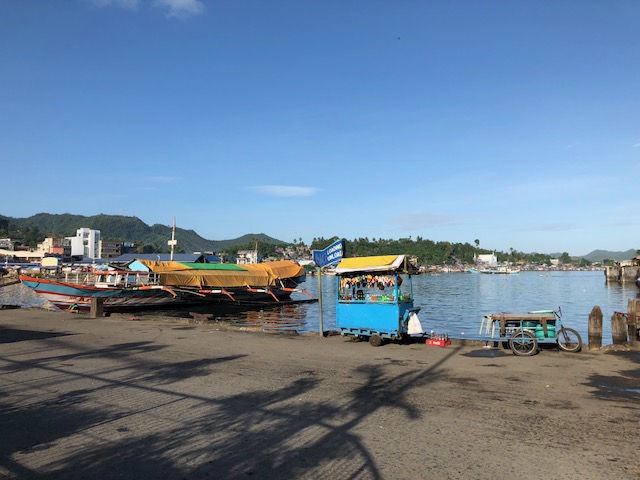
Tacloban City waterfront
While going around the city’s downtown area last week to inspect the work of our surveyors, we decided to take a break at a fast-food restaurant near the port. This branch of the fast-food chain offered nice views of the city’s waterfront and I took a few photos that I share below:
 A vendor’s cart located at the road behind the fast-food restaurant – the road is used by public utility vehicles as an informal terminal and you will seldom see vehicles passing through it.
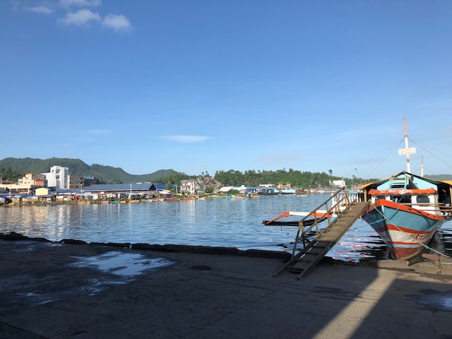 A large outrigger sits at the port. These vessels
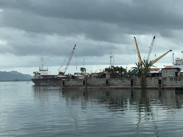 Freighters and cranes at Tacloban’s port
 A ship arriving at Tacloban
–
Overnight parking rates at NAIA T3 – some updates
I recently posted about the new parking rates at NAIA Terminal 3. I took this photo last night as we exited the Terminal 3 parking lot after our delayed arrival from a domestic trip.

There’s no mention in the signs about overnight rates. When asked about the latter, the staff at the booth simply replied that the information posted are their new parking rates. I assume this is just for Terminal 3 as that is what the signs stated and perhaps because only T3 has a multi-level parking facility. The other three terminals only have open parking lots. It’s easy to calculate your parking fees should you opt to leave your vehicles at the T3 multi-level building. If you find it expensive then perhaps you can just take public transport or have someone drop you off (and pick-up later).
–
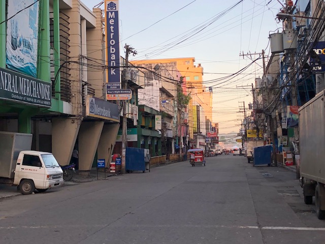
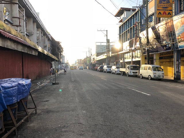
Tacloban downtown in the early mornings
Mobilizing surveyors for traffic data collection in Tacloban City’s downtown, I took the opportunity to take some photos before 6:00AM. This was before most people were at work or school on the first good weather day in the city after a week of heavy rains that brought floods and landslides to parts of the city. Schools at all levels had been suspended earlier this week with government offices also closed last Monday.
 Zamora Street towards southeast and M.H. Del Pilar Street
 Zamora Street towards northwest and Salazar Street
 Justice Romualdez Street to southwest and M.H. Del Pilar Street
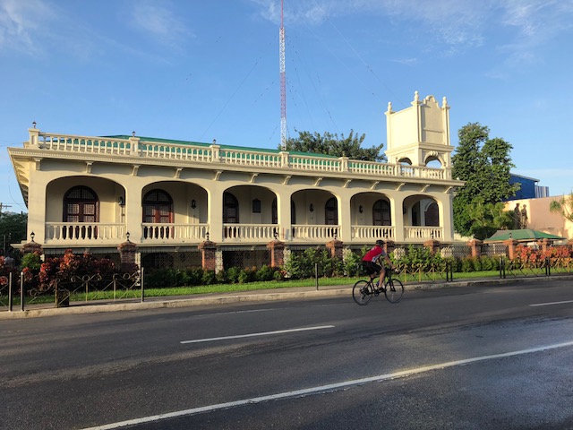 A lone cyclist along Justice Romualdez Street
There’s something about coming out to walk in the early morning in cities like Tacloban. You catch a city at a time before all the action happens, when everything seems so peaceful and calm when you see more people walking and cycling than motor vehicles dominating road space. That serenity should serve as an inspiration for what should be the vision for a city in order for it to retain its soul rather than lose it in what can be nightmarish traffic and transport conditions. Tacloban’s downtown holds so much promise for revitalisation but among the issues that need to be addressed is traffic-related. The city needs to recover spaces for pedestrians and cyclists while ensuring efficient traffic circulation for motor vehicles, particularly public transport. There seems to be spaces available for road diets and the creation of safe paths for people, and such design challenges need to be taken on in order to transform the downtown area into an example of sustainable transport.
–
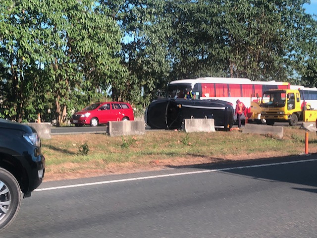
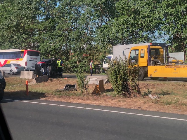
Another crash along NLEX – losing control?
We were returning from Clark last week when we chanced upon a crash site along the North Luzon Expressway (NLEX). We already suspected this as we approached a build-up of traffic along the southbound direction where there is usually free-flowing traffic. Here are some photos of an overturned vehicle on the median. It seems like it is the only vehicle involved as there were no other vehicle in the vicinity that could have been involved. However, it is possible that there was another vehicle involved in a situation where the overturned vehicle’s driver lost control after interacting with the other vehicle. Obviously both vehicles could have been traveling at high speeds (they are on an expressway) so this could have been an example where the combination of speeding and weaving in traffic led to an overturned vehicle (i.e., one lost control).

–
New rates at NAIA Terminal 3 multi-level parking
Only last weekend I was surprised to have been charged 840 pesos for what was usually a 600-peso fee for the equivalent of 2 nights parking at NAIA Terminal 3’s multi-level parking. When I asked, I was informed by the staff that they don’t have overnight parking charges anymore effective a certain date. There was supposed to be a sign at the parking entrance but I didn’t notice this when I entered the facility very early (around 4:00 AM) last Thursday. Here’s a photo of the receipt issued to me.
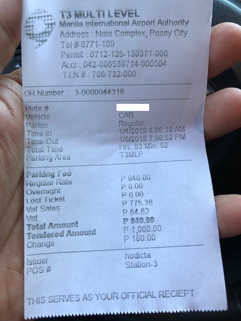
Note that regular rates were applied and zero was charged for overnight parking. Also note the classification as a “regular” parker. Before, the staff just makes the assessment that the person is an ‘overnighter’ based on the info of time-in and time-out (quite easy to see) and issues overnight tickets of 300 pesos each (per night) for the assessed number for the Parker. [I posted about this previously.]
I have another colleague who was similarly charged despite just an overnight. I still have to confirm it but it seems that there really is no longer an overnight parking rate and they just charge you with the regular rates. That means they are now maximising the revenues from parking and no longer provide incentives for those leaving their cars while away on trips. Whether this is something like a progressive initiative for parking or not, its actually going to be a turn-off for many including individuals and families who usually leave their cars when they travel domestically or abroad for business or pleasure.
–
“No-good” practices in pavement engineering and traffic management?
We did some studies a few years ago on the state of pavement engineering in the Philippines. Among the things we found was that conditions for the proper curing of concrete used for pavements of national roads are not usually met. This applied mainly for both Portland Cement Concrete Pavements (PCCP), which was the main subject of our study but also applied to Asphalt Concrete Pavements (ACP) as well as we documented practices for both types of pavements.
Last year, the traffic along Ortigas Avenue Extension was hellish for quite some time between the Rosario Bridge and Cainta Junction. One time, we eventually inched our way past De Castro, and lo and behold this scene while it was raining:
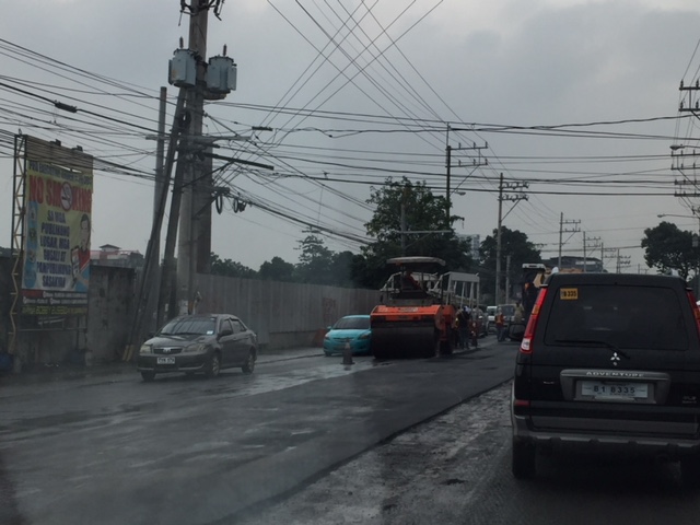 Rollers (pison) making a pass at the asphalt laid by a paving machine. Note the wet roads due to the heavy rains that afternoon.
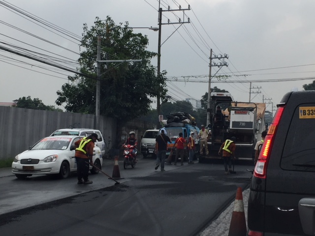 Workers patching up the edges of the overlay as a foreman and what appears to be engineers directing them. That’s a asphalt paver in action. Note the already wet asphalt? That will have implications over the short term; often resulting in distress way ahead of the intended life of the ACP.
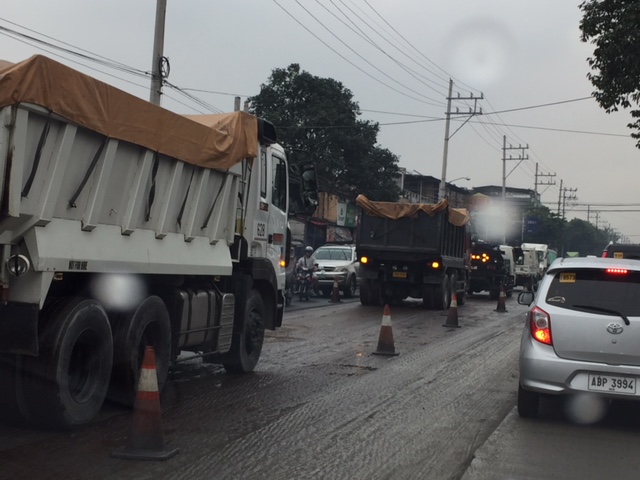
Dump trucks lined-up carrying aggregates for the asphalt overlay; occupying one lane of Ortigas Avenue Extension.
 The queues from the westbound side stretched from Countryside to Junction. Since the intersection was already affected by the spillover, the section from Junction to Brookside was also congested.
The situation I described above is something that could have been managed other ways but would still result in severe traffic congestion as at least 2 lanes were occupied by construction (one being paved and another for staging). There were also other incomplete drainage works that exacerbated the situation. So as far as traffic management goes, I thought the contractor did the best it could given the conditions. However, I question the asphalt overlay work during heavy rains. The implications is the reduction in the intended or design life of the ACP (i.e., reduced life most likely due to the rainwater and wet conditions with the bitumen not being able to bind the aggregates as effectively as desired. And so that means the aggregates tend to loosen up more quickly resulting in the deterioration of the pavement and lead to more costly maintenance of roads.
–
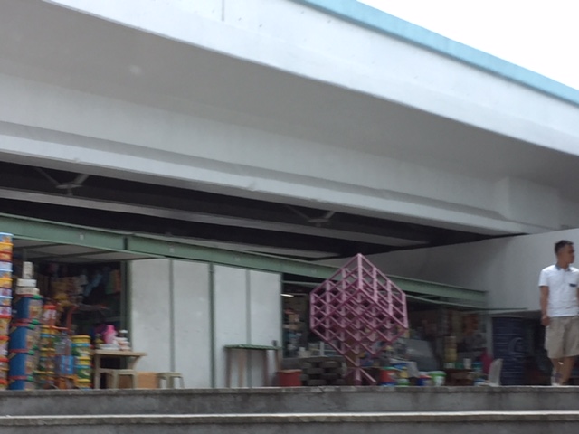
A quick look at the BFCT in Marikina
I went to SM Marikina recently and had my companion take some quick photos of the transport terminal project of former Marikina Mayor and MMDA Chair, now Congressman Bayani Fernando (BF). Following are some of the clearer shots as we were moving when these were taken.
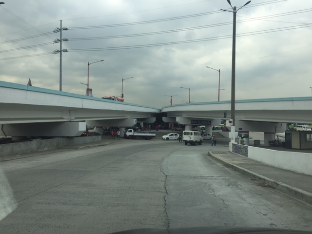 A look at the terminal located just beneath the two overpasses connecting Marcos Highway to C-5.
 The driveway to and from the terminal lot.
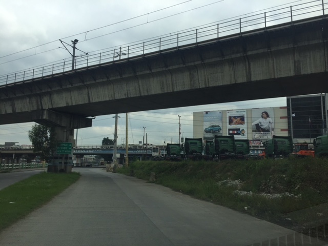 Moving towards SM Marikina under the LRT Line 2 structure, you see rows upon rows of trucks. I assume these are for sale and are there for display to prospective buyers.
 Leaving SM Marikina, this is the view of the trucks parked at the lot beneath the Marcos Highway and Line 2 bridges.
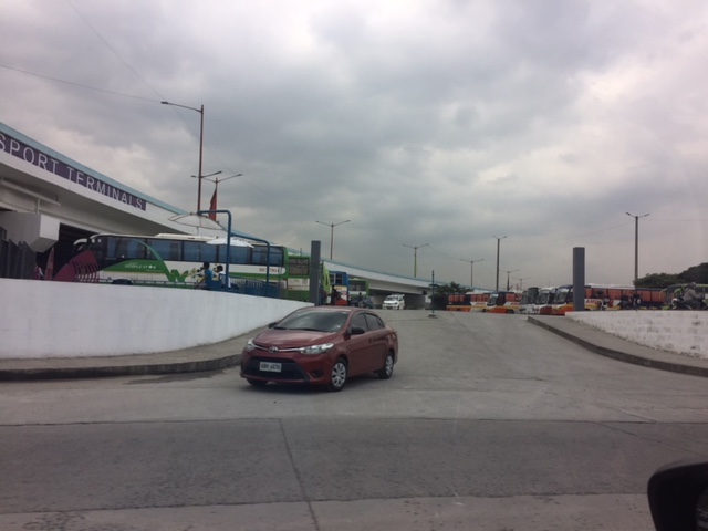
 Approach to the driveway of the terminal showing the buses currently at the BFCT.
 A closer look at the buses parked at the terminal. The green buses are RORO buses that the serve the West Philippine Nautical Highway route.
 A quick look at some of the stores at the terminal. These are mostly the sari-sari/carinderia types you see in most provincial terminals. Among the merchandise are biscuits and cookies in containers of different sizes. These are popular pasalubong for travellers to relatives and friends in their destinations.
 The sign on the right is intended for vehicles coming from C-5 that are allowed to make a U-turn near the junction with Marcos Highway to get to the terminal. This, however, takes them into direct crossing conflict with vehicles coming up from the riverbanks heading to Marcos Highway.
It would be nice to see some statistics about the number of passengers using the terminal as well as their characteristics such as origins and destinations, including transfers (e.g., how do they get to or from the terminal and what modes do they use). I suspect that there are not so many people using this terminal and the numbers will not significantly improve once the Line 2 extension is completed and the new end terminal and its environs are developed in Masinag, Antipolo City.
–
Another look at the San Juanico Bridge
We have an ongoing project with the City of Tacloban and recently we went around the northern part of the city where many relocation sites were established after the onslaught of Typhoon Yolanda (Haiyan). After doing our fieldwork, we decided to cross the San Juanico Bridge into Samar island where we were told there’s a nice restaurant sitting atop a hill in the town of Sta. Rita.
Despite the rains, we managed to get some photos of the breathtaking views. Among these were this photo of the bridge as seen from Samar. Leyte and Tacloban are behind the bridge.
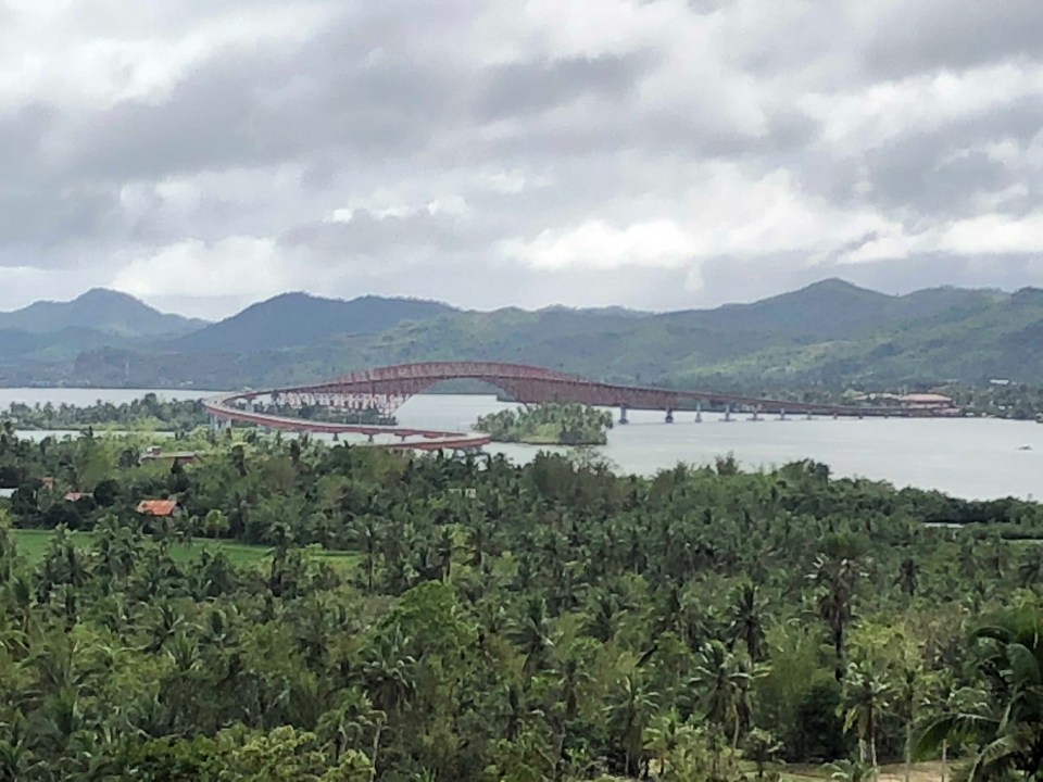 It is said that the part of the bridge on the Samar side has that distinctive ‘S’ shape while the Leyte side is a simple ‘L’ form. Trucks are weighed before they get on the bridge and the DPWH maintains a weigh station for this purpose before the Samar end. I didnt notice any from the Leyte side. Perhaps this is because most loaded trucks come via Samar rather that from Leyte?
Traffic along the San Juanico is usually light. This is despite the route being part of the eastern spine or nautical highway that is also part of the Asian Highway network. This leads me to suspect that similar (but longer and more expensive) bridges proposed for connecting other islands are unnecessary and cannot be justified when compared with other more urgent infrastructure projects including those that wil address urban congestion and promote improved mobility. The latter are more urgent and meaningful than massive structures that fewer people will use and benefit from.
–
On the other uses of ridesharing/ ridehailing services
We start 2018 with another article that I found this interesting. The article is on the other uses of ridesharing, particularly for medical emergencies:
Seipel, T. (2017) “Uber reduces ambulance usage across the country, study says”. mercurynews.com. https://www.mercurynews.com/2017/12/13/uber-reduces-ambulance-useage-in-major-u-s-cities-study-says/ (Last accessed: 12/22/2017).
This article was particularly interesting to me because we are currently doing research on ridesharing. This should be a good topic for students who are looking for something current and relevant, and should fit well in the bigger scheme of things in as far as our research agenda is concerned. There is a link to the study report in the article for those wanting to get the details on the outcomes.
–
