
Home » Highways and Streets (Page 19)
Category Archives: Highways and Streets
Some good reads on rural roads
A couple of articles came out recently on Rappler that focuses on rural roads:
Farm to market roads: a farmer’s journey, March 5, 2014
The future of rural roads, March 8, 2014
Both are solid articles and places our attention to rural roads and particularly farm to market roads (FMRs). There’s a wealth of information in the articles as well as the links embedded that allow us to see past and present efforts on rural roads. It is good that government with the help of international agencies are investing resources on these roads and we hope that this will be sustained in order to effect what has been touted as inclusive growth.
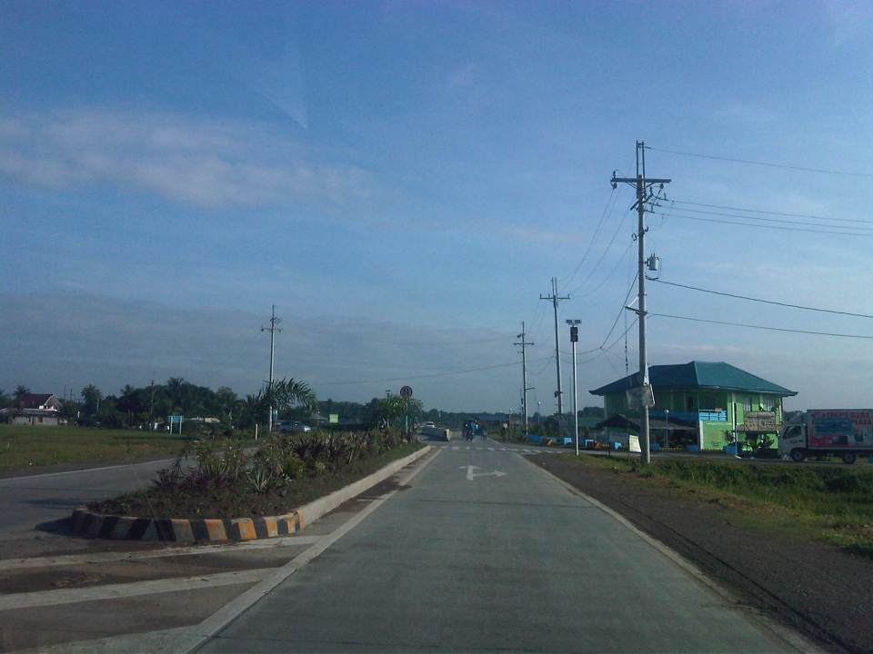
 Rural road connecting to a national highway in Palawan
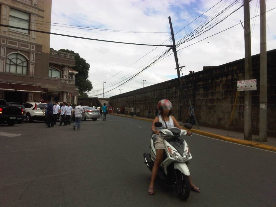
Rural roads are an important and integral part of of our transportation system. Often, attention is placed on national roads, which are under the jurisdiction of the DPWH. Local roads, however, are under various entities including the Department of Agriculture and various levels of local government (e.g., provincial, city, municipal). Of course, there are roads that are rural but are national and therefore under the DPWH. But most roads are classified as local and therefore would not be directly under that national agency. In fact, 85% of our roads are considered local and those classified as rural comprise perhaps more than 70% of the total roads in the country (i.e., national roads can be urban or rural, and city roads include those in the rural parts of cities). Rural roads including FMRs are essential as they provide basic access to jobs, education, health services, markets and other services that could help alleviate poverty and promote development in rural areas.
–
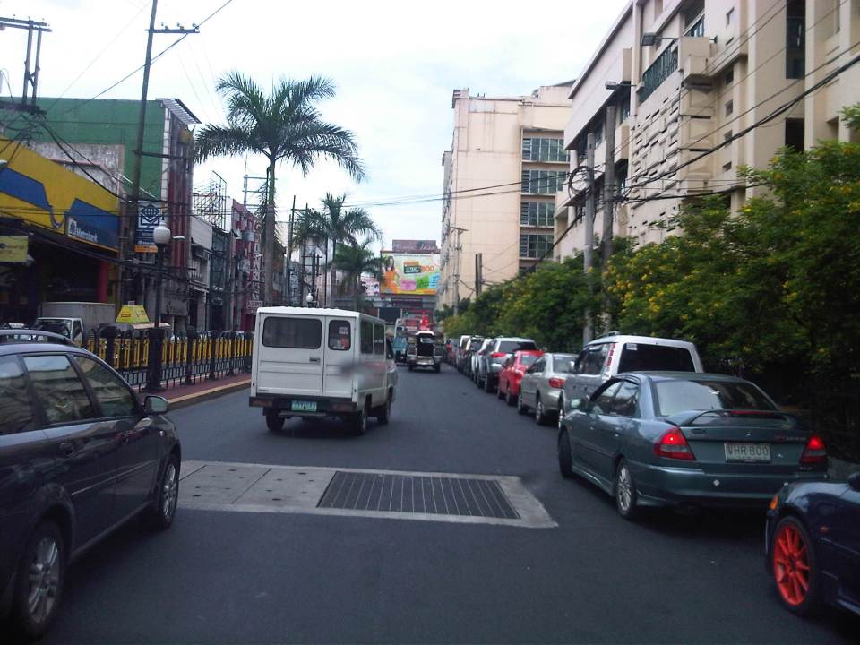
Cubao Aurora
Cubao is one of the busiest areas in Metro Manila where a lot of public transport routes converge. It is a major transfer point for road and rail transport particularly near the junction of three major roads – EDSA, Aurora Boulevard, and E. Rodriguez Avenue, which is only a few meters from EDSA. I took a few photos when I was in the area one time and here they are:
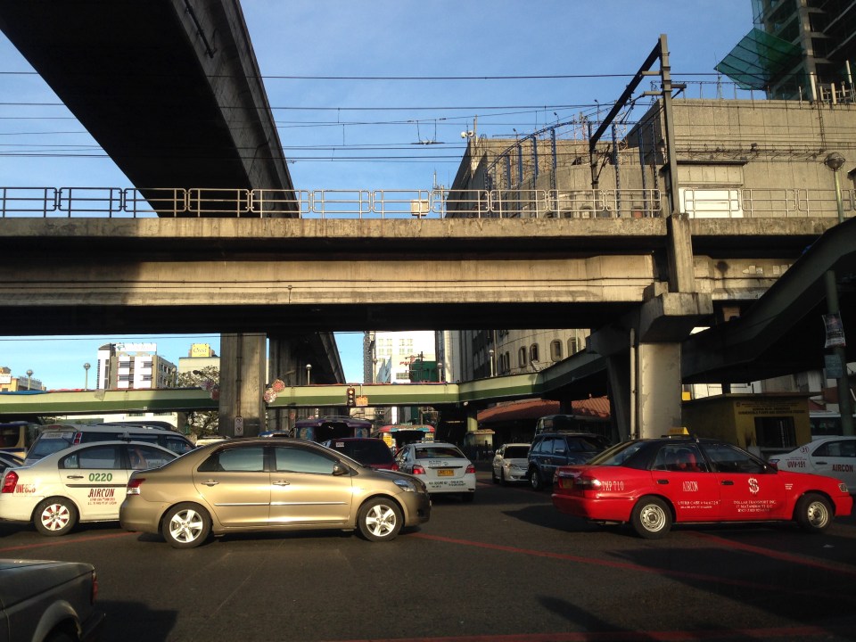 EDSA and Aurora Boulevard intersect at ground level. There is, however, an underpass along EDSA bypassing the at-grade intersection. Shown in the photo are the two rail transit lines passing through the area – EDSA MRT 3 at the 2nd level and LRT Line 2 at the 3rd level.
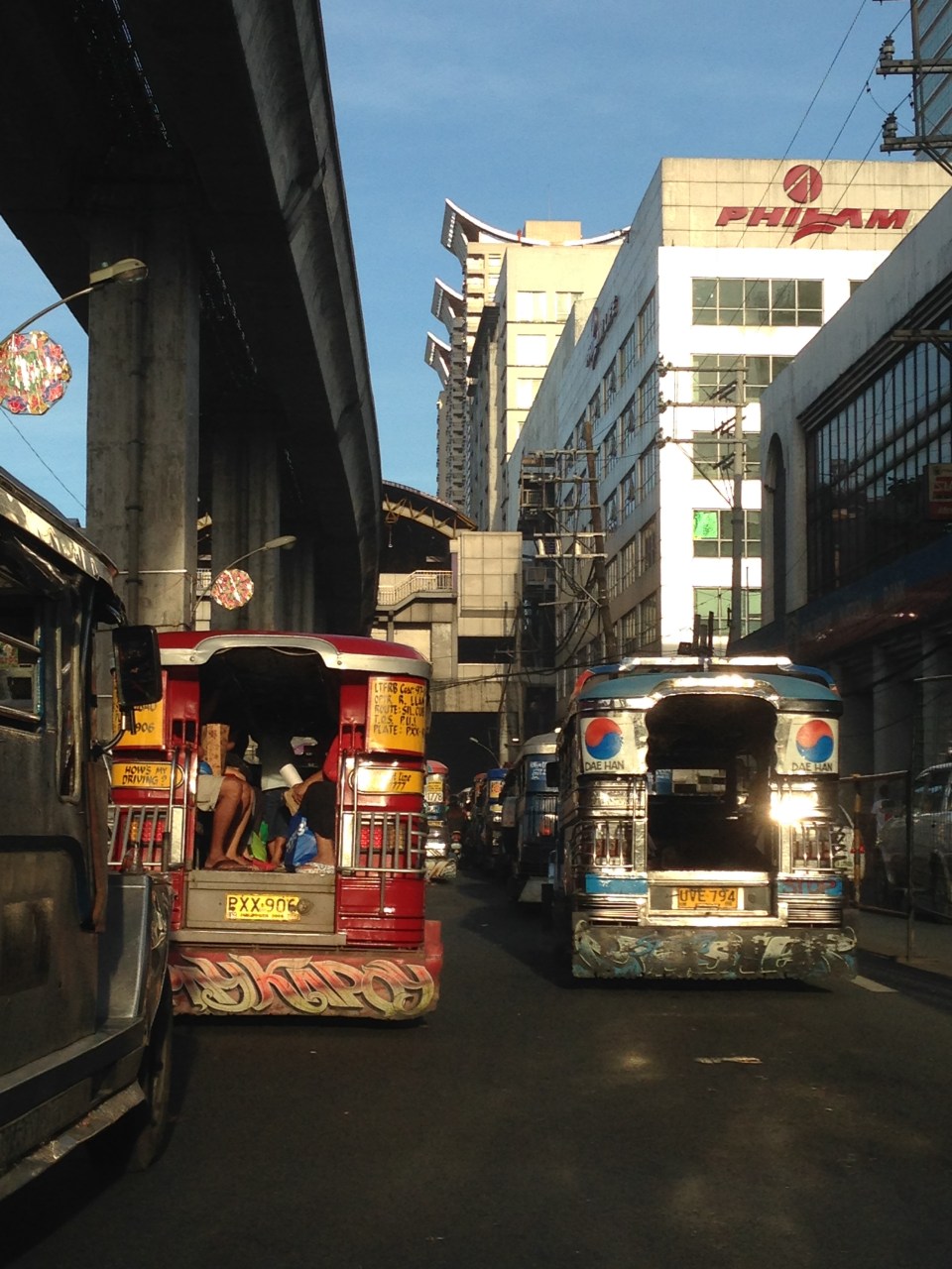 After crossing EDSA, eastbound jeepneys approach the LRT 2 Cubao Station, which is beside the Gateway Mall of the Araneta Center. Traffic along this section of Aurora Blvd. is typically slow as jeepneys bound for different destinations in the east congregate here. Meanwhile, on the other side of EDSA, the same situation is experienced as jeepneys line up along informal terminals on the street. This usually leads to congestion and low throughput along Aurora at the intersection.
 Jeepneys tend to linger under the LRT 2 station and occupy practically all the lanes with most jeepneys deliberately moving at snail’s pace as they try to get passengers. This is the case along both directions of Aurora Boulevard, which makes one wonder why many people don’t take the LRT instead. Of course, for eastbound passengers, the answer is simply that the LRT ends at Santolan Station in Pasig (along Marcos Highway and just after the Marikina River). Most passengers would rather take a single, direct jeepney ride from Cubao to their destinations rather than make the difficult transfer at Katipunan (for Marikina-bound passengers) or Santolan (for Rizal and Pasig-bound commuters).
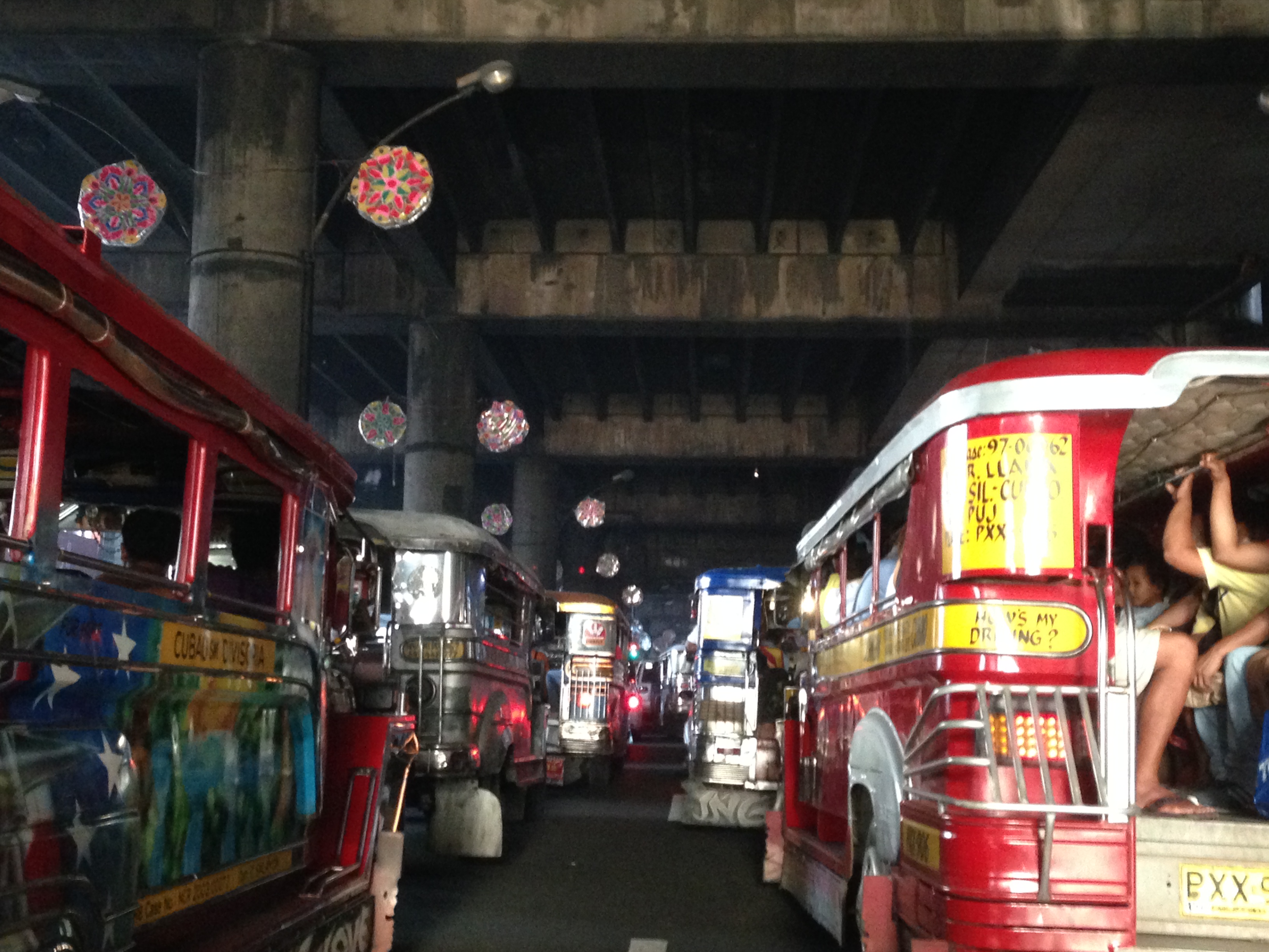
I wanted to take some photos during the night time one time we were passing under LRT 2 along Aurora Boulevard near the Gateway Mall. The area wasn’t well lighted though so all the photos didn’t come out right. This blight is similar to the situation along the LRT Line 1 corridor stretching from Caloocan to Pasay, and affecting areas along Taft Avenue and Rizal Avenue. The areas including the rail superstructure are so dirty mainly because of the emissions from road vehicles, particularly jeepneys, buses and trucks with surplus and generally poorly maintained engines. Hopefully, the local governments and MMDA can address problems of bright with a campaign to install pocket and hanging gardens like the ones already along EDSA. The plants, if cared for properly, will surely help improve both air quality and aesthetics in these areas darkened by design and soot.
–
Plaridel Bypass Road
I attended a regional consultation workshop of the National Economic and Development Authority (NEDA) last October 2013. The workshop was held in Bustos, Bulacan, which is located north of Metro Manila. There are two options to go there. One is via Quirino Highway starting from Quezon City, through North Caloocan City, and the through San Jose del Monte, Norzagaray and Angat in Bulacan where Quirino becomes the Gen. Alejo Santos Highway (which also connects to the Dona Remedios Trinidad Highway or Pan-Philippine Highway). Another route is via the North Luzon Expressway exiting right after the Guiguinto Exit and unto the Plaridel Bypass Road.
Following are a few photos of the bypass road that I was able to take. It was nice and sunny that day and my driver didn’t seem to be comfortable having someone beside him taking photos of the road. That uneasiness plus the reflection on the windshield prevented me from taking more photos. There will be a next time…
 The road is basically a two-lane, two-way undivided highway with concrete pavement for the carriageway and gravel shoulders. There’s adequate signs and road marking along the road.
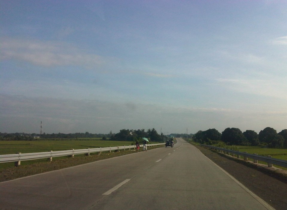 Areas on either side of the highway are agricultural land and at certain sections, the elevation of the highway requires barriers on either side of the RROW. Note the lack of lamps along the road that makes it quite dark at night time. At daytime, travelers get a nice view of the countryside or rural Philippines.
 Near intersections, the carriageway is wider to accommodate channelization including the median island shown in the photo.
 I recall at least 2 intersections with traffic signals including this one with the Gen. Alejo Santos Highway. Note the sign on the right indicating directions to Bustos, Angat and further on to Cabanatuan, Nueva Ecija.
The construction of this bypass road effectively cut down the travel time to Bustos and the nearby Bulacan towns of Angat, Baliuag and even San Ildefonso and Norzagaray. Such highways are good examples of infrastructure that provides good access to farms around the country while also providing alternate routes to bypass congested roads through fast developing towns.
–
Designing for walking and cycling
There are current discussions regarding the highway and street designs mostly from the perspective of safety. These discussions include those hosted by the academe and those posed as challenges by practitioners, mainly architects with experience designing similar facilities abroad and who are advocating for more people-friendly designs. Such discussions are slowly but steadily gaining traction in the Philippines but has met with some resistance in the form of key persons and agencies not giving due attention to the design challenges being posed that would have implications on planning and design guidelines. That is, the implications of promoting people-friendly designs in our roads will require changes in the National Building Code as well as the Highway Planning Manual of the Department of Public Works and Highways (DPWH). These changes will include standards and specifications for the geometric design of walkways and bikeways integrated into our roads and a departure from the current approach that basically treats pedestrian and cycle facilities as an afterthought to motorways.
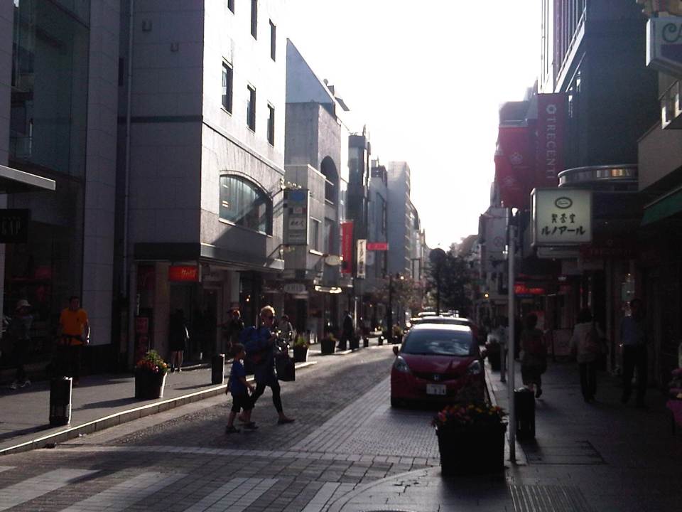
I’m posting a few photos I took from a recent visit to Yokohama, Japan, which was my home for 3 years back in the 1990s. Much has changed in Yokohama since I last visited in 2008 but notable are the people friendly transport infrastructure including pedestrian and cycling facilities. Following are photos taken in the Minato Mirai district of the city.
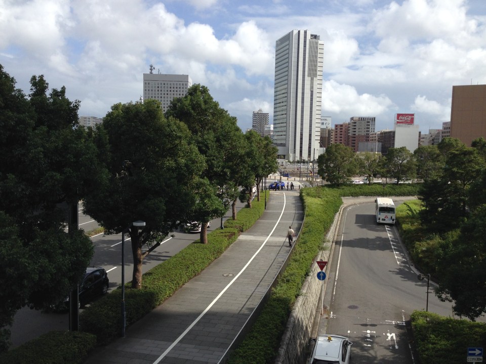 Pedestrian and cycling lanes along the main road of Yokohama’s Minato Mirai district. The tree-lined street provides a conducive environment for walking and cycling.
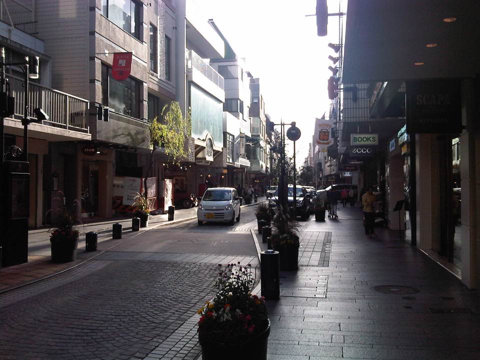
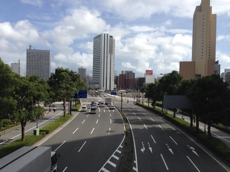 Depending on how one sees it, Minato Mirai Odori is a 10-lane road with 4 lanes allocated for walking and cycling (i.e., 1 lane each on either side of the lanes for motor vehicles).
 Pedestrian bridge connecting Minato Mirai Odori with the World Porters commercial development
 A 10-lane bridge with 2 of 5 lanes per direction devoted for walking and cycling. That’s a full lane of at least 3.2 meters allocated for pedestrians and another full lane for cyclists. While it is not shown in the photo, the pedestrian and cycling lanes are efficiently utilized during the peak periods.
–
Motomachi
It’s December again and during this month I like to reminisce about favorite places I went to or still go to here and abroad. One of my favorite haunts during the time I called Yokohama my home city was the Yamate area. I went to Mass every Sunday at Yamate Catholic Church. After church, friends and I descend towards the Motomachi shopping street to take strolls, window shop or have lunch in one of the many restaurants along the street. I think it is a good example of a shopping street that’s also found in many other places particularly in Europe and the US. It provides a better environment compared to the large malls we often find in many cities including Metro Manila.
 On-street parking spaces are provided along one side of several sections of along the street. There are parking meters at these spaces.
 It is a nice place to take a walk whether doing actual shopping, window shopping or just a simple stroll to while away the time.
 I like the brick road of Motomachi and the restaurants and shops lining the street.
 Benches where people can sit down, take a short rest or wait for their companions who are shopping at a nearby store.
 Motomachi Union where I used to do some groceries whenever I’m in the area (usually Sundays after Mass at Yamate Church).
 A look back to Motomachi as I approached the JR Ishikawacho Station.
There used to be a Indian restaurant at one of the side streets of Motomachi. The chef of the restaurant was a Sri Lankan Catholic who was a church mate at Yamate. We often went to eat there after Mass or on occasion. He would usually adjust the ingredients of our favorite curry and tandoori dishes so they weren’t too hot or spicy for our palates. I wonder where he is now with his family and hope they are doing very well.
There also used to be some clubs or pubs at the end of Motomachi. These included one that was operated by Filipinos that had the Philippine flag displayed. Those establishments are long gone, replaced by newer restaurants and shops as well as a building leading to the underground station of the Tokyu Minato Mirai Line. I know there are also a lot of new, still undiscovered shops and restaurants in the side streets to Motomachi. I look forward to going around the area again soon to check out these places.
–
#ReliefPH: Access and needs in many other places
The buzz on the streets and on social media is the focus on Tacloban, Leyte when vast areas and many other towns and provinces have been ravaged by super typhoon Yolanda (Haiyan). This seems unfair to other cities and municipalities considering Yolanda made 6 landfalls at or near peak strength (as a Category 5 typhoon) with winds topping 225 kph and generating destructive storm surges as it hammered through the central Philippines.
If you have Facebook, one provincial government staff has posted a lot of photos describing the situation in the northern towns of Iloilo where the destruction caused by the typhoon is very clear and to many, still unimaginable. These photos along with all others that can be Googled, Yahooed or found via other search engines or news agencies show the extent of the damage brought about by Yolanda.
Some people say that the islands of Cebu, Panay, Negros and Mindoro are fortunate as principal cities in those islands like Cebu City, Iloilo City, Bacolod City, Dumaguete City and Calapan City were relatively undamaged. This is also true, and so the airports and ports in these cities provide direct access to the islands for relief work. Moreover, government agencies and private entities have been able to organize relief activities through these cities and based on various news reports, it looks like a lot of people are already involved in these activities. That goes without saying that more people are still needed to be involved in various capacities for relief, rehabilitation and reconstruction work that are expected to be undertaken over a longer term considering the extent of the damages to towns. But given the circumstances for the said islands, there is no excuse for more rapid aid not being able to reach the affected towns in these provinces. In fact, much more is expected where accessibility is no longer an issue and so faster recovery is possible for Panay, Negros, Cebu and Mindoro. In the cases of Cebu and Bohol, it is important to remember that the provinces already are also still reeling from the impacts of the Magnitude 7.2 earthquake that occurred only a few weeks ago.
On another note…Tacloban Airport is still closed to commercial aircraft but the land routes via RORO or the nautical highways are open to traffic or operational. I think the quickest way to Leyte is via the route from Cebu. There are regular RORO and Supercat services between Cebu City and Ormoc City in Leyte. There are other maritime transport services from Bogo City in northern Cebu but I am not sure those services are back to normal. Then there are also access via the Eastern Nautical Route via the Bicol Region and crossing over to Samar Island (Allen) via Matnog, Sorsogon. Many roads still need to be cleared but the main highway (Pan Philippine Highway) including the San Juanico Bridge that connects the islands of Samar and Leyte.
–
P. Casals Street and Ayala Boulevard
This is a continuation of an earlier post about Manila streets. Legarda eventually becomes Pablo Casals Street and then Ayala Boulevard after the Ayala Bridge. There are many prominent academic institutions along the road including the Technological University of the Philippines and the Philippine Normal University.
 Technological Institute of the Philippines (TIP) has a branch along P. Casals St.
 Bridge across a tributary to the Pasig River is full of shanties. This is in the San Miguel district of Manila that is near Malacanan Palace. It is between the Quiapo area and the Palace and the tributary leads to the Golden Mosque to the right.
 Ayala Bridge where P. Casals Street ends and becomes Ayala Boulevard on the other side of the Pasig. I think the street lamps are quite odd and more decorative than functional. I’ve seen these at night and they look more like lanterns than street lights. At one side of the bridge (on the left in the photo) is the Isla de Balut and the Hospicio de San Jose.
 Ayala Boulevard is a 4-lane, undivided road. The southwest direction (downstream) leads to Taft Avenue.
 Just pas the bridge is an intersection with San Marcelino Street, which is part of a major truck route. Along San Marcelino is Adamson University and what was the old St. Theresa’s College Manila campus whose buildings have been integrated with Adamson.
 There are two major institutions of higher learning along Ayala Blvd. These are the Technological University of the Philippines and the Philippine Normal University.
A bit of trivia: These institutions (TUP and PNU) together with the University of the Philippines (UP) and the Polytechnic University of the Philippines (PUP) formed the pillars of professional and technical education introduced by the Americans to a post-Spanish Philippines. TUP used to be the Manila Trade School (1901) and then the Philippine School of Arts and Trades (1910) under the Americans. The PNU was Philippine Normal School during the American Period (1901) and later became the Philippine Normal College after the Second World War (1949). The PUP was the Manila Business School (1904) and later the Philippine School of Commerce (1908) during the same period. The University of the Philippines was the first state university established by the Americans in 1908. TUP was established to provide education and training in various trades (vocational school). The PUP was established to provide education and training for business/commerce. The PNU was established to provide education and training for teachers. And UP was established to provide education and training to professionals in the fields of engineering, law and medicine.
–
Streets of Intramuros: Solana Street
I’m posting more photos of the streets around Mapua and Lyceum. Solana Street is behind Mapua and practically runs parallel to Muralla Street. The southeast end of the street is at its junction with Victoria Street at the Manila Science High School while the northwest end is at the junction with Muralla St. and Andres Soriano, Jr. Ave. at Plaza Espana, where located are the ruins of the Maestranza and the Intendencia.
 Intersection of Solana Street with Beaterio Street with an informal pedicab terminal at the corner.
 Real Street (view towards the southwest) as seen from Solana Street
 A newly built or renovated building is at right across from Mapua. There are many buildings hosting dormitories or rental rooms for students in the area. This is similar to buildings near institutions in the University Belt area where now stands many high-rise condominiums also catering to students.
 Intersection of Solana Street with San Francisco Street (left), which leads back to Muralla Street and the Lyceum.
 Intersection with Sta. Potencia Street – we caught an amusing sight of these two people who appear to be compacting the asphalt concrete transition between Solana’s lower pavement surface elevation with the Sta. Potencia’s new PCCP.
 Vehicles parked along Solana Street and behind the Mapua Institute of Technology
 Approaching the intersection with Victoria Street, one sees many signs of businesses geared towards the academic nature of institutions in the area (e.g., photocopying, bookbinding, computer rentals, etc.). The building on the left is Mapua’s while the ones on the right include dormitories or rental apartments on the upper floors.
–
Another look at traffic along Morayta, Recto and Legarda
Heading to another appointment one morning, our driver avoided Quezon Boulevard and the Quiapo area, which we learned later had serious flooding at the underpass. Our driver said we were actually waved off by a traffic enforcer from heading into Quezon Blvd. to head instead towards Morayta and Recto. And so I decided to take some new photos along our way, which took us to Morayta, Recto, Legarda, P. Casals and Ayala Blvd.
 Morayta Street with the Far Eastern University (FEU) at right is part of an area that is called the University Belt because of the academic institutions located in the area including several major universities like FEU, the University of the East (UE), the University of Sto. Tomas (UST), San Sebastian College, San Beda College, Centro Escolar University and College of the Holy Spirit.
 On-street parking along Morayta Street – there should be parking fees for such spaces in Manila since vehicles significantly reduce road capacities and cause congestion. These streets are public spaces and should benefit the general public and not just a few people who happen to have cars but no parking space in an area where space is very limited and therefore valuable.
 Approach to intersection of Morayta with Recto Avenue.
 Recto Avenue eastbound with the elevated tracks of the LRT Line 2.
 Approach to the intersection of Recto with Loyola Street. San Sebastian College is just after the signalized intersection. The pedestrian crossing is for people crossing to or from the University of the East, which is on the other side of the road.
 The alignment of the LRT Line 2 led to its posts dividing the eastbound lanes of Recto for the section between Loyola Street and Legarda. San Sebastian College is at right with its arcade walkways.
 The divided eastbound lanes of Recto merge at the approach to the intersection with Legarda and Mendiola.
 That’s Mendiola from across our turning vehicle with San Beda College on the left and a branch of Jollibee obscuring a view of Centro Escolar University at right.
 Southbound lanes of Legarda in the general direction towards Arlegui Street. There are many new buildings along the street including the one on the right, which replaced what were already decrepit buildings and houses. Some of these houses probably had historical value but were demolished nonetheless after the property was sold to more enterprising people.
 A peak at San Sebastian Church from Legarda and downstream along Bilibid Viejo Street. This image has been captured in many photos and drawings from the time it was completed during the last years of the Spanish period, to the American period until the present.
 Legarda ends at its intersection with Nepomuceno and Concepcion Aguila Streets where the most prominent landmark is the National Teachers College. Here, Legarda becomes Nepomuceno and proceeds towards Arlegui and P. Casals.
–
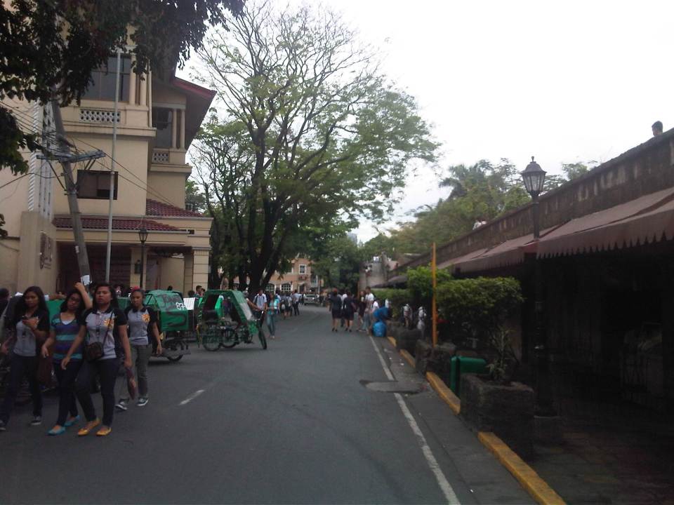
The Streets of Intramuros: Muralla Street
Intramuros is known as the “old” Manila as the enclave was practically The City when the Philippines was under Spain. Streets are generally narrow as they were designed at a time when there were no motor vehicles like automobiles, jeepneys, buses or trucks. People walked or rode on horses. Luxury vehicles were carriages while goods were carried by carts or people. The following photos show the stretch of Muralla Street from the Victoria Street (Bayleaf Hotel) to Real Street (Lyceum University).
 Entrance to Muralla Street with the Bayleaf Hotel at left, which is run by Lyceum University
 Muralla Street runs along the eastern wall of Intramuros. It is a one way street and so the photo shows a pedicab (also called padyak or sikad), a non-motorized tricycle, running counter to the flow of traffic.
 These streets were made for walking – Intramuros has narrow streets and can barely accommodate two way traffic so many have been designated for one-way flow.
 There are schools along the left side of the road including the Mapua Institute of Technology, Lyceum University and Colegio de San Juan de Letran. As such, there are usually many students in the area walking around, having their meals at the nearby canteens/eateries (right side) or perhaps just sitting and admiring the view from the top of the wall.
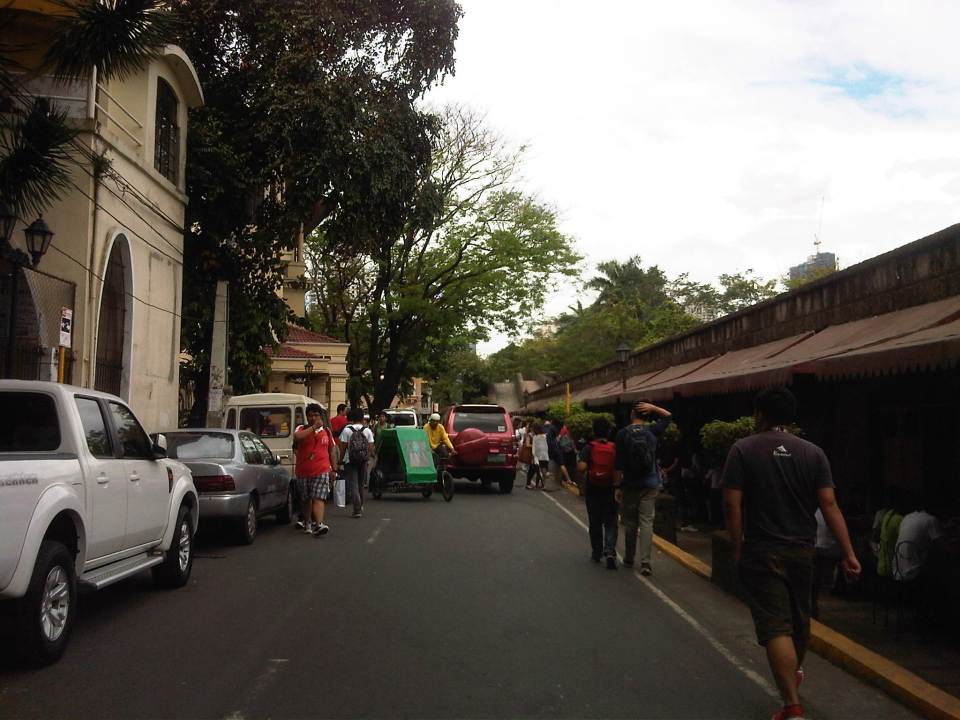 Parking is a major problem in Intramuros and one would see vehicles parked along one side of the street (evident in most of the photos in this post), obviously taking valuable space away from people and other motor vehicles (i.e., reduced road capacity).
 There are many eateries or small restaurants along Muralla St. and just under the wall. These are patronized mainly by students so meals are inexpensive.
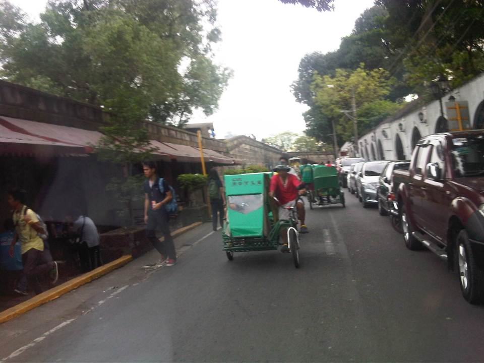 There are many pedicabs in the area with long queues at the gate waiting for passengers coming from the general direction of Padre Burgos Ave., where people can transfer to and from jeepneys serving the area. Frankly, I think there is an excessive number of pedicabs in Intramuros considering roads in the enclave can be transformed into walkable streets, just like they were during the Spanish and American periods. Notice again the on-street parking along one side of the road.
 More students and more pedicabs along Muralla Street. People are used to traffic mix and generally stay clear of the space allocated for motor vehicles.
 Security personnel posted along the walls are appropriately dressed as Katipuneros or Rayadillos (honor guards). The building down the street is a dormitory just beside the buildings of Lyceum University, whose buildings are split up by public streets making it tricky to define a campus for the university.
 Junction of Muralla Street and Real Street with a private dormitory building at the center of the photo. Muralla Street continues along the side of the wall and proceeds all the way to Plaza Espana and the old Intendencia. Meanwhile, Real Street proceeds to the left of the dormitory. Also shown at the left is the entrance to one of the buildings comprising Lyceum University. Other buildings are behind the dorm.
–
